Ford

Settlement in Somerset Somerset West and Taunton

England

Ford

Ordnance Survey Cut Mark This OS cut mark can be found on the wall of the old rectory. It marks a point 117.433m above mean sea level.
Ordnance Survey Cut Mark Credit: Adrian Dust

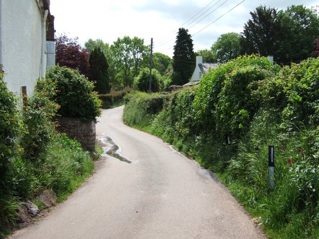
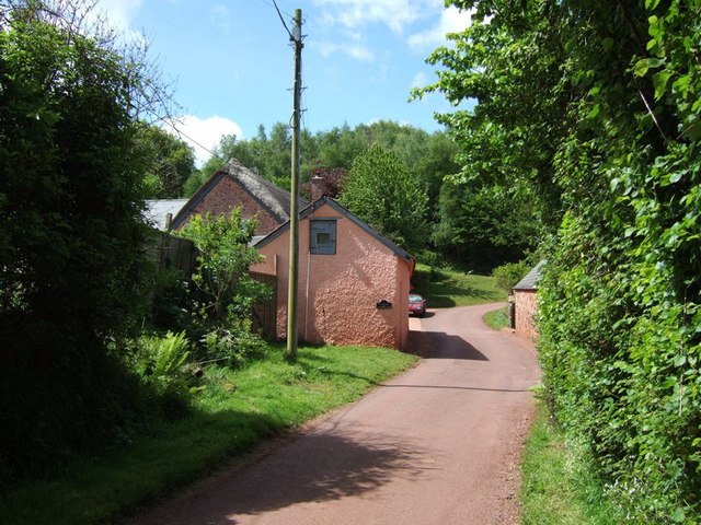
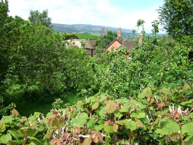
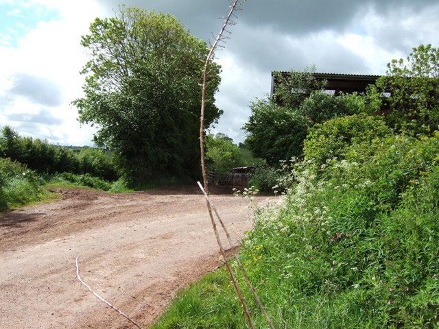
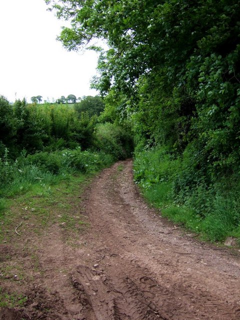
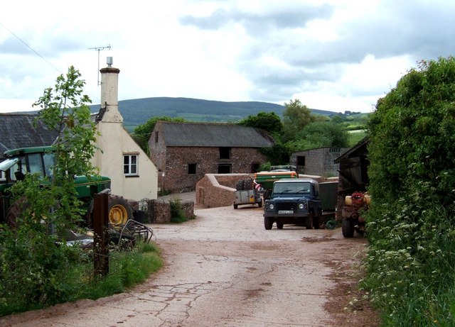
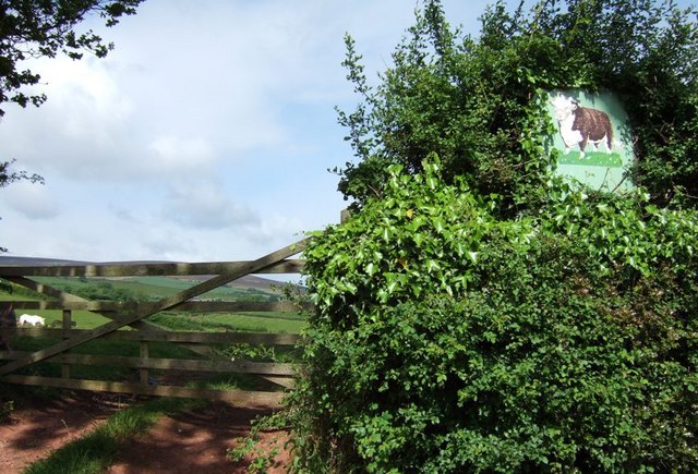
Ford is a small village located in the county of Somerset, England. Situated on the eastern edge of the Exmoor National Park, it is part of the civil parish of Alcombe. The village is nestled within a picturesque valley, surrounded by rolling hills and lush countryside.

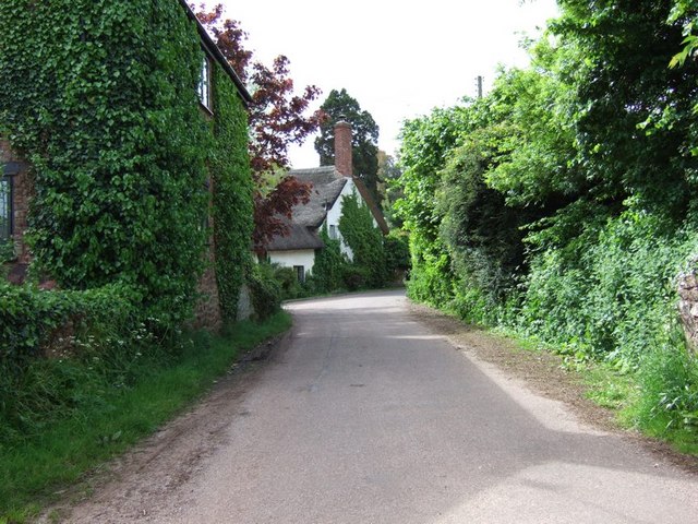
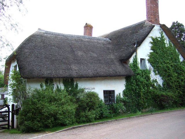
The history of Ford dates back to medieval times, with evidence of settlements in the area dating as far back as the 11th century. The village is known for its charming thatched cottages, many of which are listed buildings, adding to its rustic appeal.

Despite its small size, Ford offers a range of amenities to its residents and visitors. The village boasts a traditional country pub, The Royal Oak, which is a popular spot for locals to gather and enjoy a pint. Additionally, there is a village hall that hosts various community events, such as fairs and social gatherings.

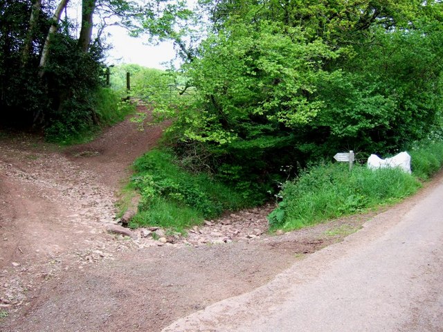
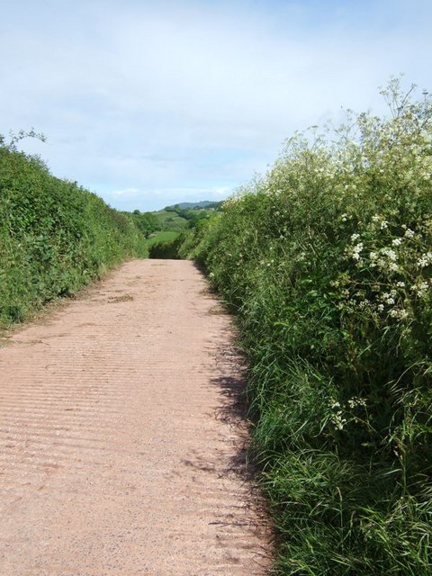
Nature enthusiasts are drawn to Ford for its stunning surroundings, making it an ideal base for outdoor activities. The nearby Exmoor National Park provides ample opportunities for hiking, cycling, and wildlife spotting. The village is also close to the River Barle, a popular spot for fishing and picnicking.

Ford's location offers a peaceful and tranquil atmosphere, appealing to those seeking a slower pace of life. With its rich history, natural beauty, and community spirit, Ford continues to be a beloved destination in Somerset.

If you have any feedback on the listing, please let us know in the comments section below.
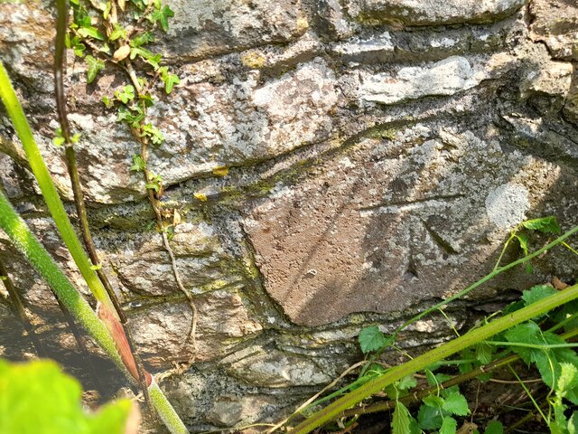
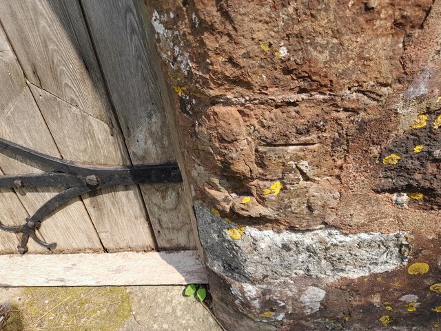
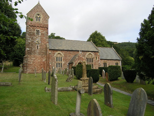
Ford Images

Images are sourced within 2km of 51.172718/-3.5323127 or Grid Reference SS9242. Thanks to Geograph Open Source API. All images are credited.

Ordnance Survey Cut Mark This OS cut mark can be found on the wall of the old rectory. It marks a point 117.433m above mean sea level.
Ordnance Survey Cut Mark
This OS cut mark can be found on the wall of the old rectory. It marks a point 117.433m above mean sea level.
Ordnance Survey Cut Mark This OS cut mark can be found on the NW angle of All Saints Church. It marks a point 129.863m above mean sea level.
Ordnance Survey Cut Mark
This OS cut mark can be found on the NW angle of All Saints Church. It marks a point 129.863m above mean sea level.
Wootton Courtenay, Somerset The church of All Saints
Wootton Courtenay, Somerset
The church of All Saints
Huntscott The hamlet of Huntscott between the villages of Luccombe and Wootton Courtenay.
Exmoor has many of these picturesque hamlets and villages, far more so than its more rugged counterparts of Dartmoor and Bodmin Moor.
Huntscott
The hamlet of Huntscott between the villages of Luccombe and Wootton Courtenay. Exmoor has many of these picturesque hamlets and villages, far more so than its more rugged counterparts of Dartmoor and Bodmin Moor.
Brockwell Farm There is a small cluster of farm buildings at Brockwell on the lane from Wootton Courtenay to Ford. The rich pink colour looks surprisingly harmonious against the verdant greenery.
Brockwell Farm
There is a small cluster of farm buildings at Brockwell on the lane from Wootton Courtenay to Ford. The rich pink colour looks surprisingly harmonious against the verdant greenery.
Cottage at Ford Coming across cottages such as this is one of the great bonuses of Geographing. Almost at the end of a dead-end lane, probably very few people ever see this beautiful example of an Exmoor cottage.
Cottage at Ford
Coming across cottages such as this is one of the great bonuses of Geographing. Almost at the end of a dead-end lane, probably very few people ever see this beautiful example of an Exmoor cottage.
Tivington Knowle Hiding behind a hedge and orchards nestle the cottages of Tivington Knowle. The hills of Exmoor can be seen rising in the background.
Tivington Knowle
Hiding behind a hedge and orchards nestle the cottages of Tivington Knowle. The hills of Exmoor can be seen rising in the background.
Stile Down There is a large barn here and a considerable quantity of large farm machinery is parked on the verges. At this 90º bend in the lane a track (Elscombe Lane) continues on straight ahead.
Stile Down
There is a large barn here and a considerable quantity of large farm machinery is parked on the verges. At this 90º bend in the lane a track (Elscombe Lane) continues on straight ahead.
Elscombe Lane, Stile Down This track initially heads off southwards then veers more eastward as it crosses a brook. It eventually gets to Waydown Cross. I think the valley which the brook runs through is probably Elscombe giving the lane its name.
Elscombe Lane, Stile Down
This track initially heads off southwards then veers more eastward as it crosses a brook. It eventually gets to Waydown Cross. I think the valley which the brook runs through is probably Elscombe giving the lane its name.
Annicombe This is the entrance and track to the property called Annicombe which is off Spangate Lane near Stile. Beyond it is Elsworthy Allotment.
Annicombe
This is the entrance and track to the property called Annicombe which is off Spangate Lane near Stile. Beyond it is Elsworthy Allotment.
Fairgarden Farm Fairgarden Farm near Stile. This is quite an extensive farm on Exmoor. It has a lot of equipment parked along the lane between here and Stile Down.
Fairgarden Farm
Fairgarden Farm near Stile. This is quite an extensive farm on Exmoor. It has a lot of equipment parked along the lane between here and Stile Down.
Hole Cross, Stile This is a track / lane junction at Stile. The metalled lane is to the right. One track goes off to the left, this is Digland Lane (<a href="https://www.geograph.org.uk/photo/177412">SS9241 : Digland Lane</a>) which becomes Spangate Lane (<a href="https://www.geograph.org.uk/photo/177410">SS9241 : Spangate Lane</a>) a little further on (near Annicombe, see <a href="https://www.geograph.org.uk/photo/177236">SS9241 : Annicombe</a>). The little sign has a "typo" as it says "Spagate". A second track goes straight ahead into the trees, only its first few yards can be seen here (it is by the sign, not the bit leading up to the gate). This track leads through to Ford (see <a href="https://www.geograph.org.uk/photo/177345">SS9242 : Ford</a>)
Hole Cross, Stile
This is a track / lane junction at Stile. The metalled lane is to the right. One track goes off to the left, this is Digland Lane (SS9241 : Digland Lane) which becomes Spangate Lane (SS9241 : Spangate Lane) a little further on (near Annicombe, see SS9241 : Annicombe). The little sign has a "typo" as it says "Spagate". A second track goes straight ahead into the trees, only its first few yards can be seen here (it is by the sign, not the bit leading up to the gate). This track leads through to Ford (see SS9242 : Ford)
Burrow The hamlet of Burrow. Burrow farm is in the centre.
Burrow
The hamlet of Burrow. Burrow farm is in the centre.
Burrow Farm A close-up of this thatched farm. This one is Burrow Farm, but there is also Middle Burrow Farm and Higher Burrow Farm. Perhaps there are a lot of rabbits around here ! (See also <a href="https://www.geograph.org.uk/photo/177243">SS9342 : Burrow</a>)
Burrow Farm
A close-up of this thatched farm. This one is Burrow Farm, but there is also Middle Burrow Farm and Higher Burrow Farm. Perhaps there are a lot of rabbits around here ! (See also SS9342 : Burrow)
Fields near Well Farm Lush grass in the fields near Well Farm near Burrow. The village that can be seen directly ahead in the valley is Timberscombe, the largest settlement for some miles in this very rural area.
Fields near Well Farm
Lush grass in the fields near Well Farm near Burrow. The village that can be seen directly ahead in the valley is Timberscombe, the largest settlement for some miles in this very rural area.
Cow in the hedge O.k. it's not a live cow. This sign showing a Herefordshire cow (or bull) is for Well Farm which is up a lane to the right of this image. The bright white horse that can be seen grazing through the gate looks a little like a chalk downs version.
Cow in the hedge
O.k. it's not a live cow. This sign showing a Herefordshire cow (or bull) is for Well Farm which is up a lane to the right of this image. The bright white horse that can be seen grazing through the gate looks a little like a chalk downs version.
Lane to Well Farm The lane to Well Farm is concrete rather than tarmac. Cow parsely dots the verges and the Exmoor hills can be seen in the background.
Lane to Well Farm
The lane to Well Farm is concrete rather than tarmac. Cow parsely dots the verges and the Exmoor hills can be seen in the background.
Wootton Courtenay - Cottage & Lane Wootton Courtenay is one of the most sought-after villages in North Somerset and with village lanes like this it's not terribly surprising. This lane forks a little further on with one lane going through Burrow (<a href="https://www.geograph.org.uk/photo/177243">SS9342 : Burrow</a>) to Timberscombe while the other heads towards Dunkery Hill via the hamlet of Stile (<a href="https://www.geograph.org.uk/photo/177241">SS9342 : Hole Cross, Stile</a>).
Wootton Courtenay - Cottage & Lane
Wootton Courtenay is one of the most sought-after villages in North Somerset and with village lanes like this it's not terribly surprising. This lane forks a little further on with one lane going through Burrow (SS9342 : Burrow) to Timberscombe while the other heads towards Dunkery Hill via the hamlet of Stile (SS9342 : Hole Cross, Stile).
Show me another place!

Ford is located at Grid Ref: SS9242 (Lat: 51.172718, Lng: -3.5323127)

Administrative County: Somerset

District: Somerset West and Taunton

Police Authority: Avon and Somerset

What 3 Words

///oblige.soldiers.onlookers. Near Minehead, Somerset

Nearby Locations

Ford

Related Wikis

Wootton Courtenay

Wootton Courtenay is a village and civil parish on Exmoor in the Somerset West and Taunton district of Somerset, England. The parish includes the hamlets...

Chapel of St Leonard, Tivington

The Anglican Chapel of St Leonard in Tivington, Somerset, England was built in the mid 14th century as a chapel of ease. It is a Grade II* listed building...

Luccombe, Somerset

Luccombe or Luckham is a village and civil parish in the Exmoor National Park in the English county of Somerset. It at the foot of the moor's highest hill...

Dovecot at Blackford Farm

The Dovecot At Blackford Farm in Selworthy on Exmoor within the English county of Somerset was probably built in the 11th century. It is a Grade II* listed...

Nearby Amenities

Located within 500m of 51.172718,-3.5323127
Ford: yes
Lat/Long: 51.1724252/-3.5313722
Barrier: kissing_gate
Foot: yes
Lat/Long: 51.1747451/-3.5302124
Barrier: kissing_gate
Foot: yes
Lat/Long: 51.17401/-3.5323969
Barrier: stile
Foot: yes
Material: wood
Stile: stepover
Lat/Long: 51.1748889/-3.5300135
Man Made: antenna
Material: steel
Lat/Long: 51.1725797/-3.5261473
Hiking: yes
Horse: yes
Information: guidepost
Tourism: information
Lat/Long: 51.1702464/-3.5292694
The data included in this document is from www.openstreetmap.org. The data is made available under ODbL.

Have you been to Ford?

Leave your review of Ford below (or comments, questions and feedback).