Follifoot

Settlement in Yorkshire Harrogate

England

Follifoot

Crimple Valley Taken on the way to the Crimple Valley Geocache during a terrible hailstorm.
Crimple Valley Credit: Nigel Knapton

Follifoot is a picturesque village located in the Harrogate district of North Yorkshire, England. Situated approximately five miles southwest of the town of Harrogate, Follifoot is a small yet charming community with a population of around 800 people.

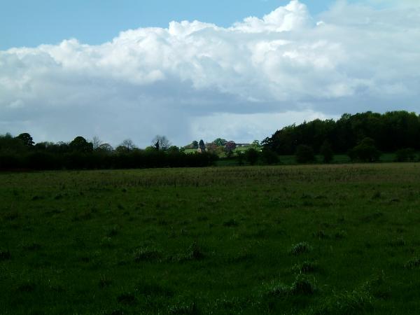
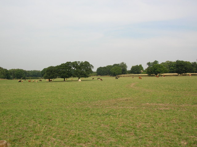
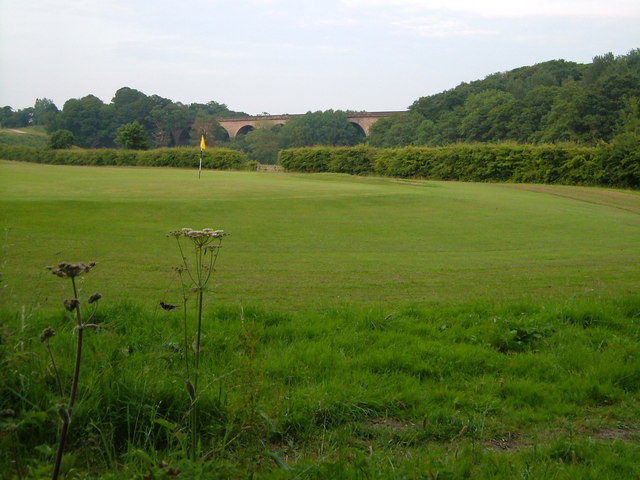
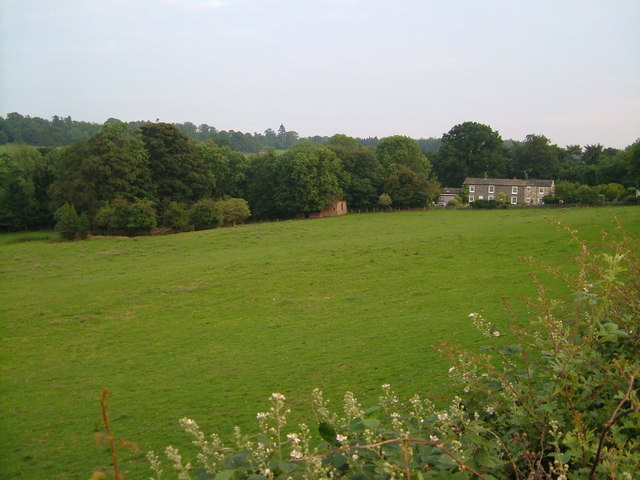
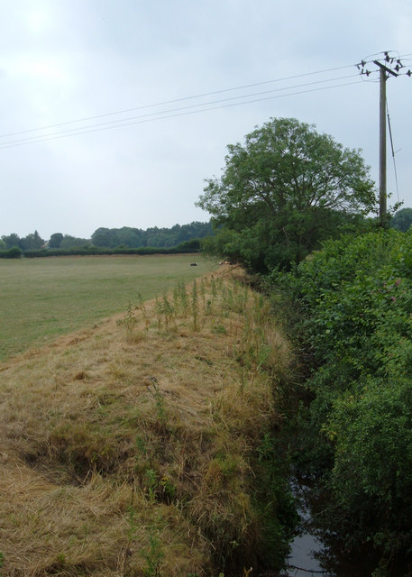
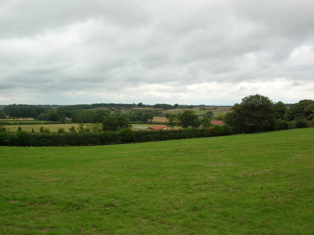
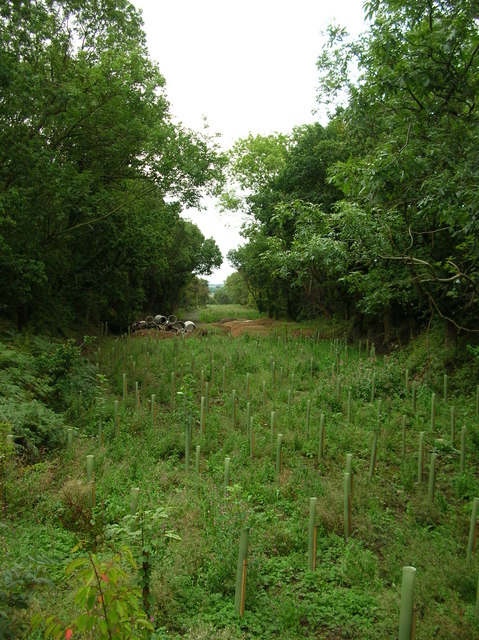
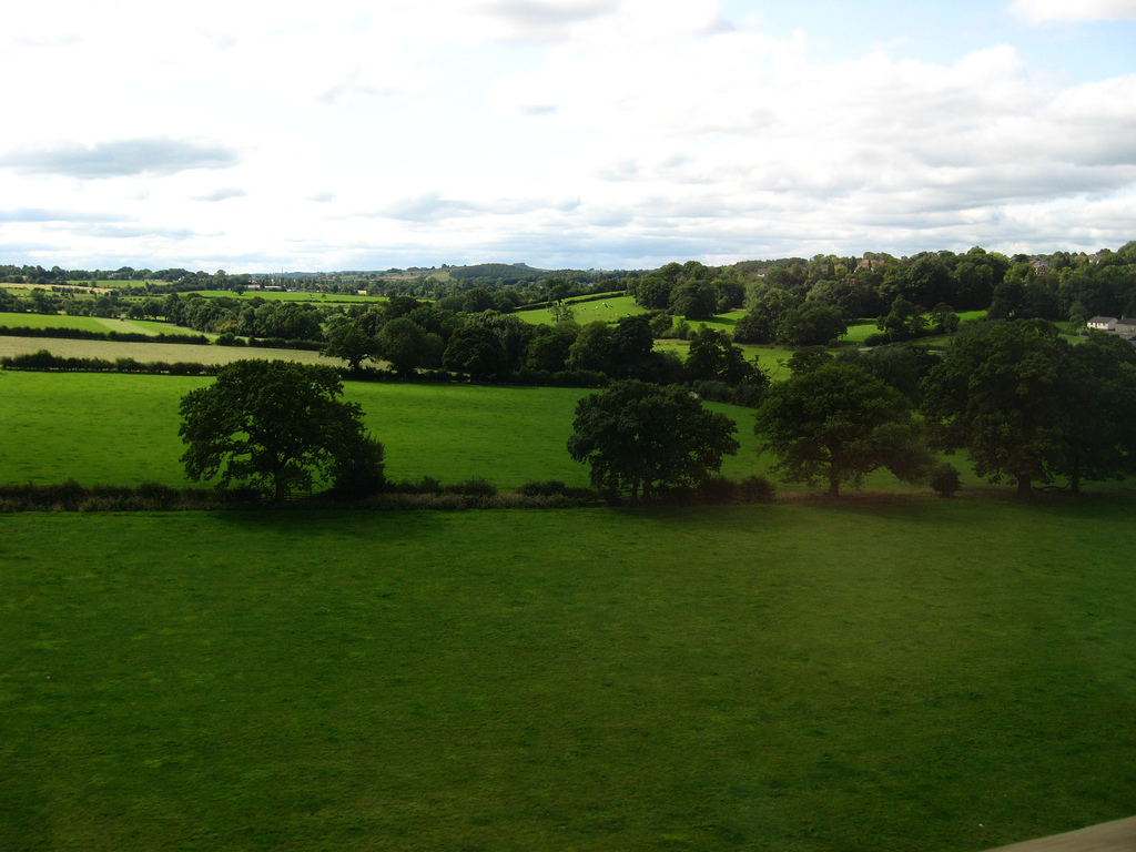
The village is known for its idyllic countryside setting, surrounded by open fields, woodlands, and rolling hills. Follifoot offers a peaceful and tranquil environment, making it an appealing destination for those seeking a break from the bustling city life.

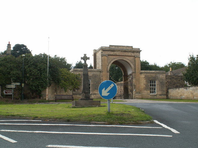
Follifoot's history dates back to the Anglo-Saxon period, and evidence of its ancient roots can still be seen today. The village boasts a number of well-preserved historic buildings, including St. Joseph's Church, a beautiful Grade II listed building that dates back to the 12th century.

In terms of amenities, Follifoot has a primary school, a village hall, and a local pub, The Harewood Arms, which serves as a popular gathering spot for residents and visitors alike. The village also benefits from its proximity to Harrogate, where residents can access a wider range of services, shopping facilities, and entertainment options.

Follifoot is a haven for nature lovers, offering numerous walking and cycling routes that showcase the stunning Yorkshire countryside. The nearby Harewood Estate and the Nidderdale Area of Outstanding Natural Beauty provide additional opportunities for outdoor activities and exploration.

Overall, Follifoot is a delightful village that combines rich history, natural beauty, and a close-knit community spirit, making it an appealing place to live or visit for a peaceful and scenic experience.

If you have any feedback on the listing, please let us know in the comments section below.

Follifoot Images

Images are sourced within 2km of 53.9683/-1.481 or Grid Reference SE3252. Thanks to Geograph Open Source API. All images are credited.

Crimple Valley Taken on the way to the Crimple Valley Geocache during a terrible hailstorm.
Crimple Valley
Taken on the way to the Crimple Valley Geocache during a terrible hailstorm.
Field of Cows. Taken in the top left corner of this gridsquare looking NE.
Field of Cows.
Taken in the top left corner of this gridsquare looking NE.
Disused viaduct over Crimple Beck There are two impressive viaducts across the Crimple valley on the south side of Harrogate. This one is on the disused Leeds Northern line between Starbeck and Pannal. Seen from the corner of the Crimple Valley golf course.
Disused viaduct over Crimple Beck
There are two impressive viaducts across the Crimple valley on the south side of Harrogate. This one is on the disused Leeds Northern line between Starbeck and Pannal. Seen from the corner of the Crimple Valley golf course.
Crimple Mill Cottages at Crimple seen across a field from Crimple Lane.
Crimple
Mill Cottages at Crimple seen across a field from Crimple Lane.
Traveller's Rest, Crimple On Crimple Lane overlooking the Crimple Beck valley. One of two Traveller's Rests close to Harrogate (see <a href="https://www.geograph.org.uk/photo/194084">SE2756 : Traveller's Rest, Skipton Road</a> ).
Traveller's Rest, Crimple
On Crimple Lane overlooking the Crimple Beck valley. One of two Traveller's Rests close to Harrogate (see SE2756 : Traveller's Rest, Skipton Road ).
Entrance to Spofforth Golf Course The golf course is off Haggs Lane just over a mile west of Spofforth. A sign says it is an "18 hole scenic course with high standards". The club house is shown as Manor Farm on the OS maps.
Entrance to Spofforth Golf Course
The golf course is off Haggs Lane just over a mile west of Spofforth. A sign says it is an "18 hole scenic course with high standards". The club house is shown as Manor Farm on the OS maps.
Bridleway near Lodge Farm, Spofforth This bridleway goes south from Haggs Lane then turns east to enter Spofforth near the castle, a distance of about two kilometres. A good mountain bike route. Here we are looking east where it turns the corner at western edge of Lodge Wood.
Bridleway near Lodge Farm, Spofforth
This bridleway goes south from Haggs Lane then turns east to enter Spofforth near the castle, a distance of about two kilometres. A good mountain bike route. Here we are looking east where it turns the corner at western edge of Lodge Wood.
Root finding The roots of an old tree in a hedge at the side of a bridleway near Lodge Farm, Spofforth.
Root finding
The roots of an old tree in a hedge at the side of a bridleway near Lodge Farm, Spofforth.
Park Beck, Spofforth Looking south from the bridge over Park Beck about half a mile north of Spofforth. Park Beck is a tributary of the River Crimple that runs through Spofforth. The Crimple is a tributary of the River Nidd.
Park Beck, Spofforth
Looking south from the bridge over Park Beck about half a mile north of Spofforth. Park Beck is a tributary of the River Crimple that runs through Spofforth. The Crimple is a tributary of the River Nidd.
Follifoot Ridge The road between Follifoot and Spacey Houses, looking in the direction of the latter. Prospect tunnel runs underneath about here.
Follifoot Ridge
The road between Follifoot and Spacey Houses, looking in the direction of the latter. Prospect tunnel runs underneath about here.
The Whins Woodland belonging to the Rudding Park Estate. The old Harrogate to Spofforth railway line used to run along here (left-right).
The Whins
Woodland belonging to the Rudding Park Estate. The old Harrogate to Spofforth railway line used to run along here (left-right).
Spofforth Moor near Rudding Park estate Taken from the bridleway in the top left of the square.
Spofforth Moor near Rudding Park estate
Taken from the bridleway in the top left of the square.
Spofforth Moor near Rudding Park Landfill The track on the right leads to Rudding Park Estates landfill. The fields are part of Spofforth Moor. Image taken from Haggs Road.
Spofforth Moor near Rudding Park Landfill
The track on the right leads to Rudding Park Estates landfill. The fields are part of Spofforth Moor. Image taken from Haggs Road.
Haggs Road Haggs Road Farm is on the corner in this image.
Haggs Road
Haggs Road Farm is on the corner in this image.
Aketon Close The farm in the dip is Aketon Close. Taken from Haggs Bridge over the former Harrogate to Spofforth railway.
Aketon Close
The farm in the dip is Aketon Close. Taken from Haggs Bridge over the former Harrogate to Spofforth railway.
Disused railway from Haggs Bridge Taken from Haggs Bridge looking at the former Harrogate to Spofforth railway.
Disused railway from Haggs Bridge
Taken from Haggs Bridge looking at the former Harrogate to Spofforth railway.
Field near Harrogate If the ground here was a few metres higher it would be possible to see Harrogate
Field near Harrogate
If the ground here was a few metres higher it would be possible to see Harrogate
Saxon Cross and Rudding Park Gates Spoiled by the keep left sign!
Saxon Cross and Rudding Park Gates
Spoiled by the keep left sign!
Show me another place!

Follifoot is located at Grid Ref: SE3252 (Lat: 53.9683, Lng: -1.481)

Division: West Riding

Administrative County: North Yorkshire

District: Harrogate

Police Authority: North Yorkshire

What 3 Words

///candy.sparks.guides. Near Spofforth, North Yorkshire

Related Wikis

Follifoot

Follifoot is a village and civil parish in the Harrogate district of North Yorkshire, England. It is situated on the A658 road and 4 miles (6.4 km) south...
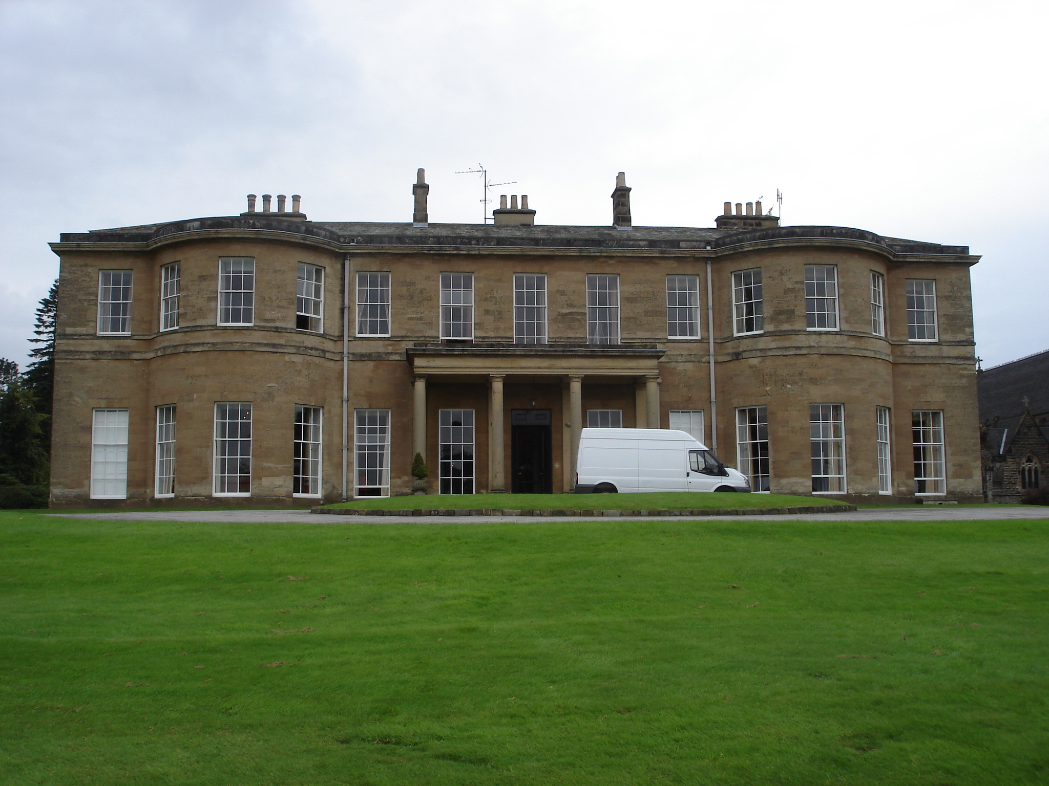
Rudding Park

Rudding Park Hotel, Spa and Golf is a Grade I listed Regency-style country house in Harrogate, North Yorkshire, England.It is situated within the 2,000...

Plumpton Rocks

Plumpton Rocks is a man-made lake and surrounding pleasure gardens 3.5 miles (5.6 km) south-east of Harrogate in North Yorkshire, England, near the village...

Crimple railway station

Crimple railway station served the suburb of Crimple, in the historical county of North Riding of Yorkshire, England, from 1867 to 1869 on the Harrogate...
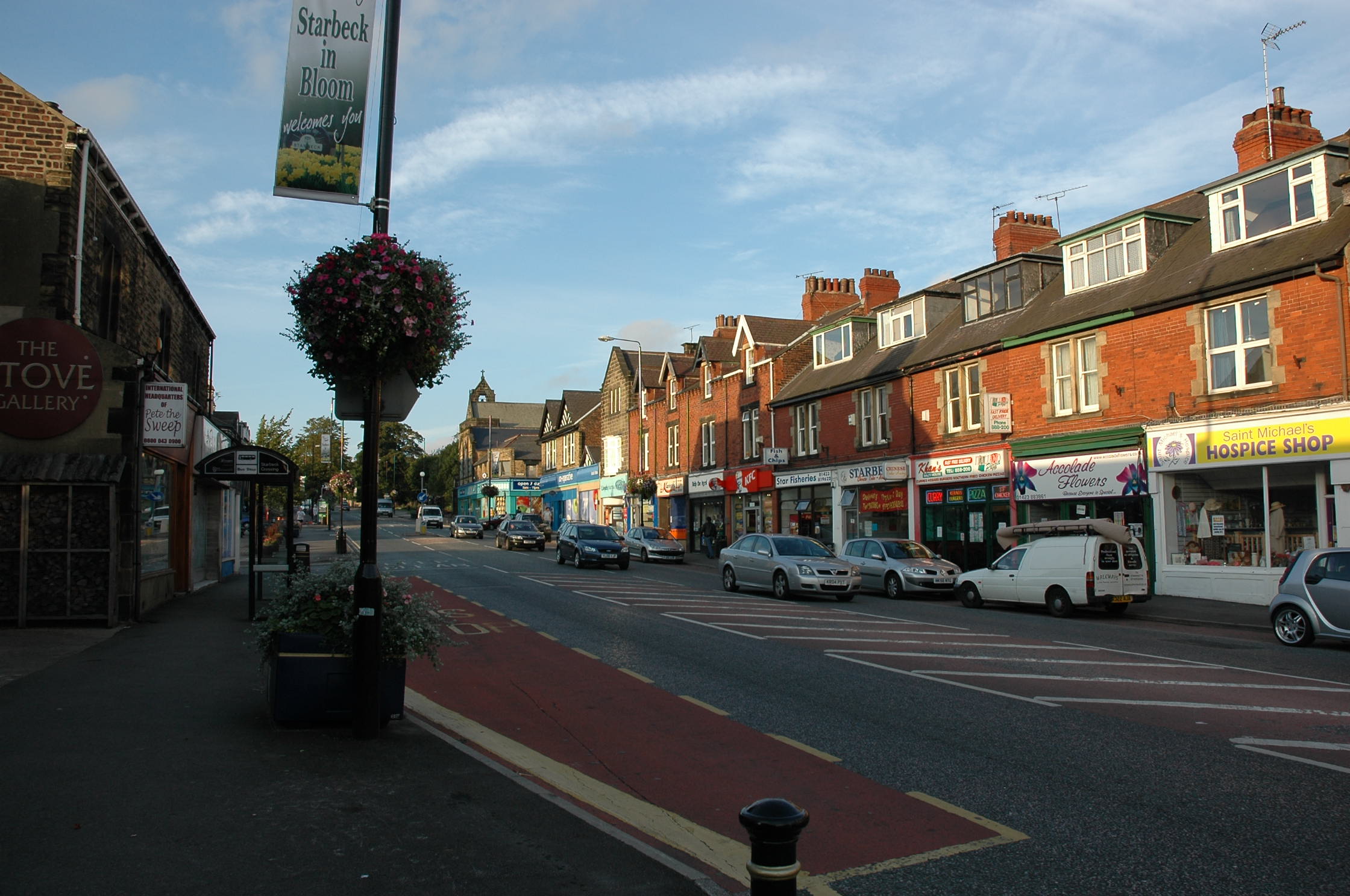
Starbeck

Starbeck is an area of Harrogate in North Yorkshire, England. The population of Starbeck Ward taken at the 2011 census was 6,226. It has many facilities...

Crimple Valley

Crimple Valley is an area south of Harrogate (North Yorkshire) surrounding the River Crimple (also known as Crimple Beck). It gave its name to the synthetic...

Harrogate and Knaresborough (UK Parliament constituency)

Harrogate and Knaresborough () is a parliamentary constituency in North Yorkshire which has been represented in the House of Commons of the UK Parliament...

Great Yorkshire Show

The Great Yorkshire Show (GYS) is an agricultural show which takes place on the Great Yorkshire Showground in Harrogate, North Yorkshire in the North of...

Nearby Amenities

Located within 500m of 53.9683,-1.481
Follifoot
Is In: Harrogate, North Yorkshire, England, UK
Is In Country: UK
Is In County: North Yorkshire
Place: village
Source: npe
Lat/Long: 53.9675793/-1.4799894
Turning Circle
Lat/Long: 53.9676041/-1.4828109
Post Office
Follifoot Village Stores
Shop: newsagent
Source: OS OpenData StreetView
Lat/Long: 53.9679494/-1.4804691
Barrier: stile
Lat/Long: 53.9677186/-1.4806193
Turning Circle
Lat/Long: 53.9676113/-1.481659
Telephone
Defibrillator
Booth: K6
Covered: booth
Defibrillator Location: inside red phone box at top of Main Street, Follifoot
Emergency: defibrillator
Listed Status: Grade II
Man Made: telephone_box
Ref GB The Circuit: 280616F9-A993-484C-9157-B04A00A73445
Lat/Long: 53.9682296/-1.4806798
Historic: stocks
Lat/Long: 53.9681625/-1.4806543
Post Box
Post Box Type: wall
Royal Cypher: EIIR
Royal Cypher Wikidata: Q33102113
Lat/Long: 53.9679219/-1.4805309
Bus Stop
Naptan AtcoCode: 3200YND77330
Naptan NaptanCode: 32077330
Shelter: yes
Lat/Long: 53.9680158/-1.4808286
Bus Stop
Naptan AtcoCode: 3200YND77160
Naptan NaptanCode: 32077160
Lat/Long: 53.9678011/-1.4804773
Pub
Harewood Arms
Lat/Long: 53.9678643/-1.4803807
Pub
Radcliffe Arms
Lat/Long: 53.9684702/-1.4822797
Barrier: stile
Lat/Long: 53.9691049/-1.4783487
Barrier: stile
Lat/Long: 53.9696128/-1.4787277
Barrier: stile
Lat/Long: 53.9719207/-1.4804508
Barrier: stile
Lat/Long: 53.9720778/-1.4805743
Saxon cross
HE Ref: listed_status
Description: C9 Saxon preaching cross. The top has ben restored (C19) but the lower portion appears to be original.
Historic: wayside_cross
Listed Status: Grade II
Source: survey
Lat/Long: 53.9683512/-1.4809323
Follifoot
Information: board
Source: survey
Tourism: information
Lat/Long: 53.9681903/-1.481045
Barrier: stile
Source: survey
Lat/Long: 53.9673914/-1.4818228
Barrier: stile
Lat/Long: 53.9686447/-1.4785932
Barrier: stile
Lat/Long: 53.9668704/-1.476195
Entrance: gate
Lat/Long: 53.9693292/-1.4778431
The data included in this document is from www.openstreetmap.org. The data is made available under ODbL.

Have you been to Follifoot?

Leave your review of Follifoot below (or comments, questions and feedback).