Farringdon Park

Settlement in Lancashire Preston

England

Farringdon Park

M6 approaching crossing of River Ribble
M6 approaching crossing of River Ribble Credit: Alpin Stewart

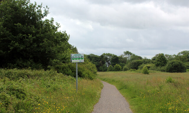
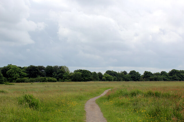
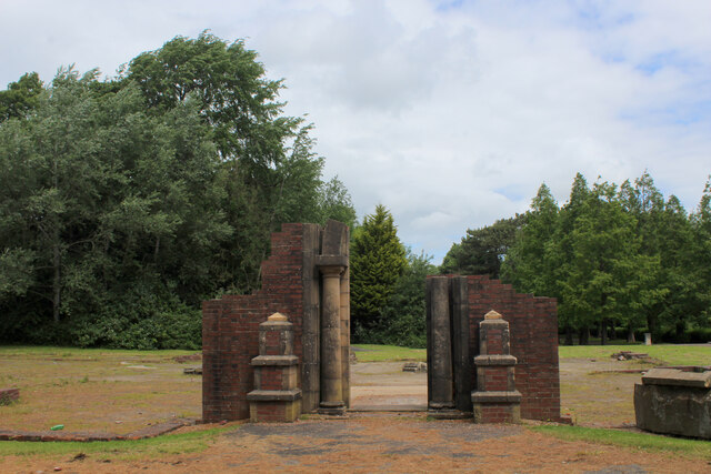
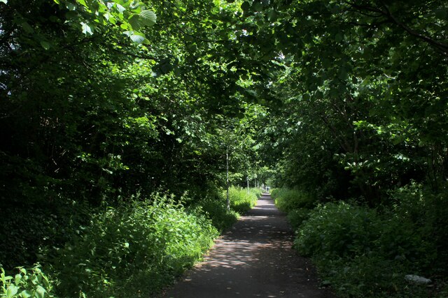
Farringdon Park is a charming public park located in the county of Lancashire, England. Situated within the borough of South Ribble, the park covers an area of approximately 8 acres and is a popular destination for locals and visitors alike.

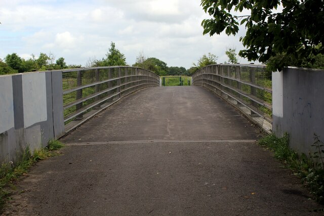
The park boasts a wide range of amenities and features that cater to various recreational activities. It is home to well-maintained walking paths, which offer a pleasant stroll through the park's lush greenery. There are also designated areas for picnicking, providing a perfect spot for families and friends to relax and enjoy the outdoors.

Children can revel in the park's playground, equipped with swings, slides, and climbing frames, providing endless entertainment for younger visitors. Additionally, Farringdon Park offers a multi-use games area, providing opportunities for sports enthusiasts to engage in activities such as football and basketball.

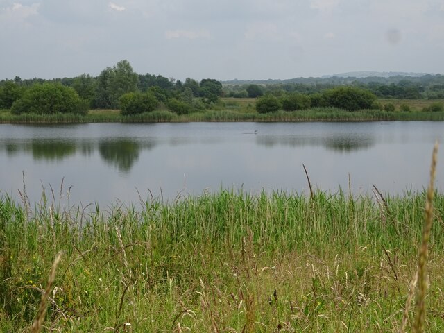
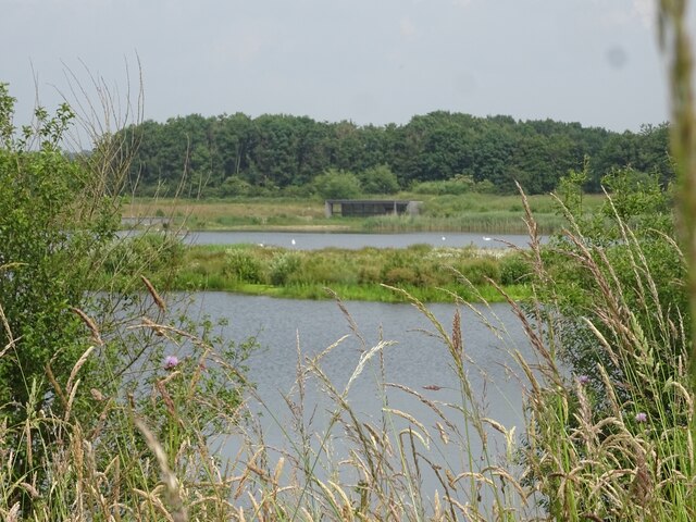
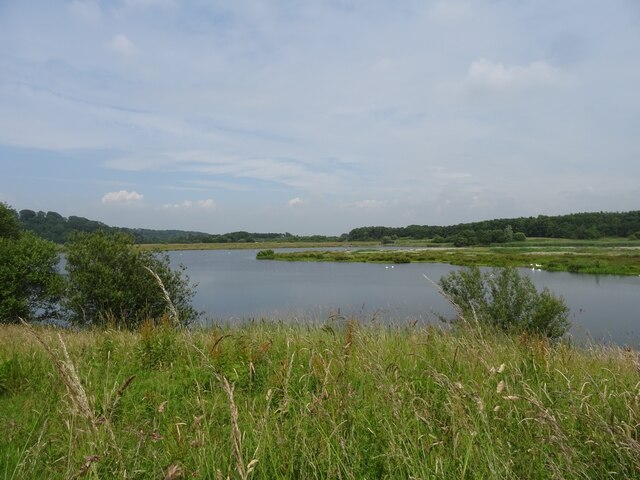
Nature lovers will appreciate the park's beautiful floral displays, which change throughout the seasons, adding bursts of color and fragrance to the surroundings. The park also features a small pond, attracting various bird species, making it a great spot for birdwatching.

Moreover, Farringdon Park hosts community events and activities, including outdoor concerts and fairs during the summer months. The park's open spaces are often utilized for gatherings, promoting a sense of community.

Overall, Farringdon Park in Lancashire is a delightful green space that offers something for everyone. Its well-maintained facilities, beautiful landscapes, and diverse range of activities make it a cherished destination for residents and visitors to enjoy leisurely outdoor pursuits.

If you have any feedback on the listing, please let us know in the comments section below.

Farringdon Park Images

Images are sourced within 2km of 53.766187/-2.6561131 or Grid Reference SD5630. Thanks to Geograph Open Source API. All images are credited.

M6 approaching crossing of River Ribble
Gantries and footbridge over M6
B6243 crossing M6
B6243 crossing M6
Ribbleton Pool, Brockholes Nature Reserve
Number One Pit, Brockholes Nature Reserve
Number One Pit, Brockholes Nature Reserve The south end of the Number One Pit at Brockholes Nature Reserve.
Number One Pit, Brockholes Nature Reserve
The south end of the Number One Pit at Brockholes Nature Reserve.
Workings at Lower Brockholes
Matrix board - northbound M6
Junction 31A signage - northbound M6
B6243 bridge - northbound M6
M5 crossing the River Ribble east of Preston Slipway for the A677 on the other viaduct
M5 crossing the River Ribble east of Preston
Slipway for the A677 on the other viaduct
Footpath heading South towards Boilton Wood The path follows the edge of Red Scar Wood. Concealed within the trees is an older path which runs parallel to this one - and carries the Ribble Way long distance footpath. The woods then plunge very steeply down to the River Ribble, below.
Footpath heading South towards Boilton Wood
The path follows the edge of Red Scar Wood. Concealed within the trees is an older path which runs parallel to this one - and carries the Ribble Way long distance footpath. The woods then plunge very steeply down to the River Ribble, below.
Pope Lane Hard surfaced footpath that crosses a large grass space from Red Scar Woods to reach and then traverse the M6 over a bridge, and into the Ribbleton district of Preston.
Pope Lane
Hard surfaced footpath that crosses a large grass space from Red Scar Woods to reach and then traverse the M6 over a bridge, and into the Ribbleton district of Preston.
Ruins of Ribbleton Hall All that is left of Ribbleton Hall in Grange Park, Preston.
Built by a Thomas Birchall in 1863, a local lawyer famed for his legion of mistresses.
It passed through several hands including a boys preparatory school in the 1920's, and the military during the Second World War.
It was finally demolished in 1955, to make way for a park for the local people of Preston.
Ruins of Ribbleton Hall
All that is left of Ribbleton Hall in Grange Park, Preston. Built by a Thomas Birchall in 1863, a local lawyer famed for his legion of mistresses. It passed through several hands including a boys preparatory school in the 1920's, and the military during the Second World War. It was finally demolished in 1955, to make way for a park for the local people of Preston.
Footbridge over the M6 Pope Lane crossing the Preston By-pass heading towards Red Scar Woods above the River Ribble
Footbridge over the M6
Pope Lane crossing the Preston By-pass heading towards Red Scar Woods above the River Ribble
Apartment Blocks on Grange Avenue Dwellings in the north eastern suburbs of Preston
Apartment Blocks on Grange Avenue
Dwellings in the north eastern suburbs of Preston
On the Former Preston/Longridge Railway Closed to passengers as far back as 1930 - and freight in 1967.
Now converted to leisure use for cyclists and walkers - forming a green tunnel as this point.
On the Former Preston/Longridge Railway
Closed to passengers as far back as 1930 - and freight in 1967. Now converted to leisure use for cyclists and walkers - forming a green tunnel as this point.
Visitor Village at Brockholes Nature Reserve Most of the site was originally farmland, on the floodplain of the River Ribble. It was bordered by woodland on the slopes to the north, and by the river to the east and south. The M6 motorway was opened in 1958.
Sand and gravel was quarried east of the M6 from 1996 to 2007, when the activity transferred to the west of the M6 (Lower Brockholes).
The site was bought by the Lancashire Wildlife Trust in 2007.
The gravel pits have been modified to improve the habitat for wildlife, and enable water levels to be controlled. The creation of wildflower meadows, reedbeds and woodland continues. 
The reserve opened to the public at Easter 2011, after the floating visitor village had been completed.
See <span class="nowrap"><a title="http://www.brockholes.org/" rel="nofollow ugc noopener" href="http://www.brockholes.org/">Link</a><img style="margin-left:2px;" alt="External link" title="External link - shift click to open in new window" src="https://s1.geograph.org.uk/img/external.png" width="10" height="10"/></span> .
Visitor Village at Brockholes Nature Reserve
Most of the site was originally farmland, on the floodplain of the River Ribble. It was bordered by woodland on the slopes to the north, and by the river to the east and south. The M6 motorway was opened in 1958. Sand and gravel was quarried east of the M6 from 1996 to 2007, when the activity transferred to the west of the M6 (Lower Brockholes). The site was bought by the Lancashire Wildlife Trust in 2007. The gravel pits have been modified to improve the habitat for wildlife, and enable water levels to be controlled. The creation of wildflower meadows, reedbeds and woodland continues. The reserve opened to the public at Easter 2011, after the floating visitor village had been completed. See LinkExternal link .
Show me another place!

Farringdon Park is located at Grid Ref: SD5630 (Lat: 53.766187, Lng: -2.6561131)

Administrative County: Lancashire

District: Preston

Police Authority: Lancashire

What 3 Words

///dreams.first.editor. Near Preston, Lancashire

Nearby Locations

Farringdon Park Ribbleton

Related Wikis

Ribbleton

Ribbleton is a suburb and ward of the city of Preston, Lancashire, England. It is located to the east of the city centre, between the A59 New Hall Lane...

Cuerdale Hoard

The Cuerdale Hoard is a hoard of more than 8,600 items, including silver coins, English and Carolingian jewellery, hacksilver and ingots. It was discovered...

St Mary Magdalene's Church, Ribbleton

St Mary Magdalene's Church is in Ribbleton Avenue, Ribbleton, Preston, Lancashire, England. It is an active Anglican parish church in the deanery of Preston...

St Matthew's Church, Preston

St Matthew's Church, is in New Hall Lane, Preston, Lancashire, England. It is an active Anglican parish church in the deanery of Preston, the archdeaconry...

St Matthew's, Preston

St Matthew's is an electoral ward in Preston, Lancashire, England. The ward is adjacent to the larger Ribbleton to the east but is considered to be an...

St Joseph's Church, Preston

St Joseph's Church is in Skeffington Road, Preston, Lancashire, England. It is an active Roman Catholic church in the Diocese of Lancaster. The church...

Madina Mosque (Preston)

Madina Mosque is a mosque in Preston, Lancashire, England.

Cuerdale

Cuerdale is a civil parish in the South Ribble district of Lancashire, England. It includes Cuerdale Hall and has no substantive settlements. It originated...

Nearby Amenities

Located within 500m of 53.766187,-2.6561131
Devonshire Garage
Addr Street: Devonshire Place
Shop: car_repair
Lat/Long: 53.7651123/-2.6625137
Turning Circle
Lat/Long: 53.7629128/-2.659535
Crossing
Crossing: uncontrolled
Crossing Ref: zebra
Tactile Paving: yes
Lat/Long: 53.7659905/-2.6634909
Crossing
Crossing: traffic_signals
Crossing Ref: pelican
Foot: yes
Lat/Long: 53.765728/-2.6559547
Bus Stop
Bus: yes
Public Transport: platform
Shelter: no
Lat/Long: 53.764555/-2.656949
Bus Stop
Bus: yes
Naptan AtcoCode: 25001163
Naptan NaptanCode: lanagjtm
Public Transport: platform
Lat/Long: 53.7654355/-2.6559505
Veterinary
New Hall Veterinary Centre
Created By: Potlatch 0.10f
Lat/Long: 53.7656089/-2.6631948
Ribble Village
Place: neighbourhood
Lat/Long: 53.7698346/-2.6571642
Atm
Santander
Cost: free
Created By: iLOE 1.9
Lat/Long: 53.765568/-2.656154
Post Box
Operator: Royal Mail
Lat/Long: 53.7654551/-2.6559008
Crossing
Crossing: uncontrolled
Lat/Long: 53.7657175/-2.6636612
Crossing
Crossing: uncontrolled
Lat/Long: 53.7658012/-2.6636774
Barrier: bollard
Bicycle: yes
Motor Vehicle: no
Lat/Long: 53.7656658/-2.6629829
Farringdon Park
Place: neighbourhood
Lat/Long: 53.7645645/-2.6566508
Barrier: bollard
Foot: yes
Lat/Long: 53.765431/-2.6623163
Barrier: bollard
Foot: yes
Lat/Long: 53.7654276/-2.6619764
Speed Camera
Maxspeed: 40 mph
Lat/Long: 53.7657194/-2.6520236
Community Centre
RAFT
Addr City: Preston
Addr Country: GB
Addr Housename: Farringdon Park Community Centre
Addr Housenumber: 18-24
Addr Postcode: PR1 5TR
Addr Street: Thirlmere Road
Fhrs Id: 479778
Survey Date: 2020-03-04
Lat/Long: 53.7669391/-2.6539372
Fast Food
Greggs
Addr City: Preston
Addr Country: GB
Addr Housename: New Hall Lane Services
Addr Housenumber: 556
Addr Postcode: PR1 4TE
Addr Street: New Hall Lane
Brand: Greggs
Brand Wikidata: Q3403981
Brand Wikipedia: en:Greggs
Contact Website: https://www.greggs.co.uk/shop-finder?shop-code=5015
Cuisine: sandwich;bakery
Fhrs Id: 1276370
Survey Date: 2021-08-13
Takeaway: yes
Lat/Long: 53.7655102/-2.6565792
Social Facility
Parklands Rest Home
Addr City: Preston
Addr Country: GB
Addr Housenumber: 516
Addr Postcode: PR1 4TD
Addr Street: New Hall Lane
Fhrs Id: 119185
Social Facility: nursing_home
Survey Date: 2019-10-03
Lat/Long: 53.7655673/-2.6600674
Social Facility
Ribble View Health Care
Addr City: Preston
Addr Country: GB
Addr Housenumber: 39
Addr Postcode: PR1 4UD
Addr Street: Church Avenue
Fhrs Id: 1194094
Operator: Ribble View Health Care Ltd
Social Facility: nursing_home
Survey Date: 2020-01-24
Lat/Long: 53.7642117/-2.6626477
Fast Food
Warburton's Traditional Fish & Chips
Addr City: Preston
Addr Country: GB
Addr Housenumber: 456
Addr Postcode: PR1 4TA
Addr Street: New Hall Lane
Cuisine: fish_and_chips
Fhrs Id: 140179
Survey Date: 2019-01-24
Lat/Long: 53.7655926/-2.6634235
Farringdon Park
Bus: yes
Public Transport: stop_position
Lat/Long: 53.7654208/-2.6558125
The data included in this document is from www.openstreetmap.org. The data is made available under ODbL.

Have you been to Farringdon Park?

Leave your review of Farringdon Park below (or comments, questions and feedback).