Entwistle

Settlement in Lancashire

England

Entwistle

Path, Turton Heights
Path, Turton Heights Credit: Richard Webb

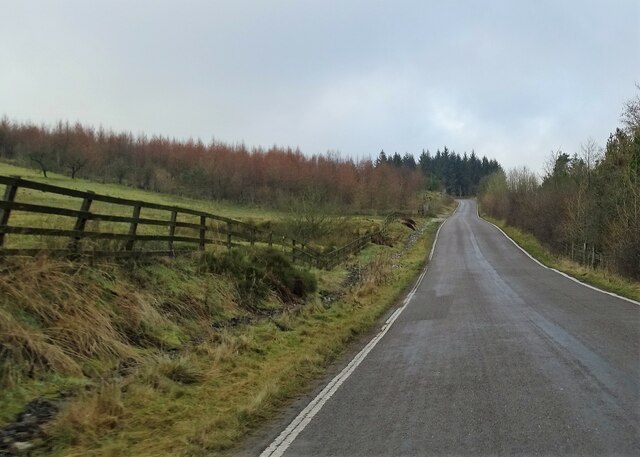
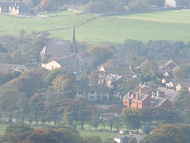
Entwistle, Lancashire is a picturesque village located in the West Pennine Moors, around 8 miles north of Bolton, England. Nestled within the borough of Blackburn with Darwen, this rural settlement is surrounded by stunning countryside and offers a tranquil retreat for those seeking a peaceful getaway.

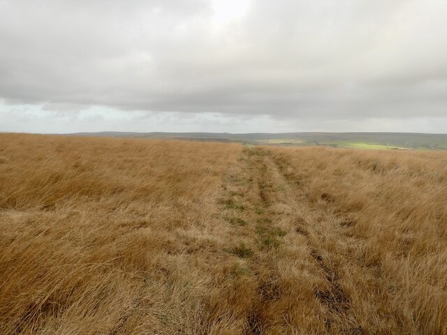
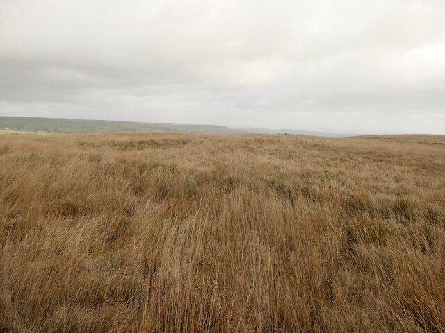
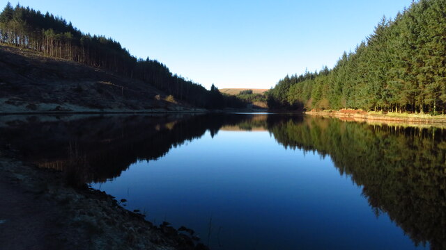
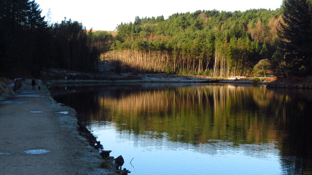
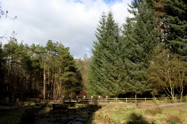
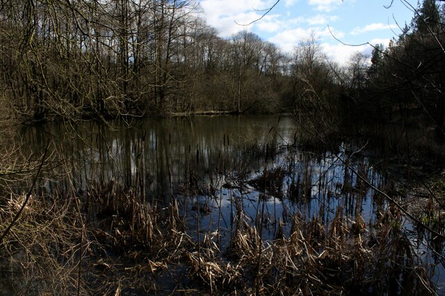
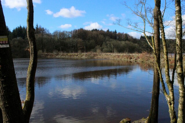
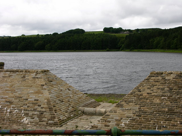
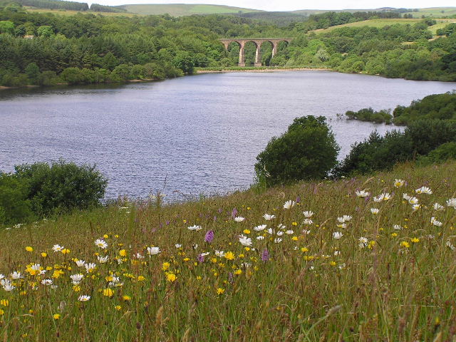
The village is famous for its stunning landscapes, with rolling hills, woodlands, and reservoirs providing a scenic backdrop. One of the key attractions in Entwistle is Entwistle Reservoir, a man-made lake created in the 19th century. This reservoir not only serves as a source of water but also offers opportunities for outdoor activities such as fishing, sailing, and walking along the surrounding trails.

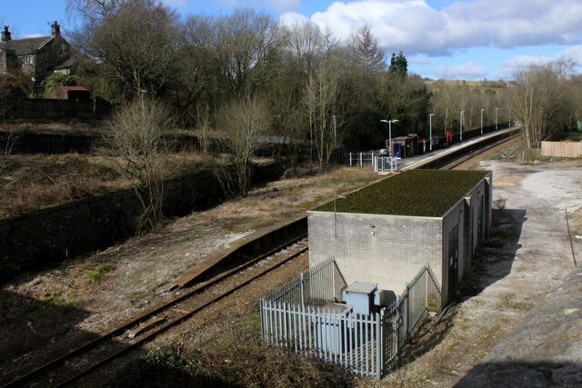
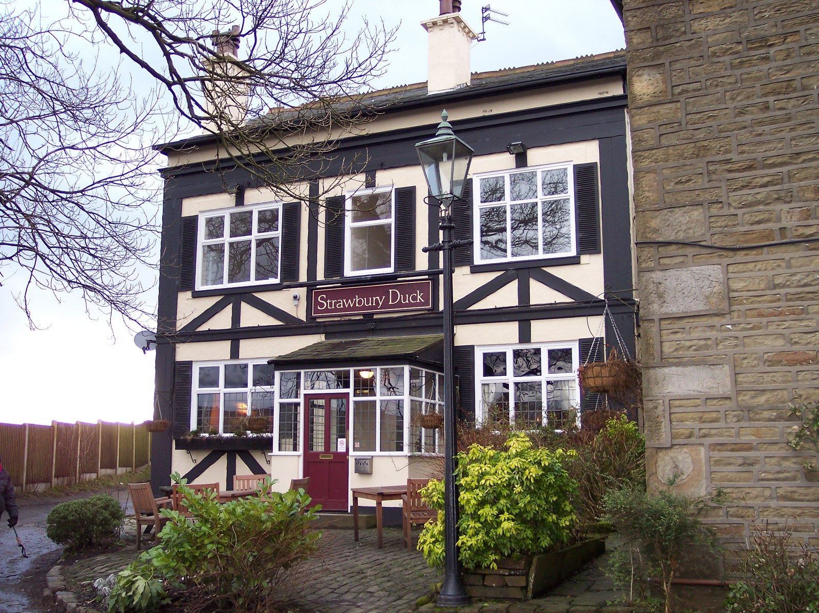
Despite its small size, Entwistle boasts a close-knit community, with a population of around 500 people. The village is home to a handful of traditional stone-built cottages, a local pub, and a small church. The nearby Entwistle railway station provides convenient access to larger towns and cities, making it an appealing location for commuters.

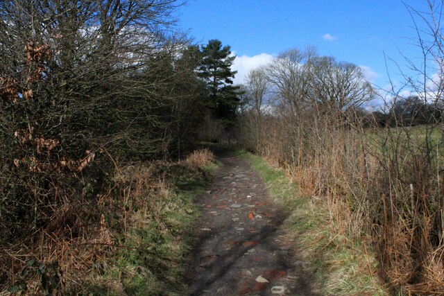
Nature enthusiasts will find Entwistle a haven for wildlife, with various bird species, including herons and kingfishers, making their home in the area. The village is also a popular spot for hikers and cyclists, thanks to its proximity to the West Pennine Moors and its many scenic trails.

Overall, Entwistle, Lancashire offers a peaceful and idyllic setting for those wishing to escape the hustle and bustle of city life and enjoy the beauty of the English countryside.

If you have any feedback on the listing, please let us know in the comments section below.

Entwistle Images

Images are sourced within 2km of 53.654238/-2.41247 or Grid Reference SD7217. Thanks to Geograph Open Source API. All images are credited.

Path, Turton Heights
Moorland, Turton Heights Dryish conditions at the time of visit, but grass is tussocky.
Moorland, Turton Heights
Dryish conditions at the time of visit, but grass is tussocky.
Greens Arms Road The road links Chapeltown with the A666 south of Darwen.
Greens Arms Road
The road links Chapeltown with the A666 south of Darwen.
Wayoh Reservoir near Edgworth as seen from the dam
Turton & Entwistle Reservoir, western arm
Footbridge over Cadshaw Brook Deep in Yarnsdale, near the point where Cadshaw Brook enters the waters of Entwhistle Reservoir
Footbridge over Cadshaw Brook
Deep in Yarnsdale, near the point where Cadshaw Brook enters the waters of Entwhistle Reservoir
Farm Track heading for Cadshaw Part of the long track between Entwistle and Cadshaw, adopted by the Witton Weavers Way long distance footpath
Farm Track heading for Cadshaw
Part of the long track between Entwistle and Cadshaw, adopted by the Witton Weavers Way long distance footpath
Section of Farm Track between Cadshaw and Entwistle Adopted by the Witton Weavers Way long distance footpath
Section of Farm Track between Cadshaw and Entwistle
Adopted by the Witton Weavers Way long distance footpath
Edge Fold Farm Solid stone farm and outbuildings, passed by on the Witton Weavers Way long distance footpath near Entwistle
Edge Fold Farm
Solid stone farm and outbuildings, passed by on the Witton Weavers Way long distance footpath near Entwistle
Delph House Passed by on the Witton Weavers Way long distance footpath, near Entwistle
Delph House
Passed by on the Witton Weavers Way long distance footpath, near Entwistle
Entwistle Station East Lancashire Line that operates between Manchester and Clitheroe, via Blackburn - single track at this point.
Entwistle Station
East Lancashire Line that operates between Manchester and Clitheroe, via Blackburn - single track at this point.
Top End of Wayoh Reservoir Furthest from the dam, this part of the reservoir is choked with a variety of interesting vegetation
Top End of Wayoh Reservoir
Furthest from the dam, this part of the reservoir is choked with a variety of interesting vegetation
Causeway across Wayoh Reservoir This causeway carries Cross Trees Lane across the still waters of Wayoh Reservoir.
Completed in 1876, and extended in 1962 to provide drinking water to nearby Bolton.
Causeway across Wayoh Reservoir
This causeway carries Cross Trees Lane across the still waters of Wayoh Reservoir. Completed in 1876, and extended in 1962 to provide drinking water to nearby Bolton.
Footpath beside Wayoh Reservoir Adopted by the Witton Weavers Way long distance footpath
Footpath beside Wayoh Reservoir
Adopted by the Witton Weavers Way long distance footpath
Wayoh Reservoir Completed in 1876 and extended in 1962, this reservoir contributes to the water supply of nearby Bolton.
Wayoh Reservoir
Completed in 1876 and extended in 1962, this reservoir contributes to the water supply of nearby Bolton.
Flight of Steps beside the Wayoh Reservoir Embankment Adopted by the Witton Weavers Way long distance footpath, these steps take the walker to the site of Edgworth Quarries - there is now no trace of the former workings.
The steps also form part of a walk that circumnavigates the reservoir.
Flight of Steps beside the Wayoh Reservoir Embankment
Adopted by the Witton Weavers Way long distance footpath, these steps take the walker to the site of Edgworth Quarries - there is now no trace of the former workings. The steps also form part of a walk that circumnavigates the reservoir.
Entering Chapeltown from the North Following Greens Arms Road into Chapeltown
Entering Chapeltown from the North
Following Greens Arms Road into Chapeltown
Show me another place!

Entwistle is located at Grid Ref: SD7217 (Lat: 53.654238, Lng: -2.41247)

Unitary Authority: Blackburn with Darwen

Police Authority: Lancashire

What 3 Words

///ponies.bypasses.softly. Near Edgworth, Lancashire

Related Wikis

Entwistle, Lancashire

Entwistle is a village in the Blackburn with Darwen unitary authority in Lancashire in the north west of England. Its name derives from the Old English...

Entwistle railway station

Entwistle railway station (first opened in 1848) is 5+3⁄4 miles (9.3 km) north of Bolton and serves the village of Entwistle. It is also the closest station...

Turton and Entwistle Reservoir

Turton and Entwistle Reservoir is a water reservoir in the village of Edgworth, Lancashire, England. The reservoir's existence is due to the Entwistle...

Wayoh Reservoir

Wayoh Reservoir is a water reservoir in the town of Edgworth, Lancashire, England. It was completed on 28 April 1876 to supply water to Bolton. Wayoh,...

Turton F.C.

Turton Football Club is a football club based in Edgworth, in the North Turton district of Blackburn with Darwen, Lancashire, England. They are currently...

West Pennine Moors

The West Pennine Moors is an area of the Pennines covering approximately 90 square miles (230 km2) of moorland and reservoirs in Lancashire and Greater...

Whittlestone Head railway station

Whittlestone Head railway station served the hamlet of Whittlestone Head, Lancashire, England, in 1848 on the Blackburn, Darwen and Bolton Railway. �...

Edgworth

Edgworth is a small village within the borough of Blackburn with Darwen, Lancashire, England. It is north east of North Turton between Broadhead Brook...

Nearby Amenities

Located within 500m of 53.654238,-2.41247
Entwistle
Addr City: Bolton
Addr Postcode: BL7 0NG
Addr Street: Overshores Road
Naptan AtcoCode: 9100ENTWISL
Network: National Rail
Network Website: https://www.nationalrail.co.uk/stations/ent/
Network Wikidata: Q26334
Operator: Northern Rail
Operator Website: https://www.northernrailway.co.uk/stations/entwistle
Operator Wikidata: Q85789775
Public Transport: station
Railway: station
Ref Crs: ENT
Request Stop: yes
Source: npe
Train: yes
Wikidata: Q2933251
Wikipedia: en:Entwistle railway station
Lat/Long: 53.6556886/-2.4139637
Crossing: informal
Lat/Long: 53.6523298/-2.4059102
Pub
Strawbury Duck
Addr City: Bolton
Addr Place: Entwistle
Addr Postcode: BL7 0LU
Addr Street: Overshores Road
Fhrs Id: 211313
Opening Hours: Mo-Su 12:00-23:00
Operator: Heritage Inn British Restaurant
Outdoor Seating: yes
Phone: +44 1204 852013
Website: https://www.thestrawburyduck.co.uk/
Wheelchair: limited
Lat/Long: 53.6547395/-2.4142985
West Pennine Moors
Natural: wood
Note: There is a boundary for this location http://www.westpenninemoors.com/visiting_map It would be great if someone could obtain some freely licensed boundary data
Website: http://www.westpenninemoors.com/
Wikidata: Q7986192
Wikipedia: en:West Pennine Moors
Lat/Long: 53.6525249/-2.4074019
Entwistle Electricity Substation
Frequency: 50
Location: outdoor
Operator: Electricity North West
Power: substation
Ref: 231519
Source: survey
Substation: minor_distribution
Voltage: 11000
Lat/Long: 53.6546616/-2.413203
Parking
The Strawbury Duck
Access: customers
Fee: no
Parking: surface
Smoothness: bad
Surface: asphalt
Lat/Long: 53.654892/-2.4145286
Railway: level_crossing
Lat/Long: 53.6511184/-2.4139081
Telephone
Booth: K6
Covered: booth
Listed Status: Grade II
Lat/Long: 53.6549462/-2.4141397
Vending Machine
Vending: public_transport_tickets
Lat/Long: 53.6556459/-2.4140539
Barrier: stile
Dog Gate: yes
Fixme: Location approximate
Material: wood
Source: survey
Lat/Long: 53.6584886/-2.4116226
Departures Board: realtime
Passenger Information Display: realtime
Lat/Long: 53.6556495/-2.4140218
Board Type: history
Information: board
Tourism: information
Lat/Long: 53.6550464/-2.414126
Barrier: yes
Lat/Long: 53.6525668/-2.4171116
The data included in this document is from www.openstreetmap.org. The data is made available under ODbL.

Have you been to Entwistle?

Leave your review of Entwistle below (or comments, questions and feedback).