Egham Hythe

Settlement in Surrey Runnymede

England

Egham Hythe

Staines : former town hall Grade II listed - <span class="nowrap"><a title="https://historicengland.org.uk/listing/the-list/list-entry/1187053?section=official-list-entry" rel="nofollow ugc noopener" href="https://historicengland.org.uk/listing/the-list/list-entry/1187053?section=official-list-entry">Link</a><img style="margin-left:2px;" alt="External link" title="External link - shift click to open in new window" src="https://s1.geograph.org.uk/img/external.png" width="10" height="10"/></span>. Architect : John Johnson. View of the building from the River Thames
Staines : former town hall Credit: Jim Osley

Egham Hythe is a small village located in the Runnymede borough of Surrey, England. Situated on the River Thames, it is approximately 20 miles southwest of central London. The village is part of the larger town of Egham and is known for its scenic beauty and historical significance.

Egham Hythe is primarily a residential area with a population of around 5,000 people. It offers a peaceful and tranquil environment, making it an ideal place to live for those seeking a quieter lifestyle away from the hustle and bustle of the city. The village is surrounded by lush green fields and picturesque landscapes, providing ample opportunities for outdoor activities such as walking, cycling, and boating.

The village has a rich history, dating back to Roman times when it served as a river crossing point. Egham Hythe's name itself signifies its historical connection to the river, with "Hythe" meaning a landing place or port. The village played a significant role during the signing of the Magna Carta in 1215, as it was near the site where King John met the barons to discuss the terms of the document.

Despite its small size, Egham Hythe offers a range of amenities and services to its residents and visitors. There are a few local shops, pubs, and restaurants, providing essential goods and leisure opportunities. The village is also well-connected, with several bus routes passing through and Egham railway station nearby, allowing easy access to London and other neighboring towns.

Overall, Egham Hythe is a charming village with a rich history and natural beauty, making it an attractive place to live or visit for those seeking a peaceful and idyllic setting.

If you have any feedback on the listing, please let us know in the comments section below.

Egham Hythe Images

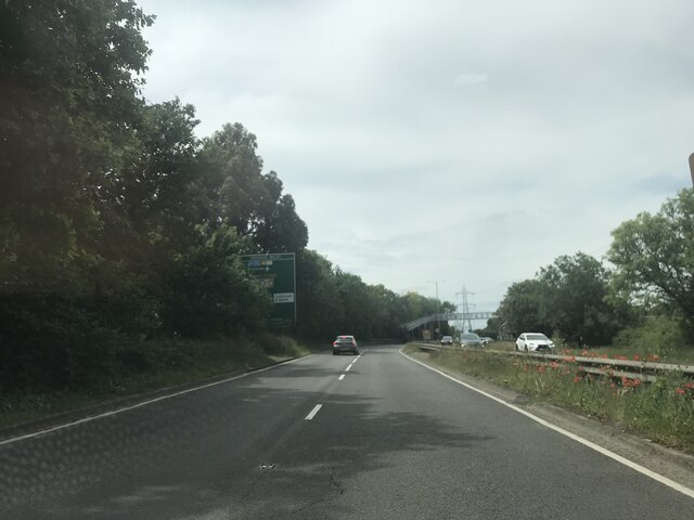
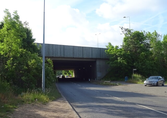
Images are sourced within 2km of 51.428099/-0.52350281 or Grid Reference TQ0270. Thanks to Geograph Open Source API. All images are credited.

Staines : former town hall Grade II listed - <span class="nowrap"><a title="https://historicengland.org.uk/listing/the-list/list-entry/1187053?section=official-list-entry" rel="nofollow ugc noopener" href="https://historicengland.org.uk/listing/the-list/list-entry/1187053?section=official-list-entry">Link</a><img style="margin-left:2px;" alt="External link" title="External link - shift click to open in new window" src="https://s1.geograph.org.uk/img/external.png" width="10" height="10"/></span>. Architect : John Johnson. View of the building from the River Thames
Staines : former town hall
Grade II listed - LinkExternal link. Architect : John Johnson. View of the building from the River Thames
Staines Bridge Grade II listed - "Opened and dated 1832. (Engineer-architects: George Rennie and John Rennie)" - <span class="nowrap"><a title="https://historicengland.org.uk/listing/the-list/list-entry/1187018?section=official-list-entry" rel="nofollow ugc noopener" href="https://historicengland.org.uk/listing/the-list/list-entry/1187018?section=official-list-entry">Link</a><img style="margin-left:2px;" alt="External link" title="External link - shift click to open in new window" src="https://s1.geograph.org.uk/img/external.png" width="10" height="10"/></span>
Staines Bridge
Grade II listed - "Opened and dated 1832. (Engineer-architects: George Rennie and John Rennie)" - LinkExternal link
Egham station This shows the up-side frontage as rebuilt in 1985.
Egham station
This shows the up-side frontage as rebuilt in 1985.
St John the Baptist, Egham - south elevation
St John the Baptist, Egham - north elevation
High Street, Egham This is the north side looking east.
High Street, Egham
This is the north side looking east.
Ongoing construction work, Egham This was taken where Church Road (running left-right) is met by Station Road (foreground).
Ongoing construction work, Egham
This was taken where Church Road (running left-right) is met by Station Road (foreground).
On the A308
On the A308
Approaching the A30/M25 junction
Houses on Wraysbury Road
A30 / M25 Motorway bridge over Wraysbury Road (B376)
Lammas Recreation Ground, Staines
Outdoor exercise area, Lammas Recreation Ground, Staines
Houses on Greenpark, Staines
Vicarage Road, Staines
The London Stone, Staines On Church Street.
See <a href="https://www.geograph.org.uk/photo/7298114">TQ0371 : Sign for the London Stone, Staines</a> for sign.
The London Stone, Staines
On Church Street. See TQ0371 : Sign for the London Stone, Staines for sign.
Sign for the London Stone, Staines See <a href="https://www.geograph.org.uk/photo/7298113">TQ0371 : The London Stone, Staines</a> for context.
Sign for the London Stone, Staines
Church Street, Staines
Show me another place!

Egham Hythe is located at Grid Ref: TQ0270 (Lat: 51.428099, Lng: -0.52350281)

Administrative County: Surrey

District: Runnymede

Police Authority: Surrey

What 3 Words

///panic.update.props. Near Staines, Surrey

Related Wikis

The Magna Carta School

The Magna Carta School is an 11–16 academy school in Staines, England, which has been awarded specialisms in Technology and ICT. It is named after Magna...

Egham Hythe

Egham Hythe, Pooley Green and Thorpe Lea are adjacent settlements in the Borough of Runnymede in Surrey, England, approximately 18 miles (29 km) west of...

Egham Town F.C.

Egham Town Football Club is a football club based in Egham, Surrey, England. They are currently members of the Combined Counties League Premier Division...
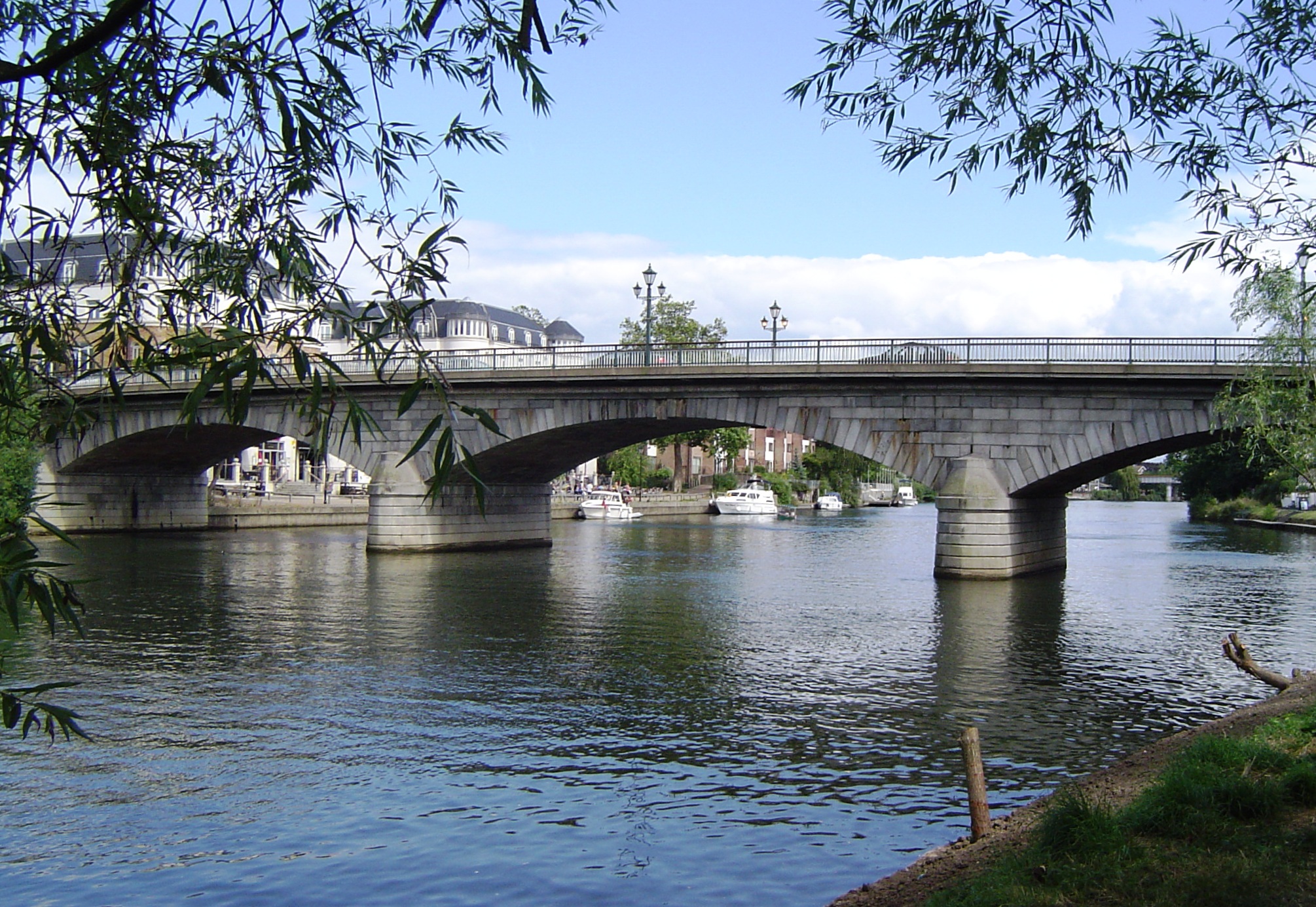
Staines Bridge

Staines Bridge is a road bridge running in a south-west to north-east direction across the River Thames in Surrey. It is on the modern A308 road and links...

Nearby Amenities

Located within 500m of 51.428099,-0.52350281
Thorpe Lane
Crossing Barrier: double_half
Crossing Light: yes
Railway: level_crossing
Supervised: no
Lat/Long: 51.4308964/-0.520204
Traffic Calming: cushion
Lat/Long: 51.4283063/-0.5305861
Traffic Calming: cushion
Lat/Long: 51.4277722/-0.5296894
Mini Roundabout
Direction: clockwise
Lat/Long: 51.4267986/-0.5281715
D&D Autos
Addr Street: Pooley Green Road
Shop: car_repair
Lat/Long: 51.4276033/-0.5288669
Post Box
Collection Times: Mo-Fr 17:15, Sa 11:30
Operator: Royal Mail
Ref: TW20 310
Lat/Long: 51.4270101/-0.5283511
Turning Circle
Lat/Long: 51.42442/-0.5270793
Turning Loop
Lat/Long: 51.4255877/-0.5255604
Bus Stop
Pooley Green Shops
Bench: yes
Naptan AtcoCode: 40004401033B
Naptan Bearing: NE
Naptan CommonName: Pooley Green Shops
Naptan Indicator: adj
Naptan Landmark: Pooley Green Shops
Naptan NaptanCode: suragjpa
Naptan Street: Thorpe Lea Road
Naptan Verified: no
Public Transport: platform
Shelter: yes
Source: naptan_import
Tactile Paving: no
Lat/Long: 51.4270314/-0.5275463
Bus Stop
Pooley Green Shops
Naptan AtcoCode: 40004401033C
Naptan Bearing: NW
Naptan CommonName: Pooley Green Shops
Naptan Indicator: Opp
Naptan Landmark: Pooley Green Shops
Naptan NaptanCode: suragjpd
Naptan Street: Pooley Green Road
Naptan Verified: no
Public Transport: platform
Shelter: yes
Source: naptan_import
Tactile Paving: no
Lat/Long: 51.4270403/-0.5286178
Bus Stop
Magna Carta School
Bench: yes
Naptan AtcoCode: 40004401034A
Naptan Bearing: SW
Naptan CommonName: Magna Carta School
Naptan Indicator: Just after
Naptan Landmark: Magna Carta School
Naptan NaptanCode: suragmwg
Naptan Street: Thorpe Lea Road
Naptan Verified: no
Public Transport: platform
Shelter: yes
Source: naptan_import
Tactile Paving: no
Lat/Long: 51.4275567/-0.5248355
Bus Stop
Magna Carta School
Bench: yes
Naptan AtcoCode: 40004401034B
Naptan Bearing: NE
Naptan CommonName: Magna Carta School
Naptan Indicator: Opp
Naptan Landmark: Magna Carta School
Naptan NaptanCode: suragpdp
Naptan Street: Thorpe Road
Naptan Verified: no
Public Transport: platform
Shelter: yes
Source: naptan_import
Tactile Paving: no
Lat/Long: 51.4282945/-0.5233507
Bus Stop
Wendover Road
Bench: no
Naptan AtcoCode: 40004401035A
Naptan Bearing: N
Naptan CommonName: Wendover Road
Naptan Indicator: adj
Naptan Landmark: Wendover Road
Naptan NaptanCode: suragpdt
Naptan Street: Thorpe Road
Naptan Verified: no
Public Transport: platform
Shelter: no
Source: naptan_import
Tactile Paving: no
Lat/Long: 51.4301779/-0.5210422
Bus Stop
Wendover Road
Naptan AtcoCode: 40004401035B
Naptan Bearing: SW
Naptan CommonName: Wendover Road
Naptan Indicator: Just after
Naptan Landmark: Wendover Road
Naptan NaptanCode: suragpgd
Naptan Street: Thorpe Road
Naptan Verified: no
Public Transport: platform
Shelter: yes
Source: naptan_import
Tactile Paving: no
Lat/Long: 51.4294563/-0.5216246
Post Office
The Hythe Post Office
Addr City: Egham
Addr Housenumber: 225
Addr Postcode: TW20 8AS
Addr Street: Pooley Green Road
Opening Hours: Mo-Sa 06:00-18:00; Su 07:00-12:00
Ref Pol Id: 19100
Website: https://www.postoffice.co.uk/branch-finder/1430254/the-hythe
Lat/Long: 51.4271023/-0.5281901
Crossing
Crossing: unmarked
Kerb: lowered
Sloped Curb: yes
Source: Surrey Air Survey
Tactile Paving: yes
Lat/Long: 51.4269468/-0.528139
Post Box
Collection Times: Mo-Fr 09:00, Sa 07:00
Operator: Royal Mail
Ref: TW20 339
Lat/Long: 51.4252968/-0.5267079
Turning Loop
Lat/Long: 51.4263087/-0.5267079
Barrier: kissing_gate
Lat/Long: 51.4303319/-0.5262651
Barrier: cycle_barrier
Lat/Long: 51.4301984/-0.5264656
Traffic Calming: choker
Lat/Long: 51.4277901/-0.5244107
Crossing
Crossing: unmarked
Crossing Island: yes
Kerb: lowered
Source: Surrey Air Survey
Tactile Paving: yes
Traffic Calming: island
Lat/Long: 51.4267432/-0.5282653
Crossing
Crossing: unmarked
Crossing Island: yes
Kerb: lowered
Source: Surrey Air Survey
Tactile Paving: yes
Traffic Calming: island
Lat/Long: 51.4268421/-0.5278862
Traffic Calming: island
Lat/Long: 51.4278925/-0.5238207
Crossing
Crossing: uncontrolled
Crossing Ref: zebra
Kerb: lowered
Tactile Paving: yes
Traffic Calming: table
Lat/Long: 51.4280207/-0.5235765
Turning Circle
Lat/Long: 51.4291406/-0.5192961
Barrier: bollard
Bicycle: yes
Foot: yes
Motor Vehicle: no
Lat/Long: 51.4297513/-0.5177738
Pooley Green
Place: village
Lat/Long: 51.4271713/-0.5298574
Thorpe Lane
Crossing Barrier: double_half
Crossing Light: yes
Railway: level_crossing
Supervised: no
Lat/Long: 51.4308704/-0.5202321
Egham Hythe
Place: village
Lat/Long: 51.4286162/-0.523605
Hythe Farm
Historic Place: farm
Lat/Long: 51.4276527/-0.5213711
Barrier: kerb
Kerb: flush
Tactile Paving: yes
Lat/Long: 51.4271312/-0.5266115
Crossing
Bicycle: yes
Crossing: uncontrolled
Kerb: lowered
Sloped Curb: yes
Tactile Paving: yes
Traffic Calming: table
Lat/Long: 51.4271535/-0.5265416
Barrier: kerb
Kerb: flush
Tactile Paving: yes
Lat/Long: 51.4271715/-0.5264854
Crossing
Bicycle: yes
Crossing: unmarked
Kerb: lowered
Sloped Curb: yes
Tactile Paving: yes
Lat/Long: 51.4277244/-0.5240123
Crossing
Button Operated: yes
Crossing: traffic_signals
Crossing Ref: pelican
Kerb: lowered
Sloped Curb: yes
Tactile Paving: yes
Traffic Calming: table
Traffic Signals Sound: yes
Lat/Long: 51.429058/-0.5222438
Barrier: kerb
Tactile Paving: no
Lat/Long: 51.4272602/-0.5263969
Crossing
Bicycle: yes
Crossing: uncontrolled
Kerb: lowered
Tactile Paving: yes
Traffic Calming: table
Lat/Long: 51.4264292/-0.5287968
Barrier: kerb
Kerb: lowered
Tactile Paving: yes
Lat/Long: 51.4276965/-0.524101
Crossing
Crossing: unmarked
Crossing Island: no
Kerb: lowered
Tactile Paving: yes
Lat/Long: 51.4291739/-0.5219439
Barrier: kerb
Kerb: lowered
Tactile Paving: yes
Lat/Long: 51.4277535/-0.5239454
Crossing
Crossing: unmarked
Kerb: lowered
Sloped Curb: yes
Source: Surrey Air Survey
Lat/Long: 51.4271446/-0.5284718
Crossing
Crossing: unmarked
Crossing Island: yes
Kerb: lowered
Sloped Curb: yes
Source: Surrey Air Survey
Tactile Paving: yes
Traffic Calming: island
Lat/Long: 51.426888/-0.5282461
Crossing
Crossing: unmarked
Kerb: lowered
Sloped Curb: yes
Source: Surrey Air Survey
Tactile Paving: no
Lat/Long: 51.4269899/-0.5276226
Crossing
Crossing: unmarked
Crossing Island: no
Kerb: lowered
Sloped Curb: yes
Source: Surrey Air Survey
Tactile Paving: yes
Lat/Long: 51.428149/-0.5235803
Crossing
Crossing: unmarked
Kerb: lowered
Sloped Curb: yes
Source: Surrey Air Survey
Lat/Long: 51.4271343/-0.5285573
Crossing
Crossing: unmarked
Kerb: lowered
Sloped Curb: yes
Source: Surrey Air Survey
Tactile Paving: yes
Lat/Long: 51.4269368/-0.5279634
Crossing
Crossing: unmarked
Kerb: lowered
Sloped Curb: yes
Source: Surrey Air Survey
Tactile Paving: yes
Traffic Calming: choker
Lat/Long: 51.4274032/-0.526347
Crossing
Crossing: unmarked
Crossing Island: no
Kerb: lowered
Sloped Curb: yes
Source: Surrey Air Survey
Tactile Paving: yes
Lat/Long: 51.4263001/-0.5295583
Addr Housenumber: 159
Addr Street: Pooley Green Road
Lat/Long: 51.4283145/-0.5302178
Addr Housenumber: 165
Addr Street: Pooley Green Road
Lat/Long: 51.4281857/-0.5300099
Traffic Calming: cushion
Lat/Long: 51.4272366/-0.5288082
Addr Housenumber: 197
Addr Street: Pooley Green Road
Lat/Long: 51.4275995/-0.5291154
Addr Housenumber: 177
Addr Street: Pooley Green Road
Lat/Long: 51.4279223/-0.5296263
Addr Housenumber: 56
Addr Street: Glebe Road
Lat/Long: 51.4286732/-0.5283013
Addr Housenumber: 42
Addr Street: Glebe Road
Lat/Long: 51.4284702/-0.5279418
Addr Housenumber: 22
Addr Street: Glebe Road
Lat/Long: 51.4281552/-0.5273838
Addr Housenumber: 4
Addr Street: Glebe Road
Lat/Long: 51.4278479/-0.5268395
Addr Housenumber: 35
Addr Street: Glebe Road
Lat/Long: 51.4281184/-0.5278862
Addr Housenumber: 55
Addr Street: Glebe Road
Lat/Long: 51.4284666/-0.5285145
Addr Housenumber: 11
Addr Street: Glebe Road
Lat/Long: 51.4277584/-0.5272365
Addr Housenumber: 7
Addr Street: Glebe Road
Lat/Long: 51.4275945/-0.5269796
Addr Housenumber: 5
Addr Street: Glebe Road
Lat/Long: 51.4275765/-0.5270118
Addr Housenumber: 3
Addr Street: Glebe Road
Lat/Long: 51.4275673/-0.5269354
Addr Housenumber: 1
Addr Street: Glebe Road
Lat/Long: 51.4275498/-0.5269662
Addr Housenumber: 215
Addr Street: Pooley Green Road
Lat/Long: 51.4272559/-0.5285521
Addr Housenumber: 205
Addr Street: Pooley Green Road
Lat/Long: 51.4274097/-0.5288116
Bench
Lat/Long: 51.4268505/-0.5283744
Bench
Lat/Long: 51.4267834/-0.5283975
Traffic Calming: hump
Lat/Long: 51.4265488/-0.5299075
Traffic Calming: hump
Lat/Long: 51.4268445/-0.5303248
Addr Housenumber: 229
Addr Street: Pooley Green Road
Lat/Long: 51.4270503/-0.5280532
Addr Housenumber: 221
Addr Street: Pooley Green Road
Lat/Long: 51.4271878/-0.5282796
Barrier: bollard
Lat/Long: 51.4288413/-0.522371
Access: no
Barrier: kissing_gate
Foot: yes
Lat/Long: 51.4253573/-0.5196238
Addr Housenumber: 39
Addr Street: Stephen Close
Lat/Long: 51.4244017/-0.5266321
Addr Housenumber: 38
Addr Street: Stephen Close
Lat/Long: 51.4243106/-0.5273221
Addr Housenumber: 24
Addr Street: Stephen Close
Lat/Long: 51.4247332/-0.5280701
Addr Housenumber: 23
Addr Street: Stephen Close
Lat/Long: 51.4248497/-0.5275879
Addr Housenumber: 33
Addr Street: Stephen Close
Lat/Long: 51.4245876/-0.5269614
Addr Housenumber: 3
Addr Street: Stephen Close
Lat/Long: 51.4253996/-0.5286101
Addr Housenumber: 4
Addr Street: Stephen Close
Lat/Long: 51.4257085/-0.5290354
Addr Housenumber: 48
Addr Street: Huntingfield Way
Lat/Long: 51.4242313/-0.5260047
Addr Housenumber: 119
Addr Street: Thorpe Lea Road
Lat/Long: 51.425937/-0.5297017
Addr Housenumber: 113
Addr Street: Thorpe Lea Road
Lat/Long: 51.4260535/-0.529398
Traffic Calming: table
Lat/Long: 51.4285451/-0.5229063
Barrier: cycle_barrier
Lat/Long: 51.4279782/-0.5235092
Addr Housenumber: 11
Addr Street: Malet Close
Lat/Long: 51.4264972/-0.5267459
Addr Housenumber: 8
Addr Street: Malet Close
Lat/Long: 51.426349/-0.5271998
Addr Housenumber: 57
Addr Street: Langton Way
Lat/Long: 51.4248142/-0.525412
Addr Housenumber: 37
Addr Street: Langton Way
Lat/Long: 51.4253019/-0.5263961
Addr Housenumber: 31
Addr Street: Langton Way
Lat/Long: 51.4255939/-0.5269638
Addr Housenumber: 11
Addr Street: Langton Way
Lat/Long: 51.4260752/-0.5279348
Addr Housenumber: 64
Addr Street: Langton Way
Lat/Long: 51.4245059/-0.5257636
Addr Housenumber: 52
Addr Street: Langton Way
Lat/Long: 51.424771/-0.526354
Addr Housenumber: 32
Addr Street: Langton Way
Lat/Long: 51.425267/-0.5273544
Addr Housenumber: 12
Addr Street: Langton Way
Lat/Long: 51.4257511/-0.5282495
Addr Housenumber: 7
Addr Street: Knights Close
Lat/Long: 51.4253834/-0.5253787
Addr Housenumber: 4
Addr Street: Knights Close
Lat/Long: 51.4255217/-0.5252021
Addr Housenumber: 16
Addr Street: Crossways
Lat/Long: 51.4266048/-0.5259812
Addr Housenumber: 8
Addr Street: Crossways
Lat/Long: 51.4267854/-0.5263585
Addr Housenumber: 30
Addr Street: Crossways
Lat/Long: 51.4258506/-0.5246891
Addr Housenumber: 22
Addr Street: Crossways
Lat/Long: 51.4259926/-0.524972
Addr Housenumber: 19
Addr Street: Crossways
Lat/Long: 51.4261033/-0.5243588
Addr Housenumber: 13
Addr Street: Crossways
Lat/Long: 51.4262684/-0.5246331
Barrier: height_restrictor
Maxheight: 6'9"
Lat/Long: 51.4266752/-0.5286444
Addr Housenumber: 107
Addr Street: Thorpe Lea Road
Lat/Long: 51.4265784/-0.5280155
Addr Housenumber: 93
Addr Street: Thorpe Lea Road
Lat/Long: 51.4268476/-0.5271451
Addr Housenumber: 108
Addr Street: Thorpe Lea Road
Lat/Long: 51.4274177/-0.5265684
Addr Housenumber: 110
Addr Street: Thorpe Lea Road
Lat/Long: 51.4273968/-0.5265335
Addr Housenumber: 130
Addr Street: Thorpe Lea Road
Lat/Long: 51.4271388/-0.5274902
Addr Housenumber: 114
Addr Street: Thorpe Lea Road
Lat/Long: 51.4273344/-0.5268368
Barrier: kerb
Kerb: lowered
Tactile Paving: yes
Lat/Long: 51.4264636/-0.5287
Addr Housenumber: 33
Addr Street: Barons Way
Lat/Long: 51.4259274/-0.5257401
Addr Housenumber: 23
Addr Street: Barons Way
Lat/Long: 51.4262282/-0.5253562
Addr Housenumber: 38
Addr Street: Barons Way
Lat/Long: 51.4257677/-0.5265864
Addr Housenumber: 32
Addr Street: Barons Way
Lat/Long: 51.4259654/-0.5263816
Addr Housenumber: 22
Addr Street: Huntingfield Way
Lat/Long: 51.4256552/-0.5242369
Addr Housenumber: 42
Addr Street: Huntingfield Way
Lat/Long: 51.4250776/-0.5249736
Addr Housenumber: 4
Addr Street: Huntingfield Way
Lat/Long: 51.4262068/-0.5235333
Addr Housenumber: 78
Addr Street: Bishops Way
Lat/Long: 51.4252996/-0.5228611
Addr Housenumber: 90
Addr Street: Bishops Way
Lat/Long: 51.4256362/-0.5235056
Addr Housenumber: 66
Addr Street: Bishops Way
Lat/Long: 51.4250481/-0.5223797
Traffic Calming: island
Lat/Long: 51.4289393/-0.5224017
Entrance: main
Lat/Long: 51.4289912/-0.5218868
Entrance: yes
Lat/Long: 51.4288632/-0.5220219
Addr Housenumber: 17
Addr Street: Barons Way
Lat/Long: 51.426525/-0.5249552
Addr Housenumber: 11
Addr Street: Barons Way
Lat/Long: 51.4266822/-0.5244456
Addr Housenumber: 10
Addr Street: Bishops Way
Lat/Long: 51.4264324/-0.5238429
Addr Housenumber: 4
Addr Street: Bishops Way
Lat/Long: 51.4265474/-0.5240747
Addr Housenumber: 30
Addr Street: Bishops Way
Lat/Long: 51.4256988/-0.5223994
Addr Housenumber: 46
Addr Street: Bishops Way
Lat/Long: 51.4253703/-0.5217361
Addr Housenumber: 16
Addr Street: Bishops Way
Lat/Long: 51.4260098/-0.5230272
Addr Housenumber: 12
Addr Street: Barons Way
Lat/Long: 51.4269757/-0.5247657
Addr Housenumber: 6
Addr Street: Barons Way
Lat/Long: 51.4271158/-0.5245888
Addr Housenumber: 87
Addr Street: Thorpe Lea Road
Lat/Long: 51.4272153/-0.525939
Addr Housenumber: 67
Addr Street: Thorpe Lea Road
Lat/Long: 51.4274461/-0.5247396
Fast Food
Best Kebab
Addr City: Egham
Addr Housenumber: 138
Addr Postcode: TW20 8BL
Addr Street: Thorpe Lea Road
Cuisine: burger
Fhrs Id: 315373
Source Addr: FHRS Open Data
Lat/Long: 51.4270434/-0.5278562
Leisure: adult_gaming_centre
Lat/Long: 51.4270705/-0.5277851
Pooley Green Local
Addr City: Egham
Addr Housenumber: 134
Addr Postcode: TW20 8BL
Addr Street: Thorpe Lea Road
Fhrs Id: 315744
Shop: convenience
Source Addr: FHRS Open Data
Lat/Long: 51.4270978/-0.5277133
Restaurant
Amore and More
Cuisine: pizza
Lat/Long: 51.4270033/-0.5280149
Pharmacy
Jay's Pharmacy
Lat/Long: 51.4270353/-0.5280716
Shop: yes
Lat/Long: 51.4270684/-0.5281302
Restaurant
Pop Inn Cafe
Addr City: Egham
Addr Housenumber: 223
Addr Postcode: TW20 8AS
Addr Street: Pooley Green Road
Cuisine: breakfast
Fhrs Id: 638680
Opening Hours: 07:00-16:00
Payment Cash: yes
Payment Credit Cards: no
Payment Cryptocurrencies: no
Payment Debit Cards: no
Payment Electronic Purses: no
Source Addr: FHRS Open Data
Lat/Long: 51.4271351/-0.5282483
Shop: bathroom_furnishing
Lat/Long: 51.4271694/-0.528309
Unisex Hair Salon
Shop: hairdresser
Lat/Long: 51.4272003/-0.5283637
Barrier: height_restrictor
Maxheight: 7'3"
Lat/Long: 51.4264252/-0.5296344
Atm
Fee: yes
Opening Hours: 24/7
Lat/Long: 51.4270773/-0.5282616
Addr Housenumber: 93
Addr Street: Bishops Way
Lat/Long: 51.4246029/-0.521667
Addr Housenumber: 79
Addr Street: Bishops Way
Lat/Long: 51.4249296/-0.5209836
Addr Housenumber: 77
Addr Street: Bishops Way
Lat/Long: 51.4250291/-0.5208602
Addr Housenumber: 67
Addr Street: Bishops Way
Lat/Long: 51.4253392/-0.5209
Addr Housenumber: 63
Addr Street: Bishops Way
Lat/Long: 51.4254883/-0.5210785
Addr Housenumber: 59
Addr Street: Bishops Way
Lat/Long: 51.4255706/-0.5213078
Addr Housenumber: 51
Addr Street: Bishops Way
Lat/Long: 51.4257439/-0.5216576
Addr Housenumber: 41
Addr Street: Bishops Way
Lat/Long: 51.4259428/-0.5220589
Addr Housenumber: 31
Addr Street: Bishops Way
Lat/Long: 51.4262012/-0.5225804
Addr Housenumber: 21
Addr Street: Bishops Way
Lat/Long: 51.426407/-0.5229957
Addr Housenumber: 11
Addr Street: Bishops Way
Lat/Long: 51.4266418/-0.5234696
Addr Housenumber: 3
Addr Street: Bishops Way
Lat/Long: 51.426791/-0.5237707
Addr Housenumber: 86
Addr Street: Hythe Field Avenue
Lat/Long: 51.4253712/-0.5199038
Addr Housenumber: 78
Addr Street: Hythe Field Avenue
Lat/Long: 51.4255563/-0.5202741
Addr Housenumber: 70
Addr Street: Hythe Field Avenue
Lat/Long: 51.4257408/-0.520643
Addr Housenumber: 62
Addr Street: Hythe Field Avenue
Lat/Long: 51.4259248/-0.5210112
Addr Housenumber: 56
Addr Street: Hythe Field Avenue
Lat/Long: 51.4260731/-0.5213077
Addr Housenumber: 77
Addr Street: Hythe Field Avenue
Lat/Long: 51.425668/-0.5198229
Addr Housenumber: 71
Addr Street: Hythe Field Avenue
Lat/Long: 51.4258142/-0.5201155
Addr Housenumber: 63
Addr Street: Hythe Field Avenue
Lat/Long: 51.4260038/-0.5204946
Addr Housenumber: 51
Addr Street: Hythe Field Avenue
Lat/Long: 51.4262812/-0.5210495
Addr Housenumber: 50
Addr Street: Hythe Field Avenue
Lat/Long: 51.4262105/-0.5215935
Addr Housenumber: 40
Addr Street: Hythe Field Avenue
Lat/Long: 51.4264197/-0.5220119
Addr Housenumber: 30
Addr Street: Hythe Field Avenue
Lat/Long: 51.4266388/-0.52245
Addr Housenumber: 20
Addr Street: Hythe Field Avenue
Lat/Long: 51.4268803/-0.5229331
Addr Housenumber: 10
Addr Street: Hythe Field Avenue
Lat/Long: 51.4270972/-0.5233668
Addr Housenumber: 4
Addr Street: Hythe Field Avenue
Lat/Long: 51.427252/-0.5236765
Addr Housenumber: 45
Addr Street: Hythe Field Avenue
Lat/Long: 51.426425/-0.5213221
Addr Housenumber: 41
Addr Street: Hythe Field Avenue
Lat/Long: 51.4264899/-0.5214518
Addr Housenumber: 31
Addr Street: Hythe Field Avenue
Lat/Long: 51.4267191/-0.5219102
Addr Housenumber: 21
Addr Street: Hythe Field Avenue
Lat/Long: 51.4269427/-0.5223575
Addr Housenumber: 11
Addr Street: Hythe Field Avenue
Lat/Long: 51.4271844/-0.5228409
Addr Housenumber: 3
Addr Street: Hythe Field Avenue
Lat/Long: 51.4273798/-0.5232317
Barrier: kerb
Kerb: lowered
Tactile Paving: yes
Lat/Long: 51.4290243/-0.5221778
Traffic Signals
Source: survey
Traffic Signals Direction: backward
Lat/Long: 51.429097/-0.5221947
Traffic Signals
Source: survey
Traffic Signals Direction: forward
Lat/Long: 51.4290147/-0.5223014
Barrier: kerb
Tactile Paving: no
Lat/Long: 51.4276106/-0.5246028
Barrier: kerb
Kerb: lowered
Tactile Paving: yes
Lat/Long: 51.4264055/-0.5288636
Barrier: bollard
Lat/Long: 51.4287704/-0.522439
Barrier: kerb
Tactile Paving: no
Lat/Long: 51.4267116/-0.5284711
Addr Housenumber: 25
Addr Street: Avenue Road
Lat/Long: 51.4320934/-0.5240226
Addr Housenumber: 13
Addr Street: Avenue Road
Lat/Long: 51.432317/-0.5232618
Addr Housenumber: 20
Addr Street: Claremont Road
Lat/Long: 51.4323579/-0.5248789
Addr Housenumber: 30
Addr Street: Claremont Road
Lat/Long: 51.4319665/-0.5252636
Addr Housenumber: 35
Addr Street: Claremont Road
Lat/Long: 51.4321418/-0.525594
Traffic Calming: island
Lat/Long: 51.4302911/-0.5208193
Addr Housenumber: 18
Addr Street: Avenue Road
Lat/Long: 51.4318312/-0.5236966
Addr Housenumber: 18a
Addr Street: Avenue Road
Lat/Long: 51.4318508/-0.5237506
Addr Flats: 6-11
Entrance: main
Lat/Long: 51.4291973/-0.5173205
Addr Flats: 13-18
Entrance: main
Lat/Long: 51.429368/-0.5171303
Addr Flats: 19-23
Entrance: main
Lat/Long: 51.4293291/-0.5168345
Addr Flats: 1-5
Entrance: main
Lat/Long: 51.4286149/-0.5183685
Addr Flats: 8-10
Entrance: main
Lat/Long: 51.4287894/-0.5186328
Addr Flats: 17-20
Entrance: main
Lat/Long: 51.4291341/-0.5182509
Addr Flats: 23-27
Entrance: main
Lat/Long: 51.4290362/-0.5178939
Addr Flats: 11-16
Entrance: main
Lat/Long: 51.4278444/-0.5167468
Addr Flats: 6-10
Entrance: main
Lat/Long: 51.4279374/-0.516569
Addr Flats: 17-22
Entrance: main
Lat/Long: 51.4277646/-0.5169427
Addr Flats: 1-5
Entrance: main
Lat/Long: 51.4280454/-0.5164247
Addr Flats: 1-6
Entrance: main
Lat/Long: 51.4283083/-0.517224
Addr Flats: 25-29
Entrance: main
Lat/Long: 51.4280319/-0.5170065
Addr Flats: 19-24
Entrance: main
Lat/Long: 51.428142/-0.5168581
Addr Flats: 13-18
Entrance: main
Lat/Long: 51.4283082/-0.5167749
Addr Flats: 7-12
Entrance: main
Lat/Long: 51.4284536/-0.516783
Addr Flats: 1-4
Entrance: main
Lat/Long: 51.4285698/-0.5176841
Addr Flats: 5-10
Entrance: main
Lat/Long: 51.4287201/-0.5178335
Addr Flats: 19-23
Entrance: main
Lat/Long: 51.4288982/-0.5173344
Addr Flats: 13-18
Entrance: main
Lat/Long: 51.4289293/-0.5176119
Video Systems AV
Addr Housename: The Parade
Addr Housenumber: 1
Addr Postcode: TW18 3HF
Addr Street: Thorpe Road
Email: sales@vsav.com
Office: company
Phone: +44 1784 460958
Website: https://www.vsav.com/
Lat/Long: 51.4295601/-0.5213653
Mace
Addr City: Egham
Addr Housename: The Parade
Addr Housenumber: 3
Addr Postcode: TW18 3HF
Addr Street: Thorpe Road
Brand: Mace
Brand Wikidata: Q75240338
Fhrs Id: 315330
Opening Hours: Mo-Sa 07:00-20:30; Su 07:00-19:30
Payment Coins: yes
Payment Contactless: yes
Payment Maestro: yes
Payment Mastercard: yes
Payment Notes: yes
Payment Visa: yes
Payment Visa Debit: yes
Payment Visa Electron: yes
Shop: convenience
Source Addr: FHRS Open Data
Lat/Long: 51.4294975/-0.5214488
Position: left
Railway: signal
Lat/Long: 51.430396/-0.5176547
Advertising: board
Message: local
Operator: Runnymede Borough Council
Lat/Long: 51.4296093/-0.521432
Post Box
Mapillary: 505220964233996
Post Box Type: pillar
Survey Date: 2020-02-22
Lat/Long: 51.4295954/-0.5214457
Post Box
Lat/Long: 51.4311556/-0.5262443
Addr Housenumber: 23
Addr Postcode: TW18 3DE
Addr Street: Wendover Road
Lat/Long: 51.4305334/-0.5232971
Addr Housenumber: 12
Addr Postcode: TW18 3DE
Addr Street: Wendover Road
Lat/Long: 51.4303312/-0.5224819
Addr Housenumber: 1
Addr Postcode: TW18 3DE
Addr Street: Wendover Road
Lat/Long: 51.4301566/-0.5217778
Addr Housenumber: 20a
Addr Postcode: TW18 3HD
Addr Street: Thorpe Road
Lat/Long: 51.4300167/-0.5214084
Addr Housenumber: 30
Addr Postcode: TW18 3HD
Addr Street: Thorpe Road
Lat/Long: 51.429546/-0.5219047
Addr Housenumber: 19
Addr Postcode: TW18 3HD
Addr Street: Thorpe Road
Lat/Long: 51.430035/-0.5213175
Position: left
Railway: signal
Lat/Long: 51.4316069/-0.5240433
Addr Housenumber: 45
Addr Postcode: TW18 3DE
Addr Street: Wendover Road
Lat/Long: 51.4309082/-0.5252407
Addr Housenumber: 36
Addr Postcode: TW18 3DE
Addr Street: Wendover Road
Lat/Long: 51.4308462/-0.5244858
Addr Housenumber: 26
Addr Postcode: TW18 3DE
Addr Street: Wendover Road
Lat/Long: 51.4307178/-0.5238223
Addr Housenumber: 199
Addr Postcode: TW18 3DF
Addr Street: Wendover Road
Lat/Long: 51.430861/-0.5233444
Addr Housenumber: 187
Addr Postcode: TW18 3DF
Addr Street: Wendover Road
Lat/Long: 51.4310464/-0.5241174
Addr Housenumber: 176
Addr Postcode: TW18 3DF
Addr Street: Wendover Road
Lat/Long: 51.4311586/-0.525002
Addr Housenumber: 154
Addr Postcode: TW18 3DQ
Addr Street: Wendover Road
Lat/Long: 51.4312887/-0.5268463
Addr Housenumber: 149
Addr Postcode: TW18 3DQ
Addr Street: Wendover Road
Lat/Long: 51.4313779/-0.5272015
Parking Entrance
Lat/Long: 51.4310079/-0.5184603
Parking Entrance
Lat/Long: 51.430894/-0.51843
The data included in this document is from www.openstreetmap.org. The data is made available under ODbL.

Have you been to Egham Hythe?

Leave your review of Egham Hythe below (or comments, questions and feedback).