Mannings Heath

Settlement in Sussex Horsham

England

Mannings Heath

Oaks, Monk's Gate (1) There are quite a number of fine old specimens in the area, perhaps relics of former parkland.
Oaks, Monk's Gate (1) Credit: Stephen Richards

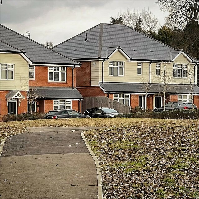
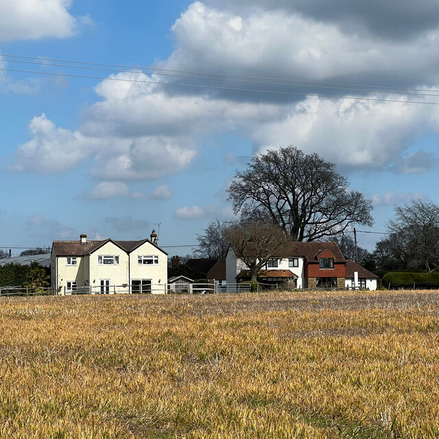
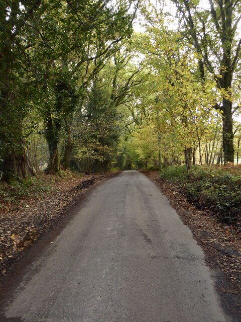
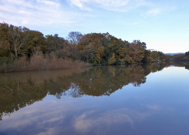
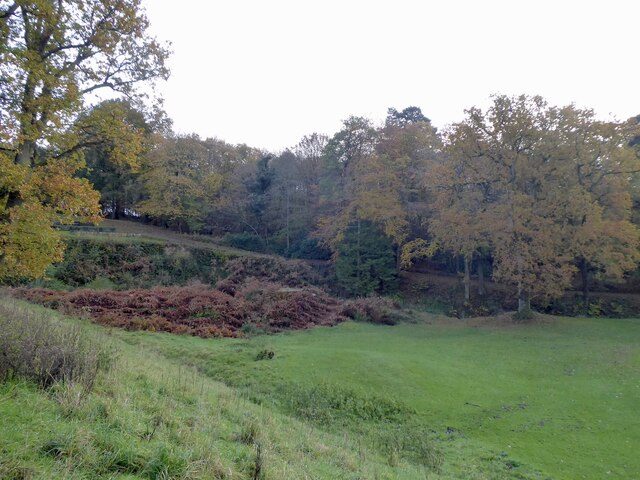
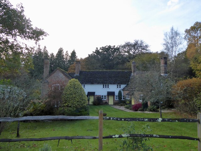
Mannings Heath is a picturesque village nestled in the heart of Sussex, England. Located approximately 10 miles south of Horsham, it is surrounded by the stunning natural beauty of the West Sussex countryside. The village boasts a rich history dating back to medieval times and exudes a charming and tranquil atmosphere.

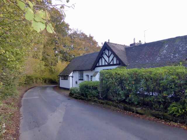
The focal point of Mannings Heath is its historic church, St. Leonard's, which dates back to the 12th century. This beautifully preserved building showcases exquisite architectural details and provides a glimpse into the village's past. Surrounding the church, the village is lined with a mix of period cottages and modern homes, offering a diverse range of architectural styles.

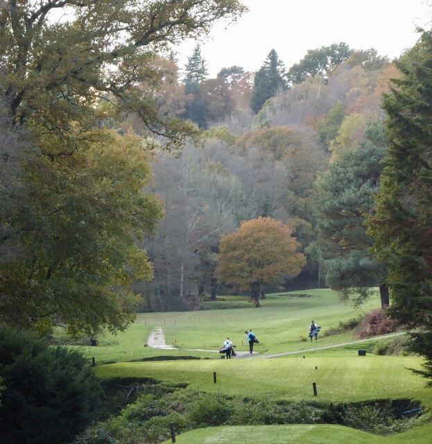
The village is also home to Mannings Heath Golf Club, an acclaimed golfing destination known for its two championship courses. Golf enthusiasts from all over the country are drawn to the meticulously maintained fairways and challenging greens, set against the backdrop of rolling hills and verdant countryside.

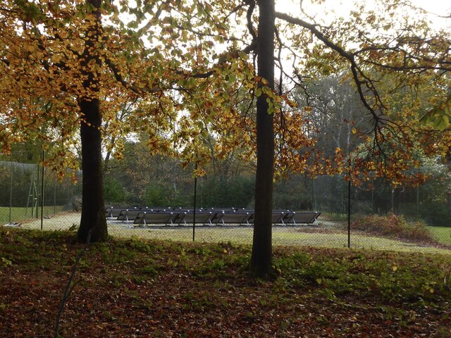
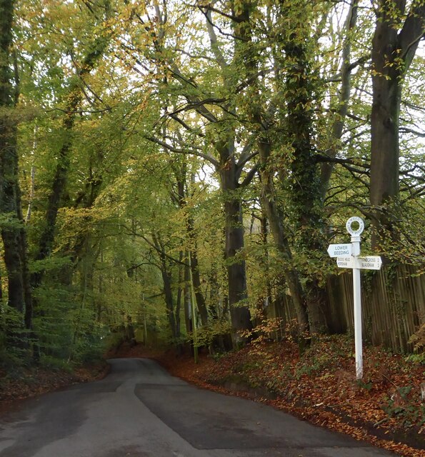
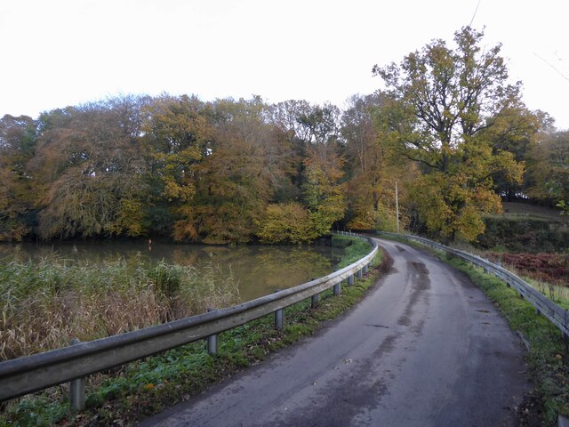
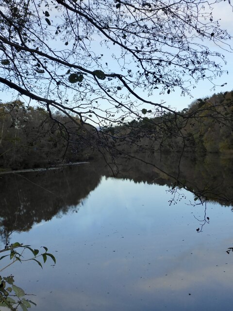
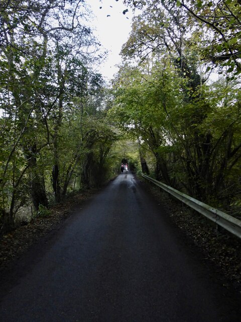
For those seeking a taste of the outdoors, Mannings Heath offers plenty of opportunities for exploration. The surrounding countryside is crisscrossed with walking and cycling trails, providing the perfect escape for nature lovers. Additionally, the nearby South Downs National Park offers breathtaking views and further opportunities for outdoor activities.

Mannings Heath enjoys a close-knit community spirit, with several local amenities including a village shop, a pub, and a primary school. The village also benefits from its proximity to Horsham, which offers a wider range of amenities and transport links.

Overall, Mannings Heath is a charming and idyllic village, perfect for those seeking a peaceful and picturesque retreat in the heart of the Sussex countryside.

If you have any feedback on the listing, please let us know in the comments section below.

Mannings Heath Images

Images are sourced within 2km of 51.045649/-0.280261 or Grid Reference TQ2028. Thanks to Geograph Open Source API. All images are credited.

Oaks, Monk's Gate (1) There are quite a number of fine old specimens in the area, perhaps relics of former parkland.
Oaks, Monk's Gate (1)
There are quite a number of fine old specimens in the area, perhaps relics of former parkland.
Oaks, Monk's Gate (2) There are quite a number of fine old specimens in the area, perhaps relics of former parkland.
Oaks, Monk's Gate (2)
There are quite a number of fine old specimens in the area, perhaps relics of former parkland.
New houses in Coolhurst Close
Sweet chestnut leaves on the edge of Stanford's Copse
Rears of houses on the A281
Inholms Gill A tributary of the River Arun that rises in St Leonard's Forest.
Inholms Gill
A tributary of the River Arun that rises in St Leonard's Forest.
Track, St Leonard's Forest The surfaced track heads north from the car park on Hammerpond Road to Mick's Cross.
Track, St Leonard's Forest
The surfaced track heads north from the car park on Hammerpond Road to Mick's Cross.
Solar Panels, Woodbank, Hammerpond Road An old tennis court now used for generating electricity.
Solar Panels, Woodbank, Hammerpond Road
An old tennis court now used for generating electricity.
Hammerpond Road Viewed from the junction with Church Lane as it descends into a small valley containing Hammer Pond. This section is marked as Hammer Hill on older OS maps.
Hammerpond Road
Viewed from the junction with Church Lane as it descends into a small valley containing Hammer Pond. This section is marked as Hammer Hill on older OS maps.
Church Lane Heading south from Hammerpond Road to Lower Beeding.
Church Lane
Heading south from Hammerpond Road to Lower Beeding.
Hammer Pond The surviving hammer pond that once powered St Leonards Upper Forge which operated between 1554 and 1655. The pond bay still survives at the southern end, see <a href="https://www.geograph.org.uk/photo/7654201">TQ2128 : Pond Bay, St Leonards Upper Forge</a>, though the former site, see <a href="https://www.geograph.org.uk/photo/7654197">TQ2128 : Site of St Leonards Upper Forge</a>, has been landscaped by Mannings Heath Golf Club. <a href="https://www.geograph.org.uk/photo/7654199">TQ2128 : Hammer Pond Cottage, Hammerpond Road</a> at the western end is linked too.
Hammer Pond
The surviving hammer pond that once powered St Leonards Upper Forge which operated between 1554 and 1655. The pond bay still survives at the southern end, see TQ2128 : Pond Bay, St Leonards Upper Forge, though the former site, see TQ2128 : Site of St Leonards Upper Forge, has been landscaped by Mannings Heath Golf Club. TQ2128 : Hammer Pond Cottage, Hammerpond Road at the western end is linked too.
Mannings Heath Golf Club This section adjacent to Goldings Stream, viewed from Hammerpond Road, is believed to be the site of the former hammer pond for St Leonards Lower Forge. The works operated from 1554 to 1655, often in conjunction with a furnbace built on the site as well as the Upper Forge. <a href="https://www.geograph.org.uk/photo/7654210">TQ2129 : Hawkins Pond</a> was a pen pond for the Lower Forge.
Mannings Heath Golf Club
This section adjacent to Goldings Stream, viewed from Hammerpond Road, is believed to be the site of the former hammer pond for St Leonards Lower Forge. The works operated from 1554 to 1655, often in conjunction with a furnbace built on the site as well as the Upper Forge. TQ2129 : Hawkins Pond was a pen pond for the Lower Forge.
Site of St Leonards Upper Forge The forge operated from 1554 to 1655 in conjunction with the Lower Forge and Furnace downstream. Viewed from Hammerpond Road which contains the surviving pond bay, see <a href="https://www.geograph.org.uk/photo/7654201">TQ2128 : Pond Bay, St Leonards Upper Forge</a>, that separated the site from <a href="https://www.geograph.org.uk/photo/7654184">TQ2128 : Hammer Pond</a>. Now part of Mannigs Heath Golf Club whose landscaping has disturbed the site which also contains a World War Two pillbox.
Site of St Leonards Upper Forge
The forge operated from 1554 to 1655 in conjunction with the Lower Forge and Furnace downstream. Viewed from Hammerpond Road which contains the surviving pond bay, see TQ2128 : Pond Bay, St Leonards Upper Forge, that separated the site from TQ2128 : Hammer Pond. Now part of Mannigs Heath Golf Club whose landscaping has disturbed the site which also contains a World War Two pillbox.
Hammer Pond Cottage, Hammerpond Road The building dates from the 17th century and is contemporary with the adjacent <a href="https://www.geograph.org.uk/photo/7654197">TQ2128 : Site of St Leonards Upper Forge</a>. For a while it was a pair of cottages prior to becoming a single dwelling.
Hammer Pond Cottage, Hammerpond Road
The building dates from the 17th century and is contemporary with the adjacent TQ2128 : Site of St Leonards Upper Forge. For a while it was a pair of cottages prior to becoming a single dwelling.
Pond Bay, St Leonards Upper Forge The bay carries Hammerpond Road past <a href="https://www.geograph.org.uk/photo/7654184">TQ2128 : Hammer Pond</a> to the left, separating it from the working, see <a href="https://www.geograph.org.uk/photo/7654197">TQ2128 : Site of St Leonards Upper Forge</a>, to the right.
Pond Bay, St Leonards Upper Forge
The bay carries Hammerpond Road past TQ2128 : Hammer Pond to the left, separating it from the working, see TQ2128 : Site of St Leonards Upper Forge, to the right.
Bucks Head, Buckshead Hill, Bucks Head The cottage appears to date back to the 19th century and is one of a couple of buildings that make up the hamlet of Bucks Head that is located on a ridge between two former hammer ponds.
Bucks Head, Buckshead Hill, Bucks Head
The cottage appears to date back to the 19th century and is one of a couple of buildings that make up the hamlet of Bucks Head that is located on a ridge between two former hammer ponds.
Hawkins Pond Built as a pen pond for St Leonards Lower Forge that operated between 1554 and 1655. Now used as a private fishing pond.
Hawkins Pond
Built as a pen pond for St Leonards Lower Forge that operated between 1554 and 1655. Now used as a private fishing pond.
Pond Bay, Hawkins Pond The dam for <a href="https://www.geograph.org.uk/photo/7654210">TQ2129 : Hawkins Pond</a> that was built as a pen pond for St Leonards Lower Forge that operated between 1554 and 1655. Now carrying Hammerpond Road.
Pond Bay, Hawkins Pond
The dam for TQ2129 : Hawkins Pond that was built as a pen pond for St Leonards Lower Forge that operated between 1554 and 1655. Now carrying Hammerpond Road.
Show me another place!

Mannings Heath is located at Grid Ref: TQ2028 (Lat: 51.045649, Lng: -0.280261)

Administrative County: West Sussex

District: Horsham

Police Authority: Sussex

What 3 Words

///plums.glides.studs. Near Horsham, West Sussex

Related Wikis

Mannings Heath

Mannings Heath is a village in the civil parish of Nuthurst and the Horsham District of West Sussex, England. The village is on the A281 road, 2 miles...

Mannings Heath Golf & Wine Estate

Mannings Heath Golf & Wine Estate is located in Mannings Heath, Horsham in the south of England. The 500 acre parkland site includes two golf courses and...

Monk's Gate

Monk's Gate is a hamlet in the civil parish of Nuthurst, in the Horsham District of West Sussex, England. It lies on the A281 road 3 miles (5 km) southeast...

St Leonard's Forest SSSI

St Leonard's Forest SSSI is an 85.4-hectare (211-acre) biological Site of Special Scientific Interest east of Horsham in West Sussex. The SSSI is in two...

Lower Beeding

Lower Beeding is a village and civil parish in the Horsham District of West Sussex, England. The village lies on the B2110, B2115 and A281 roads 3.5 miles...

St Leonard's Park Ponds

St Leonard's Park Ponds is a 3.9-hectare (9.6-acre) biological Site of Special Scientific Interest east of Horsham in West Sussex.These ponds and adjacent...

Newells Preparatory School

Newells Preparatory School came to Lower Beeding, Sussex, in 1946. It has been at Handcross and known as Handcross Park School since 1968. It merged with...

Southwater & Nuthurst (electoral division)

Southwater & Nuthurst is an electoral division of West Sussex in the United Kingdom and returns one member to sit on West Sussex County Council. The current...

Nearby Amenities

Located within 500m of 51.045649,-0.280261
Bus Stop
Stores
Bus: yes
Naptan AtcoCode: 4400HR0432
Naptan Bearing: E
Naptan CommonName: Stores
Naptan Indicator: o/s 'Fairways'
Naptan Landmark: Church Road
Naptan NaptanCode: wsxawjgd
Naptan ShortCommonName: Mannings Hth Store
Naptan Street: Pound Lane
Naptan Verified: no
Public Transport: platform
Source: naptan_import
Lat/Long: 51.0453102/-0.284016
Bus Stop
Stores
Bus: yes
Naptan AtcoCode: 4400HR0433
Naptan Bearing: N
Naptan CommonName: Stores
Naptan Indicator: o/s 'Vine Cottage'
Naptan Landmark: Pound Lane
Naptan NaptanCode: wsxawjgj
Naptan ShortCommonName: Mannings Hth Store
Naptan Street: Church Road
Naptan Verified: no
Public Transport: platform
Source: naptan_import
Lat/Long: 51.0448049/-0.2832302
Mannings Heath
Place: village
Source: OS OpenData StreetView
Wikidata: Q11767123
Lat/Long: 51.0455083/-0.2817539
Washout Hydrant
Fire Hydrant
Emergency: fire_hydrant
Fire Hydrant Type: underground
Survey Date: 2018-11-11
Water Source: main
Lat/Long: 51.043847/-0.2856081
Washout Hydrant
Fire Hydrant
Emergency: fire_hydrant
Fire Hydrant Type: underground
Survey Date: 2018-11-11
Water Source: main
Lat/Long: 51.048479/-0.2837821
Post Box
Post Box Type: lamp
Ref: RH13 125D
Royal Cypher: EIIR
Royal Cypher Wikidata: Q33102113
Lat/Long: 51.0452178/-0.2831581
Nick Emens Osteopath clinic
Addr City: Horsham
Addr Housename: Hurst Cottage
Addr Postcode: RH13 6JX
Addr Street: Golding Lane
Addr Suburb: Mannings Heath
Healthcare: alternative
Opening Hours: Mo-Fr 07:00-19:00
Operator: Nick Emens
Operator Type: business
Phone: +44 (0)1403 272 144
Website: https://www.betterback.co.uk/
Lat/Long: 51.0457031/-0.2822359
The data included in this document is from www.openstreetmap.org. The data is made available under ODbL.

Have you been to Mannings Heath?

Leave your review of Mannings Heath below (or comments, questions and feedback).