East Cliff

Settlement in Hampshire

England

East Cliff

Bournemouth Pier The beach and pier at Bournemouth, taken on a sunny afternoon in August 2021.
Bournemouth Pier Credit: Malc McDonald

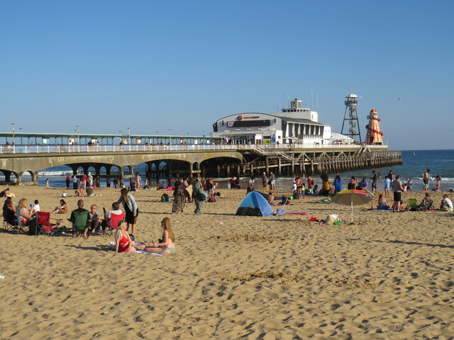
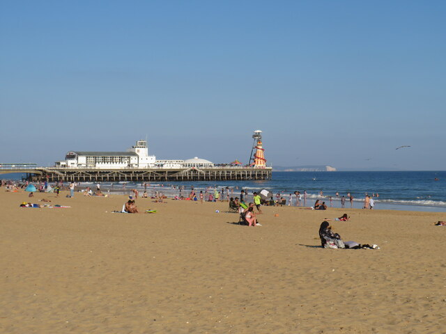
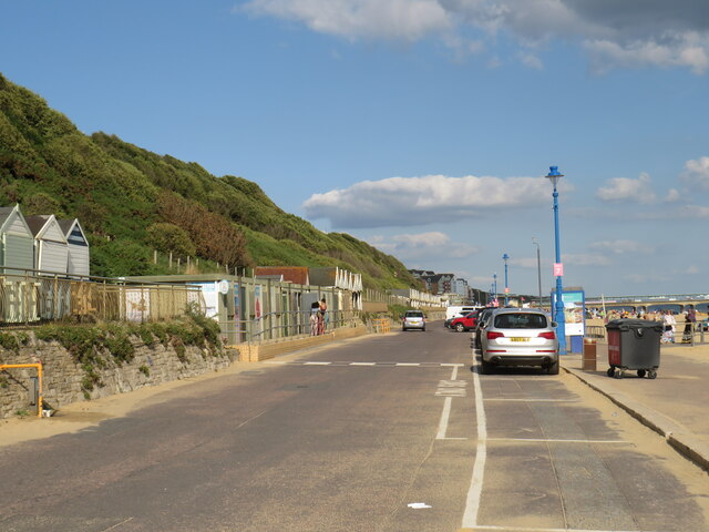
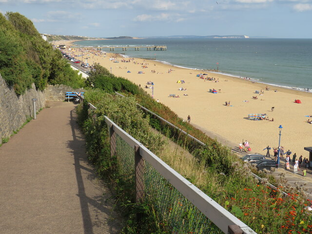
East Cliff is a picturesque coastal area located in Hampshire, a county in southern England. Situated on the eastern side of the larger town of Bournemouth, East Cliff offers stunning views of the English Channel and is known for its natural beauty and tranquility.

The area is characterized by its steep cliffs, which provide a dramatic backdrop to the charming Victorian and Edwardian buildings that line the streets. Many of these buildings have been converted into hotels, guesthouses, and apartments, making East Cliff a popular destination for tourists seeking a peaceful seaside retreat.

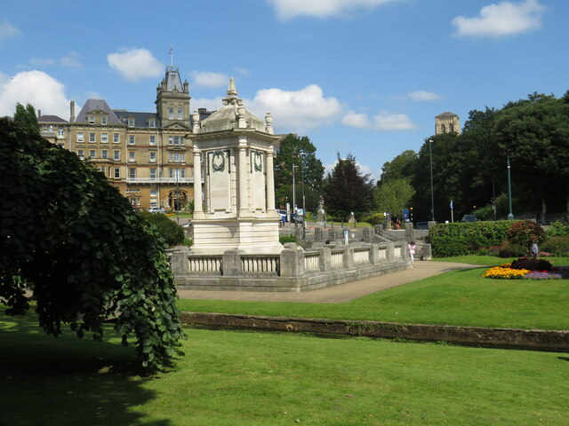
East Cliff is also home to a number of well-maintained gardens and parks, providing ample opportunities for outdoor activities and relaxation. The nearby East Overcliff Drive offers a scenic route for leisurely walks or bike rides, with panoramic views of the coastline.

For those interested in history and culture, East Cliff is in close proximity to several notable landmarks. The Russell-Cotes Art Gallery & Museum, housed in a stunning Victorian villa overlooking the sea, showcases an impressive collection of art and artifacts. Additionally, the Bournemouth Natural Science Society Museum offers a glimpse into the region's natural history and geological heritage.

East Cliff benefits from its convenient location, with easy access to Bournemouth's bustling town center and its array of shops, restaurants, and entertainment venues. With its serene atmosphere, stunning views, and cultural attractions, East Cliff, Hampshire is a sought-after destination for both visitors and residents seeking a coastal haven in the heart of southern England.

If you have any feedback on the listing, please let us know in the comments section below.
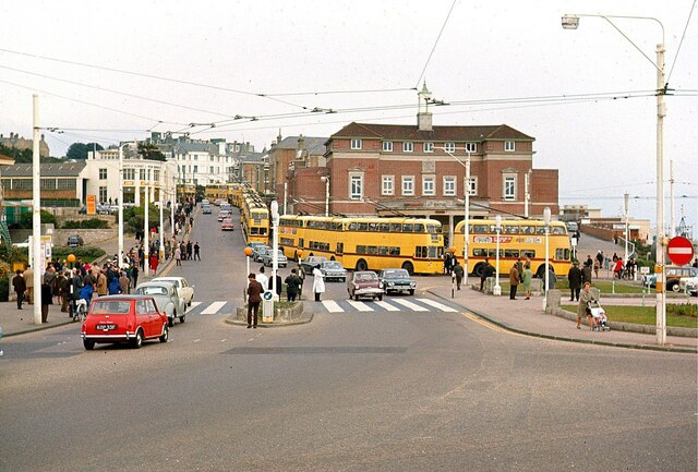
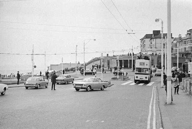
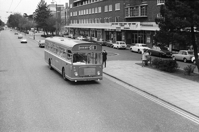
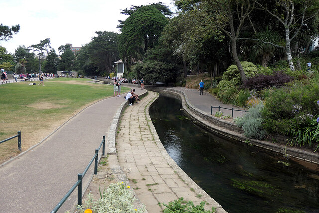
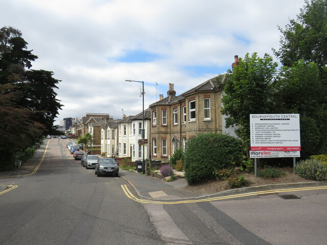
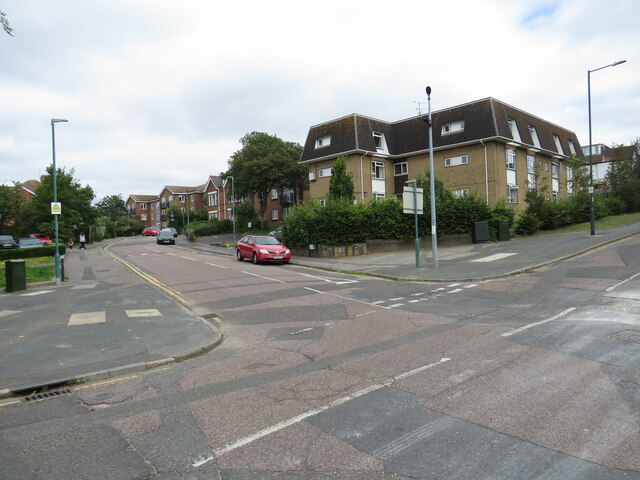
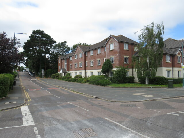
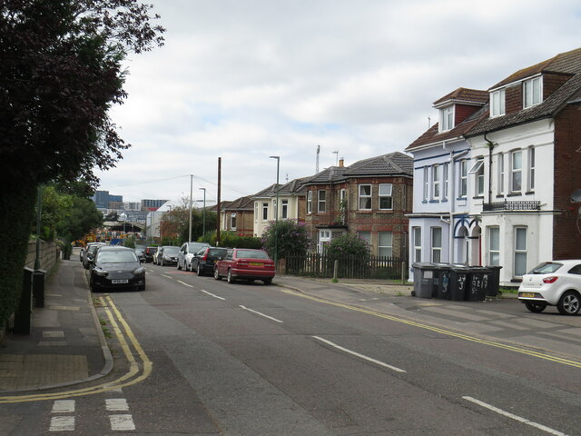
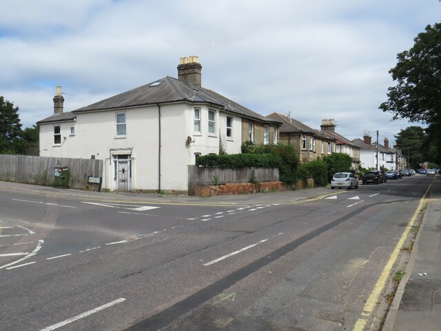
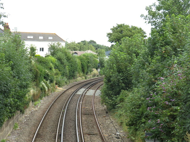
East Cliff Images

Images are sourced within 2km of 50.720789/-1.8580478 or Grid Reference SZ1091. Thanks to Geograph Open Source API. All images are credited.

Bournemouth Pier The beach and pier at Bournemouth, taken on a sunny afternoon in August 2021.
Bournemouth Pier
The beach and pier at Bournemouth, taken on a sunny afternoon in August 2021.
Bournemouth beach and pier A view of Bournemouth beach and pier, taken on a sunny afternoon in August 2021.

In the distance, the chalk cliffs of The Needles on the Isle of Wight are visible.
Bournemouth beach and pier
A view of Bournemouth beach and pier, taken on a sunny afternoon in August 2021. In the distance, the chalk cliffs of The Needles on the Isle of Wight are visible.
Cenotaph and Town Hall, Bournemouth The cenotaph in Bournemouth's Central Gardens, with Bournemouth's town hall in the background.  The Bourne flows in front of the cenotaph.
Cenotaph and Town Hall, Bournemouth
The cenotaph in Bournemouth's Central Gardens, with Bournemouth's town hall in the background. The Bourne flows in front of the cenotaph.
Cliff lift at East Cliff, Bournemouth In August 2021, the cliff lift at East Cliff was still closed following a landslip which had occurred in April 2016.  The landslip caused serious damage but, thankfully, nobody was injured.
Cliff lift at East Cliff, Bournemouth
In August 2021, the cliff lift at East Cliff was still closed following a landslip which had occurred in April 2016. The landslip caused serious damage but, thankfully, nobody was injured.
Undercliff Drive, near Boscombe Undercliff Drive forms part of a promenade which stretches for around 10 miles along the seafront at Bournemouth.  It forms part of the route of National Cycle Network route 2.  However, during the peak summer holiday months of July and August, cycling is prohibited on this section of route between 10:00 and 18:00.  Cyclists must use an alternative route on the cliff top.
Undercliff Drive, near Boscombe
Undercliff Drive forms part of a promenade which stretches for around 10 miles along the seafront at Bournemouth. It forms part of the route of National Cycle Network route 2. However, during the peak summer holiday months of July and August, cycling is prohibited on this section of route between 10:00 and 18:00. Cyclists must use an alternative route on the cliff top.
Path to the beach, East Cliff, Bournemouth Toft Zig-Zag is a path leading from the overcliff to the beach at East Cliff, between Bournemouth and Boscombe.  From the top of the path there are views along the coastline to Boscombe Pier (in the middle distance) and Hengistbury Head, and also to the chalk cliffs of The Needles on the Isle of Wight (towards the right of the image)
Path to the beach, East Cliff, Bournemouth
Toft Zig-Zag is a path leading from the overcliff to the beach at East Cliff, between Bournemouth and Boscombe. From the top of the path there are views along the coastline to Boscombe Pier (in the middle distance) and Hengistbury Head, and also to the chalk cliffs of The Needles on the Isle of Wight (towards the right of the image)
Bournemouth Pier Approach – 1969 The area has changed out of all recognition. The public baths building has disappeared, and indeed its later replacement too, while the area is now overlooked by the elevated roadway between Bath Road and Exeter Road which does allow unimpeded pedestrian movement between Lower Gardens and the beach. For a view in the opposite direction see <a title="https://www.geograph.org.uk/photo/6957375" href="https://www.geograph.org.uk/photo/6957375">Link</a> 

The long string of trolleybuses is exceptional. They were lined up for the ceremonial procession marking the end of trolleybus operation in Bournemouth. By this time the wiring to the Pier was only used occasionally, but it provided a suitable location for parking a large number of vehicles, which could not have been achieved in the central part of the town.
Bournemouth Pier Approach – 1969
The area has changed out of all recognition. The public baths building has disappeared, and indeed its later replacement too, while the area is now overlooked by the elevated roadway between Bath Road and Exeter Road which does allow unimpeded pedestrian movement between Lower Gardens and the beach. For a view in the opposite direction see Link The long string of trolleybuses is exceptional. They were lined up for the ceremonial procession marking the end of trolleybus operation in Bournemouth. By this time the wiring to the Pier was only used occasionally, but it provided a suitable location for parking a large number of vehicles, which could not have been achieved in the central part of the town.
Bournemouth Pier Approach – 1969 The area has changed out of all recognition. The point of view is now taken up by the elevated roadway between Bath Road and Exeter Road which does allow unimpeded pedestrian movement between Lower Gardens and the beach, and the whole area is now pedestrianised. The colonnaded shelter behind the trolleybus has also disappeared. See <a title="https://www.geograph.org.uk/photo/6957160" href="https://www.geograph.org.uk/photo/6957160">Link</a> for a view in the opposite direction.

The trolleybus is one of the small number of pre-war AEC double-deck vehicles converted to open-top use for special tours, generally based from the Pier terminus. The view was taken on the final day of operation of trolleybuses in Bournemouth, the bus forming part of the final parade from the Pier to Christchurch.

This is one of a series of views featuring buses in the 60s, 70s, and 80s. <a title="https://www.geograph.org.uk/search.php?i=137652761" href="https://www.geograph.org.uk/search.php?i=137652761">Link</a>
Bournemouth Pier Approach – 1969
The area has changed out of all recognition. The point of view is now taken up by the elevated roadway between Bath Road and Exeter Road which does allow unimpeded pedestrian movement between Lower Gardens and the beach, and the whole area is now pedestrianised. The colonnaded shelter behind the trolleybus has also disappeared. See Link for a view in the opposite direction. The trolleybus is one of the small number of pre-war AEC double-deck vehicles converted to open-top use for special tours, generally based from the Pier terminus. The view was taken on the final day of operation of trolleybuses in Bournemouth, the bus forming part of the final parade from the Pier to Christchurch. This is one of a series of views featuring buses in the 60s, 70s, and 80s. Link
Christchurch Road, Lansdowne – 1969 At the time this was still the main A35, running through the centre of the town. In the background is the entrance to the Odeon cinema, nestling between the apartment blocks on either side. The cinema is showing the film 'Candy', and the sign features Marlon Brando, Richard Burton and John Coburn as stars. The female lead, the relatively unknown Ewa Aulin, playing Candy, gets no mention! <span class="nowrap"><a title="https://en.wikipedia.org/wiki/Candy_(1968_film)" rel="nofollow ugc noopener" href="https://en.wikipedia.org/wiki/Candy_(1968_film)">Link</a><img style="margin-left:2px;" alt="External link" title="External link - shift click to open in new window" src="https://s1.geograph.org.uk/img/external.png" width="10" height="10"/></span> . Like many cinemas it became a Bingo hall in the 1970s, finally closing in 2021 due to the Covid 19 pandemic.

In the foreground Wilts & Dorset bus 823 is on its way into Bournemouth on route 38 from Salisbury. It is a Bristol RE with ECW bodywork, new that same year.

This is one of a series of views featuring buses in the 60s, 70s, and 80s. <a title="https://www.geograph.org.uk/search.php?i=137652761" href="https://www.geograph.org.uk/search.php?i=137652761">Link</a>
Christchurch Road, Lansdowne – 1969
At the time this was still the main A35, running through the centre of the town. In the background is the entrance to the Odeon cinema, nestling between the apartment blocks on either side. The cinema is showing the film 'Candy', and the sign features Marlon Brando, Richard Burton and John Coburn as stars. The female lead, the relatively unknown Ewa Aulin, playing Candy, gets no mention! LinkExternal link . Like many cinemas it became a Bingo hall in the 1970s, finally closing in 2021 due to the Covid 19 pandemic. In the foreground Wilts & Dorset bus 823 is on its way into Bournemouth on route 38 from Salisbury. It is a Bristol RE with ECW bodywork, new that same year. This is one of a series of views featuring buses in the 60s, 70s, and 80s. Link
Bourne river, Bournemouth Over 70 years ago, I played with a pond yacht here during a family visit to Bournemouth - happy memories!
Bourne river, Bournemouth
Over 70 years ago, I played with a pond yacht here during a family visit to Bournemouth - happy memories!
Southcote Road, Bournemouth Southcote Road is a minor road in the suburbs of Bournemouth.
Southcote Road, Bournemouth
Southcote Road is a minor road in the suburbs of Bournemouth.
Vale Road, Bournemouth Vale Road is a residential road in the suburbs of Bournemouth.
Vale Road, Bournemouth
Vale Road is a residential road in the suburbs of Bournemouth.
Southcote Road, Bournemouth Southcote Road is a residential road in the suburbs of Bournemouth.
Southcote Road, Bournemouth
Southcote Road is a residential road in the suburbs of Bournemouth.
St. Clement's Road, Bournemouth St. Clement's Road is a residential road in the suburbs of Bournemouth.
St. Clement's Road, Bournemouth
St. Clement's Road is a residential road in the suburbs of Bournemouth.
St. Clement's Road, Bournemouth St. Clement's Road is a residential road in the suburbs of Bournemouth.
St. Clement's Road, Bournemouth
St. Clement's Road is a residential road in the suburbs of Bournemouth.
Railway near Boscombe A double-track railway passing through Boscombe, near Bournemouth.  This railway is the main line from London and Southampton to Bournemouth and Weymouth.  The tracks are electrified using the third rail system.
Railway near Boscombe
A double-track railway passing through Boscombe, near Bournemouth. This railway is the main line from London and Southampton to Bournemouth and Weymouth. The tracks are electrified using the third rail system.
Salvation Army church, Boscombe A Salvation Army church in Boscombe, near Bournemouth.
Salvation Army church, Boscombe
A Salvation Army church in Boscombe, near Bournemouth.
Borthwick Road, Boscombe Borthwick Road is a residential road in Boscombe, near Bournemouth.  The road is one-way for motor vehicles, but there is a contraflow lane for cyclists.
Borthwick Road, Boscombe
Borthwick Road is a residential road in Boscombe, near Bournemouth. The road is one-way for motor vehicles, but there is a contraflow lane for cyclists.
Show me another place!

East Cliff is located at Grid Ref: SZ1091 (Lat: 50.720789, Lng: -1.8580478)

Unitary Authority: Bournemouth, Christchurch and Poole

Police Authority: Dorset

What 3 Words

///pines.offers.breath. Near Bournemouth, Dorset

Nearby Locations

East Cliff

Related Wikis

St Swithun's Church, Bournemouth

St Swithun's Church is a Grade II listed church in the town of Bournemouth, England. == History == The church was a product of the Revd. Alexander Morden...
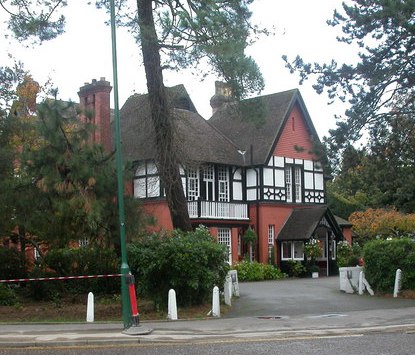
Langtry Manor

The Langtry Manor (formerly the Red House) is a country house hotel at 26 Derby Road in the East Cliff area of Bournemouth, England. The foundation stone...

East Cliff, Bournemouth

East Cliff is a suburb and ward in Bournemouth, Dorset, England. == History == In 2016, and again on 17 April 2021, a landslide occurred at the cliffside...

The Downstairs Club

The Downstairs Club was Bournemouth's first full-time rock, rhythm and blues and jazz venue. It opened in 1961 and under its later name of Le Disque a...
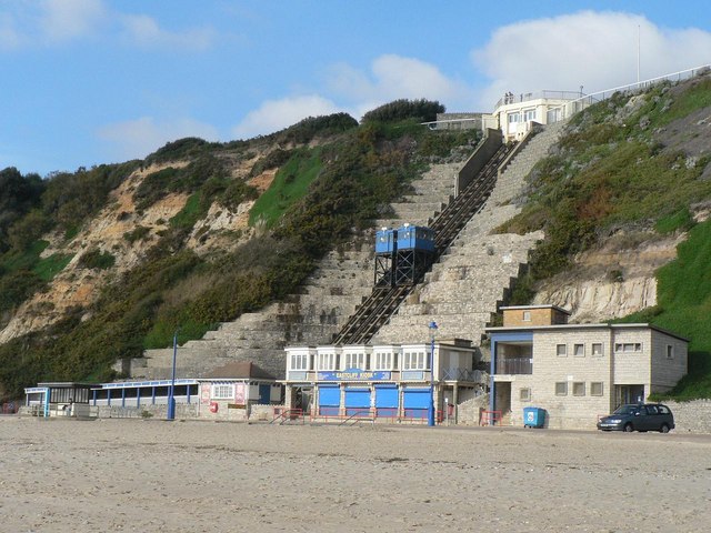
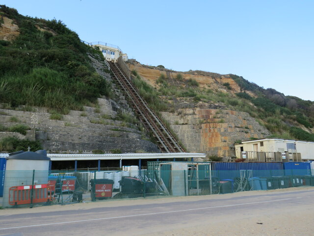
East Cliff Railway

The East Cliff Railway, or East Cliff Lift, is a funicular railway located on the East Cliff of the English seaside resort of Bournemouth. The line serves...

Lansdowne, Bournemouth

Lansdowne is a suburb of Bournemouth. It occupies the north-east part of the main built-up area around Bournemouth Town Centre. It is home to Lansdowne...

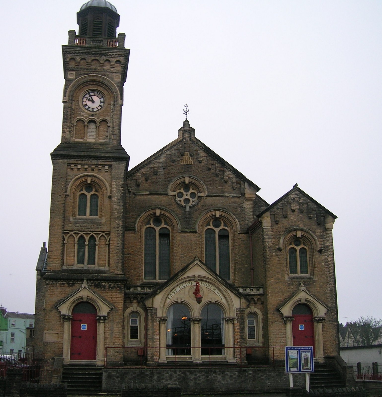
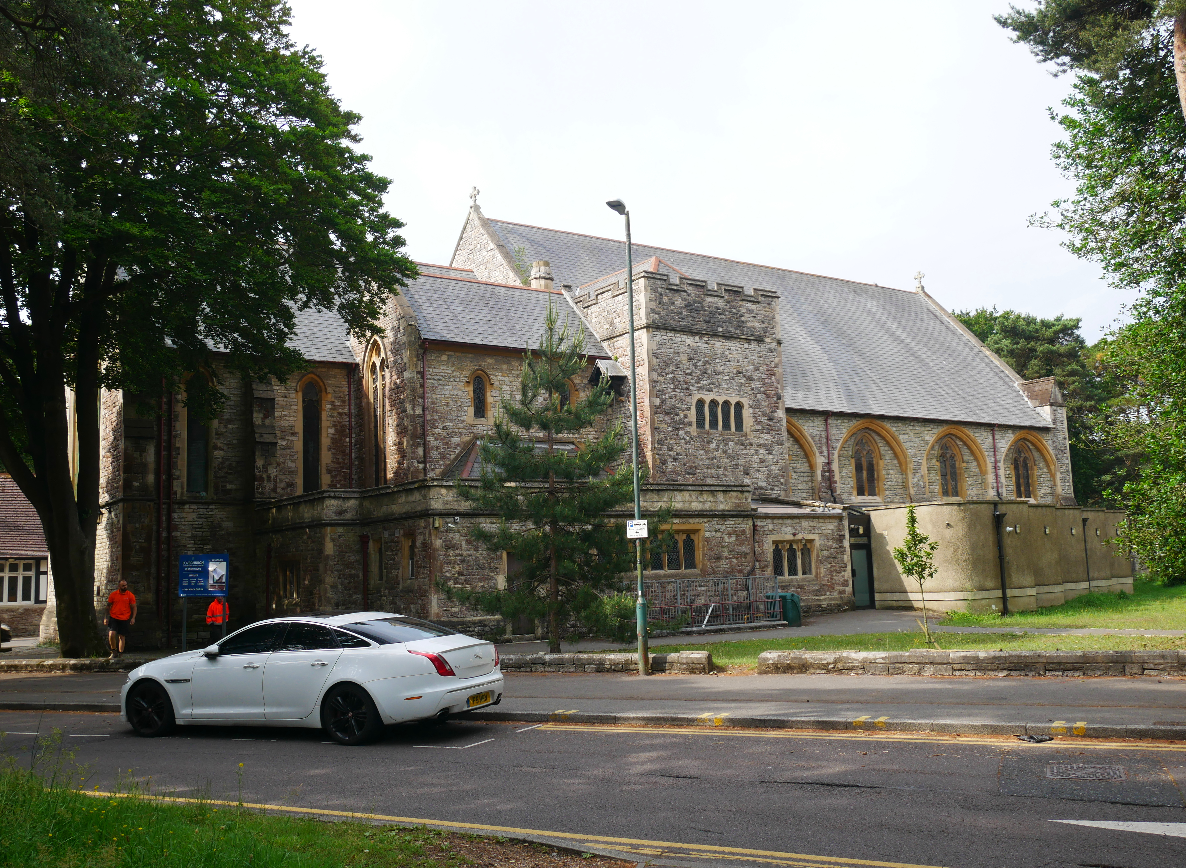
East Cliff Church, Bournemouth

East Cliff Church is a Grade II listed United Reformed church in East Cliff Bournemouth, Dorset, England. == History == The church was completed in 1879...

Bournemouth East railway station (1870–1885)

Bournemouth East was the first railway station to be built in Bournemouth, England. Completed on 14 March 1870, it was sited at the south-east side of...

Nearby Amenities

Located within 500m of 50.720789,-1.8580478
Crossing
Check Date Crossing: 2021-10-27
Crossing: uncontrolled
Tactile Paving: no
Lat/Long: 50.7190146/-1.8537136
Crossing
Crossing: unmarked
Crossing Island: yes
Kerb: flush
Tactile Paving: yes
Lat/Long: 50.7196889/-1.8542232
Pub
Inn on the Cliff
Lat/Long: 50.7192728/-1.860176
Post Box
Check Date Collection Times: 2023-01-03
Collection Times: Mo-Fr 09:00; Sa 07:00
Operator: Royal Mail
Operator Wikidata: Q638098
Post Box Design: type_b
Post Box Type: pillar
Ref: BH1 90
Ref GB Uprn: 10015416627
Royal Cypher: VR
Royal Cypher Wikidata: Q33102356
Source: survey
Lat/Long: 50.7230291/-1.8607343
Post Box
Collection Times: Mo-Fr 18:30
Description: Outside Bracken House, number 16.
Opening Hours: Mo-Fr 12:00-18:30
Operator: Royal Mail
Operator Wikidata: Q638098
Post Box Type: meter
Ref: BH1 502
Ref GB Uprn: 10015705993
Royal Cypher: no
Source: survey
Lat/Long: 50.722231/-1.8634424
Post Box
Brand: Royal Mail
Brand Wikidata: Q638098
Brand Wikipedia: en:Royal Mail
Collection Times: Mo-Fr 09:00, Sa 07:00
Operator: Royal Mail
Operator Wikidata: Q638098
Post Box Design: type_b
Post Box Type: pillar
Ref: BH1 2
Ref GB Uprn: 10015724446
Royal Cypher: GR
Royal Cypher Wikidata: Q33102273
Source: survey
Lat/Long: 50.7227192/-1.8561235
Post Box
Brand: Royal Mail
Brand Wikidata: Q638098
Collection Times: Mo-Fr 16:45; Sa 12:15
Description: Anonymous Victorian.
Operator: Royal Mail
Operator Wikidata: Q638098
Post Box Design: type_b
Post Box Type: pillar
Ref: BH1 40
Ref GB Uprn: 10015459470
Royal Cypher: no
Source: survey
Lat/Long: 50.7246734/-1.8549699
Post Box
Collection Times: Mo-Fr 09:00; Sa 07:00
Fixme: RM has this as a business box; it isn't
Operator: Royal Mail
Operator Wikidata: Q638098
Post Box Design: type_b
Post Box Type: pillar
Ref: BH1 1
Ref GB Uprn: 10015296616
Royal Cypher: GR
Royal Cypher Wikidata: Q33102273
Source: survey
Lat/Long: 50.7214329/-1.8529821
Post Box
Collection Times: Mo-Fr 09:00; Sa 07:00
Description: By zebra crossing
Fixme: This is very confusing. There appears to have been a business box next to here.
Operator: Royal Mail
Operator Wikidata: Q638098
Post Box Design: type_b
Post Box Type: pillar
Ref: BH1 5
Ref GB Uprn: 10015327409
Royal Cypher: EIIR
Royal Cypher Wikidata: Q33102113
Source: survey
Lat/Long: 50.72102/-1.8589083
Turning Circle
Lat/Long: 50.7216883/-1.8623973
Entrance: yes
Lat/Long: 50.7220229/-1.8625522
Telephone
Booth: ST6
Operator: BT
Operator Wikidata: Q593786
Lat/Long: 50.7242296/-1.861142
Restaurant
Lynton Court
Addr Housenumber: 47
Addr Postcode: BH1 3PA
Addr Street: Christchurch Road
Brand: Table Table
Brand Wikidata: Q16952586
Cuisine: british
Fhrs Id: 342677
Operator: Table Table
Source Addr: FHRS Open Data
Website: https://www.tabletable.co.uk/en-gb/locations/dorset/lynton-court
Lat/Long: 50.7227225/-1.8530391
Hotel Mon Bijou
Tourism: guest_house
Lat/Long: 50.7210715/-1.8540819
Bus Stop
Lansdowne, Christchurch Road
Bearing: E
Bench: yes
Bin: yes
Bus: yes
Lit: yes
Naptan AtcoCode: 1290BOB20413
Naptan Bearing: E
Naptan CommonName: Lansdowne
Naptan Indicator: E-bound
Naptan NaptanCode: boudmpm
Naptan PlusbusZoneRef: BOMO
Naptan StopType: bus
Naptan Street: Christchurch Road
Naptan Verified: no
Public Transport: platform
Route Ref: 1;1a;1b;m2;X3
Shelter: yes
Tactile Paving: no
Lat/Long: 50.7221783/-1.8643949
Bus Stop
Lansdowne, Christchurch Road
Bearing: W
Bench: yes
Bin: no
Bus: yes
Lit: yes
Naptan AtcoCode: 1290BOB20414
Naptan Bearing: W
Naptan CommonName: Lansdowne
Naptan Indicator: W-bound
Naptan NaptanCode: boudmpt
Naptan PlusbusZoneRef: BOMO
Naptan StopType: bus
Naptan Street: Christchurch Road
Naptan Verified: no
Passenger Information Display: yes
Public Transport: platform
Shelter: yes
Tactile Paving: no
Wheelchair: yes
Lat/Long: 50.7220138/-1.8643528
Premier East Cliff News, Food & Wine
Addr Postcode: BH1 3JP
Addr Street: Christchurch Road
Brand: Premier
Brand Wikidata: Q7240340
Brand Wikipedia: en:Premier Stores
Fhrs Id: 494543
Shop: convenience
Source Addr: FHRS Open Data
Website: https://www.premier-stores.co.uk/our-stores/east-cliff-news
Lat/Long: 50.7218727/-1.86395
Bicycle Parking
Bicycle Parking: stands
Capacity: 20
Covered: no
Lat/Long: 50.7223364/-1.8621797
Co-op Food
Addr Housenumber: 38
Addr Postcode: BH1 3PD
Addr Street: Christchurch Road
Brand: Co-op Food
Brand Wikidata: Q3277439
Fhrs Id: 958535
Opening Hours: Mo-Su 07:00-23:00
Operator: The Co-operative Group
Operator Wikidata: Q117202
Shop: convenience
Source Addr: FHRS Open Data
Website: https://www.coop.co.uk/store-finder/BH1-3PD/38-christchurch-road
Lat/Long: 50.7228084/-1.8592079
Crossing
Button Operated: yes
Crossing: traffic_signals
Lat/Long: 50.7243876/-1.8613735
Bench
Backrest: yes
Source: Bing; survey
Lat/Long: 50.7191/-1.8599447
Bench
Backrest: yes
Source: Bing; survey
Lat/Long: 50.7191432/-1.8594873
Bench
Backrest: yes
Source: Bing; survey
Lat/Long: 50.7191582/-1.8593048
Bench
Backrest: yes
Source: Bing; survey
Lat/Long: 50.7192421/-1.8585342
Bench
Backrest: yes
Source: Bing; survey
Lat/Long: 50.7192455/-1.8584307
Bench
Backrest: yes
Source: Bing; survey
Lat/Long: 50.7193766/-1.8584062
Premier Inn
Brand: Premier Inn
Brand Wikidata: Q2108626
Internet Access: wlan
Internet Access Fee: customers
Internet Access Operator: Virgin Media
Internet Access Ssid: Premier Inn Free Wi-Fi
Tourism: hotel
Lat/Long: 50.7226674/-1.8532837
Restaurant
La Gondola
Cuisine: italian
Lat/Long: 50.7219047/-1.8635573
Turning Circle
Lat/Long: 50.7187495/-1.856647
Parking
Fee: yes
Layer: -1
Parking: underground
Lat/Long: 50.722495/-1.8549173
Barrier: lift_gate
Lat/Long: 50.7217673/-1.8611047
Crossing
Crossing: unmarked
Kerb: lowered
Tactile Paving: yes
Lat/Long: 50.7218506/-1.8607646
Speed Camera
Maxspeed: 30 mph
Lat/Long: 50.7229383/-1.8540914
Bicycle Rental
BU Lansdowne
Bicycle Rental: dropoff_point
Capacity: 10
Email: support@beryl.cc
Fee: yes
Name Signed: no
Network: Beryl - Bournemouth Poole Christchurch
Official Name: BU Lansdowne
Operator: Beryl
Operator Wikidata: Q106575369
Payment App: yes
Payment App Android: cc.beryl.basis
Payment App Ios: 1386768364
Payment Cash: no
Payment Credit Cards: no
Payment Cryptocurrencies: no
Payment Debit Cards: no
Payment Electronic Purses: no
Phone: +44 20 3003 5044
Ref Gbfs: beryl_bcp:535
Rental: city_bike
Website: https://beryl.cc/scheme/bournemouth-christchurch-and-poole
Lat/Long: 50.7222366/-1.861601
Bicycle Rental
Manor Road
Bicycle Rental: dropoff_point
Capacity: 7
Email: support@beryl.cc
Fee: yes
Name Signed: no
Network: Beryl - Bournemouth Poole Christchurch
Official Name: Manor Road
Operator: Beryl
Operator Wikidata: Q106575369
Payment App: yes
Payment App Android: cc.beryl.basis
Payment App Ios: 1386768364
Payment Cash: no
Payment Credit Cards: no
Payment Cryptocurrencies: no
Payment Debit Cards: no
Payment Electronic Purses: no
Phone: +44 20 3003 5044
Ref Gbfs: beryl_bcp:125
Rental: city_bike
Website: https://beryl.cc/scheme/bournemouth-christchurch-and-poole
Lat/Long: 50.7212067/-1.854506
Bicycle Rental
St. Swithun's Roundabout
Bicycle Rental: dropoff_point
Capacity: 5
Email: support@beryl.cc
Fee: yes
Name Signed: no
Network: Beryl - Bournemouth Poole Christchurch
Official Name: St. Swithun's Roundabout
Operator: Beryl
Operator Wikidata: Q106575369
Payment App: yes
Payment App Android: cc.beryl.basis
Payment App Ios: 1386768364
Payment Cash: no
Payment Credit Cards: no
Payment Cryptocurrencies: no
Payment Debit Cards: no
Payment Electronic Purses: no
Phone: +44 20 3003 5044
Ref Gbfs: beryl_bcp:553
Rental: city_bike
Website: https://beryl.cc/scheme/bournemouth-christchurch-and-poole
Lat/Long: 50.7226143/-1.861145
Bicycle Rental
Christchurch Road East
Bicycle Rental: dropoff_point
Capacity: 10
Email: support@beryl.cc
Fee: yes
Name Signed: no
Network: Beryl - Bournemouth Poole Christchurch
Official Name: Christchurch Road East
Operator: Beryl
Operator Wikidata: Q106575369
Payment App: yes
Payment App Android: cc.beryl.basis
Payment App Ios: 1386768364
Payment Cash: no
Payment Credit Cards: no
Payment Cryptocurrencies: no
Payment Debit Cards: no
Payment Electronic Purses: no
Phone: +44 20 3003 5044
Ref Gbfs: beryl_bcp:538
Rental: city_bike
Website: https://beryl.cc/scheme/bournemouth-christchurch-and-poole
Lat/Long: 50.7220802/-1.863376
Bus Stop
St. Swithun's Roundabout
Bearing: W
Bench: yes
Bin: no
Bus: yes
Lit: yes
Naptan AtcoCode: 1290BOB20415
Naptan Bearing: W
Naptan CommonName: St Swithuns Roundabout
Naptan Indicator: W-bound
Naptan NaptanCode: boudpgt
Naptan PlusbusZoneRef: BOMO
Naptan StopType: bus
Naptan Street: Christchurch Road
Naptan Verified: no
Passenger Information Display: yes
Public Transport: platform
Shelter: yes
Tactile Paving: no
Lat/Long: 50.7222149/-1.8620526
Crossing
Button Operated: yes
Crossing: traffic_signals
Lat/Long: 50.724276/-1.8614804
Addr Flats: 1-36
Addr Housename: Strata House
Addr Housenumber: 14-16
Addr Postcode: BH1 3NJ
Addr Street: Christchurch Road
Entrance: main
Note: there are two entrances to strata house for different flats
Lat/Long: 50.7223632/-1.8634092
Addr Flats: 37-62
Addr Housename: Strata House
Addr Housenumber: 14-16
Addr Postcode: BH1 3NJ
Addr Street: Christchurch Road
Entrance: main
Note: there are two entrances to strata house for different flats
Lat/Long: 50.7225273/-1.8634446
Entrance: emergency
Lat/Long: 50.72287/-1.8635575
Addr Housename: Bracken House
Addr Housenumber: 20-28
Addr Postcode: BH1 3BS;BH1 3BT
Addr Street: Cotlands Road
Entrance: main
Note: postcode BH1 3BS for flats 1-60 and office, BH1 3BT for above
Lat/Long: 50.7228769/-1.8634761
Bus Stop
Derby Road
Bench: yes
Bin: yes
Bus: yes
Lit: yes
Naptan AtcoCode: 1290BOB20424
Naptan Bearing: W
Naptan CommonName: Derby Road
Naptan Indicator: W-bound
Naptan NaptanCode: boudtgw
Naptan PlusbusZoneRef: BOMO
Naptan Street: Christchurch Road
Naptan Verified: no
Public Transport: platform
Shelter: yes
Tactile Paving: no
Lat/Long: 50.7226657/-1.8571615
Bus Stop
Lynton Court
Bench: no
Bin: no
Bus: yes
Lit: yes
Naptan AtcoCode: 1290BOB20426
Naptan Bearing: W
Naptan CommonName: Lynton Court
Naptan Indicator: W-bound
Naptan NaptanCode: boudtpd
Naptan PlusbusZoneRef: BOMO
Naptan Street: Christchurch Road
Naptan Verified: no
Public Transport: platform
Shelter: yes
Tactile Paving: no
Lat/Long: 50.7229696/-1.8531704
Bus Stop
Lynton Court
Bench: yes
Bin: yes
Bus: yes
Lit: no
Naptan AtcoCode: 1290BOB20427
Naptan Bearing: E
Naptan CommonName: Lynton Court
Naptan Indicator: E-bound
Naptan NaptanCode: boudtpm
Naptan PlusbusZoneRef: BOMO
Naptan Street: Christchurch Road
Naptan Verified: no
Public Transport: platform
Shelter: no
Tactile Paving: no
Lat/Long: 50.7230817/-1.8524516
Bus Stop
Derby Road
Bench: yes
Bin: yes
Bus: yes
Lit: yes
Naptan AtcoCode: 1290BOB20425
Naptan Bearing: E
Naptan CommonName: Derby Road
Naptan Indicator: E-bound
Naptan NaptanCode: boudtjm
Naptan PlusbusZoneRef: BOMO
Naptan Street: Christchurch Road
Naptan Verified: no
Public Transport: platform
Shelter: yes
Tactile Paving: no
Lat/Long: 50.7229119/-1.8549916
Bus Stop
St. Swithun's Roundabout
Bench: yes
Bin: yes
Bus: yes
Lit: yes
Naptan AtcoCode: 1290BOB20423
Naptan Bearing: E
Naptan CommonName: St Swithuns Roundabout
Naptan Indicator: E-bound
Naptan NaptanCode: boudpwa
Naptan PlusbusZoneRef: BOMO
Naptan Street: Christchurch Road
Naptan Verified: no
Public Transport: platform
Shelter: yes
Tactile Paving: no
Lat/Long: 50.7225078/-1.8601173
Bus Stop
Suncliff Hotel
Bench: no
Bin: no
Bus: yes
Lit: no
Naptan AtcoCode: 1290BOA90817
Naptan Bearing: E
Naptan CommonName: Suncliff Hotel
Naptan Indicator: E-bound
Naptan NaptanCode: bougtjp
Naptan PlusbusZoneRef: BOMO
Naptan Street: East Overcliff Drive
Naptan Verified: no
Public Transport: platform
Shelter: no
Tactile Paving: no
Lat/Long: 50.718946/-1.86093
Bus Stop
Toft Steps
Bench: no
Bin: yes
Bus: yes
Lit: no
Naptan AtcoCode: 1290BOB20438
Naptan Bearing: W
Naptan CommonName: Toft Steps
Naptan Indicator: W-bound
Naptan NaptanCode: boudtmj
Naptan PlusbusZoneRef: BOMO
Naptan Street: East Overcliff Drive
Naptan Verified: no
Public Transport: platform
Shelter: no
Tactile Paving: no
Lat/Long: 50.7196906/-1.8538839
Bus Stop
Colman Court
Bench: no
Bin: no
Bus: yes
Lit: no
Naptan AtcoCode: 1290BOA90870
Naptan Bearing: E
Naptan CommonName: Colman Court
Naptan Indicator: E-bound
Naptan NaptanCode: bougwmt
Naptan Verified: no
Public Transport: platform
Shelter: no
Tactile Paving: no
Lat/Long: 50.7215025/-1.8530846
Bus Stop
Hinton Firs Hotel
Bench: no
Bin: no
Bus: yes
Lit: no
Naptan AtcoCode: 1290BOA90869
Naptan Bearing: E
Naptan CommonName: Manor Road
Naptan Indicator: E-bound
Naptan NaptanCode: bougwmp
Naptan Verified: no
Public Transport: platform
Shelter: no
Tactile Paving: no
Lat/Long: 50.7208292/-1.8576631
Bus Stop
Needles Point
Bench: no
Bin: no
Bus: yes
Lit: no
Naptan AtcoCode: 1290BOB20441
Naptan Bearing: E
Naptan CommonName: Needles Point
Naptan Indicator: E-bound
Naptan NaptanCode: boudtat
Naptan PlusbusZoneRef: BOMO
Naptan Verified: no
Public Transport: platform
Shelter: no
Tactile Paving: no
Lat/Long: 50.7194028/-1.8569293
Bus Stop
Suncliff Hotel
Bench: yes
Bin: yes
Bus: yes
Lit: no
Naptan AtcoCode: 1290BOA90818
Naptan Bearing: W
Naptan CommonName: Suncliff Hotel
Naptan Indicator: W-bound
Naptan NaptanCode: bougtjt
Naptan PlusbusZoneRef: BOMO
Naptan Street: East Overcliff Drive
Naptan Verified: no
Public Transport: platform
Shelter: yes
Tactile Paving: yes
Lat/Long: 50.7188721/-1.8607396
Bus Stop
Cottonwood Hotel
Bench: no
Bin: no
Bus: yes
Lit: no
Naptan AtcoCode: 1290BOB20440
Naptan Bearing: W
Naptan CommonName: Cottonwood Hotel
Naptan Indicator: W-bound
Naptan NaptanCode: boudtdm
Naptan PlusbusZoneRef: BOMO
Naptan Street: East Overcliff Drive
Naptan Verified: no
Public Transport: platform
Shelter: no
Tactile Paving: no
Lat/Long: 50.7191489/-1.8582854
Bus Stop
Travelodge
Bench: no
Bin: no
Bus: yes
Covered: no
Lit: no
Naptan AtcoCode: 1290BOA90871
Naptan Bearing: S
Naptan CommonName: Derby Road
Naptan Indicator: S-bound
Naptan NaptanCode: bougwmw
Naptan Verified: no
Passenger Information Display: no
Public Transport: platform
Route Ref: GT
Tactile Paving: no
Lat/Long: 50.7227098/-1.8554151
Bus Stop
Toft Steps
Bench: no
Bin: no
Bus: yes
Lit: no
Naptan AtcoCode: 1290BOB20439
Naptan Bearing: E
Naptan CommonName: Toft Steps
Naptan Indicator: E-bound
Naptan NaptanCode: boudtmt
Naptan PlusbusZoneRef: BOMO
Naptan Street: East Overcliff Drive
Naptan Verified: no
Public Transport: platform
Shelter: no
Tactile Paving: no
Lat/Long: 50.719784/-1.8539134
Crossing
Button Operated: yes
Crossing: traffic_signals
Crossing Island: no
Kerb: flush
Tactile Paving: yes
Traffic Signals Sound: yes
Traffic Signals Vibration: yes
Lat/Long: 50.7228069/-1.8558353
Crossing
Button Operated: yes
Crossing: traffic_signals
Crossing Island: no
Kerb: lowered
Tactile Paving: yes
Traffic Signals Sound: yes
Traffic Signals Vibration: yes
Lat/Long: 50.7223174/-1.8617713
Crossing
Button Operated: yes
Crossing: traffic_signals
Kerb: lowered
Tactile Paving: yes
Traffic Signals Sound: no
Traffic Signals Vibration: yes
Lat/Long: 50.7227772/-1.8611184
Crossing
Button Operated: yes
Crossing: traffic_signals
Kerb: lowered
Tactile Paving: yes
Traffic Signals Sound: no
Traffic Signals Vibration: yes
Lat/Long: 50.7227567/-1.8609828
Shelter
Bench: yes
Bin: yes
Lat/Long: 50.7195594/-1.8543108
Speed Camera
Direction: 250
Maxspeed: 30 mph
Lat/Long: 50.7195228/-1.8549435
Bicycle Parking
Bicycle Parking: stands
Capacity: 8
Covered: no
Fee: no
Lat/Long: 50.7225095/-1.8615392
Bicycle Parking
Bicycle Parking: stands
Capacity: 20
Covered: no
Fee: no
Lat/Long: 50.7223397/-1.8633472
Bicycle Parking
Bicycle Parking: stands
Capacity: 6
Covered: no
Fee: no
Lat/Long: 50.7221586/-1.8646287
Bench
Backrest: yes
Material: wood
Lat/Long: 50.7229715/-1.8525194
Bicycle Parking
Bicycle Parking: stands
Capacity: 6
Covered: no
Fee: no
Lat/Long: 50.7220684/-1.8638069
Bicycle Parking
Bicycle Parking: stands
Capacity: 4
Covered: no
Fee: no
Lat/Long: 50.7220334/-1.8640038
Turning Circle
Lat/Long: 50.7193714/-1.8590746
Bench
Backrest: yes
Lat/Long: 50.7185911/-1.8623871
Bench
Backrest: yes
Lat/Long: 50.7184153/-1.8634198
Entrance: yes
Lat/Long: 50.7222823/-1.8644462
Charging Station
Capacity: 2
Lat/Long: 50.7222189/-1.864409
Bench
Backrest: yes
Colour: brown
Material: wood
Seats: 4
Lat/Long: 50.7190129/-1.8585948
3PB Barristers
Office: lawyer
Lat/Long: 50.7226436/-1.8605563
Bicycle Parking
Access: yes
Bicycle Parking: stands
Capacity: 16
Covered: no
Fee: no
Lat/Long: 50.7233202/-1.8615969
Hope Housing
Addr Housenumber: 10
Addr Street: St. Swithun's Road
Office: charity
Lat/Long: 50.7234404/-1.8607191
Quality Health Care
Addr Housenumber: 20
Addr Street: St. Swithun's Road
Healthcare: alternative
Healthcare Speciality: chiropractic
Operator: Quality Health Care
Lat/Long: 50.7239266/-1.8607451
Vending Machine
Vending: parking_tickets
Lat/Long: 50.7239725/-1.8624112
Bench
Backrest: yes
Material: wood
Lat/Long: 50.7199654/-1.8511428
Bench
Backrest: yes
Material: wood
Lat/Long: 50.719972/-1.8512909
Bench
Backrest: yes
Material: wood
Lat/Long: 50.7199786/-1.8514555
Bicycle: yes
Information: guidepost
Operator: BCP Council
Tourism: information
Lat/Long: 50.7242538/-1.8610084
Bench
Backrest: yes
Lat/Long: 50.7246539/-1.8556662
Bench
Backrest: yes
Lat/Long: 50.7244603/-1.8556313
Bench
Backrest: yes
Lat/Long: 50.7244179/-1.85598
21 St Swithuns Roas
Building: no
Operator: Scottish and Southern Electricity Networks
Operator Wikidata: Q43080530
Power: substation
Ref: 4126371
Substation: minor_distribution
Lat/Long: 50.7243919/-1.8611851
The data included in this document is from www.openstreetmap.org. The data is made available under ODbL.

Have you been to East Cliff?

Leave your review of East Cliff below (or comments, questions and feedback).