Earl Stonham

Settlement in Suffolk Mid Suffolk

England

Earl Stonham

Poplar Farm, Creeting Bottom Looking east from All Saints' Road.
Poplar Farm, Creeting Bottom Credit: Simon Mortimer

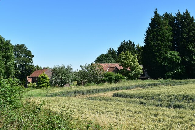
Earl Stonham is a small village located in the county of Suffolk, England. Situated approximately 5 miles north of the town of Stowmarket, the village is nestled in the picturesque countryside of East Anglia.

With a population of around 500 residents, Earl Stonham maintains a tight-knit community atmosphere. The village is known for its charming and well-preserved traditional English architecture, including a collection of thatched cottages, timber-framed houses, and historic churches.

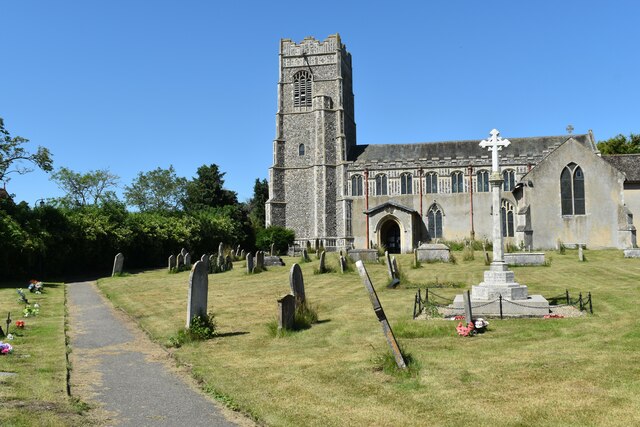
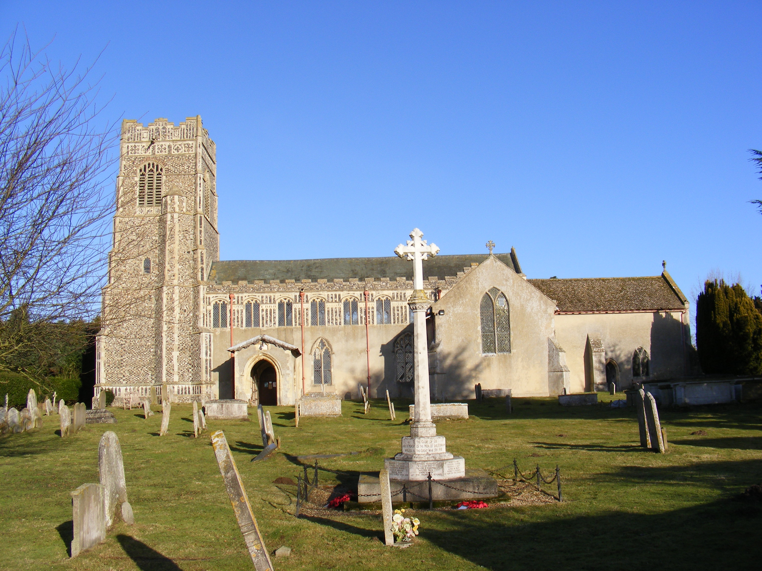
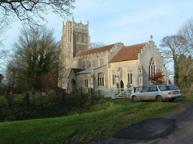
The focal point of Earl Stonham is the 15th-century St. Mary's Church, a stunning example of medieval architecture. The church features intricate stained glass windows and a tower that offers panoramic views of the surrounding countryside.

The village is also home to the historic Earl Stonham Castle, which dates back to the 16th century. While the castle is not open to the public, its presence adds to the village's rich history and character.

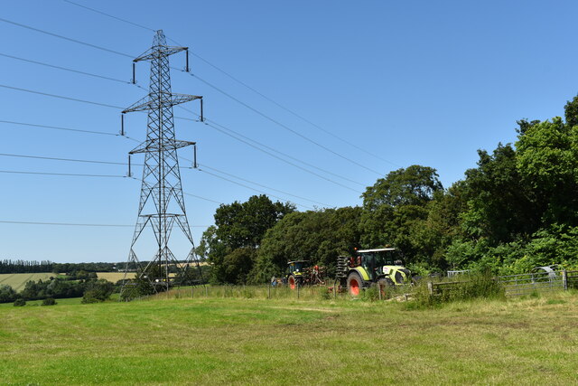
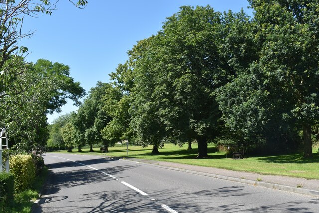
In terms of amenities, Earl Stonham boasts a village hall, a primary school, and a cozy pub, The Four Horseshoes, where locals and visitors can gather for a drink or a meal. The village is also surrounded by beautiful walking trails and nature reserves, allowing residents and visitors to appreciate the natural beauty of the area.

Overall, Earl Stonham offers a tranquil and idyllic setting, combining history, natural beauty, and a strong sense of community, making it a desirable place to live or visit for those seeking a peaceful escape in the heart of the Suffolk countryside.

If you have any feedback on the listing, please let us know in the comments section below.

Earl Stonham Images

Images are sourced within 2km of 52.186143/1.0718857 or Grid Reference TM1058. Thanks to Geograph Open Source API. All images are credited.

Poplar Farm, Creeting Bottom Looking east from All Saints' Road.
Poplar Farm, Creeting Bottom
Looking east from All Saints' Road.
Wheat field, All Saints' Road, Creeting St. Mary Looking east, close to the house called The Lime Trees, visible on the left.
Wheat field, All Saints' Road, Creeting St. Mary
Looking east, close to the house called The Lime Trees, visible on the left.
Tractors parked on a field edge Looking north from All Saints' Road, Creeting St. Mary.
Tractors parked on a field edge
Looking north from All Saints' Road, Creeting St. Mary.
Red Houses, All Saints' Road, Creeting St. Mary Red Houses is the name given to a row of eleven cottages at the northern end of the parish.
Red Houses, All Saints' Road, Creeting St. Mary
Red Houses is the name given to a row of eleven cottages at the northern end of the parish.
Pasture near Red Houses, Creeting St. Mary Looking north-west from All Saint's Road towards Chapel Farm, Earl Stonham.
Pasture near Red Houses, Creeting St. Mary
Looking north-west from All Saint's Road towards Chapel Farm, Earl Stonham.
Waste water storage tanks beside Douche's Lane
Field cut for haylage, Earl Stonham Looking north from the A1120 near Jubilee Cottages.  The rgass has been cut and collected in plastic-wrapped bales.
Field cut for haylage, Earl Stonham
Looking north from the A1120 near Jubilee Cottages. The rgass has been cut and collected in plastic-wrapped bales.
National Grid pylons near Earl Stonham Looking south from the A1120 near Jubilee Cottages.
National Grid pylons near Earl Stonham
Looking south from the A1120 near Jubilee Cottages.
Church of St. Mary the Virgin, Earl Stonham Much of the building dates back to the mid 14th and early 16th Century, with some 13th Century elements.  It has a cruciform layout without side aisles and is a Grade I Listed Building.
Church of St. Mary the Virgin, Earl Stonham
Much of the building dates back to the mid 14th and early 16th Century, with some 13th Century elements. It has a cruciform layout without side aisles and is a Grade I Listed Building.
Guildhall Cottages, Earl Stonham This pair of cottages, sitting on the A1120 adjacent to the parish church, dates back to about 1700 and is a Grade II Listed Building.
Guildhall Cottages, Earl Stonham
This pair of cottages, sitting on the A1120 adjacent to the parish church, dates back to about 1700 and is a Grade II Listed Building.
The Old School House, Forward Green, Earl Stonham The school was built in 1870 on land at the southern end of Forrolde (now Forward) Green.  It is now a private house.
The Old School House, Forward Green, Earl Stonham
The school was built in 1870 on land at the southern end of Forrolde (now Forward) Green. It is now a private house.
Trees on Forward Green Forward Green is one of several satellite settlements in the parish of Earl Stonham.  The trees here line the green alongside the A1120.
Trees on Forward Green
Forward Green is one of several satellite settlements in the parish of Earl Stonham. The trees here line the green alongside the A1120.
Church Lane, Earl Stonham Church Lane leads north from the church through the parkland of Earl Stonham House.
Church Lane, Earl Stonham
Church Lane leads north from the church through the parkland of Earl Stonham House.
Barns at Brewery Farm, Little Stonham Looking east along the A1120 as it enters the settlement at Angel Hill.
Barns at Brewery Farm, Little Stonham
Looking east along the A1120 as it enters the settlement at Angel Hill.
Ripening wheat field near Meadow View Farm Looking north-west from the A1120.
Ripening wheat field near Meadow View Farm
Looking north-west from the A1120.
Abandoned signage, A140 / All Saints Road
A140 north at A1120 crossroads
St. Mary's church, Little Stonham, Suffolk This perpendicular church stands to the west of the village away from the main road to Norwich.  It is a fine looking church with an attractive tower richly decorated with flushwork.
St. Mary's church, Little Stonham, Suffolk
This perpendicular church stands to the west of the village away from the main road to Norwich. It is a fine looking church with an attractive tower richly decorated with flushwork.
Show me another place!

Earl Stonham is located at Grid Ref: TM1058 (Lat: 52.186143, Lng: 1.0718857)

Administrative County: Suffolk

District: Mid Suffolk

Police Authority: Suffolk

What 3 Words

///soon.worthy.solid. Near Needham Market, Suffolk

Related Wikis

Earl Stonham

Earl Stonham is a small village and civil parish (formerly called Stonham Earl) in the Mid Suffolk district of Suffolk, England. It is between the A14...

Lingwood Meadows

Lingwood Meadows is a 2.7-hectare (6.7-acre) biological Site of Special Scientific Interest east of Earl Stonham in Suffolk.These ancient meadows are one...

St Mary the Virgin's Church, Stonham Parva

St Mary the Virgin's Church is a redundant Anglican church in the village of Stonham Parva, Suffolk, England. It is recorded in the National Heritage...

Creeting St Mary

Creeting St Mary is a village and civil parish in the Mid Suffolk district of Suffolk in eastern England. Sandwiched between the A14 and A140 to the north...

Nearby Amenities

Located within 500m of 52.186143,1.0718857
Power: pole
Lat/Long: 52.1844398/1.0770519
Power: pole
Lat/Long: 52.1825765/1.0693915
Power: pole
Lat/Long: 52.1828841/1.0706441
Power: pole
Lat/Long: 52.1837968/1.0744367
Power: pole
Lat/Long: 52.1831341/1.0716794
Power: pole
Lat/Long: 52.1847753/1.0784493
Power: pole
Lat/Long: 52.1841011/1.0756893
Power: pole
Lat/Long: 52.183486/1.0731412
Power: pole
Lat/Long: 52.1824187/1.0681147
The data included in this document is from www.openstreetmap.org. The data is made available under ODbL.

Have you been to Earl Stonham?

Leave your review of Earl Stonham below (or comments, questions and feedback).