Droitwich Spa

Settlement in Worcestershire Wychavon

England

Droitwich Spa

Small cemetery at Hadzor
Small cemetery at Hadzor Credit: Jeff Gogarty

Droitwich Spa is a small town located in the county of Worcestershire, England. Situated approximately 6 miles south of the city of Worcester, it is nestled within the picturesque countryside of the West Midlands region. The town is known for its historic significance as a spa town, dating back to the Roman era.

Droitwich Spa is famous for its salt production, which has been a vital part of the town's economy for centuries. The brine springs in the area contain high levels of salt, and the town's salt works were once the largest in the country. Today, visitors can still witness the traditional salt production process at the restored and operational Droitwich Salt Museum.

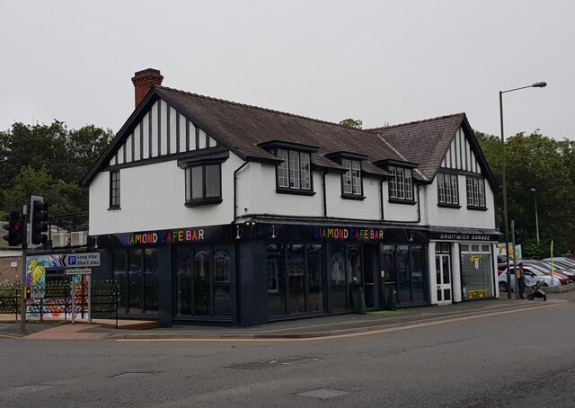
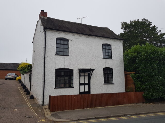
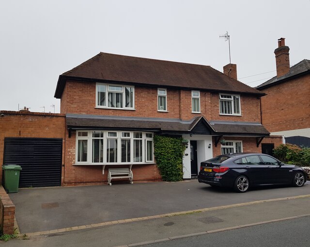
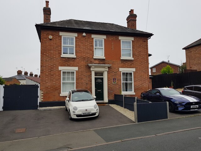
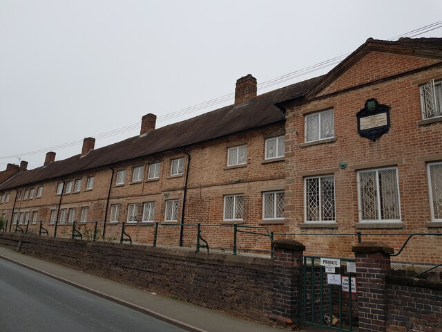
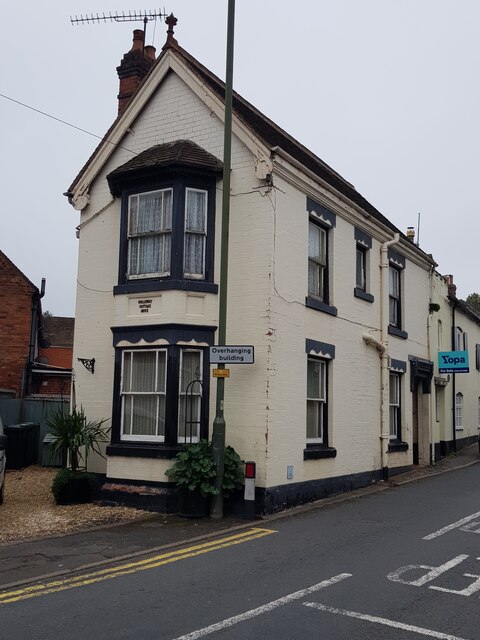
The town's picturesque landscape is adorned with charming black and white timber-framed buildings, reflecting its rich heritage. The historic Droitwich town center offers a delightful range of independent shops, cafes, and restaurants, making it a popular destination for both locals and tourists.

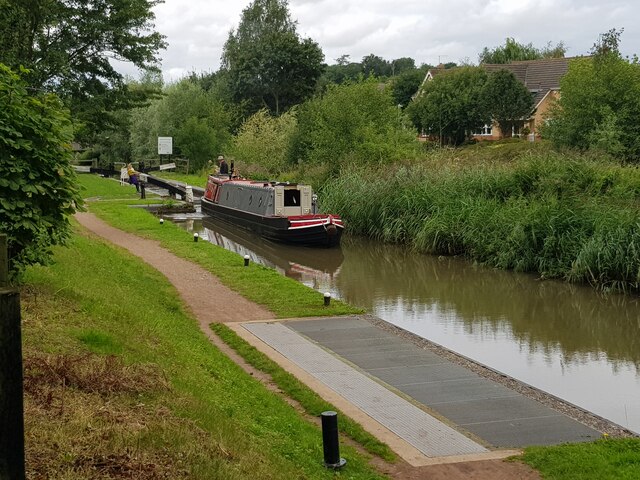
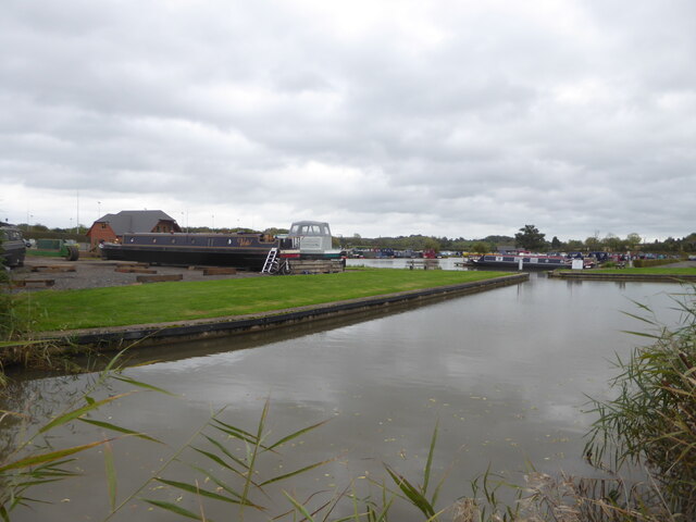
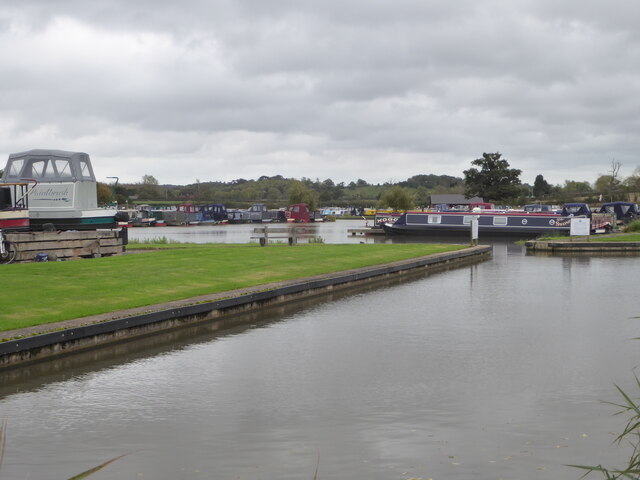
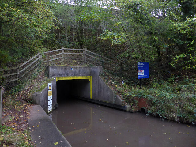
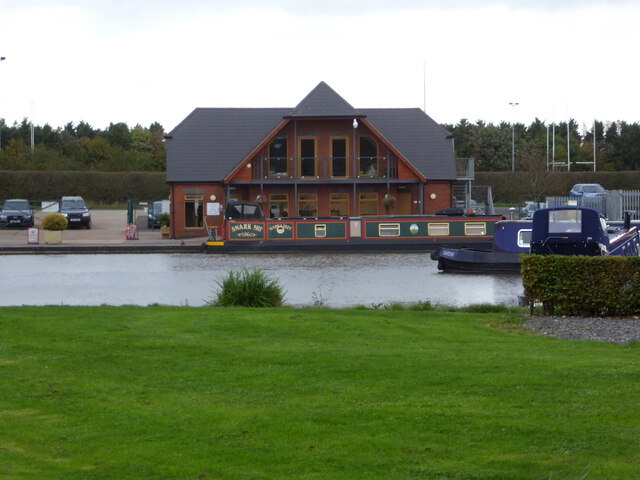
Nature lovers can explore the nearby Droitwich Canals, which have been beautifully restored and provide a tranquil setting for boating, fishing, and leisurely walks. Additionally, the nearby Worcestershire countryside offers opportunities for hiking and exploring the surrounding natural beauty.

Droitwich Spa has excellent transport links, with easy access to the M5 motorway and a direct train service to Birmingham and Worcester. The town also boasts a range of amenities, including schools, healthcare facilities, and recreational spaces, making it an attractive place to live for families and individuals alike.

Overall, Droitwich Spa offers a unique blend of history, natural beauty, and modern conveniences, making it a captivating destination for visitors and a delightful place to call home.

If you have any feedback on the listing, please let us know in the comments section below.

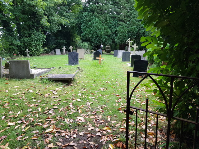
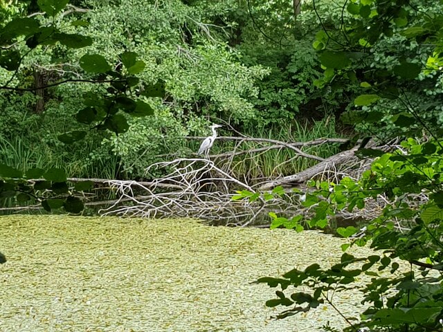
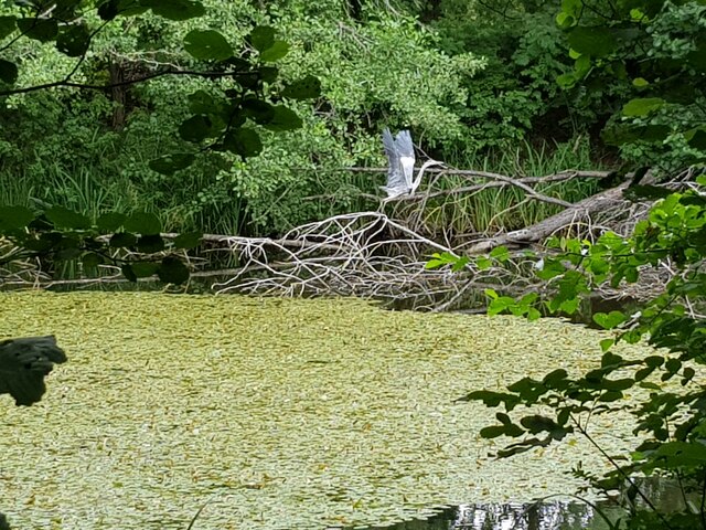
Droitwich Spa Images

Images are sourced within 2km of 52.268092/-2.1457019 or Grid Reference SO9063. Thanks to Geograph Open Source API. All images are credited.

Small cemetery at Hadzor
Heron at Swan Pool, Droitwich Spa
Heron taking flight at Swan Pool, Droitwich Spa
Narrow boat on the Droitwich Junction Canal The grating on the towpath is where water is taken from the canal and transferred via pipes under the towpath to where the canal begins again. This is because the re-builders of the canal did not want to pollute the River Salwarpe.
Narrow boat on the Droitwich Junction Canal
The grating on the towpath is where water is taken from the canal and transferred via pipes under the towpath to where the canal begins again. This is because the re-builders of the canal did not want to pollute the River Salwarpe.
Diamond Coffee Bar, at the crossroads Droitwich Many businesses have tried to flourish at this location which is subject to flooding.
Diamond Coffee Bar, at the crossroads Droitwich
Many businesses have tried to flourish at this location which is subject to flooding.
2, The Holloway, Droitwich Spa
5 The Holloway, Droitwich Spa This used to be a general store at least up to 2001 when the owner complained of too many roadworks in the road.
5 The Holloway, Droitwich Spa
This used to be a general store at least up to 2001 when the owner complained of too many roadworks in the road.
7 The Holloway, Droitwich Spa Presently a semi-detached house this was formally the Ring O'Bells <a href="https://www.geograph.org.uk/photo/5196358">SO9063 : Ring O' Bells, Droitwich</a> which is still marked in the glass above the door.
7 The Holloway, Droitwich Spa
Presently a semi-detached house this was formally the Ring O'Bells SO9063 : Ring O' Bells, Droitwich which is still marked in the glass above the door.
Coventry Almshouses, The Holloway, Droitwich Spa This is one of the original wings which has recently been repointed with lime mortar. Said to have been founded as a result of a horse race between Henry Coventry and Sir John Pakington of Westwood <a href="https://www.geograph.org.uk/photo/4583125">SO8763 : Westwood House from the drive</a>. The loser was to pay for the building of the property named after the winner. Henry Coventry horse won but John Pakington had no cash spare so promised the income of two farms for the upkeep and Henry Coventry left money the building of the houses in his will.
Coventry Almshouses, The Holloway, Droitwich Spa
This is one of the original wings which has recently been repointed with lime mortar. Said to have been founded as a result of a horse race between Henry Coventry and Sir John Pakington of Westwood SO8763 : Westwood House from the drive. The loser was to pay for the building of the property named after the winner. Henry Coventry horse won but John Pakington had no cash spare so promised the income of two farms for the upkeep and Henry Coventry left money the building of the houses in his will.
1, The Holloway, Droitwich Spa
Droitwich Spa Marina  Accessed from the Droitwich Junction Canal in the foreground.
Droitwich Spa Marina
Accessed from the Droitwich Junction Canal in the foreground.
Droitwich Spa Marina  Accessed from the Droitwich Junction Canal seen in the foreground.
Droitwich Spa Marina
Accessed from the Droitwich Junction Canal seen in the foreground.
Droitwich Junction Canal - the M5 tunnel Classed as bridge No. 5 this is actually a tight 60 metre long tunnel. The canal at this point carries water from the Body Brook and the headroom is variable through the tunnel. This waterfront is accessible by some steps from the left but is now virtually completely hidden from the nearby road by the growth of vegetation in the last decade or so.
Droitwich Junction Canal - the M5 tunnel
Classed as bridge No. 5 this is actually a tight 60 metre long tunnel. The canal at this point carries water from the Body Brook and the headroom is variable through the tunnel. This waterfront is accessible by some steps from the left but is now virtually completely hidden from the nearby road by the growth of vegetation in the last decade or so.
Droitwich Spa Marina Alongside the Droitwich Junction Canal.
Droitwich Spa Marina
Alongside the Droitwich Junction Canal.
Droitwich Junction Canal - lock No. 1 The first of seven on this short canal. The first three are in a short distance and are the only original locks left. The other four are modern locks. These three have water-saving side pounds and the two sluices for lock No. 1 are seen to its right. These are still in use and a note on the gate instructs users to use the side paddles first.
Droitwich Junction Canal - lock No. 1
The first of seven on this short canal. The first three are in a short distance and are the only original locks left. The other four are modern locks. These three have water-saving side pounds and the two sluices for lock No. 1 are seen to its right. These are still in use and a note on the gate instructs users to use the side paddles first.
Droitwich Junction Canal - sign by lock No. 3 The top three locks have working side pounds (or ponds) and boaters are instructed to operate these sluices first. The side pounds save water that in this case is approximately worth half a lock full. 

Some locks, such as those at Knowle on the Grand Union had two side pounds and could save about 2/3rds of a lock full.
Droitwich Junction Canal - sign by lock No. 3
The top three locks have working side pounds (or ponds) and boaters are instructed to operate these sluices first. The side pounds save water that in this case is approximately worth half a lock full. Some locks, such as those at Knowle on the Grand Union had two side pounds and could save about 2/3rds of a lock full.
Droitwich Junction Canal - lock No. 2 side pound The top three locks on this short canal have water-saving side pounds. This is the pound by lock No. 2 and its associated sluices. Use of the side pound will save about half a lock full of water to be used for the next boat coming up the flight.
Droitwich Junction Canal - lock No. 2 side pound
The top three locks on this short canal have water-saving side pounds. This is the pound by lock No. 2 and its associated sluices. Use of the side pound will save about half a lock full of water to be used for the next boat coming up the flight.
Droitwich Junction Canal - warning indicator board This very snazzy live display is by the top lock near Hanbury Wharf. It indicates whether it is safe to navigate under the M5 and onto the canalised section of the River Salwarpe.
Droitwich Junction Canal - warning indicator board
This very snazzy live display is by the top lock near Hanbury Wharf. It indicates whether it is safe to navigate under the M5 and onto the canalised section of the River Salwarpe.
Show me another place!

Droitwich Spa is located at Grid Ref: SO9063 (Lat: 52.268092, Lng: -2.1457019)

Administrative County: Worcestershire

District: Wychavon

Police Authority: West Merica

Also known as: Droitwich

What 3 Words

///trips.ashes.valley. Near Droitwich, Worcestershire

Related Wikis

Old Town Hall, Droitwich Spa

The Old Town Hall is a municipal building in St Andrews Street, Droitwich Spa, Worcestershire, England. The structure, which was the headquarters of Droitwich...

Droitwich Spa Lido

The Droitwich Spa Lido is a lido in Droitwich Spa, Worcestershire, England. It is one of the few remaining inland, open-air salt-water swimming pools...

RGS Dodderhill

RGS Dodderhill is a private school on the outskirts of Droitwich Spa, Worcestershire, England. Girls & Boys are educated from 2–11 years of age - most...

Droitwich Spa

Droitwich Spa (often abbreviated to Droitwich ) is a historic spa town in the Wychavon district in northern Worcestershire, England, on the River Salwarpe...

Droitwich Spa railway station

Droitwich Spa railway station serves the town of Droitwich Spa in Worcestershire, England. It is located just to the south-west of Droitwich Spa Junction...

Chateau Impney

Chateau Impney Hotel & Exhibition Centre is a Grade II* listed 19th-century house built in the style of an elaborate French château near Droitwich Spa...

Church of the Sacred Heart and St Catherine of Alexandria

The Church of the Sacred Heart and St Catherine of Alexandria is a Catholic church situated in Droitwich Spa, Worcestershire, England, noted for its remarkable...

Droitwich Spa High School

Droitwich Spa High School is a secondary school and specialist Sports College with academy status in Droitwich Spa, Worcestershire, England. It serves...

Nearby Amenities

Located within 500m of 52.268092,-2.1457019
Droitwich Spa
Alt Name: Droitwich
Old Name: Salinae
Place: town
Wikidata: Q1260116
Wikipedia: en:Droitwich Spa
Lat/Long: 52.26851/-2.1486075
Crossing
Crossing: traffic_signals
Source: visual survey;bing
Lat/Long: 52.2671391/-2.1518112
Barrier: bollard
Lat/Long: 52.26923/-2.1512732
Barrier: bollard
Source: survey
Lat/Long: 52.2695174/-2.1520749
Barrier: bollard
Source: survey
Lat/Long: 52.2696049/-2.1523683
Traffic Signals
Source: bing
Lat/Long: 52.2689344/-2.1450158
Bus Stop
Ombersley Street East
Bus: yes
Naptan AtcoCode: 2000G001600
Naptan Bearing: E
Naptan CommonName: Ombersley Street East
Naptan Indicator: adj
Naptan NaptanCode: wocdgpag
Naptan PlusbusZoneRef: DRTWCHS
Naptan Street: Ombersley Street East
Naptan Verified: no
Public Transport: platform
Source: naptan_import
Lat/Long: 52.2673147/-2.1527822
Bus Stop
Ombersley Street East
Bus: yes
Local Ref: 2
Naptan AtcoCode: 2000G001601
Naptan Bearing: E
Naptan CommonName: Ombersley Street East
Naptan Indicator: Adj
Naptan NaptanCode: wocdgpaj
Naptan PlusbusZoneRef: DRTWCHS
Naptan Street: Ombersley Street East
Naptan Verified: no
Public Transport: platform
Source: naptan_import
Lat/Long: 52.2671874/-2.1526994
Bus Stop
Raven Hotel
Bus: yes
Naptan AtcoCode: 2000G001603
Naptan Bearing: E
Naptan CommonName: Raven Hotel
Naptan Indicator: Adj
Naptan Landmark: Raven Hotel
Naptan NaptanCode: wocdgpap
Naptan PlusbusZoneRef: DRTWCHS
Naptan Street: St. Andrew's Road
Naptan Verified: no
Public Transport: platform
Source: naptan_import
Lat/Long: 52.2667887/-2.1492781
Bus Stop
Victoria Square
Bus: yes
Naptan AtcoCode: 2000G001605
Naptan Bearing: SE
Naptan CommonName: Victoria Square
Naptan Indicator: Adj
Naptan NaptanCode: wocdgpat
Naptan PlusbusZoneRef: DRTWCHS
Naptan Street: Victoria Square
Naptan Verified: no
Public Transport: platform
Source: naptan_import
Lat/Long: 52.2671583/-2.1508823
Bus Stop
Droitwich- Queen St- Chapel Bridge
Bus: yes
Naptan AtcoCode: 2000G156700
Naptan Bearing: SW
Naptan CommonName: Droitwich- Queen St- Chapel Bridge
Naptan Indicator: Adj
Naptan Landmark: Crutch Lane
Naptan NaptanCode: wocdwjmd
Naptan PlusbusZoneRef: DRTWCHS
Naptan Street: Bromsgrove Road
Naptan Verified: no
Public Transport: platform
Source: naptan_import
Lat/Long: 52.2703317/-2.143228
Bus Stop
Waitrose
Bus: yes
Naptan AtcoCode: 2000G156701
Naptan Bearing: NW
Naptan CommonName: Saltway
Naptan Indicator: adj
Naptan Landmark: Waitrose
Naptan NaptanCode: wocdwjmg
Naptan PlusbusZoneRef: DRTWCHS
Naptan Street: Saltway
Naptan Verified: no
Public Transport: platform
Source: naptan_import
Lat/Long: 52.2690761/-2.1462376
Bus Stop
Dodderhill Road
Bus: yes
Naptan AtcoCode: 2000G323004
Naptan Bearing: NE
Naptan CommonName: Dodderhill Road
Naptan Crossing: Dodderhill Road
Naptan Indicator: adj
Naptan NaptanCode: wocdtdpj
Naptan PlusbusZoneRef: DRTWCHS
Naptan Street: Bromsgrove Road
Naptan Verified: no
Public Transport: platform
Source: naptan_import
Lat/Long: 52.2717428/-2.1417179
Bus Stop
Dodderhill Road
Bus: yes
Naptan AtcoCode: 2000G323005
Naptan Bearing: SW
Naptan CommonName: Dodderhill Road
Naptan Crossing: Dodderhill Road
Naptan Indicator: opp
Naptan NaptanCode: wocdtdpm
Naptan PlusbusZoneRef: DRTWCHS
Naptan Street: Bromsgrove Road
Naptan Verified: no
Public Transport: platform
Source: naptan_import
Lat/Long: 52.2715191/-2.1417885
Bus Stop
Queen Street
Bus: yes
Naptan AtcoCode: 2000G323006
Naptan Bearing: S
Naptan BusStopType: CUS
Naptan CommonName: Queen Street
Naptan Indicator: Opp
Naptan Landmark: High Street
Naptan NaptanCode: wocdtdpt
Naptan PlusbusZoneRef: DRTWCHS
Naptan Street: Worcester Road
Naptan Verified: no
Public Transport: platform
Source: naptan_import
Lat/Long: 52.2683492/-2.1451801
Bus Stop
Lullow House
Bus: yes
Naptan AtcoCode: 2000G323057
Naptan Bearing: S
Naptan CommonName: Lullow House
Naptan Indicator: Adj
Naptan Landmark: Lullow House
Naptan NaptanCode: wocdapwg
Naptan PlusbusZoneRef: DRTWCHS
Naptan Street: The Holloway
Naptan Verified: no
Public Transport: platform
Source: naptan_import
Lat/Long: 52.2665052/-2.1425467
Bus Stop
Droitwich- Queen Street
Bus: yes
Naptan AtcoCode: 2000G502691
Naptan Bearing: N
Naptan CommonName: Droitwich- Queen Street
Naptan Indicator: adj
Naptan Landmark: Droitwich High Street
Naptan NaptanCode: wocdmpgt
Naptan PlusbusZoneRef: DRTWCHS
Naptan Street: Queen Street
Naptan Verified: no
Public Transport: platform
Source: naptan_import
Lat/Long: 52.2677897/-2.146027
Bus Stop
Henry Brummel
Bus: yes
Naptan AtcoCode: 2000G502702
Naptan Bearing: NE
Naptan CommonName: Queen Street
Naptan Indicator: Adj
Naptan NaptanCode: wocdgjad
Naptan PlusbusZoneRef: DRTWCHS
Naptan Street: Queen Street
Naptan Verified: no
Public Transport: platform
Source: naptan_import
Lat/Long: 52.2682599/-2.1456283
Bus Stop
Health Centre- Ombersley Street East
Bus: yes
Naptan AtcoCode: 2000G502726
Naptan Bearing: E
Naptan CommonName: Health Centre- Ombersley Street East
Naptan Indicator: Adj
Naptan Landmark: Droitwich Health centre
Naptan NaptanCode: wocdgdtp
Naptan PlusbusZoneRef: DRTWCHS
Naptan Street: Ombersley Street East
Naptan Verified: no
Public Transport: platform
Source: naptan_import
Lat/Long: 52.2671813/-2.1524842
Post Box
Collection Plate: CP1
Collection Times: Mo-Fr 18:30; Sa 10:30
Historic Operator: Post Office
Post Box Type: pillar
Ref: WR9 376
Royal Cypher: GVIR
Royal Cypher Wikidata: Q33102169
Lat/Long: 52.2684345/-2.1484365
Seamark Type: gate
Waterway: lock_gate
Lat/Long: 52.2696956/-2.1452253
Lock: yes
Seamark Type: gate
Waterway: lock_gate
Lat/Long: 52.2696937/-2.1455413
Turning Circle
Source: bing
Lat/Long: 52.2716314/-2.1469998
Mini Roundabout
Direction: clockwise
Lat/Long: 52.2680659/-2.1398408
Mini Roundabout
Direction: clockwise
Lat/Long: 52.2680324/-2.138972
Leisure: playground
Lat/Long: 52.2653732/-2.1448287
Post Box
Alt Ref: WR9 4910
Collection Plate: CP1-LC
Collection Times: Mo-Fr 18:30; Sa 12:30
Historic Operator: Royal Mail
Note: Royal Mail gives ref for right hand apperture as 'WR9 4910' but both plates are the same and are 'WR9 491'
Post Box Apertures: 2
Post Box Design: type_c
Post Box Type: pillar
Ref: WR9 491
Royal Cypher: EIIR
Royal Cypher Wikidata: Q33102113
Lat/Long: 52.2671812/-2.1509316
Post Box
Collection Plate: CP7
Collection Times: Mo-Fr 16:45; Sa 10:30
Historic Operator: Post Office
Post Box Type: lamp
Ref: WR9 356
Royal Cypher: EIIR
Royal Cypher Wikidata: Q33102113
Lat/Long: 52.2688093/-2.1442711
Post Box
Collection Plate: CP7
Collection Times: Mo-Fr 16:45; Sa 09:30
Historic Operator: Royal Mail
Post Box Type: lamp
Ref: WR9 375
Royal Cypher: EIIR
Royal Cypher Wikidata: Q33102113
Lat/Long: 52.2708934/-2.1424173
Fixme: continue
Lat/Long: 52.270531/-2.1424513
Post Box
Collection Plate: CP7
Collection Times: Mo-Fr 17:00; Sa 10:45
Historic Operator: Post Office
Post Box Type: lamp
Ref: WR9 355
Royal Cypher: EIIR
Royal Cypher Wikidata: Q33102113
Lat/Long: 52.2652223/-2.1474817
Post Box
Collection Plate: CP7
Collection Times: Mo-Fr 16:45; Sa 09:30
Historic Operator: Post Office
Post Box Type: lamp
Ref: WR9 525
Royal Cypher: EIIR
Royal Cypher Wikidata: Q33102113
Lat/Long: 52.2702587/-2.1470136
Give Way
Direction: backward
Lat/Long: 52.2679985/-2.1388775
Railway: switch
Lat/Long: 52.270068/-2.1438508
Pub
Mason's Arms
Lat/Long: 52.2704438/-2.1429374
Man Made: surveillance
Source: survey
Lat/Long: 52.267425/-2.1502483
War Memorial
Historic: memorial
Lat/Long: 52.2671075/-2.1506525
Entrance: yes
Lat/Long: 52.2681418/-2.151144
Entrance: yes
Lat/Long: 52.2683394/-2.1520506
Barrier: cycle_barrier
Source: survey
Lat/Long: 52.2684084/-2.15062
Traffic Signals
Source: bing
Lat/Long: 52.2662106/-2.1479211
Bench
Source: survey
Lat/Long: 52.2681876/-2.1508296
Bicycle Parking
Source: survey
Lat/Long: 52.2682013/-2.1508967
Bench
Source: survey
Lat/Long: 52.268214/-2.1509727
Fire Station
Lat/Long: 52.2695315/-2.1504336
Bench
Lat/Long: 52.2684792/-2.147452
Crossing
Crossing: marked
Crossing Island: no
Lat/Long: 52.2679763/-2.1458859
Bicycle Parking
Source: survey
Lat/Long: 52.2669314/-2.15025
WHS Tile Mosaic
Tourism: artwork
Lat/Long: 52.2673755/-2.1502469
Tile Mosaic
Tourism: artwork
Lat/Long: 52.2680141/-2.1492862
Saltworkers
Artwork Type: sculpture
Source: survey
Tourism: artwork
Lat/Long: 52.2670843/-2.1498721
Clock
Display: analog
Source: survey
Visibility: area
Lat/Long: 52.2681314/-2.1512475
Atm
Source: bing
Lat/Long: 52.2672214/-2.1512379
Atm
Source: survey
Lat/Long: 52.2672608/-2.1509914
Atm
Operator: Barclays Bank PLC
Source: bing
Lat/Long: 52.2672635/-2.1516064
Atm
Source: survey
Lat/Long: 52.2673239/-2.1500448
Power: substation
Ref: 33252
Source: survey
Lat/Long: 52.2679407/-2.1511409
Leisure: playground
Lat/Long: 52.2691996/-2.1454792
Railway: crossing
Lat/Long: 52.2708976/-2.1477078
Droitwich Spa Diamond Julilee Walk 2012
Hiking: yes
Information: map
Tourism: information
Lat/Long: 52.2696334/-2.1447877
John Corbett Way
Hiking: yes
Information: map
Tourism: information
Lat/Long: 52.2696349/-2.1448311
Wychavon Way
Hiking: yes
Information: map
Tourism: information
Lat/Long: 52.2696334/-2.1447526
Traffic Signals
Source: bing
Lat/Long: 52.2688834/-2.1443479
Bicycle Parking
Source: survey
Lat/Long: 52.2672335/-2.151652
Barrier: bollard
Lat/Long: 52.2672064/-2.1516478
Mini Roundabout
Direction: clockwise
Lat/Long: 52.2667405/-2.1497919
Generator Method: photovoltaic
Generator Output Electricity: yes
Generator Source: solar
Generator Type: solar_photovoltaic_panel
Location: roof
Power: generator
Lat/Long: 52.2677076/-2.1389329
Generator Method: photovoltaic
Generator Output Electricity: yes
Generator Source: solar
Generator Type: solar_photovoltaic_panel
Location: roof
Power: generator
Lat/Long: 52.2694877/-2.1410412
Generator Method: photovoltaic
Generator Output Electricity: yes
Generator Source: solar
Generator Type: solar_photovoltaic_panel
Location: roof
Power: generator
Lat/Long: 52.2677175/-2.1392226
Generator Method: photovoltaic
Generator Output Electricity: yes
Generator Source: solar
Generator Type: solar_photovoltaic_panel
Location: roof
Power: generator
Lat/Long: 52.2655655/-2.1435088
Generator Method: photovoltaic
Generator Output Electricity: yes
Generator Source: solar
Generator Type: solar_photovoltaic_panel
Location: roof
Power: generator
Lat/Long: 52.2655474/-2.1436027
Ombersley Street East
Bus: yes
Public Transport: stop_position
Lat/Long: 52.2671349/-2.1527063
Pub
Barley Mow
Lat/Long: 52.2688771/-2.1437061
Generator Method: photovoltaic
Generator Output Electricity: yes
Generator Source: solar
Generator Type: solar_photovoltaic_panel
Location: roof
Power: generator
Lat/Long: 52.2698439/-2.1444784
Generator Method: photovoltaic
Generator Output Electricity: yes
Generator Source: solar
Generator Type: solar_photovoltaic_panel
Location: roof
Power: generator
Lat/Long: 52.2698094/-2.1443658
Generator Method: photovoltaic
Generator Output Electricity: yes
Generator Source: solar
Generator Type: solar_photovoltaic_panel
Location: roof
Power: generator
Lat/Long: 52.2697684/-2.1442759
Generator Method: photovoltaic
Generator Output Electricity: yes
Generator Source: solar
Generator Type: solar_photovoltaic_panel
Location: roof
Power: generator
Lat/Long: 52.2688238/-2.1407676
Waterway: weir
Lat/Long: 52.2698168/-2.1452107
Give Way
Direction: backward
Lat/Long: 52.268585/-2.1434243
Give Way
Direction: forward
Lat/Long: 52.2679924/-2.1398757
Generator Method: photovoltaic
Generator Output Electricity: yes
Generator Source: solar
Generator Type: solar_photovoltaic_panel
Location: roof
Power: generator
Lat/Long: 52.2722936/-2.1461374
Generator Method: photovoltaic
Generator Output Electricity: yes
Generator Source: solar
Generator Type: solar_photovoltaic_panel
Location: roof
Power: generator
Lat/Long: 52.2722443/-2.1463922
Generator Method: photovoltaic
Generator Output Electricity: yes
Generator Source: solar
Generator Type: solar_photovoltaic_panel
Location: roof
Power: generator
Lat/Long: 52.272159/-2.146714
Generator Method: photovoltaic
Generator Output Electricity: yes
Generator Source: solar
Generator Type: solar_photovoltaic_panel
Location: roof
Power: generator
Lat/Long: 52.2696051/-2.1419048
Generator Method: photovoltaic
Generator Output Electricity: yes
Generator Source: solar
Generator Type: solar_photovoltaic_panel
Location: roof
Power: generator
Lat/Long: 52.264675/-2.1499461
Generator Method: photovoltaic
Generator Output Electricity: yes
Generator Source: solar
Generator Type: solar_photovoltaic_panel
Location: roof
Power: generator
Lat/Long: 52.2646717/-2.1498214
Traffic Signals
Source: bing
Lat/Long: 52.2687483/-2.1448311
Traffic Signals
Source: bing
Lat/Long: 52.26907/-2.1444047
Generator Method: photovoltaic
Generator Output Electricity: yes
Generator Source: solar
Generator Type: solar_photovoltaic_panel
Location: roof
Power: generator
Lat/Long: 52.2695271/-2.1501151
Generator Method: photovoltaic
Generator Output Electricity: yes
Generator Source: solar
Generator Type: solar_photovoltaic_panel
Location: roof
Power: generator
Lat/Long: 52.271889/-2.1469058
Generator Method: photovoltaic
Generator Output Electricity: yes
Generator Source: solar
Generator Type: solar_photovoltaic_panel
Location: roof
Power: generator
Lat/Long: 52.2699924/-2.1456438
Generator Method: photovoltaic
Generator Output Electricity: yes
Generator Source: solar
Generator Type: solar_photovoltaic_panel
Power: generator
Lat/Long: 52.2704561/-2.1491589
Generator Method: photovoltaic
Generator Output Electricity: yes
Generator Source: solar
Generator Type: solar_photovoltaic_panel
Power: generator
Lat/Long: 52.270484/-2.1492353
Cycleway: asl
Source: bing
Lat/Long: 52.265975/-2.1479438
Cycleway: asl
Source: bing
Lat/Long: 52.2660202/-2.1482925
Cycleway: asl
Source: bing
Lat/Long: 52.2662426/-2.1482764
Cycleway: asl
Source: bing
Lat/Long: 52.2662311/-2.1478902
Traffic Signals
Source: bing
Lat/Long: 52.2660071/-2.1479894
Traffic Signals
Source: bing
Lat/Long: 52.2660325/-2.1482617
Traffic Signals
Source: bing
Lat/Long: 52.2662237/-2.1482523
Generator Method: photovoltaic
Generator Output Electricity: yes
Generator Source: solar
Generator Type: solar_photovoltaic_panel
Location: roof
Power: generator
Lat/Long: 52.2671758/-2.1427819
Generator Method: photovoltaic
Generator Output Electricity: yes
Generator Source: solar
Generator Type: solar_photovoltaic_panel
Location: roof
Power: generator
Lat/Long: 52.2663148/-2.1397309
Generator Method: photovoltaic
Generator Output Electricity: yes
Generator Source: solar
Generator Type: solar_photovoltaic_panel
Location: roof
Power: generator
Lat/Long: 52.2661064/-2.1415709
Generator Method: photovoltaic
Generator Output Electricity: yes
Generator Source: solar
Generator Type: solar_photovoltaic_panel
Location: roof
Power: generator
Source: bs
Lat/Long: 52.2642958/-2.146482
Generator Method: photovoltaic
Generator Output Electricity: yes
Generator Source: solar
Generator Type: solar_photovoltaic_panel
Location: roof
Power: generator
Source: bs
Lat/Long: 52.2656394/-2.1472894
Social Facility
Droitwich Spa Foodbank
Addr City: Droitwich
Addr Postcode: WR9 8QS
Addr Street: Ombersley Street East
Address: Droitwich Baptist Church Ombersley Street East WR9 8QS
Email: info@droitwichspa.foodbank.org.uk
Network: Trussell Trust
Parliamentary Constituency: Mid Worcestershire
Phone: 07532130604
Social Facility: food_bank
Social Facility For: underprivileged
Source: give_food
Url: https://www.givefood.org.uk/needs/at/droitwich-spa/
Lat/Long: 52.2675312/-2.1519712
Droitwich Cycling Club
Description: Droitwich Cycling Club
Source: local knowledge
Lat/Long: 52.2667847/-2.1467081
Railway: crossing
Lat/Long: 52.2708497/-2.1477387
The data included in this document is from www.openstreetmap.org. The data is made available under ODbL.

Have you been to Droitwich Spa?

Leave your review of Droitwich Spa below (or comments, questions and feedback).