Impney Park

Wood, Forest in Worcestershire Wychavon

England

Impney Park

Three Wells, timber framed house in Hadzor, Worcestershire
Three Wells, timber framed house in Hadzor, Worcestershire Credit: Jeff Gogarty

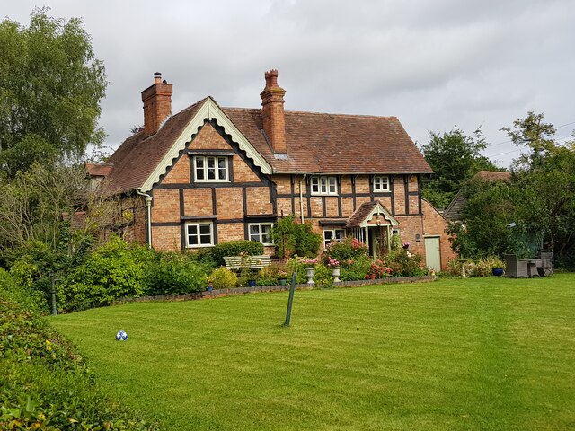
Impney Park is an expansive estate located in Worcestershire, England. Situated near the town of Droitwich Spa, the park covers a vast area of woodland and forest. It is a magnificent example of natural beauty and tranquility.

The park is renowned for its rich history, dating back to the 19th century when it was originally designed by renowned landscape architect John Claudius Loudon. It was once the grounds of the grand Impney Hall, a magnificent mansion built in the neo-Gothic style. While the mansion sadly no longer stands, the park continues to flourish and captivate visitors with its picturesque landscape.

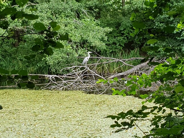
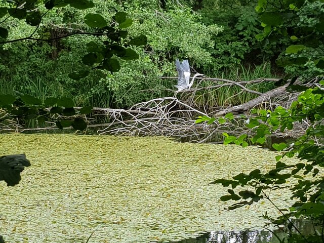
The woodland in Impney Park is abundant with a diverse range of trees, including oak, beech, and chestnut. The forested areas are intertwined with meandering paths and trails, offering a delightful experience for nature enthusiasts and walkers. The park also boasts a variety of wildlife, making it a haven for birdwatchers and nature lovers.

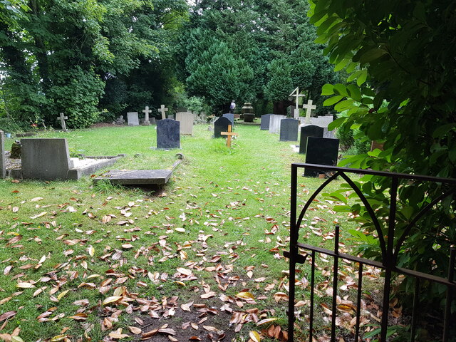
Impney Park is not only a natural haven but also an important historical site. It has been designated as a Grade II listed park and garden, recognizing its architectural and historical significance. The park offers a glimpse into Worcestershire's past, showcasing the elegant design and grandeur of its bygone era.

Visitors to Impney Park can enjoy its serene atmosphere, take leisurely walks, and indulge in a picnic amidst the tranquil surroundings. The park's beauty and historical significance make it a popular destination for locals and tourists alike, providing a perfect escape from the hustle and bustle of everyday life.

If you have any feedback on the listing, please let us know in the comments section below.
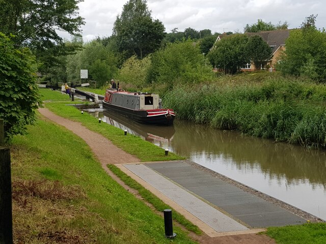
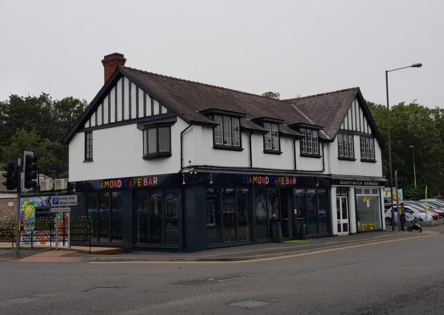
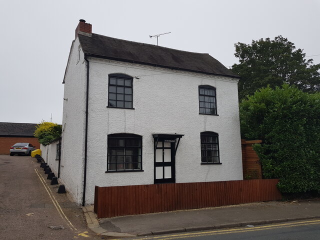
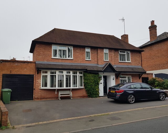
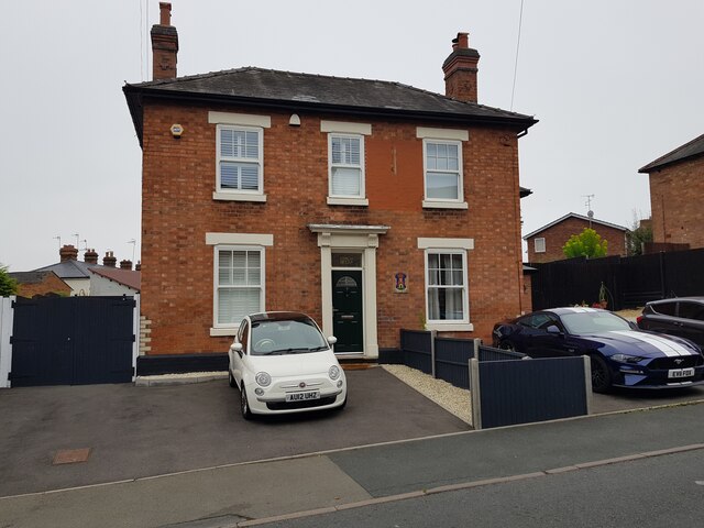
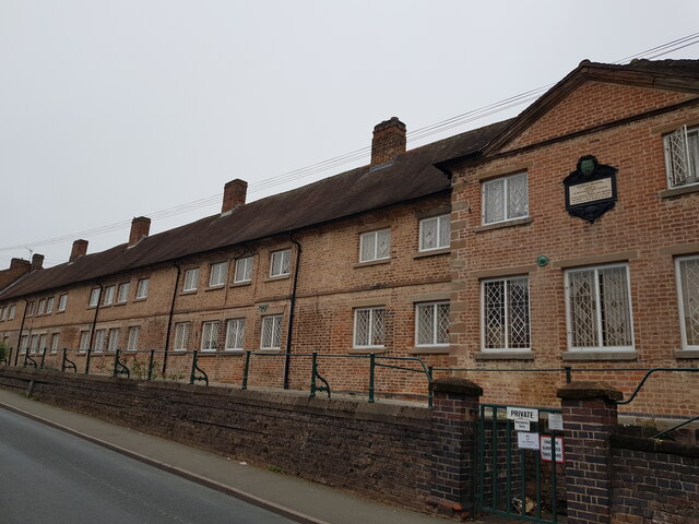
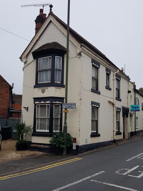
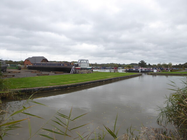
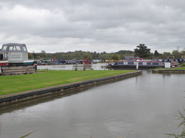
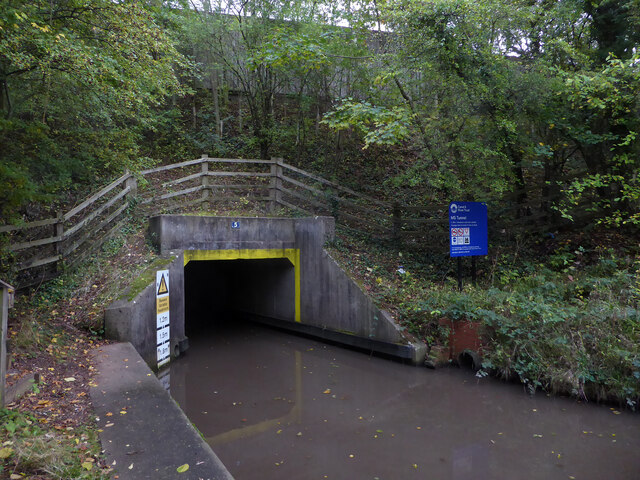
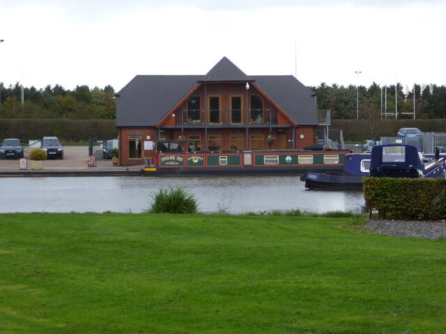
Impney Park Images

Images are sourced within 2km of 52.271662/-2.137287 or Grid Reference SO9063. Thanks to Geograph Open Source API. All images are credited.

Three Wells, timber framed house in Hadzor, Worcestershire
Small cemetery at Hadzor
Heron at Swan Pool, Droitwich Spa
Heron taking flight at Swan Pool, Droitwich Spa
Narrow boat on the Droitwich Junction Canal The grating on the towpath is where water is taken from the canal and transferred via pipes under the towpath to where the canal begins again. This is because the re-builders of the canal did not want to pollute the River Salwarpe.
Narrow boat on the Droitwich Junction Canal
The grating on the towpath is where water is taken from the canal and transferred via pipes under the towpath to where the canal begins again. This is because the re-builders of the canal did not want to pollute the River Salwarpe.
Diamond Coffee Bar, at the crossroads Droitwich Many businesses have tried to flourish at this location which is subject to flooding.
Diamond Coffee Bar, at the crossroads Droitwich
Many businesses have tried to flourish at this location which is subject to flooding.
2, The Holloway, Droitwich Spa
5 The Holloway, Droitwich Spa This used to be a general store at least up to 2001 when the owner complained of too many roadworks in the road.
5 The Holloway, Droitwich Spa
This used to be a general store at least up to 2001 when the owner complained of too many roadworks in the road.
7 The Holloway, Droitwich Spa Presently a semi-detached house this was formally the Ring O'Bells <a href="https://www.geograph.org.uk/photo/5196358">SO9063 : Ring O' Bells, Droitwich</a> which is still marked in the glass above the door.
7 The Holloway, Droitwich Spa
Presently a semi-detached house this was formally the Ring O'Bells SO9063 : Ring O' Bells, Droitwich which is still marked in the glass above the door.
Coventry Almshouses, The Holloway, Droitwich Spa This is one of the original wings which has recently been repointed with lime mortar. Said to have been founded as a result of a horse race between Henry Coventry and Sir John Pakington of Westwood <a href="https://www.geograph.org.uk/photo/4583125">SO8763 : Westwood House from the drive</a>. The loser was to pay for the building of the property named after the winner. Henry Coventry horse won but John Pakington had no cash spare so promised the income of two farms for the upkeep and Henry Coventry left money the building of the houses in his will.
Coventry Almshouses, The Holloway, Droitwich Spa
This is one of the original wings which has recently been repointed with lime mortar. Said to have been founded as a result of a horse race between Henry Coventry and Sir John Pakington of Westwood SO8763 : Westwood House from the drive. The loser was to pay for the building of the property named after the winner. Henry Coventry horse won but John Pakington had no cash spare so promised the income of two farms for the upkeep and Henry Coventry left money the building of the houses in his will.
1, The Holloway, Droitwich Spa
Droitwich Spa Marina  Accessed from the Droitwich Junction Canal in the foreground.
Droitwich Spa Marina
Accessed from the Droitwich Junction Canal in the foreground.
Droitwich Spa Marina  Accessed from the Droitwich Junction Canal seen in the foreground.
Droitwich Spa Marina
Accessed from the Droitwich Junction Canal seen in the foreground.
Droitwich Junction Canal - the M5 tunnel Classed as bridge No. 5 this is actually a tight 60 metre long tunnel. The canal at this point carries water from the Body Brook and the headroom is variable through the tunnel. This waterfront is accessible by some steps from the left but is now virtually completely hidden from the nearby road by the growth of vegetation in the last decade or so.
Droitwich Junction Canal - the M5 tunnel
Classed as bridge No. 5 this is actually a tight 60 metre long tunnel. The canal at this point carries water from the Body Brook and the headroom is variable through the tunnel. This waterfront is accessible by some steps from the left but is now virtually completely hidden from the nearby road by the growth of vegetation in the last decade or so.
Droitwich Spa Marina Alongside the Droitwich Junction Canal.
Droitwich Spa Marina
Alongside the Droitwich Junction Canal.
Worcester and Birmingham Canal near Hanbury Wharf On the left is the junction with the restored Droitwich Junction Canal.
Worcester and Birmingham Canal near Hanbury Wharf
On the left is the junction with the restored Droitwich Junction Canal.
Worcester and Birmingham Canal, Hanbury Wharf
Droitwich Junction Canal - lock No. 1 The first of seven on this short canal. The first three are in a short distance and are the only original locks left. The other four are modern locks. These three have water-saving side pounds and the two sluices for lock No. 1 are seen to its right. These are still in use and a note on the gate instructs users to use the side paddles first.
Droitwich Junction Canal - lock No. 1
The first of seven on this short canal. The first three are in a short distance and are the only original locks left. The other four are modern locks. These three have water-saving side pounds and the two sluices for lock No. 1 are seen to its right. These are still in use and a note on the gate instructs users to use the side paddles first.
Show me another place!

Impney Park is located at Grid Ref: SO9063 (Lat: 52.271662, Lng: -2.137287)

Administrative County: Worcestershire

District: Wychavon

Police Authority: West Mercia

What 3 Words

///chimp.stamp.flight. Near Droitwich, Worcestershire

Related Wikis

Chateau Impney

Chateau Impney Hotel & Exhibition Centre is a Grade II* listed 19th-century house built in the style of an elaborate French château near Droitwich Spa...

RGS Dodderhill

RGS Dodderhill is a private school on the outskirts of Droitwich Spa, Worcestershire, England. Girls & Boys are educated from 2–11 years of age - most...

Droitwich Spa Lido

The Droitwich Spa Lido is a lido in Droitwich Spa, Worcestershire, England. It is one of the few remaining inland, open-air salt-water swimming pools...

Old Town Hall, Droitwich Spa

The Old Town Hall is a municipal building in St Andrews Street, Droitwich Spa, Worcestershire, England. The structure, which was the headquarters of Droitwich...

Droitwich Spa

Droitwich Spa (often abbreviated to Droitwich ) is a historic spa town in the Wychavon district in northern Worcestershire, England, on the River Salwarpe...

Droitwich Spa railway station

Droitwich Spa railway station serves the town of Droitwich Spa in Worcestershire, England. It is located just to the south-west of Droitwich Spa Junction...

Dodderhill

Dodderhill is a civil parish, near Droitwich, Worcestershire, England, located on the River Salwarpe. The parish is bisected by the M5 motorway, constructed...

Hadzor

Hadzor is a small village near Droitwich, Worcestershire, England. There are around fourteen houses and a Roman Catholic church in the village, although...

Nearby Amenities

Located within 500m of 52.271662,-2.137287
Bus Stop
Droitwich- Queen St- Chapel Bridge
Bus: yes
Naptan AtcoCode: 2000G156700
Naptan Bearing: SW
Naptan CommonName: Droitwich- Queen St- Chapel Bridge
Naptan Indicator: Adj
Naptan Landmark: Crutch Lane
Naptan NaptanCode: wocdwjmd
Naptan PlusbusZoneRef: DRTWCHS
Naptan Street: Bromsgrove Road
Naptan Verified: no
Public Transport: platform
Source: naptan_import
Lat/Long: 52.2703317/-2.143228
Bus Stop
Dodderhill Road
Bus: yes
Naptan AtcoCode: 2000G323004
Naptan Bearing: NE
Naptan CommonName: Dodderhill Road
Naptan Crossing: Dodderhill Road
Naptan Indicator: adj
Naptan NaptanCode: wocdtdpj
Naptan PlusbusZoneRef: DRTWCHS
Naptan Street: Bromsgrove Road
Naptan Verified: no
Public Transport: platform
Source: naptan_import
Lat/Long: 52.2717428/-2.1417179
Bus Stop
Dodderhill Road
Bus: yes
Naptan AtcoCode: 2000G323005
Naptan Bearing: SW
Naptan CommonName: Dodderhill Road
Naptan Crossing: Dodderhill Road
Naptan Indicator: opp
Naptan NaptanCode: wocdtdpm
Naptan PlusbusZoneRef: DRTWCHS
Naptan Street: Bromsgrove Road
Naptan Verified: no
Public Transport: platform
Source: naptan_import
Lat/Long: 52.2715191/-2.1417885
Mini Roundabout
Direction: clockwise
Lat/Long: 52.2680659/-2.1398408
Mini Roundabout
Direction: clockwise
Lat/Long: 52.2680324/-2.138972
Post Box
Collection Plate: CP7
Collection Times: Mo-Fr 16:45; Sa 09:30
Historic Operator: Royal Mail
Post Box Type: lamp
Ref: WR9 375
Royal Cypher: EIIR
Royal Cypher Wikidata: Q33102113
Lat/Long: 52.2708934/-2.1424173
Fixme: continue
Lat/Long: 52.270531/-2.1424513
Url: http://www.worcs.com/dct/newmap.htm
Lat/Long: 52.2676006/-2.1343196
Bench
Lat/Long: 52.2676724/-2.1358782
Seamark Type: gate
Waterway: lock_gate
Lat/Long: 52.267981/-2.1373136
Give Way
Direction: backward
Lat/Long: 52.2679985/-2.1388775
Seamark Type: gate
Waterway: lock_gate
Lat/Long: 52.2680287/-2.1376764
Railway: switch
Lat/Long: 52.270068/-2.1438508
Pub
Mason's Arms
Lat/Long: 52.2704438/-2.1429374
Hill End
Natural: peak
Lat/Long: 52.271637/-2.1376853
Generator Method: photovoltaic
Generator Output Electricity: yes
Generator Source: solar
Generator Type: solar_photovoltaic_panel
Location: roof
Power: generator
Lat/Long: 52.2677076/-2.1389329
Generator Method: photovoltaic
Generator Output Electricity: yes
Generator Source: solar
Generator Type: solar_photovoltaic_panel
Location: roof
Power: generator
Lat/Long: 52.2694877/-2.1410412
Generator Method: photovoltaic
Generator Output Electricity: yes
Generator Source: solar
Generator Type: solar_photovoltaic_panel
Location: roof
Power: generator
Lat/Long: 52.2677175/-2.1392226
Generator Method: photovoltaic
Generator Output Electricity: yes
Generator Source: solar
Generator Type: solar_photovoltaic_panel
Location: roof
Power: generator
Lat/Long: 52.2688238/-2.1407676
Give Way
Direction: forward
Lat/Long: 52.2679924/-2.1398757
Generator Method: photovoltaic
Generator Output Electricity: yes
Generator Source: solar
Generator Type: solar_photovoltaic_panel
Location: roof
Power: generator
Lat/Long: 52.2696051/-2.1419048
Traffic Signals
Source: bing
Lat/Long: 52.2735565/-2.1398449
Traffic Signals
Source: bing
Lat/Long: 52.273385/-2.1400541
Traffic Signals
Source: bing
Lat/Long: 52.273536/-2.1403907
Generator Method: photovoltaic
Generator Output Electricity: yes
Generator Source: solar
Generator Type: solar_photovoltaic_panel
Location: roof
Power: generator
Lat/Long: 52.2691061/-2.1358323
Generator Method: photovoltaic
Generator Output Electricity: yes
Generator Source: solar
Generator Type: solar_photovoltaic_panel
Location: roof
Power: generator
Lat/Long: 52.2726604/-2.141705
Generator Method: photovoltaic
Generator Output Electricity: yes
Generator Source: solar
Generator Type: solar_photovoltaic_panel
Location: roof
Power: generator
Lat/Long: 52.2696281/-2.1344402
Generator Method: photovoltaic
Generator Output Electricity: yes
Generator Source: solar
Generator Type: solar_photovoltaic_panel
Location: roof
Power: generator
Lat/Long: 52.2691414/-2.1352664
Generator Method: photovoltaic
Generator Output Electricity: yes
Generator Source: solar
Generator Type: solar_photovoltaic_panel
Location: roof
Power: generator
Source: bs
Lat/Long: 52.2684028/-2.1324326
Generator Method: photovoltaic
Generator Output Electricity: yes
Generator Source: solar
Generator Type: solar_photovoltaic_panel
Location: roof
Power: generator
Source: bs
Lat/Long: 52.2684668/-2.1322918
Location Transition: yes
Power: pole
Lat/Long: 52.2700983/-2.1324031
Power: pole
Lat/Long: 52.2701984/-2.1316011
Chateau Impney Sewage Works
Power: pole
Transformer: distribution
Voltage Primary: 11000
Lat/Long: 52.2708386/-2.1306677
Power: pole
Lat/Long: 52.2705842/-2.1302439
The data included in this document is from www.openstreetmap.org. The data is made available under ODbL.

Have you been to Impney Park?

Leave your review of Impney Park below (or comments, questions and feedback).