Cultercullen

Settlement in Aberdeenshire

Scotland

Cultercullen

Grassland near Cultercullen Looking south-west over a grassy field near Cultercullen, with Runnygurnal in the distance.,
Grassland near Cultercullen Credit: Scott Cormie

Cultercullen is a small village located in Aberdeenshire, Scotland. Situated approximately 8 miles west of Aberdeen, Cultercullen is a rural community surrounded by picturesque farmland and rolling hills. The village is home to a population of around 300 residents.

Cultercullen is known for its peaceful and tranquil atmosphere, making it a popular destination for those seeking a quiet and idyllic setting. The village is primarily residential, with a few small businesses and amenities scattered throughout. There is a local pub, a primary school, and a church, providing essential services for the residents.

The surrounding countryside offers plenty of opportunities for outdoor activities such as hiking, cycling, and wildlife spotting. The nearby River Don also provides fishing opportunities for anglers.

Overall, Cultercullen is a charming village with a strong sense of community and a close-knit population. Its beautiful surroundings and peaceful ambiance make it a desirable place to live for those looking to escape the hustle and bustle of city life.

If you have any feedback on the listing, please let us know in the comments section below.
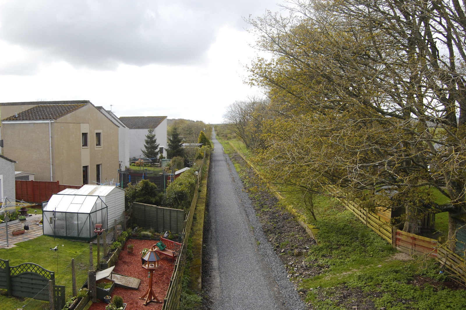
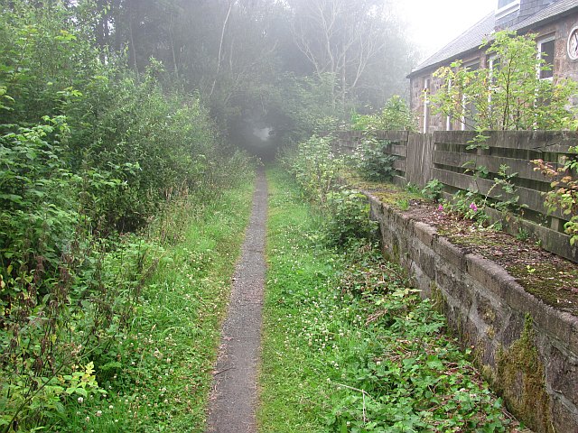
Cultercullen Images

Images are sourced within 2km of 57.30985/-2.1450941 or Grid Reference NJ9124. Thanks to Geograph Open Source API. All images are credited.

Grassland near Cultercullen Looking south-west over a grassy field near Cultercullen, with Runnygurnal in the distance.,
Grassland near Cultercullen
Looking south-west over a grassy field near Cultercullen, with Runnygurnal in the distance.,
Cultercullen Community Park The little park to the west of Cultercullen.
Cultercullen Community Park
The little park to the west of Cultercullen.
Field of barley near Cultercullen Looking north-east over a barley field north of Cultercullen, with the landscape of Buchan beyond.
Field of barley near Cultercullen
Looking north-east over a barley field north of Cultercullen, with the landscape of Buchan beyond.
Formartine & Buchan Way over the Tarty Burn The Formartine & Buchan Way heading north to bridge the Tarty Burn.
Formartine & Buchan Way over the Tarty Burn
The Formartine & Buchan Way heading north to bridge the Tarty Burn.
Formartine & Buchan Way at Orchardtown The Formartine & Buchan Way heading south under the bridge carrying the access road to the Mains of Orchardtown.
Formartine & Buchan Way at Orchardtown
The Formartine & Buchan Way heading south under the bridge carrying the access road to the Mains of Orchardtown.
Copse by Udny Station A small patch of woodland in farmland to the east of Udny Station.
Copse by Udny Station
A small patch of woodland in farmland to the east of Udny Station.
Improvised gates by Monkshill Wooden gates and iron gates together in a field between Monkshil and Cultercullen farms.
Improvised gates by Monkshill
Wooden gates and iron gates together in a field between Monkshil and Cultercullen farms.
Field by Tillery A roadside field with farm buildings behind.
Field by Tillery
A roadside field with farm buildings behind.
Uphill to Monkshill The long treelined bare to Monkshill Farm.
Uphill to Monkshill
The long treelined bare to Monkshill Farm.
Doon Hill A view downhill on the Monkshill to a very sharp lefthand bend!
Doon Hill
A view downhill on the Monkshill to a very sharp lefthand bend!
Railway Underpass An old railway underpass by Monkshill now carrying a walkway rather than rail.
Railway Underpass
An old railway underpass by Monkshill now carrying a walkway rather than rail.
Paddock by Orchardstown A sheep occupied paddock by the Mains of Orchardstown. The trees on the right mask the farm access road and the bushes in front the old "Buchanie" rail line to Ellon and beyond, now the Formartine and Buchan Walkway.
Paddock by Orchardstown
A sheep occupied paddock by the Mains of Orchardstown. The trees on the right mask the farm access road and the bushes in front the old "Buchanie" rail line to Ellon and beyond, now the Formartine and Buchan Walkway.
Formartine and Buchan  Way A bridge carries the B999 over the trackbed of the Formartine and Buchan Railway, now a cycle/footpath.
Formartine and Buchan Way
A bridge carries the B999 over the trackbed of the Formartine and Buchan Railway, now a cycle/footpath.
Udny Station in the haar Udny Station no longer has a station, the railway is now a cycle path.
Udny Station in the haar
Udny Station no longer has a station, the railway is now a cycle path.
Formartine and Buchan  Way North of Udny, the surface of the path improves (not that I mind the single track bits). Here the railway crossed an embankment above what is now arable land.
Formartine and Buchan Way
North of Udny, the surface of the path improves (not that I mind the single track bits). Here the railway crossed an embankment above what is now arable land.
Cutting, Formartine and Buchan Railway A cutting filled with rosebay willowherb in flower.

The Formartine and Buchan Railway is now a 80km path between Fraserburgh, Peterhead and Aberdeen. The railway closed in 1979 and was last used as part of the North Sea oil development, moving material up to Fraserburgh.
Cutting, Formartine and Buchan Railway
A cutting filled with rosebay willowherb in flower. The Formartine and Buchan Railway is now a 80km path between Fraserburgh, Peterhead and Aberdeen. The railway closed in 1979 and was last used as part of the North Sea oil development, moving material up to Fraserburgh.
Formartine and Buchan  Way A foggy morning in Aberdeenshire, the fog was later to be replaced by heavy rain.

The Formartine and Buchan Railway is now a 80km path between Fraserburgh, Peterhead and Aberdeen. The railway closed in 1979 and was last used as part of the North Sea oil development, moving material up to Fraserburgh.
Formartine and Buchan Way
A foggy morning in Aberdeenshire, the fog was later to be replaced by heavy rain. The Formartine and Buchan Railway is now a 80km path between Fraserburgh, Peterhead and Aberdeen. The railway closed in 1979 and was last used as part of the North Sea oil development, moving material up to Fraserburgh.
The Big House in the Village This was once the Clydesdale Bank in Udny Station, when villages such as this had banks...  (thanks to the present owner for the information).
The Big House in the Village
This was once the Clydesdale Bank in Udny Station, when villages such as this had banks... (thanks to the present owner for the information).
Show me another place!

Cultercullen is located at Grid Ref: NJ9124 (Lat: 57.30985, Lng: -2.1450941)

Unitary Authority: Aberdeenshire

Police Authority: North East

What 3 Words

///ghost.liability.smirking. Near Pitmedden, Aberdeenshire

Nearby Locations

Cultercullen

Related Wikis

Udny Station

Udny Station (Scots: Widnie Station) is a small village in Aberdeenshire, Scotland. It is 8 miles east of Oldmeldrum and 5 miles south west of Ellon....

Udny railway station

Udny railway station was a railway station located in Udny, Aberdeenshire. == History == The station was opened on 18 July 1861 by the Formartine and Buchan...

Logierieve railway station

Logierieve railway station was a railway station in Logierieve, Aberdeenshire. == History == Logierieve railway station was opened on 18 July 1861, originally...

Pitmedden

Pitmedden is a rural village in the parish of Udny, Aberdeenshire, Scotland, situated midway between Ellon and Oldmeldrum, and approximately 16 miles...

Nearby Amenities

Located within 500m of 57.30985,-2.1450941
Udny Station
Name Sco: Widnie
Place: village
Source: OS_OpenData_StreetView
Wikidata: Q7877253
Wikipedia: en:Udny Station
Lat/Long: 57.3104908/-2.1530785
Bus Stop
Cherry Row
Bench: yes
Bus: yes
Naptan AtcoCode: 630032161
Naptan Bearing: E
Naptan CommonName: Cherry Row
Naptan Indicator: opp
Naptan NaptanCode: 23626398
Naptan Street: Cherry Row
Naptan Verified: no
Operator: Stagecoach
Public Transport: platform
Shelter: yes
Source: naptan;bing;naptan_compare_tool
Lat/Long: 57.3104298/-2.1527765
Playground: swing
Lat/Long: 57.3108461/-2.1527026
Leisure: picnic_table
Lat/Long: 57.3104895/-2.1524721
Telephone
Booth: KX100
Covered: booth
Lat/Long: 57.3104845/-2.1522991
Bus Stop
Cherry Row
Bench: no
Bus: yes
Naptan AtcoCode: 630032162
Naptan Bearing: W
Naptan BusStopType: CUS
Naptan CommonName: Cherry Row
Naptan Indicator: at
Naptan NaptanCode: 23626424
Naptan Street: Cherry Row
Naptan Verified: no
Operator: Stagecoach
Public Transport: platform
Shelter: no
Source: naptan;bing;naptan_compare_tool
Lat/Long: 57.3103653/-2.1522246
Post Box
Collection Times: Mo-Fr 11:30; Sa 11:30
Operator: Royal Mail
Post Box Type: lamp
Ref: AB41 495
Royal Cypher: scottish_crown
Lat/Long: 57.3104377/-2.1521978
Defibrillator
Access: yes
Defibrillator Location: Udny Station Community Center outside wall in yellow case
Emergency: defibrillator
Indoor: no
Level: 0
Opening Hours: 24/7
Ref GB The Circuit: EFEE0A5F-9D6B-4EFA-86CA-9DC67CA374AC
Lat/Long: 57.3104966/-2.1523348
Board Type: notice
Information: board
Tourism: information
Lat/Long: 57.3104356/-2.1523668
Waste Basket
Waste: trash
Lat/Long: 57.3103968/-2.1530528
Bench
Backrest: yes
Colour: brown
Material: wood
Lat/Long: 57.3104037/-2.1528536
Bench
Backrest: yes
Colour: green
Material: wood
Lat/Long: 57.310412/-2.1531225
Give Way
Direction: backward
Lat/Long: 57.3103602/-2.1526216
Power: pole
Lat/Long: 57.3103268/-2.1373916
Power: pole
Lat/Long: 57.3106299/-2.138401
Power: pole
Lat/Long: 57.310977/-2.1395716
Power: pole
Lat/Long: 57.3112851/-2.1406255
Power: pole
Lat/Long: 57.3104471/-2.1437156
Power: pole
Lat/Long: 57.3107044/-2.1450569
Power: pole
Lat/Long: 57.3110286/-2.1464108
Power: pole
Lat/Long: 57.3113608/-2.1477814
Power: pole
Lat/Long: 57.3116601/-2.149045
Power: pole
Lat/Long: 57.3120092/-2.1501827
Power: pole
Lat/Long: 57.3122858/-2.1510705
Power: pole
Lat/Long: 57.3058237/-2.1481198
Power: pole
Lat/Long: 57.3065956/-2.1476775
Power: pole
Lat/Long: 57.3072935/-2.1471759
Power: pole
Lat/Long: 57.3079946/-2.1466619
Power: pole
Lat/Long: 57.308563/-2.1462422
Power: pole
Lat/Long: 57.3091348/-2.1458204
Power: pole
Lat/Long: 57.3098326/-2.1453147
Power: pole
Lat/Long: 57.3099984/-2.145198
Power: pole
Lat/Long: 57.3067958/-2.1488855
Power: pole
Lat/Long: 57.3134211/-2.1497242
Power: pole
Lat/Long: 57.3129217/-2.1503038
Power: pole
Lat/Long: 57.3119092/-2.1514901
Power: pole
Lat/Long: 57.3113612/-2.1519191
Power: pole
Lat/Long: 57.3108221/-2.1523292
The data included in this document is from www.openstreetmap.org. The data is made available under ODbL.

Have you been to Cultercullen?

Leave your review of Cultercullen below (or comments, questions and feedback).