Culsh

Settlement in Aberdeenshire

Scotland

Culsh

Farm road, Artamford This road branches off in several directions serving residential properties. The population density is always given away by the bins at the end of the "drive".
Farm road, Artamford Credit: Richard Webb

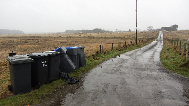
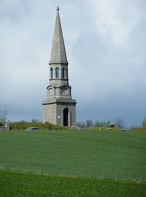
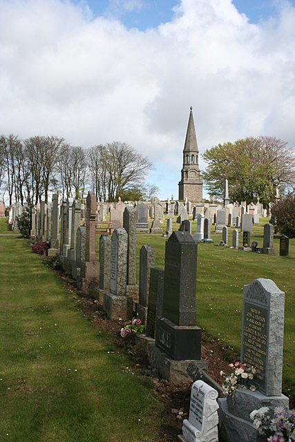
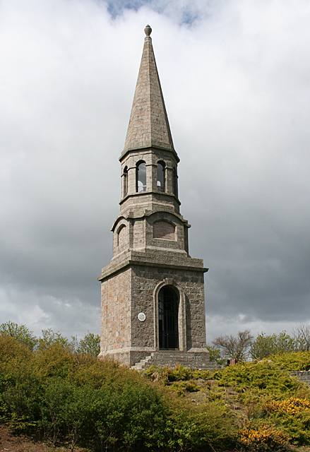
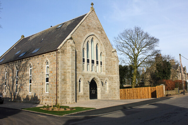
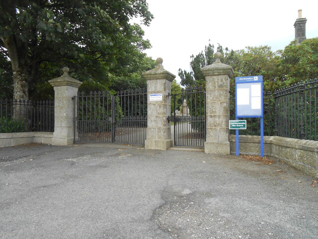
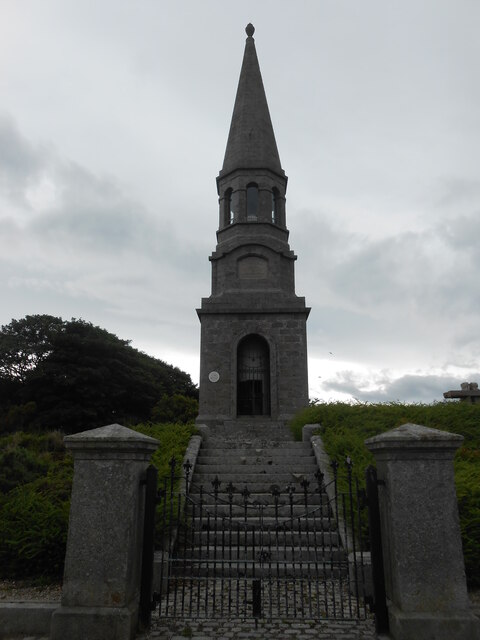
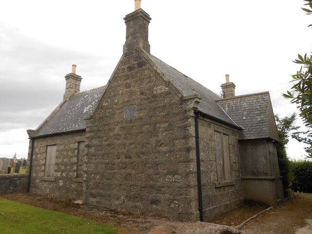
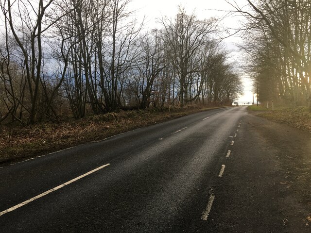
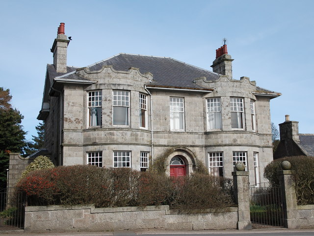
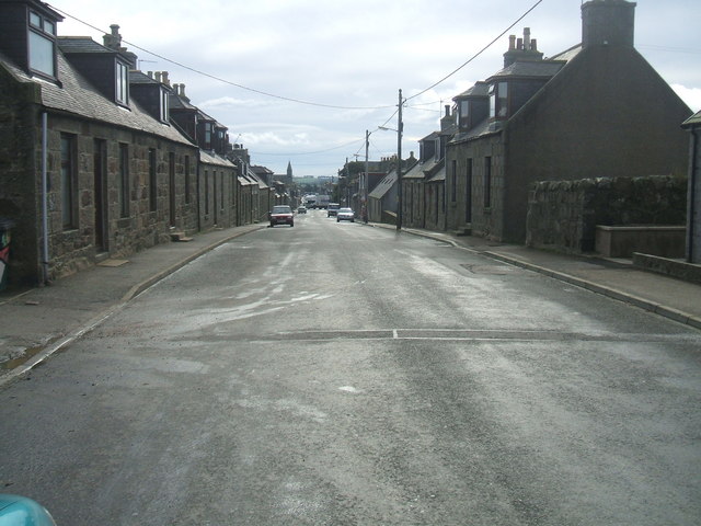
Culsh is a small rural village located in Aberdeenshire, Scotland. Situated near the River Don, Culsh is known for its picturesque countryside and stunning views of the surrounding landscape. The village is home to a small population of residents who enjoy a peaceful and tranquil way of life.

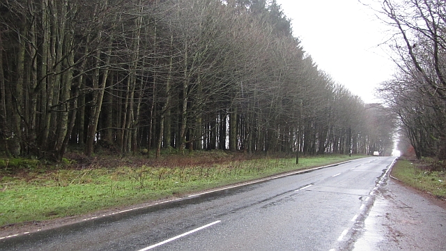
Culsh is surrounded by rolling hills and farmland, making it an ideal location for those who appreciate nature and outdoor activities. The village is also close to several walking and hiking trails, providing residents with ample opportunities to explore the beautiful Scottish countryside.

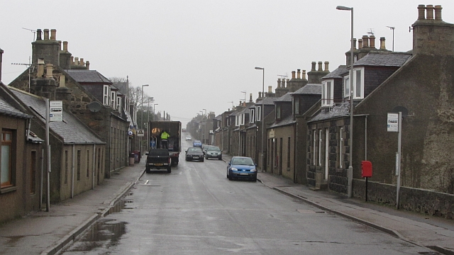
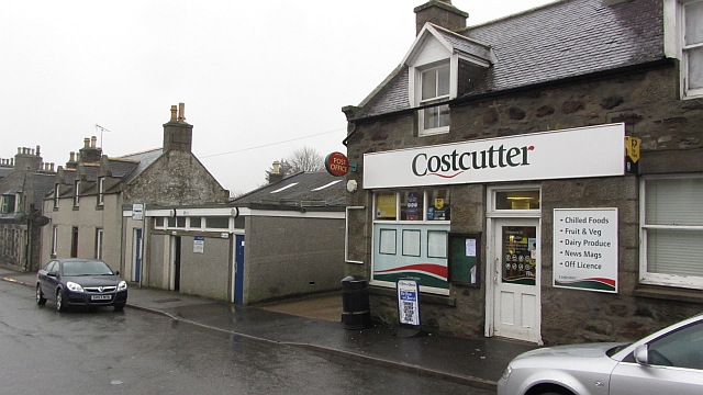
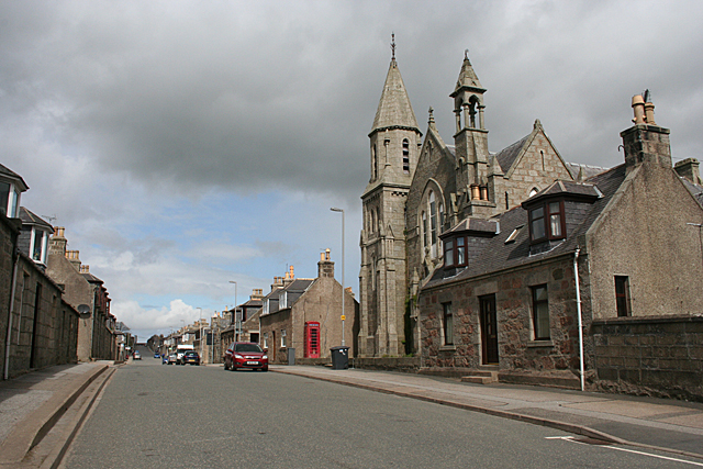
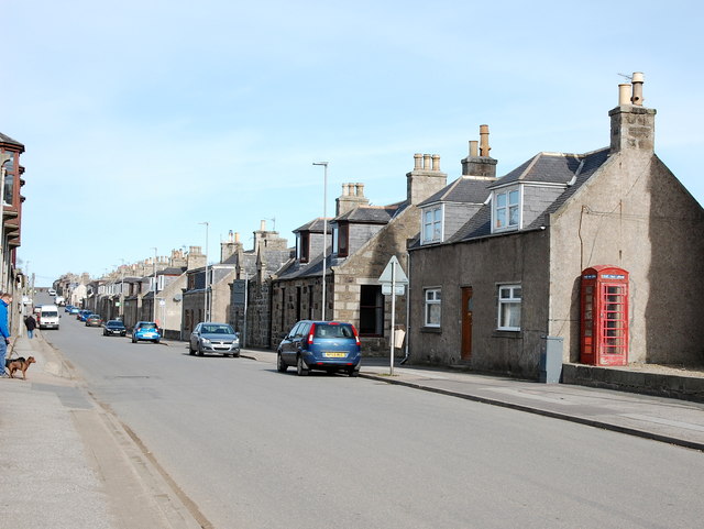
In terms of amenities, Culsh is a relatively quiet village with limited services. However, nearby towns such as Inverurie and Aberdeen offer a wider range of shops, restaurants, and other facilities for residents to enjoy.

Overall, Culsh is a charming village that offers a peaceful and idyllic setting for those looking to escape the hustle and bustle of city life and immerse themselves in the beauty of the Scottish countryside.

If you have any feedback on the listing, please let us know in the comments section below.

Culsh Images

Images are sourced within 2km of 57.520684/-2.196417 or Grid Reference NJ8847. Thanks to Geograph Open Source API. All images are credited.

Farm road, Artamford This road branches off in several directions serving residential properties. The population density is always given away by the bins at the end of the "drive".
Farm road, Artamford
This road branches off in several directions serving residential properties. The population density is always given away by the bins at the end of the "drive".
Woods, Artamford The A981 passes through a small wood near New Deer.
Woods, Artamford
The A981 passes through a small wood near New Deer.
Main Street, New Deer
New Deer: Bogs and PO New Deer Post Office is now in this shop, maps show it to be further up Main Street. The low building is the public conveniences.
New Deer: Bogs and PO
New Deer Post Office is now in this shop, maps show it to be further up Main Street. The low building is the public conveniences.
Mid Culsh A substantial farm on flat fertile land near New Deer.
Mid Culsh
A substantial farm on flat fertile land near New Deer.
Culsh Monument The monument is very conspicuous, being set on top of one of the few hills in the area. See also <a href="https://www.geograph.org.uk/photo/4467847">NJ8848 : Monument to William Dingwall Fordyce</a>.
Culsh Monument
The monument is very conspicuous, being set on top of one of the few hills in the area. See also NJ8848 : Monument to William Dingwall Fordyce.
New Deer Cemetery The cemetery is on the slope up to the conspicuous monument, but there is no gate between them.
New Deer Cemetery
The cemetery is on the slope up to the conspicuous monument, but there is no gate between them.
Monument to William Dingwall Fordyce The panel above the entrance reads, "To the Memory of William Dingwall Fordyce of Brucklay, born 31 March 1836 and died 27 November 1875. Erectede by tenants and friends in token of their sorrow for his early death and their warm remembrance of him as a just and liberal landlord a trustworthy Member of Parliament and an exemplary Christian gentleman. No man liveth to himself". The small white plaque to the left of the doorway reads, "Culsh Monument. This plaque was unveiled by Andrew Dingwall Fordyce, great-great-nephew of William Dingwall Fordyce, in whose memory this monument was erected, to mark the completion of a project to conserve the structure and its environs by Banff and Buchan District Council, 11th September 1991".
Monument to William Dingwall Fordyce
The panel above the entrance reads, "To the Memory of William Dingwall Fordyce of Brucklay, born 31 March 1836 and died 27 November 1875. Erectede by tenants and friends in token of their sorrow for his early death and their warm remembrance of him as a just and liberal landlord a trustworthy Member of Parliament and an exemplary Christian gentleman. No man liveth to himself". The small white plaque to the left of the doorway reads, "Culsh Monument. This plaque was unveiled by Andrew Dingwall Fordyce, great-great-nephew of William Dingwall Fordyce, in whose memory this monument was erected, to mark the completion of a project to conserve the structure and its environs by Banff and Buchan District Council, 11th September 1991".
Main Street The Gothic building on the right is the St Kane's Hall, originally a United Presbyterian church. It was built in 1876-1877 to a design by George Marr and cost £1400.
Main Street
The Gothic building on the right is the St Kane's Hall, originally a United Presbyterian church. It was built in 1876-1877 to a design by George Marr and cost £1400.
Converted church in New Deer
Entrance gate to New Deer Cemetery
Culsh Monument
Culsh Monument
New Deer Cemetery Lodge
A981 towards New Deer
New Deer Villa A fine granite villa beside the kirk with bow windows and stylised battlements above.
New Deer Villa
A fine granite villa beside the kirk with bow windows and stylised battlements above.
Main Street, New Deer New Deer was established ca. 1805 as an 'improvement village' to boost the rural economy.
Main Street, New Deer
New Deer was established ca. 1805 as an 'improvement village' to boost the rural economy.
Royal Bank of Scotland, New Deer branch Formerly the Clydesdale Bank, but closed in that bank's savage purge of its rural branches ca. 2005.  After negotiations said to involve Alex Salmond and Fred Goodwin, it reopened as an RBS outlet.
Royal Bank of Scotland, New Deer branch
Formerly the Clydesdale Bank, but closed in that bank's savage purge of its rural branches ca. 2005. After negotiations said to involve Alex Salmond and Fred Goodwin, it reopened as an RBS outlet.
Dingwall Fordyce Monument, New Deer As seen from New Deer cemetery.  The steeple-like monument to William Dingwall Fordyce, a progressive landowner and Liberal MP, who died at the age of 39: <span class="nowrap"><a title="https://en.wikipedia.org/wiki/William_Dingwall_Fordyce" rel="nofollow ugc noopener" href="https://en.wikipedia.org/wiki/William_Dingwall_Fordyce">Link</a><img style="margin-left:2px;" alt="External link" title="External link - shift click to open in new window" src="https://s1.geograph.org.uk/img/external.png" width="10" height="10"/></span> .
Dingwall Fordyce Monument, New Deer
As seen from New Deer cemetery. The steeple-like monument to William Dingwall Fordyce, a progressive landowner and Liberal MP, who died at the age of 39: LinkExternal link .
Show me another place!

Culsh is located at Grid Ref: NJ8847 (Lat: 57.520684, Lng: -2.196417)

Unitary Authority: Aberdeenshire

Police Authority: North East

What 3 Words

///thrones.aunts.blame. Near New Pitsligo, Aberdeenshire

Nearby Locations

Culsh

Related Wikis

New Deer

New Deer (Scottish Gaelic: Achadh Reite) is a settlement in Aberdeenshire, North East Scotland, which lies in the valley of Deer. It is located at the...

Maud F.C.

Maud Football Club are a Scottish football club from the village of Maud, Aberdeenshire. Members of the Scottish Junior Football Association, they currently...

Brucklay Castle

Brucklay Castle, also known as Brucklay House, is a 16th-century castle in the Buchan area of Aberdeenshire, Scotland. The earliest part of the castle...

Maud, Aberdeenshire

Maud (Scottish Gaelic: Am Mòd) is a village in the Buchan area of the Scottish county of Aberdeenshire, with a population of 780 (2006 estimate). Located...

Nearby Amenities

Located within 500m of 57.520684,-2.196417
Culsh Monument
Historic: memorial
Memorial: stele
Lat/Long: 57.5246338/-2.2000912
Barrier: entrance
Lat/Long: 57.5246532/-2.1997684
Power: pole
Lat/Long: 57.5190533/-2.2036488
Power: pole
Lat/Long: 57.5188966/-2.2022724
Power: pole
Lat/Long: 57.5187856/-2.2013108
Power: pole
Lat/Long: 57.5186734/-2.2003411
Power: pole
Lat/Long: 57.5185457/-2.1992197
Power: pole
Lat/Long: 57.5184097/-2.2034804
Power: pole
Lat/Long: 57.5194248/-2.1995406
Power: pole
Lat/Long: 57.5201781/-2.1987169
Power: pole
Lat/Long: 57.5202979/-2.1985712
Power: pole
Lat/Long: 57.5209466/-2.1978565
Power: pole
Lat/Long: 57.5208712/-2.1987185
Power: pole
Lat/Long: 57.5214125/-2.1988558
Power: pole
Lat/Long: 57.521494/-2.1988774
Power: pole
Lat/Long: 57.5223233/-2.1990651
Power: pole
Lat/Long: 57.5227558/-2.1991835
Power: pole
Lat/Long: 57.5231461/-2.1992778
Power: pole
Lat/Long: 57.523927/-2.1994765
Power: pole
Lat/Long: 57.5196459/-2.1976147
Power: pole
Lat/Long: 57.5192344/-2.1967362
Power: pole
Lat/Long: 57.5188149/-2.1958822
Power: pole
Lat/Long: 57.5184508/-2.1951448
Power: pole
Lat/Long: 57.5179658/-2.1941366
Power: pole
Lat/Long: 57.5177886/-2.1925751
Power: pole
Lat/Long: 57.5176179/-2.1910595
Power: pole
Lat/Long: 57.5182032/-2.1902121
Power: pole
Lat/Long: 57.5187127/-2.189428
Power: pole
Lat/Long: 57.5192407/-2.188697
Power: pole
Lat/Long: 57.519485/-2.1890959
Power: pole
Lat/Long: 57.5197725/-2.1895295
Power: pole
Lat/Long: 57.5200594/-2.1899627
Power: pole
Lat/Long: 57.5204446/-2.1905734
Power: pole
Lat/Long: 57.5174119/-2.1946758
Power: pole
Lat/Long: 57.516903/-2.1951714
Power: pole
Lat/Long: 57.5208567/-2.1938202
Power: pole
Lat/Long: 57.5206847/-2.1946736
Power: pole
Lat/Long: 57.5203741/-2.1962029
Power: pole
Lat/Long: 57.5202299/-2.1968713
Generator Method: photovoltaic
Generator Output Electricity: small_installation
Generator Source: solar
Generator Type: solar_photovoltaic_panel
Location: roof
Power: generator
Lat/Long: 57.5169289/-2.1980059
Bus Stop
High Street
Bus: yes
Naptan AtcoCode: 630023011
Naptan Bearing: SE
Naptan CommonName: High Street
Naptan Indicator: at 44
Naptan NaptanCode: 23626275
Naptan Street: High Street
Naptan Verified: no
Public Transport: platform
Source: naptan;bing;naptan_compare_tool
Lat/Long: 57.5172396/-2.197961
Bus Stop
High Street
Bus: yes
Naptan AtcoCode: 630023012
Naptan Bearing: NW
Naptan CommonName: High Street
Naptan Indicator: at 49
Naptan NaptanCode: 23626272
Naptan Street: High Street
Naptan Verified: no
Public Transport: platform
Source: naptan;bing;naptan_compare_tool
Lat/Long: 57.5172334/-2.1981179
Bench
Backrest: yes
Lat/Long: 57.524569/-2.1997421
The data included in this document is from www.openstreetmap.org. The data is made available under ODbL.

Have you been to Culsh?

Leave your review of Culsh below (or comments, questions and feedback).