Cuckoo Bushes

Settlement in Hampshire Eastleigh

England

Cuckoo Bushes

Chandler's Ford railway station, Hampshire Opened in 1847 on the London & South Western Railway's line from Eastleigh to Romsey, this station closed in 1969. It was rebuilt and reopened in 2003.
View north west towards Romsey. The original station's main building was to the right of the line, rather than the left. The disused eastbound platform can also be seen on the right.
Chandler's Ford railway station, Hampshire Credit: Nigel Thompson

Cuckoo Bushes is a small village located in Hampshire, England. Situated in the borough of Test Valley, it is nestled amidst the picturesque countryside of southern England. The village is known for its idyllic setting, characterized by rolling green hills, lush meadows, and charming cottages.

Despite its small size, Cuckoo Bushes offers a range of amenities to its residents and visitors. The village has a quaint local pub, where locals gather to enjoy a pint of ale and engage in friendly conversation. Additionally, there is a small convenience store that caters to the daily needs of the community.

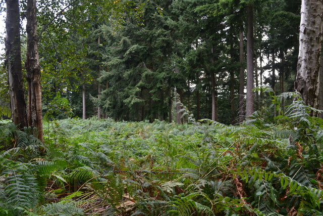
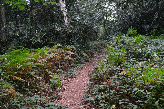
One of the highlights of Cuckoo Bushes is its surrounding natural beauty. The village is encompassed by expansive woodlands, providing ample opportunities for outdoor activities such as hiking, cycling, and picnicking. The nearby River Test, renowned for its crystal-clear waters and abundant wildlife, offers excellent fishing and boating experiences for enthusiasts.

Cultural events and festivals are also celebrated in Cuckoo Bushes throughout the year. The village hosts an annual summer fair, where locals and visitors come together to enjoy traditional games, live music, and delicious food stalls. The fair serves as a community gathering, fostering a sense of camaraderie among the villagers.

Overall, Cuckoo Bushes is a charming and peaceful village that offers a serene escape from the bustling city life. Its natural beauty, friendly community, and range of amenities make it an attractive place to visit or reside in Hampshire.

If you have any feedback on the listing, please let us know in the comments section below.

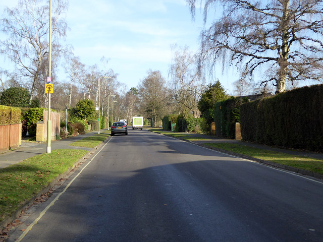
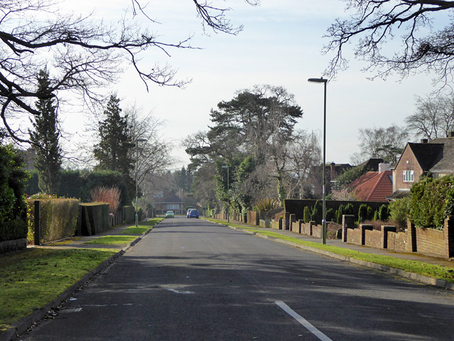
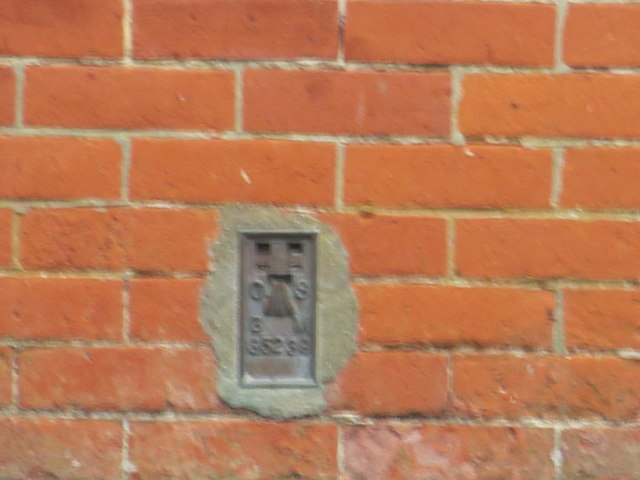
Cuckoo Bushes Images

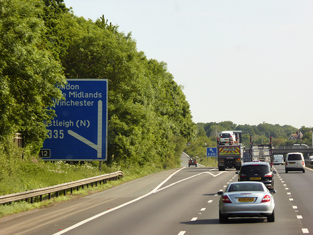
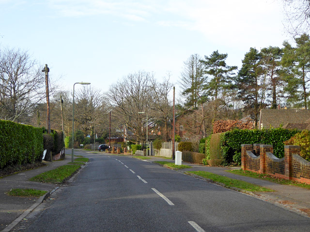
Images are sourced within 2km of 50.993539/-1.3854676 or Grid Reference SU4321. Thanks to Geograph Open Source API. All images are credited.

Chandler's Ford railway station, Hampshire Opened in 1847 on the London & South Western Railway's line from Eastleigh to Romsey, this station closed in 1969. It was rebuilt and reopened in 2003.
View north west towards Romsey. The original station's main building was to the right of the line, rather than the left. The disused eastbound platform can also be seen on the right.
Chandler's Ford railway station, Hampshire
Opened in 1847 on the London & South Western Railway's line from Eastleigh to Romsey, this station closed in 1969. It was rebuilt and reopened in 2003. View north west towards Romsey. The original station's main building was to the right of the line, rather than the left. The disused eastbound platform can also be seen on the right.
Northbound M3, Exit at Junction 12 The M3 motorway runs for 59 miles from Sunbury-on-Thames to Southampton. Construction started 1968 and was finally completed in 1995. The Winchester bypass through Twyford Downs was the most controversial section to be built.
Wikipedia: <span class="nowrap"><a title="http://en.wikipedia.org/wiki/M3_motorway_(Great_Britain)" rel="nofollow ugc noopener" href="http://en.wikipedia.org/wiki/M3_motorway_(Great_Britain)">Link</a><img style="margin-left:2px;" alt="External link" title="External link - shift click to open in new window" src="https://s1.geograph.org.uk/img/external.png" width="10" height="10"/></span>
Northbound M3, Exit at Junction 12
The M3 motorway runs for 59 miles from Sunbury-on-Thames to Southampton. Construction started 1968 and was finally completed in 1995. The Winchester bypass through Twyford Downs was the most controversial section to be built. Wikipedia: LinkExternal link
Corner of a clearing in Hocombe Upper Plantation
Footpath in Hocombe Upper Plantation
Midhurst Court, Chandler's Ford A little infilling development.
Midhurst Court, Chandler's Ford
A little infilling development.
Valley Road, Chandler's Ford Looking west.
Valley Road, Chandler's Ford
Looking west.
Monks Brook Looking upstream.
Monks Brook
Looking upstream.
Nichol Road, Hiltingbury, Chandler's Ford Looking north.
Nichol Road, Hiltingbury, Chandler's Ford
Looking north.
Marlborough Road,  Hiltingbury, Chandler's Ford Looking south.
Marlborough Road, Hiltingbury, Chandler's Ford
Looking south.
Kingsway in Chandlers Ford Looking southward.
Kingsway in Chandlers Ford
Looking southward.
The Church of St Edward the Confessor at Chandlers Ford Viewed from the east.
The Church of St Edward the Confessor at Chandlers Ford
Viewed from the east.
Ordnance Survey Flush Bracket G5239 This bracket can be found on the wall of Chandlers Ford Infant School.
For more detail see : <span class="nowrap"><a title="http://www.bench-marks.org.uk/bm12939" rel="nofollow ugc noopener" href="http://www.bench-marks.org.uk/bm12939">Link</a><img style="margin-left:2px;" alt="External link" title="External link - shift click to open in new window" src="https://s1.geograph.org.uk/img/external.png" width="10" height="10"/></span>
Ordnance Survey Flush Bracket G5239
This bracket can be found on the wall of Chandlers Ford Infant School. For more detail see : LinkExternal link
Ordnance Survey Flush Bracket 2790 This can be found on the wall of a house -private flats - in Winchester Road, Chandlers Ford.
For more detail see : <span class="nowrap"><a title="http://www.bench-marks.org.uk/bm10491" rel="nofollow ugc noopener" href="http://www.bench-marks.org.uk/bm10491">Link</a><img style="margin-left:2px;" alt="External link" title="External link - shift click to open in new window" src="https://s1.geograph.org.uk/img/external.png" width="10" height="10"/></span>
Ordnance Survey Flush Bracket 2790
This can be found on the wall of a house -private flats - in Winchester Road, Chandlers Ford. For more detail see : LinkExternal link
Nail Look, Chandler's Ford Nail salon at 1 Bournemouth Road.
Nail Look, Chandler's Ford
Nail salon at 1 Bournemouth Road.
Single track line towards Chandler's Ford railway station From Bournemouth Road bridge. <a title="https://www.geograph.org.uk/photo/5478025" href="https://www.geograph.org.uk/photo/5478025">Link</a>
Single track line towards Chandler's Ford railway station
From Bournemouth Road bridge. Link
Maya Fine Indian Dining, Chandler's Ford Indian cuisine restaurant and takeaway at 5 Bournemouth Road.
Maya Fine Indian Dining, Chandler's Ford
Indian cuisine restaurant and takeaway at 5 Bournemouth Road.
King George VI pillarbox, Bournemouth Road, Chandler's Ford  On the west side of the B3043 Bournemouth Road, near a row of shops.
King George VI pillarbox, Bournemouth Road, Chandler's Ford
On the west side of the B3043 Bournemouth Road, near a row of shops.
Footpath and cycleway to Chandler's Ford railway station Descending from Bournemouth Road past Chandler's Ford Chinese Medical Centre.
Footpath and cycleway to Chandler's Ford railway station
Descending from Bournemouth Road past Chandler's Ford Chinese Medical Centre.
Show me another place!

Cuckoo Bushes is located at Grid Ref: SU4321 (Lat: 50.993539, Lng: -1.3854676)

Administrative County: Hampshire

District: Eastleigh

Police Authority: Hampshire

What 3 Words

///proof.lame.belts. Near Eastleigh, Hampshire

Related Wikis

Hiltingbury

Hiltingbury is an area within the Borough of Eastleigh in Hampshire, England. There are two electoral wards representing Hiltingbury, returning a total...

Flexford Nature Reserve

Flexford Nature Reserve is a 18-hectare (44-acre) nature reserve in Chandler's Ford in Hampshire. It is managed by the Hampshire and Isle of Wight Wildlife...

Hocombe Mead

Hocombe Mead is a 8.3-hectare (21-acre) Local Nature Reserve in Eastleigh in Hampshire. It is owned by Eastleigh Borough Council and managed by Eastleigh...

Chandler's Ford

Chandler's Ford (originally The Ford and historically Chandlersford) is a largely residential area and civil parish in the Borough of Eastleigh in Hampshire...

Nearby Amenities

Located within 500m of 50.993539,-1.3854676
Turning Circle
Lat/Long: 50.9937601/-1.3840846
Barrier: bollard
Bicycle: yes
Foot: yes
Motor Vehicle: no
Lat/Long: 50.9914691/-1.3914599
Turning Circle
Lat/Long: 50.9897171/-1.3859126
Turning Circle
Lat/Long: 50.9901244/-1.3837898
Turning Circle
Lat/Long: 50.9896967/-1.3869664
Turning Circle
Lat/Long: 50.991631/-1.3880521
Turning Circle
Lat/Long: 50.9920964/-1.3853426
Turning Circle
Lat/Long: 50.9932044/-1.3867976
Turning Circle
Lat/Long: 50.9934952/-1.385716
Turning Circle
Lat/Long: 50.9936064/-1.3849631
Turning Circle
Lat/Long: 50.9947563/-1.3919124
Turning Circle
Lat/Long: 50.993941/-1.3822244
Turning Circle
Lat/Long: 50.9945518/-1.3798652
Bus Stop
Pine Crescent
Bus: yes
Naptan AtcoCode: 1900HA030055
Naptan Bearing: N
Naptan CommonName: Pine Crescent
Naptan Crossing: Pine Crescent
Naptan NaptanCode: hamawmjm
Naptan Street: Pine Road
Naptan Verified: no
Public Transport: platform
Source: naptan_import
Lat/Long: 50.9962523/-1.3808911
Bus Stop
Pine Crescent
Bus: yes
Naptan AtcoCode: 1900HA030056
Naptan Bearing: S
Naptan CommonName: Pine Crescent
Naptan Crossing: Pine Crescent
Naptan NaptanCode: hamawmjt
Naptan Street: Pine Road
Naptan Verified: no
Public Transport: platform
Source: naptan_import
Lat/Long: 50.9961659/-1.3807658
Bus Stop
Linden Grove
Bus: yes
Naptan AtcoCode: 1900HA030057
Naptan Bearing: N
Naptan CommonName: Linden Grove
Naptan Crossing: Linden Grove
Naptan NaptanCode: hamawjtd
Naptan Street: Park Road
Naptan Verified: no
Public Transport: platform
Source: naptan_import
Lat/Long: 50.9946574/-1.3835273
Bus Stop
Linden Grove
Bus: yes
Naptan AtcoCode: 1900HA030058
Naptan Bearing: S
Naptan CommonName: Linden Grove
Naptan Crossing: Paulson Close
Naptan NaptanCode: hamawjtp
Naptan Street: Park Road
Naptan Verified: no
Public Transport: platform
Source: naptan_import
Lat/Long: 50.9938156/-1.3832672
Bus Stop
Valley Road
Bus: yes
Naptan AtcoCode: 1900HA030059
Naptan Bearing: N
Naptan CommonName: Valley Road
Naptan Crossing: The Maples
Naptan NaptanCode: hamawjwd
Naptan Street: Park Road
Naptan Verified: no
Public Transport: platform
Source: naptan_import
Lat/Long: 50.9916619/-1.3829826
Bus Stop
Valley Road
Bus: yes
Naptan AtcoCode: 1900HA030060
Naptan Bearing: S
Naptan CommonName: Valley Road
Naptan Crossing: Merdon Avenue
Naptan NaptanCode: hamawjwp
Naptan Street: Park Road
Naptan Verified: no
Public Transport: platform
Source: naptan_import
Lat/Long: 50.9915134/-1.3828811
Bus Stop
Ramalley Lane
Bus: yes
Naptan AtcoCode: 1900HA030026
Naptan Bearing: N
Naptan CommonName: Ramalley Lane
Naptan Crossing: Common Road
Naptan NaptanCode: hamawgmg
Naptan Street: Hursley Road
Naptan Verified: no
Public Transport: platform
Source: naptan_import
Lat/Long: 50.9920004/-1.3897535
Bus Stop
Ramalley Lane
Bus: yes
Naptan AtcoCode: 1900HA030027
Naptan Bearing: N
Naptan CommonName: Ramalley Lane
Naptan Crossing: Common Road
Naptan NaptanCode: hamawgmp
Naptan Street: Hursley Road
Naptan Verified: no
Public Transport: platform
Source: naptan_import
Lat/Long: 50.992171/-1.3896943
Bus Stop
Leigh House Hospital
Naptan AtcoCode: 1900HA030028
Naptan Bearing: SE
Naptan CommonName: Leigh House Hospital
Naptan Crossing: Cuckoo Bushes Lane
Naptan Landmark: Leigh House Hospital
Naptan NaptanCode: hamawgdj
Naptan Street: Hursley Road
Naptan Verified: no
Source: naptan_import
Lat/Long: 50.9946133/-1.3907167
Bus Stop
Leigh House Hospital
Naptan AtcoCode: 1900HA030029
Naptan Bearing: NW
Naptan CommonName: Leigh House Hospital
Naptan Crossing: Cuckoo Bushes Lane
Naptan NaptanCode: hamawgap
Naptan Street: Hursley Road
Naptan Verified: no
Source: naptan_import
Lat/Long: 50.9947759/-1.3908571
Bus Stop
Heathlands Road
Bus: yes
Naptan AtcoCode: 1900HAA10130
Naptan Bearing: SW
Naptan CommonName: Heathlands Road
Naptan Crossing: Neilson Close
Naptan Indicator: Opp
Naptan NaptanCode: hamjmjtp
Naptan Street: Valley Road
Naptan Verified: no
Public Transport: platform
Source: naptan_import
Lat/Long: 50.9905732/-1.3868086
Bus Stop
Cypress Grove
Bus: yes
Naptan AtcoCode: 1900HAA10131
Naptan Bearing: W
Naptan CommonName: Cypress Grove
Naptan Crossing: Park Road
Naptan Landmark: Nursing Home
Naptan NaptanCode: hamjmjtw
Naptan Street: Valley Road
Naptan Verified: no
Public Transport: platform
Source: naptan_import
Lat/Long: 50.9910814/-1.3842656
Post Box
Collection Plate: CP1
Collection Times: Mo-Fr 17:30; Sa 12:00
Operator: Royal Mail
Operator Wikidata: Q638098
Post Box Type: pillar
Ref: SO50 186
Royal Cypher: GR
Royal Cypher Wikidata: Q33102273
Lat/Long: 50.9915676/-1.3828737
Park Road Stores
Shop: convenience
Lat/Long: 50.9921129/-1.3832059
Barrier: cycle_barrier
Foot: yes
Lat/Long: 50.9954955/-1.3858424
Barrier: lift_gate
Lat/Long: 50.9931839/-1.3897819
Turning Circle
Lat/Long: 50.9946478/-1.3827336
Post Box
Collection Plate: CP1D
Collection Times: Mo-Fr 09:00; Sa 07:00
Operator: Royal Mail
Operator Wikidata: Q638098
Post Box Type: wall
Ref: SO53 138D
Royal Cypher: GVIR
Royal Cypher Wikidata: Q33102169
Lat/Long: 50.9918893/-1.3894871
Post Box
Collection Plate: CP7
Collection Times: Mo-Fr 17:15; Sa 11:45
Operator: Royal Mail
Operator Wikidata: Q638098
Post Box Type: lamp
Ref: SO53 318
Royal Cypher: EIIR
Royal Cypher Wikidata: Q33102113
Lat/Long: 50.9951196/-1.381825
Barrier: kissing_gate
Lat/Long: 50.9915793/-1.3914067
Information: board
Tourism: information
Lat/Long: 50.9916033/-1.39158
Entrance: yes
Lat/Long: 50.997476/-1.3855531
Waste Basket
Waste: trash
Lat/Long: 50.9977994/-1.3854154
Defibrillator
Emergency: defibrillator
Ref GB The Circuit: B2505767-3C50-4F46-8012-AD26010C5C7B
Lat/Long: 50.997521/-1.3855294
Bench
Backrest: yes
Lat/Long: 50.9978163/-1.3859576
Waste Basket
Waste: trash
Lat/Long: 50.9978422/-1.3859412
Backrest: no
Covered: no
Leisure: picnic_table
Lat/Long: 50.9977356/-1.3855409
Waste Basket
Waste: trash
Lat/Long: 50.9978621/-1.385271
Backrest: no
Covered: no
Leisure: picnic_table
Lat/Long: 50.9977529/-1.3855057
Entrance: yes
Lat/Long: 50.9968367/-1.3856521
Bench
Backrest: yes
Lat/Long: 50.9974724/-1.3860328
Bench
Lat/Long: 50.9979161/-1.3861065
Waste Basket
Waste: trash
Lat/Long: 50.9979042/-1.3860868
The data included in this document is from www.openstreetmap.org. The data is made available under ODbL.

Have you been to Cuckoo Bushes?

Leave your review of Cuckoo Bushes below (or comments, questions and feedback).