Cowley

Settlement in Staffordshire Stafford

England

Cowley

Plardiwick Bridge, Shropshire Union Canal Erected around 1830 as an agricultural accommodation bridge, and Grade II listed <span class="nowrap"><a title="https://britishlistedbuildings.co.uk/101273080-plardiwick-bridge-no-36-at-sj-815-206-gnosall#.YS5APo5KjIU" rel="nofollow ugc noopener" href="https://britishlistedbuildings.co.uk/101273080-plardiwick-bridge-no-36-at-sj-815-206-gnosall#.YS5APo5KjIU">Link</a><img style="margin-left:2px;" alt="External link" title="External link - shift click to open in new window" src="https://s1.geograph.org.uk/img/external.png" width="10" height="10"/></span> & <span class="nowrap"><a title="https://historicengland.org.uk/listing/the-list/list-entry/1273080" rel="nofollow ugc noopener" href="https://historicengland.org.uk/listing/the-list/list-entry/1273080">Link</a><img style="margin-left:2px;" alt="External link" title="External link - shift click to open in new window" src="https://s1.geograph.org.uk/img/external.png" width="10" height="10"/></span> in Oct 1991.
Plardiwick Bridge, Shropshire Union Canal Credit: Richard Law

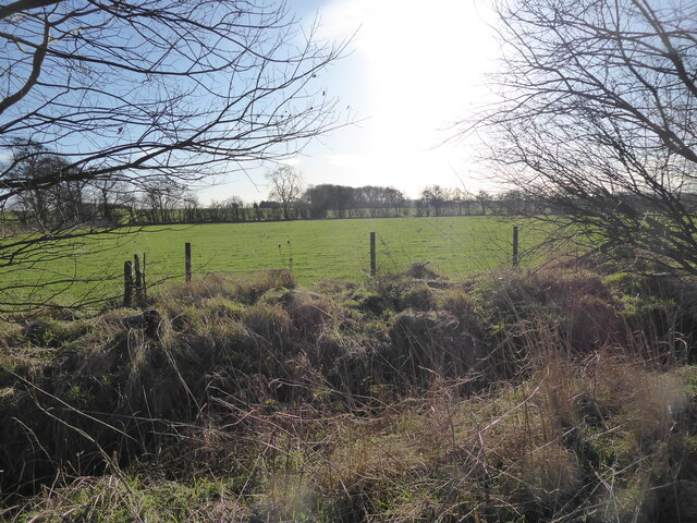
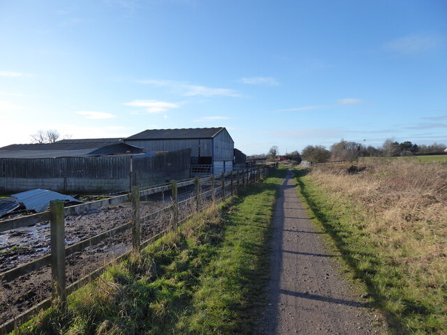
Cowley is a small village located in the county of Staffordshire, England. Situated in the West Midlands region, it lies approximately 4 miles southeast of the town of Uttoxeter. The village is nestled in the picturesque countryside, surrounded by rolling hills and farmland, which contributes to its serene and peaceful atmosphere.

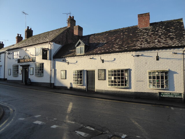
With a population of around 300 residents, Cowley is known for its tight-knit community and friendly locals. The village features a mix of traditional and modern architecture, with charming cottages and a few newer developments. The village center is the heart of Cowley, where you can find the local pub, The Cowley Arms, serving classic British dishes and ales.

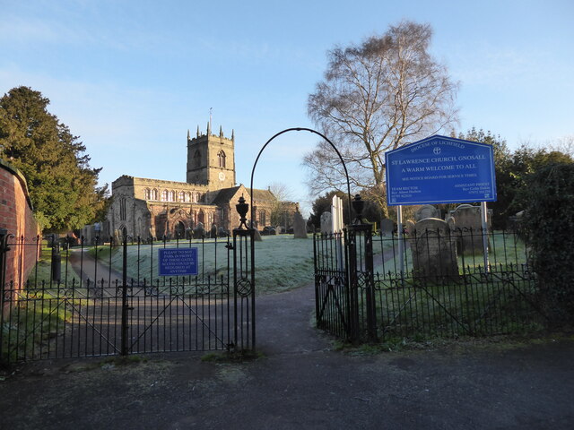
Cowley is also home to St. Mary's Church, a historic place of worship dating back to the 12th century. The church's architecture showcases a blend of Norman and Gothic styles, making it a site of historical and cultural significance.

The village benefits from its proximity to the larger town of Uttoxeter, where residents can access a wider range of amenities, including supermarkets, schools, and healthcare facilities. Additionally, Cowley enjoys good transport links, with convenient road connections to nearby towns and cities such as Burton upon Trent and Derby.

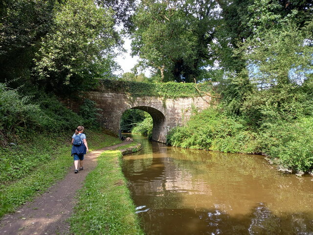
For those seeking outdoor activities, Cowley is surrounded by beautiful countryside, offering opportunities for scenic walks, cycling, and exploring nature. The nearby River Dove also provides a peaceful spot for fishing and picnicking.

In summary, Cowley is a charming village in Staffordshire, known for its close-knit community, picturesque countryside, and historic landmarks. It offers a tranquil and idyllic living environment for its residents.

If you have any feedback on the listing, please let us know in the comments section below.
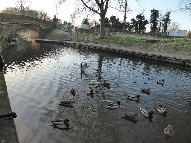
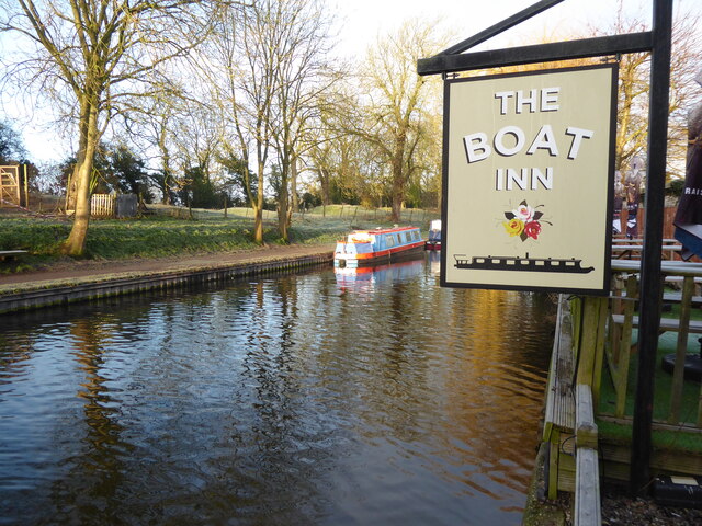
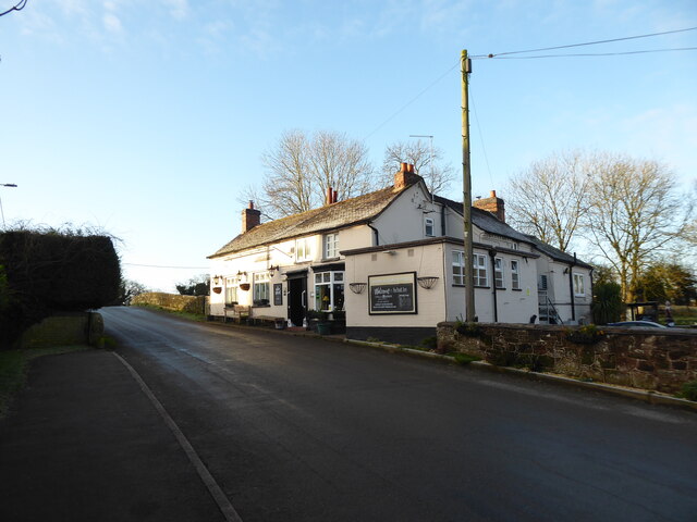
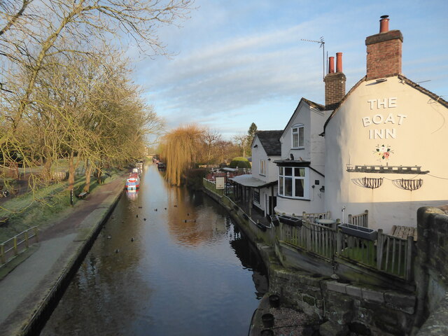
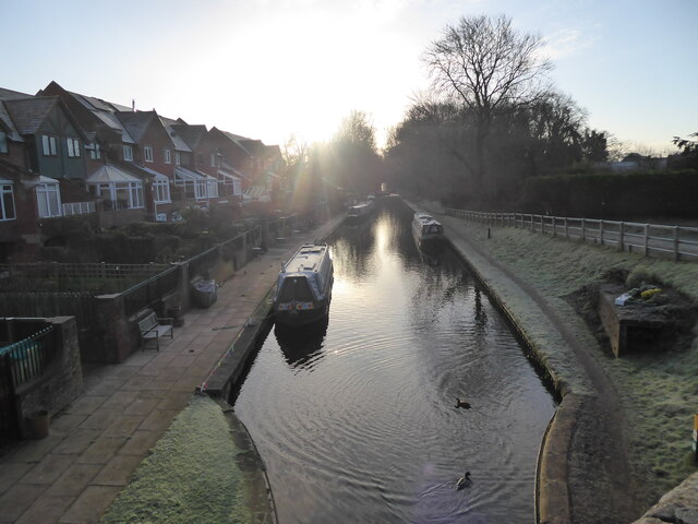
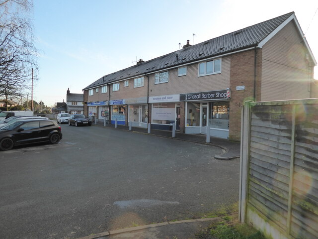
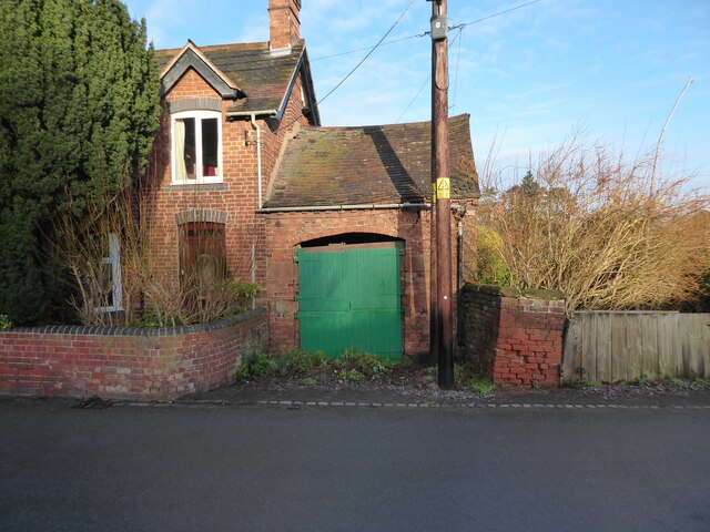
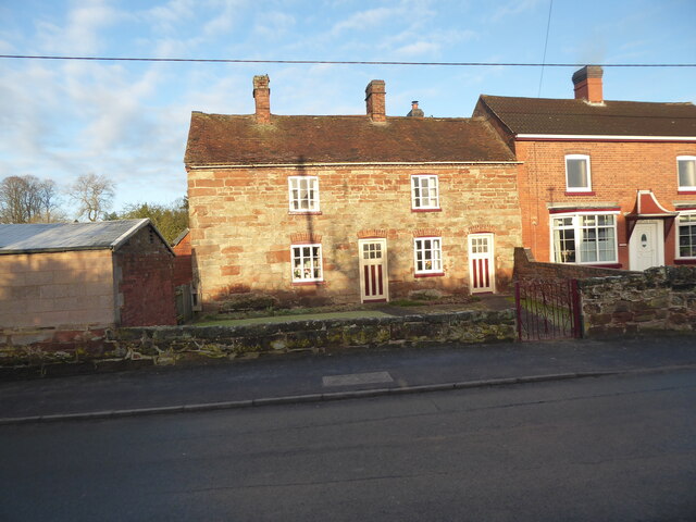
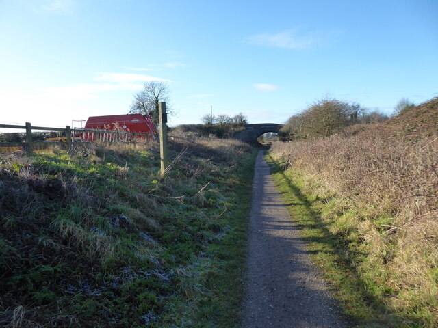
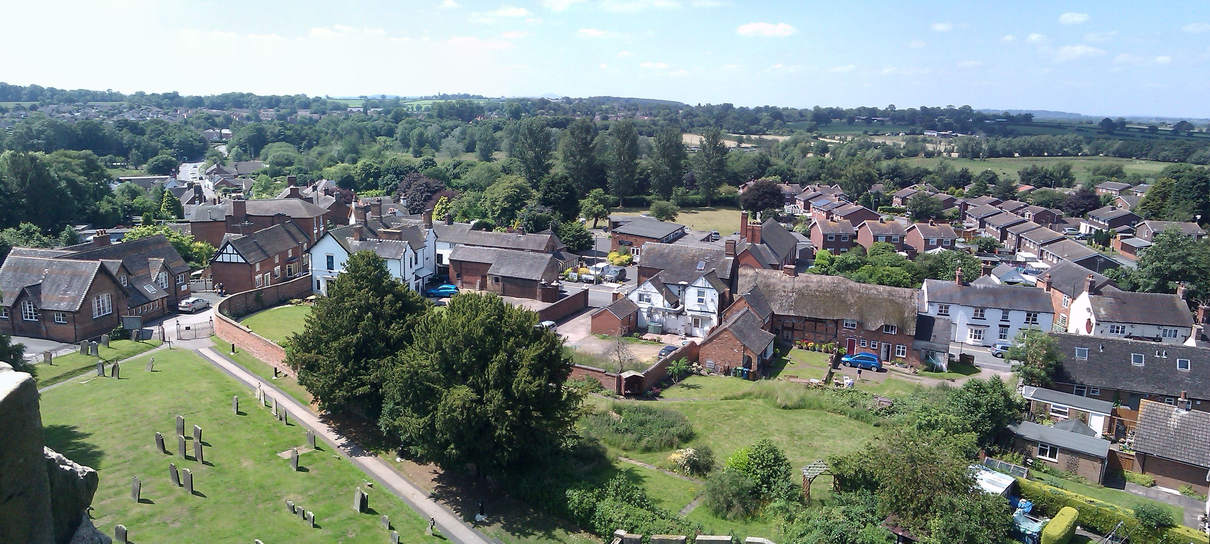
Cowley Images

Images are sourced within 2km of 52.769954/-2.2564479 or Grid Reference SJ8219. Thanks to Geograph Open Source API. All images are credited.

Plardiwick Bridge, Shropshire Union Canal Erected around 1830 as an agricultural accommodation bridge, and Grade II listed <span class="nowrap"><a title="https://britishlistedbuildings.co.uk/101273080-plardiwick-bridge-no-36-at-sj-815-206-gnosall#.YS5APo5KjIU" rel="nofollow ugc noopener" href="https://britishlistedbuildings.co.uk/101273080-plardiwick-bridge-no-36-at-sj-815-206-gnosall#.YS5APo5KjIU">Link</a><img style="margin-left:2px;" alt="External link" title="External link - shift click to open in new window" src="https://s1.geograph.org.uk/img/external.png" width="10" height="10"/></span> & <span class="nowrap"><a title="https://historicengland.org.uk/listing/the-list/list-entry/1273080" rel="nofollow ugc noopener" href="https://historicengland.org.uk/listing/the-list/list-entry/1273080">Link</a><img style="margin-left:2px;" alt="External link" title="External link - shift click to open in new window" src="https://s1.geograph.org.uk/img/external.png" width="10" height="10"/></span> in Oct 1991.
Plardiwick Bridge, Shropshire Union Canal
Erected around 1830 as an agricultural accommodation bridge, and Grade II listed LinkExternal link & LinkExternal link in Oct 1991.
Cast iron rope fender at Plardiwick Bridge One of the two well-worn rope fenders on the bridge at Plardiwick. It's included in the Grade II listing that the bridge holds.
Cast iron rope fender at Plardiwick Bridge
One of the two well-worn rope fenders on the bridge at Plardiwick. It's included in the Grade II listing that the bridge holds.
Benchmark, 1 High Street, Gnosall Detail of the Ordnance Survey flush bracket benchmark 2453 on the west angle of 1 High Street, Gnosall. The benchmark marks a height of 94.652m above mean sea level (Ordnance Datum Newlyn) last levelled in 1956 and verified in 1969 (location photograph <a href="https://www.geograph.org.uk/photo/6971154">SJ8220 : The corner of 1 High Street</a>).
Benchmark, 1 High Street, Gnosall
Detail of the Ordnance Survey flush bracket benchmark 2453 on the west angle of 1 High Street, Gnosall. The benchmark marks a height of 94.652m above mean sea level (Ordnance Datum Newlyn) last levelled in 1956 and verified in 1969 (location photograph SJ8220 : The corner of 1 High Street).
The corner of 1 High Street Formerly the police station, the south west face of 1 High Street faces onto the A518, Stafford Road.
There is an Ordnance Survey flush bracket benchmark low down near the corner of the wall (photograph <a href="https://www.geograph.org.uk/photo/6971120">SJ8220 : Benchmark, 1 High Street, Gnosall</a>).
The corner of 1 High Street
Formerly the police station, the south west face of 1 High Street faces onto the A518, Stafford Road. There is an Ordnance Survey flush bracket benchmark low down near the corner of the wall (photograph SJ8220 : Benchmark, 1 High Street, Gnosall).
Canalside scene in Gnosall Heath These quackers came over to say hello.
Canalside scene in Gnosall Heath
These quackers came over to say hello.
Canalside scene in Gnosall Heath Canals always succeed at being colourful.
Canalside scene in Gnosall Heath
Canals always succeed at being colourful.
The Boat Inn pub in Gnosall Heath Best pub I know.
The Boat Inn pub in Gnosall Heath
Best pub I know.
Part of the canal in Gnosall Heath Beautiful.
Part of the canal in Gnosall Heath
Beautiful.
Morning on the canal at Gnosall Heath Like me, the ducks here are stretching, moving about and getting ready to explore their environment.
Morning on the canal at Gnosall Heath
Like me, the ducks here are stretching, moving about and getting ready to explore their environment.
Small parade of shops on Wharf Road, Gnosall Heath A few local businesses and convenience shops.
Small parade of shops on Wharf Road, Gnosall Heath
A few local businesses and convenience shops.
Old building alongside a house on Wharf Road, Gnosall Heath A vehicle garage I assume, though possibly not for the house it is built alongside of any more. It looks a little dangerous now. Obviously long disused.
Old building alongside a house on Wharf Road, Gnosall Heath
A vehicle garage I assume, though possibly not for the house it is built alongside of any more. It looks a little dangerous now. Obviously long disused.
Old cottage on Wharf Road, Gnosall Heath Nice old place.
Old cottage on Wharf Road, Gnosall Heath
Nice old place.
Road linking Gnosall Heath with Gnosall Nice places.
Road linking Gnosall Heath with Gnosall
Nice places.
St Lawrence church in Gnosall Beautiful church on a hilltop.
St Lawrence church in Gnosall
Beautiful church on a hilltop.
The Horns pub in Gnosall Public house.
The Horns pub in Gnosall
Public house.
Meadow with a large flock of birds near Gnosall Redwing I think. They space out evenly and hop about, glance at me, feed, hop a bit more. Nice.
Meadow with a large flock of birds near Gnosall
Redwing I think. They space out evenly and hop about, glance at me, feed, hop a bit more. Nice.
Farm beside the Way for the Millennium near Gnosall I like this walk. I am playing some music on my phone (I cannot recall the track, but it suited the mood). My walk is very close to being completed. Always a nice feeling.
Farm beside the Way for the Millennium near Gnosall
I like this walk. I am playing some music on my phone (I cannot recall the track, but it suited the mood). My walk is very close to being completed. Always a nice feeling.
Walking the Way for the Millennium near Gnosall The Way has its own Wikipedia page, <span class="nowrap"><a title="https://en.wikipedia.org/wiki/Way_for_the_Millennium" rel="nofollow ugc noopener" href="https://en.wikipedia.org/wiki/Way_for_the_Millennium">Link</a><img style="margin-left:2px;" alt="External link" title="External link - shift click to open in new window" src="https://s1.geograph.org.uk/img/external.png" width="10" height="10"/></span> here.
Walking the Way for the Millennium near Gnosall
The Way has its own Wikipedia page, LinkExternal link here.
Show me another place!

Cowley is located at Grid Ref: SJ8219 (Lat: 52.769954, Lng: -2.2564479)

Administrative County: Staffordshire

District: Stafford

Police Authority: Staffordshire

What 3 Words

///gazes.micro.orbit. Near Gnosall, Staffordshire

Nearby Locations

Cowley

Related Wikis

Gnosall railway station

Gnosall railway station was a station in Gnosall, Staffordshire, England. The station was opened in June 1849 and closed on 7 September 1964. == References... ==

Gnosall

Gnosall () is a village and civil parish in the Borough of Stafford, Staffordshire, England, with a population of 4,736 across 2,048 households (2011 census...

St Lawrence's Church, Gnosall

St Lawrence's Church is an Anglican church in Gnosall, Staffordshire, England. It is a Grade I listed building. The earliest parts of the church are of...

Coton, Staffordshire

Coton is a hamlet in the English county of Staffordshire.It lies on the A518 road some two miles west of Gnosall. == See also == Listed buildings in Gnosall...

Beffcote

Beffcote is a village in Staffordshire, England. For the population taken at the United Kingdom Census 2011 see Gnosall.

Apeton

Apeton is a hamlet in Staffordshire in the West Midlands region of England. It is located 5+1⁄2 miles (8.9 km) southwest of Stafford, in the civil parish...

Allimore Green

Allimore Green is a small hamlet in Staffordshire, England, 1 mile north-east of Church Eaton. It is the location of a Site of Special Scientific Interest...

Church Eaton

Church Eaton is a village and civil parish in Staffordshire some 6 miles (10 km) southwest of Stafford, 6 miles (10 km) northwest of Penkridge and 4 miles...

Nearby Amenities

Located within 500m of 52.769954,-2.2564479
The data included in this document is from www.openstreetmap.org. The data is made available under ODbL.

Have you been to Cowley?

Leave your review of Cowley below (or comments, questions and feedback).