Cowlam

Settlement in Yorkshire

England

Cowlam

Farmland at Collingwood One of the higher points in this area
Farmland at Collingwood Credit: David Brown

Cowlam is a small village located in the East Riding of Yorkshire, England. Situated approximately 5 miles northeast of Driffield, it lies in the picturesque Yorkshire Wolds, surrounded by beautiful rolling hills and countryside.

The village itself is home to a tight-knit community and boasts a population of around 200 residents. It is characterized by its charming rural character and tranquility, making it an idyllic place to live or visit for those seeking a peaceful retreat.

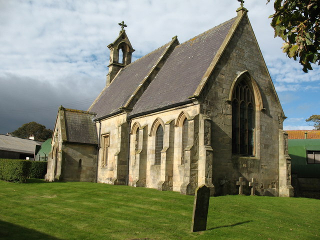
Cowlam is renowned for its historic charm and has several notable landmarks. One such landmark is the Grade II listed Cowlam Manor, a stunning 18th-century manor house that adds to the village's allure. It serves as a reminder of the area's rich heritage.

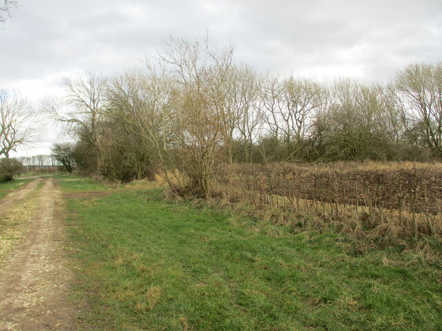
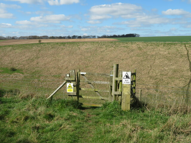
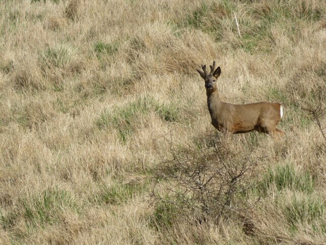
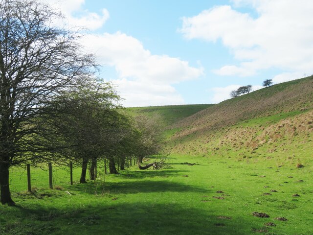
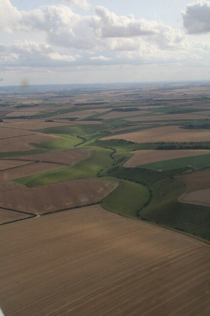
For nature enthusiasts, Cowlam offers ample opportunities for outdoor activities. The surrounding countryside is crisscrossed with footpaths and bridleways, allowing visitors to explore the area's natural beauty on foot or horseback. The village is also close to several nature reserves, providing ample opportunities for birdwatching and wildlife spotting.

While small in size, Cowlam does have a few amenities to cater to its residents' needs. These include a local pub, offering a warm and friendly atmosphere, as well as a village hall that hosts various community events throughout the year.

Overall, Cowlam is a charming village that offers a peaceful escape and a chance to immerse oneself in the beauty of the Yorkshire countryside.

If you have any feedback on the listing, please let us know in the comments section below.

Cowlam Images

Images are sourced within 2km of 54.083656/-0.53236633 or Grid Reference SE9666. Thanks to Geograph Open Source API. All images are credited.
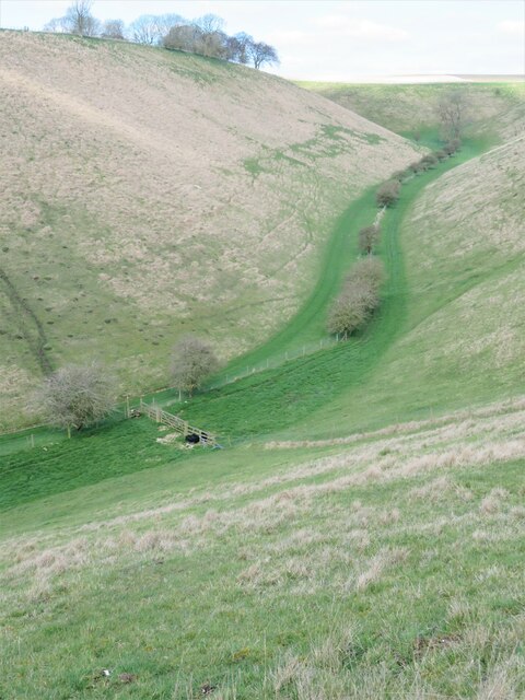
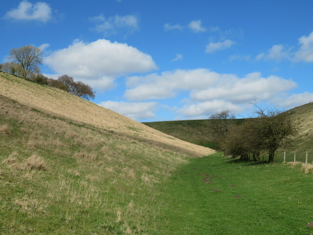
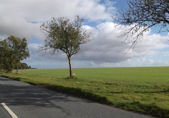
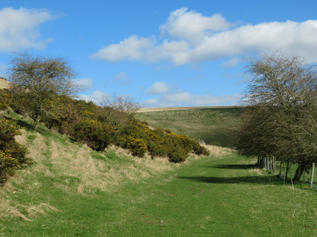
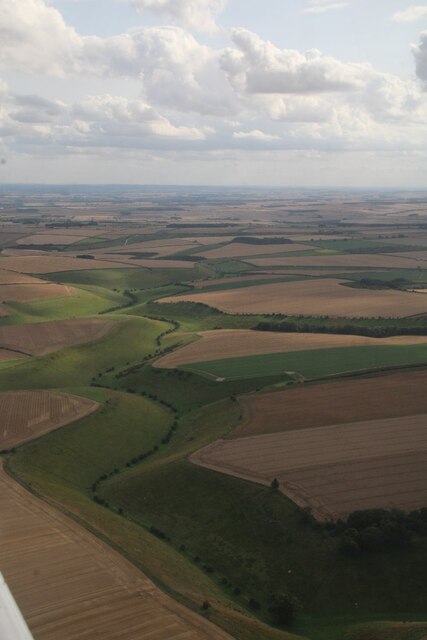
Farmland at Collingwood One of the higher points in this area
Farmland at Collingwood
One of the higher points in this area
Cowlam Grange
Cowlam Grange
Unsuitable.  Stating  the  obvious.  Green  Lane  (track)
Unsuitable. Stating the obvious. Green Lane (track)
Disused  pit  being  used  to  dump  potatoes  by  farmer One can only presume they are of no commercial value
Disused pit being used to dump potatoes by farmer
One can only presume they are of no commercial value
From  Green  Lane  (track)  to  Little  Pasture  Farm
From Green Lane (track) to Little Pasture Farm
Green  Lane  (track)  approaching  lane  junction To the left are Pasture Cottages, to the right end of field before wooded disused pit
Green Lane (track) approaching lane junction
To the left are Pasture Cottages, to the right end of field before wooded disused pit
Steep drop ahead Time to prepare the parachute as the path descends very steeply into Phillip's Slack beyond the gate.  The contour lines on the OS map confirm this, although being at 5m intervals, they do accentuate the gradient.
Steep drop ahead
Time to prepare the parachute as the path descends very steeply into Phillip's Slack beyond the gate. The contour lines on the OS map confirm this, although being at 5m intervals, they do accentuate the gradient.
Phillip's Slack The junction of fences below marks the point where there's a junction of paths. This contributor opted for a slow zig-zag route down this steep slope into the dale bottom rather than trying the direct route. The view is into the upper reaches of a typical Wolds dry valley.
Phillip's Slack
The junction of fences below marks the point where there's a junction of paths. This contributor opted for a slow zig-zag route down this steep slope into the dale bottom rather than trying the direct route. The view is into the upper reaches of a typical Wolds dry valley.
Phillip's Slack The upper part of this dry valley where the public footpath appears to end close by an old chalk pit. One assumes that this is a dead end for pedestrians, although I did photograph a possible junction with the B1253 back in May 2011.
Phillip's Slack
The upper part of this dry valley where the public footpath appears to end close by an old chalk pit. One assumes that this is a dead end for pedestrians, although I did photograph a possible junction with the B1253 back in May 2011.
Roe deer on the dale side As I walked into the upper reaches of Phillip's Slack I disturbed two roe deer which scampered part way up the hillside before turning to look at this intruder. One of them stood long enough to be captured on camera.
Roe deer on the dale side
As I walked into the upper reaches of Phillip's Slack I disturbed two roe deer which scampered part way up the hillside before turning to look at this intruder. One of them stood long enough to be captured on camera.
Path through Phillip's Slack A pleasant green path through a delightful dry Wolds valley. The line of small trees along the fence line would suggest a former hedge, but there's no indication that the trees were ever forced into a hedge line.
Path through Phillip's Slack
A pleasant green path through a delightful dry Wolds valley. The line of small trees along the fence line would suggest a former hedge, but there's no indication that the trees were ever forced into a hedge line.
Gentle contours A small unnamed side valley on the east side of Phillip's Slack.  The Wolds landscape has many similarities to the chalk downs of Wessex, and my old home territory of the Marlborough Downs, but there are subtle differences. The narrow, steep sided, dry valleys of the Wolds are not replicated on the Downs. There are many dry valleys there, but they tend to be more open and spacious.  The Wolds plateau is largely given over to cereal crops and large farms, whereas the Downs still [thankfully] have large areas of open grassland, often with evidence of habitation by early man.
Gentle contours
A small unnamed side valley on the east side of Phillip's Slack. The Wolds landscape has many similarities to the chalk downs of Wessex, and my old home territory of the Marlborough Downs, but there are subtle differences. The narrow, steep sided, dry valleys of the Wolds are not replicated on the Downs. There are many dry valleys there, but they tend to be more open and spacious. The Wolds plateau is largely given over to cereal crops and large farms, whereas the Downs still [thankfully] have large areas of open grassland, often with evidence of habitation by early man.
Gorse on the dale side An area of gorse by the path in Phillip's Slack. The bright yellow flowers, together with a rather 'buttery' smell, add to the attraction of the dale.
Gorse on the dale side
An area of gorse by the path in Phillip's Slack. The bright yellow flowers, together with a rather 'buttery' smell, add to the attraction of the dale.
Phillip's Slack, NW of Cottam: aerial 2023 (1)
Phillip's Slack, NW of Cottam: aerial 2023 (2)
Site of Cowlam DMV, east of Sledmere: aerila 2023
Cowlam Well Dale: aerial 2023
Wood Dale, east of Sledmere: aerial 2023
Show me another place!

Cowlam is located at Grid Ref: SE9666 (Lat: 54.083656, Lng: -0.53236633)

Division: East Riding

Unitary Authority: East Riding of Yorkshire

Police Authority: Humberside

What 3 Words

///ounce.pianists.apparatus. Near Wetwang, East Yorkshire

Nearby Locations

Cowlam

Related Wikis

Cowlam

Cowlam is a hamlet in the Cottam civil parish of the East Riding of Yorkshire, England, and in the Yorkshire Wolds. The hamlet is on the B1253 Bridlington...

Croome, East Riding of Yorkshire

Croome is a hamlet in the East Riding of Yorkshire, England. It is situated approximately 8 miles (13 km) north-west of Driffield. It lies just to the...

Sledmere

Sledmere is a village in the East Riding of Yorkshire, England, about 7 miles (11 km) north-west of Driffield on the B1253 road. The village lies in a...

Sledmere House

Sledmere House is a Grade I listed Georgian country house, containing Chippendale, Sheraton and French furnishings and many fine pictures, set within a...

Wagoners' Memorial

The Wagoners' Memorial is a war memorial in Sledmere, in the East Riding of Yorkshire in England. The unusual squat columnar memorial was designed by...

Eleanor Cross, Sledmere

A replica Eleanor Cross was erected in Sledmere, East Riding of Yorkshire, in 1896–98. The tall stone structure was constructed by the Sykes family of...

Cottam, East Riding of Yorkshire

Cottam is a hamlet and civil parish in the East Riding of Yorkshire, England. The hamlet is west of the B1249 Skipsea to Staxton road, and in the Yorkshire...

East Lutton

East Lutton is a hamlet in North Yorkshire, England. It is situated approximately 9 miles (14 km) east from Malton, and within the Yorkshire Wolds. The...

Nearby Amenities

Located within 500m of 54.083656,-0.53236633
Cowlam
Is In: East Riding of Yorkshire, England, UK
Is In County: East Riding of Yorkshire
Place: hamlet
Wikidata: Q5179737
Lat/Long: 54.0833233/-0.5324998
Post Box
Collection Times: Mo-Fr 16:00; Sa 12:30
Post Box Type: lamp
Ref: YO25 398
Royal Cypher: EIIR
Royal Cypher Wikidata: Q33102113
Lat/Long: 54.0844096/-0.5329461
Cowlam Cross Roads
Naptan AtcoCode: 2200YEZ01285
Naptan Bearing: E
Naptan BusStopType: CUS
Naptan CommonName: Cowlam Cross Roads
Naptan Landmark: Cowlam Grange
Naptan Street: Cross Roads
Naptan Verified: no
Source: naptan_import
Lat/Long: 54.0837391/-0.532617
Board Type: notice
Note: board missing but two upright remaining, hopefullit might get fixed
Removed Information: board
Tourism: information
Lat/Long: 54.084434/-0.5329657
Guyed: pole
Material: wood
Power: pole
Lat/Long: 54.0797685/-0.52992
Material: wood
Power: pole
Lat/Long: 54.0806268/-0.5304747
Material: wood
Power: pole
Lat/Long: 54.0813652/-0.530955
Guyed: pole
Material: wood
Power: pole
Lat/Long: 54.0821258/-0.5314642
Material: wood
Power: pole
Lat/Long: 54.0828753/-0.5320693
Material: wood
Power: pole
Transformer: distribution
Lat/Long: 54.0837144/-0.5327315
Material: wood
Power: pole
Lat/Long: 54.0826669/-0.5334489
Material: wood
Power: pole
Lat/Long: 54.0824546/-0.5348602
Material: wood
Power: pole
Lat/Long: 54.0818284/-0.5389331
Material: wood
Power: pole
Lat/Long: 54.0820395/-0.5375525
Material: wood
Power: pole
Lat/Long: 54.0822485/-0.5361887
The data included in this document is from www.openstreetmap.org. The data is made available under ODbL.

Have you been to Cowlam?

Leave your review of Cowlam below (or comments, questions and feedback).