Cottam

Settlement in Yorkshire

England

Cottam

Cottam  Lane  toward  Langtoft  with  Communication  Mast
Cottam Lane toward Langtoft with Communication Mast Credit: Martin Dawes

Cottam is a small village located in the East Riding of Yorkshire, England. Situated approximately 10 miles north-west of the city of Hull, it is nestled in the picturesque countryside of the Yorkshire Wolds. With a population of around 200 people, Cottam maintains a close-knit community atmosphere.

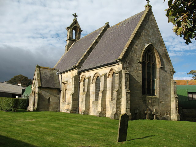
The village is known for its charming, traditional architecture, featuring a mix of stone and brick buildings that give it a timeless appeal. The centerpiece of Cottam is the All Saints Church, a beautiful historic structure dating back to the 12th century. The church's tall spire can be seen from miles around and serves as a prominent landmark in the area.

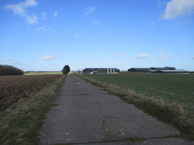
Surrounded by rolling hills and lush green fields, Cottam offers a peaceful and idyllic setting. The village is well-connected to the rest of Yorkshire, with good road links to nearby towns and cities. Despite its rural location, Cottam benefits from amenities such as a local pub and a village hall, where various community events and activities take place.

The surrounding countryside provides opportunities for outdoor activities such as hiking, cycling, and horseback riding, with numerous scenic trails and bridleways to explore. Cottam also enjoys close proximity to the Yorkshire Wolds Way, a long-distance footpath that offers stunning views of the surrounding landscape.

Overall, Cottam is a picturesque and welcoming village, offering a peaceful escape from the hustle and bustle of city life while still providing easy access to the amenities and attractions of the wider region.

If you have any feedback on the listing, please let us know in the comments section below.

Cottam Images

Images are sourced within 2km of 54.069224/-0.48128274 or Grid Reference SE9964. Thanks to Geograph Open Source API. All images are credited.

Cottam  Lane  toward  Langtoft  with  Communication  Mast
Cottam Lane toward Langtoft with Communication Mast
Cottam  Lane  with  Woodbine  Farm  on  the  left
Cottam Lane with Woodbine Farm on the left
Access  road  to  Crooked  Dale  Farm
Access road to Crooked Dale Farm
Old  WW2  buildings  reduced  to  rubble I took a Geograph on 19th Nov 2008 when derelict building was still standing. The high Wolds in this area were used for tank training before D Day
Old WW2 buildings reduced to rubble
I took a Geograph on 19th Nov 2008 when derelict building was still standing. The high Wolds in this area were used for tank training before D Day
Crooked Dale, south of Langtoft: aerial 2023
Holy  Trinity  Church  Cottam.  Rebuilt  1890  (1) Gutted and stands derelict, among the earthworks of one of the finest deserted village sites in Britain. A fine Norman font and a carved stone were removed to Langtoft Church c1950
Holy Trinity Church Cottam. Rebuilt 1890 (1)
Gutted and stands derelict, among the earthworks of one of the finest deserted village sites in Britain. A fine Norman font and a carved stone were removed to Langtoft Church c1950
Holy  Trinity  Church  Cottam.  Rebuilt  1890  (2)
Holy Trinity Church Cottam. Rebuilt 1890 (2)
Holy  Trinity  Church  Cottam.  Rebuilt  1890  (3)
Holy Trinity Church Cottam. Rebuilt 1890 (3)
Holy  Trinity  Church  Cottam.  Rebuilt  1890  (4) Close up of the door showing the weathering of bricks on one side due to prevailing winds
Holy Trinity Church Cottam. Rebuilt 1890 (4)
Close up of the door showing the weathering of bricks on one side due to prevailing winds
Holy  Trinity  Church  Cottam.  Rebuilt  1890  (5) The church stands in the midst of the deserted medieval village hence the grassed earthworks all around
Holy Trinity Church Cottam. Rebuilt 1890 (5)
The church stands in the midst of the deserted medieval village hence the grassed earthworks all around
Runway  on  the  disused  2nd  WW  RAF  Cottam Built in 1939 as a Satellite airfield to RAF Driffield used only occasionally for flying due to adverse winds and low cloud on the high wold. Mostly used by Maintenance Units for bomb storage. Closed 1954
Runway on the disused 2nd WW RAF Cottam
Built in 1939 as a Satellite airfield to RAF Driffield used only occasionally for flying due to adverse winds and low cloud on the high wold. Mostly used by Maintenance Units for bomb storage. Closed 1954
Buildings  on  runway  of  disused  RAF  Cottam Built 1939 closed 1954 reverted to agricultural use
Buildings on runway of disused RAF Cottam
Built 1939 closed 1954 reverted to agricultural use
WW2  disused  airfield  now  track  to  fields  and  bridleway
WW2 disused airfield now track to fields and bridleway
Wolds countryside A view eastwards from the junction of two minor roads at Cottam, looking towards Crooked Dale.
Wolds countryside
A view eastwards from the junction of two minor roads at Cottam, looking towards Crooked Dale.
Lane and footpath towards Cottam House The lane, now a private road, leads towards Cottam House and the deserted village site of Cottam. The roadside signpost appears to have seen better days.
Lane and footpath towards Cottam House
The lane, now a private road, leads towards Cottam House and the deserted village site of Cottam. The roadside signpost appears to have seen better days.
Big sky country Typical Wolds landscape with big arable fields and distant shelter belt surrounding a farm.
Big sky country
Typical Wolds landscape with big arable fields and distant shelter belt surrounding a farm.
Field path towards Cottam Grange It makes a pleasant change to find that the farmer has left a generous grass strip at the field edge for the footpath. So often fields are ploughed right to the edge, leaving little room for walkers.
Field path towards Cottam Grange
It makes a pleasant change to find that the farmer has left a generous grass strip at the field edge for the footpath. So often fields are ploughed right to the edge, leaving little room for walkers.
Into Cottam Grange farmyard Not a typical farmyard as there's an absence of livestock in this arable farming area.
Into Cottam Grange farmyard
Not a typical farmyard as there's an absence of livestock in this arable farming area.
Show me another place!

Cottam is located at Grid Ref: SE9964 (Lat: 54.069224, Lng: -0.48128274)

Division: East Riding

Unitary Authority: East Riding of Yorkshire

Police Authority: Humberside

What 3 Words

///snows.boot.cabbages. Near Kilham, East Yorkshire

Nearby Locations

Cottam Cottam Village

Related Wikis

Cottam, East Riding of Yorkshire

Cottam is a hamlet and civil parish in the East Riding of Yorkshire, England. The hamlet is west of the B1249 Skipsea to Staxton road, and in the Yorkshire...
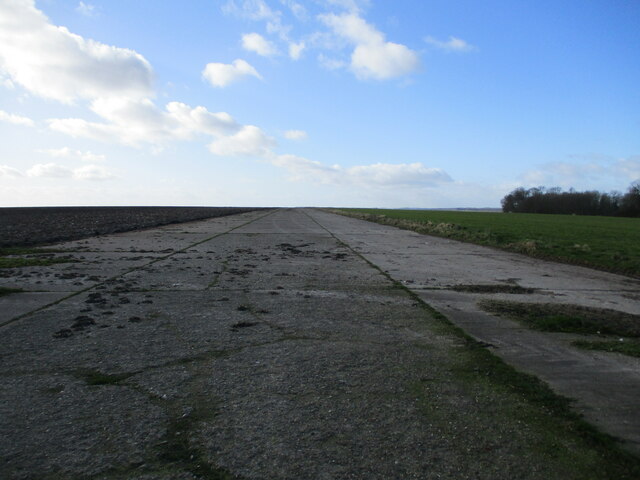
RAF Cottam

Royal Air Force Cottam or more simply RAF Cottam is a former Royal Air Force satellite airfield near Cottam in the East Riding of Yorkshire, England and...

Langtoft, East Riding of Yorkshire

Langtoft is a small village and civil parish in the East Riding of Yorkshire, England. It is situated 6 miles (10 km) north of Driffield town centre, and...

Danes Graves

Danes Graves is an archaeological site in the East Riding of Yorkshire. It forms part of the Arras Culture of inhumation and chariot burial prevalent in...

Cowlam

Cowlam is a hamlet in the Cottam civil parish of the East Riding of Yorkshire, England, and in the Yorkshire Wolds. The hamlet is on the B1253 Bridlington...

East Yorkshire (district)

The Borough of East Yorkshire was one of nine local government districts of the county of Humberside, England, from 1 April 1974 to 1 April 1996. The district...

East Yorkshire (UK Parliament constituency)

East Yorkshire is a county constituency for the House of Commons of the Parliament of the United Kingdom. It elects one Member of Parliament (MP) at least...

Driffield Rural District

Driffield was a rural district in the East Riding of Yorkshire in England from 1894 to 1974. It surrounded the municipal borough of Driffield. The district...

Nearby Amenities

Located within 500m of 54.069224,-0.48128274
Cottam
Place: locality
Lat/Long: 54.0693912/-0.4801517
Barrier: kissing_gate
Foot: designated
Lat/Long: 54.0719606/-0.4843466
Material: wood
Power: pole
Lat/Long: 54.0697137/-0.4874371
Material: wood
Power: pole
Lat/Long: 54.0698655/-0.4860466
Line Management: branch
Material: wood
Power: pole
Lat/Long: 54.0702175/-0.4866098
Material: wood
Power: pole
Lat/Long: 54.0696093/-0.4856154
Material: wood
Power: pole
Lat/Long: 54.0708453/-0.4856113
Material: wood
Power: pole
Lat/Long: 54.0691434/-0.4848657
Guyed: pole
Material: wood
Power: pole
Transformer: distribution
Lat/Long: 54.0685543/-0.4839107
Line Management: branch
Material: wood
Power: pole
Lat/Long: 54.0718301/-0.4840397
Material: wood
Power: pole
Lat/Long: 54.0712615/-0.4849192
Material: wood
Power: pole
Lat/Long: 54.0719791/-0.4842035
Material: wood
Power: pole
Lat/Long: 54.0723407/-0.4832119
Power: pole
Lat/Long: 54.072776/-0.4850997
Fixme: What's on this pole?
Material: wood
Power: pole
Lat/Long: 54.0729137/-0.4822918
Material: wood
Power: pole
Switch: mechanical
Lat/Long: 54.0736886/-0.4815309
The data included in this document is from www.openstreetmap.org. The data is made available under ODbL.

Have you been to Cottam?

Leave your review of Cottam below (or comments, questions and feedback).