Coton Green

Settlement in Staffordshire Tamworth

England

Coton Green

Obelisk on the Green, Wigginton This is where the Comberford lane meets the main road in Wigginton, with the Old Crown pub in the background.
Obelisk on the Green, Wigginton Credit: Mick Malpass

Coton Green is a small village located in the county of Staffordshire, England. Situated approximately 3 miles north of Tamworth, it falls within the district of Lichfield. The village is primarily residential, with a population of around 2,000 people.

Coton Green is surrounded by picturesque countryside, offering its residents a peaceful and idyllic setting. The village benefits from excellent transport links, with the A5 road passing nearby, providing easy access to the nearby towns and cities. The village is also served by several bus routes, connecting it to the wider area.

The village is known for its close-knit community and friendly atmosphere. It has a range of amenities to cater to the needs of its residents, including a primary school, a convenience store, a community center, and a pub. Additionally, the nearby town of Tamworth provides more extensive shopping and leisure facilities.

Coton Green boasts a number of recreational opportunities for its residents. The village is surrounded by beautiful countryside, making it an ideal location for outdoor activities such as walking, cycling, and horse riding. The nearby Drayton Manor Theme Park is a popular attraction for families, offering thrill rides, a zoo, and various events throughout the year.

Overall, Coton Green offers a tranquil and charming place to live, with its rural setting and strong sense of community. Its convenient location and range of amenities make it an appealing choice for those seeking a peaceful village lifestyle within easy reach of larger towns and cities.

If you have any feedback on the listing, please let us know in the comments section below.
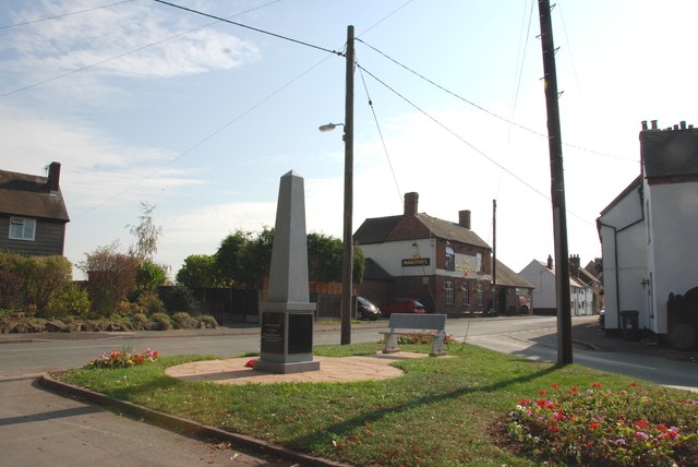
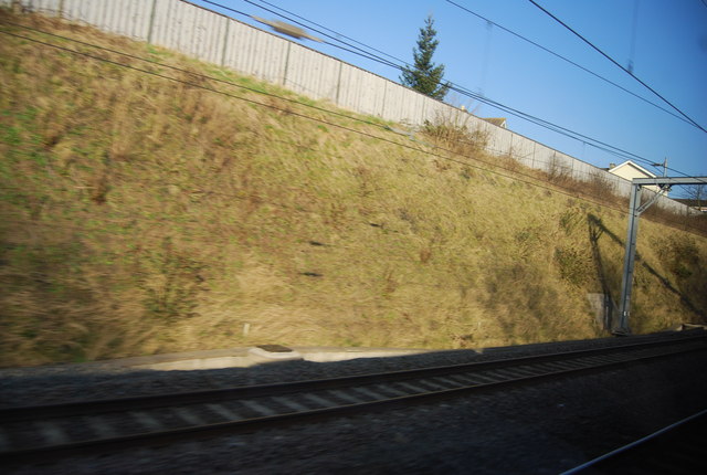
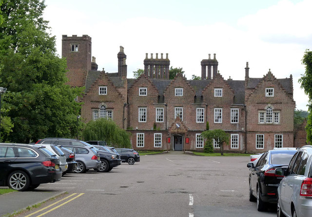
Coton Green Images

Images are sourced within 2km of 52.647367/-1.7171367 or Grid Reference SK1905. Thanks to Geograph Open Source API. All images are credited.

Obelisk on the Green, Wigginton This is where the Comberford lane meets the main road in Wigginton, with the Old Crown pub in the background.
Obelisk on the Green, Wigginton
This is where the Comberford lane meets the main road in Wigginton, with the Old Crown pub in the background.
Tamworth: Tame Drive crosses the River Tame
Tamworth - Park Street seen from Tamedrive
Kwik Fit, Tamworth
Kwik Fit, Tamworth
Houses on Wigginton Road
Wigginton Road Heading north.
Wigginton Road
Heading north.
Cemetery off Wigginton Road
House on Brown's Lane, Borough Park
Brown's Lane, Borough Park
Farmland north of Comberford Lane
Comberford Lane heading east Towards Wigginton.
Comberford Lane heading east
Towards Wigginton.
The Old Crown, Wigginton
Cutting on the West Coast Main Line The West Coast Main line is a 399 mile long high speed railway from London Euston to Glasgow. The route has a long history dating back to the 1830s. The route today is one of the busiest in the country and serves the West Midlands, North West, North Wales and Southern Scotland.
Cutting on the West Coast Main Line
The West Coast Main line is a 399 mile long high speed railway from London Euston to Glasgow. The route has a long history dating back to the 1830s. The route today is one of the busiest in the country and serves the West Midlands, North West, North Wales and Southern Scotland.
Tamworth Arms An early 19th century terrace group, of which the nearer end has at some stage become a pub. It and its neighbour retain late 19th century shop fronts in little-altered condition. Listed Grade II.
Tamworth Arms
An early 19th century terrace group, of which the nearer end has at some stage become a pub. It and its neighbour retain late 19th century shop fronts in little-altered condition. Listed Grade II.
Tamworth Mercia Community Fire Station Opened in September 2012. Not to be confused with Tamworth Community Fire Station <a title="https://www.geograph.org.uk/photo/3168690" href="https://www.geograph.org.uk/photo/3168690">Link</a>
Tamworth Mercia Community Fire Station
Opened in September 2012. Not to be confused with Tamworth Community Fire Station Link
Moat House, Tamworth A large Elizabethan house, dating back to around 1572. The windows were reconstructed in the 18th century, typified by the Venetian style windows in the end wings. The prominent chimneys are not original, dating from the 19th century. Listed Grade II*.
Moat House, Tamworth
A large Elizabethan house, dating back to around 1572. The windows were reconstructed in the 18th century, typified by the Venetian style windows in the end wings. The prominent chimneys are not original, dating from the 19th century. Listed Grade II*.
92 Lichfield Street, Tamworth A large late Georgian town house, now converted to offices. Listed Grade II.
92 Lichfield Street, Tamworth
A large late Georgian town house, now converted to offices. Listed Grade II.
Tower blocks at Tamworth The view across Lady Meadow.
Tower blocks at Tamworth
The view across Lady Meadow.
Show me another place!

Coton Green is located at Grid Ref: SK1905 (Lat: 52.647367, Lng: -1.7171367)

Administrative County: Staffordshire

District: Tamworth

Police Authority: Staffordshire

What 3 Words

///videos.louder.navigate. Near Tamworth, Staffordshire

Related Wikis

Wigginton and Hopwas

Wigginton and Hopwas is a civil parish in Lichfield District, Staffordshire, England. The villages of Wigginton and Hopwas, that make up the parish, lie...

Leyfields

Leyfields is a housing estate in Tamworth, Staffordshire, consisting of 3-storey flats, maisonettes, bungalows and houses. It was built in the 1960s as...

The Rawlett School

The Rawlett School is a secondary school with academy status located on the outskirts of Tamworth, a market town in Staffordshire, England. It was previously...

Gillway

Gillway is a council estate in Tamworth, United Kingdom built in the 1950s. It is a small suburb consisting of brick and concrete houses and two storey...

Related Videos

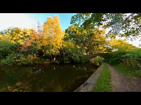
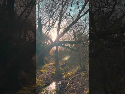
Hopwas Forest Canal Early Morning Walk, English Countryside 4K. Walking Tour

Join me on an early morning walk along the Birmingham & Fazeley Canal alongside the Hopwas Forest, enjoying the beautiful ...

What to See in #Tamworth in a Flash Visit | Discover the Capital of Mercia 【4K】

This video provides guidance for a one day visit to Tamworth, Staffordshire, England. We've focused our visit to 3 main touristic ...

Tamworth England - A Relaxing Walk Through Nature in a Town in United Kingdeom TMV

Tamworth Walk. Town in England. Miles across the English Countryside. Beautiful Countryside United Kingdom. Amazing Places ...

Walking Tamworth in Staffordshire

Time to head up the A5 Watling Street and have a look at Tamworth Sam one of our subscribers invited me up to have a walk ...

Nearby Amenities

Located within 500m of 52.647367,-1.7171367
Bus Stop
Scimitar Close
Bus: yes
Naptan AtcoCode: 3800C902700
Naptan Bearing: SE
Naptan CommonName: Scimitar Close
Naptan Indicator: Adj
Naptan Landmark: Scimitar Cl
Naptan PlusbusZoneRef: TAMWORTH
Naptan Street: Fontenaye Rd
Naptan Verified: no
Public Transport: platform
Source: naptan_import
Lat/Long: 52.6459208/-1.7153926
Bus Stop
Scimitar Close
Bus: yes
Naptan AtcoCode: 3800C902701
Naptan Bearing: NW
Naptan CommonName: Scimitar Close
Naptan Indicator: Opp
Naptan Landmark: Scimitar Cl
Naptan PlusbusZoneRef: TAMWORTH
Naptan Street: Fontenaye Rd
Naptan Verified: no
Public Transport: platform
Source: naptan_import
Lat/Long: 52.6458221/-1.7154524
Cavendish
Naptan AtcoCode: 3800C905801
Naptan Bearing: SE
Naptan BusStopType: CUS
Naptan CommonName: Cavendish
Naptan Indicator: Adj
Naptan Landmark: Cavendish
Naptan PlusbusZoneRef: TAMWORTH
Naptan Street: Mariner
Naptan Verified: no
Source: naptan_import
Lat/Long: 52.6433244/-1.7160893
Cavendish
Naptan AtcoCode: 3800C905802
Naptan Bearing: NW
Naptan BusStopType: CUS
Naptan CommonName: Cavendish
Naptan Indicator: opp
Naptan Landmark: Cavendish
Naptan PlusbusZoneRef: TAMWORTH
Naptan Street: Mariner
Naptan Verified: no
Source: naptan_import
Lat/Long: 52.6431895/-1.7160754
Bus Stop
Sewage Works
Bus: yes
Naptan AtcoCode: 3800C908601
Naptan Bearing: SW
Naptan CommonName: Sewage Works
Naptan Indicator: Opp
Naptan Street: Coton Lane
Naptan Verified: no
Public Transport: platform
Source: naptan_import
Lat/Long: 52.6489464/-1.7135112
Bus Stop
Cromwell Road
Bus: yes
Naptan AtcoCode: 3800C918401
Naptan Bearing: N
Naptan CommonName: Cromwell Road
Naptan Indicator: Opp
Naptan Landmark: Cromwell Rd
Naptan PlusbusZoneRef: TAMWORTH
Naptan Street: Fontenaye Rd
Public Transport: platform
Route Ref: 1E;3;3E
Shelter: no
Source: naptan_import;survey
Lat/Long: 52.6467001/-1.71682
Bus Stop
Cromwell Road
Bus: yes
Naptan AtcoCode: 3800C918402
Naptan Bearing: S
Naptan CommonName: Cromwell Road
Naptan Indicator: Adj
Naptan Landmark: Cromwell Road
Naptan PlusbusZoneRef: TAMWORTH
Naptan Street: Fontenaye Rd
Public Transport: platform
Route Ref: 1E;3;3E
Shelter: yes
Source: naptan_import;survey
Lat/Long: 52.6467719/-1.7166054
Bus Stop
Roman Way
Bus: yes
Naptan AtcoCode: 3800C918501
Naptan Bearing: E
Naptan CommonName: Roman Way
Naptan Indicator: Opp
Naptan Landmark: Roman Way
Naptan PlusbusZoneRef: TAMWORTH
Naptan Street: Fontenaye Road
Public Transport: platform
Route Ref: 1E;3;3E
Shelter: yes
Source: naptan_import;survey
Lat/Long: 52.6448356/-1.7127245
Bus Stop
Roman Way
Bus: yes
Naptan AtcoCode: 3800C918502
Naptan Bearing: W
Naptan CommonName: Roman Way
Naptan Indicator: Adj
Naptan Landmark: Roman Way
Naptan PlusbusZoneRef: TAMWORTH
Naptan Street: Fontenaye Rd
Naptan Verified: no
Public Transport: platform
Source: naptan_import
Lat/Long: 52.6447643/-1.712991
Bus Stop
Browning Close
Bus: yes
Naptan AtcoCode: 3800C918701
Naptan Bearing: S
Naptan CommonName: Browning Close
Naptan Indicator: Opp
Naptan Landmark: Browning Close
Naptan PlusbusZoneRef: TAMWORTH
Naptan Street: Fontenaye Rd
Naptan Verified: no
Public Transport: platform
Source: naptan_import
Lat/Long: 52.6491816/-1.7105971
Bus Stop
Browning Close
Bus: yes
Naptan AtcoCode: 3800C918702
Naptan Bearing: N
Naptan CommonName: Browning Close
Naptan Indicator: Adj
Naptan Landmark: Browning Cl
Naptan PlusbusZoneRef: TAMWORTH
Naptan Street: Fontenaye Rd
Public Transport: platform
Route Ref: 1E;3;3E
Shelter: yes
Source: naptan_import;survey
Lat/Long: 52.6492701/-1.7108692
Bus Stop
Mariner
Bus: yes
Naptan AtcoCode: 3800C918801
Naptan Bearing: NE
Naptan CommonName: Mariner
Naptan Indicator: Opp
Naptan Landmark: Mariner
Naptan PlusbusZoneRef: TAMWORTH
Naptan Street: Coton Ln
Public Transport: platform
Shelter: no
Source: naptan_import;survey
Lat/Long: 52.6458542/-1.7212642
Bus Stop
Mariner
Bus: yes
Naptan AtcoCode: 3800C918802
Naptan Bearing: SW
Naptan CommonName: Mariner
Naptan Indicator: Adj
Naptan Landmark: Mariner
Naptan PlusbusZoneRef: TAMWORTH
Naptan Street: Coton Ln
Public Transport: platform
Shelter: no
Source: naptan_import;survey
Lat/Long: 52.645833/-1.720972
Crossing
Crossing: zebra
Lat/Long: 52.6449202/-1.713487
Noexit: yes
Source: OS_OpenData_StreetView
Lat/Long: 52.6446654/-1.7129924
Power: tower
Source: survey
Lat/Long: 52.6458839/-1.7204926
Operator: Central Networks
Power: substation
Source: visual survey;estimate
Lat/Long: 52.6451625/-1.7202667
Operator: Central Networks
Power: substation
Ref: 42D 4827
Source: survey
Lat/Long: 52.6476587/-1.711948
Power: tower
Source: visual survey;estimate
Lat/Long: 52.6479102/-1.7181929
Barrier: bollard
Source: survey
Lat/Long: 52.6477975/-1.7122657
Man Made: tower
Source: visual survey;estimate
Tower Type: communication
Lat/Long: 52.6465071/-1.7189151
Source: survey
Structure: yes
Utility: gas
Lat/Long: 52.6451593/-1.7210463
ACD Interiors
Man Made: works
Source: survey
Lat/Long: 52.6435008/-1.7178885
Addr City: Tamworth
Addr Housename: Pim House
Addr Postcode: B79 7UL
Addr Street: Mariner
Source: survey
Lat/Long: 52.6453275/-1.7202999
Addr City: Tamworth
Addr Housename: Denis House
Addr Postcode: B79 7UL
Addr Street: Mariner
Source: survey
Lat/Long: 52.6445508/-1.7196698
Barrier: cycle_barrier
Source: visual survey;estimate
Lat/Long: 52.6439244/-1.7148153
Source: survey
Structure: yes
Utility: gas
Lat/Long: 52.6438207/-1.7167877
Barrier: bollard
Source: survey
Lat/Long: 52.6433324/-1.7148953
Toughened Glass Ltd
Man Made: works
Source: survey
Lat/Long: 52.6432533/-1.7178691
Man Made: surveillance
Source: survey
Lat/Long: 52.6432541/-1.7148561
Power: tower
Source: bing
Lat/Long: 52.6500292/-1.7158081
Noexit: yes
Lat/Long: 52.6459701/-1.7234775
Generator Method: photovoltaic
Generator Output Electricity: yes
Generator Source: solar
Generator Type: solar_photovoltaic_panel
Location: roof
Power: generator
Lat/Long: 52.6440269/-1.7123088
Generator Method: photovoltaic
Generator Output Electricity: yes
Generator Source: solar
Generator Type: solar_photovoltaic_panel
Location: roof
Power: generator
Lat/Long: 52.6453696/-1.7107022
Generator Method: photovoltaic
Generator Output Electricity: yes
Generator Source: solar
Generator Type: solar_photovoltaic_panel
Location: roof
Power: generator
Lat/Long: 52.6457097/-1.7106512
Generator Method: photovoltaic
Generator Output Electricity: yes
Generator Source: solar
Generator Type: solar_photovoltaic_panel
Location: roof
Power: generator
Lat/Long: 52.6457341/-1.7104447
Generator Method: photovoltaic
Generator Output Electricity: yes
Generator Source: solar
Generator Type: solar_photovoltaic_panel
Location: roof
Power: generator
Lat/Long: 52.6450148/-1.7108148
Generator Method: photovoltaic
Generator Output Electricity: yes
Generator Source: solar
Generator Type: solar_photovoltaic_panel
Location: roof
Power: generator
Lat/Long: 52.6449448/-1.7110831
Generator Method: photovoltaic
Generator Output Electricity: yes
Generator Source: solar
Generator Type: solar_photovoltaic_panel
Location: roof
Power: generator
Lat/Long: 52.6449481/-1.7117509
Generator Method: photovoltaic
Generator Output Electricity: yes
Generator Source: solar
Generator Type: solar_photovoltaic_panel
Location: roof
Power: generator
Lat/Long: 52.6449204/-1.7124644
Generator Method: photovoltaic
Generator Output Electricity: yes
Generator Source: solar
Generator Type: solar_photovoltaic_panel
Location: roof
Power: generator
Lat/Long: 52.6453809/-1.711885
Generator Method: photovoltaic
Generator Output Electricity: yes
Generator Source: solar
Generator Type: solar_photovoltaic_panel
Location: roof
Power: generator
Lat/Long: 52.6462516/-1.7112574
Generator Method: photovoltaic
Generator Output Electricity: yes
Generator Source: solar
Generator Type: solar_photovoltaic_panel
Location: roof
Power: generator
Lat/Long: 52.646027/-1.7109785
Generator Method: photovoltaic
Generator Output Electricity: yes
Generator Source: solar
Generator Type: solar_photovoltaic_panel
Location: roof
Power: generator
Lat/Long: 52.6459961/-1.7111877
Generator Method: photovoltaic
Generator Output Electricity: yes
Generator Source: solar
Generator Type: solar_photovoltaic_panel
Location: roof
Power: generator
Lat/Long: 52.6459245/-1.7114505
Generator Method: photovoltaic
Generator Output Electricity: yes
Generator Source: solar
Generator Type: solar_photovoltaic_panel
Location: roof
Power: generator
Lat/Long: 52.6460954/-1.7138565
Generator Method: photovoltaic
Generator Output Electricity: yes
Generator Source: solar
Generator Type: solar_photovoltaic_panel
Location: roof
Power: generator
Lat/Long: 52.6463151/-1.7140254
Generator Method: photovoltaic
Generator Output Electricity: yes
Generator Source: solar
Generator Type: solar_photovoltaic_panel
Location: roof
Power: generator
Lat/Long: 52.6460254/-1.7145699
Generator Method: photovoltaic
Generator Output Electricity: yes
Generator Source: solar
Generator Type: solar_photovoltaic_panel
Location: roof
Power: generator
Lat/Long: 52.646289/-1.7157474
Generator Method: photovoltaic
Generator Output Electricity: yes
Generator Source: solar
Generator Type: solar_photovoltaic_panel
Location: roof
Power: generator
Lat/Long: 52.6465136/-1.7160264
Generator Method: photovoltaic
Generator Output Electricity: yes
Generator Source: solar
Generator Type: solar_photovoltaic_panel
Location: roof
Power: generator
Lat/Long: 52.6474054/-1.7145941
Generator Method: photovoltaic
Generator Output Electricity: yes
Generator Source: solar
Generator Type: solar_photovoltaic_panel
Location: roof
Power: generator
Lat/Long: 52.6476365/-1.7146853
Generator Method: photovoltaic
Generator Output Electricity: yes
Generator Source: solar
Generator Type: solar_photovoltaic_panel
Location: roof
Power: generator
Lat/Long: 52.6489823/-1.7120621
Noexit: yes
Lat/Long: 52.6456991/-1.7226071
Noexit: yes
Lat/Long: 52.6496409/-1.7132791
Noexit: yes
Lat/Long: 52.6498358/-1.7129848
Noexit: yes
Lat/Long: 52.6455216/-1.7230222
Noexit: yes
Lat/Long: 52.6470708/-1.7232092
Barrier: yes
Lat/Long: 52.6441766/-1.714171
Noexit: yes
Lat/Long: 52.6494105/-1.712171
Crossing
Crossing Island: yes
Lat/Long: 52.6493736/-1.7118328
Crossing
Crossing Island: yes
Lat/Long: 52.6488755/-1.71391
Noexit: yes
Lat/Long: 52.6492174/-1.7131484
The data included in this document is from www.openstreetmap.org. The data is made available under ODbL.

Have you been to Coton Green?

Leave your review of Coton Green below (or comments, questions and feedback).