Copple House

Settlement in Lancashire

England

Copple House

Business units off East Lancashire Road (A580)
Business units off East Lancashire Road (A580) Credit: JThomas

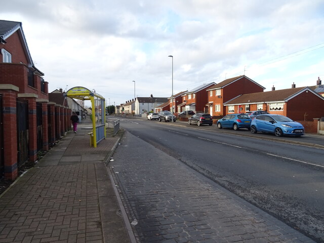
Copple House is a quaint village located in the picturesque county of Lancashire, England. Situated in the northern part of the county, it is nestled amidst rolling hills and lush green countryside, providing residents and visitors with breathtaking views and a serene atmosphere.

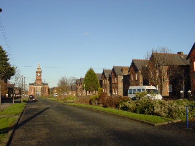
The village is home to a small population, primarily consisting of tight-knit communities that have been living here for generations. Copple House boasts a rich history, with evidence of human habitation dating back to the medieval period. The architecture in the village reflects its heritage, with charming stone cottages and buildings that add to its traditional charm.

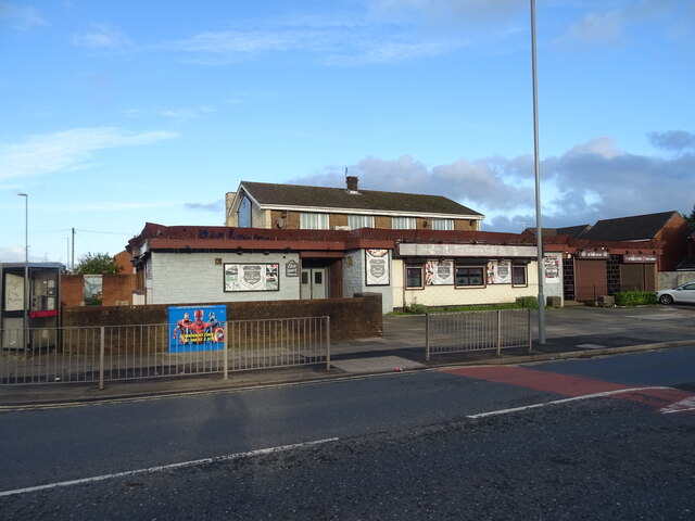
Despite its rural setting, Copple House offers a range of amenities to cater to the needs of its residents. A local pub, The Golden Hare, acts as a social hub where locals can gather and enjoy a pint while catching up with friends. Additionally, there is a village hall that serves as a venue for community events and gatherings.

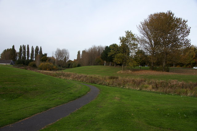
Surrounding Copple House, visitors can explore the stunning Lancashire countryside. The village is conveniently located near several natural attractions, including picturesque walking trails and scenic viewpoints. Outdoor enthusiasts can take advantage of the numerous opportunities for hiking, cycling, and wildlife observation that the area provides.

Overall, Copple House offers a peaceful and idyllic setting for those seeking a rural lifestyle. With its rich history, beautiful landscapes, and strong sense of community, it is a place that captures the essence of traditional Lancashire living.

If you have any feedback on the listing, please let us know in the comments section below.
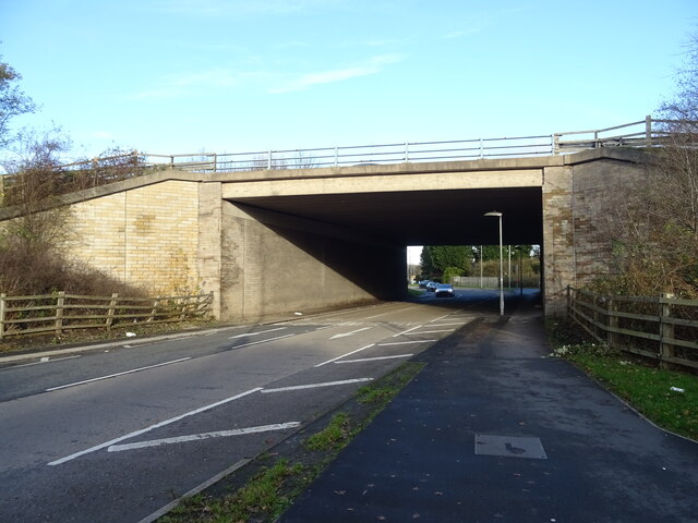
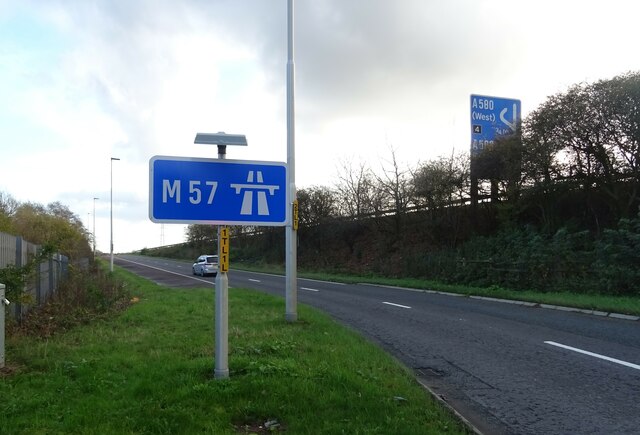
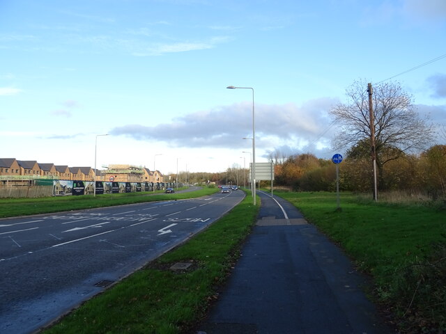
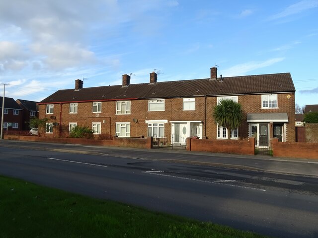
Copple House Images

Images are sourced within 2km of 53.468219/-2.9148909 or Grid Reference SJ3997. Thanks to Geograph Open Source API. All images are credited.

Business units off East Lancashire Road (A580)
East Lancashire Road (A580)
M57 Motorway bridge over the A506, Junction 6
Slip road onto the M57 Motorway, Junction 6
Valley Road (A506)
Valley Road (A506)
Houses on Whitefield Drive
The Johnny Todd public house
Bus stop and shelter on Whitefield Drive (B5192)
Elizabeth II postbox on Whitefield Drive Postbox No. L32 859.
Elizabeth II postbox on Whitefield Drive
Postbox No. L32 859.
Lodge, Gillmoss Close, Liverpool One of many former lodges to Croxteth Hall, possibly designed by William Eden Nesfield, c1860. There is a stone bench on the left. Grade II listed.
Lodge, Gillmoss Close, Liverpool
One of many former lodges to Croxteth Hall, possibly designed by William Eden Nesfield, c1860. There is a stone bench on the left. Grade II listed.
Kirkby Brook at Westvale, Kirkby
Roundabout at Junction 6 on the M57 at Kirkby
Kirkby House Privately owned care home on James Holt Avenue
Kirkby House
Privately owned care home on James Holt Avenue
Whitefield Drive, Kirkby
The Mariners Inn, Whitefield Drive, Kirkby
Pedestrian crossing on Whitefield Drive, Kirkby
Bench and Sign on Valley Road near Kirkby Brook
Kirkby Brook at Little Brook Lane
Show me another place!

Copple House is located at Grid Ref: SJ3997 (Lat: 53.468219, Lng: -2.9148909)

Unitary Authority: Knowsley

Police Authority: Merseyside

What 3 Words

///flops.honey.noon. Near Melling, Merseyside

Related Wikis

Simonswood Brook

Simonswood Brook is a minor, 12-kilometre-long (7.5 mi) river (brook) in Merseyside, England, that is a tributary to the River Alt in the Alt catchment...

Kirkby Brook

Kirkby Brook is the name for Simonswood Brook in Kirkby, a minor river (brook) in Merseyside, England, that is a tributary to the River Alt in the Alt...

Fazakerley (ward)

Fazakerley ward was an electoral division of Liverpool City Council between 1953 and 2022. == Background == The ward was first formed in 1953, its boundaries...

New Hall, Fazakerley

New Hall is located to the north of Longmoor Lane, Fazakerley, Liverpool, England. Originally built as a model village, all the buildings in New Hall...

ROF Fazakerley

ROF Fazakerley was a Royal Ordnance Factory rifle manufacturing plant in Fazakerley, Liverpool, which manufactured small arms such as the Sten and Sterling...

Dixons Fazakerley Academy

Dixons Fazakerley Academy (formerly Fazakerley High School) is a coeducational secondary school located in the Fazakerley area of Liverpool, England.The...
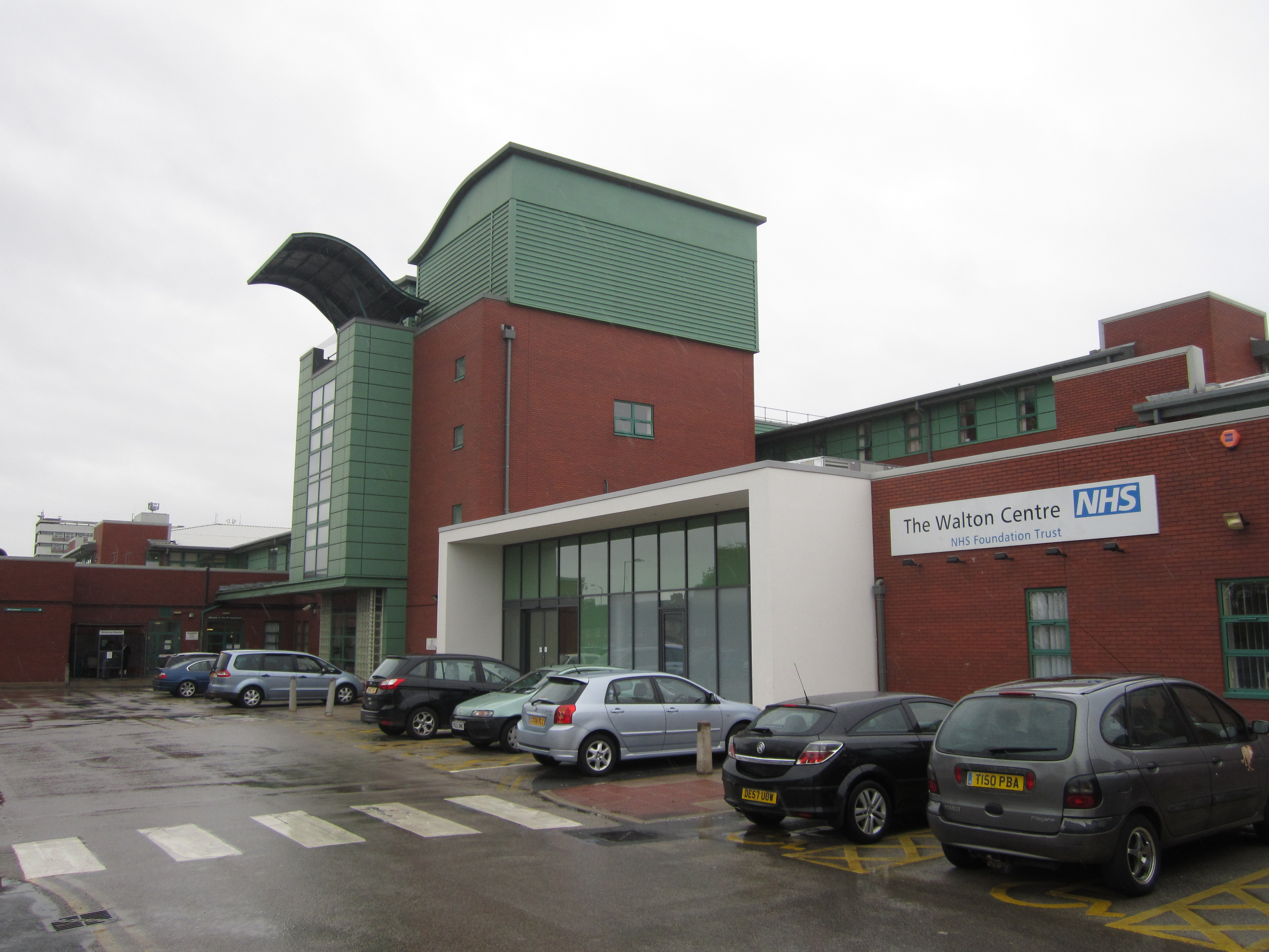
Walton Centre

The Walton Centre, formerly known as the Walton Centre for Neurology and Neurosurgery, is a major neurology hospital located in the suburb of Fazakerley...

Home Bargains

Home Bargains is a British variety store chain founded in 1976 by Tom Morris in Liverpool, England, as Home and Bargain. It is the trading name of TJ Morris...

Nearby Amenities

Located within 500m of 53.468219,-2.9148909
Traffic Signals
Traffic Signals: signal
Lat/Long: 53.4711382/-2.9113542
Traffic Signals
Traffic Signals: signal
Lat/Long: 53.471169/-2.9105172
Traffic Calming: table
Lat/Long: 53.4659093/-2.912841
Crossing
Crossing: traffic_signals
Crossing Ref: pelican
Kerb: lowered
Tactile Paving: yes
Lat/Long: 53.4709666/-2.9108612
Traffic Calming: hump
Lat/Long: 53.4682445/-2.9121154
Mini Roundabout
Direction: clockwise
Lat/Long: 53.467295/-2.9117994
Bus Stop
COPPLE HOUSE LANE/LONGMOOR LANE
Bus: yes
Naptan AtcoCode: 2800S46055B
Naptan Bearing: N
Naptan CommonName: COPPLE HOUSE LANE/LONGMOOR LANE
Naptan Indicator: COPPLE HOUSE LANE/LONGMOOR LANE
Naptan Landmark: ADJ COPPLE HOUSE PH
Naptan NaptanCode: merdpgdp
Naptan Notes: No Notes
Naptan PlusbusZoneRef: LVRPLCH
Naptan ShortCommonName: The Copple House
Naptan Street: COPPLE HOUSE LANE
Naptan Verified: no
Public Transport: platform
Source: naptan_import
Lat/Long: 53.4693716/-2.9155562
Bus Stop
FIELD LANE/CHESHIRE AVENUE
Bus: yes
Naptan AtcoCode: 2800S46056B
Naptan Bearing: SW
Naptan CommonName: FIELD LANE/CHESHIRE AVENUE
Naptan Indicator: FIELD LANE/CHESHIRE AVENUE
Naptan Landmark: OPP 82
Naptan NaptanCode: merdpgdt
Naptan Notes: No Notes
Naptan PlusbusZoneRef: LVRPLCH
Naptan ShortCommonName: Cheshire Ave
Naptan Street: FIELD LANE
Naptan Verified: no
Public Transport: platform
Source: naptan_import
Lat/Long: 53.466554/-2.9122383
Bus Stop
FIELD LANE/VALLEY ROAD
Bus: yes
Naptan AtcoCode: 2800S46057B
Naptan Bearing: N
Naptan CommonName: FIELD LANE/VALLEY ROAD
Naptan Indicator: FIELD LANE/VALLEY ROAD
Naptan Landmark: NR AMANDA CLOSE OPP 5
Naptan NaptanCode: merdpgdw
Naptan Notes: No Notes
Naptan PlusbusZoneRef: LVRPLCH
Naptan ShortCommonName: Field Ln/Valley Rd
Naptan Street: FIELD LANE
Naptan Verified: no
Public Transport: platform
Source: naptan_import
Lat/Long: 53.4701605/-2.910809
Bus Stop
VALLEY ROAD/AINTREE LANE
Bus: yes
Naptan AtcoCode: 2800S46058A
Naptan Bearing: E
Naptan CommonName: VALLEY ROAD/AINTREE LANE
Naptan Indicator: VALLEY ROAD/LONGMOOR LANE
Naptan Landmark: CORNER AINTREE LANE OPP MOOR LANE
Naptan NaptanCode: merdpgja
Naptan Notes: No Notes
Naptan PlusbusZoneRef: LVRPLCH
Naptan ShortCommonName: Field Lane
Naptan Street: VALLEY ROAD
Naptan Verified: no
Public Transport: platform
Source: naptan_import
Lat/Long: 53.4708244/-2.9133392
Bus Stop
VALLEY ROAD/FIELD LANE
Bus: yes
Naptan AtcoCode: 2800S46058B
Naptan Bearing: W
Naptan CommonName: VALLEY ROAD/FIELD LANE
Naptan Indicator: VALLEY ROAD/LONGMOOR LANE
Naptan Landmark: CORNER FIELD LANE NR HOUSE CALLED 'LINK VILLA`
Naptan NaptanCode: merdpgjd
Naptan Notes: No Notes
Naptan PlusbusZoneRef: LVRPLCH
Naptan ShortCommonName: Valley Rd/Field Ln
Naptan Street: VALLEY ROAD
Naptan Verified: no
Public Transport: platform
Source: naptan_import
Lat/Long: 53.4706967/-2.9124024
Bus Stop
STONE BRIDGE LN/WADEBRIDGE RD
Bus: yes
Naptan AtcoCode: 2800S46088A
Naptan Bearing: S
Naptan CommonName: STONE BRIDGE LN/WADEBRIDGE RD
Naptan Indicator: STONEBRIDGE LANE
Naptan Landmark: BETWEEN FIELD LANE/WADEBRIDGE ROAD
Naptan NaptanCode: merdpjdt
Naptan Notes: No Notes
Naptan PlusbusZoneRef: LVRPLCH
Naptan ShortCommonName: Wadebridge Rd
Naptan Street: STONEBRIDGE LANE
Naptan Verified: no
Public Transport: platform
Source: naptan_import
Lat/Long: 53.4646301/-2.9134473
Bus Stop
ELMHAM CRESCENT/TERMINUS
Bus: yes
Naptan AtcoCode: 2800S46032A
Naptan Bearing: E
Naptan CommonName: ELMHAM CRESCENT/TERMINUS
Naptan Indicator: ELMHAM CRESCENT/TERMINUS
Naptan Landmark: O/S 415 CORNER HAVENUEN ROAD
Naptan NaptanCode: merdpdad
Naptan Notes: No Notes
Naptan PlusbusZoneRef: LVRPLCH
Naptan ShortCommonName: Elmham Crescent
Naptan Street: ELMHAM CRESCENT
Naptan Verified: no
Public Transport: platform
Source: naptan_import
Lat/Long: 53.4698281/-2.9201726
Bus Stop
LONGMOOR LANE/ELMHAM CRESCENT
Bus: yes
Naptan AtcoCode: 2800S46032B
Naptan Bearing: W
Naptan CommonName: LONGMOOR LANE/ELMHAM CRESCENT
Naptan Indicator: LONGMOOR LANE/HAVEN ROAD
Naptan Landmark: O/S 425 ADJ PETROL STATION
Naptan NaptanCode: merdpdag
Naptan Notes: No Notes
Naptan PlusbusZoneRef: LVRPLCH
Naptan ShortCommonName: Elmham Crescent
Naptan Street: LONGMOOR LANE
Naptan Verified: no
Public Transport: platform
Shelter: yes
Source: naptan_import
Lat/Long: 53.4698766/-2.9194085
Bus Stop
ELMHAM CRESCENT
Bus: yes
Naptan AtcoCode: 2800S46032C
Naptan Bearing: W
Naptan CommonName: ELMHAM CRESCENT
Naptan Indicator: LONGMOOR LANE/ELMHAM CRESCENT
Naptan Landmark: O/S 774
Naptan NaptanCode: merdpdaj
Naptan Notes: No Notes
Naptan PlusbusZoneRef: LVRPLCH
Naptan ShortCommonName: Elmham Cres
Naptan Street: LONGMOOR LANE
Naptan Verified: no
Public Transport: platform
Shelter: yes
Source: naptan_import
Lat/Long: 53.4695671/-2.9197533
Bus Stop
ELMHAM CRESCENT
Bus: yes
Naptan AtcoCode: 2800S46032D
Naptan Bearing: W
Naptan CommonName: ELMHAM CRESCENT
Naptan Indicator: LONGMOOR LANE/ELMHAM CRESCENT
Naptan Landmark: O/S 766
Naptan NaptanCode: merdpdam
Naptan Notes: No Notes
Naptan PlusbusZoneRef: LVRPLCH
Naptan ShortCommonName: Elmham Crescent
Naptan Street: LONGMOOR LANE
Naptan Verified: no
Public Transport: platform
Source: naptan_import
Lat/Long: 53.4695432/-2.920504
Chantler Household
Addr City: Liverpool
Addr Housenumber: 46
Addr Postcode: L10 0AG
Addr Street: Field Lane
Building: house
Lat/Long: 53.4684319/-2.911609
Fuel
Shell
Addr City: Liverpool
Addr Postcode: L10 1LF
Addr Street: Longmoor Lane
Brand: Shell
Brand Wikidata: Q110716465
Brand Wikipedia: en:Royal Dutch Shell
Opening Hours: 24/7
Phone: +44 151 523 2456
Ref Navads: NVDS353_10019251
Website: https://find.shell.com/gb/fuel/10019251-shell-fazakerley
Lat/Long: 53.469998/-2.918991
Crossing
Crossing: traffic_signals
Crossing Ref: pelican
Kerb: lowered
Tactile Paving: yes
Lat/Long: 53.4711491/-2.9113023
Crossing
Crossing: traffic_signals
Crossing Ref: pelican
Kerb: lowered
Tactile Paving: yes
Lat/Long: 53.4710353/-2.9111728
Crossing
Crossing: traffic_signals
Crossing Ref: pelican
Kerb: lowered
Tactile Paving: yes
Lat/Long: 53.4695674/-2.9208791
Crossing
Crossing: traffic_signals
Crossing Ref: pelican
Kerb: lowered
Tactile Paving: yes
Lat/Long: 53.4697576/-2.9208301
Barrier: bollard
Lat/Long: 53.4657032/-2.9207539
Generator Method: photovoltaic
Generator Output Electricity: yes
Generator Source: solar
Generator Type: solar_photovoltaic_panel
Location: roof
Power: generator
Lat/Long: 53.4674377/-2.9216249
Generator Method: photovoltaic
Generator Output Electricity: yes
Generator Source: solar
Generator Type: solar_photovoltaic_panel
Location: roof
Power: generator
Lat/Long: 53.4674345/-2.9216839
Generator Method: photovoltaic
Generator Output Electricity: yes
Generator Source: solar
Generator Type: solar_photovoltaic_panel
Location: roof
Power: generator
Lat/Long: 53.4685586/-2.9220273
Generator Method: photovoltaic
Generator Output Electricity: yes
Generator Source: solar
Generator Type: solar_photovoltaic_panel
Location: roof
Power: generator
Lat/Long: 53.4684724/-2.9219307
Generator Method: photovoltaic
Generator Output Electricity: yes
Generator Source: solar
Generator Type: solar_photovoltaic_panel
Location: roof
Power: generator
Lat/Long: 53.4694351/-2.919447
Generator Method: photovoltaic
Generator Output Electricity: yes
Generator Source: solar
Generator Type: solar_photovoltaic_panel
Location: roof
Power: generator
Lat/Long: 53.4682313/-2.9178913
Generator Method: photovoltaic
Generator Output Electricity: yes
Generator Source: solar
Generator Type: solar_photovoltaic_panel
Location: roof
Power: generator
Lat/Long: 53.4693058/-2.9160862
Generator Method: photovoltaic
Generator Output Electricity: yes
Generator Source: solar
Generator Type: solar_photovoltaic_panel
Location: roof
Power: generator
Lat/Long: 53.4699907/-2.9126959
Generator Method: photovoltaic
Generator Output Electricity: yes
Generator Source: solar
Generator Type: solar_photovoltaic_panel
Location: roof
Power: generator
Lat/Long: 53.4700051/-2.9126127
Generator Method: photovoltaic
Generator Output Electricity: yes
Generator Source: solar
Generator Type: solar_photovoltaic_panel
Location: roof
Power: generator
Lat/Long: 53.4696778/-2.9128407
Generator Method: photovoltaic
Generator Output Electricity: yes
Generator Source: solar
Generator Type: solar_photovoltaic_panel
Location: roof
Power: generator
Lat/Long: 53.4652758/-2.910711
Generator Method: photovoltaic
Generator Output Electricity: yes
Generator Source: solar
Generator Type: solar_photovoltaic_panel
Location: roof
Power: generator
Lat/Long: 53.4658103/-2.9191811
Generator Method: photovoltaic
Generator Output Electricity: yes
Generator Source: solar
Generator Type: solar_photovoltaic_panel
Location: roof
Power: generator
Lat/Long: 53.4660107/-2.9198449
Generator Method: photovoltaic
Generator Output Electricity: yes
Generator Source: solar
Generator Type: solar_photovoltaic_panel
Location: roof
Power: generator
Lat/Long: 53.4659517/-2.915776
Generator Method: photovoltaic
Generator Output Electricity: yes
Generator Source: solar
Generator Type: solar_photovoltaic_panel
Location: roof
Power: generator
Lat/Long: 53.4661994/-2.9147864
Generator Method: photovoltaic
Generator Output Electricity: yes
Generator Source: solar
Generator Type: solar_photovoltaic_panel
Location: roof
Power: generator
Lat/Long: 53.4662002/-2.9148615
Generator Method: photovoltaic
Generator Output Electricity: yes
Generator Source: solar
Generator Type: solar_photovoltaic_panel
Location: roof
Power: generator
Lat/Long: 53.4669071/-2.9150178
Generator Method: photovoltaic
Generator Output Electricity: yes
Generator Source: solar
Generator Type: solar_photovoltaic_panel
Location: roof
Power: generator
Lat/Long: 53.4669071/-2.9149525
Generator Method: photovoltaic
Generator Output Electricity: yes
Generator Source: solar
Generator Type: solar_photovoltaic_panel
Location: roof
Power: generator
Lat/Long: 53.4692571/-2.9119222
Generator Method: photovoltaic
Generator Output Electricity: yes
Generator Source: solar
Generator Type: solar_photovoltaic_panel
Location: roof
Power: generator
Lat/Long: 53.4692563/-2.9118713
Generator Method: photovoltaic
Generator Output Electricity: yes
Generator Source: solar
Generator Type: solar_photovoltaic_panel
Location: roof
Power: generator
Lat/Long: 53.4693199/-2.9113306
Generator Method: photovoltaic
Generator Output Electricity: yes
Generator Source: solar
Generator Type: solar_photovoltaic_panel
Location: roof
Power: generator
Lat/Long: 53.4690932/-2.9098138
Generator Method: photovoltaic
Generator Output Electricity: yes
Generator Source: solar
Generator Type: solar_photovoltaic_panel
Location: roof
Power: generator
Lat/Long: 53.4688699/-2.9096343
Generator Method: photovoltaic
Generator Output Electricity: yes
Generator Source: solar
Generator Type: solar_photovoltaic_panel
Location: roof
Power: generator
Lat/Long: 53.4689546/-2.9094331
Generator Method: photovoltaic
Generator Output Electricity: yes
Generator Source: solar
Generator Type: solar_photovoltaic_panel
Location: roof
Power: generator
Lat/Long: 53.4686209/-2.9102459
Generator Method: photovoltaic
Generator Output Electricity: yes
Generator Source: solar
Generator Type: solar_photovoltaic_panel
Location: roof
Power: generator
Lat/Long: 53.4682968/-2.909924
Generator Method: photovoltaic
Generator Output Electricity: yes
Generator Source: solar
Generator Type: solar_photovoltaic_panel
Location: roof
Power: generator
Lat/Long: 53.4681738/-2.909401
Generator Method: photovoltaic
Generator Output Electricity: yes
Generator Source: solar
Generator Type: solar_photovoltaic_panel
Location: roof
Power: generator
Lat/Long: 53.4680301/-2.9090442
Generator Method: photovoltaic
Generator Output Electricity: yes
Generator Source: solar
Generator Type: solar_photovoltaic_panel
Location: roof
Power: generator
Lat/Long: 53.4678002/-2.9086017
Generator Method: photovoltaic
Generator Output Electricity: yes
Generator Source: solar
Generator Type: solar_photovoltaic_panel
Location: roof
Power: generator
Lat/Long: 53.4677459/-2.9087277
Generator Method: photovoltaic
Generator Output Electricity: yes
Generator Source: solar
Generator Type: solar_photovoltaic_panel
Location: roof
Power: generator
Lat/Long: 53.4689258/-2.9086231
Crossing
Crossing: unmarked
Crossing Island: no
Crossing Markings: no
Tactile Paving: yes
Lat/Long: 53.4698295/-2.9163204
Crossing
Crossing: uncontrolled
Crossing Island: no
Crossing Markings: zebra
Crossing Ref: zebra
Tactile Paving: yes
Lat/Long: 53.4695029/-2.915813
Post Box
Collection Times: Mo-Fr 16:00; Sa 12:00
Description: GR type A post box L10 286 by Carron Company on Copplehouse Lane, Fazakerley
Manufacturer: Carron Company
Operator: Royal Mail
Operator Wikidata: Q638098
Post Box Design: type_a
Post Box Type: pillar
Ref: L10 286
Royal Cypher: GR
Royal Cypher Wikidata: Q33102273
Wikimedia Commons: File:Post box on Copplehouse Lane.jpg
Lat/Long: 53.4673152/-2.9147164
Crossing
Crossing: unmarked
Crossing Island: no
Crossing Markings: no
Tactile Paving: no
Lat/Long: 53.4703345/-2.9161338
Barrier: bollard
Lat/Long: 53.467796/-2.9140164
ALDI
Addr City: Liverpool
Addr Country: GB
Addr Postcode: L10 0AE
Addr Street: Copplehouse Lane
Brand: ALDI
Brand Wikidata: Q41171672
Brand Wikipedia: en:Aldi
Contact Website: https://stores.aldi.co.uk/fazakerley/copplehouse-lane
Fhrs Id: 858330
Shop: supermarket
Lat/Long: 53.4690965/-2.9160869
Traffic Calming: table
Lat/Long: 53.4664286/-2.9124034
Traffic Calming: table
Lat/Long: 53.4671735/-2.9112521
Traffic Calming: table
Lat/Long: 53.4688006/-2.9112733
Traffic Calming: table
Lat/Long: 53.4694409/-2.9110792
Traffic Calming: table
Lat/Long: 53.4696848/-2.9104897
Traffic Calming: table
Lat/Long: 53.4701291/-2.9109022
Traffic Signals
Traffic Signals: signal
Traffic Signals Direction: forward
Lat/Long: 53.4709421/-2.9108502
Traffic Calming: hump
Lat/Long: 53.4701508/-2.9097437
Traffic Calming: hump
Lat/Long: 53.4697948/-2.9092914
Give Way
Direction: backward
Lat/Long: 53.4708524/-2.9109206
Give Way
Direction: backward
Lat/Long: 53.4704457/-2.91078
Traffic Calming: hump
Lat/Long: 53.4699702/-2.9152597
Traffic Calming: hump
Lat/Long: 53.4696056/-2.9184629
Traffic Calming: hump
Lat/Long: 53.4696454/-2.917884
Traffic Calming: hump
Lat/Long: 53.4696574/-2.9173676
Traffic Calming: hump
Lat/Long: 53.4696992/-2.9168027
Cycleway: asl
Lat/Long: 53.4701197/-2.9163636
Traffic Signals
Traffic Signals: signal
Traffic Signals Direction: forward
Lat/Long: 53.470279/-2.9160956
Traffic Signals
Traffic Signals: signal
Lat/Long: 53.4701077/-2.9164201
Traffic Signals
Traffic Signals: signal
Lat/Long: 53.4700468/-2.9163938
Cycleway: asl
Lat/Long: 53.470057/-2.9163341
Crossing
Crossing: unmarked
Crossing Island: no
Crossing Markings: no
Tactile Paving: yes
Lat/Long: 53.4699848/-2.916244
Crossing
Crossing: unmarked
Crossing Island: no
Crossing Markings: no
Tactile Paving: yes
Lat/Long: 53.4700667/-2.916278
Crossing
Crossing: unmarked
Crossing Island: no
Crossing Markings: no
Tactile Paving: yes
Lat/Long: 53.4701296/-2.9163041
Crossing
Crossing: unmarked
Crossing Island: yes
Crossing Markings: no
Tactile Paving: yes
Lat/Long: 53.4699601/-2.9158766
Crossing
Crossing: unmarked
Crossing Island: no
Crossing Markings: no
Tactile Paving: yes
Lat/Long: 53.4698849/-2.9155963
Crossing
Crossing: unmarked
Crossing Island: yes
Crossing Markings: no
Tactile Paving: yes
Lat/Long: 53.4695397/-2.9155659
Direction: backward
Traffic Calming: cushion
Lat/Long: 53.4694874/-2.9155314
Barrier: cycle_barrier
Cycle Barrier: double
Lat/Long: 53.4695233/-2.9157307
Traffic Signals
Traffic Signals: signal
Lat/Long: 53.4700991/-2.9156238
Traffic Signals
Traffic Signals: signal
Traffic Signals Direction: backward
Lat/Long: 53.4699315/-2.9158565
Direction: 245
Man Made: surveillance
Surveillance: public
Surveillance Type: ALPR
Surveillance Zone: traffic
Lat/Long: 53.4714722/-2.9100706
The data included in this document is from www.openstreetmap.org. The data is made available under ODbL.

Have you been to Copple House?

Leave your review of Copple House below (or comments, questions and feedback).