Compton Beauchamp

Settlement in Berkshire Vale of White Horse

England

Compton Beauchamp

The Ridgeway
The Ridgeway Credit: Matthew Chadwick

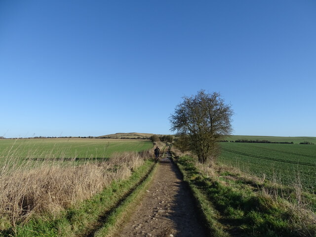
Compton Beauchamp is a small village located in the county of Berkshire, England. Situated approximately 6 miles southwest of the market town of Faringdon, it is nestled within the Vale of White Horse district. The village is surrounded by picturesque countryside, offering stunning views of the rolling hills and farmland that characterizes the area.

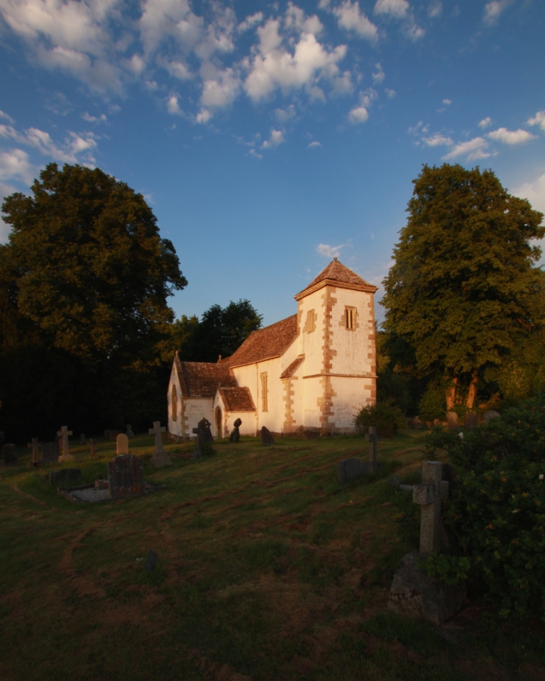
With a population of around 200 residents, Compton Beauchamp is known for its tranquil and rural atmosphere. The village is renowned for its historic charm and features a number of well-preserved thatched cottages and traditional buildings, some dating back to the 16th century. The centerpiece of the village is the Grade I listed parish church, St. Swithun's, which dates back to the 12th century and boasts beautiful stained glass windows.

Compton Beauchamp is also home to a thriving equestrian community, with many residents owning horses and participating in equestrian events and activities. The village is surrounded by bridleways and offers ample opportunities for horse riding and exploring the countryside.

While Compton Beauchamp is primarily a residential area, it benefits from its proximity to nearby towns and cities. The village is conveniently located within easy reach of Faringdon, Wantage, and Swindon, providing residents with access to a range of amenities, including shops, schools, and healthcare facilities.

Overall, Compton Beauchamp offers a serene and idyllic setting for those seeking a peaceful countryside lifestyle, with its historic charm, rural surroundings, and strong sense of community.

If you have any feedback on the listing, please let us know in the comments section below.

Compton Beauchamp Images

Images are sourced within 2km of 51.581655/-1.5973139 or Grid Reference SU2787. Thanks to Geograph Open Source API. All images are credited.

The Ridgeway
The Ridgeway
Footpath to Ridgeway via Dragon Hill
View from Whitehorse Hill car park Looking down the valley from the main car park at Whitehorse Hill.
View from Whitehorse Hill car park
Looking down the valley from the main car park at Whitehorse Hill.
Old and new signs Old and new signs on a post at Whitehorse Hill.

From top to bottom, they read: "THE NATIONAL TRUST
WHITE HORSE HILL".
"THE NATIONAL TRUST
OPEN TO THE PUBLIC
(SUBJECT TO THE BYELAWS
ON THE BACK OF THIS NOTICE)
PLEASE AVOID
LEAVING LITTER
LIGHTING FIRES
DAMAGING TREES
OR PLANTS".
"SHEEP GRAZING
PLEASE KEEP DOGS
ON A LEAD".
"When you're
packing up, pick it up
Help protect nature and wildlife
by taking your litter home".
Old and new signs
Old and new signs on a post at Whitehorse Hill. From top to bottom, they read: "THE NATIONAL TRUST WHITE HORSE HILL". "THE NATIONAL TRUST OPEN TO THE PUBLIC (SUBJECT TO THE BYELAWS ON THE BACK OF THIS NOTICE) PLEASE AVOID LEAVING LITTER LIGHTING FIRES DAMAGING TREES OR PLANTS". "SHEEP GRAZING PLEASE KEEP DOGS ON A LEAD". "When you're packing up, pick it up Help protect nature and wildlife by taking your litter home".
Walking up Whitehorse Hill The unmarked path up Whitehorse Hill from the car park.
Walking up Whitehorse Hill
The unmarked path up Whitehorse Hill from the car park.
Towards The Manger Looking from the footpath up Whitehorse Hill towards The Manger, a hill formation.
Towards The Manger
Looking from the footpath up Whitehorse Hill towards The Manger, a hill formation.
Whitehorse Hill to Woolstone Wells Looking from the footpath up Whitehorse Hill towards Woolstone Wells and beyond.
Whitehorse Hill to Woolstone Wells
Looking from the footpath up Whitehorse Hill towards Woolstone Wells and beyond.
Path up Whitehorse Hill The path appears here as a narrow dirt track, leading up Whitehorse Hill.
Path up Whitehorse Hill
The path appears here as a narrow dirt track, leading up Whitehorse Hill.
Dragonhill Road A single track road up Whitehorse Hill.
Dragonhill Road
A single track road up Whitehorse Hill.
Path up Whitehorse Hill The narrow track leading up Whitehorse Hill, viewed from Dragonhill Road, accessed through a wooden gate.
Path up Whitehorse Hill
The narrow track leading up Whitehorse Hill, viewed from Dragonhill Road, accessed through a wooden gate.
Dragonhill Road A single track road up Whitehorse Hill.
Dragonhill Road
A single track road up Whitehorse Hill.
Towards The Manger Looking from the path up Whitehorse Hill, over Dragonhill Road and towards The Manger and the view beyond.
Towards The Manger
Looking from the path up Whitehorse Hill, over Dragonhill Road and towards The Manger and the view beyond.
Across Whitehorse Hill Looking across Whitehorse Hill towards the National Trust car park.
Across Whitehorse Hill
Looking across Whitehorse Hill towards the National Trust car park.
Looking over The Manger Looking from Whitehorse Hill towards The Manger, a hill formation. The winding road is the B4507.
Looking over The Manger
Looking from Whitehorse Hill towards The Manger, a hill formation. The winding road is the B4507.
Uffington Castle The large grass expanse in the middle of the Iron Age hillfort, at the top of Whitehorse Hill.
Uffington Castle
The large grass expanse in the middle of the Iron Age hillfort, at the top of Whitehorse Hill.
Uffington Castle fort wall The raised ground around the edge of the Iron Age hillfort, at the top of Whitehorse Hill. You can just see some of the buildings in Swindon in the distance.
Uffington Castle fort wall
The raised ground around the edge of the Iron Age hillfort, at the top of Whitehorse Hill. You can just see some of the buildings in Swindon in the distance.
Uffington Castle fort wall The raised ground around the edge of the Iron Age hillfort, at the top of Whitehorse Hill.
Uffington Castle fort wall
The raised ground around the edge of the Iron Age hillfort, at the top of Whitehorse Hill.
The Manger Hill formations at the base of Whitehorse Hill.
The Manger
Hill formations at the base of Whitehorse Hill.
Show me another place!

Compton Beauchamp is located at Grid Ref: SU2787 (Lat: 51.581655, Lng: -1.5973139)

Administrative County: Oxfordshire

District: Vale of White Horse

Police Authority: Thames Valley

What 3 Words

///kick.skillet.tidying. Near Shrivenham, Oxfordshire

Related Wikis

Compton Beauchamp

Compton Beauchamp is a hamlet and civil parish 3 miles (5 km) southeast of Shrivenham in the Vale of White Horse, England. It was part of Berkshire until...

Hardwell Castle

Hardwell Castle or Hardwell Camp is an Iron Age valley fort in the civil parish of Compton Beauchamp in Oxfordshire (previously Berkshire). == Site... ==

Woolstone, Oxfordshire

Woolstone is a village and civil parish about 4+1⁄2 miles (7 km) south of Faringdon in the Vale of White Horse. Woolstone was part of Berkshire until the...
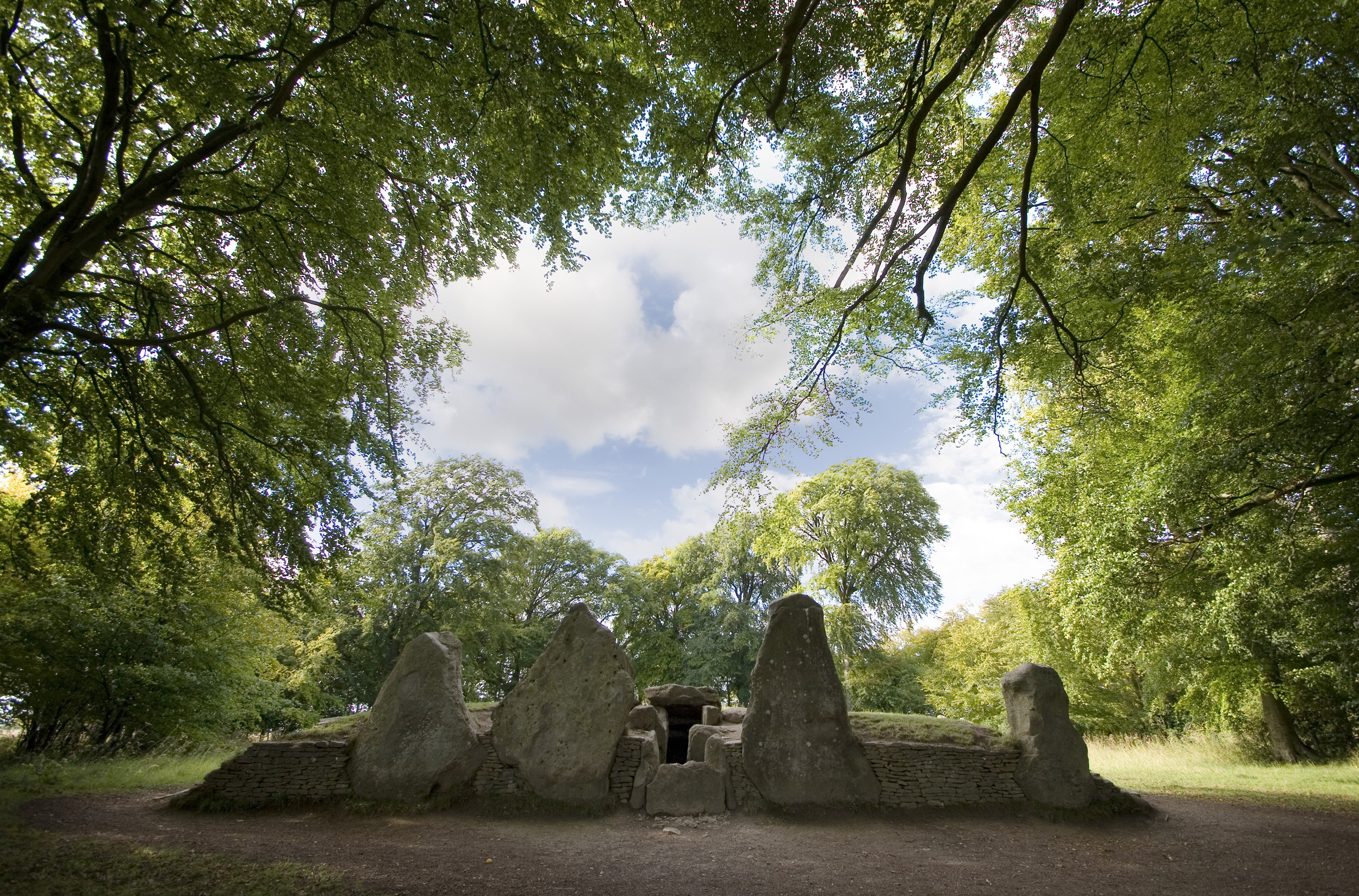
Wayland's Smithy

Wayland's Smithy is an Early Neolithic chambered long barrow located near the village of Ashbury in the south-central English county of Oxfordshire. The...

Nearby Amenities

Located within 500m of 51.581655,-1.5973139
Compton Beauchamp
Place: hamlet
Source: NPE
Lat/Long: 51.5811866/-1.5974554
Knighton
Place: hamlet
Lat/Long: 51.5821965/-1.5936819
Historic: memorial
Memorial: war_memorial
Lat/Long: 51.5794748/-1.5932094
Post Box
Operator: Royal Mail
Post Box Type: lamp
Ref: SN6 391
Royal Cypher: EIIR
Royal Cypher Wikidata: Q33102113
Lat/Long: 51.5827095/-1.6002341
The data included in this document is from www.openstreetmap.org. The data is made available under ODbL.

Have you been to Compton Beauchamp?

Leave your review of Compton Beauchamp below (or comments, questions and feedback).