Coltstone

Settlement in Staffordshire Staffordshire Moorlands

England

Coltstone

The Black Lion, Consall Forge In the heart of the Churnet Valley, with the Churnet Valley Railway line passing between it and the Caldon Canal. The railway station is about 100 yards away.
The Black Lion, Consall Forge Credit: Eirian Evans

Coltstone is a small village located in the county of Staffordshire, England. Situated approximately 8 miles east of Stafford, it is nestled within the picturesque countryside, offering residents and visitors a tranquil and scenic environment.

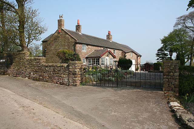
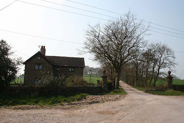
The village has a rich history, dating back to the medieval era when it was known for its agricultural activities. Today, Coltstone retains much of its traditional charm with a mix of well-preserved historical buildings and modern amenities. The local architecture is predominantly characterized by charming cottages made of local stone, giving the village a quintessentially English feel.

Despite its small size, Coltstone offers a range of amenities to cater to the needs of its residents. These include a village hall, a primary school, and a local pub, which serves as a hub for social gatherings and community events. The village hall is often used for various community activities, from fitness classes to art exhibitions.

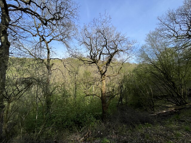
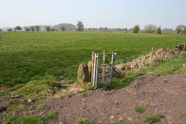
Surrounded by beautiful countryside, Coltstone is a haven for nature lovers and outdoor enthusiasts. The village is located close to several walking and cycling trails, providing ample opportunities to explore the stunning Staffordshire landscape. Additionally, the nearby Cannock Chase, an Area of Outstanding Natural Beauty, offers an array of recreational activities such as hiking, horse riding, and wildlife spotting.

In summary, Coltstone is a charming village in Staffordshire, known for its historical architecture, peaceful ambiance, and access to stunning natural landscapes.

If you have any feedback on the listing, please let us know in the comments section below.
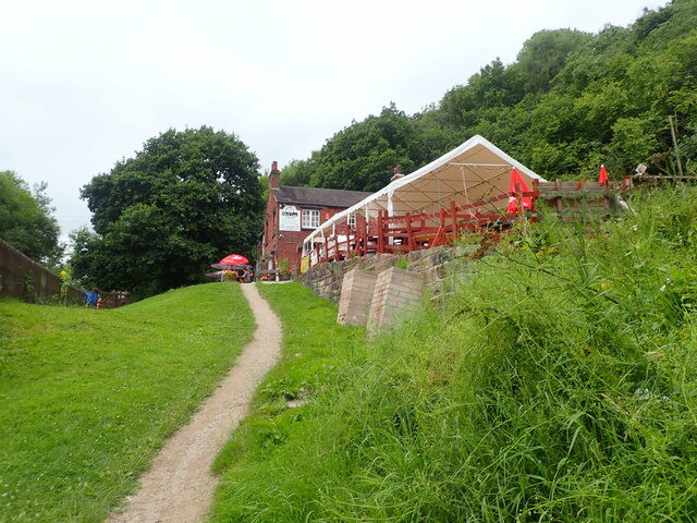
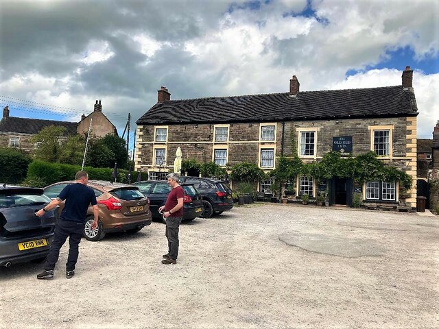
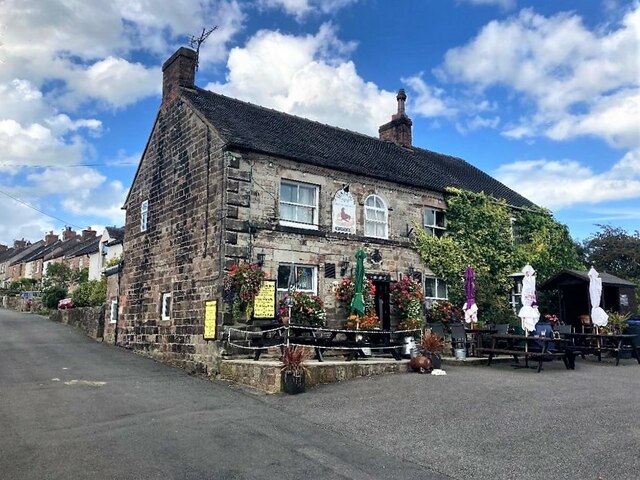
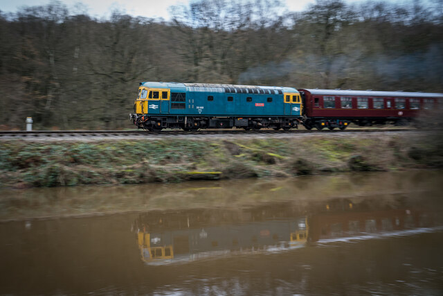
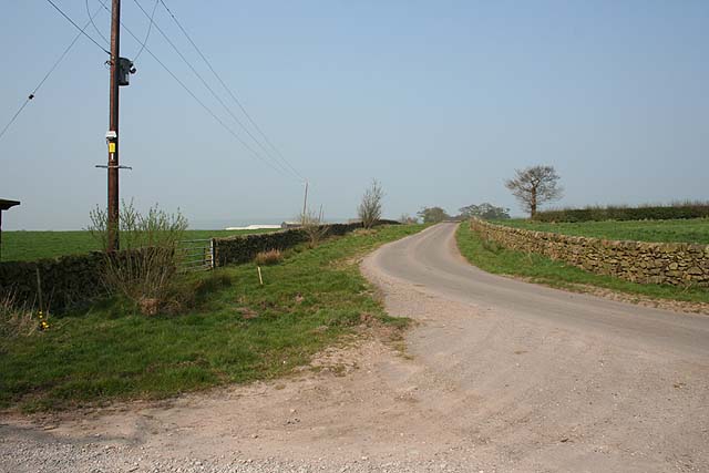
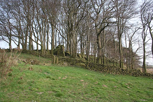
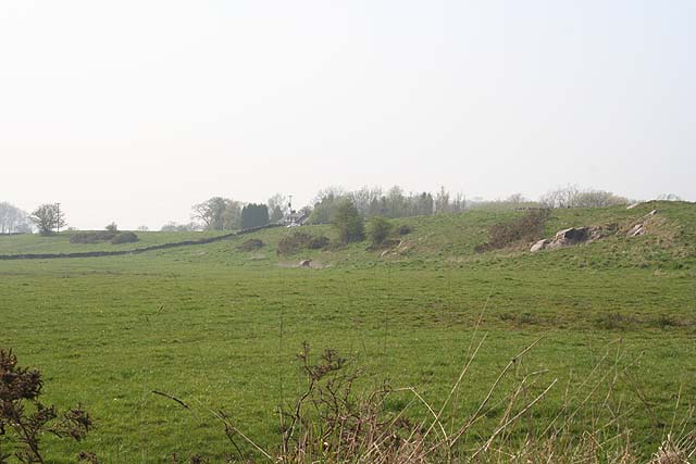
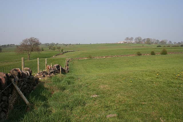
Coltstone Images

Images are sourced within 2km of 53.05128/-1.9787755 or Grid Reference SK0150. Thanks to Geograph Open Source API. All images are credited.

The Black Lion, Consall Forge In the heart of the Churnet Valley, with the Churnet Valley Railway line passing between it and the Caldon Canal. The railway station is about 100 yards away.
The Black Lion, Consall Forge
In the heart of the Churnet Valley, with the Churnet Valley Railway line passing between it and the Caldon Canal. The railway station is about 100 yards away.
Black Lion Inn, Consall Forge In the heart of the Churnet Valley, with the Churnet Valley Railway line (left) passing between it and the Caldon Canal
Black Lion Inn, Consall Forge
In the heart of the Churnet Valley, with the Churnet Valley Railway line (left) passing between it and the Caldon Canal
The Old Red Lion in Ipstones
The Sea Lion Public House, Ipstones Well-appointed pub tucked away in a quiet corner of the village.
The Sea Lion Public House, Ipstones
Well-appointed pub tucked away in a quiet corner of the village.
Diesel Train, Churnet Valley Railway
Footpath into Chase Wood Part of Consall Woodlands, a 479 acre nature reserve.
Footpath into Chase Wood
Part of Consall Woodlands, a 479 acre nature reserve.
Angling on the Churnet A lone angler set up by the river
Angling on the Churnet
A lone angler set up by the river
Consall Woods RSPB reserve Consall Woods is an RSPB Nature Reserve in Staffordshire. 194ha in area, the site was formally an industrial valley, now occupied by mixed woodland and various water features. Link to RSPB website: <span class="nowrap"><a title="https://www.rspb.org.uk/reserves-and-events/reserves-a-z/consall-woods/" rel="nofollow ugc noopener" href="https://www.rspb.org.uk/reserves-and-events/reserves-a-z/consall-woods/">Link</a><img style="margin-left:2px;" alt="External link" title="External link - shift click to open in new window" src="https://s1.geograph.org.uk/img/external.png" width="10" height="10"/></span>
Consall Woods RSPB reserve
Consall Woods is an RSPB Nature Reserve in Staffordshire. 194ha in area, the site was formally an industrial valley, now occupied by mixed woodland and various water features. Link to RSPB website: LinkExternal link
Path through Consall Woods Consall Woods is an RSPB Nature Reserve in Staffordshire. 194ha in area, the site was formally an industrial valley, now occupied by mixed woodland and various water features. Link to RSPB website: <span class="nowrap"><a title="https://www.rspb.org.uk/reserves-and-events/reserves-a-z/consall-woods/" rel="nofollow ugc noopener" href="https://www.rspb.org.uk/reserves-and-events/reserves-a-z/consall-woods/">Link</a><img style="margin-left:2px;" alt="External link" title="External link - shift click to open in new window" src="https://s1.geograph.org.uk/img/external.png" width="10" height="10"/></span>
Path through Consall Woods
Consall Woods is an RSPB Nature Reserve in Staffordshire. 194ha in area, the site was formally an industrial valley, now occupied by mixed woodland and various water features. Link to RSPB website: LinkExternal link
Chase Wood Part of Consall Woods RSPB reserve.
Chase Wood
Part of Consall Woods RSPB reserve.
Ladyedge Nicely converted farmhouse on no-through road.
Ladyedge
Nicely converted farmhouse on no-through road.
Footpath to Summer Hill Little-used footpath cutting a corner on the no-through road to Ladyedge and Brown Edge Farm.
Footpath to Summer Hill
Little-used footpath cutting a corner on the no-through road to Ladyedge and Brown Edge Farm.
Sharpcliffe Lodge At the entrance to the track to Sharpcliffe Hall.
Sharpcliffe Lodge
At the entrance to the track to Sharpcliffe Hall.
Road to Ladyedge From outside Sharpcliffe Lodge on the sharp right-hand bend.
Road to Ladyedge
From outside Sharpcliffe Lodge on the sharp right-hand bend.
Rock outcrop near Sharpcliffe Lodge This unnamed wood contains a number of large outcropping rocks.
Rock outcrop near Sharpcliffe Lodge
This unnamed wood contains a number of large outcropping rocks.
White Chimneys From the B5053; the well marked on the map is just visible as a sedgy patch in the field to the left of this picture. A few rocks outcrop on the bank to the right.
White Chimneys
From the B5053; the well marked on the map is just visible as a sedgy patch in the field to the left of this picture. A few rocks outcrop on the bank to the right.
View to New House Farm Undulating farmland between New House Farm and Ipstones.
View to New House Farm
Undulating farmland between New House Farm and Ipstones.
Redundant gate Nice to see money being spent on rights-of-way but this nearly-new gate struck me as rather a waste of money...
Redundant gate
Nice to see money being spent on rights-of-way but this nearly-new gate struck me as rather a waste of money...
Show me another place!

Coltstone is located at Grid Ref: SK0150 (Lat: 53.05128, Lng: -1.9787755)

Administrative County: Staffordshire

District: Staffordshire Moorlands

Police Authority: Staffordshire

What 3 Words

///rinses.casino.tasteful. Near Cheddleton, Staffordshire

Related Wikis

Above Church

Above Church is a hamlet about 0.6 kilometers (0.4 mi) northwest of Ipstones in the English county of Staffordshire. It is located at grid reference SK016504...

Ipstones

Ipstones is a village and civil parish in the north of the English county of Staffordshire. Ipstones is part of the Staffordshire Moorlands district; within...

Staffordshire Moorlands (UK Parliament constituency)

Staffordshire Moorlands is a constituency represented in the House of Commons of the UK Parliament since 2010 by Karen Bradley, a Conservative who served...

Consall railway station

Consall railway station is a former passenger railway station of the North Staffordshire Railway (NSR) and is now a preserved station on the Churnet Valley...

Coombes Valley RSPB reserve

Coombes Valley RSPB reserve (grid reference SK005525) is a nature reserve, run by the RSPB, near the town of Leek in Staffordshire, England. It is best...

Ipstones railway station

Ipstones railway station was a railway station that served the village of Ipstones, Staffordshire. It was opened by the North Staffordshire Railway (NSR...

Uttoxeter Canal

The Uttoxeter Canal was a thirteen-mile extension of the Caldon Canal running from Froghall as far as Uttoxeter in Staffordshire, England. It was authorised...

Harston Wood

Harston Wood is a nature reserve of the Staffordshire Wildlife Trust. It is an ancient woodland, adjacent to the village of Froghall, near Cheadle, Staffordshire...

Nearby Amenities

Located within 500m of 53.05128,-1.9787755
Barrier: stile
Lat/Long: 53.0540948/-1.9776436
Barrier: stile
Fixme: Does this stile still exist? I didn't remember it.
Lat/Long: 53.0523652/-1.9756214
Barrier: stile
Stile: squeezer
Lat/Long: 53.0519604/-1.975371
Barrier: stile
Source: survey
Stile: squeezer
Lat/Long: 53.0502648/-1.9743573
Barrier: stile
Source: survey
Stile: squeezer
Lat/Long: 53.0508498/-1.972255
Barrier: stile
Stile: squeezer
Lat/Long: 53.0510925/-1.9748232
Barrier: stile
Source: survey
Stile: squeezer
Lat/Long: 53.0516758/-1.9744188
Barrier: entrance
Source: survey;gps
Lat/Long: 53.0489062/-1.9747406
Entrance: main
Source: survey
Lat/Long: 53.0491871/-1.9750314
Slack Memorial
Heritage: 2
Heritage Operator: Historic England
Historic: memorial
Listed Status: Grade II
Lat/Long: 53.0492976/-1.9748614
Fernihough Memorial
Heritage: 2
Heritage Operator: Historic England
Historic: memorial
Listed Status: Grade II
Lat/Long: 53.0493875/-1.9747427
Oulsnam Memorial
Heritage: 2
Heritage Operator: Historic England
Historic: memorial
Listed Status: Grade II
Lat/Long: 53.0494911/-1.9748735
Man Made: survey_point
Source: visual survey;bing
Survey Point: trig_point
Lat/Long: 53.0478969/-1.9780747
Scarratt Memorial
Heritage: 2
Heritage Operator: Historic England
Historic: memorial
Listed Status: Grade II
Lat/Long: 53.0494412/-1.9749768
Power: transformer
Source: survey
Lat/Long: 53.0487535/-1.9756822
Power: transformer
Source: survey
Lat/Long: 53.0485632/-1.9729262
Fixme: Longer than this
Lat/Long: 53.0488768/-1.973059
Barrier: stile
Source: survey
Stile: squeezer
Lat/Long: 53.0488946/-1.9733446
Barrier: stile
Source: survey
Stile: squeezer
Lat/Long: 53.051679/-1.9743283
Barrier: stile
Source: survey
Stile: squeezer
Lat/Long: 53.0477445/-1.9823495
Barrier: stile
Source: survey
Stile: squeezer
Lat/Long: 53.0478119/-1.9817896
Above Church
Place: locality
Source: OS OpenData StreetView
Lat/Long: 53.0506375/-1.977781
Coltstone
Place: locality
Source: OS OpenData StreetView
Lat/Long: 53.0528689/-1.9804847
Ball Memorial
Heritage: 2
Heritage Operator: Historic England
Historic: memorial
Source: survey
Lat/Long: 53.0494254/-1.975059
Prince Memorial
Heritage: 2
Heritage Operator: Historic England
Historic: memorial
Source: estimate
Lat/Long: 53.0494206/-1.9751231
Barrier: stile
Material: stone
Source: survey;gps
Stile: squeezer
Lat/Long: 53.0494792/-1.9733975
Barrier: stile
Steps: 0
Stile: stepover
Lat/Long: 53.0533963/-1.9765107
Fixme: check relationship of both wall and fence here to path. Check number of stiles
Lat/Long: 53.0540749/-1.9776589
Barrier: stile
Steps: 0
Stile: stepover
Lat/Long: 53.0540984/-1.9777408
Barrier: stile
Stile: squeezer
Lat/Long: 53.0484141/-1.9764178
Direction: SSW
Generator Method: photovoltaic
Generator Output Electricity: yes
Generator Solar Modules: 30
Generator Source: solar
Generator Type: solar_photovoltaic_panel
Location: roof
Power: generator
Lat/Long: 53.0487702/-1.9740129
Direction: 150
Maxspeed: national
Traffic Sign: maxspeed
Lat/Long: 53.0489921/-1.9751494
Direction: 330
Maxspeed: 30 mph
Traffic Sign: maxspeed
Lat/Long: 53.048997/-1.9751531
Barrier: bollard
Lat/Long: 53.0489029/-1.9735886
Barrier: bollard
Lat/Long: 53.0488941/-1.97357
Waste Basket
Waste: trash;dog_excrement
Lat/Long: 53.0489327/-1.9735835
The data included in this document is from www.openstreetmap.org. The data is made available under ODbL.

Have you been to Coltstone?

Leave your review of Coltstone below (or comments, questions and feedback).