Coldfall

Settlement in Middlesex

England

Coldfall

QR Tambo Recreation Ground, Durnsford Road Looking towards Alexandra Palace.  This was formerly the Albert Recreation Ground.
QR Tambo Recreation Ground, Durnsford Road Credit: Christine Matthews

Coldfall is a suburban area located in the London borough of Haringey, in the historic county of Middlesex, England. Situated approximately 6 miles north of central London, Coldfall is a predominantly residential neighborhood known for its leafy streets and quiet atmosphere.

The area is characterized by a mix of housing types, including Victorian and Edwardian terraces, as well as more modern developments. Many of these homes are sought-after due to their proximity to green spaces and excellent transport links. Coldfall is bounded by Muswell Hill to the west, Bounds Green to the east, and East Finchley to the north.

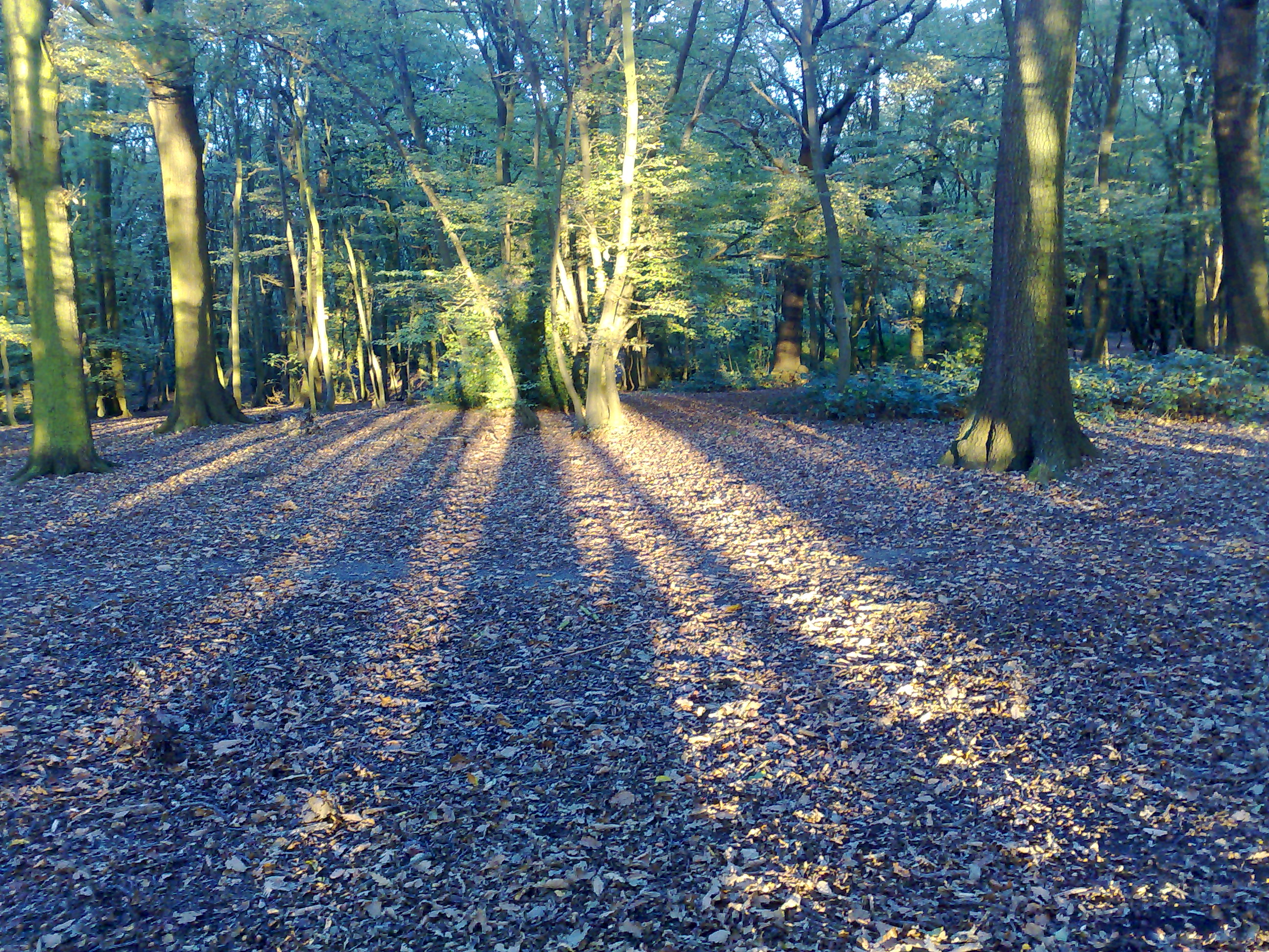
One of the key features of Coldfall is Coldfall Wood, a local nature reserve and ancient woodland. Covering an area of approximately 14 hectares, the wood is a popular destination for residents and visitors alike, offering opportunities for walking, jogging, and exploring nature.

In terms of amenities, Coldfall has a number of local shops, cafes, and restaurants, providing residents with convenient access to everyday necessities. Nearby, Muswell Hill offers a wider range of shopping and dining options, including high street chains and independent boutiques.

The area benefits from excellent transport links, with several bus routes serving the neighborhood and connecting it to nearby underground stations, including East Finchley and Bounds Green. Coldfall is also within easy reach of major road networks, such as the North Circular and A1, providing convenient access to other parts of London and beyond.

If you have any feedback on the listing, please let us know in the comments section below.
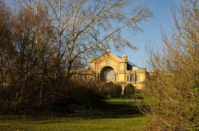
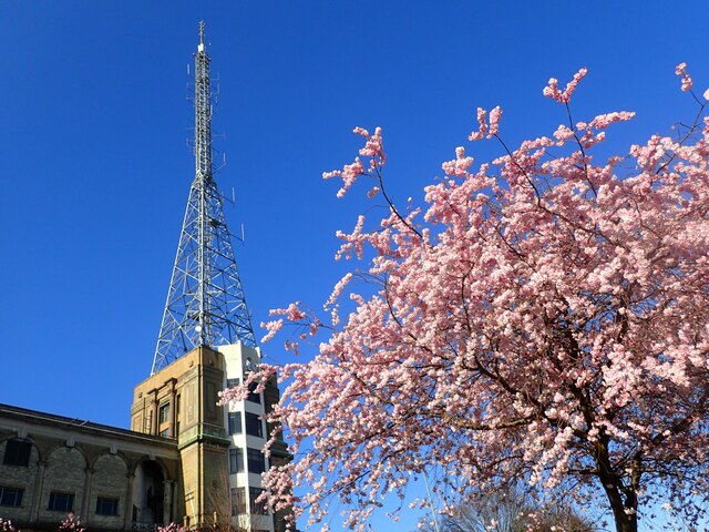
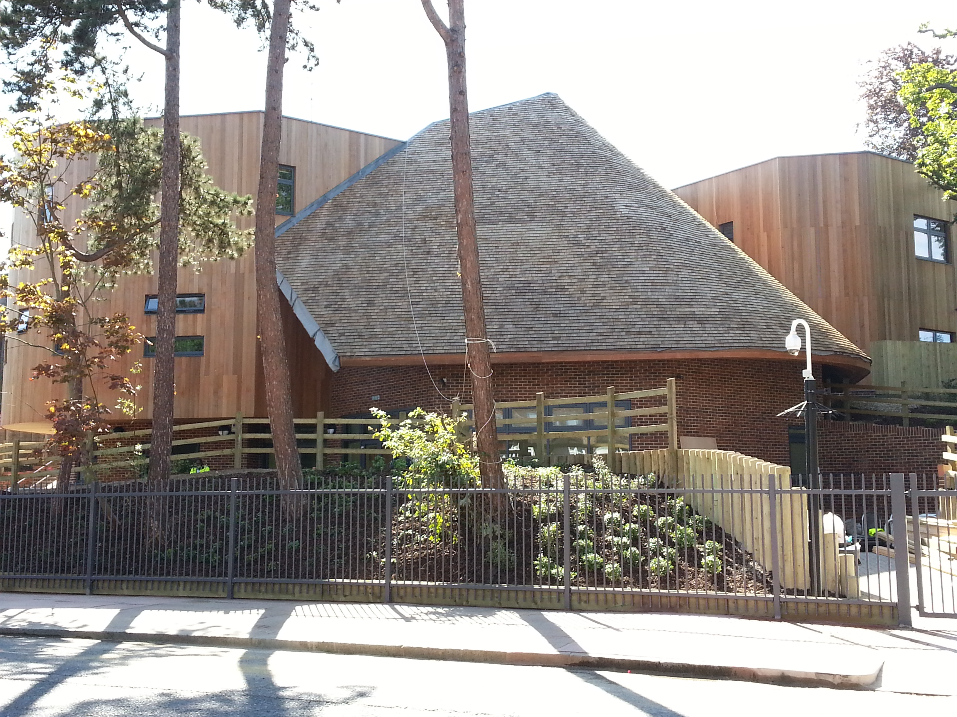
Coldfall Images

Images are sourced within 2km of 51.595129/-0.15612783 or Grid Reference TQ2790. Thanks to Geograph Open Source API. All images are credited.

QR Tambo Recreation Ground, Durnsford Road Looking towards Alexandra Palace.  This was formerly the Albert Recreation Ground.
QR Tambo Recreation Ground, Durnsford Road
Looking towards Alexandra Palace. This was formerly the Albert Recreation Ground.
QR Tambo Recreation Ground, Durnsford Road Access via footpath from Durnsford Road.
QR Tambo Recreation Ground, Durnsford Road
Access via footpath from Durnsford Road.
East Finchley : St Mary's Catholic Church "The church replaced a WW2 damaged church and was built by Westmore and Sanders in collaboration with Mrs G. M. Reeves in 1953." - <span class="nowrap"><a title="https://londonchurchbuildings.com/2017/04/21/st-mary-high-road-east-finchley-roman-catholic/" rel="nofollow ugc noopener" href="https://londonchurchbuildings.com/2017/04/21/st-mary-high-road-east-finchley-roman-catholic/">Link</a><img style="margin-left:2px;" alt="External link" title="External link - shift click to open in new window" src="https://s1.geograph.org.uk/img/external.png" width="10" height="10"/></span>. See also this <span class="nowrap"><a title="https://taking-stock.org.uk/building/finchley-east-st-mary/" rel="nofollow ugc noopener" href="https://taking-stock.org.uk/building/finchley-east-st-mary/">Link</a><img style="margin-left:2px;" alt="External link" title="External link - shift click to open in new window" src="https://s1.geograph.org.uk/img/external.png" width="10" height="10"/></span>.
East Finchley : St Mary's Catholic Church
"The church replaced a WW2 damaged church and was built by Westmore and Sanders in collaboration with Mrs G. M. Reeves in 1953." - LinkExternal link. See also this LinkExternal link.
East Finchley : cemetery angels Statuary at the Islington and St Pancras Cemetery.
East Finchley : cemetery angels
Statuary at the Islington and St Pancras Cemetery.
East Finchley : Payne Mausoleum "A classical mausoleum built of large rough-hewn blocks of stone the gargantuan style of which is in strong contrast to the intricate foliate carving in the pediment and detail of the smooth-columned Doric porch." - <span class="nowrap"><a title="https://mmtrust.org.uk/view.php?name=212" rel="nofollow ugc noopener" href="https://mmtrust.org.uk/view.php?name=212">Link</a><img style="margin-left:2px;" alt="External link" title="External link - shift click to open in new window" src="https://s1.geograph.org.uk/img/external.png" width="10" height="10"/></span>. Location: Islington and St Pancras Cemetery
East Finchley : Payne Mausoleum
"A classical mausoleum built of large rough-hewn blocks of stone the gargantuan style of which is in strong contrast to the intricate foliate carving in the pediment and detail of the smooth-columned Doric porch." - LinkExternal link. Location: Islington and St Pancras Cemetery
East Finchley : White Mausoleum "A Gothic Revival chapel built largely of Portland stone with an openwork iron door. The arcade of small pink granite colonettes, which runs all round the building, provides a series of spaces suitable for commemorative inscriptions ..." - <span class="nowrap"><a title="https://mmtrust.org.uk/view.php?name=204" rel="nofollow ugc noopener" href="https://mmtrust.org.uk/view.php?name=204">Link</a><img style="margin-left:2px;" alt="External link" title="External link - shift click to open in new window" src="https://s1.geograph.org.uk/img/external.png" width="10" height="10"/></span>. Location : Islington and St Pancras Cemetery
East Finchley : White Mausoleum
"A Gothic Revival chapel built largely of Portland stone with an openwork iron door. The arcade of small pink granite colonettes, which runs all round the building, provides a series of spaces suitable for commemorative inscriptions ..." - LinkExternal link. Location : Islington and St Pancras Cemetery
East Finchley : Ball Mausoleum "A small classical temple with pink granite columns at each corner, an oculus in the pediment and openwork iron door." - <span class="nowrap"><a title="https://mmtrust.org.uk/view.php?name=205" rel="nofollow ugc noopener" href="https://mmtrust.org.uk/view.php?name=205">Link</a><img style="margin-left:2px;" alt="External link" title="External link - shift click to open in new window" src="https://s1.geograph.org.uk/img/external.png" width="10" height="10"/></span>. Location : Islington and St Pancras Cemetery
East Finchley : Ball Mausoleum
"A small classical temple with pink granite columns at each corner, an oculus in the pediment and openwork iron door." - LinkExternal link. Location : Islington and St Pancras Cemetery
East Finchley : Commonwealth war graves and memorial Location : Islington and St Pancras Cemetery
East Finchley : Commonwealth war graves and memorial
Location : Islington and St Pancras Cemetery
East Finchley : Saunders Mausoleum Location : Islington and St Pancras Cemetery
East Finchley : Saunders Mausoleum
Location : Islington and St Pancras Cemetery
East Finchley : cemetery chapel Grade II listed chapel, St Pancras Cemetery - "The St Pancras Anglican chapel (listed grade II) lies at the centre of the semicircular drive which links the entrance and exit to the cemetery, c 250m north-east of the entrance. It was built in 1853 by John Barnett and William C Birch in a cruciform design, with decorated windows in Gothic style and a central octagonal crossing tower and spire. It was used by both St Pancras and Islington until 1896, when the Islington chapel was built." - <span class="nowrap"><a title="https://historicengland.org.uk/listing/the-list/list-entry/1001688?section=official-listing" rel="nofollow ugc noopener" href="https://historicengland.org.uk/listing/the-list/list-entry/1001688?section=official-listing">Link</a><img style="margin-left:2px;" alt="External link" title="External link - shift click to open in new window" src="https://s1.geograph.org.uk/img/external.png" width="10" height="10"/></span>.
East Finchley : cemetery chapel
Grade II listed chapel, St Pancras Cemetery - "The St Pancras Anglican chapel (listed grade II) lies at the centre of the semicircular drive which links the entrance and exit to the cemetery, c 250m north-east of the entrance. It was built in 1853 by John Barnett and William C Birch in a cruciform design, with decorated windows in Gothic style and a central octagonal crossing tower and spire. It was used by both St Pancras and Islington until 1896, when the Islington chapel was built." - LinkExternal link.
East Finchley : Bardet Mausoleum Location : Islington and St Pancras Cemetery
East Finchley : Bardet Mausoleum
Location : Islington and St Pancras Cemetery
Muswell Hill : Alexandra Palace
Blossom at Alexandra Park Alexandra Park is the former commercial pleasure grounds of the Alexandra Palace. The Alexandra Palace was erected by the Alexandra Park Company between 1864 and 1873. It was designed to serve as a public centre of recreation, education and entertainment and as North London's counterpart to The Crystal Palace. Sixteen days after the public opening ceremony the Palace caught fire and was destroyed. The owners immediately began construction again and the Palace was rebuilt within two years. In July 1980, this building was again almost destroyed by fire but has since been largely restored again. In 1936 the palace became the home of the world's first regular public high-definition television service, operated by the BBC. Alexandra Palace continued to be used by the BBC for many years and its radio and television mast is still in use. For a full history see <span class="nowrap"><a title="http://en.wikipedia.org/wiki/Alexandra_Palace" rel="nofollow ugc noopener" href="http://en.wikipedia.org/wiki/Alexandra_Palace">Link</a><img style="margin-left:2px;" alt="External link" title="External link - shift click to open in new window" src="https://s1.geograph.org.uk/img/external.png" width="10" height="10"/></span>

Alexandra Palace and Park were purchased "for the free use of the people for ever" in 1900 by a consortium of local authorities led by Hornsey Urban District Council. An Act of Parliament in that year created the Alexandra Palace and Park Trust. The Park and Palace are named after Queen Alexandra, the wife of King Edward VIIth. Ownership passed to the London Borough of Haringey in 1980. 

As seen here, one of the great attractions is the tremendous views to the south and east, stretching down towards the Thames Estuary, as well as to Kent and Essex. The towers of the City of London and Canary Wharf are also usually clearly seen.
Blossom at Alexandra Park
Alexandra Park is the former commercial pleasure grounds of the Alexandra Palace. The Alexandra Palace was erected by the Alexandra Park Company between 1864 and 1873. It was designed to serve as a public centre of recreation, education and entertainment and as North London's counterpart to The Crystal Palace. Sixteen days after the public opening ceremony the Palace caught fire and was destroyed. The owners immediately began construction again and the Palace was rebuilt within two years. In July 1980, this building was again almost destroyed by fire but has since been largely restored again. In 1936 the palace became the home of the world's first regular public high-definition television service, operated by the BBC. Alexandra Palace continued to be used by the BBC for many years and its radio and television mast is still in use. For a full history see LinkExternal link Alexandra Palace and Park were purchased "for the free use of the people for ever" in 1900 by a consortium of local authorities led by Hornsey Urban District Council. An Act of Parliament in that year created the Alexandra Palace and Park Trust. The Park and Palace are named after Queen Alexandra, the wife of King Edward VIIth. Ownership passed to the London Borough of Haringey in 1980. As seen here, one of the great attractions is the tremendous views to the south and east, stretching down towards the Thames Estuary, as well as to Kent and Essex. The towers of the City of London and Canary Wharf are also usually clearly seen.
View from Alexandra Park Alexandra Park is the former commercial pleasure grounds of the Alexandra Palace. The Alexandra Palace was erected by the Alexandra Park Company between 1864 and 1873. It was designed to serve as a public centre of recreation, education and entertainment and as North London's counterpart to The Crystal Palace. Sixteen days after the public opening ceremony the Palace caught fire and was destroyed. The owners immediately began construction again and the Palace was rebuilt within two years. In July 1980, this building was again almost destroyed by fire but has since been largely restored again. In 1936 the palace became the home of the world's first regular public high-definition television service, operated by the BBC. Alexandra Palace continued to be used by the BBC for many years and its radio and television mast is still in use. For a full history see <span class="nowrap"><a title="http://en.wikipedia.org/wiki/Alexandra_Palace" rel="nofollow ugc noopener" href="http://en.wikipedia.org/wiki/Alexandra_Palace">Link</a><img style="margin-left:2px;" alt="External link" title="External link - shift click to open in new window" src="https://s1.geograph.org.uk/img/external.png" width="10" height="10"/></span>

Alexandra Palace and Park were purchased "for the free use of the people for ever" in 1900 by a consortium of local authorities led by Hornsey Urban District Council. An Act of Parliament in that year created the Alexandra Palace and Park Trust. The Park and Palace are named after Queen Alexandra, the wife of King Edward VIIth. Ownership passed to the London Borough of Haringey in 1980. 

As seen here, one of the great attractions is the tremendous views to the south and east, stretching down towards the Thames Estuary, as well as to Kent and Essex. The towers of Canary Wharf are clearly seen here right of centre while Shooters Hill is to the left of these. The City of London is just on the edge of the right hand horizon.
View from Alexandra Park
Alexandra Park is the former commercial pleasure grounds of the Alexandra Palace. The Alexandra Palace was erected by the Alexandra Park Company between 1864 and 1873. It was designed to serve as a public centre of recreation, education and entertainment and as North London's counterpart to The Crystal Palace. Sixteen days after the public opening ceremony the Palace caught fire and was destroyed. The owners immediately began construction again and the Palace was rebuilt within two years. In July 1980, this building was again almost destroyed by fire but has since been largely restored again. In 1936 the palace became the home of the world's first regular public high-definition television service, operated by the BBC. Alexandra Palace continued to be used by the BBC for many years and its radio and television mast is still in use. For a full history see LinkExternal link Alexandra Palace and Park were purchased "for the free use of the people for ever" in 1900 by a consortium of local authorities led by Hornsey Urban District Council. An Act of Parliament in that year created the Alexandra Palace and Park Trust. The Park and Palace are named after Queen Alexandra, the wife of King Edward VIIth. Ownership passed to the London Borough of Haringey in 1980. As seen here, one of the great attractions is the tremendous views to the south and east, stretching down towards the Thames Estuary, as well as to Kent and Essex. The towers of Canary Wharf are clearly seen here right of centre while Shooters Hill is to the left of these. The City of London is just on the edge of the right hand horizon.
Blossom in Alexandra Park Alexandra Park is the former commercial pleasure grounds of the Alexandra Palace. The Alexandra Palace was erected by the Alexandra Park Company between 1864 and 1873. It was designed to serve as a public centre of recreation, education and entertainment and as North London's counterpart to The Crystal Palace. Sixteen days after the public opening ceremony the Palace caught fire and was destroyed. The owners immediately began construction again and the Palace was rebuilt within two years. In July 1980, this building was again almost destroyed by fire but has since been largely restored again. In 1936 the palace became the home of the world's first regular public high-definition television service, operated by the BBC. Alexandra Palace continued to be used by the BBC for many years and its radio and television mast is still in use. For a full history see <span class="nowrap"><a title="http://en.wikipedia.org/wiki/Alexandra_Palace" rel="nofollow ugc noopener" href="http://en.wikipedia.org/wiki/Alexandra_Palace">Link</a><img style="margin-left:2px;" alt="External link" title="External link - shift click to open in new window" src="https://s1.geograph.org.uk/img/external.png" width="10" height="10"/></span>

Alexandra Palace and Park were purchased "for the free use of the people for ever" in 1900 by a consortium of local authorities led by Hornsey Urban District Council. An Act of Parliament in that year created the Alexandra Palace and Park Trust. The Park and Palace are named after Queen Alexandra, the wife of King Edward VIIth. Ownership passed to the London Borough of Haringey in 1980. 

One of the great attractions is the tremendous views to the south and east, stretching down towards the Thames Estuary, as well as to Kent and Essex - see <a title="https://www.geograph.org.uk/photo/7123478" href="https://www.geograph.org.uk/photo/7123478">Link</a> The towers of the City of London and Canary Wharf are also usually clearly seen.
Blossom in Alexandra Park
Alexandra Park is the former commercial pleasure grounds of the Alexandra Palace. The Alexandra Palace was erected by the Alexandra Park Company between 1864 and 1873. It was designed to serve as a public centre of recreation, education and entertainment and as North London's counterpart to The Crystal Palace. Sixteen days after the public opening ceremony the Palace caught fire and was destroyed. The owners immediately began construction again and the Palace was rebuilt within two years. In July 1980, this building was again almost destroyed by fire but has since been largely restored again. In 1936 the palace became the home of the world's first regular public high-definition television service, operated by the BBC. Alexandra Palace continued to be used by the BBC for many years and its radio and television mast is still in use. For a full history see LinkExternal link Alexandra Palace and Park were purchased "for the free use of the people for ever" in 1900 by a consortium of local authorities led by Hornsey Urban District Council. An Act of Parliament in that year created the Alexandra Palace and Park Trust. The Park and Palace are named after Queen Alexandra, the wife of King Edward VIIth. Ownership passed to the London Borough of Haringey in 1980. One of the great attractions is the tremendous views to the south and east, stretching down towards the Thames Estuary, as well as to Kent and Essex - see Link The towers of the City of London and Canary Wharf are also usually clearly seen.
Daffodils and blossom in Alexandra Park Alexandra Park is the former commercial pleasure grounds of the Alexandra Palace. The Alexandra Palace was erected by the Alexandra Park Company between 1864 and 1873. It was designed to serve as a public centre of recreation, education and entertainment and as North London's counterpart to The Crystal Palace. Sixteen days after the public opening ceremony the Palace caught fire and was destroyed. The owners immediately began construction again and the Palace was rebuilt within two years. In July 1980, this building was again almost destroyed by fire but has since been largely restored again. In 1936 the palace became the home of the world's first regular public high-definition television service, operated by the BBC. Alexandra Palace continued to be used by the BBC for many years and its radio and television mast is still in use. For a full history see <span class="nowrap"><a title="http://en.wikipedia.org/wiki/Alexandra_Palace" rel="nofollow ugc noopener" href="http://en.wikipedia.org/wiki/Alexandra_Palace">Link</a><img style="margin-left:2px;" alt="External link" title="External link - shift click to open in new window" src="https://s1.geograph.org.uk/img/external.png" width="10" height="10"/></span>

Alexandra Palace and Park were purchased "for the free use of the people for ever" in 1900 by a consortium of local authorities led by Hornsey Urban District Council. An Act of Parliament in that year created the Alexandra Palace and Park Trust. The Park and Palace are named after Queen Alexandra, the wife of King Edward VIIth. Ownership passed to the London Borough of Haringey in 1980. 

One of the great attractions is the tremendous views to the south and east, stretching down towards the Thames Estuary, as well as to Kent and Essex - see <a title="https://www.geograph.org.uk/photo/7123478" href="https://www.geograph.org.uk/photo/7123478">Link</a> The towers of the City of London and Canary Wharf are also usually clearly seen.

This view is from in front of the Palace looking across South Terrace.
Daffodils and blossom in Alexandra Park
Alexandra Park is the former commercial pleasure grounds of the Alexandra Palace. The Alexandra Palace was erected by the Alexandra Park Company between 1864 and 1873. It was designed to serve as a public centre of recreation, education and entertainment and as North London's counterpart to The Crystal Palace. Sixteen days after the public opening ceremony the Palace caught fire and was destroyed. The owners immediately began construction again and the Palace was rebuilt within two years. In July 1980, this building was again almost destroyed by fire but has since been largely restored again. In 1936 the palace became the home of the world's first regular public high-definition television service, operated by the BBC. Alexandra Palace continued to be used by the BBC for many years and its radio and television mast is still in use. For a full history see LinkExternal link Alexandra Palace and Park were purchased "for the free use of the people for ever" in 1900 by a consortium of local authorities led by Hornsey Urban District Council. An Act of Parliament in that year created the Alexandra Palace and Park Trust. The Park and Palace are named after Queen Alexandra, the wife of King Edward VIIth. Ownership passed to the London Borough of Haringey in 1980. One of the great attractions is the tremendous views to the south and east, stretching down towards the Thames Estuary, as well as to Kent and Essex - see Link The towers of the City of London and Canary Wharf are also usually clearly seen. This view is from in front of the Palace looking across South Terrace.
The mast at Alexandra Palace Alexandra Park is the former commercial pleasure grounds of the Alexandra Palace. The Alexandra Palace was erected by the Alexandra Park Company between 1864 and 1873. It was designed to serve as a public centre of recreation, education and entertainment and as North London's counterpart to The Crystal Palace. Sixteen days after the public opening ceremony the Palace caught fire and was destroyed. The owners immediately began construction again and the Palace was rebuilt within two years. In July 1980, this building was again almost destroyed by fire but has since been largely restored again. In 1936 the palace became the home of the world's first regular public high-definition television service, operated by the BBC. Alexandra Palace continued to be used by the BBC for many years and its radio and television mast is still in use. For a full history see <span class="nowrap"><a title="http://en.wikipedia.org/wiki/Alexandra_Palace" rel="nofollow ugc noopener" href="http://en.wikipedia.org/wiki/Alexandra_Palace">Link</a><img style="margin-left:2px;" alt="External link" title="External link - shift click to open in new window" src="https://s1.geograph.org.uk/img/external.png" width="10" height="10"/></span>

Alexandra Palace and Park were purchased "for the free use of the people for ever" in 1900 by a consortium of local authorities led by Hornsey Urban District Council. An Act of Parliament in that year created the Alexandra Palace and Park Trust. The Park and Palace are named after Queen Alexandra, the wife of King Edward VIIth. Ownership passed to the London Borough of Haringey in 1980. 

One of the great attractions is the tremendous views to the south and east, stretching down towards the Thames Estuary, as well as to Kent and Essex - see <a title="https://www.geograph.org.uk/photo/7123478" href="https://www.geograph.org.uk/photo/7123478">Link</a> The towers of the City of London and Canary Wharf are also usually clearly seen.

In 1936, Alexandra Palace became the home of the BBC's first regular public television service. After the war, Alexandra Palace continued to be used by the BBC for many years and its radio and television mast is still in use. It is a prominent landmark.
The mast at Alexandra Palace
Alexandra Park is the former commercial pleasure grounds of the Alexandra Palace. The Alexandra Palace was erected by the Alexandra Park Company between 1864 and 1873. It was designed to serve as a public centre of recreation, education and entertainment and as North London's counterpart to The Crystal Palace. Sixteen days after the public opening ceremony the Palace caught fire and was destroyed. The owners immediately began construction again and the Palace was rebuilt within two years. In July 1980, this building was again almost destroyed by fire but has since been largely restored again. In 1936 the palace became the home of the world's first regular public high-definition television service, operated by the BBC. Alexandra Palace continued to be used by the BBC for many years and its radio and television mast is still in use. For a full history see LinkExternal link Alexandra Palace and Park were purchased "for the free use of the people for ever" in 1900 by a consortium of local authorities led by Hornsey Urban District Council. An Act of Parliament in that year created the Alexandra Palace and Park Trust. The Park and Palace are named after Queen Alexandra, the wife of King Edward VIIth. Ownership passed to the London Borough of Haringey in 1980. One of the great attractions is the tremendous views to the south and east, stretching down towards the Thames Estuary, as well as to Kent and Essex - see Link The towers of the City of London and Canary Wharf are also usually clearly seen. In 1936, Alexandra Palace became the home of the BBC's first regular public television service. After the war, Alexandra Palace continued to be used by the BBC for many years and its radio and television mast is still in use. It is a prominent landmark.
Show me another place!

Coldfall is located at Grid Ref: TQ2790 (Lat: 51.595129, Lng: -0.15612783)

Unitary Authority: Haringey

Police Authority: Metropolitan

What 3 Words

///pens.sleeps.rivers. Near Wood Green, London

Nearby Locations

Coldfall Wood Coldfall

Related Wikis

Eden Primary School, Muswell Hill

Eden Primary School is a cross-communal Jewish Primary school or Jewish day school in Muswell Hill, in the borough of Haringey, North London, UK, catering...

Coldfall Wood

Coldfall Wood is an ancient woodland in Muswell Hill, North London. It covers an area of approximately 14 hectares (35 acres) and is surrounded by St Pancras...

Tollington School

Tollington School (1901-1967) was a selective, coeducational grammar school in Muswell Hill, London, England. For the present school on this site, see...
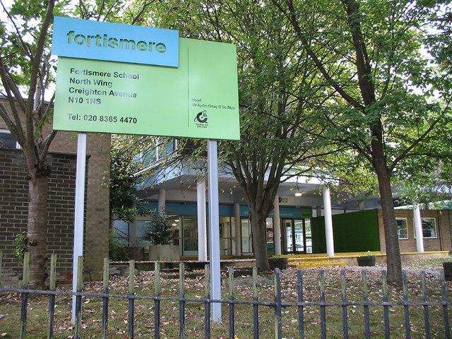
Fortismere School

Fortismere School (simply referred to as Fortismere) is an 11–18 mixed, foundation secondary school and sixth form in Muswell Hill, Greater London, England...

Nearby Amenities

Located within 500m of 51.595129,-0.15612783
Ref GB Tflcid: RWG288908
Traffic Calming: table
Lat/Long: 51.5978154/-0.1532989
Ref GB Tflcid: RWG288928
Traffic Calming: table
Lat/Long: 51.5976288/-0.1546292
Ref GB Tflcid: RWG288676
Traffic Calming: hump
Lat/Long: 51.5974835/-0.1559098
Bus Stop
Everington Road
Bench: no
Bin: yes
Lit: yes
Naptan AtcoCode: 490006663Z
Public Transport: platform
Ref: 92138
Shelter: no
Tactile Paving: no
Lat/Long: 51.5982281/-0.1522022
Bus Stop
Midhurst Avenue
Bench: yes
Bin: no
Lit: yes
Naptan AtcoCode: 490006947W
Naptan Bearing: N
Naptan CommonName: Midhurst Avenue
Naptan Verified: no
Public Transport: platform
Ref: 74640
Shelter: yes
Tactile Paving: no
Lat/Long: 51.5909142/-0.1536122
Bus Stop
Everington Road
Bench: no
Bin: no
Lit: yes
Naptan AtcoCode: 490006663Y
Public Transport: platform
Ref: 92137
Shelter: yes
Tactile Paving: no
Lat/Long: 51.5983681/-0.1521026
Mini Roundabout
Direction: clockwise
Lat/Long: 51.5950828/-0.1580733
Mini Roundabout
Lat/Long: 51.5944483/-0.1503814
Mini Roundabout
Direction: clockwise
Lat/Long: 51.5954963/-0.1507204
Ref GB Tflcid: RWG288906
Traffic Calming: table
Lat/Long: 51.5970666/-0.1512187
Information: map
Tourism: information
Lat/Long: 51.5951308/-0.1586123
Restaurant
Indian Rasoi
Addr City: London
Addr Country: GB
Addr Housename: Denmark Terrace
Addr Postcode: N2 9HG
Addr Street: Fortis Green
Addr Unit: 7
Cuisine: indian
Fhrs Id: 422035
Opening Hours: Tu-Sa 12:00-15:00,17:00-23:00; Su 12:00-15:00,17:00-22:30
Phone: +44 20 8883 9093
Website: https://www.indian-rasoi.co.uk
Lat/Long: 51.5907922/-0.15579
Post Box
Check Date: 2021-05-16
Collection Times: Mo-Fr 09:00, Sa 07:00
Operator: Royal Mail
Operator Wikidata: Q638098
Post Box Type: pillar
Ref: N10 3
Royal Cypher: EVIIR
Royal Cypher Wikidata: Q33102324
Lat/Long: 51.5973684/-0.1516326
Post Box
Check Date: 2021-05-23
Collection Times: Mo-Fr 09:00, Sa 07:00
Operator: Royal Mail
Operator Wikidata: Q638098
Post Box Type: pillar
Ref: N10 30D
Royal Cypher: GR
Royal Cypher Wikidata: Q33102273
Lat/Long: 51.5974404/-0.1559192
Entrance: yes
Lat/Long: 51.5982142/-0.1515842
Board Type: nature
Information: board
Tourism: information
Lat/Long: 51.5951155/-0.1586027
Midhurst Avenue
Bus: yes
Public Transport: stop_position
Lat/Long: 51.5909899/-0.1536409
Fortis Green
Is In: London Borough of Haringey
Place: neighbourhood
Wikidata: Q3748789
Wikipedia: en:Fortis Green
Lat/Long: 51.5910863/-0.1533604
Bus Stop
Creighton Avenue
Bench: no
Bin: no
Lit: yes
Naptan AtcoCode: 490000428Z
Public Transport: platform
Ref: 92140
Shelter: no
Tactile Paving: no
Lat/Long: 51.5961376/-0.1510334
Bus Stop
Creighton Avenue
Bench: no
Bin: no
Lit: yes
Naptan AtcoCode: 490000428Y
Public Transport: platform
Ref: 92139
Shelter: no
Tactile Paving: no
Lat/Long: 51.5958597/-0.1507461
Crossing
Crossing: unmarked
Crossing Island: yes
Crossing Markings: no
Tactile Paving: yes
Traffic Calming: table
Lat/Long: 51.5951317/-0.1555835
Crossing
Crossing: unmarked
Crossing Island: yes
Crossing Markings: no
Tactile Paving: no
Lat/Long: 51.5950463/-0.1585696
Addr Housenumber: 88
Addr Street: Hertford Road
Lat/Long: 51.5936504/-0.16243
Addr Housenumber: 92
Addr Street: Hertford Road
Lat/Long: 51.5936808/-0.1622201
Addr Housenumber: 100
Addr Street: Hertford Road
Lat/Long: 51.5937458/-0.161862
GMS Joinery
Craft: joiner
Website: https://gmsjoinery.co.uk
Lat/Long: 51.5908582/-0.1556235
Number Four Clocks and Watches
Craft: clockmaker
Lat/Long: 51.5908382/-0.1553996
Restaurant
Hing Takeaway
Cuisine: chinese
Lat/Long: 51.5908507/-0.1553298
Kimberley's Salon
Shop: hairdresser
Lat/Long: 51.5908557/-0.1552655
Leverton's Funeral Directors
Opening Hours: Mo-Fr 09:00-17:00
Shop: funeral_directors
Website: https://www.levertons.co.uk/branch/muswell-hill
Wheelchair: yes
Lat/Long: 51.5908641/-0.1551917
Post Box
Collection Times: Mo-Fr 09:00, Sa 07:00
Operator: Royal Mail
Operator Wikidata: Q638098
Post Box Type: pillar
Ref: N2 20D
Royal Cypher: GR
Royal Cypher Wikidata: Q33102273
Lat/Long: 51.5909395/-0.1537401
Restaurant
bund
Addr City: London
Addr Country: GB
Addr Housename: Cheapside
Addr Postcode: N2 9HP
Addr Street: Fortis Green
Addr Unit: 4,5
Cuisine: asian
Fhrs Id: 1224010
Opening Hours: Th-Su 17:00-22:00
Phone: +44 20 8365 2643
Website: https://bundrestaurant.co.uk
Wheelchair: limited
Lat/Long: 51.5908797/-0.1537565
A. J. L. Domestic Appliances
Shop: appliance
Lat/Long: 51.5908625/-0.1538984
Power: substation
Lat/Long: 51.5916553/-0.1592903
Crossing
Crossing: zebra
Crossing Island: yes
Crossing Markings: zebra
Crossing Ref: zebra
Tactile Paving: yes
Traffic Calming: table
Lat/Long: 51.5954743/-0.1508829
Crossing
Crossing: zebra
Crossing Island: no
Crossing Markings: zebra
Crossing Ref: zebra
Tactile Paving: yes
Lat/Long: 51.5971805/-0.1512572
Grit Bin
Lat/Long: 51.5970581/-0.1511206
Post Box
Collection Times: Mo-Fr 09:00, Sa 07:00
Operator: Royal Mail
Operator Wikidata: Q638098
Post Box Type: pillar
Ref: N10 19D
Royal Cypher: EVIIR
Royal Cypher Wikidata: Q33102324
Lat/Long: 51.5941752/-0.1502719
Croft's Tiles
Opening Hours: Mo-Fr 09:00-14:00; Sa 10:00-14:00
Shop: tiles
Wheelchair: limited
Lat/Long: 51.5944018/-0.1500792
Post Box
Collection Times: Mo-Fr 09:00, Sa 07:00
Ref: N2 29D
Royal Cypher: GR
Royal Cypher Wikidata: Q33102273
Lat/Long: 51.5921839/-0.156853
Power: substation
Lat/Long: 51.5909662/-0.1568791
Waste Basket
Description: Mixed recycling, general waste and dog waste accepted
Lat/Long: 51.5972519/-0.1565201
Bench
Backrest: no
Material: wood
Lat/Long: 51.5977053/-0.1615034
Bench
Backrest: no
Material: wood
Lat/Long: 51.595652/-0.1594952
Bench
Backrest: no
Material: wood
Lat/Long: 51.5964122/-0.1611804
Board Type: nature
Information: board
Tourism: information
Lat/Long: 51.5986155/-0.1578299
Bench
Backrest: no
Material: wood
Lat/Long: 51.5957878/-0.156326
Waste Basket
Description: Mixed recycling, general waste and dog waste accepted
Lat/Long: 51.5952536/-0.1542756
Bench
Backrest: no
Material: wood
Lat/Long: 51.5965229/-0.155835
Crossing
Crossing: marked
Lat/Long: 51.5931253/-0.1505645
Entrance: yes
Lat/Long: 51.5944261/-0.1535434
Entrance: yes
Lat/Long: 51.5944368/-0.1535019
Access: private
Entrance: yes
Lat/Long: 51.5949292/-0.154075
Entrance: yes
Lat/Long: 51.5924943/-0.1510019
Entrance: yes
Lat/Long: 51.5925425/-0.1506708
Entrance: yes
Lat/Long: 51.5925601/-0.1508695
Waste Basket
Description: Mixed recycling, general waste and dog waste accepted
Lat/Long: 51.5952402/-0.1587768
Reedbeds
Board Type: nature
Direction: -45
Information: board
Tourism: information
Lat/Long: 51.5955867/-0.1584148
Bench
Backrest: no
Material: wood
Lat/Long: 51.5970718/-0.1588574
Crossing
Crossing: zebra
Crossing Island: yes
Crossing Markings: zebra
Tactile Paving: yes
Traffic Calming: table
Lat/Long: 51.5951556/-0.1543165
Power: substation
Lat/Long: 51.5959924/-0.1544074
Entrance: main
Lat/Long: 51.5951004/-0.1503603
Crossing
Crossing: unmarked
Crossing Island: yes
Crossing Markings: no
Kerb: lowered
Tactile Paving: yes
Traffic Calming: table
Lat/Long: 51.5955122/-0.1505624
Door: 10A
Entrance: home
Lat/Long: 51.5944603/-0.1495921
Door: 10
Entrance: home
Lat/Long: 51.5944604/-0.1496169
Door: 8A
Entrance: home
Lat/Long: 51.5944606/-0.1496669
Door: 8
Entrance: home
Lat/Long: 51.5944607/-0.1496921
Door: 6A
Entrance: home
Lat/Long: 51.5944609/-0.1497405
Door: 6
Entrance: home
Lat/Long: 51.5944609/-0.1497638
Crossing
Crossing: uncontrolled
Crossing Island: no
Crossing Ref: zebra
Kerb: flush
Tactile Paving: yes
Lat/Long: 51.5979667/-0.1518819
Bicycle Parking
Access: customers
Bicycle Parking: stands
Capacity: 4
Covered: no
Lat/Long: 51.5978155/-0.1514633
Addr Flats: 36-41
Entrance: yes
Lat/Long: 51.5980304/-0.1516126
Entrance: yes
Lat/Long: 51.5983421/-0.1512278
Addr Flats: 1-6
Entrance: yes
Lat/Long: 51.598266/-0.1509573
Post Box
Collection Times: Mo-Fr 09:00; Sa 07:00
Operator: Royal Mail
Operator Wikidata: Q638098
Post Box Type: pillar
Ref: N2 26D
Royal Cypher: GR
Royal Cypher Wikidata: Q33102273
Lat/Long: 51.5948643/-0.1595418
Kindergarten
Kidz Kabin Fortismere
Isced Level: 0
Operator: Kidz Kabin
Website: https://kidzkabin.com/fortismere
Lat/Long: 51.5949559/-0.1544443
Ref GB Tflcid: RWG288678
Traffic Calming: hump
Lat/Long: 51.5975376/-0.1552481
Ref GB Tflcid: RWG288389
Traffic Calming: hump
Lat/Long: 51.5953309/-0.1522739
Ref GB Tflcid: RWG286994
Traffic Calming: cushion
Lat/Long: 51.5986031/-0.1524429
Ref GB Tflcid: RWG286965
Traffic Calming: cushion
Lat/Long: 51.5945357/-0.1497559
Ref GB Tflcid: RWG286967
Traffic Calming: cushion
Lat/Long: 51.5955502/-0.1501851
Ref GB Tflcid: RWG288390
Traffic Calming: hump
Lat/Long: 51.5952399/-0.1531804
Ref GB Tflcid: RWG287062
Traffic Calming: cushion
Lat/Long: 51.5934882/-0.1498551
Ref GB Tflcid: RWG288393
Traffic Calming: hump
Lat/Long: 51.597922/-0.1526269
Ref GB Tflcid: RWG289464
Traffic Calming: hump
Lat/Long: 51.5966407/-0.1512612
Ref GB Tflcid: RWG288388
Traffic Calming: hump
Lat/Long: 51.5954144/-0.151464
Ref GB Tflcid: RWG288681
Traffic Calming: hump
Lat/Long: 51.5977273/-0.1539267
Ref GB Tflcid: RWG286968
Traffic Calming: cushion
Lat/Long: 51.5956675/-0.1490184
Ref GB Tflcid: RWG288350
Traffic Calming: hump
Lat/Long: 51.5951288/-0.157101
Post Box
Collection Times: Mo-Fr 09:00; Sa 07:00
Operator: Royal Mail
Operator Wikidata: Q638098
Post Box Type: pillar
Ref: N2 17D
Royal Cypher: EIIR
Royal Cypher Wikidata: Q33102113
Source: survey
Lat/Long: 51.5930849/-0.1610593
Barrier: cycle_barrier
Bicycle: no
Cycle Barrier: triple
Cycle Barrier Installation: fixed
Material: metal
Lat/Long: 51.594522/-0.1612747
Barrier: cycle_barrier
Bicycle: no
Cycle Barrier: triple
Cycle Barrier Installation: fixed
Material: metal
Lat/Long: 51.5941393/-0.1610933
Traffic Calming: hump
Lat/Long: 51.5955172/-0.1505127
Traffic Calming: hump
Lat/Long: 51.5955944/-0.1507529
Traffic Calming: hump
Lat/Long: 51.595469/-0.1509347
Traffic Calming: hump
Lat/Long: 51.5953828/-0.1506852
Crossing
Crossing: unmarked
Crossing Island: no
Crossing Markings: no
Tactile Paving: yes
Lat/Long: 51.5955652/-0.1507432
Crossing
Crossing: unmarked
Crossing Island: no
Crossing Markings: no
Tactile Paving: yes
Traffic Calming: table
Lat/Long: 51.5970916/-0.1511537
The data included in this document is from www.openstreetmap.org. The data is made available under ODbL.

Have you been to Coldfall?

Leave your review of Coldfall below (or comments, questions and feedback).