Clintmains

Settlement in Berwickshire

Scotland

Clintmains

The River Tweed  St Cuthbert's Way passes along the bank, through tall weeds, below Benrig.
The River Tweed Credit: Russel Wills

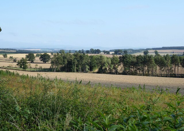
Clintmains is a small village located in the Scottish Borders region of Berwickshire. Situated approximately 5 miles south of the town of Duns, Clintmains is nestled amidst the beautiful countryside and rolling hills of the area.

The village is home to a tight-knit community, with a population of around 150 residents. Clintmains offers a tranquil and peaceful setting, perfect for those seeking a rural retreat away from the hustle and bustle of city life.

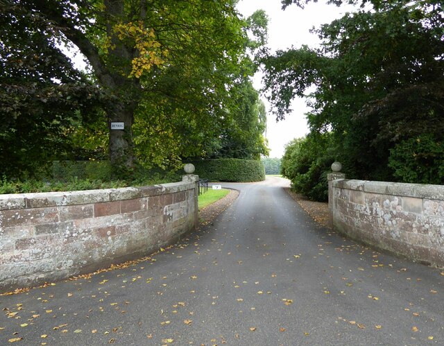
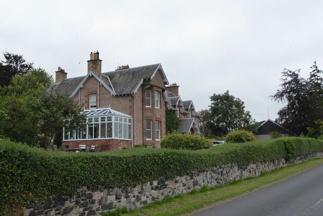
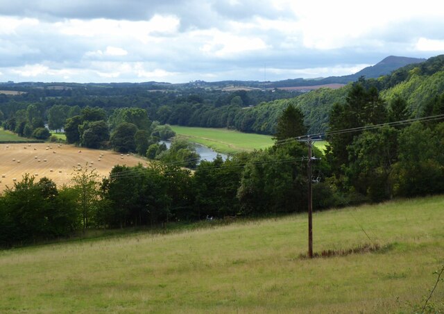
The village is primarily residential, with a mix of traditional stone cottages and newer housing developments. Clintmains boasts a picturesque landscape, with vast farmlands and fields surrounding the village, making it an ideal location for nature lovers and outdoor enthusiasts.

Although Clintmains is a small village, it benefits from its close proximity to nearby towns and amenities. The town of Duns provides a range of services, including shops, supermarkets, schools, and healthcare facilities, which are easily accessible for residents of Clintmains.

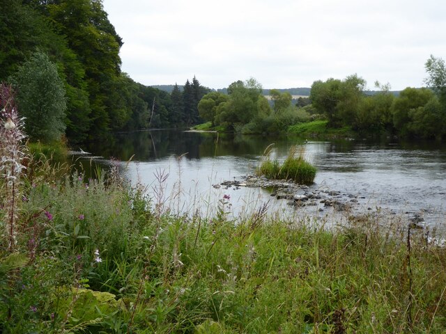
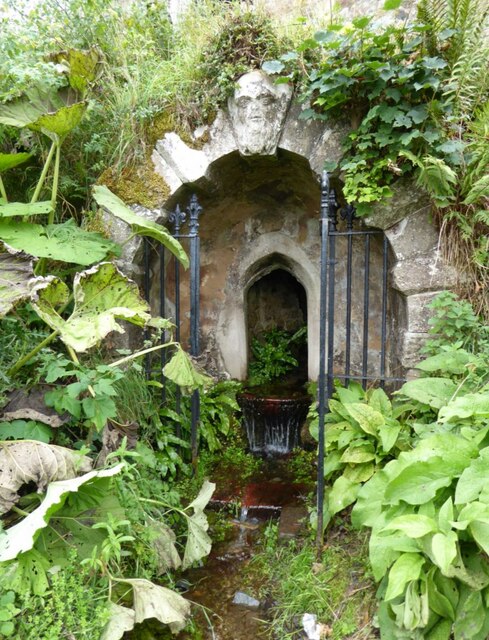
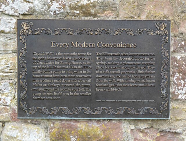
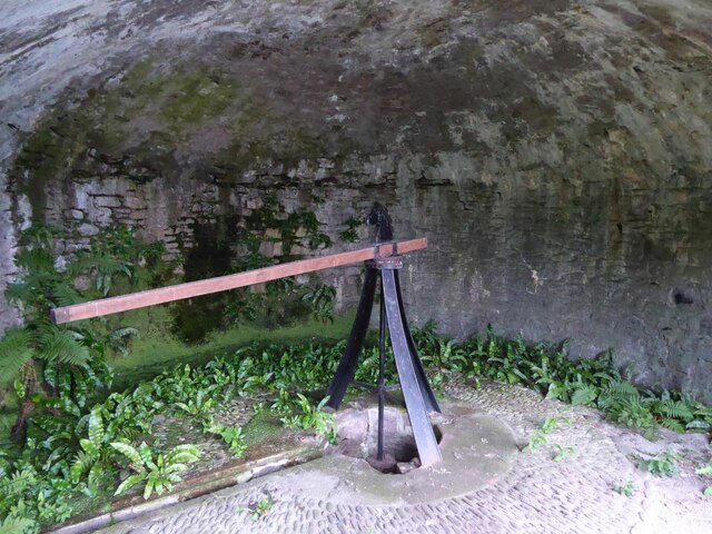
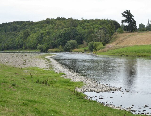
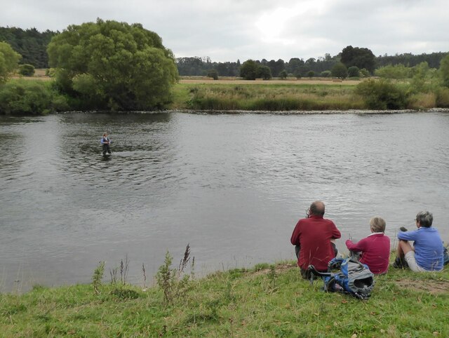
The surrounding area offers numerous recreational opportunities, such as walking, cycling, and fishing, with the beautiful Berwickshire coastline just a short drive away. The village is also within reach of historical attractions like the imposing Duns Castle and the ruins of Edin's Hall Broch, providing a glimpse into the region's rich heritage.

In summary, Clintmains is a charming village set amidst the picturesque Scottish Borders, offering a peaceful and idyllic lifestyle for residents who appreciate the beauty of rural living.

If you have any feedback on the listing, please let us know in the comments section below.

Clintmains Images

Images are sourced within 2km of 55.585249/-2.616229 or Grid Reference NT6132. Thanks to Geograph Open Source API. All images are credited.

The River Tweed  St Cuthbert's Way passes along the bank, through tall weeds, below Benrig.
The River Tweed
St Cuthbert's Way passes along the bank, through tall weeds, below Benrig.
The Crystal Well A spring originally supplying clean water for Benrig House.
In the mid 1800s the Elliot family built a pump to bring water up to the house, much more convenient than sending a maid down with a bucket!
The Crystal Well
A spring originally supplying clean water for Benrig House. In the mid 1800s the Elliot family built a pump to bring water up to the house, much more convenient than sending a maid down with a bucket!
Every Modern Convenience A plaque on the wall listing the technological progressions involved in getting water up to Benrig House.
Every Modern Convenience
A plaque on the wall listing the technological progressions involved in getting water up to Benrig House.
Donkey or mule power house This chamber, above the Crystal Well, housed the animals that trudged in circles round the room to power the adjacent pump that pumped the water up to Benrig House. See <a title="https://www.geograph.org.uk/photo/6955163" href="https://www.geograph.org.uk/photo/6955163">Link</a>
Donkey or mule power house
This chamber, above the Crystal Well, housed the animals that trudged in circles round the room to power the adjacent pump that pumped the water up to Benrig House. See Link
Gateway to Benrig The house overlooks the River Tweed.
Gateway to Benrig
The house overlooks the River Tweed.
Fisherman in River Tweed Viewed from St Cuthbert's Way.
Fisherman in River Tweed
Viewed from St Cuthbert's Way.
Fishing as a spectator sport! Walkers on St Cuthbert's Way watch a lady fishing in the River Tweed.
Fishing as a spectator sport!
Walkers on St Cuthbert's Way watch a lady fishing in the River Tweed.
Clint Lodge Clint Lodge country house was built in 1869 by Lord Polwarth as the family’s shooting home, Clint Lodge is owned by the Duke of Sutherland. After extensive and careful refurbishment, Clint Lodge opened in August ’97.  <span class="nowrap"><a title="https://clintlodge.co.uk/" rel="nofollow ugc noopener" href="https://clintlodge.co.uk/">Link</a><img style="margin-left:2px;" alt="External link" title="External link - shift click to open in new window" src="https://s1.geograph.org.uk/img/external.png" width="10" height="10"/></span>
Clint Lodge
Clint Lodge country house was built in 1869 by Lord Polwarth as the family’s shooting home, Clint Lodge is owned by the Duke of Sutherland. After extensive and careful refurbishment, Clint Lodge opened in August ’97. LinkExternal link
River Tweed Near Clintmains.
Pity about the electricity pole!
River Tweed
Near Clintmains. Pity about the electricity pole!
Ordnance Survey cut mark On Mertoun Bridge.
With backdrop of River Tweed and the Eildon Hills.
(Better than the usual buried in a hedge location!)
Ordnance Survey cut mark
On Mertoun Bridge. With backdrop of River Tweed and the Eildon Hills. (Better than the usual buried in a hedge location!)
Mill at Clintmains With adjacent weir on the River Tweed.
There is a fisherman in the river above the weir.
Mill at Clintmains
With adjacent weir on the River Tweed. There is a fisherman in the river above the weir.
View downstream from Mertoun Bridge With island in the River Tweed.
View downstream from Mertoun Bridge
With island in the River Tweed.
Walkway to hide on Bemersyde Moss Wildlife Reserve Prior to the 19th Century a large body of water occupied the site.  Known as Mertoun Loch, it was fished foreels and used for driving the water mills of the parish.
Walkway to hide on Bemersyde Moss Wildlife Reserve
Prior to the 19th Century a large body of water occupied the site. Known as Mertoun Loch, it was fished foreels and used for driving the water mills of the parish.
Bemersyde Moss Not much activity to be seen from the hide!
Bemersyde Moss
Not much activity to be seen from the hide!
Road running alongside Bemersyde Moss A pleasant walk!
Road running alongside Bemersyde Moss
A pleasant walk!
Gated track off B6404 Leading to the woods at Danderhall.
Gated track off B6404
Leading to the woods at Danderhall.
Arable land east of Danderhall Looking into the valley of the River Tweed.
Arable land east of Danderhall
Looking into the valley of the River Tweed.
River Tweed
River Tweed
Show me another place!

Clintmains is located at Grid Ref: NT6132 (Lat: 55.585249, Lng: -2.616229)

Unitary Authority: The Scottish Borders

Police Authority: The Lothians and Scottish Borders

What 3 Words

///september.star.charging. Near Saint Boswells, Scottish Borders

Nearby Locations

Clintmains

Related Wikis

Clintmains

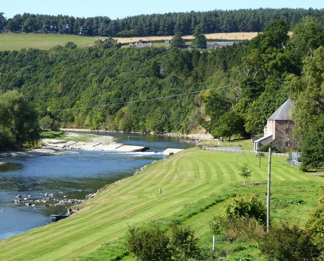
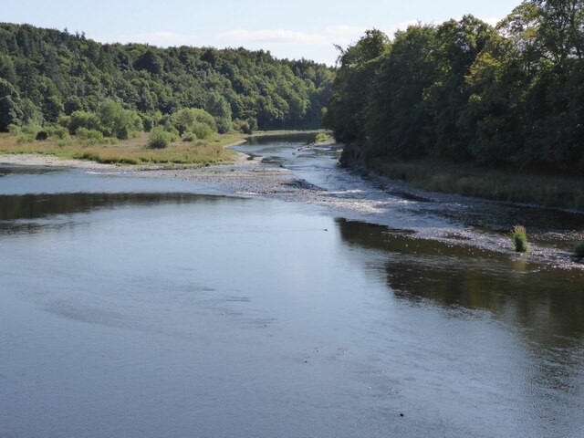
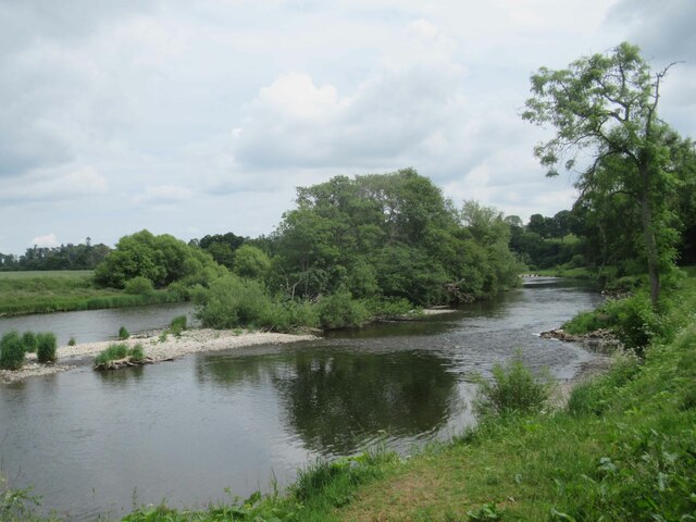
Clintmains is a village by the River Tweed, in the parish of Mertoun, to the east of Newtown St Boswells, in the Scottish Borders area of Scotland, in...
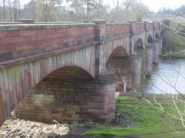
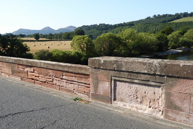
Mertoun Bridge

The Mertoun Bridge is a bridge across the River Tweed in the Scottish Borders. == History == The Act of Parliament that authorised the building of a bridge...

Mertoun

Mertoun is a parish in the south-west of the historic county of Berwickshire in the Scottish Borders area of Scotland. Together with the parish of Maxton...

Mertoun House

Mertoun House is a country house situated by the River Tweed, 2 miles (3 kilometres) east of St Boswells in the Scottish Borders. It is home to the Duke...
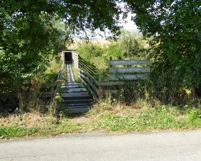
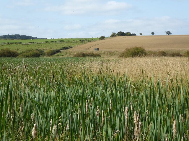
Bemersyde Moss

Bemersyde Moss is a Scottish Wildlife Trust nature reserve and a Site of Special Scientific Interest at Bemersyde in the Scottish Borders area of Scotland...

Bemersyde

Bemersyde is a hamlet in the Mertoun parish of Berwickshire, in the Scottish Borders. It sits on the left bank of the River Tweed, about three miles east...

Statue of William Wallace, Bemersyde

The William Wallace Statue near the grounds of the Bemersyde estate, near Melrose in the Scottish Borders is a statue commemorating William Wallace. It...

Dryburgh Abbey Hotel

Dryburgh Abbey Hotel is a baronial country house, located on the banks of the River Tweed, in Dryburgh about 5 km south east of Melrose in the Scottish...

Nearby Amenities

Located within 500m of 55.585249,-2.616229
Bus Stop
Road End
Bench: no
Bus: yes
Departures Board: no
Lit: no
Local Ref: opp
Naptan AtcoCode: 6900198
Naptan Bearing: W
Naptan CommonName: Road End
Naptan Indicator: opp
Naptan NaptanCode: 72723647
Naptan Street: B6404
Operator: Scottish Borders Council
Public Transport: platform
Ref: 6900198
Shelter: no
Source: local knowledge;survey;NaPTAN
Lat/Long: 55.5832185/-2.6143194
Bus Stop
Road End
Bench: yes
Bus: yes
Departures Board: no
Lit: no
Local Ref: at
Naptan AtcoCode: 6900199
Naptan Bearing: E
Naptan CommonName: Clintmains Road End
Naptan Indicator: at
Naptan NaptanCode: 72723649
Naptan Street: B6404
Operator: Scottish Borders Council
Public Transport: platform
Ref: 6900199
Shelter: yes
Source: local knowledge;survey;NaPTAN
Lat/Long: 55.5833852/-2.614101
Clintmains
Place: village
Wikidata: Q5134018
Wikipedia: en:Clintmains
Lat/Long: 55.5852371/-2.6161751
Post Box
Post Box Type: wall
Postal Code: TD6
Ref: TD6 61
Royal Cypher: GR
Royal Cypher Wikidata: Q33102273
Source: survey
Lat/Long: 55.5851407/-2.6161996
Power: pole
Source: Bing
Lat/Long: 55.5847649/-2.6227371
Power: pole
Source: Bing
Lat/Long: 55.5842682/-2.6232601
Noexit: yes
Lat/Long: 55.5825408/-2.6152182
Defibrillator
Booth: K6
Covered: booth
Defibrillator Location: In a red phone box, Clintmains
Disused Amenity: telephone
Emergency: defibrillator
Indoor: yes
Man Made: telephone_box
Lat/Long: 55.5852782/-2.6160219
Mertoun Mill
Place: hamlet
Lat/Long: 55.5822401/-2.6216053
Give Way
Direction: backward
Lat/Long: 55.5852357/-2.6161308
Bench
Lat/Long: 55.5851743/-2.6158879
Power: pole
Source: Bing
Lat/Long: 55.5877803/-2.6100335
Power: pole
Source: Bing
Lat/Long: 55.5873635/-2.6113316
Power: pole
Source: Bing
Lat/Long: 55.5866116/-2.6138958
Power: pole
Source: Bing
Lat/Long: 55.5862887/-2.6149647
Power: pole
Source: Bing
Lat/Long: 55.58641/-2.6161489
Power: pole
Source: Bing
Lat/Long: 55.5865138/-2.6173505
Power: pole
Source: Bing
Lat/Long: 55.586078/-2.6186836
Power: pole
Source: Bing
Lat/Long: 55.5856399/-2.6200354
Power: pole
Lat/Long: 55.5852746/-2.6236242
Power: pole
Lat/Long: 55.5852122/-2.621356
The data included in this document is from www.openstreetmap.org. The data is made available under ODbL.

Have you been to Clintmains?

Leave your review of Clintmains below (or comments, questions and feedback).