Church Field

Settlement in Norfolk King's Lynn and West Norfolk

England

Church Field

Terrington St Clement Parish Church: mid-September 2022 During a great walking week-end in Norfolk with two friends from my school days (1972 - 1979) there were times when I nipped off in the car to look at churches and other historical features: these are they!
Terrington St Clement Parish Church: mid-September 2022 Credit: Basher Eyre

Church Field is a charming village located in the picturesque county of Norfolk, England. Situated in the East of the country, it is renowned for its idyllic countryside and rich history. The village gets its name from a prominent church that dates back to the medieval era, adding to its traditional and historic atmosphere.

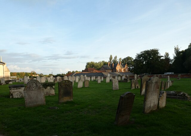
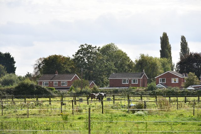
Nestled amidst rolling hills and verdant farmlands, Church Field offers a tranquil and serene setting. The village is characterized by its quaint and well-preserved cottages, which showcase the architectural heritage of the region. Many of these buildings are constructed with traditional Norfolk flint, giving them a distinctive appearance.

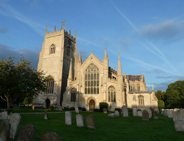
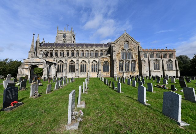
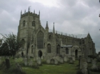
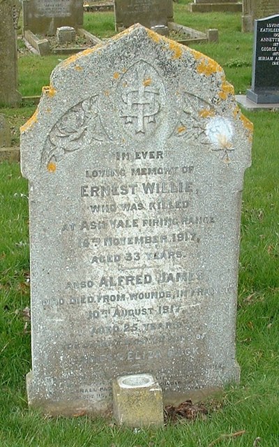
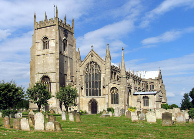
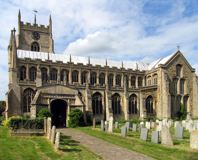
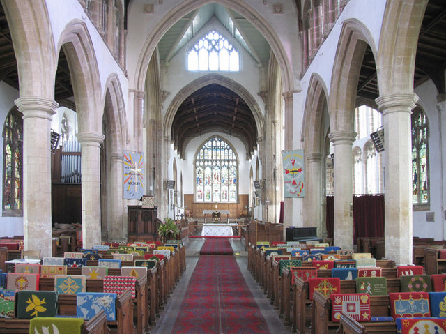
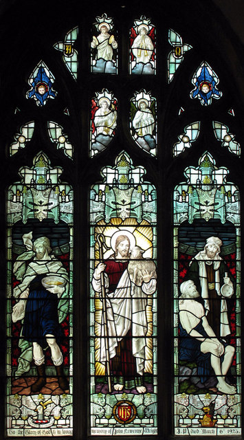
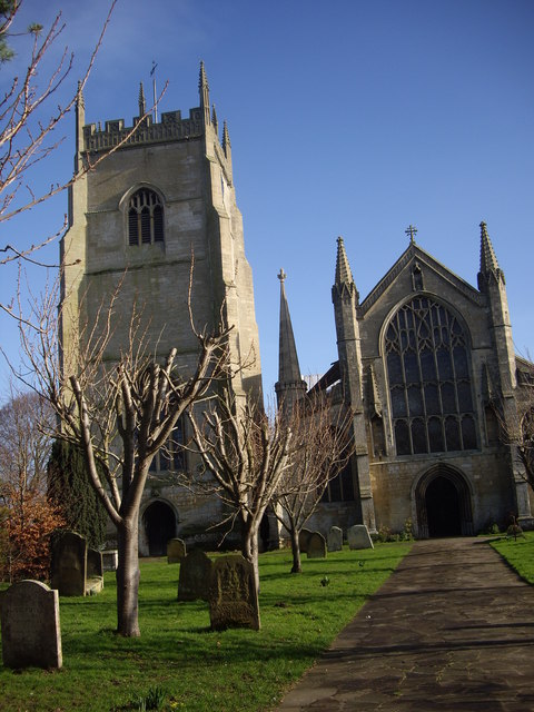
The heart of the village is centered around the historic church, which serves as a focal point for the community. The church, with its impressive spire, is a prominent feature of the landscape and offers a glimpse into the area's religious and cultural past.

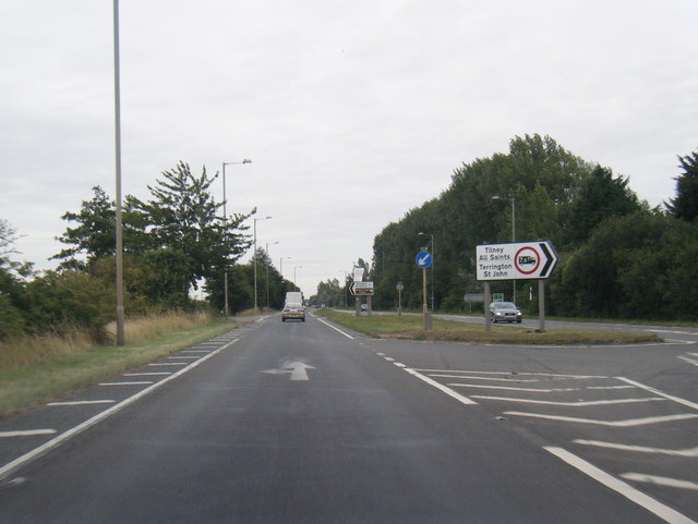
Surrounding the village are vast expanses of open fields and meadows, making it an ideal destination for nature lovers and outdoor enthusiasts. The countryside offers a plethora of walking and cycling trails, allowing visitors to explore the surrounding natural beauty at their leisure.

While Church Field may be small in size, it boasts a strong sense of community and a welcoming atmosphere. The village is home to a variety of amenities, including a local pub, village hall, and a primary school, ensuring that residents have access to the essentials.

Overall, Church Field encapsulates the quintessential charm of rural Norfolk, with its historic buildings, stunning landscapes, and close-knit community. It offers a peaceful retreat for those seeking a break from the hustle and bustle of modern life.

If you have any feedback on the listing, please let us know in the comments section below.
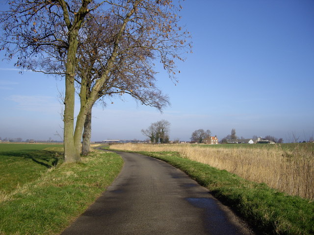
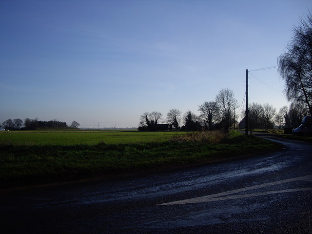
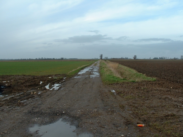
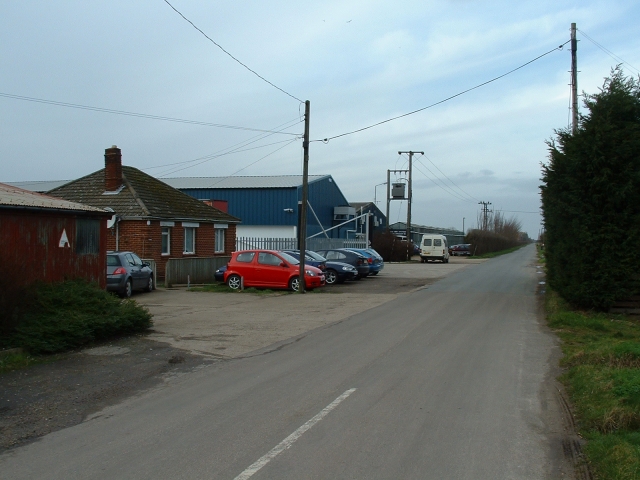
Church Field Images

Images are sourced within 2km of 52.763852/0.3004104 or Grid Reference TF5520. Thanks to Geograph Open Source API. All images are credited.

Terrington St Clement Parish Church: mid-September 2022 During a great walking week-end in Norfolk with two friends from my school days (1972 - 1979) there were times when I nipped off in the car to look at churches and other historical features: these are they!
Terrington St Clement Parish Church: mid-September 2022
During a great walking week-end in Norfolk with two friends from my school days (1972 - 1979) there were times when I nipped off in the car to look at churches and other historical features: these are they!
Terrington St Clement Churchyard
Terrington St Clement: Fenced off horse grazing areas
Terrington St Clement, St Clement's Church: Southern aspect
A17 at Moat Road junction
St Clement's Church The Church of St Clement, Terrington St Clement. Known as The Cathedral of the Marshes
St Clement's Church
The Church of St Clement, Terrington St Clement. Known as The Cathedral of the Marshes
Dack grave - Wesleyan churchyard, Terrington St Clement The Dack brothers were commemorated with a civilian headstone, rather than the simpler one issued by the War Graves Commission
Dack grave - Wesleyan churchyard, Terrington St Clement
The Dack brothers were commemorated with a civilian headstone, rather than the simpler one issued by the War Graves Commission
St Clement, Terrington St Clement, Norfolk
St Clement, Terrington St Clement, Norfolk - East end
St Clement, Terrington St Clement, Norfolk - Window The Good Shepherd
St Clement, Terrington St Clement, Norfolk - Window
The Good Shepherd
St Clements Church, Terrington St Clements Oranges and lemons... This picture shows the tower being separate from the main church building.
St Clements Church, Terrington St Clements
Oranges and lemons... This picture shows the tower being separate from the main church building.
Orange Row, Terrington St Clement ...Sadly, no Lemon Row that I could find. Once again, none of these roads are great for meeting large vehicles!
Orange Row, Terrington St Clement
...Sadly, no Lemon Row that I could find. Once again, none of these roads are great for meeting large vehicles!
Rhoon Road Nr Terrington St Clement <span class="nowrap"><a title="http://www.hetkasteelvanrhoon.nl/" rel="nofollow ugc noopener" href="http://www.hetkasteelvanrhoon.nl/">Link</a><img style="margin-left:2px;" alt="External link" title="External link - shift click to open in new window" src="https://s1.geograph.org.uk/img/external.png" width="10" height="10"/></span>
Rhoon is a village that borders Rotterdam, any links?
Rhoon Road Nr Terrington St Clement
LinkExternal link Rhoon is a village that borders Rotterdam, any links?
Old New Marsh What a name for a marsh!
Old New Marsh
What a name for a marsh!
Track off Roman Bank, Terrington St Clement A farm track runs north from the evocatively named 'Roman Bank' on the north-western edge of Terrington.
Track off Roman Bank, Terrington St Clement
A farm track runs north from the evocatively named 'Roman Bank' on the north-western edge of Terrington.
Bellmont Nurseries, Terrington St Clement The OS map records the site as 'Bellmount'. The prosperity of Terrington was built in the 1920s on flower and bulb cultivation. Nowadays most of the nurseries take twice-weekly deliveries of plants and flowers from Holland, but Bellmont remains the largest and oldest of the local nurseries.
Bellmont Nurseries, Terrington St Clement
The OS map records the site as 'Bellmount'. The prosperity of Terrington was built in the 1920s on flower and bulb cultivation. Nowadays most of the nurseries take twice-weekly deliveries of plants and flowers from Holland, but Bellmont remains the largest and oldest of the local nurseries.
Cottage, Long Road, Terrington This is an attractive and warm brick cottage sited on a sharp bend on Long Road, which leads out of Terrington towards the marsh - next stop Belgium!
It was formerly a licensed beer house known as The Foresters' Arms and is now known as Foresters' Farm.
Cottage, Long Road, Terrington
This is an attractive and warm brick cottage sited on a sharp bend on Long Road, which leads out of Terrington towards the marsh - next stop Belgium! It was formerly a licensed beer house known as The Foresters' Arms and is now known as Foresters' Farm.
Show me another place!

Church Field is located at Grid Ref: TF5520 (Lat: 52.763852, Lng: 0.3004104)

Administrative County: Norfolk

District: King's Lynn and West Norfolk

Police Authority: Norfolk

What 3 Words

///colleague.handle.mailings. Near Terrington St Clement, Norfolk

Related Wikis

St Clement's High School

St Clement's High School is a coeducational secondary school with academy status, located in the village of Terrington St Clement, in the English county...

Terrington St Clement

Terrington St Clement is a village and civil parish in King's Lynn and West Norfolk borough and district in Norfolk, England. It is in the drained marshlands...

Bellmount

Bellmount is a village in Norfolk, England.

Terrington railway station

Terrington railway station is a former station in Terrington St Clement, Norfolk. It opened in 1866 and was closed in 1959. It was on the Midland and Great...

Nearby Amenities

Located within 500m of 52.763852,0.3004104
Bus Stop
High School, opp
Bus: yes
Naptan AtcoCode: 2900T0524
Naptan Bearing: SW
Naptan BusStopType: CUS
Naptan CommonName: High School
Naptan Indicator: adj
Naptan Locality: Terrington St Clement
Naptan NaptanCode: nfodwptg
Naptan PlusbusZoneRef: KLYNN
Naptan Street: Churchgate Way
Naptan Verified: no
Public Transport: platform
Source: naptan_import
Lat/Long: 52.7612308/0.2985756
Bus Stop
Tower Farm, adj
Bus: yes
Naptan AtcoCode: 2900T0525
Naptan Bearing: E
Naptan BusStopType: CUS
Naptan CommonName: Tower Farm
Naptan Indicator: adj
Naptan Locality: Terrington St Clement
Naptan NaptanCode: nfodwptj
Naptan PlusbusZoneRef: KLYNN
Naptan ShortCommonName: Northgate Way
Naptan Street: Northgate Way
Naptan Verified: no
Public Transport: platform
Source: naptan_import
Lat/Long: 52.7639584/0.3011948
Bus Stop
Tower Farm, opp
Naptan AtcoCode: 2900T0526
Naptan Bearing: W
Naptan CommonName: Tower Farm
Naptan Indicator: opp
Naptan Locality: Terrington St Clement
Naptan NaptanCode: nfodwptm
Naptan PlusbusZoneRef: KLYNN
Naptan ShortCommonName: Northgate Way
Naptan Street: Northgate Way
Naptan Verified: no
Source: naptan_import
Lat/Long: 52.7637875/0.3012006
Bus Stop
Alma Chase, adj
Bus: yes
Naptan AtcoCode: 2900T0527
Naptan Bearing: W
Naptan BusStopType: CUS
Naptan CommonName: Alma Chase
Naptan Indicator: adj
Naptan Locality: Terrington St Clement
Naptan NaptanCode: nfodwptp
Naptan PlusbusZoneRef: KLYNN
Naptan ShortCommonName: Northgate Way
Naptan Street: Northgate Way
Naptan Verified: no
Public Transport: platform
Source: naptan_import
Lat/Long: 52.7642877/0.3064597
Bus Stop
Alma Chase, opp
Bus: yes
Naptan AtcoCode: 2900T0528
Naptan Bearing: NE
Naptan CommonName: Alma Chase
Naptan Indicator: opp
Naptan Locality: Terrington St Clement
Naptan NaptanCode: nfodwptw
Naptan PlusbusZoneRef: KLYNN
Naptan ShortCommonName: Northgate Way
Naptan Street: Northgate Way
Naptan Verified: no
Public Transport: platform
Source: naptan_import
Lat/Long: 52.7644883/0.3071102
Turning Circle
Lat/Long: 52.7630661/0.3063726
Church Farm
Place: farm
Lat/Long: 52.7633731/0.3022149
Church Field
Place: locality
Lat/Long: 52.7601558/0.3027929
Marsh Field
Place: locality
Lat/Long: 52.764487/0.2946002
Tower Farm
Place: farm
Lat/Long: 52.7642237/0.3011606
Give Way
Lat/Long: 52.7678265/0.2986572
Give Way
Lat/Long: 52.7677879/0.2985468
Give Way
Lat/Long: 52.7676905/0.2986667
The Bench - Year 10
Bench: yes
Leisure: picnic_table
Lit: no
Lat/Long: 52.7616464/0.2976784
Bus Stop
High School, adj
Bus: yes
Naptan AtcoCode: 2900T0533
Naptan Bearing: NE
Naptan BusStopType: CUS
Naptan CommonName: High School
Naptan Indicator: opp
Naptan Locality: Terrington St Clement
Naptan NaptanCode: NFODWPWP
Naptan PlusbusZoneRef: KLYNN
Naptan Street: Churchgate Way
Naptan Verified: no
Public Transport: platform
Source: naptan_import
Lat/Long: 52.7612516/0.298511
Barrier: bollard
Bollard: fixed
Material: concrete
Lat/Long: 52.7622116/0.3064442
Waste Basket
Colour: black
Inscription: Litter
Material: plastic
Waste: trash
Lat/Long: 52.7620624/0.3053856
Communication Mobile Phone: yes
Layer: 1
Man Made: mast
Material: metal
Operator: EE
Tower Construction: guyed_tube
Tower Type: communication
Lat/Long: 52.7620847/0.3071082
Traffic Calming: island
Lat/Long: 52.7639372/0.3005001
The data included in this document is from www.openstreetmap.org. The data is made available under ODbL.

Have you been to Church Field?

Leave your review of Church Field below (or comments, questions and feedback).