Christ Church

Settlement in Staffordshire Lichfield

England

Christ Church

Old Milestone, A461 Modern placement is on the SE side of the road on the grass verge. Installed between 1947 and 1956 according to maps.

Inscription: Lichfield / Parish // Walsall 8 // Lichfield 1½

Milestone Society ID: ST_WLLF08
Old Milestone, A461 Credit: Ivan Clare

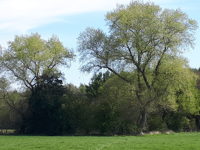
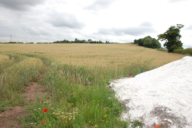
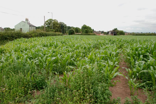
Christ Church is a charming village located in the county of Staffordshire, England. Situated in the heart of the picturesque Cannock Chase Area of Outstanding Natural Beauty, the village is surrounded by rolling hills, lush greenery, and an abundance of wildlife.

At the center of the village stands the iconic Christ Church, a historic Anglican church that dates back to the 19th century. The church is an architectural gem, featuring a beautiful stone exterior adorned with intricate detailing. Its tower proudly displays a set of melodious bells, which have been delighting the village for generations.

Inside, the church boasts a serene and tranquil atmosphere, with stunning stained-glass windows that cast colorful hues upon the pews. The interior is adorned with ornate woodwork and intricate carvings, showcasing the craftsmanship of its time.

Christ Church serves as a focal point for the community, hosting regular services, weddings, and various events throughout the year. The church also plays an active role in the village's social fabric, providing space for community gatherings and fostering a sense of togetherness among its residents.

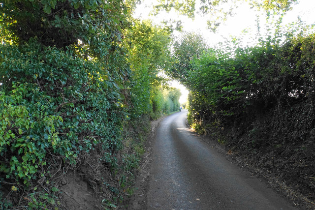
Surrounding the church, visitors can explore the quaint village, with its charming cottages, traditional tea rooms, and welcoming pubs. The village is also an excellent base for outdoor enthusiasts, with numerous walking trails, cycling routes, and opportunities for wildlife spotting in the nearby Cannock Chase Forest.

Christ Church, Staffordshire, offers a glimpse into the rich history and natural beauty of the region, making it a must-visit destination for those seeking a peaceful and authentic English countryside experience.

If you have any feedback on the listing, please let us know in the comments section below.

Christ Church Images

Images are sourced within 2km of 52.680502/-1.8359202 or Grid Reference SK1109. Thanks to Geograph Open Source API. All images are credited.

Old Milestone, A461 Modern placement is on the SE side of the road on the grass verge. Installed between 1947 and 1956 according to maps.

Inscription: Lichfield / Parish // Walsall 8 // Lichfield 1½

Milestone Society ID: ST_WLLF08
Old Milestone, A461
Modern placement is on the SE side of the road on the grass verge. Installed between 1947 and 1956 according to maps. Inscription: Lichfield / Parish // Walsall 8 // Lichfield 1½ Milestone Society ID: ST_WLLF08
Abnalls Lane The Heart of England Way uses this lane but it is not ideal. The lane is narrow with no provision for pedestrians. A break in the hedgerows would be nice too. To add to the users, it is also part of cycle route 54.
Abnalls Lane
The Heart of England Way uses this lane but it is not ideal. The lane is narrow with no provision for pedestrians. A break in the hedgerows would be nice too. To add to the users, it is also part of cycle route 54.
Western edge of Sloppy Wood Giant Hornbeam trees at the edge of Sloppy Wood, Leomansley
Western edge of Sloppy Wood
Giant Hornbeam trees at the edge of Sloppy Wood, Leomansley
A Field Of Wheat, Walsall Rd, Pipehill There is a load of lime ready to be put on the ground, when the wheat has been harvested.
A Field Of Wheat, Walsall Rd, Pipehill
There is a load of lime ready to be put on the ground, when the wheat has been harvested.
Field of Sweetcorn, Walsall Road St Mary's Church spire in the market place Lichfield, can be seen to the left of the old barn.
Field of Sweetcorn, Walsall Road
St Mary's Church spire in the market place Lichfield, can be seen to the left of the old barn.
Fossway Crossing, Lichfield. A rather surprising survivor is the little signal box at Fossway Crossing just outside Lichfield.

The box is situated on the former South Staffordshire line from Wichnor Junction (M.R. spelling) to Walsall and was brought into use in 1875 containing a 10 lever LNWR tumbler frame.

After an uneventful existence closure came 98 years later on 16th December 1973 when the crossing was automated with AHB's supervised by Lichfield City No1.  The box remained however as the crossing attendant's accommodation for times when the barriers were on 'local control'.

Eleven years later on 19th March 1984 the through route closed but the double line remained from Lichfield to Anglesea Sidings at Brownhills for deliveries of heating oil to Charringtons depot.  Bizarrely the double line was worked as a one-train single line with a train staff, trains going as before on the up and returning on the down merely because of the automatic crossing here.

This situation remained until the cross-city line was electrified and with the closure of Lichfield City box on 10th October 1992 control of the signalling passed to Aston and - the  opportunity was taken to single the branch line and renew the half barriers here.

The final delivery of heating oil took place in 2001 and the branch was mothballed, there are still long term plans to reinstate the through route to Walsall so trains may once again pass this way...

In the meantime someone should surely look at preserving this diminutive little LNWR type 3 for posterity.
Fossway Crossing, Lichfield.
A rather surprising survivor is the little signal box at Fossway Crossing just outside Lichfield. The box is situated on the former South Staffordshire line from Wichnor Junction (M.R. spelling) to Walsall and was brought into use in 1875 containing a 10 lever LNWR tumbler frame. After an uneventful existence closure came 98 years later on 16th December 1973 when the crossing was automated with AHB's supervised by Lichfield City No1. The box remained however as the crossing attendant's accommodation for times when the barriers were on 'local control'. Eleven years later on 19th March 1984 the through route closed but the double line remained from Lichfield to Anglesea Sidings at Brownhills for deliveries of heating oil to Charringtons depot. Bizarrely the double line was worked as a one-train single line with a train staff, trains going as before on the up and returning on the down merely because of the automatic crossing here. This situation remained until the cross-city line was electrified and with the closure of Lichfield City box on 10th October 1992 control of the signalling passed to Aston and - the opportunity was taken to single the branch line and renew the half barriers here. The final delivery of heating oil took place in 2001 and the branch was mothballed, there are still long term plans to reinstate the through route to Walsall so trains may once again pass this way... In the meantime someone should surely look at preserving this diminutive little LNWR type 3 for posterity.
Muddy Bridleway This is one of those strange bridleways that makes its way across the fields and then changes into a footpath.
Muddy Bridleway
This is one of those strange bridleways that makes its way across the fields and then changes into a footpath.
Rusty Rails Lichfield is just down the line and in the other direction the railway comes to a dead end.  This could explain the rusty rails.
Rusty Rails
Lichfield is just down the line and in the other direction the railway comes to a dead end. This could explain the rusty rails.
The Abnalls
The Abnalls
Maple Hayes School
Maple Hayes School
Abnalls Lane, The Abnalls I dont encourage anyone to park here to get the photo.
Abnalls Lane, The Abnalls
I dont encourage anyone to park here to get the photo.
Entrance to Darwin Park, The Abnalls
Track to The Abnalls
Abnalls Lane heading west National Cycle Route 54.
Abnalls Lane heading west
National Cycle Route 54.
117 metre spot height on Cross in Hand Lane At the bend, just past the magnificent tree. The photographer is at the entrance to 'The Swallows'.
117 metre spot height on Cross in Hand Lane
At the bend, just past the magnificent tree. The photographer is at the entrance to 'The Swallows'.
Abnalls Lane The Heart of England Way uses this lane but it is not ideal. The lane is narrow with no provision for pedestrians. A break in the hedgerows would be nice too.
Abnalls Lane
The Heart of England Way uses this lane but it is not ideal. The lane is narrow with no provision for pedestrians. A break in the hedgerows would be nice too.
The Gazebo The Gazebo is a folly at the top of Borrowcop Hill which has excellent views to the south and north.
The Gazebo
The Gazebo is a folly at the top of Borrowcop Hill which has excellent views to the south and north.
Lichfield Cathedral A view from the south with Minster Pool in the foreground (only wall visible). The spires of the Cathedral are known as the Three Ladies of the Vale. It is unusual in having three spires.
Lichfield Cathedral
A view from the south with Minster Pool in the foreground (only wall visible). The spires of the Cathedral are known as the Three Ladies of the Vale. It is unusual in having three spires.
Show me another place!

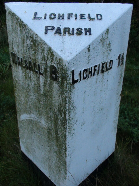
Christ Church is located at Grid Ref: SK1109 (Lat: 52.680502, Lng: -1.8359202)

Administrative County: Staffordshire

District: Lichfield

Police Authority: Staffordshire

What 3 Words

///daring.precautions.oils. Near Lichfield, Staffordshire

Related Wikis

Lichfield Clock Tower

Lichfield Clock Tower or Friary Clock Tower is a 19th-century Grade II listed clock tower located on "The Friary" south of Festival Gardens in the city...

Christ Church, Lichfield

Christ Church is a parish church in Lichfield, Staffordshire in the United Kingdom. The church is situated in Leamonsley in the south west area of the...

Franciscan Friary, Lichfield

The Franciscan Friary was once a large estate located on the west side of Lichfield city centre in Staffordshire. The estate was built and inhabited by...

Beacon Park

Beacon Park is a public park in the centre of the city of Lichfield, Staffordshire, in the United Kingdom. The park was created in 1859 when the Museum...

Lichfield Record Office

Lichfield Record Office held the archives for the City of Lichfield and its immediate vicinity. The archives were held at The Friary, Lichfield, and run...

Lichfield

Lichfield () is a cathedral city and civil parish in Staffordshire, England. Lichfield is situated 18 miles (29 km) south-east of Stafford, 9 miles (14...

Adelphi Cinema, Lichfield

The Adelphi Cinema was a cinema in Lichfield, Staffordshire, England. Earlier names are the Lido Cinema and the Palladium Cinema. It was the David Garrick...

Lichfield District

Lichfield District (UK: ) is a local government district in Staffordshire, England. The district is named after its largest settlement, the city of Lichfield...

Nearby Amenities

Located within 500m of 52.680502,-1.8359202
Crossing
Crossing: traffic_signals
Crossing Ref: toucan
Lat/Long: 52.6821299/-1.8399166
Traffic Signals
Lat/Long: 52.6802943/-1.8362026
Waterway: weir
Lat/Long: 52.6843985/-1.8357968
Crossing
Button Operated: yes
Crossing: traffic_signals
Crossing Island: no
Crossing Ref: pelican
Tactile Paving: yes
Traffic Signals Sound: yes
Lat/Long: 52.6795925/-1.8365703
Clock Tower
Historic: monument
Wikidata: Q6543267
Wikipedia: en:Lichfield Clock Tower
Lat/Long: 52.6796943/-1.8334612
Post Box
Ref: WS13 10
Lat/Long: 52.6817235/-1.8321274
Pub
Queens Head
Wikidata: Q26489491
Lat/Long: 52.681773/-1.8323682
Toilets
Changing Table: yes
Disabled: yes
Fee: no
Lat/Long: 52.6806967/-1.8319882
Turning Circle
Lat/Long: 52.6795357/-1.8425982
Power: substation
Ref: 01265
Lat/Long: 52.6780947/-1.839078
Man Made: surveillance
Lat/Long: 52.6807594/-1.8325302
Man Made: surveillance
Lat/Long: 52.6813685/-1.8305795
Crossing
Crossing: traffic_signals
Crossing Ref: pelican
Lat/Long: 52.6799666/-1.8380816
Bus Stop
Swan Road
Bus: yes
Naptan AtcoCode: 3800C404100
Naptan Bearing: NE
Naptan CommonName: Swan Road
Naptan Indicator: Adj
Naptan Landmark: Swan Road
Naptan PlusbusZoneRef: LCHC
Naptan Street: The Friary
Naptan Verified: no
Public Transport: platform
Source: naptan_import
Lat/Long: 52.6808801/-1.8316229
Bus Stop
Clock Tower
Bus: yes
Naptan AtcoCode: 3800C404101
Naptan Bearing: SW
Naptan CommonName: Clock Tower
Naptan Indicator: Adj
Naptan Landmark: Clock Tower
Naptan PlusbusZoneRef: LCHC
Naptan Street: The Friary
Naptan Verified: no
Public Transport: platform
Source: naptan_import
Lat/Long: 52.6806167/-1.8315417
Bus Stop
Christchurch Lane
Bus: yes
Naptan AtcoCode: 3800C409201
Naptan Bearing: SW
Naptan CommonName: Christchurch Lane
Naptan Indicator: Opp
Naptan Landmark: Christchurch Lane
Naptan PlusbusZoneRef: LCHC
Naptan Street: Walsall Rd
Naptan Verified: no
Public Transport: platform
Source: naptan_import
Lat/Long: 52.679632/-1.8391862
Bus Stop
Christchurch Lane
Bus: yes
Naptan AtcoCode: 3800C409202
Naptan Bearing: NE
Naptan CommonName: Christchurch Lane
Naptan Indicator: Adj
Naptan Landmark: Christchurch Lane
Naptan PlusbusZoneRef: LCHC
Naptan Street: Walsall Road
Naptan Verified: no
Public Transport: platform
Source: naptan_import
Lat/Long: 52.679713/-1.8392598
Bus Stop
Clock Tower
Bus: yes
Naptan AtcoCode: 3800C416901
Naptan Bearing: NE
Naptan CommonName: Clock Tower
Naptan Indicator: Opp
Naptan Street: The Friary
Naptan Verified: no
Public Transport: platform
Source: naptan_import
Lat/Long: 52.6799031/-1.8336827
Bus Stop
Angorfa Close
Bus: yes
Naptan AtcoCode: 3800C432702
Naptan Bearing: NE
Naptan CommonName: Angorfa Close
Naptan Indicator: Adj
Naptan Landmark: Angorfa Close
Naptan PlusbusZoneRef: LCHC
Naptan Street: Walsall Road
Naptan Verified: no
Public Transport: platform
Source: naptan_import
Lat/Long: 52.6789515/-1.8422492
Bus Stop
Victoria Hospital
Bus: yes
Naptan AtcoCode: 3800C490300
Naptan Bearing: SE
Naptan CommonName: Victoria Hospital
Naptan Indicator: Adj
Naptan Landmark: Victoria Hospital
Naptan PlusbusZoneRef: LCHC
Naptan Street: The Friary
Naptan Verified: no
Public Transport: platform
Source: naptan_import
Lat/Long: 52.6772226/-1.8326427
Bus Stop
Victoria Hospital
Bus: yes
Naptan AtcoCode: 3800C490301
Naptan Bearing: NW
Naptan CommonName: Victoria Hospital
Naptan Indicator: Adj
Naptan Landmark: Victoria Hospital
Naptan PlusbusZoneRef: LCHC
Naptan Street: The Friary
Naptan Verified: no
Public Transport: platform
Source: naptan_import
Lat/Long: 52.6771962/-1.8330274
E J Smith - Captain of RMS Titanic
Historic: memorial
Memorial: statue
Lat/Long: 52.6834428/-1.8330151
Waste Basket
Check Date: 2022-03-23
Type: dog_waste
Lat/Long: 52.6822754/-1.8396421
Waste Basket
Check Date: 2022-03-23
Type: dog_waste
Lat/Long: 52.6846003/-1.8386143
Pub
Walkabout
Addr City: Lichfield
Addr Housenumber: 13
Addr Postcode: WS13 6PW
Addr Street: Bird Street
Brand: Walkabout
Brand Wikidata: Q7962149
Brand Wikipedia: en:Walkabout (pub chain)
Fhrs Id: 1248751
Fhrs Local Authority Id: 63402
Image: http://www.flickr.com/photos/lichfieldlive/6865255142/in/set-72157629657995169/
Operator: Stonegate
Operator Wikidata: Q7619176
Source: visual survey
Source Addr: FHRS Open Data
Website: https://www.walkaboutbars.co.uk/lichfield
Lat/Long: 52.6825716/-1.8300758
Broads Travel Group
Image: http://www.flickr.com/photos/lichfieldlive/7011375135/in/set-72157629657995169/
Shop: travel_agency
Source: visual survey
Lat/Long: 52.6826236/-1.829837
C. C. Wheate & Sons
Shop: jewelry
Source: visual survey
Lat/Long: 52.6826252/-1.8293784
Cafe
Damn Fine Café
Addr City: Lichfield
Addr Housenumber: 16
Addr Postcode: WS13 6PR
Addr Street: Bird Street
Fhrs Id: 1248752
Fhrs Local Authority Id: 65954
Source: visual survey
Source Addr: FHRS Open Data
Website: https://www.just-eat.co.uk/restaurants-damnfinecafe-curborough/menu
Lat/Long: 52.6830119/-1.8302375
George Hotel
Addr City: Lichfield
Addr Housenumber: 12-14
Addr Postcode: WS13 6PR
Addr Street: Bird Street
Brand: Best Western
Brand Wikidata: Q830334
Brand Wikipedia: en:Best Western
Fhrs Id: 1248750
Fhrs Local Authority Id: 4114
Image: http://www.flickr.com/photos/lichfieldlive/6865254148/in/set-72157629657995169/
Operator: Best Western
Source: visual survey
Source Addr: FHRS Open Data
Tourism: hotel
Wikidata: Q17557809
Lat/Long: 52.6828388/-1.8299088
Golunski
Shop: bag
Lat/Long: 52.6827/-1.8296118
Restaurant
Sing Tong
Cuisine: chinese
Image: http://www.flickr.com/photos/lichfieldlive/7011380419/in/set-72157629657995169/
Source: visual survey
Lat/Long: 52.6823364/-1.8297156
Pub
Horse & Jockey
Addr City: Lichfield
Addr Housenumber: 10
Addr Postcode: WS13 6QA
Addr Street: Sandford Street
Fhrs Id: 1248853
Food: yes
Internet Access: wlan
Note: CAMRA Branch pub of the year 2017
Parking: yes
Real Ale: 4 beers
Source: visual survey
Lat/Long: 52.6824801/-1.8306773
Ivison
Image: http://www.flickr.com/photos/lichfieldlive/6865245804/in/set-72157629657995169/
Shop: florist
Source: visual survey
Lat/Long: 52.6830427/-1.8302832
Joells
Image: http://www.flickr.com/photos/lichfieldlive/6865268300/in/set-72157629657995169/
Shop: hairdresser
Source: visual survey
Lat/Long: 52.6823656/-1.8293514
Kiss xx
Image: http://www.flickr.com/photos/lichfieldlive/6865267430/in/set-72157629657995169/
Phone: +44 1543 258286
Shop: clothes
Source: visual survey
Lat/Long: 52.6824159/-1.8295498
La Boutique
Shop: clothes
Source: visual survey
Lat/Long: 52.6825292/-1.8295582
Restaurant
Lal Bagh
Addr City: Lichfield
Addr Housenumber: 9
Addr Postcode: WS13 6PW
Addr Street: Bird Street
Cuisine: indian
Fhrs Id: 1248749
Fhrs Local Authority Id: 2502
Source: visual survey
Source Addr: FHRS Open Data
Lat/Long: 52.6824739/-1.829931
Restaurant
Le Rêve
Addr City: Lichfield
Addr Housenumber: 26
Addr Postcode: WS13 6PR
Addr Street: Bird Street
Fhrs Id: 1248756
Fhrs Local Authority Id: 45441
Source: visual survey
Source Addr: FHRS Open Data
Wikidata: Q26504602
Lat/Long: 52.6831949/-1.8305095
Fast Food
Lichfield Kebab & Pizza House
Addr City: Lichfield
Addr Housenumber: 5
Addr Postcode: WS13 6PW
Addr Street: Bird Street
Fhrs Id: 1248748
Fhrs Local Authority Id: 2387
Image: http://www.flickr.com/photos/lichfieldlive/7011379601/in/set-72157629657995169/
Source: visual survey
Source Addr: FHRS Open Data
Lat/Long: 52.6824316/-1.8298263
Marjorie Reader
Shop: clothes
Source: visual survey
Lat/Long: 52.6826453/-1.8296888
Fast Food
Millennium Fried Chicken
Addr City: Lichfield
Addr Housenumber: 2b
Addr Postcode: WS13 6PR
Addr Street: Bird Street
Cuisine: chicken
Fhrs Id: 1248747
Fhrs Local Authority Id: 43593
Image: http://www.flickr.com/photos/lichfieldlive/6865266662/in/set-72157629657995169/
Source: visual survey
Source Addr: FHRS Open Data
Lat/Long: 52.6823262/-1.8292937
Morgan Hair
Image: http://www.flickr.com/photos/lichfieldlive/6865261446/in/set-72157629657995169/
Shop: hairdresser
Source: visual survey
Lat/Long: 52.6826242/-1.8297397
Overheads
Shop: hairdresser
Source: visual survey
Lat/Long: 52.6825289/-1.8306157
Bar
Paradise Lounge
Source: visual survey
Lat/Long: 52.6820658/-1.8310145
Restaurant
Qmin
Addr City: Lichfield
Addr Housenumber: 30-36
Addr Postcode: WS13 6PR
Addr Street: Bird Street
Cuisine: indian
Fhrs Id: 1248759
Fhrs Local Authority Id: 2196
Image: http://www.flickr.com/photos/lichfieldlive/7011355165/in/set-72157629657995169/
Source: visual survey
Source Addr: FHRS Open Data
Lat/Long: 52.6833266/-1.8307188
Restaurant
Ristorante Sorrento
Addr City: Lichfield
Addr Housenumber: 28
Addr Postcode: WS13 6PR
Addr Street: Bird Street
Cuisine: italian
Fhrs Id: 1249399
Fhrs Local Authority Id: 66630
Fhrs Name: Ristorante Sorriso
Image: http://www.flickr.com/photos/lichfieldlive/7011357269/in/set-72157629657995169/
Source: visual survey
Source Addr: FHRS Open Data
Lat/Long: 52.6832655/-1.8306156
Room to Inspire
Phone: +44 1543 264390
Shop: furniture
Source: visual survey
Website: http://www.roomtoinspire.co.uk
Lat/Long: 52.6820019/-1.8317168
Pub
Angel Inn
Addr City: Lichfield
Addr Housenumber: 4
Addr Postcode: WS13 6LH
Addr Street: Market Street
Fhrs Id: 1248830
Fhrs Local Authority Id: 50309
Real Ale: yes
Source: visual survey
Source Addr: FHRS Open Data
Lat/Long: 52.6825602/-1.8294428
Eleven Hair & Beauty
Email: appointments@temple-tree.co.uk
Image: http://www.flickr.com/photos/lichfieldlive/7011376819/in/set-72157629657995169/
Phone: +44 1543 418844
Shop: hairdresser
Source: visual survey
Website: http://www.temple-tree.co.uk
Lat/Long: 52.6825227/-1.82999
The Kitchen Shop
Addr City: LICHFIELD
Addr Housenumber: 5
Addr Postcode: WS13 6JX
Addr Street: Market Street
Fhrs Id: 1248831
Fhrs Local Authority Id: 56446
Opening Hours: Tu-Sa 10:00-16:30; Su 12:00-16:00; Mo off
Shop: kitchen
Source: visual survey
Source Addr: FHRS Open Data
Lat/Long: 52.682752/-1.8295071
Cafe
The Lounge
Image: http://www.flickr.com/photos/lichfieldlive/7011378589/in/set-72157629657995169/
Source: visual survey
Lat/Long: 52.6824968/-1.8296405
Crossing
Lat/Long: 52.682086/-1.8292021
Lieutenant-Colonel M.A.W. Swinfen-Broun J.P.
PMSA Ref: http://pmsa.cch.kcl.ac.uk/BM/STliLIlb006.htm
Historic: memorial
Inscription: Freeman of the City and Public Benefactor
Source: survey; Bing; PSMA
Start Date: 1972
Subject Wikidata: Q6834731
Subject Wikipedia: en:Michael Swinfen-Broun
Lat/Long: 52.6845764/-1.8377177
Restaurant
Ego
Addr City: Lichfield
Addr Postcode: WS13 6PW
Addr Street: Bird Street
Cuisine: international
Opening Hours: Mo-Su 11:00-23:00
Phone: +44 01543 258234
Website: https://www.egorestaurants.co.uk/restaurant-lichfield/
Lat/Long: 52.6836333/-1.8310977
Crossing
Lat/Long: 52.6777499/-1.8335018
Crossing
Lat/Long: 52.6781159/-1.8333192
Plaque of Martyrs
Historic: monument
Lat/Long: 52.6837229/-1.8348452
Statue of King Edward VII
Historic: memorial
Memorial: statue
Lat/Long: 52.6838319/-1.8322461
Fountain
Chancellor Laws Fountain
Lat/Long: 52.6836863/-1.8325405
Statue of Erasmus Darwin
Historic: memorial
Memorial: statue
Lat/Long: 52.6840319/-1.832517
Addr Housename: Greyfriars House
Addr Housenumber: 1-6
Addr Postcode: WS13 6QD
Addr Street: Queen Street
Building: apartments
Source: Lichfield District Council - Street Naming and Numbering Officer
Lat/Long: 52.6817726/-1.8319209
Addr Housename: Franciscan View
Addr Housenumber: 1-55
Addr Postcode: WS13 6QE
Addr Street: The Friary
Building: apartments
Source: Lichfield District Council - Street Naming and Numbering Officer
Lat/Long: 52.6810896/-1.8325969
City Point
Addr Housenumber: 1 - 7
Addr Postcode: WS13 6QZ
Addr Street: Swan Road
Building: residential
Source: Lichfield District Council - Street Naming and Numbering Officer
Lat/Long: 52.6819763/-1.8313721
Bench
Lat/Long: 52.6809116/-1.8333161
Central Garage
Shop: car_repair
Lat/Long: 52.6813666/-1.8327735
Cafe
Melbourne in Lichfield
Addr City: Lichfield
Addr Housenumber: 32-34
Addr Postcode: WS13 6PR
Addr Street: Bird Street
Contact Facebook: https://facebook.com/melbourneinlichfield
Fhrs Id: 1248758
Fhrs Local Authority Id: 65702
Opening Hours: Mo-Fr 07:30-16:00, Sa 08:00-16:00; Su 09:00-14:00
Payment Cash: yes
Payment Credit Cards: yes
Payment Debit Cards: yes
Source: visual survey
Source Addr Postcode: FHRS Open Data
Lat/Long: 52.6833495/-1.8307753
Restaurant
Lichfield House
Addr City: Lichfield
Addr Housenumber: 9
Addr Postcode: WS13 6QA
Addr Street: Sandford Street
Cuisine: chinese
Wikidata: Q26512950
Lat/Long: 52.6823859/-1.8304843
Pub
Walkabout
Brand: Walkabout
Brand Wikidata: Q7962149
Brand Wikipedia: en:Walkabout (pub chain)
Lat/Long: 52.6823738/-1.8296958
Cafe
Platters
Lat/Long: 52.681721/-1.8309638
Restaurant
Pom's Kitchen & Deli
Addr City: Lichfield
Addr Housenumber: 20-22
Addr Postcode: WS13 6PR
Addr Street: Bird Street
Fhrs Id: 1248754
Fhrs Local Authority Id: 52973
Source Addr: FHRS Open Data
Lat/Long: 52.6830648/-1.8303248
Cafe
Chandler's Cafe
Lat/Long: 52.6836982/-1.8317286
Hair by Imad
Shop: hairdresser
Lat/Long: 52.6816775/-1.8310796
Lichfield Local
Addr City: Lichfield
Addr Housenumber: 7
Addr Postcode: WS13 6PW
Addr Street: Bird Street
Fhrs Id: 1054759
Fhrs Local Authority Id: 64938
Shop: convenience
Source Addr: FHRS Open Data
Lat/Long: 52.6824582/-1.8298459
Access: private
Barrier: lift_gate
Lat/Long: 52.682152/-1.833233
Telephone
Booth: K6
Covered: booth
Listed Status: Grade II
Operator: BT
Phone: +44 1543 262169
Lat/Long: 52.6816411/-1.8288744
Bus Stop
Library
Bus: yes
Public Transport: platform
Lat/Long: 52.6817777/-1.8297037
Bus Stop
Library
Bus: yes
Naptan AtcoCode: 3800C408901
Naptan NaptanCode: stadmtmg
Public Transport: platform
Lat/Long: 52.6819273/-1.8296957
Bus Stop
Swan Mews
Bus: yes
Naptan AtcoCode: 3800C428002
Naptan NaptanCode: stadpjdj
Public Transport: platform
Lat/Long: 52.6828135/-1.8328996
Bus Stop
Swan Mews
Bus: yes
Naptan AtcoCode: 3800C428001
Naptan NaptanCode: stadpjdg
Public Transport: platform
Lat/Long: 52.6832956/-1.8322586
Bus Stop
The Close
Bus: yes
Naptan AtcoCode: 3800C412402
Naptan NaptanCode: stadmwmd
Public Transport: platform
Lat/Long: 52.6841517/-1.8320574
Bus Stop
The Close
Bench: no
Bin: yes
Bus: yes
Lit: no
Naptan AtcoCode: 3800C412401
Naptan NaptanCode: stadmwma
Public Transport: platform
Shelter: no
Tactile Paving: no
Lat/Long: 52.6842745/-1.8323337
Generator Method: photovoltaic
Generator Output Electricity: yes
Generator Source: solar
Generator Type: solar_photovoltaic_panel
Location: roof
Power: generator
Lat/Long: 52.6798654/-1.8403897
Generator Method: photovoltaic
Generator Output Electricity: yes
Generator Source: solar
Generator Type: solar_photovoltaic_panel
Location: roof
Power: generator
Lat/Long: 52.6780848/-1.8418086
Waste Basket
Lat/Long: 52.6844719/-1.8364828
Life Ring
Emergency: life_ring
Lat/Long: 52.6845762/-1.8375236
Toilets
Changing Table: yes
Disabled: yes
Lat/Long: 52.6845191/-1.8380032
Waste Basket
Lat/Long: 52.6826904/-1.8300222
Waste Basket
Lat/Long: 52.6837991/-1.8353421
Waste Basket
Lat/Long: 52.6845928/-1.8377904
Recycling
Lat/Long: 52.6827067/-1.8299863
The Crucifix Conduit
Man Made: water_well
Lat/Long: 52.6817468/-1.8291311
Bench
Backrest: yes
Lat/Long: 52.6818627/-1.8292297
Moses and the Moggs
Board Type: history
Information: board
Network: Lichfield Heritage Trail
Tourism: information
Lat/Long: 52.683785/-1.8309969
Information: map
Map Size: city
Tourism: information
Lat/Long: 52.6841387/-1.8320225
Information: map
Map Size: city
Tourism: information
Lat/Long: 52.6834192/-1.831179
Inns and Outs
Board Type: history
Information: board
Network: Lichfield Heritage Trail
Tourism: information
Lat/Long: 52.6826798/-1.8298989
The data included in this document is from www.openstreetmap.org. The data is made available under ODbL.

Have you been to Christ Church?

Leave your review of Christ Church below (or comments, questions and feedback).