Chorley Moor

Settlement in Lancashire Chorley

England

Chorley Moor

The Queens 
The Queen's Hotel on Church Street dates back to the 1860s. It closed in 2009 and was falling into disrepair until it was restored and converted to residential use in 2015. See <span class="nowrap"><a title="http://chorleyinnsandtaverns.blogspot.com/p/queens-hotel.html" rel="nofollow ugc noopener" href="http://chorleyinnsandtaverns.blogspot.com/p/queens-hotel.html">Link</a><img style="margin-left:2px;" alt="External link" title="External link - shift click to open in new window" src="https://s1.geograph.org.uk/img/external.png" width="10" height="10"/></span> for more details.
The Queens Credit: Gerald England

Chorley Moor is a small village located in the county of Lancashire, England. Situated approximately 4 miles southwest of the town of Chorley, it is nestled within the picturesque landscape of the West Pennine Moors. The village is surrounded by vast stretches of open moorland, offering breathtaking views and a serene atmosphere.

Historically, Chorley Moor was primarily an agricultural community, with farming and sheep rearing being the main occupations of its inhabitants. Today, however, the village has evolved into a residential area, attracting individuals seeking a peaceful countryside lifestyle.

The village itself is characterized by a charming mix of traditional stone-built houses and more modern developments. Its close-knit community fosters a friendly and welcoming atmosphere, providing a sense of unity and belonging.

Chorley Moor offers a range of amenities for its residents, including a small primary school, a village hall, and a local pub. For recreational activities, the surrounding moorland provides ample opportunities for walking, hiking, and birdwatching. The nearby Rivington Pike, a prominent local landmark, attracts visitors with its stunning panoramic views and historical significance.

Despite its rural setting, Chorley Moor benefits from good transportation links. The village is conveniently located near major road networks, such as the M61 motorway, allowing for easy access to nearby towns and cities.

Overall, Chorley Moor is a peaceful and picturesque village, offering a tranquil countryside lifestyle while still providing convenient access to essential amenities and neighboring urban areas.

If you have any feedback on the listing, please let us know in the comments section below.

Chorley Moor Images

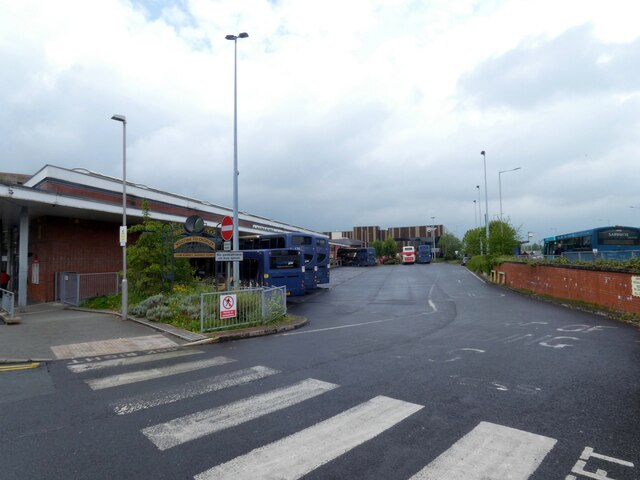
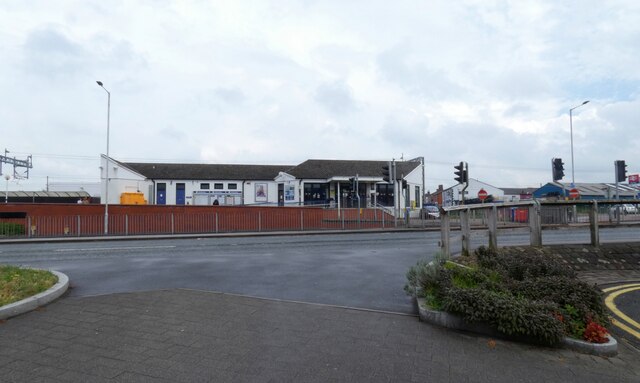
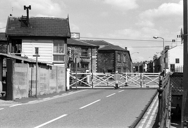
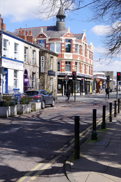
Images are sourced within 2km of 53.646539/-2.6319404 or Grid Reference SD5816. Thanks to Geograph Open Source API. All images are credited.

The Queens 
The Queen's Hotel on Church Street dates back to the 1860s. It closed in 2009 and was falling into disrepair until it was restored and converted to residential use in 2015. See <span class="nowrap"><a title="http://chorleyinnsandtaverns.blogspot.com/p/queens-hotel.html" rel="nofollow ugc noopener" href="http://chorleyinnsandtaverns.blogspot.com/p/queens-hotel.html">Link</a><img style="margin-left:2px;" alt="External link" title="External link - shift click to open in new window" src="https://s1.geograph.org.uk/img/external.png" width="10" height="10"/></span> for more details.
The Queens
The Queen's Hotel on Church Street dates back to the 1860s. It closed in 2009 and was falling into disrepair until it was restored and converted to residential use in 2015. See LinkExternal link for more details.
Shepherd's Victoria Hall The Ancient Order of Shepherds Friendly Society was formed in 1826 and was quite prominent in Chorley in the late 1800s and early 1900s.

The hall is presently occupied Chorley Fitness Centre and a micro-brewery 

On the right is the bus station.

<a href="https://www.geograph.org.uk/photo/7185639">SD5817 : Shepherd's Victoria Hall: Architectural detail (1)</a>.
<a href="https://www.geograph.org.uk/photo/7185644">SD5817 : Shepherd's Victoria Hall: Architectural detail (2)</a>.
Shepherd's Victoria Hall
The Ancient Order of Shepherds Friendly Society was formed in 1826 and was quite prominent in Chorley in the late 1800s and early 1900s. The hall is presently occupied Chorley Fitness Centre and a micro-brewery On the right is the bus station. SD5817 : Shepherd's Victoria Hall: Architectural detail (1). SD5817 : Shepherd's Victoria Hall: Architectural detail (2).
Shepherd's Victoria Hall: Architectural detail (1) 
Detail on Shepherd's Victoria Hall <a href="https://www.geograph.org.uk/photo/7185596">SD5817 : Shepherd's Victoria Hall</a>.
Shepherd's Victoria Hall: Architectural detail (1)
Detail on Shepherd's Victoria Hall SD5817 : Shepherd's Victoria Hall.
Shepherd's Victoria Hall: Architectural detail (2) 
Detail on Shepherd's Victoria Hall <a href="https://www.geograph.org.uk/photo/7185596">SD5817 : Shepherd's Victoria Hall</a>.
Shepherd's Victoria Hall: Architectural detail (2)
Detail on Shepherd's Victoria Hall SD5817 : Shepherd's Victoria Hall.
Chorley Bus Station
Chorley Bus Station
Chorley Railway Station 
As viewed from the bus station across Shepherd's Way (A6).
Chorley Railway Station
As viewed from the bus station across Shepherd's Way (A6).
Astley Hall The render had just been removed from the brickwork
Astley Hall
The render had just been removed from the brickwork
The Courtyard Formed by the stable block to Astley Hall and Astley Farm
The Courtyard
Formed by the stable block to Astley Hall and Astley Farm
Steely Lane Level Crossing, Chorley – 1971 This crossing has disappeared completely, together with the signal box, the only evidence being some asphalt visible in the foreground of this view <a title="https://www.geograph.org.uk/photo/2786575" href="https://www.geograph.org.uk/photo/2786575">Link</a> . The pedestrian subway on the right does survive.
Steely Lane Level Crossing, Chorley – 1971
This crossing has disappeared completely, together with the signal box, the only evidence being some asphalt visible in the foreground of this view Link . The pedestrian subway on the right does survive.
The Malt 'n' Hops, Chorley This building on Friday Street dates from the 1870s and looks as though it might always have been a pub. In fact, it was for very many years a grocer's shop and subsequently found a variety of uses before being converted to a pub in 1989. Today it is renowned for the quality and range of real ales on offer, winning CAMRA's Central Lancashire pub of the year title in 2017.
The Malt 'n' Hops, Chorley
This building on Friday Street dates from the 1870s and looks as though it might always have been a pub. In fact, it was for very many years a grocer's shop and subsequently found a variety of uses before being converted to a pub in 1989. Today it is renowned for the quality and range of real ales on offer, winning CAMRA's Central Lancashire pub of the year title in 2017.
The Bob Inn, Chorley Occupying what is effectively a stall in Chorley's covered market, this is a particularly small micropub. As it forms part of the market it is closed on Sundays.
The Bob Inn, Chorley
Occupying what is effectively a stall in Chorley's covered market, this is a particularly small micropub. As it forms part of the market it is closed on Sundays.
Ben's Tap & Bottleshop, Chorley This is one of several micropubs in the centre of Chorley and is almost opposite the Bob Inn. It is the brewery tap for Ben's microbrewery and opened in March 2022.
Ben's Tap & Bottleshop, Chorley
This is one of several micropubs in the centre of Chorley and is almost opposite the Bob Inn. It is the brewery tap for Ben's microbrewery and opened in March 2022.
Chapel Street, Chorley Chapel Street connects Chorley town centre with the bus and rail stations; the stretch here is pedestrianised. On the left is a charity shop supporting Cancer Research UK.
Chapel Street, Chorley
Chapel Street connects Chorley town centre with the bus and rail stations; the stretch here is pedestrianised. On the left is a charity shop supporting Cancer Research UK.
Chapel Street, Chorley This stretch of Chapel Street runs immediately to the north of St George's Church. Grosvenor Partners on the left is a wealth management and financial planning firm. The larger building on the corner is Shepherd's Hall that originally belonged to the Shepherd's Guild but now houses a gym and a micropub.
Chapel Street, Chorley
This stretch of Chapel Street runs immediately to the north of St George's Church. Grosvenor Partners on the left is a wealth management and financial planning firm. The larger building on the corner is Shepherd's Hall that originally belonged to the Shepherd's Guild but now houses a gym and a micropub.
St George's Church, Chorley - tower St George's Church was designed by Thomas Rickman, an architect with a particular interest in the Gothic Revival, and built between 1822 and 1825. It was a 'commissioner's church', funded by a grant made available under the Church Building Acts of 1818 and 1824 and administered by the Church Building Commission. The object was to provide churches in the fast-growing urban areas of the industrial revolution and Chorley, a Lancashire mill town, would have been a prime candidate. The building is now grade II* listed. The clock is showing the correct time.
St George's Church, Chorley - tower
St George's Church was designed by Thomas Rickman, an architect with a particular interest in the Gothic Revival, and built between 1822 and 1825. It was a 'commissioner's church', funded by a grant made available under the Church Building Acts of 1818 and 1824 and administered by the Church Building Commission. The object was to provide churches in the fast-growing urban areas of the industrial revolution and Chorley, a Lancashire mill town, would have been a prime candidate. The building is now grade II* listed. The clock is showing the correct time.
The Ale Station, Chorley Taking its name from the nearby rail and bus stations, The Ale Station has adopted the British Transport Commission style of sign over its door. This is one of several micropubs in the immediate vicinity.
The Ale Station, Chorley
Taking its name from the nearby rail and bus stations, The Ale Station has adopted the British Transport Commission style of sign over its door. This is one of several micropubs in the immediate vicinity.
Stephenson Street, Chorley Looking along Stephenson Street from its junction with Seymour Street, nine identical ground floor bay windows are in view eight of which are white and one is maroon.
Stephenson Street, Chorley
Looking along Stephenson Street from its junction with Seymour Street, nine identical ground floor bay windows are in view eight of which are white and one is maroon.
Leeds & Liverpool Canal, Chorley The Leeds & Liverpool Canal skirts the eastern edge of Chorley although now the town has spilt over to the far side as this new development shows. The street is called Tate Fold, named after Chorley's most famous son, Sir Henry Tate, who made his money from sugar refining and funded the building of the Tate Gallery.
Leeds & Liverpool Canal, Chorley
The Leeds & Liverpool Canal skirts the eastern edge of Chorley although now the town has spilt over to the far side as this new development shows. The street is called Tate Fold, named after Chorley's most famous son, Sir Henry Tate, who made his money from sugar refining and funded the building of the Tate Gallery.
Show me another place!

Chorley Moor is located at Grid Ref: SD5816 (Lat: 53.646539, Lng: -2.6319404)

Administrative County: Lancashire

District: Chorley

Police Authority: Lancashire

What 3 Words

///hang.blame.payer. Near Chorley, Lancashire

Related Wikis

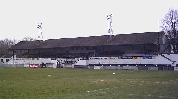
Victory Park (Chorley)

Victory Park is a football ground in Chorley, Lancashire, England. The home ground of Chorley F.C., it opened in 1920. It has hosted some big games, including...

St George's Church, Chorley

St George's Church is in St George's Street, Chorley, Lancashire, England. It is an active Anglican parish church in the deanery of Chorley, the archdeaconry...

Chorley

Chorley is a town and the administrative centre of the wider Borough of Chorley in Lancashire, England, 8 miles (13 km) north of Wigan, 11 miles (18 km...

Municipal Borough of Chorley

The Municipal Borough of Chorley was a local government district in the administrative county of Lancashire, England, with municipal borough status and...

Nearby Amenities

Located within 500m of 53.646539,-2.6319404
Traffic Signals
Traffic Signals Direction: backward
Lat/Long: 53.6465136/-2.6260181
Chorley Moor
Place: suburb
Source: npe
Lat/Long: 53.6443075/-2.6316022
Crossing
Bicycle: yes
Button Operated: yes
Crossing: traffic_signals
Crossing Island: no
Kerb: lowered
Tactile Paving: yes
Lat/Long: 53.6501262/-2.631413
Pub
The White Bull Hotel
Addr City: Chorley
Addr Housenumber: 135
Addr Postcode: PR7 2SG
Addr Street: Market Street
Fhrs Id: 946174
Lat/Long: 53.6504197/-2.631326
Source: Yahoo imagery
Lat/Long: 53.647981/-2.6387281
Source: Yahoo imagery
Lat/Long: 53.646523/-2.6388529
Source: Yahoo imagery
Lat/Long: 53.6469028/-2.6380495
Source: Yahoo imagery
Lat/Long: 53.6474579/-2.6386897
Source: Yahoo imagery
Lat/Long: 53.6474936/-2.63816
Source: Yahoo imagery
Lat/Long: 53.6475346/-2.638512
Source: Yahoo imagery
Lat/Long: 53.6474591/-2.6377889
Source: Yahoo imagery
Lat/Long: 53.647499/-2.637405
Source: Yahoo imagery
Lat/Long: 53.6477074/-2.6368498
Source: Yahoo imagery
Lat/Long: 53.6479697/-2.6360676
Source: Yahoo imagery
Lat/Long: 53.6483245/-2.6349308
Source: Yahoo imagery
Lat/Long: 53.6482665/-2.6347006
Source: Yahoo imagery
Lat/Long: 53.6479277/-2.6335844
Source: Yahoo imagery
Lat/Long: 53.6475133/-2.6318438
Source: Yahoo imagery
Lat/Long: 53.6446911/-2.636559
Source: Yahoo imagery
Lat/Long: 53.6450491/-2.6362296
Mini Roundabout
Direction: clockwise
Source: Yahoo imagery
Lat/Long: 53.6455621/-2.6357113
Source: Yahoo imagery
Lat/Long: 53.6462263/-2.6351141
Source: Yahoo imagery
Lat/Long: 53.6465748/-2.6348046
Source: Yahoo imagery
Lat/Long: 53.646917/-2.634502
Source: Yahoo imagery
Lat/Long: 53.6470571/-2.6343799
Source: Yahoo imagery
Lat/Long: 53.647225/-2.6342424
Source: Yahoo imagery
Lat/Long: 53.6475558/-2.6339374
Source: Yahoo imagery
Lat/Long: 53.6483093/-2.6332403
Source: Yahoo imagery
Lat/Long: 53.6484969/-2.6330692
Source: Yahoo imagery
Lat/Long: 53.6486522/-2.6329423
Source: Yahoo imagery
Lat/Long: 53.6488487/-2.632761
Source: Yahoo imagery
Lat/Long: 53.6493215/-2.6323125
Source: Yahoo imagery
Lat/Long: 53.6460587/-2.6371529
Source: Yahoo imagery
Lat/Long: 53.64616/-2.6369484
Source: Yahoo imagery
Lat/Long: 53.6462933/-2.6366688
Source: Yahoo imagery
Lat/Long: 53.6466604/-2.635856
Source: Yahoo imagery
Lat/Long: 53.6472059/-2.6377641
Source: Yahoo imagery
Lat/Long: 53.6473495/-2.6375958
Source: Yahoo imagery
Lat/Long: 53.647329/-2.6378537
Source: Yahoo imagery
Lat/Long: 53.647462/-2.6380064
Source: Yahoo imagery
Lat/Long: 53.6473067/-2.6357313
Source: Yahoo imagery
Lat/Long: 53.6472219/-2.6354964
Source: Yahoo imagery
Lat/Long: 53.6469019/-2.6337268
Source: Yahoo imagery
Lat/Long: 53.6463306/-2.6341796
Source: Yahoo imagery
Lat/Long: 53.646367/-2.6342785
Source: Yahoo imagery
Lat/Long: 53.6462195/-2.633887
Turning Circle
Source: Yahoo imagery
Lat/Long: 53.6460068/-2.6341083
Source: Yahoo imagery
Lat/Long: 53.6445979/-2.6331773
Source: Yahoo imagery
Lat/Long: 53.6446119/-2.6350452
Source: Yahoo imagery
Lat/Long: 53.6443762/-2.6344028
Source: Yahoo imagery
Lat/Long: 53.644346/-2.6334646
Source: Yahoo imagery
Lat/Long: 53.6466488/-2.6319554
Source: Yahoo imagery
Lat/Long: 53.6458029/-2.6319416
Source: Yahoo imagery
Lat/Long: 53.6434264/-2.6357546
Source: Yahoo imagery
Lat/Long: 53.6438325/-2.6362463
Source: Yahoo imagery
Lat/Long: 53.6442047/-2.6358748
Source: Yahoo imagery
Lat/Long: 53.6442892/-2.6354938
Source: Yahoo imagery
Lat/Long: 53.6429666/-2.6364569
Source: Yahoo imagery
Lat/Long: 53.6436262/-2.6351836
Traffic Signals
Source: Yahoo imagery
Lat/Long: 53.6436148/-2.6375846
Source: Yahoo imagery
Lat/Long: 53.6456678/-2.637878
Turning Circle
Source: Yahoo imagery
Lat/Long: 53.645526/-2.6381131
Source: Yahoo imagery
Lat/Long: 53.645402/-2.6383225
Source: Yahoo imagery
Lat/Long: 53.6443589/-2.6378518
Turning Circle
Source: Yahoo imagery
Lat/Long: 53.6444661/-2.6380165
Source: Yahoo imagery
Lat/Long: 53.6465407/-2.6323741
Source: Yahoo imagery
Lat/Long: 53.6465157/-2.6321502
Source: Yahoo imagery
Lat/Long: 53.6473232/-2.6298377
Crossing
Check Date Tactile Paving: 2023-01-24
Crossing: unmarked
Crossing Island: yes
Source: Yahoo imagery
Tactile Paving: yes
Lat/Long: 53.6477777/-2.628345
Source: Yahoo imagery
Lat/Long: 53.6469155/-2.6293848
Source: Yahoo imagery
Lat/Long: 53.6461852/-2.6283471
Source: Yahoo imagery
Lat/Long: 53.6460535/-2.6280704
Source: Yahoo imagery
Lat/Long: 53.6457307/-2.6270047
Source: Yahoo imagery
Lat/Long: 53.6470328/-2.6270829
Source: Yahoo imagery
Lat/Long: 53.6461912/-2.6266533
Source: Yahoo imagery
Lat/Long: 53.6455223/-2.6254565
Source: Yahoo imagery
Lat/Long: 53.6451673/-2.6257707
Source: Yahoo imagery
Lat/Long: 53.6455008/-2.6271702
Source: Yahoo imagery
Lat/Long: 53.6443445/-2.6305745
Source: Yahoo imagery
Lat/Long: 53.6435254/-2.6311595
Source: Yahoo imagery
Lat/Long: 53.6440795/-2.6295806
Source: Yahoo imagery
Lat/Long: 53.6431984/-2.6302072
Source: Yahoo imagery
Lat/Long: 53.6446479/-2.6319144
Source: Yahoo imagery
Lat/Long: 53.6442614/-2.6325266
Source: Yahoo imagery
Lat/Long: 53.6438296/-2.6317921
Source: Yahoo imagery
Lat/Long: 53.6429596/-2.6291386
Source: Yahoo imagery
Lat/Long: 53.6426398/-2.6324733
Source: Yahoo imagery
Lat/Long: 53.6429648/-2.6315761
Source: Yahoo imagery
Lat/Long: 53.6426843/-2.630399
Source: Yahoo imagery
Lat/Long: 53.6424508/-2.6294851
Source: Yahoo imagery
Lat/Long: 53.642208/-2.6307765
Turning Circle
Source: Yahoo imagery
Lat/Long: 53.642073/-2.6324966
Source: Yahoo imagery
Lat/Long: 53.649801/-2.6362934
Source: Yahoo imagery
Lat/Long: 53.6495359/-2.635562
Source: Yahoo imagery
Lat/Long: 53.649458/-2.6353492
Source: Yahoo imagery
Lat/Long: 53.6492058/-2.6346475
Source: Yahoo imagery
Lat/Long: 53.6489752/-2.6339039
Source: Yahoo imagery
Lat/Long: 53.6486143/-2.6376986
Source: Yahoo imagery
Lat/Long: 53.6486051/-2.6370186
Source: Yahoo imagery
Lat/Long: 53.6485964/-2.6363355
Source: Yahoo imagery
Lat/Long: 53.6484625/-2.636309
Source: Yahoo imagery
Lat/Long: 53.6486969/-2.6355368
Source: Yahoo imagery
Lat/Long: 53.6487749/-2.6352998
Source: Yahoo imagery
Lat/Long: 53.6477168/-2.6282382
Source: Yahoo imagery
Lat/Long: 53.6476286/-2.6277152
Source: Yahoo imagery
Lat/Long: 53.6472789/-2.627546
Source: Yahoo imagery
Lat/Long: 53.6483223/-2.62764
Source: Yahoo imagery
Lat/Long: 53.6491602/-2.6262527
Source: Yahoo imagery
Lat/Long: 53.6493561/-2.6263116
Source: Yahoo imagery
Lat/Long: 53.6491145/-2.6265273
Source: Yahoo imagery
Lat/Long: 53.6490277/-2.6263968
Source: Yahoo imagery
Lat/Long: 53.6491702/-2.6257897
Source: Yahoo imagery
Lat/Long: 53.6468336/-2.6355262
Source: Yahoo imagery
Lat/Long: 53.6477934/-2.634722
Source: Yahoo imagery
Lat/Long: 53.6475269/-2.635158
Source: Yahoo imagery
Lat/Long: 53.6428269/-2.6362141
Source: Yahoo imagery
Lat/Long: 53.6431835/-2.6368325
Source: Yahoo imagery
Lat/Long: 53.642603/-2.6283429
Source: Yahoo imagery
Lat/Long: 53.6466005/-2.6261795
Source: Yahoo imagery
Lat/Long: 53.6467573/-2.62597
Source: Yahoo imagery
Lat/Long: 53.6469453/-2.625928
Source: Yahoo imagery
Lat/Long: 53.6475808/-2.6258587
Source: Yahoo imagery
Lat/Long: 53.6469329/-2.6255233
Source: Yahoo imagery
Lat/Long: 53.6468507/-2.6252569
Source: Yahoo imagery
Lat/Long: 53.6468158/-2.6250343
Turning Circle
Source: Yahoo imagery
Lat/Long: 53.6470436/-2.6247053
Source: Yahoo imagery
Lat/Long: 53.6479179/-2.6266278
Source: Yahoo imagery
Lat/Long: 53.6477216/-2.6262978
Source: Yahoo imagery
Lat/Long: 53.6485189/-2.6272041
Source: Yahoo imagery
Lat/Long: 53.6481359/-2.6255148
Source: Yahoo imagery
Lat/Long: 53.6476962/-2.6257139
Source: Yahoo imagery
Lat/Long: 53.6474602/-2.6247985
Source: Yahoo imagery
Lat/Long: 53.6486976/-2.629411
Source: Yahoo imagery
Lat/Long: 53.6487077/-2.6278263
Source: Yahoo imagery
Lat/Long: 53.6485922/-2.6276992
Source: Yahoo imagery
Lat/Long: 53.6490985/-2.6299424
Source: Yahoo imagery
Lat/Long: 53.6491722/-2.6297456
Source: Yahoo imagery
Lat/Long: 53.6488058/-2.6295473
Source: Yahoo imagery
Lat/Long: 53.6501528/-2.6289484
Source: Yahoo imagery
Lat/Long: 53.6501652/-2.6298537
Source: Yahoo imagery
Lat/Long: 53.6500748/-2.6315285
Source: Yahoo imagery
Lat/Long: 53.6498739/-2.6312774
Source: Yahoo imagery
Lat/Long: 53.6482053/-2.6317101
Source: Yahoo imagery
Lat/Long: 53.6498094/-2.6349507
Source: Yahoo imagery
Lat/Long: 53.6492941/-2.6334152
Source: Yahoo imagery
Lat/Long: 53.6490059/-2.6326255
Source: Yahoo imagery
Lat/Long: 53.6501913/-2.6346007
Source: Yahoo imagery
Lat/Long: 53.6503744/-2.6351197
Turning Circle
Lat/Long: 53.6480477/-2.6327009
Turning Circle
Lat/Long: 53.6471708/-2.6269442
Turning Circle
Lat/Long: 53.6461039/-2.6381265
Turning Circle
Lat/Long: 53.6459947/-2.6376946
Crossing
Crossing: traffic_signals
Lat/Long: 53.6493869/-2.6303336
Pub
Black Horse
Addr City: Chorley
Addr Housenumber: 252
Addr Postcode: PR7 2LH
Addr Street: Pall Mall
Lat/Long: 53.643869/-2.6374752
Bus Stop
Weldbank Lane
Bench: yes
Bin: yes
Bus: yes
Lit: yes
Naptan AtcoCode: 250011110
Naptan CommonName: Weldbank Lane
Naptan Indicator: opp
Naptan NaptanCode: lanadwgp
Naptan Verified: no
Public Transport: platform
Shelter: yes
Tactile Paving: no
Lat/Long: 53.6440592/-2.6372128
Bus Stop
Coventry Street
Bus: yes
Naptan AtcoCode: 2500535
Naptan CommonName: Coventry St
Naptan Indicator: opp
Naptan NaptanCode: lanawmgt
Naptan Verified: no
Public Transport: platform
Lat/Long: 53.6463637/-2.6348726
Bus Stop
Lupton Street
Bench: no
Bin: no
Bus: yes
Lit: yes
Naptan AtcoCode: 2500LAA07330
Naptan CommonName: Lupton Street
Naptan Indicator: by
Naptan NaptanCode: lanjmwjw
Naptan Verified: no
Public Transport: platform
Shelter: no
Tactile Paving: yes
Lat/Long: 53.6477624/-2.6338346
Bus Stop
Hamilton Road
Bus: yes
Naptan AtcoCode: 2500DCL3377
Naptan CommonName: Hamilton Road
Naptan Indicator: opp
Naptan NaptanCode: landjgdp
Naptan Verified: no
Public Transport: platform
Shelter: no
Lat/Long: 53.6492721/-2.6321931
Bus Stop
Hamilton Road
Bench: no
Bin: no
Bus: yes
Lit: yes
Naptan AtcoCode: 2500IMG1379
Naptan CommonName: Hamilton Road
Naptan Indicator: by
Naptan NaptanCode: landtaga
Naptan Verified: no
Public Transport: platform
Shelter: no
Tactile Paving: no
Lat/Long: 53.6494918/-2.6323435
Post Box
Brand: Royal Mail
Brand Wikidata: Q638098
Collection Times: Mo-Fr 17:15; Sa 11:30
Operator: Royal Mail
Operator Wikidata: Q638098
Post Box Mounting: pier
Post Box Type: lamp
Ref: PR7 29
Lat/Long: 53.6465406/-2.6346879
Post Box
Brand: Royal Mail
Brand Wikidata: Q638098
Collection Times: Mo-Fr 17:30; Sa 11:30
Operator: Royal Mail
Operator Wikidata: Q638098
Post Box Type: pillar
Ref: PR7 28
Lat/Long: 53.6486451/-2.6364079
Post Office
Devonshire Road
Addr City: Chorley
Addr Housenumber: 47
Addr Postcode: PR7 2DR
Addr Street: Devonshire Road
Opening Hours: Mo-Fr 08:30-17:30; Sa 09:00-14:00
Ref Pol Id: 11942
Source: pol_branch_list_2018-02
Lat/Long: 53.6486756/-2.6365115
Pharmacy
Lloyds Pharmacy
Opening Hours: Mo-Fr 08:00-18:30; Sa 09:00-14:00
Lat/Long: 53.6508704/-2.6335768
Londis
Brand: Londis
Brand Wikidata: Q21008564
Shop: convenience
Lat/Long: 53.6446117/-2.6329744
Post Box
Check Date Collection Times: 2023-03-16
Collection Times: Mo-Fr 09:00; Sa 07:00
Operator: Royal Mail
Post Box Type: lamp
Ref: PR7 79
Lat/Long: 53.6443288/-2.6325743
Turning Circle
Lat/Long: 53.6481627/-2.6262532
Turning Circle
Lat/Long: 53.6458017/-2.628109
Turning Circle
Lat/Long: 53.6480466/-2.6319511
Source: Yahoo imagery
Lat/Long: 53.6501456/-2.6307971
Crossing
Button Operated: yes
Crossing: traffic_signals
Crossing Island: no
Crossing Ref: pelican
Kerb: lowered
Tactile Paving: yes
Lat/Long: 53.6501571/-2.6286355
Fast Food
Domino's
Addr City: Chorley
Addr Country: GB
Addr Postcode: PR7 2BN
Addr Street: George Street
Addr Unit: 2 Chorley Retail Park
Brand: Domino's
Brand Wikidata: Q839466
Brand Wikipedia: en:Domino's Pizza
Contact Website: https://www.dominos.co.uk/pizza-near-me/chorley/unit-2-chorley-retail-park
Cuisine: pizza
Lat/Long: 53.6496916/-2.6274047
Post Box
Check Date Collection Times: 2022-05-05
Collection Times: Mo-Fr 09:00; Sa 07:00
Operator: Royal Mail
Post Box Type: pillar
Ref: PR7 11
Royal Cypher: GVIR
Royal Cypher Wikidata: Q33102169
Source: survey;Mapillary
Lat/Long: 53.6435272/-2.6373182
Crossing
Button Operated: yes
Crossing: traffic_signals
Crossing Island: no
Tactile Paving: yes
Traffic Signals Sound: yes
Traffic Signals Vibration: yes
Lat/Long: 53.6442795/-2.6281106
VDM News
Addr City: Chorley
Addr Housenumber: 66
Addr Postcode: PR7 3HZ
Addr Street: Ash Grove
Fhrs Id: 377144
Shop: confectionery
Lat/Long: 53.6424342/-2.6297672
Turning Circle
Lat/Long: 53.6429225/-2.6283779
Turning Circle
Lat/Long: 53.6443218/-2.6270803
Fast Food
JJ Chinese Take Away
Cuisine: chinese
Lat/Long: 53.6466095/-2.626476
Purple Pig IT
Office: company
Lat/Long: 53.6475347/-2.6282692
Fast Food
N95 Fast Food Indian Take Away
Cuisine: indian
Lat/Long: 53.6479918/-2.6283256
Studio 89
Addr City: Chorley
Addr Housenumber: 89
Addr Postcode: PR7 3AG
Addr Street: Bolton Street
Shop: hairdresser
Unisex: yes
Lat/Long: 53.648115/-2.6284704
Fast Food
Good Boyz Take Away
Addr City: Chorley
Addr Postcode: PR7 3DL
Addr Street: Bolton Street
Cuisine: pizza
Lat/Long: 53.6487955/-2.6298048
Fast Food
Mario's Food House
Addr City: Chorley
Addr Housenumber: 46
Addr Postcode: PR7 3DL
Addr Street: Bolton Street
Cuisine: pizza
Lat/Long: 53.6488399/-2.6298518
Angels
Female: yes
Male: yes
Shop: hairdresser
Lat/Long: 53.6424553/-2.6298535
Chorley Glass
Craft: window_construction
Lat/Long: 53.6431494/-2.6292113
Disused Shop: yes
Lat/Long: 53.6432059/-2.6291376
Turning Circle
Lat/Long: 53.6458272/-2.6389042
Traffic Signals
Traffic Signals Direction: both
Lat/Long: 53.6499969/-2.6313686
Crossing
Crossing: unmarked
Crossing Island: no
Kerb: lowered
Tactile Paving: no
Lat/Long: 53.6437363/-2.6282196
Bus Stop
Harrison Road
Bench: no
Bus: yes
Covered: no
Naptan AtcoCode: 250015013
Naptan CommonName: Harrison Road
Naptan Indicator: adj
Naptan NaptanCode: lanapdpa
Naptan Verified: no
Operator: Stagecoach
Public Transport: platform
Shelter: yes
Tactile Paving: no
Lat/Long: 53.6426264/-2.6294164
Bus Stop
Pilling Lane
Bench: no
Bin: no
Bus: yes
Covered: no
Naptan AtcoCode: 2500DCL338
Naptan CommonName: Pilling Lane
Naptan Indicator: by
Naptan NaptanCode: landjgdw
Naptan Verified: no
Operator: Stagecoach
Public Transport: platform
Shelter: no
Lat/Long: 53.6469011/-2.6269749
Bus Stop
Bolton Street
Bench: yes
Bin: yes
Bus: yes
Covered: yes
Lit: yes
Naptan AtcoCode: 2500DCL3379
Naptan CommonName: Bolton Street
Naptan Indicator: by
Naptan NaptanCode: landjgdt
Naptan Verified: no
Operator: Stagecoach
Public Transport: platform
Shelter: yes
Tactile Paving: yes
Lat/Long: 53.6469374/-2.6266366
Bus Stop
Goring Street
Bench: yes
Bin: no
Bus: yes
Covered: yes
Lit: yes
Naptan AtcoCode: 2500DCL3419
Naptan CommonName: Goring Street
Naptan Indicator: by
Naptan NaptanCode: landjgwa
Naptan Verified: no
Operator: Stagecoach
Public Transport: platform
Shelter: yes
Tactile Paving: no
Lat/Long: 53.6486078/-2.6269185
Bus Stop
Goring Street
Bench: no
Bus: yes
Covered: no
Naptan AtcoCode: 2500DCL3420
Naptan CommonName: Goring Street
Naptan Indicator: opp
Naptan NaptanCode: landjgwd
Naptan Verified: no
Operator: Stagecoach
Public Transport: platform
Shelter: no
Lat/Long: 53.6483883/-2.6276263
Source: Yahoo imagery
Lat/Long: 53.6462106/-2.6317439
Turning Circle
Lat/Long: 53.646499/-2.6327264
Turning Circle
Lat/Long: 53.6470093/-2.6292114
Turning Circle
Source: Bing
Lat/Long: 53.6468092/-2.6297432
Source: Yahoo imagery
Lat/Long: 53.6462307/-2.6318802
Source: Yahoo imagery
Lat/Long: 53.6459206/-2.6320198
Turning Circle
Lat/Long: 53.6455827/-2.6328386
Car Wash
Supershine Hand Car Wash
Addr City: Chorley
Addr Postcode: PR7 3DX
Addr Street: Bolton Street
Lat/Long: 53.646817/-2.6270413
Turning Circle
Lat/Long: 53.646198/-2.6335457
Turning Circle
Lat/Long: 53.6489068/-2.6303872
Traffic Signals
Traffic Signals Direction: both
Lat/Long: 53.6492833/-2.6302065
Access: customers
Entrance: yes
Wheelchair: yes
Lat/Long: 53.6484733/-2.6306496
Crossing
Bicycle: yes
Button Operated: yes
Crossing: traffic_signals
Crossing Island: yes
Kerb: lowered
Tactile Paving: yes
Lat/Long: 53.6498928/-2.6310814
Fast Food
Subway
Addr City: Chorley
Addr Postcode: PR7 2BN
Addr Street: George Street
Addr Unit: 3 Chorley Retail Park
Brand: Subway
Brand Wikidata: Q244457
Brand Wikipedia: en:Subway (restaurant)
Contact Website: https://restaurants.subway.com/united-kingdom/en/chorley/unit-3-chorley-retail-park-george-street
Cuisine: sandwich
Drive Through: no
Takeaway: yes
Lat/Long: 53.6496953/-2.6272586
Blue House
Addr City: Chorley
Addr Housenumber: 129
Addr Postcode: PR7 2SG
Addr Street: Market Street
Shop: interior_decoration
Lat/Long: 53.6506476/-2.6313691
Uncles Pawnbrokers
Addr City: Chorley
Addr Housenumber: 133
Addr Postcode: PR7 2SG
Addr Street: Market Street
Shop: pawnbroker
Lat/Long: 53.6505474/-2.6313355
Dickinsons
Addr City: Chorley
Addr Housenumber: 137-143
Addr Postcode: PR7 2ST
Addr Street: Market Street
Operator: Herbert Dickinson (Furniture & Music) Ltd
Shop: furniture
Wheelchair: limited
Lat/Long: 53.6502732/-2.6312591
Cafe
The Big Lamp Chip Shop & Cafe
Takeaway: yes
Lat/Long: 53.64996/-2.63188
Marshalls Florist
Shop: florist
Lat/Long: 53.6500546/-2.6317553
Pub
The Ginnell
Lat/Long: 53.6500896/-2.6317352
PAWNBROKER
Shop: pawnbroker
Lat/Long: 53.6501555/-2.6316668
Pub
Bootleggers
Addr City: Chorley
Addr Housenumber: 21
Addr Postcode: PR7 3AA
Addr Street: Bolton Street
Lat/Long: 53.6498368/-2.6306462
Fast Food
Venice Papas
Lat/Long: 53.6498781/-2.6306972
Fireworks
Shop: yes
Lat/Long: 53.6499083/-2.6307374
Drumbeat
Addr City: Chorley
Addr Housenumber: 15
Addr Postcode: PR7 3AA
Addr Street: Bolton Street
Shop: music
Lat/Long: 53.6499433/-2.6307938
Fast Food
Golden Dragon
Addr City: Chorley
Addr Housenumber: 13
Addr Postcode: PR7 3AA
Addr Street: Bolton Street
Cuisine: chinese
Takeaway: only
Lat/Long: 53.6499814/-2.6308394
Bellshire Accountancy Ltd
Addr City: Chorley
Addr Housenumber: 23
Addr Postcode: PR7 3AA
Addr Street: Bolton Street
Office: accountant
Lat/Long: 53.6497048/-2.6304719
Taylor Memorials
Addr City: Chorley
Addr Postcode: PR7 3AA
Addr Street: Bolton Street
Craft: stonemason
Lat/Long: 53.6496285/-2.6303512
B Livesey Ltd
Addr City: Chorley
Addr Housenumber: 31
Addr Postcode: PR7 3AA
Addr Street: Bolton Street
Shop: funeral_directors
Lat/Long: 53.6495132/-2.6302516
Pharmacy
Chorley Pharmacy
Addr City: Chorley
Addr Postcode: PR7 2EF
Addr Street: Peel Street
Opening Hours: Mo-Fr 07:30-22:00; Sa 08:00-22:00; Su 08:30-22:00
Lat/Long: 53.6507517/-2.6331984
Lancashire Mind
Office: ngo
Lat/Long: 53.6496015/-2.6360831
Access: private
Barrier: swing_gate
Swing Gate Type: single
Lat/Long: 53.650026/-2.6339614
Access: private
Barrier: bollard
Swing Gate Type: single
Lat/Long: 53.6502501/-2.6337603
Entrance: main
Lat/Long: 53.6496285/-2.6341894
Morrisons (Chorley)
Location: indoor
Mapillary: 827346841494593
Operator: Electricity North West
Power: substation
Ref: 417349
Lat/Long: 53.6482462/-2.6259846
Turning Circle
Lat/Long: 53.6428848/-2.63284
Post Box
Collection Times: Mo-Fr 16:00; Sa 11:45
Note: Inside Morrisons foyer
Operator: Royal Mail
Post Box Type: pillar
Ref: PR7 75
Source: survey
Lat/Long: 53.648429/-2.6250873
Post Box
Collection Times: Mo-Fr 09:00; Sa 07:00
Mapillary: 517125232641638
Operator: Royal Mail
Post Box Type: pillar
Ref: PR7 9
Royal Cypher: GR
Royal Cypher Wikidata: Q33102273
Lat/Long: 53.6482466/-2.6287566
Post Box
Collection Times: Mo-Fr 09:00
Operator: Royal Mail
Post Box Type: pillar
Ref: PR7 101
Royal Cypher: GVIR
Royal Cypher Wikidata: Q33102169
Lat/Long: 53.6424468/-2.6293749
Bus Stop
Gloucester Road
Bus: yes
Naptan AtcoCode: 2500LAA16116
Naptan CommonName: Gloucester Road
Naptan Indicator: adj
Naptan NaptanCode: lanwmpg
Naptan Verified: no
Public Transport: platform
Lat/Long: 53.6430652/-2.6365172
Bus Stop
Coventry Street
Bus: yes
Naptan AtcoCode: 250020185
Naptan CommonName: Coventry Street
Naptan Indicator: by
Naptan NaptanCode: lanatwpa
Naptan Verified: no
Public Transport: platform
Lat/Long: 53.6461729/-2.635263
Bus Stop
Silvester Road
Bench: yes
Bin: no
Bus: yes
Lit: yes
Naptan AtcoCode: 2500DCL3376
Naptan CommonName: Silvester Road
Naptan Indicator: by
Naptan NaptanCode: landjgdm
Naptan Verified: no
Public Transport: platform
Shelter: yes
Tactile Paving: yes
Lat/Long: 53.6476823/-2.6336821
Bus Stop
George Street
Bus: yes
Naptan AtcoCode: 2500DCL3422
Naptan CommonName: George Street
Naptan Indicator: by
Naptan NaptanCode: landjgwj
Naptan Verified: no
Public Transport: platform
Lat/Long: 53.6501816/-2.6301795
Bus Stop
George Street
Bus: yes
Naptan AtcoCode: 2500DCL3421
Naptan CommonName: George Street
Naptan Indicator: adj
Naptan NaptanCode: landjgwg
Naptan Verified: no
Public Transport: platform
Lat/Long: 53.6501074/-2.6303958
Restaurant
La Estrella
Addr City: Chorley
Addr Street: Bolton Street
Cuisine: spanish
Lat/Long: 53.6476632/-2.6284251
Car Rental
MDC Autos
Addr City: Chorley
Addr Street: Albion Street
Lat/Long: 53.6498463/-2.629965
Entrance: yes
Lat/Long: 53.6489786/-2.6256885
Atm
Lat/Long: 53.6486086/-2.6302868
Atm
Lat/Long: 53.6486251/-2.630254
Bar
Lucky 8's Rock and Blues Bar
Addr City: Chorley
Addr Street: Cheapside
Lat/Long: 53.6503312/-2.6320866
Simplicity Harie
Shop: hairdresser
Lat/Long: 53.6502946/-2.6321442
Angels Beauty
Shop: beauty
Lat/Long: 53.650274/-2.6319028
Restaurant
Italian Cottage
Addr City: Chorley
Addr Housenumber: 12
Addr Postcode: PR7 2EX
Addr Street: Cheapside
Cuisine: italian
Fhrs Id: 377299
Website: https://www.italiancottagerestaurant.com/
Lat/Long: 53.6502406/-2.6322207
Fast Food
Godfather
Addr City: Chorley
Addr Housenumber: 110
Addr Postcode: PR7 2SL
Addr Street: Market Street
Cuisine: pizza
Delivery: yes
Phone: +44 1257 261818
Takeaway: yes
Lat/Long: 53.6508479/-2.6318116
BAKED
Shop: beauty
Lat/Long: 53.6509019/-2.631821
Fast Food
Pizza Hut Delivery
Addr City: Chorley
Addr Housenumber: 98-102
Addr Postcode: PR7 2SL
Addr Street: Market Street
Brand: Pizza Hut Delivery
Brand Wikidata: Q107293079
Brand Wikipedia: en:Pizza Hut
Cuisine: pizza
Delivery: yes
Fhrs Id: 807675
Operator: Pizza Hut
Takeaway: only
Wheelchair: yes
Lat/Long: 53.6510077/-2.6318894
Crossing
Crossing: unmarked
Crossing Island: yes
Tactile Paving: yes
Lat/Long: 53.6478718/-2.6282689
the washbowl
Addr City: Chorley
Addr Housenumber: 46
Addr Postcode: PR7 2LA
Addr Street: Pall Mall
Self Service: yes
Shop: laundry
Source: survey
Lat/Long: 53.6491206/-2.6327397
Bella Dior Hair Design
Addr City: Chorley
Addr Housenumber: 42
Addr Postcode: PR7 2LA
Addr Street: Pall Mall
Shop: hairdresser
Source: survey
Lat/Long: 53.6492112/-2.6326405
Barber77
Addr City: Chorley
Addr Postcode: PR7 2LA
Addr Street: Pall Mall
Shop: hairdresser
Source: survey
Lat/Long: 53.6492446/-2.6326109
Tasty Convenience
Addr City: Chorley
Addr Housenumber: 38
Addr Postcode: PR7 2LA
Addr Street: Pall Mall
Contact Facebook: https://www.facebook.com/Tasty-Convenience-105428794829326
Email: sales@tastyconvenience.co.uk
Opening Hours: Mo-Sa 10:00-17:30; Su 10:30-16:30
Phone: +44 12570367676
Shop: convenience
Source: survey
Website: www.tastyconvenience.co.uk
Lat/Long: 53.6492756/-2.6325908
Dojo
The Alleycat Academy
Addr City: Chorley
Addr Housenumber: 36
Addr Postcode: PR7 2LA
Addr Street: Pall Mall
Source: survey
Sport: jiu jitsu
Lat/Long: 53.6493185/-2.632556
Ladbrokes
Addr City: Chorley
Addr Housenumber: 40
Addr Postcode: PR7 2LA
Addr Street: Pall Mall
Brand: Ladbrokes
Brand Wikidata: Q1799875
Operator: Ladbrokes
Shop: bookmaker
Source: survey
Wheelchair: yes
Lat/Long: 53.649367/-2.6325184
ATW DEALS
Addr City: Chorley
Addr Housenumber: 56
Addr Postcode: PR7 2LE
Addr Street: Pall Mall
Shop: yes
Source: survey
Lat/Long: 53.6488622/-2.6329449
Hughes Estate Agents
Addr City: Chorley
Addr Postcode: PR7 2LE
Addr Street: Pall Mall
Office: estate_agent
Source: survey
Lat/Long: 53.6488988/-2.6329234
William Hill
Addr City: Chorley
Addr Housenumber: 48-50
Addr Postcode: PR7 2LE
Addr Street: Pall Mall
Brand: William Hill
Brand Wikidata: Q4053147
Operator: William Hill
Shop: bookmaker
Source: survey
Wheelchair: yes
Lat/Long: 53.648991/-2.6328215
Whiskers Hair Design
Addr City: Chorley
Addr Housenumber: 60
Addr Postcode: PR7 2LE
Addr Street: Pall Mall
Shop: hairdresser
Source: survey
Lat/Long: 53.6488066/-2.6330119
crafty uniforms
Addr City: Chorley
Addr Housenumber: 58
Addr Postcode: PR7 2LE
Addr Street: Pall Mall
Opening Hours: Mo-Fr 09:00-16:00
Shop: clothes
Source: survey
Lat/Long: 53.6488312/-2.6329878
Bargain Booze
Addr City: Chorley
Addr Housenumber: 74-76
Addr Postcode: PR7 2LE
Addr Street: Pall Mall
Opening Hours: Mo-Sa 07:30-22:30; Su 08:00-22:30
Shop: alcohol
Lat/Long: 53.6484421/-2.63336
Fast Food
Ariel Chinese Take Away
Addr City: Chorley
Addr Housenumber: 72
Addr Postcode: PR7 2LE
Addr Street: Pall Mall
Cuisine: chinese
Delivery: yes
Takeaway: yes
Lat/Long: 53.6485069/-2.6332862
Erfmann & Son
Addr City: Chorley
Addr Housenumber: 70
Addr Postcode: PR7 2LE
Addr Street: Pall Mall
Office: company
Opening Hours: Mo-Fr 07:30-17:00
Phone: +44 1257 247914
Lat/Long: 53.6485411/-2.633258
Cafe
Kath's Kitchen & Ice Cream Parlour
Addr City: Chorley
Addr Housenumber: 68
Addr Postcode: PR7 2LE
Addr Street: Pall Mall
Delivery: yes
Source: survey
Takeaway: yes
Lat/Long: 53.6485848/-2.6332098
Premier News
Addr City: Chorley
Addr Housenumber: 66
Addr Postcode: PR7 2LE
Addr Street: Pall Mall
Shop: newsagent
Source: survey
Lat/Long: 53.6486174/-2.633187
A.B.Blinds
Addr City: Chorley
Addr Housenumber: 64
Addr Postcode: PR7 2LE
Addr Street: Pall Mall
Shop: houseware
Source: survey
Lat/Long: 53.6486448/-2.6331595
Aztec Domestics
Addr City: Chorley
Addr Housenumber: 62
Addr Postcode: PR7 2LE
Addr Street: Pall Mall
Shop: electronics
Source: survey
Wheelchair: limited
Lat/Long: 53.6487605/-2.6330441
Access: yes
Entrance: main
Wheelchair: yes
Lat/Long: 53.6487336/-2.6327602
Co-Operative Funeral Care
Addr City: Chorley
Addr Housenumber: 45-47
Addr Postcode: PR7 3LT
Addr Street: Pall Mall
Shop: funeral_directors
Lat/Long: 53.6487243/-2.6327156
Crossing
Button Operated: yes
Crossing: traffic_signals
Crossing Ref: pelican
Tactile Paving: yes
Traffic Signals Sound: yes
Lat/Long: 53.647263/-2.6342073
Parking
Access: private
Capacity: 16
Parking: surface
Smoothness: intermediate
Surface: asphalt
Lat/Long: 53.6471849/-2.6335028
The Picture Shop
Addr City: Chorley
Addr Housenumber: 86
Addr Postcode: PR7 2LE
Addr Street: Pall Mall
Shop: frame
Lat/Long: 53.6481293/-2.6336624
Cafe
Lily's
Addr City: Chorley
Addr Housenumber: 80
Addr Postcode: PR7 2LE
Addr Street: Pall Mall
Lat/Long: 53.648235/-2.6335578
Fast Food
Romeo's
Addr City: Chorley
Addr Housenumber: 78
Addr Postcode: PR7 2LE
Addr Street: Pall Mall
Cuisine: burger;kebab;pizza
Delivery: yes
Takeaway: yes
Lat/Long: 53.6482962/-2.6335175
Turning Circle
Lat/Long: 53.6477915/-2.6349002
Cafe
Mags Japanese Cafe
Addr City: Chorley
Addr Housenumber: 90
Addr Postcode: PR7 2LB
Addr Street: Pall Mall
Lat/Long: 53.6477883/-2.6339521
Ace Workwear
Addr City: Chorley
Addr Housenumber: 88
Addr Postcode: PR7 2LB
Addr Street: Pall Mall
Shop: clothes
Lat/Long: 53.6478225/-2.6339212
Asda Opticians
Brand: Asda
Brand Wikidata: Q297410
Brand Wikipedia: en:Asda
Contact Phone: +44 1257 429596
Contact Website: https://storelocator.asda.com/north-west/chorley/bolton-street/opticians
Operator: Asda Stores Ltd
Shop: optician
Lat/Long: 53.6481019/-2.6298016
Information: Charity_Information_Notice_Board
Tourism: information
Lat/Long: 53.648025/-2.6300257
Tony's Off-licence and convenience shop
Shop: convenience
Lat/Long: 53.6456951/-2.6246887
Crossing
Crossing: marked
Crossing Island: yes
Crossing Ref: zebra
Kerb: lowered
Tactile Paving: yes
Lat/Long: 53.6458523/-2.624799
Waste Basket
Lat/Long: 53.6461752/-2.625569
Waste Basket
Lat/Long: 53.6465889/-2.6264116
Crossing
Button Operated: yes
Crossing: traffic_signals
Crossing Island: yes
Kerb: lowered
Tactile Paving: yes
Traffic Signals Sound: yes
Traffic Signals Vibration: yes
Lat/Long: 53.6467474/-2.6264797
Waste Basket
Lat/Long: 53.6468365/-2.6264371
Chorley Roofline
Office: company
Lat/Long: 53.6477206/-2.6284908
Social Facility
Chorley Adult Disability Services
Addr City: Chorley
Addr Postcode: PR7 3NG
Addr Street: Weldbank Lane
Alt Name: Chorley Bankside Day Care Cantre
Fhrs Id: 376891
Operator: Lancashire County Council
Social Facility: day_care
Lat/Long: 53.643307/-2.6345904
Fast Food
Chorley Masala
Addr City: Chorley
Addr Housenumber: 236
Addr Postcode: PR7 2LH
Addr Street: Pall Mall
Cuisine: indian
Delivery: yes
Fhrs Id: 1456012
Opening Hours: Mo-Th 17:00-23:00;Fr-Su 17:00-23:30
Takeaway: yes
Lat/Long: 53.6442419/-2.6371962
Snipper Sisters Barber Shop
Shop: hairdresser
Lat/Long: 53.6442061/-2.637215
Ark Computers
Shop: computer
Lat/Long: 53.6441688/-2.6372565
Fast Food
Lucky Star
Addr City: Chorley
Addr Housenumber: 120
Addr Postcode: PR7 2LB
Addr Street: Pall Mall
Cuisine: chinese
Delivery: yes
Fhrs Id: 998544
Opening Hours: Mo,Tu,Th,Fr,Sa,Su 16:30-23:00
Takeaway: only
Lat/Long: 53.6471038/-2.6345448
Entrance: main
Lat/Long: 53.6467256/-2.6363997
Sleepy Hollow Bedroom Centre
Addr City: Chorley
Addr Postcode: PR7 2DT
Addr Street: Cottam Street
Shop: bed
Lat/Long: 53.6467032/-2.6349237
Sleepy Hollow Bedroom Centre
Addr City: Chorley
Addr Postcode: PR7 2DT
Addr Street: Cottam Street
Shop: bed
Lat/Long: 53.6469206/-2.6354085
Entrance: main
Lat/Long: 53.6468109/-2.6359562
The Print Quarter
Addr City: Chorley
Addr Postcode: PR7 2DT
Addr Street: Cottam Street
Office: company
Phone: +44 1257 269707
Website: https://theprintquarter.com/
Lat/Long: 53.6467962/-2.6359959
Entrance: main
Wheelchair: yes
Lat/Long: 53.6464998/-2.6342072
Entrance: main
Wheelchair: yes
Lat/Long: 53.6466165/-2.6345851
Pub
The Plough
Addr City: Chorley
Addr Housenumber: 139
Addr Postcode: PR7 3NE
Addr Street: Pall Mall
Lat/Long: 53.6461105/-2.635039
Diets2Go
Addr City: Chorley
Addr Housenumber: 114
Addr Postcode: PR7 2LB
Addr Street: Pall Mall
Fhrs Id: 878751
Shop: convenience
Lat/Long: 53.6472207/-2.634467
Excell Care Services
Addr City: Chorley
Addr Housenumber: 116
Addr Postcode: PR7 2LB
Addr Street: Pall Mall
Office: company
Lat/Long: 53.6471829/-2.6345032
Hair By Juliet
Addr City: Chorley
Addr Housenumber: 118
Addr Postcode: PR7 2LB
Addr Street: Pall Mall
Shop: hairdresser
Unisex: yes
Lat/Long: 53.6471464/-2.6345408
Cafe
Leanne's Little Coffee Shop
Addr City: Chorley
Addr Housenumber: 122
Addr Postcode: PR7 2LB
Addr Street: Pall Mall
Fhrs Id: 956569
Lat/Long: 53.6470696/-2.6346099
The Salvation Army Charity Shop
Operator: The Salvation Army
Shop: charity
Lat/Long: 53.6470319/-2.63464
The Comfort Zone
Shop: mobility
Lat/Long: 53.6468697/-2.6347782
Mobility 2000
Addr City: Chorley
Addr Housenumber: 126
Addr Postcode: PR7 2LD
Addr Street: Pall Mall
Shop: mobility
Lat/Long: 53.6469071/-2.6347614
Kolo
Addr City: Chorley
Addr Housenumber: 132
Addr Postcode: PR7 2LB
Addr Street: Pall Mall
Shop: hairdresser
Lat/Long: 53.6467954/-2.6348513
Crossing
Button Operated: yes
Crossing: traffic_signals
Crossing Island: no
Crossing Ref: pelican
Kerb: lowered
Tactile Paving: yes
Lat/Long: 53.6444536/-2.6367852
Handley's Bakery
Addr City: Chorley
Addr Housenumber: 210-212
Addr Postcode: PR7 2LH
Addr Street: Pall Mall
Fhrs Id: 917832
Shop: bakery
Lat/Long: 53.6448366/-2.636645
Turning Circle
Lat/Long: 53.6450751/-2.6250055
Bus Stop
Burlington Street
Bench: no
Bin: no
Bus: yes
Lit: yes
Naptan AtcoCode: 2500LAA16123
Naptan CommonName: Burlington Street
Naptan Indicator: opp
Naptan NaptanCode: lanwmtd
Naptan Verified: no
Public Transport: platform
Shelter: no
Tactile Paving: no
Lat/Long: 53.648407/-2.629215
Bus Stop
Burlington Street
Bench: no
Bin: no
Bus: yes
Lit: no
Naptan AtcoCode: 250015746
Naptan CommonName: Burlington Street
Naptan Indicator: by
Naptan NaptanCode: lanapwgd
Naptan Verified: no
Public Transport: platform
Shelter: no
Tactile Paving: no
Lat/Long: 53.648471/-2.6290042
Bus Stop
Market Street
Bus: yes
Naptan AtcoCode: 2500520
Naptan CommonName: Market Street
Naptan Indicator: by
Naptan NaptanCode: lanawmdp
Naptan Verified: no
Public Transport: platform
Lat/Long: 53.6506861/-2.6316545
Bus Stop
Brindle Street
Bench: no
Bus: yes
Naptan AtcoCode: 2500DCL3381
Naptan CommonName: Brindle Street
Naptan Indicator: by
Naptan NaptanCode: landjgja
Naptan Verified: no
Public Transport: platform
Shelter: no
Lat/Long: 53.6444653/-2.6330193
Charging Station
Access: yes
Amperage: 32
Capacity: 4
Fee: yes
Motorcar: yes
Network: Polar
Opening Hours: 24/7
Operator: Asda
Lat/Long: 53.64896/-2.6305953
Entrance: main
Lat/Long: 53.6503305/-2.6331223
Crossing
Bicycle: yes
Button Operated: yes
Crossing: traffic_signals
Crossing Island: yes
Kerb: lowered
Tactile Paving: yes
Lat/Long: 53.6500711/-2.6311258
Crossing
Bicycle: yes
Button Operated: yes
Crossing: traffic_signals
Crossing Island: yes
Kerb: lowered
Tactile Paving: yes
Lat/Long: 53.6499426/-2.6314929
Parcel Locker
Brand: Locker InPost
Brand Wikidata: Q3182097
Brand Wikipedia: en:InPost
Location: outdoor
Operator: InPost
Parcel Mail In: yes
Lat/Long: 53.6482692/-2.6257083
Crossing
Button Operated: yes
Crossing: puffin
Crossing Island: yes
Crossing Ref: pelican
Tactile Paving: yes
Lat/Long: 53.6488522/-2.6268906
Crossing
Button Operated: yes
Crossing: traffic_signals
Crossing Island: yes
Crossing Ref: puffin
Tactile Paving: yes
Lat/Long: 53.6488495/-2.6266898
Copper Top Interiors
Addr City: Chorley
Addr Housenumber: 89
Addr Postcode: PR7 3HU
Addr Street: Harrison Road
Opening Hours: Mo-Fr 09:30-17:00
Shop: interior_decoration
Lat/Long: 53.6432108/-2.6295291
Victoria Beauty
Addr City: Chorley
Addr Housenumber: 62
Addr Postcode: PR7 3HZ
Addr Street: Ash Grove
Shop: beauty
Lat/Long: 53.6424809/-2.6299851
Crossing
Crossing: unmarked
Kerb: lowered
Tactile Paving: yes
Lat/Long: 53.6494361/-2.6263339
Crossing
Crossing: unmarked
Kerb: lowered
Tactile Paving: yes
Lat/Long: 53.6494314/-2.6261562
Fast Food
Hamilton Road Fish & Chip Shop
Addr City: Chorley
Addr Housenumber: 37
Addr Postcode: PR7 2DL
Addr Street: Hamilton Road
Cuisine: fish_and_chips
Opening Hours: 00:00-24:00
Takeaway: only
Lat/Long: 53.6498026/-2.6351269
Evans Halshaw Used Cars
Operator: Evans Halshaw
Second Hand: only
Shop: car
Lat/Long: 53.64908/-2.6292528
Defibrillator
Access: yes
Defibrillator Location: On wall of Living Waters by Asda traffic lights
Emergency: defibrillator
Emergency Phone: 999
Indoor: no
Opening Hours: 24/7
Ref: CPAD448
Ref GB The Circuit: 20459D6A-BC00-4567-82F4-ADEC007C5B42
Wheelchair: limited
Lat/Long: 53.6493113/-2.630057
United Carpets
Addr City: Chorley
Addr Housenumber: 50
Addr Postcode: PR7 3DL
Addr Street: Bolton Street
Shop: carpet
Lat/Long: 53.6486606/-2.6296199
Cafe
Asda Café
Addr City: Chorley
Addr Country: GB
Addr Postcode: PR7 3DL
Addr Street: Bolton Street
Brand: Asda
Brand Wikidata: Q297410
Brand Wikipedia: en:Asda
Contact Phone: +44 1257 429594
Contact Website: https://storelocator.asda.com/north-west/chorley/bolton-street/cafe
Cuisine: coffee_shop
Drinking Water Refill: yes
Drinking Water Refill Network: Refill
Fhrs Id: 1172562
Fixme: Location not accurate
Internet Access: wlan
Internet Access Fee: no
Opening Hours Covid19: Mo-Su off
Operator: Asda Stores Ltd
Takeaway: yes
Lat/Long: 53.6481198/-2.6309413
Defibrillator
Access: yes
Defibrillator Location: On wall at side of Chorley Methodist Church
Emergency: defibrillator
Mapillary: 372235977533795
Opening Hours: 24/7
Operator: Chorley Methodist Senior Social Club
Ref: CPAD940
Ref GB The Circuit: B72BC598-78D3-449E-8632-AE3500F43C2B
Wheelchair: limited
Lat/Long: 53.6483465/-2.6355985
Cafe
Massa's Dessert Cafe Bar
Addr City: Chorley
Addr Housenumber: 3
Addr Postcode: PR7 2BA
Addr Street: Cunliffe Street
Cuisine: ice_cream
Takeaway: yes
Lat/Long: 53.6508336/-2.6311753
Chorley Plumbing Heating & Bathrooms Ltd
Addr City: Chorley
Addr Postcode: PR7 2BD
Addr Street: Cunliffe Street
Shop: trade
Trade: plumbing
Lat/Long: 53.650894/-2.6305886
Fast Food
Great Wall
Addr City: Chorley
Addr Housenumber: 23
Addr Postcode: PR7 2BD
Addr Street: Cunliffe Street
Cuisine: chinese;fish_and_chips
Delivery: yes
Takeaway: only
Lat/Long: 53.6509266/-2.6303177
Restaurant
Seven Seas Fish & Chip Restaurant
Addr City: Chorley
Addr Housenumber: 110A
Addr Postcode: PR7 2SL
Addr Street: Market Street
Cuisine: fish_and_chips
Delivery: yes
Opening Hours: Mo-Sa 11:00-23:00; Su 12:00-19:00
Phone: +44 1257 826166
Takeaway: yes
Lat/Long: 53.6507406/-2.631817
Cambridge Weight Plan Centre Chorley
Addr City: Chorley
Addr Postcode: PR7 2BD
Addr Street: Cunliffe Street
Office: company
Lat/Long: 53.6507199/-2.6305027
Turning Circle
Lat/Long: 53.6457166/-2.6376508
Cafe
The Blue House
Addr City: Chorley
Addr Housenumber: 129
Addr Postcode: PR7 2SG
Addr Street: Market Street
Fhrs Id: 377247
Takeaway: no
Lat/Long: 53.6506631/-2.6313738
Access: customers
Door: sliding
Entrance: main
Wheelchair: yes
Lat/Long: 53.6498948/-2.6281186
Barrier: bollard
Lat/Long: 53.6445641/-2.6386589
Charging Station
Capacity: 2
Operator: GeniePoint
Ref: GP14112
Socket Chademo: 2
Lat/Long: 53.6477724/-2.6256278
Access: private
Addr City: Chorley
Addr Flats: 1-9
Addr Housename: Elmwood Court
Addr Postcode: PR7 2LA
Addr Street: Pall Mall
Entrance: main
Lat/Long: 53.6496309/-2.6322216
Mollie Elise
Addr City: Chorley
Addr Housenumber: 16
Addr Postcode: PR7 2LA
Addr Street: Pall Mall
Opening Hours: Mo-Fr 09:00-17:00; Tu,We 09:00-20:00; Sa 09:00-15:00
Shop: beauty
Lat/Long: 53.6497752/-2.6320886
Movuno
Addr City: Chorley
Addr Housenumber: 22
Addr Postcode: PR7 2LA
Addr Street: Pall Mall
Office: estate_agent
Lat/Long: 53.6496067/-2.632273
The Salvation Army Charity Shop
Addr City: Chorley
Addr Postcode: PR7 2LA
Addr Street: Pall Mall
Operator: The Salvation Army
Shop: charity
Lat/Long: 53.6495514/-2.632336
Entrance: main
Lat/Long: 53.6437091/-2.6271076
Entrance: main
Lat/Long: 53.6437063/-2.6271436
Direction: SE
Generator Method: photovoltaic
Generator Output Electricity: yes
Generator Solar Modules: 14
Generator Source: solar
Generator Type: solar_photovoltaic_panel
Location: roof
Power: generator
Lat/Long: 53.6471913/-2.624732
Direction: SW
Generator Method: photovoltaic
Generator Output Electricity: yes
Generator Solar Modules: 14
Generator Source: solar
Generator Type: solar_photovoltaic_panel
Location: roof
Power: generator
Lat/Long: 53.6466618/-2.6252671
Car Wash
Automated: no
Opening Hours: 24/7
Payment Coins: yes
Payment Credit Cards: yes
Payment Debit Cards: yes
Self Service: yes
Lat/Long: 53.6493058/-2.6306902
Vacuum Cleaner
Lat/Long: 53.6492567/-2.6307396
Compressed Air
Lat/Long: 53.649243/-2.6307803
Crossing
Crossing: traffic_signals
Lat/Long: 53.6492121/-2.6303653
Crossing
Crossing: traffic_signals
Lat/Long: 53.6491643/-2.6303032
Crossing
Button Operated: yes
Crossing: traffic_signals
Crossing Island: no
Tactile Paving: yes
Traffic Signals Sound: yes
Lat/Long: 53.6491792/-2.6300621
Crossing
Crossing: traffic_signals
Crossing Island: yes
Tactile Paving: yes
Lat/Long: 53.6465423/-2.6260714
Crossing
Button Operated: yes
Crossing: traffic_signals
Crossing Island: no
Kerb: lowered
Tactile Paving: yes
Traffic Signals Sound: yes
Lat/Long: 53.6465161/-2.6263839
Traffic Signals
Traffic Signals: signal
Traffic Signals Direction: forward
Lat/Long: 53.6464607/-2.6264298
Traffic Signals
Traffic Signals: signal
Traffic Signals Direction: backward
Lat/Long: 53.6467611/-2.6265086
Traffic Signals
Traffic Signals: crossing
Lat/Long: 53.6488713/-2.626654
Traffic Signals
Traffic Signals: crossing
Lat/Long: 53.648829/-2.6269283
Fast Food
Hot N Spicy Grill House
Addr City: Chorley
Addr Housenumber: 232
Addr Postcode: PR7 2LH
Addr Street: Pall Mall
Delivery: yes
Fhrs Id: 1256086
Takeaway: yes
Lat/Long: 53.6443119/-2.637105
Fast Food
Nabzys
Addr City: Chorley
Addr Housenumber: 234
Addr Postcode: PR7 2LH
Addr Street: Pall Mall
Delivery: yes
Fhrs Id: 1315133
Opening Hours: Mo-Su 00:00-00:30,11:15-24:00; Fr,Sa 00:00-01:30,11:15-24:00
Takeaway: yes
Lat/Long: 53.6442769/-2.6371372
Source: Yahoo imagery
Lat/Long: 53.6476587/-2.6277386
Crossing
Crossing: unmarked
Crossing Island: yes
Lat/Long: 53.6479641/-2.6277543
Source: Yahoo imagery
Lat/Long: 53.6478627/-2.6284179
Source: Yahoo imagery
Lat/Long: 53.648222/-2.6282315
Source: Yahoo imagery
Lat/Long: 53.6478349/-2.6284369
Crossing
Crossing: unmarked
Crossing Island: yes
Tactile Paving: no
Lat/Long: 53.6475056/-2.6277503
Crossing
Crossing: unmarked
Crossing Island: yes
Lat/Long: 53.6474815/-2.6278766
Crossing
Crossing: unmarked
Crossing Island: yes
Lat/Long: 53.648007/-2.6279257
Source: Yahoo imagery
Lat/Long: 53.6446096/-2.6331548
Source: Yahoo imagery
Lat/Long: 53.6446012/-2.633177
Source: Yahoo imagery
Lat/Long: 53.6446/-2.6332185
Source: Yahoo imagery
Lat/Long: 53.6443325/-2.6334438
Source: Yahoo imagery
Lat/Long: 53.6443404/-2.6332916
Source: Yahoo imagery
Lat/Long: 53.6443786/-2.6333285
Atm
Mapillary: 210906894177845
Lat/Long: 53.6486493/-2.6365413
Wysteria Beauty
Addr City: Chorley
Addr Housename: Pilkington Court
Addr Postcode: PR7 2BE
Addr Street: George Street
Shop: beauty
Lat/Long: 53.6500657/-2.6306516
Alan Gordon Engineering
Addr City: Chorley
Addr Postcode: PR7 2BE
Addr Street: George Street
Office: company
Lat/Long: 53.6504282/-2.6286104
Crossing
Crossing: unmarked
Crossing Island: no
Kerb: lowered
Tactile Paving: yes
Lat/Long: 53.648761/-2.629587
Crossing
Crossing: unmarked
Crossing Markings: no
Lat/Long: 53.6480064/-2.628783
Source: Yahoo imagery
Lat/Long: 53.6486555/-2.6288353
Addr City: Chorley
Addr Housenumber: 79
Addr Postcode: PR7 3AG
Addr Street: Bolton Street
Lat/Long: 53.6483455/-2.628774
A6 Towing Brackets
Addr City: Chorley
Addr Housenumber: 1-3
Addr Postcode: PR7 3AE
Addr Street: Burlington Street
Shop: car_parts
Lat/Long: 53.6487867/-2.6290704
Totally Wicked
Addr City: Chorley
Addr Housenumber: 65
Addr Postcode: PR7 3AG
Addr Street: Bolton Street
Shop: e-cigarette
Lat/Long: 53.6486198/-2.6290912
Love Yourself
Addr City: Chorley
Addr Housenumber: 73
Addr Postcode: PR7 3AG
Addr Street: Bolton Street
Shop: beauty
Lat/Long: 53.6485657/-2.6290315
Sun Salon
Addr City: Chorley
Addr Housenumber: 69
Addr Postcode: PR7 3AG
Addr Street: Bolton Street
Shop: beauty
Lat/Long: 53.648528/-2.6289886
Mirror Image Hair
Addr City: Chorley
Addr Housenumber: 73
Addr Postcode: PR7 3AG
Addr Street: Bolton Street
Shop: hairdresser
Lat/Long: 53.6484934/-2.6289437
Craystone investments
Addr City: Chorley
Addr Housenumber: 75
Addr Postcode: PR7 3AG
Addr Street: Bolton Street
Office: it
Lat/Long: 53.6484564/-2.6288968
Ben Snape Health & Fitness
Addr City: Chorley
Addr Housenumber: 77
Addr Postcode: PR7 3AG
Addr Street: Bolton Street
Leisure: fitness_centre
Lat/Long: 53.648425/-2.6288619
Crossing
Crossing: unmarked
Crossing Markings: no
Lat/Long: 53.6478166/-2.628487
Crossing
Crossing: unmarked
Crossing Markings: no
Lat/Long: 53.6469869/-2.6271325
Crossing
Crossing: unmarked
Crossing Markings: no
Lat/Long: 53.6479239/-2.6285404
Crossing
Crossing: unmarked
Crossing Markings: no
Lat/Long: 53.647963/-2.628442
Master Tyres Chorley
Addr City: Chorley
Addr Postcode: PR7 3DZ
Addr Street: Jackson Street
Opening Hours: Mo-Su 09:00-19:00
Operator: Master Tyres
Shop: tyres
Lat/Long: 53.6467639/-2.6271317
Communication Mobile Phone: yes
Height: 10
Man Made: tower
Tower Construction: freestanding
Tower Type: communication
Lat/Long: 53.6493002/-2.6266138
Communication Mobile Phone: yes
Height: 10
Man Made: tower
Tower Construction: freestanding
Tower Type: communication
Lat/Long: 53.6492417/-2.6267246
Cafe
Bees Kitchen & Deli
Addr City: Chorley
Addr Postcode: PR7 2EE
Addr Street: Fleet Street
Lat/Long: 53.650107/-2.6325761
The data included in this document is from www.openstreetmap.org. The data is made available under ODbL.

Have you been to Chorley Moor?

Leave your review of Chorley Moor below (or comments, questions and feedback).