Charlestown

Settlement in Lancashire

England

Charlestown

Agecroft Cemetery
Agecroft Cemetery Credit: habiloid

Charlestown, Lancashire is a small village located in the Ribble Valley district of Lancashire, England. Situated about 6 miles north-east of the town of Blackburn, Charlestown is a rural community surrounded by rolling hills and picturesque countryside. It forms part of the civil parish of Clayton-le-Dale.

The village is known for its quaint and tranquil atmosphere, offering residents and visitors a peaceful escape from the bustling city life. The architecture in Charlestown predominantly consists of traditional stone-built houses, adding to the village's charm and character.

Although Charlestown is a small village, it benefits from its proximity to nearby amenities. The town of Blackburn provides residents with a range of shopping facilities, supermarkets, and leisure activities, while also offering excellent transport links. The village is well-connected by road, with the A59 running to the south, providing easy access to other parts of Lancashire.

For nature enthusiasts, Charlestown is surrounded by beautiful landscapes, offering opportunities for outdoor activities such as hiking, cycling, and exploring the surrounding countryside. The nearby Ribble Valley is particularly popular with walkers, boasting stunning views and a variety of walking routes.

In summary, Charlestown, Lancashire is a serene village nestled in the Ribble Valley district. With its idyllic countryside setting, traditional architecture, and nearby amenities, it offers a tranquil lifestyle for its residents and serves as a charming destination for visitors seeking a peaceful retreat.

If you have any feedback on the listing, please let us know in the comments section below.
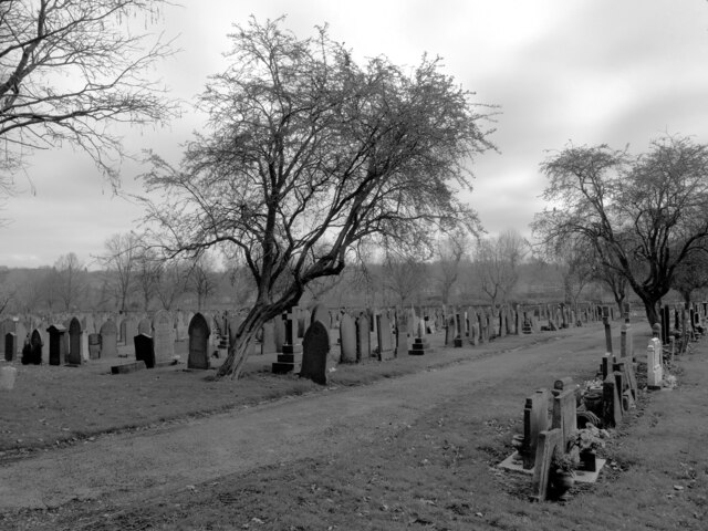
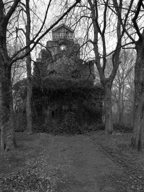
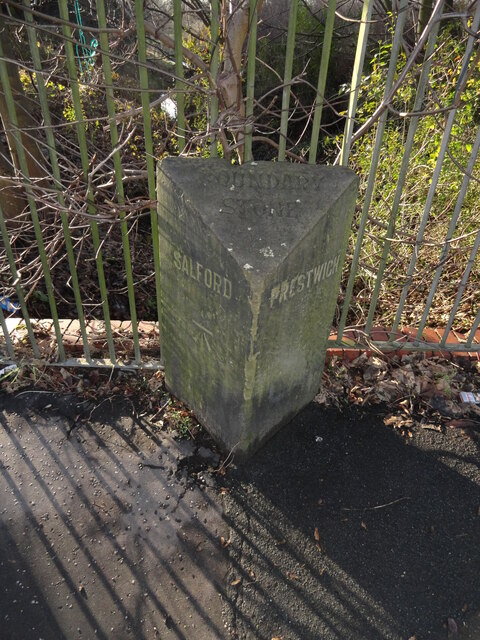
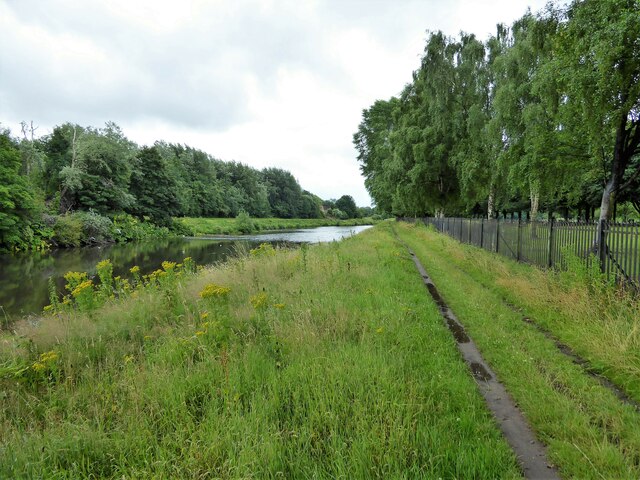
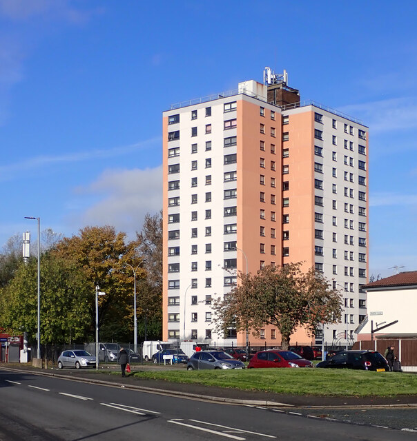
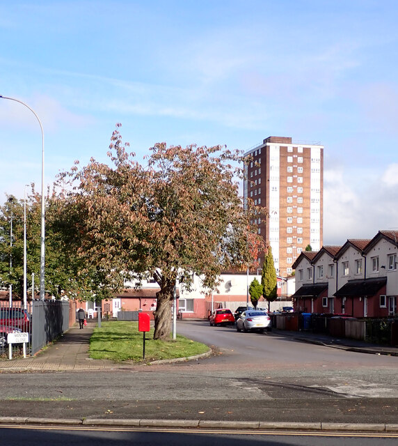
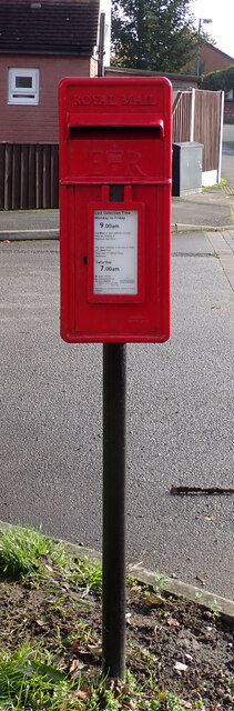
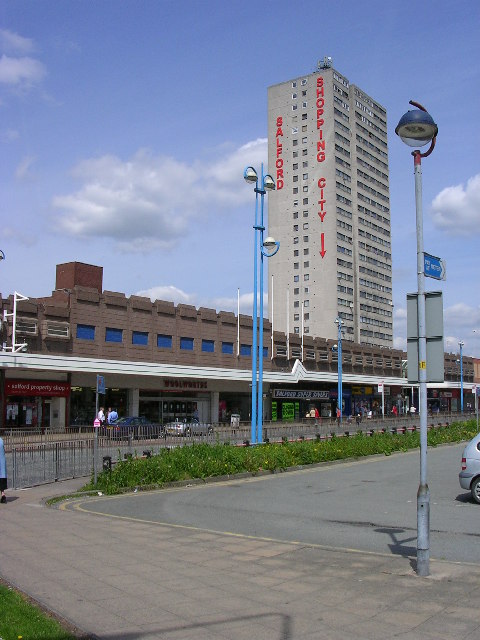
Charlestown Images

Images are sourced within 2km of 53.496939/-2.2764195 or Grid Reference SD8100. Thanks to Geograph Open Source API. All images are credited.

Agecroft Cemetery
Agecroft Cemetery
The crematorium, Agecroft Cemetery
Castle Park Care Home The derelict Castle Park care home in Broughton.
See also <a href="https://www.geograph.org.uk/photo/5371734">SD8200 : Castle Park Care Home</a>.
Castle Park Care Home
The derelict Castle Park care home in Broughton. See also SD8200 : Castle Park Care Home.
Old Boundary Marker on Kersal Vale Road Parish Boundary Marker against railings on the southwest side of Kersal Vale Road, just north of its junction with Moor Lane. On the former boundary of Salford and Prestwich parishes. Now on the boundary of Salford and Bury metropolitan boroughs. Grade II Listed details <span class="nowrap"><a title="https://historicengland.org.uk/listing/the-list/list-entry/1386143" rel="nofollow ugc noopener" href="https://historicengland.org.uk/listing/the-list/list-entry/1386143">Link</a><img style="margin-left:2px;" alt="External link" title="External link - shift click to open in new window" src="https://s1.geograph.org.uk/img/external.png" width="10" height="10"/></span>.

Milestone Society National ID: LA_PRESAL02pb
Old Boundary Marker on Kersal Vale Road
Parish Boundary Marker against railings on the southwest side of Kersal Vale Road, just north of its junction with Moor Lane. On the former boundary of Salford and Prestwich parishes. Now on the boundary of Salford and Bury metropolitan boroughs. Grade II Listed details LinkExternal link. Milestone Society National ID: LA_PRESAL02pb
View from Kersal Wetlands over the skyline of central Manchester and Salford The raised path (Derek Antrobus Way) runs around the perimeter of the Castle Irwell Flood Storage Basin, forming the tranquil Kersal Wetlands
View from Kersal Wetlands over the skyline of central Manchester and Salford
The raised path (Derek Antrobus Way) runs around the perimeter of the Castle Irwell Flood Storage Basin, forming the tranquil Kersal Wetlands
Cromwell Bridge Across the River Irwell, erected in 1882
Cromwell Bridge
Across the River Irwell, erected in 1882
River Irwell View from an old path around the former racecourse perimeter
River Irwell
View from an old path around the former racecourse perimeter
Modern Footbridge Across the River Irwell
Modern Footbridge
Across the River Irwell
River Irwell View from Littleton Bridge towards the weir
River Irwell
View from Littleton Bridge towards the weir
River Irwell and riverside path By the side of the cemetery at Agecroft, the Salford Northern Cemetery
River Irwell and riverside path
By the side of the cemetery at Agecroft, the Salford Northern Cemetery
River Irwell Approaching Charlestown in Salford
River Irwell
Approaching Charlestown in Salford
Lower Broughton Road Development alongside Lower Broughton Road.
Lower Broughton Road
Development alongside Lower Broughton Road.
Footpath towards a riverside walk 
The path from the northwest side of Cromwell Bridge leads to the side of the River Irwell.
Footpath towards a riverside walk
The path from the northwest side of Cromwell Bridge leads to the side of the River Irwell.
Cromwell Bridge 
Carrying  the A576 over the River Irwell.
Cromwell Bridge
Carrying the A576 over the River Irwell.
River Irwell 
Looking upstream from Cromwell Bridge.
River Irwell
Looking upstream from Cromwell Bridge.
Cheshill Court seen from Marlborough Road (A6010), Manchester
Manton Close seen from Marlborough Road (A6010), Manchester A close-up of the post box can be seen in <a href="https://www.geograph.org.uk/photo/7637356">SD8300 : Post box, Manton Close, Manchester</a>.
Manton Close seen from Marlborough Road (A6010), Manchester
A close-up of the post box can be seen in SD8300 : Post box, Manton Close, Manchester.
Post box, Manton Close, Manchester This post box can be seen in context in <a href="https://www.geograph.org.uk/photo/7637355">SD8300 : Manton Close seen from Marlborough Road (A6010), Manchester</a>.
Post box, Manton Close, Manchester
Show me another place!

Charlestown is located at Grid Ref: SD8100 (Lat: 53.496939, Lng: -2.2764195)

Unitary Authority: Salford

Police Authority: Greater Manchester

What 3 Words

///gives.deed.rooms. Near Salford, Manchester

Nearby Locations

Charlestown

Related Wikis

The Tree of Knowledge (mural)

The Tree of Knowledge is a relief mural by the artist Alan Boyson. It was created in 1962 for Cromwell Secondary School for Girls in Salford, England,...

The Albion Academy

The Albion Academy (formerly the Albion High School) is a coeducational secondary school located in Pendleton, Salford, Greater Manchester.The school was...

Irwell Riverside (ward)

Irwell Riverside (ward) is an electoral ward of Salford, England. The ward is bounded by meanders of the River Irwell and includes the main University...

Broughton Suspension Bridge

Broughton Suspension Bridge was an iron chain suspension bridge built in 1826 to span the River Irwell between Broughton and Pendleton, now in Salford...

Pendleton Bridge railway station

Pendleton Bridge railway station was a railway station in Pendleton, Salford built on the Manchester and Bolton Railway, between Salford and Clifton Junction...

Wat Phra Dhammakaya Manchester

Wat Phra Dhammakaya Manchester (Thai: วัดเจริญภาวนา แมนเชสเตอร์; lit. 'the temple for cultivation of meditation'), also known in English as the North-West...

Pendleton, Greater Manchester

Pendleton is an inner-city suburb and district of Salford, Greater Manchester, England. The A6 dual carriageway skirts the east of the district. Historically...

Pendleton railway station

Pendleton (Broad Street) railway station was a railway station serving Pendleton, a district of Salford. It was located on Broughton Road (A576) just behind...

Nearby Amenities

Located within 500m of 53.496939,-2.2764195
Mini Roundabout
Lat/Long: 53.4975727/-2.2798272
Mini Roundabout
Lat/Long: 53.4977706/-2.2810842
Mini Roundabout
Lat/Long: 53.497082/-2.2800852
Bus Stop
Seaford Road/Gerald Road
Bus: yes
Naptan AtcoCode: 1800NF05151
Naptan Bearing: N
Naptan CommonName: Seaford Road/Gerald Road
Naptan Indicator: The Fryer
Naptan Landmark: HOUSE 103
Naptan NaptanCode: mantgjwa
Naptan PlusbusZoneRef: MNCRPIC
Naptan ShortCommonName: Gerald Road
Naptan Street: SEAFORD ROAD
Naptan Verified: no
Network: TfGM
Public Transport: platform
Source: naptan_import
Lat/Long: 53.4962669/-2.2734316
Bus Stop
Littleton Road/Cromwell Road
Bus: yes
Naptan AtcoCode: 1800NF24511
Naptan Bearing: N
Naptan CommonName: Littleton Road/Cromwell Road
Naptan Indicator: Royal Estates
Naptan Landmark: House 11
Naptan NaptanCode: mangjpmw
Naptan PlusbusZoneRef: MNCRPIC
Naptan ShortCommonName: Cromwell Road
Naptan Street: LITTLETON ROAD
Naptan Verified: no
Network: TfGM
Public Transport: platform
Source: naptan_import
Lat/Long: 53.4975973/-2.2772842
Bus Stop
Littleton Road/Cromwell Road
Bus: yes
Naptan AtcoCode: 1800NF24521
Naptan Bearing: S
Naptan CommonName: Littleton Road/Cromwell Road
Naptan Indicator: Op Royal Estate
Naptan Landmark: OP ROYAL ESTATE
Naptan NaptanCode: mangjpta
Naptan PlusbusZoneRef: MNCRPIC
Naptan ShortCommonName: Cromwell Road
Naptan Street: LITTLETON ROAD
Naptan Verified: no
Network: TfGM
Public Transport: platform
Source: naptan_import
Lat/Long: 53.4977862/-2.2772402
Bus Stop
Littleton Road/Reading Street
Bus: yes
Naptan AtcoCode: 1800NF24531
Naptan Bearing: N
Naptan CommonName: Littleton Road/Reading Street
Naptan Indicator: House 73
Naptan Landmark: HOUSE 73
Naptan NaptanCode: mangjptd
Naptan PlusbusZoneRef: MNCRPIC
Naptan ShortCommonName: Reading Street
Naptan Street: LITTLETON ROAD
Naptan Verified: no
Network: TfGM
Public Transport: platform
Source: naptan_import
Lat/Long: 53.4988351/-2.2783286
Bus Stop
Littleton Road/Reading Street
Bus: yes
Naptan AtcoCode: 1800NF24541
Naptan Bearing: S
Naptan CommonName: Littleton Road/Reading Street
Naptan Indicator: Opp House 97
Naptan Landmark: OPP HOUSE 97
Naptan NaptanCode: mangjptg
Naptan PlusbusZoneRef: MNCRPIC
Naptan ShortCommonName: Reading Street
Naptan Street: LITTLETON ROAD
Naptan Verified: no
Network: TfGM
Public Transport: platform
Source: naptan_import
Lat/Long: 53.4994742/-2.2780352
Bus Stop
Gerald Road/Cromwell Road
Bus: yes
Naptan AtcoCode: 1800NF24551
Naptan Bearing: E
Naptan CommonName: Gerald Road/Cromwell Road
Naptan Indicator: Chip Shop
Naptan Landmark: PROPERTY 117
Naptan NaptanCode: mangjptj
Naptan PlusbusZoneRef: MNCRPIC
Naptan ShortCommonName: Cromwell Road
Naptan Street: GERALD ROAD
Naptan Verified: no
Network: TfGM
Public Transport: platform
Source: naptan_import
Lat/Long: 53.4972372/-2.2775231
Bus Stop
Seaford Road/Cromwell Road
Bus: yes
Naptan AtcoCode: 1800NF00461
Naptan Bearing: S
Naptan CommonName: Seaford Road/Cromwell Road
Naptan Indicator: Op 147
Naptan Landmark: House 151
Naptan NaptanCode: mangjdtg
Naptan PlusbusZoneRef: MNCRPIC
Naptan ShortCommonName: Cromwell Road
Naptan Street: SEAFORD ROAD
Naptan Verified: no
Network: TfGM
Public Transport: platform
Source: naptan_import
Lat/Long: 53.4978579/-2.2734268
Bus Stop
Seaford Road/Frederick Road
Bus: yes
Naptan AtcoCode: 1800NF01001
Naptan Bearing: N
Naptan CommonName: Seaford Road/Frederick Road
Naptan Indicator: Op Tramways
Naptan Landmark: WORKS
Naptan NaptanCode: mangjdwm
Naptan Notes: NAME AMENDED
Naptan PlusbusZoneRef: MNCRPIC
Naptan ShortCommonName: Frederick Way
Naptan Street: SEAFORD ROAD
Naptan Verified: no
Network: TfGM
Public Transport: platform
Source: naptan_import
Lat/Long: 53.4942453/-2.2730568
Bus Stop
Littleton Road/Racecourse Hotel
Bus: yes
Naptan AtcoCode: 1800NF40021
Naptan Bearing: S
Naptan CommonName: Littleton Road/Racecourse Hotel
Naptan Indicator: Racecourse
Naptan Landmark: RACECOURSE HTL
Naptan NaptanCode: mangmwtp
Naptan PlusbusZoneRef: MNCRPIC
Naptan ShortCommonName: Racecourse Hotel
Naptan Street: LITTLETON ROAD
Naptan Verified: no
Network: TfGM
Public Transport: platform
Source: naptan_import
Lat/Long: 53.5009217/-2.2778939
Bus Stop
Frederick Road/Seaford Road
Bus: yes
Naptan AtcoCode: 1800NF40381
Naptan Bearing: SW
Naptan CommonName: Frederick Road/Seaford Road
Naptan Indicator: D'vd Lewis Park
Naptan Landmark: D'VD LEWIS PARK
Naptan NaptanCode: mangpapm
Naptan PlusbusZoneRef: MNCRPIC
Naptan ShortCommonName: Seaford Road
Naptan Street: FREDERICK ROAD
Naptan Verified: no
Network: TfGM
Public Transport: platform
Source: naptan_import
Lat/Long: 53.493094/-2.273366
Bus Stop
Cromwell Road/Castle Irwell
Bus: yes
Naptan AtcoCode: 1800NF40431
Naptan Bearing: W
Naptan CommonName: Cromwell Road/Castle Irwell
Naptan Indicator: Op Casino
Naptan Landmark: CASINO
Naptan NaptanCode: mangpatg
Naptan PlusbusZoneRef: MNCRPIC
Naptan ShortCommonName: Castle Irwell
Naptan Street: CROMWELL ROAD
Naptan Verified: no
Network: TfGM
Public Transport: platform
Shelter: yes
Source: naptan_import
Lat/Long: 53.4992288/-2.2714004
Bus Stop
Cromwell Road/Castle Irwell
Bus: yes
Naptan AtcoCode: 1800NF40441
Naptan Bearing: E
Naptan CommonName: Cromwell Road/Castle Irwell
Naptan Indicator: Opp Casino
Naptan Landmark: OPP CASINO
Naptan NaptanCode: mangpatj
Naptan PlusbusZoneRef: MNCRPIC
Naptan ShortCommonName: Castle Irwell
Naptan Street: CROMWELL ROAD
Naptan Verified: no
Network: TfGM
Public Transport: platform
Source: naptan_import
Lat/Long: 53.4992549/-2.2717624
Bus Stop
Cromwell Road/Littleton Road
Bus: yes
Naptan AtcoCode: 1800NF40461
Naptan Bearing: SW
Naptan CommonName: Cromwell Road/Littleton Road
Naptan Indicator: Os House 142
Naptan Landmark: PROPERTY 140
Naptan NaptanCode: mangpatm
Naptan PlusbusZoneRef: MNCRPIC
Naptan ShortCommonName: Littleton Road
Naptan Street: CROMWELL ROAD
Naptan Verified: no
Network: TfGM
Public Transport: platform
Source: naptan_import
Lat/Long: 53.4973669/-2.2758808
Bus Stop
Cromwell Road/Langley Road South
Bus: yes
Naptan AtcoCode: 1800NF40471
Naptan Bearing: NE
Naptan CommonName: Cromwell Road/Langley Road South
Naptan Indicator: Nr Petrol Stn
Naptan Landmark: PETROL STATION
Naptan NaptanCode: mangpatp
Naptan PlusbusZoneRef: MNCRPIC
Naptan ShortCommonName: Langley Road Sth
Naptan Street: CROMWELL ROAD
Naptan Verified: no
Network: TfGM
Public Transport: platform
Source: naptan_import
Lat/Long: 53.4958852/-2.279097
Bus Stop
Cromwell Road/Langley Road South
Bus: yes
Naptan AtcoCode: 1800NF40481
Naptan Bearing: SW
Naptan CommonName: Cromwell Road/Langley Road South
Naptan Indicator: O/s House 18
Naptan Landmark: HOUSE 18
Naptan NaptanCode: mangpatw
Naptan PlusbusZoneRef: MNCRPIC
Naptan ShortCommonName: Langley Road Sth
Naptan Street: CROMWELL ROAD
Naptan Verified: no
Network: TfGM
Public Transport: platform
Source: naptan_import
Lat/Long: 53.4952899/-2.2800126
Bus Stop
Langley Road South/Cromwell Road
Bus: yes
Naptan AtcoCode: 1800NF40531
Naptan Bearing: SE
Naptan CommonName: Langley Road South/Cromwell Road
Naptan Indicator: Kings Arms Pub
Naptan Landmark: St George's Centre
Naptan NaptanCode: mangpawm
Naptan PlusbusZoneRef: MNCRPIC
Naptan ShortCommonName: Cromwell Road
Naptan Street: Langley Road South
Naptan Verified: no
Network: TfGM
Public Transport: platform
Source: naptan_import
Lat/Long: 53.4953355/-2.2814386
Bus Stop
Langley Road South/Cromwell Road
Bus: yes
Naptan AtcoCode: 1800NF40541
Naptan Bearing: NW
Naptan CommonName: Langley Road South/Cromwell Road
Naptan Indicator: Opp Kings Arms
Naptan Landmark: Warehouse
Naptan NaptanCode: mangpawp
Naptan PlusbusZoneRef: MNCRPIC
Naptan ShortCommonName: Cromwell Road
Naptan Street: Langley Road South
Naptan Verified: no
Network: TfGM
Public Transport: platform
Source: naptan_import
Lat/Long: 53.4954767/-2.2817789
Bus Stop
Langley Road South/Douglas Green
Bus: yes
Naptan AtcoCode: 1800NF40551
Naptan Bearing: NW
Naptan CommonName: Langley Road South/Douglas Green
Naptan Indicator: Os Warehouse
Naptan Landmark: WAREHOUSE
Naptan NaptanCode: mangpawt
Naptan PlusbusZoneRef: MNCRPIC
Naptan ShortCommonName: Douglas Green
Naptan Street: Langley Road South
Naptan Verified: no
Network: TfGM
Public Transport: platform
Source: naptan_import
Lat/Long: 53.4966564/-2.2837148
Bus Stop
Langley Road South/Douglas Green
Bus: yes
Naptan AtcoCode: 1800NF40561
Naptan Bearing: SE
Naptan CommonName: Langley Road South/Douglas Green
Naptan Indicator: House 31
Naptan Landmark: HOUSE 31
Naptan NaptanCode: mangpdad
Naptan PlusbusZoneRef: MNCRPIC
Naptan ShortCommonName: Douglas Green
Naptan Street: Langley Road South
Naptan Verified: no
Network: TfGM
Public Transport: platform
Source: naptan_import
Lat/Long: 53.4966658/-2.2835189
Bus Stop
Douglas Green/Library
Bus: yes
Naptan AtcoCode: 1800NF40571
Naptan Bearing: NE
Naptan CommonName: Douglas Green/Library
Naptan Indicator: Opp House 14
Naptan Landmark: COMMUNITY CENT
Naptan NaptanCode: mangpdag
Naptan PlusbusZoneRef: MNCRPIC
Naptan ShortCommonName: Library
Naptan Street: DOUGLAS GREEN
Naptan Verified: no
Network: TfGM
Public Transport: platform
Source: naptan_import
Lat/Long: 53.4976726/-2.2835257
Bus Stop
Douglas Green/Library
Bus: yes
Naptan AtcoCode: 1800NF40581
Naptan Bearing: SW
Naptan CommonName: Douglas Green/Library
Naptan Indicator: House 22
Naptan Landmark: HOUSE 22
Naptan NaptanCode: mangpdaj
Naptan PlusbusZoneRef: MNCRPIC
Naptan ShortCommonName: Library
Naptan Street: DOUGLAS GREEN
Naptan Verified: no
Network: TfGM
Public Transport: platform
Source: naptan_import
Lat/Long: 53.4977274/-2.2831642
Bus Stop
Seaford Road/Cromwell Road
Bus: yes
Naptan AtcoCode: 1800NF01961
Naptan Bearing: N
Naptan CommonName: Seaford Road/Cromwell Road
Naptan Indicator: House 159
Naptan Landmark: HOUSE 159
Naptan NaptanCode: mangjgpw
Naptan PlusbusZoneRef: MNCRPIC
Naptan ShortCommonName: Cromwell Road
Naptan Street: SEAFORD ROAD
Naptan Verified: no
Network: TfGM
Public Transport: platform
Source: naptan_import
Lat/Long: 53.498118/-2.2736696
Bus Stop
Gerald Road/Cromwell Road
Bus: yes
Naptan AtcoCode: 1800NF01971
Naptan Bearing: W
Naptan CommonName: Gerald Road/Cromwell Road
Naptan Indicator: House 100
Naptan Landmark: HOUSE 100
Naptan NaptanCode: mangjgta
Naptan PlusbusZoneRef: MNCRPIC
Naptan ShortCommonName: Cromwell Road
Naptan Street: GERALD ROAD
Naptan Verified: no
Network: TfGM
Public Transport: platform
Source: naptan_import
Lat/Long: 53.4972538/-2.2781412
Bus Stop
Cromwell Road/Littleton Road
Bus: yes
Naptan AtcoCode: 1800NF02721
Naptan Bearing: NE
Naptan CommonName: Cromwell Road/Littleton Road
Naptan Indicator: Race Course
Naptan Landmark: PROPERTY 146
Naptan NaptanCode: mangjmam
Naptan PlusbusZoneRef: MNCRPIC
Naptan ShortCommonName: Littleton Road
Naptan Street: CROMWELL ROAD
Naptan Verified: no
Network: TfGM
Public Transport: platform
Source: naptan_import
Lat/Long: 53.49761/-2.2757014
Bus Stop
Broughton Road East/Albion High School
Bus: yes
Naptan AtcoCode: 1800NF03621
Naptan Bearing: E
Naptan CommonName: Broughton Road East/Albion High School
Naptan Indicator: Nr Warehouse
Naptan Landmark: SCHOOL
Naptan NaptanCode: mangjmja
Naptan PlusbusZoneRef: MNCRPIC
Naptan ShortCommonName: Albion High Schl
Naptan Street: Broughton Road E.
Naptan Verified: no
Network: TfGM
Public Transport: platform
Source: naptan_import
Lat/Long: 53.4938624/-2.2754058
Bus Stop
Seaford Road/Gerald Road
Bus: yes
Naptan AtcoCode: 1800NF03651
Naptan Bearing: S
Naptan CommonName: Seaford Road/Gerald Road
Naptan Indicator: The Fryer
Naptan Landmark: GREGGS
Naptan NaptanCode: mangjmjd
Naptan PlusbusZoneRef: MNCRPIC
Naptan ShortCommonName: Gerald Road
Naptan Street: SEAFORD ROAD
Naptan Verified: no
Network: TfGM
Public Transport: platform
Source: naptan_import
Lat/Long: 53.4962674/-2.2731904
Taxi
Cromwell Road Taxi Rank
Naptan AtcoCode: 1800NFT0701
Naptan CommonName: Cromwell Road Taxi Rank
Naptan Indicator: Cromwell Bridge
Naptan Landmark: CROMWELL BRIDGE
Naptan PlusbusZoneRef: MNCRPIC
Naptan Street: Cromwell Rd
Naptan Verified: no
Source: naptan_import
Lat/Long: 53.4992267/-2.27232
Barrier: block
Bicycle: yes
Foot: yes
Lat/Long: 53.4989425/-2.2786986
Crossing
Crossing: unmarked
Crossing Island: no
Crossing Markings: no
Tactile Paving: yes
Lat/Long: 53.4987893/-2.2812562
Crossing
Crossing: unmarked
Crossing Island: no
Crossing Markings: no
Tactile Paving: yes
Lat/Long: 53.4982467/-2.283412
Turning Circle
Lat/Long: 53.4983822/-2.2730235
Crossing
Lat/Long: 53.4958759/-2.27202
Barrier: bollard
Bicycle: yes
Foot: yes
Motor Vehicle: no
Lat/Long: 53.4961551/-2.2696074
Traffic Signals
Traffic Signals: signal
Traffic Signals Direction: forward
Lat/Long: 53.4935434/-2.2725183
Crossing
Crossing: unmarked
Crossing Island: yes
Crossing Markings: no
Tactile Paving: yes
Lat/Long: 53.4942752/-2.2708658
Fuel
Texaco
Addr City: Salford
Addr Postcode: M6 6DA
Brand: Texaco
Brand Wikidata: Q775060
Fhrs Id: 132749
Fixme Addr1: Castle Irwell Service Station
Fixme Addr2: Cromwell Road
Source Addr: FHRS Open Data
Website: https://locations.valero.com/en-gb/LocationDetails/Index/CROMWELL-ROAD/0000254772
Lat/Long: 53.4988637/-2.2726298
Turning Circle
Lat/Long: 53.4967672/-2.2708842
Crossing
Button Operated: yes
Crossing: traffic_signals
Crossing Island: no
Crossing Markings: dots
Tactile Paving: yes
Lat/Long: 53.4986063/-2.273561
Turning Circle
Maxspeed: 20 mph
Lat/Long: 53.4964038/-2.2795435
Crossing
Lat/Long: 53.4941635/-2.2815529
The Tree of Knowledge
Artist Name: Alan Boyson
Artwork Type: mural
Material: concrete;glass;ceramic tile
Tourism: artwork
Wikidata: Q26672595
Wikipedia: en:The Tree of Knowledge (mural)
Lat/Long: 53.495371/-2.2764995
Bus Stop
Frederick Road/Seaford Road
Bus: yes
Naptan AtcoCode: 1800NF40371
Naptan Bearing: NE
Naptan CommonName: Frederick Road/Seaford Road
Naptan Indicator: Old Bus Depot
Naptan Landmark: SANCTUARY STDNT
Naptan NaptanCode: mangpapj
Naptan PlusbusZoneRef: MNCRPIC
Naptan ShortCommonName: Seaford Road
Naptan Street: FREDERICK ROAD
Naptan Verified: no
Network: TfGM
Public Transport: platform
Source: naptan_import
Lat/Long: 53.4938866/-2.2718966
Barrier: kissing_gate
Bicycle: yes
Foot: yes
Lat/Long: 53.4947051/-2.2728955
Fuel
Shell
Addr Housenumber: 11-13
Addr Postcode: M6 6SX
Addr Street: Cromwell Road
Brand: Shell
Brand Wikidata: Q110716465
Phone: +44 161 925 0760
Ref Navads: NVDS353_10019245
Website: https://find.shell.com/gb/fuel/10019245-salford-service-station
Lat/Long: 53.495852/-2.279394
Camera Direction: 180
Camera Height: 4
Camera Mount: wall
Camera Type: fixed
Man Made: surveillance
Surveillance: outdoor
Surveillance Type: camera
Lat/Long: 53.4944908/-2.2721182
Camera Direction: 270
Camera Height: 4
Camera Mount: wall
Camera Type: fixed
Man Made: surveillance
Surveillance: outdoor
Surveillance Type: camera
Lat/Long: 53.4945618/-2.2719599
Camera Mount: pole
Camera Type: fixed
Man Made: surveillance
Surveillance: outdoor
Surveillance Type: camera
Lat/Long: 53.4943656/-2.271603
Camera Mount: pole
Camera Type: fixed
Man Made: surveillance
Surveillance: outdoor
Surveillance Type: camera
Lat/Long: 53.4948172/-2.2713
Camera Mount: pole
Camera Type: fixed
Man Made: surveillance
Surveillance: outdoor
Surveillance Type: camera
Lat/Long: 53.4946927/-2.2717144
Camera Mount: pole
Camera Type: fixed
Man Made: surveillance
Surveillance: outdoor
Surveillance Type: camera
Lat/Long: 53.4944358/-2.2722857
Camera Direction: 245
Camera Height: 4
Camera Mount: wall
Camera Type: fixed
Man Made: surveillance
Surveillance: outdoor
Surveillance Type: camera
Lat/Long: 53.4945108/-2.2720737
Entrance: main
Lat/Long: 53.4943624/-2.2725611
Noexit: yes
Lat/Long: 53.4990342/-2.2785312
Location: outdoor
Power: transformer
Lat/Long: 53.4941292/-2.2722029
Traffic Signals
Traffic Signals: signal
Lat/Long: 53.4936663/-2.2728366
Barrier: cycle_barrier
Bicycle: yes
Cycle Barrier: double
Cycle Barrier Installation: fixed
Foot: yes
Material: metal
Wheelchair: yes
Lat/Long: 53.4948705/-2.2697854
Barrier: cycle_barrier
Bicycle: yes
Cycle Barrier: double
Foot: yes
Material: metal
Wheelchair: yes
Lat/Long: 53.4999827/-2.2780806
Give Way
Lat/Long: 53.4959903/-2.2824302
Give Way
Lat/Long: 53.4959411/-2.2821869
Give Way
Lat/Long: 53.4963839/-2.2830357
Traffic Signals
Traffic Signals: signal
Traffic Signals Direction: backward
Lat/Long: 53.4940874/-2.2814401
Traffic Signals
Traffic Signals: signal
Traffic Signals Direction: backward
Lat/Long: 53.4940053/-2.2819113
Traffic Signals
Traffic Signals: signal
Traffic Signals Direction: backward
Lat/Long: 53.4943447/-2.2815358
Crossing
Lat/Long: 53.4955488/-2.2725771
Crossing
Lat/Long: 53.4957045/-2.2725789
Crossing
Lat/Long: 53.4958236/-2.2719174
Crossing
Lat/Long: 53.4954935/-2.2719547
Crossing
Lat/Long: 53.4952084/-2.2725772
Crossing
Lat/Long: 53.4954049/-2.2726623
Fast Food
Subway
Brand: Subway
Brand Wikidata: Q244457
Brand Wikipedia: en:Subway (restaurant)
Contact Website: https://restaurants.subway.com/united-kingdom/en/manchester/unit-1-poets-corner-seaford-road
Cuisine: sandwich
Takeaway: yes
Lat/Long: 53.4959405/-2.2729592
Atm
Lat/Long: 53.4959501/-2.2728788
Spar
Brand: Spar
Brand Wikidata: Q610492
Brand Wikipedia: en:SPAR (retailer)
Shop: convenience
Website: https://www.spar.co.uk/store-locator/hal24693-spar-poets-corner-salford/
Lat/Long: 53.4960024/-2.2728273
Fast Food
Greggs
Brand: Greggs
Brand Wikidata: Q3403981
Brand Wikipedia: en:Greggs
Contact Website: https://www.greggs.co.uk/shop-finder?shop-code=1953
Cuisine: sandwich;bakery
Takeaway: yes
Lat/Long: 53.4962609/-2.2728551
Waste Basket
Lat/Long: 53.4959757/-2.2723395
Waste Basket
Lat/Long: 53.4959412/-2.272023
Waste Basket
Lat/Long: 53.4959374/-2.2718964
Waste Basket
Lat/Long: 53.4957172/-2.2718449
Waste Basket
Lat/Long: 53.4955202/-2.2718328
Waste Basket
Lat/Long: 53.4950143/-2.2725662
Crossing
Lat/Long: 53.4956283/-2.2718851
Charlestown
Place: suburb
Lat/Long: 53.4959269/-2.2786424
Bus Stop
Broughton Road East
Bus: yes
Naptan AtcoCode: 1800NFH1681
Naptan Bearing: W
Naptan CommonName: Broughton Road East
Naptan Indicator: W-bound
Naptan Street: Broughton Road East
Naptan Verified: no
Network: TfGM
Public Transport: platform
Source: naptan;bing;naptan_compare_tool
Lat/Long: 53.4935134/-2.2735786
Traffic Signals
Traffic Signals: signal
Traffic Signals Direction: forward
Lat/Long: 53.494123/-2.2819394
Traffic Signals
Traffic Signals: signal
Traffic Signals Direction: forward
Lat/Long: 53.4934636/-2.2732377
Cycleway: asl
Lat/Long: 53.4936399/-2.272799
Traffic Signals
Traffic Signals: signal
Traffic Signals Direction: forward
Lat/Long: 53.4936608/-2.2729014
Cycleway: asl
Direction: forward
Lat/Long: 53.4936238/-2.2728987
Cycleway: asl
Direction: forward
Lat/Long: 53.4934521/-2.2731659
Traffic Signals
Traffic Signals: signal
Traffic Signals Direction: backward
Lat/Long: 53.4932549/-2.2731659
Cycleway: asl
Direction: backward
Lat/Long: 53.4932764/-2.2731177
Cycleway: asl
Direction: forward
Lat/Long: 53.493516/-2.2725798
Bicycle Rental
Sanctuary Students/Broughton Road East
Bicycle Rental: docking_station
Capacity: 10
Email: support@beryl.cc
Fee: yes
Network: tfgm_cycle_hire
Operator: Beryl
Operator Wikidata: Q106575369
Payment App: yes
Payment Cash: no
Payment Credit Cards: no
Payment Cryptocurrencies: no
Payment Debit Cards: no
Payment Electronic Purses: no
Phone: +44 20 3003 5044
Ref Gbfs: beryl_greater_manchester:2977
Rental: city_bike;ebike
Website: https://beryl.cc/scheme/greater-manchester
Lat/Long: 53.493549/-2.27323
Bicycle Rental
Sanctuary Students
Bicycle Rental: docking_station
Capacity: 4
Email: support@beryl.cc
Fee: yes
Network: tfgm_cycle_hire
Operator: Beryl
Operator Wikidata: Q106575369
Payment App: yes
Payment Cash: no
Payment Credit Cards: no
Payment Cryptocurrencies: no
Payment Debit Cards: no
Payment Electronic Purses: no
Phone: +44 20 3003 5044
Ref Gbfs: beryl_greater_manchester:2979
Rental: city_bike;ebike
Website: https://beryl.cc/scheme/greater-manchester
Lat/Long: 53.49364/-2.272615
Bicycle Rental
Orchard Street Industrial Estate
Bicycle Rental: docking_station
Capacity: 6
Email: support@beryl.cc
Fee: yes
Network: tfgm_cycle_hire
Operator: Beryl
Operator Wikidata: Q106575369
Payment App: yes
Payment Cash: no
Payment Credit Cards: no
Payment Cryptocurrencies: no
Payment Debit Cards: no
Payment Electronic Purses: no
Phone: +44 20 3003 5044
Ref Gbfs: beryl_greater_manchester:4067
Rental: city_bike;ebike
Website: https://beryl.cc/scheme/greater-manchester
Lat/Long: 53.496037/-2.282612
Barrier: bollard
Lat/Long: 53.4995736/-2.2716342
Barrier: bollard
Bicycle: yes
Foot: yes
Motor Vehicle: no
Lat/Long: 53.496133/-2.2704615
Crossing
Crossing: unmarked
Crossing Island: yes
Crossing Markings: no
Tactile Paving: yes
Lat/Long: 53.4998219/-2.2779767
Crossing
Button Operated: yes
Crossing: traffic_signals
Crossing Island: yes
Crossing Markings: dots
Tactile Paving: yes
Lat/Long: 53.4973812/-2.2759817
Crossing
Button Operated: yes
Crossing: traffic_signals
Crossing Island: no
Crossing Markings: dots
Tactile Paving: yes
Lat/Long: 53.4984333/-2.2739027
Crossing
Crossing: traffic_signals
Crossing Island: no
Crossing Markings: dots
Tactile Paving: yes
Lat/Long: 53.4984656/-2.2736395
Crossing
Button Operated: yes
Crossing: traffic_signals
Crossing Island: no
Crossing Markings: dots
Tactile Paving: yes
Lat/Long: 53.4986193/-2.27377
Barrier: bollard
Bollard: fixed
Motor Vehicle: no
Lat/Long: 53.4975679/-2.2826253
Barrier: cycle_barrier
Lat/Long: 53.4962533/-2.2793196
Barrier: cycle_barrier
Lat/Long: 53.4962641/-2.2803816
Generator Method: photovoltaic
Generator Output Electricity: yes
Generator Source: solar
Generator Type: solar_photovoltaic_panel
Location: roof
Power: generator
Lat/Long: 53.4986823/-2.2697489
The data included in this document is from www.openstreetmap.org. The data is made available under ODbL.

Have you been to Charlestown?

Leave your review of Charlestown below (or comments, questions and feedback).