Chapel Hill

Settlement in Suffolk Mid Suffolk

England

Chapel Hill

The church of King Charles the Martyr, Shelland A medieval church virtually rebuilt in 1767 <span class="nowrap"><a title="https://historicengland.org.uk/listing/the-list/list-entry/1352321?section=official-list-entry" rel="nofollow ugc noopener" href="https://historicengland.org.uk/listing/the-list/list-entry/1352321?section=official-list-entry">Link</a><img style="margin-left:2px;" alt="External link" title="External link - shift click to open in new window" src="https://s1.geograph.org.uk/img/external.png" width="10" height="10"/></span>
The church of King Charles the Martyr, Shelland Credit: Jonathan Thacker

Chapel Hill is a small village located in the county of Suffolk, England. It is situated approximately 4 miles east of the historic town of Bury St Edmunds, and about 80 miles northeast of London. With a population of around 500 residents, Chapel Hill offers a peaceful and idyllic rural setting.

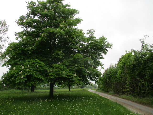
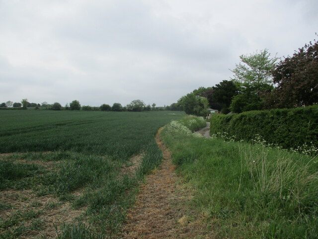
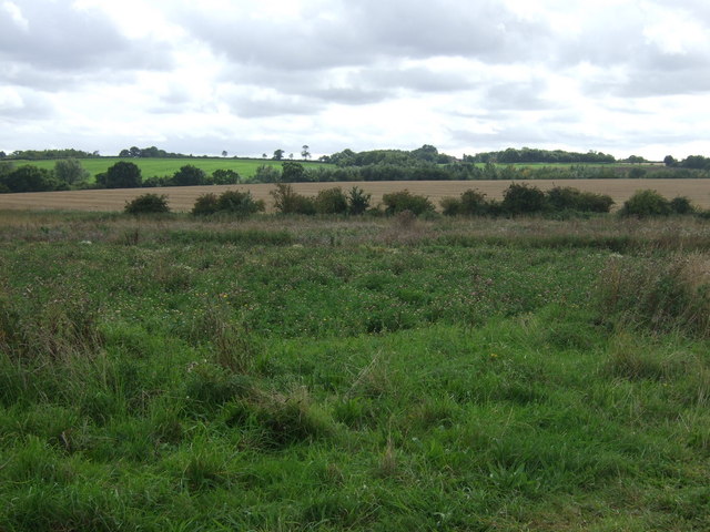
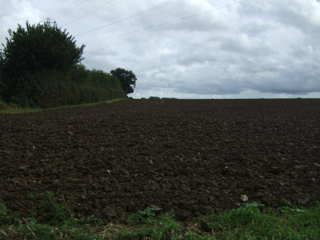
The village is characterized by its charming and picturesque countryside, with rolling hills, meadows, and traditional English cottages dotting the landscape. It is surrounded by farmland, which contributes to the village's agricultural heritage and a strong sense of community.

Chapel Hill is home to a beautiful and historic 12th-century church, St. Mary's, which is a focal point of the village. The church is known for its stunning architecture and hosts regular services, as well as community events. The village also has a small primary school, providing education for local children.

Despite its small size, Chapel Hill offers a variety of amenities and services to its residents. There is a village hall, which serves as a gathering place for social events, clubs, and meetings. Additionally, there is a local pub, offering a cozy atmosphere and a place for residents to relax and socialize.

The village is well-connected to surrounding areas by road, making it easily accessible for both residents and visitors. It is also located near the A14, a major road connecting the Midlands to the East Coast of England.

Overall, Chapel Hill, Suffolk, offers a tranquil and charming countryside experience, with a close-knit community and a rich sense of history.

If you have any feedback on the listing, please let us know in the comments section below.
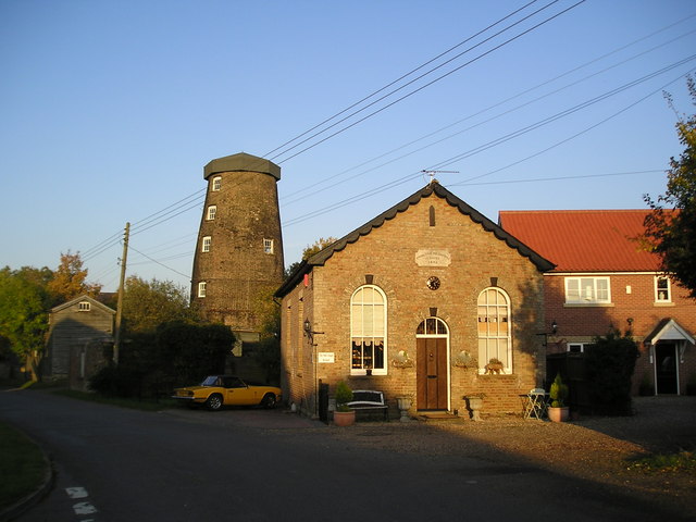
Chapel Hill Images

Images are sourced within 2km of 52.190863/0.94433011 or Grid Reference TM0158. Thanks to Geograph Open Source API. All images are credited.

The church of King Charles the Martyr, Shelland A medieval church virtually rebuilt in 1767 <span class="nowrap"><a title="https://historicengland.org.uk/listing/the-list/list-entry/1352321?section=official-list-entry" rel="nofollow ugc noopener" href="https://historicengland.org.uk/listing/the-list/list-entry/1352321?section=official-list-entry">Link</a><img style="margin-left:2px;" alt="External link" title="External link - shift click to open in new window" src="https://s1.geograph.org.uk/img/external.png" width="10" height="10"/></span>
The church of King Charles the Martyr, Shelland
A medieval church virtually rebuilt in 1767 LinkExternal link
Avenue, Harleston Green
The church of King Charles the Martyr, Shelland Of medieval origin but largely of the eighteenth century <span class="nowrap"><a title="https://historicengland.org.uk/listing/the-list/list-entry/1352321?section=official-list-entry" rel="nofollow ugc noopener" href="https://historicengland.org.uk/listing/the-list/list-entry/1352321?section=official-list-entry">Link</a><img style="margin-left:2px;" alt="External link" title="External link - shift click to open in new window" src="https://s1.geograph.org.uk/img/external.png" width="10" height="10"/></span>
The church of King Charles the Martyr, Shelland
Of medieval origin but largely of the eighteenth century LinkExternal link
Shelland Green
Shelland Green
Footpath to Harleston
Horse chestnut at Shelland
Harleston Green
Harleston Green
Wheat field, Buxhall Fen Street
Entrance To Fishing Lake Entrance to Bakers Puddle fishing lake at Buxhall, Suffolk also see <a title="https://www.geograph.org.uk/photo/2646620" href="https://www.geograph.org.uk/photo/2646620">Link</a>
Entrance To Fishing Lake
Entrance to Bakers Puddle fishing lake at Buxhall, Suffolk also see Link
Bakers Puddle Sign for fishing lake at Buxhall, Suffolk.
Bakers Puddle
Sign for fishing lake at Buxhall, Suffolk.
Field of purple loosestrife
Farmland near Shelland Hall
The Buxhall Crown, Mill Green
Sign for the Buxhall Crown, Mill Green
Track to Shelland Hall
Minor road towards Buxhall Fen Street Heading south east.
Minor road towards Buxhall Fen Street
Heading south east.
Spring Cottage on Mill Lane
Field and hedgerow, Mill Green
Show me another place!

Chapel Hill is located at Grid Ref: TM0158 (Lat: 52.190863, Lng: 0.94433011)

Administrative County: Suffolk

District: Mid Suffolk

Police Authority: Suffolk

What 3 Words

///arch.scrapped.tries. Near Stowmarket, Suffolk

Related Wikis

Onehouse

Onehouse is a small village in the English county of Suffolk, about 3 miles west from the centre of Stowmarket near to the Golf Club. The population of...

Finborough Hall

Finborough Hall is a Grade II listed stucco-faced Tuscan-style country house in Great Finborough, Suffolk, England. The grounds were originally purchased...

Finborough School

Finborough School is a co-educational independent school. It is situated in and around Finborough Hall, in the village of Great Finborough, near Stowmarket...

St Andrews, Great Finborough

St Andrew's Church is situated in the village of Great Finborough, Suffolk, England. It is a Grade II listed building.The church that stands today has...

East Stow Rural District

East Stow was a rural district in East Suffolk, England from 1894 to 1934. It was created under the Local Government Act 1894, from the part of the Stow...

Great Finborough

Great Finborough is a village and civil parish in the Mid Suffolk district, in the county of Suffolk, England; about 3 miles (5 km) south west of Stowmarket...

Harleston, Suffolk

Harleston is a village and civil parish in the Mid Suffolk district of Suffolk, England, just south of the Haughley Bends on the A14. It is located between...

Buxhall

Buxhall is a village and a civil parish in the Mid Suffolk district, in the county of Suffolk, England. The nearest town is Stowmarket. It is home to a...

Nearby Amenities

Located within 500m of 52.190863,0.94433011
Golf: pin
Ref: 18
Lat/Long: 52.1900916/0.9390175
Golf: tee
Ref: 18
Tee: red
Lat/Long: 52.1894343/0.9408232
Golf: tee
Ref: 18
Tee: yellow
Lat/Long: 52.1894766/0.9406935
Golf: tee
Ref: 18
Tee: white
Lat/Long: 52.189519/0.9405662
Golf: pin
Ref: 17
Lat/Long: 52.1883799/0.9417672
Golf: tee
Ref: 16
Tee: white
Lat/Long: 52.1884659/0.9424096
Golf: tee
Ref: 16
Tee: yellow
Lat/Long: 52.1884067/0.942376
Golf: tee
Ref: 16
Tee: red
Lat/Long: 52.1883463/0.9423418
Golf: pin
Ref: 15
Lat/Long: 52.1878191/0.9426382
Golf: tee
Ref: 14
Tee: white
Lat/Long: 52.1878422/0.9430741
Golf: tee
Ref: 14
Tee: yellow
Lat/Long: 52.1876868/0.9431452
Golf: tee
Ref: 14
Tee: red
Lat/Long: 52.1871811/0.9432699
Golf: pin
Ref: 13
Lat/Long: 52.1884667/0.9429391
Golf: tee
Ref: 7
Tee: white
Lat/Long: 52.1870293/0.9472997
Golf: tee
Ref: 7
Tee: yellow
Lat/Long: 52.187012/0.9474164
Golf: tee
Ref: 7
Tee: red
Lat/Long: 52.186996/0.947525
Golf: pin
Ref: 6
Lat/Long: 52.18745/0.9471443
Golf: tee
Ref: 5
Tee: white
Lat/Long: 52.1877702/0.9456711
Golf: tee
Ref: 5
Tee: yellow
Lat/Long: 52.1877665/0.945828
Golf: tee
Ref: 5
Tee: red
Lat/Long: 52.1876979/0.9464751
Golf: pin
Ref: 4
Lat/Long: 52.1874894/0.9461093
Golf: tee
Ref: 3
Tee: red
Lat/Long: 52.1876761/0.9445573
Golf: tee
Ref: 3
Tee: yellow
Lat/Long: 52.1880354/0.9445587
Golf: tee
Ref: 3
Tee: white
Lat/Long: 52.1881168/0.9444876
Golf: pin
Ref: 2
Lat/Long: 52.1882323/0.9438515
Golf: tee
Ref: 2
Tee: white
Lat/Long: 52.1893637/0.9449025
Golf: tee
Ref: 2
Tee: yellow
Lat/Long: 52.1893048/0.9448487
Golf: tee
Ref: 2
Tee: red
Lat/Long: 52.1892419/0.9447912
Golf: pin
Ref: 1
Lat/Long: 52.1896745/0.9453498
Golf: tee
Ref: 1
Tee: white
Lat/Long: 52.1906539/0.938939
Golf: tee
Ref: 1
Tee: yellow
Lat/Long: 52.190626/0.9390614
Golf: tee
Ref: 1
Tee: red
Lat/Long: 52.1906964/0.9392355
The data included in this document is from www.openstreetmap.org. The data is made available under ODbL.

Have you been to Chapel Hill?

Leave your review of Chapel Hill below (or comments, questions and feedback).