Cessford

Settlement in Roxburghshire

Scotland

Cessford

Old milestone After clearing overgrown vegetation from this milestone, the white painted legend is still clear after 11 years of Border weather.  It is a short distance south of Whinnyhouse which is on the east side of the road.   This part of Borders was Roxburghshire prior to the 1970s.
Old milestone Credit: Chris Minto

Cessford is a small rural village located in the Scottish Borders region of Roxburghshire, Scotland. Situated approximately 6 miles southwest of Jedburgh, Cessford is nestled in a picturesque countryside setting.

The village is known for its rich historical heritage, particularly its ancient castle ruins. Cessford Castle, which dates back to the 15th century, stands as a prominent landmark in the area. Although the castle is now in ruins, it offers visitors a glimpse into its former grandeur and architectural splendor.

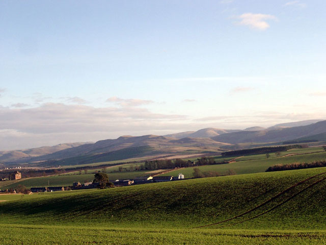
The surrounding landscape of Cessford is characterized by rolling hills, lush green pastures, and meandering rivers. The area is a haven for nature enthusiasts, offering ample opportunities for hiking, fishing, and wildlife spotting. The nearby Oxnam Water and Jed Water provide idyllic spots for fishing and leisurely walks along their banks.

Despite its small size, Cessford has a close-knit community, with a population of around 150 residents. The village benefits from a primary school, a community hall, and a local pub, providing essential amenities for its inhabitants. The Cessford Inn, a traditional Scottish pub, offers warm hospitality and serves as a popular gathering place for locals and visitors alike.

Cessford is well-connected to nearby towns and cities through well-maintained road networks. It provides a peaceful and tranquil setting for those seeking a break from the hustle and bustle of city life, while still being within reach of urban conveniences.

In summary, Cessford offers a charming blend of historical significance, natural beauty, and a close community spirit, making it an appealing destination for visitors and a pleasant place to call home.

If you have any feedback on the listing, please let us know in the comments section below.

Cessford Images

Images are sourced within 2km of 55.50604/-2.421472 or Grid Reference NT7323. Thanks to Geograph Open Source API. All images are credited.

Old milestone After clearing overgrown vegetation from this milestone, the white painted legend is still clear after 11 years of Border weather.  It is a short distance south of Whinnyhouse which is on the east side of the road.   This part of Borders was Roxburghshire prior to the 1970s.
Old milestone
After clearing overgrown vegetation from this milestone, the white painted legend is still clear after 11 years of Border weather. It is a short distance south of Whinnyhouse which is on the east side of the road. This part of Borders was Roxburghshire prior to the 1970s.
Old milestone The road southwards from the Kelso 7 milestone.
Old milestone
The road southwards from the Kelso 7 milestone.
Old milestone Travelling southwards, turning left over the Cessford Burn, then right, this milestone is just to the left in the very small lane, part of a cycle route leading to the B6401 west of Morebattle.   The cottages at the west side of the burn can be seen in the distance.
Old milestone
Travelling southwards, turning left over the Cessford Burn, then right, this milestone is just to the left in the very small lane, part of a cycle route leading to the B6401 west of Morebattle. The cottages at the west side of the burn can be seen in the distance.
Old milestone Looking north along the lane leading to the castle on the east side of the Cessford Burn.   This may have been the original line of this route with a track leading northwards from the right-hand bend beyond the castle and crossing the Cessford Burn nearly a mile further north than the current bridge.
Old milestone
Looking north along the lane leading to the castle on the east side of the Cessford Burn. This may have been the original line of this route with a track leading northwards from the right-hand bend beyond the castle and crossing the Cessford Burn nearly a mile further north than the current bridge.
Marchcleuch Now used for training racehorses
Marchcleuch
Now used for training racehorses
Gallops, Marchcleuch
Farm buildings, Cessford
Spare land, Cessford Obviously something had changed here - a small patch of ground near a large collection of farm buildings. It is the site of a millpond.
Spare land, Cessford
Obviously something had changed here - a small patch of ground near a large collection of farm buildings. It is the site of a millpond.
Oilseed rape, Cessford View towards Hownam Law
Oilseed rape, Cessford
View towards Hownam Law
Scots pines near Cessford
Farm track, Cessford
Oilseed rape near Otterburn View towards Bowmont Forest.
Oilseed rape near Otterburn
View towards Bowmont Forest.
Summit, Bank Hill A field with Aberdeen Angus cattle.
Summit, Bank Hill
A field with Aberdeen Angus cattle.
Gate, Bank Hill Blocked by an electric fence.
Gate, Bank Hill
Blocked by an electric fence.
Gallops, Marchcleuch
Fields near Cessford Cessford and the Cheviots behind.
Fields near Cessford
Cessford and the Cheviots behind.
Cessford Castle Cessford is little more than a single terrace of cottages, and as unattractive as the name. Its one distinction is the 14th Century castle, home of the Kers - a clan of Border Reivers.
Cessford Castle
Cessford is little more than a single terrace of cottages, and as unattractive as the name. Its one distinction is the 14th Century castle, home of the Kers - a clan of Border Reivers.
St Cuthbert's Way looking east towards Cessford Cessford is a small hamlet with an old castle that can be seen to the left of the end of the track.
St Cuthbert's Way looking east towards Cessford
Cessford is a small hamlet with an old castle that can be seen to the left of the end of the track.
Show me another place!

Cessford is located at Grid Ref: NT7323 (Lat: 55.50604, Lng: -2.421472)

Unitary Authority: The Scottish Borders

Police Authority: The Lothians and Scottish Borders

What 3 Words

///embraced.starter.rectangular. Near Jedburgh, Scottish Borders

Nearby Locations

Cessford

Related Wikis

Cessford, Scottish Borders

Cessford is a hamlet and former barony about a mile south of the B6401 road, in the Scottish Borders area of Scotland. The placename is from Gaelic 'ceis...

Cessford Castle

Cessford Castle is a large ruined mid-15th century L-plan castle near the village of Cessford, midway Jedburgh and Kelso, in the historic county of Roxburghshire...

Cessford Burn

Cessford Burn is a small stream which eventually runs to meet the Kale Water and then joins the River Teviot, finally entering the River Tweed at Kelso...

Eckford, Scottish Borders

Eckford is a small village located between the larger towns of Kelso and Jedburgh in the Scottish Borders. The village is in close proximity to both the...

Morebattle

Morebattle is a village in the Scottish Borders area of Scotland, on the B6401, seven miles south of Kelso, Scottish Borders, beside the Kale Water, a...

Crailinghall

Crailinghall is a village near Oxnam in the Scottish Borders area of Scotland, in the former Roxburghshire. Crailinghall is on the route of the St. Cuthbert...

Kale Water

The Kale Water is a 20 miles (32 km) long tributary of the River Teviot in the Scottish Borders area of Scotland. Its feeder burns in the Cheviot Hills...

Kalemouth

Kalemouth is a place in the Scottish Borders area of Scotland, where the Kale Water joins the River Teviot, near to Eckford, Cessford, Crailing, Kelso...

Nearby Amenities

Located within 500m of 55.50604,-2.421472
Cessford
Place: hamlet
Lat/Long: 55.505669/-2.4215447
Ford: yes
Lat/Long: 55.5071888/-2.4211183
Phone
Booth: K6
Covered: booth
Emergency: phone
Note: You can no longer pay for calls is emergency use only, and marked for removal
Lat/Long: 55.5063379/-2.4226758
Power: pole
Lat/Long: 55.5025414/-2.4223056
Power: pole
Lat/Long: 55.5033124/-2.4215707
Power: pole
Lat/Long: 55.5040279/-2.4209029
Power: pole
Lat/Long: 55.5047012/-2.4201569
Power: pole
Lat/Long: 55.5055818/-2.4207285
Power: pole
Lat/Long: 55.5062046/-2.4198219
Power: pole
Lat/Long: 55.5068259/-2.4188831
Power: pole
Lat/Long: 55.5074638/-2.4179363
Power: pole
Lat/Long: 55.5082689/-2.4171799
Power: pole
Lat/Long: 55.5088946/-2.4166113
Information: board
Survey Date: 2021-05-30
Tourism: information
Lat/Long: 55.5078569/-2.4156558
Power: pole
Lat/Long: 55.5044475/-2.4191449
Power: pole
Lat/Long: 55.5041821/-2.4181536
Power: pole
Lat/Long: 55.5039065/-2.417309
Power: pole
Lat/Long: 55.5058664/-2.4216581
Power: pole
Lat/Long: 55.5061887/-2.4228194
Power: pole
Lat/Long: 55.5064118/-2.4236151
The data included in this document is from www.openstreetmap.org. The data is made available under ODbL.

Have you been to Cessford?

Leave your review of Cessford below (or comments, questions and feedback).