Celtic Lakes

Settlement in Monmouthshire

Wales

Celtic Lakes

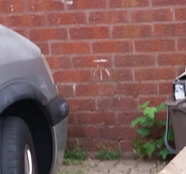
Ordnance Survey Cut Mark This OS cut mark can be found on No83 Swallow Way. It marks a point 8.860m above mean sea level.
Ordnance Survey Cut Mark Credit: Adrian Dust

Celtic Lakes is a picturesque fishing and camping site located in Monmouthshire, Wales. It is nestled amidst the enchanting countryside, offering visitors a tranquil escape from the hustle and bustle of city life. The site spans over 70 acres of stunning natural beauty, including seven well-maintained lakes that are a haven for fishing enthusiasts.

The lakes at Celtic Lakes are stocked with a variety of fish species, including carp, bream, roach, and perch, making it a popular destination for anglers of all levels. Whether you are a seasoned fisherman or a novice looking to try your hand at fishing, Celtic Lakes provides the perfect setting to cast your line and relax in the peaceful surroundings.

For those seeking a longer stay, Celtic Lakes offers a range of camping and glamping options. From traditional tent pitches to luxurious lodges and cabins, there is accommodation to suit every preference. The campsite facilities are well-maintained and include showers, toilets, and a communal kitchen area.

Beyond fishing and camping, Celtic Lakes offers a range of outdoor activities to keep visitors entertained. The site features scenic walking trails, perfect for exploring the surrounding countryside and taking in the breathtaking views. Additionally, there are opportunities for birdwatching and wildlife spotting, as the lakes and surrounding areas are home to a diverse range of species.

With its idyllic setting, excellent fishing opportunities, and a variety of accommodation options, Celtic Lakes is a must-visit destination for nature lovers, fishing enthusiasts, and anyone seeking a peaceful retreat in the heart of Monmouthshire.

If you have any feedback on the listing, please let us know in the comments section below.

Celtic Lakes Images

Images are sourced within 2km of 51.552395/-3.0361055 or Grid Reference ST2884. Thanks to Geograph Open Source API. All images are credited.

Ordnance Survey Cut Mark This OS cut mark can be found on No83 Swallow Way. It marks a point 8.860m above mean sea level.
Ordnance Survey Cut Mark
This OS cut mark can be found on No83 Swallow Way. It marks a point 8.860m above mean sea level.
Ordnance Survey Cut Mark This OS cut mark can be found on No1 Kingfisher Place. It marks a point 9.480m above mean sea level.
Ordnance Survey Cut Mark
This OS cut mark can be found on No1 Kingfisher Place. It marks a point 9.480m above mean sea level.
Ordnance Survey Cut Mark This OS cut mark can be found on No1 Kestrel Way. It marks a point 8.320m above mean sea level.
Ordnance Survey Cut Mark
This OS cut mark can be found on No1 Kestrel Way. It marks a point 8.320m above mean sea level.
Ordnance Survey Cut Mark This OS cut mark can be found on No11 Kestrel Way. It marks a point 8.350m above mean sea level.
Ordnance Survey Cut Mark
This OS cut mark can be found on No11 Kestrel Way. It marks a point 8.350m above mean sea level.
Ordnance Survey Cut Mark This OS cut mark can be found on No86 Woodside. It marks a point 8.480m above mean sea level.
Ordnance Survey Cut Mark
This OS cut mark can be found on No86 Woodside. It marks a point 8.480m above mean sea level.
Ordnance Survey Cut Mark This OS cut mark can be found on The Duffryn Arms. It marks a point 9.140m above mean sea level.
Ordnance Survey Cut Mark
This OS cut mark can be found on The Duffryn Arms. It marks a point 9.140m above mean sea level.
Ordnance Survey Cut Mark This OS cut mark can be found on No104 Sandpiper Way. It marks a point 8.210m above mean sea level.
Ordnance Survey Cut Mark
This OS cut mark can be found on No104 Sandpiper Way. It marks a point 8.210m above mean sea level.
Ordnance Survey Cut Mark This OS cut mark can be found on No1 Mallard Way. It marks a point 7.130m above mean sea level.
Ordnance Survey Cut Mark
This OS cut mark can be found on No1 Mallard Way. It marks a point 7.130m above mean sea level.
Ordnance Survey Cut Mark This OS cut mark can be found on the wall above Pontygwen Reen on Lighthouse Road. It marks a point 7.810m above mean sea level.
Ordnance Survey Cut Mark
This OS cut mark can be found on the wall above Pontygwen Reen on Lighthouse Road. It marks a point 7.810m above mean sea level.
Ordnance Survey Cut Mark This OS cut mark can be found on the wall north side of Cardiff Road. It marks a point 11.440m above mean sea level.
Ordnance Survey Cut Mark
This OS cut mark can be found on the wall north side of Cardiff Road. It marks a point 11.440m above mean sea level.
Dyno plumbing van, Manor Park, Newport Text on the van in August 2021 includes "24 Hour Emergency Plumbing Service". Dyno is a drainage and plumbing company founded in 1963 as Dyno-Rod.
Dyno plumbing van, Manor Park, Newport
Text on the van in August 2021 includes "24 Hour Emergency Plumbing Service". Dyno is a drainage and plumbing company founded in 1963 as Dyno-Rod.
Green and trees near Manor Park, Newport Looking south from the southeast corner of Manor Park.
Green and trees near Manor Park, Newport
Looking south from the southeast corner of Manor Park.
Dominant pylon at the edge of Manor Park, Newport About 100 metres from the camera.
Dominant pylon at the edge of Manor Park, Newport
About 100 metres from the camera.
Social distancing notice, Tredegar House Wales is at COVID-19 Alert Level 0.
Here is a reminder from the National Trust to main social distancing in indoor areas.
Social distancing notice, Tredegar House
Wales is at COVID-19 Alert Level 0. Here is a reminder from the National Trust to main social distancing in indoor areas.
Tredegar House, Newport View up towards the main house, across huge courtyard/stable yard
Tredegar House, Newport
View up towards the main house, across huge courtyard/stable yard
Tredegar House Country Park, Newport The gateway into the parkland.
Tredegar House Country Park, Newport
The gateway into the parkland.
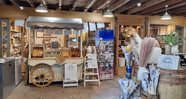
Sero Zero waste shop, Tredegar House, Newport Situated in Tredegar House's grade II listed barn.
Selling dry whole foods, local produce such as bread, baked goods, milk and British grown flowers as well refillable and sustainable products.
Sero Zero waste shop, Tredegar House, Newport
Situated in Tredegar House's grade II listed barn. Selling dry whole foods, local produce such as bread, baked goods, milk and British grown flowers as well refillable and sustainable products.
Wales Coast Path on Lighthouse Road The path follows the road for about 400m at this point
Wales Coast Path on Lighthouse Road
The path follows the road for about 400m at this point
Show me another place!

Celtic Lakes is located at Grid Ref: ST2884 (Lat: 51.552395, Lng: -3.0361055)

Unitary Authority: Newport

Police Authority: Gwent

What 3 Words

///crest.boots.deal. Near Marshfield, Newport

Nearby Locations

Celtic Lakes

Related Wikis

Cwm Silicon

Cwm Silicon (Welsh for Silicon Valley) is an epithet applied to a region of South Wales in the far west of Newport that attracted interest and inward investment...

Coedkernew

Coedkernew (Welsh: Coedcernyw) is a community in the south west of the city of Newport, South Wales, in the Marshfield ward. The parish is bounded by Percoed...

St Joseph's Roman Catholic High School, Newport

St. Joseph's RC High School is a secondary high school on the outskirts of Newport, Wales. == School history and performance == The school was a case study...

Stable Block, Tredegar House

The Stable Block at Tredegar House (Welsh: Tŷ Tredegar) forms part of the complex of buildings at Tredegar House, at Coedkernew, on the western edge of...

Tredegar House

Tredegar House (Welsh: Tŷ Tredegar) is a 17th-century Charles II-era mansion on the southwestern edge of Newport, Wales. For over five hundred years it...

Marshfield, Newport

Marshfield (Welsh: Maerun) is a village and community of Newport, Wales. It sits approximately 5 miles (8 km) southwest of Newport, and 7 miles (11 km...

Tredegar House Country Park

Tredegar Park (Welsh: Parc Tredegar) is a 90-acre (36 ha) public park situated in the western Coedkernew area of the city of Newport, South Wales. It lies...

Tredegar Park and Marshfield

Tredegar Park and Marshfield is an electoral ward for Newport City Council in south Wales. It was created in 2022 by combining the former wards of Tredegar...

Related Videos

Phillipines

A month island hopping.

St Brides coastline april 2023

Lovely to walk a different part of the coastline area towards the lighthouse where swans and geese were walking round the field ...

Tredegar House (2)

A Walk around the inside of Tredegar House Newport Christmas 2021. feel free to share on your media webpage and subscribe ...

Nearby Amenities

Located within 500m of 51.552395,-3.0361055
Coedkernew
Is In City: Newport
Name Cy: Coedcernyw
Name En: Coedkernew
Place: suburb
Source: NPE
Lat/Long: 51.5491768/-3.0383979
Next Generation Data
Addr City: Newport
Addr Housename: Celtic Technology Centre, Celtic Lakes
Addr Place: Imperial Park
Addr Postcode: NP10 8BE
Operator: Next Generation Data
Phone: +44 1633 674 518
Telecom: data_center
Website: https://www.nextgenerationdata.co.uk
Lat/Long: 51.5550188/-3.0382722
Alert Logic datacenter
Addr City: Newport
Addr Housename: Celtic Technology Centre, Celtic Lakes
Addr Place: Imperial Park
Addr Postcode: NP10 8BE
Email: info@alertlogic.com
Office: it
Opening Hours: 24/7
Phone: +44 20 3011 5533
Website: https://www.alertlogic.com/
Lat/Long: 51.5549899/-3.0376553
Lighthouse Laboratory Newport
Addr City: Newport
Addr Housename: Building IP5, Imperial Way
Addr Housenumber: Unit 4
Addr Place: Imperial Park
Addr Postcode: NP10 8BE
Healthcare: laboratory
Opening Hours: Mo-Fr 07:30-16:00; Sa off; Su off
Opening Hours Covid19: Mo-Fr 07:30-16:00; Sa Off; Su Off
Operator: Perkin Elmer
Lat/Long: 51.5527463/-3.0412071
Bicycle Parking
Access: private
Bicycle Parking: stands
Covered: no
Indoor: no
Level: 0
Lit: yes
Operator: KLA
Operator Type: business
Lat/Long: 51.552879/-3.0349814
MM Newport
Addr City: Newport
Addr Place: Imperial Park
Addr Postcode: NP10 8BE
Email: marketing-packaging@mm.group
Man Made: works
Phone: +44 2920 100 600
Product: packaging
Website: https://www.mm-packaging.com/en/
Lat/Long: 51.5540231/-3.0407594
Smith News
Addr City: Newport
Addr Place: Imperial Park
Addr Postcode: NP10 8BE
Addr Unit: Unit 3A
Alt Name: WH Smith
Email: media@smithsnews.co.uk
Office: logistics
Phone: +44 3451 288 888
Website: https://www.smithnews.co.uk/
Lat/Long: 51.5540478/-3.0417725
Centerprise International Newport
Addr City: Newport
Addr Place: Imperial Park
Addr Postcode: NP10 8BE
Alt Name: CiCloud Newport
Telecom: data_center
Website: https://www.centerprisecloud.co.uk
Lat/Long: 51.5556071/-3.0376928
The data included in this document is from www.openstreetmap.org. The data is made available under ODbL.

Have you been to Celtic Lakes?

Leave your review of Celtic Lakes below (or comments, questions and feedback).