Ceann-na-Cleithe

Settlement in Inverness-shire

Scotland

Ceann-na-Cleithe

Loch Harmasaig Most of this loch is hidden behind the knoll on the left.
Loch Harmasaig Credit: Anne Burgess

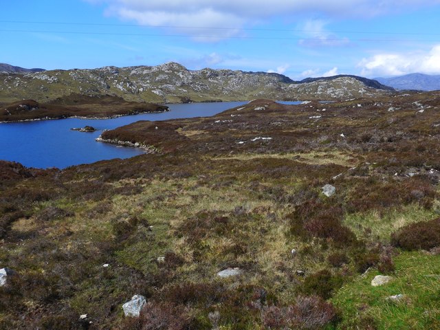
Ceann-na-Cleithe is a small hamlet located in the county of Inverness-shire, Scotland. Situated in the picturesque Scottish Highlands, it is nestled between the scenic Glen Strathfarrar and Glen Cannich, offering breathtaking views of the surrounding mountains and lush green landscapes.

With a population of around 50 residents, Ceann-na-Cleithe is a close-knit community that prides itself on its tranquility and natural beauty. The hamlet primarily consists of traditional stone cottages, adding to its charm and historic character.

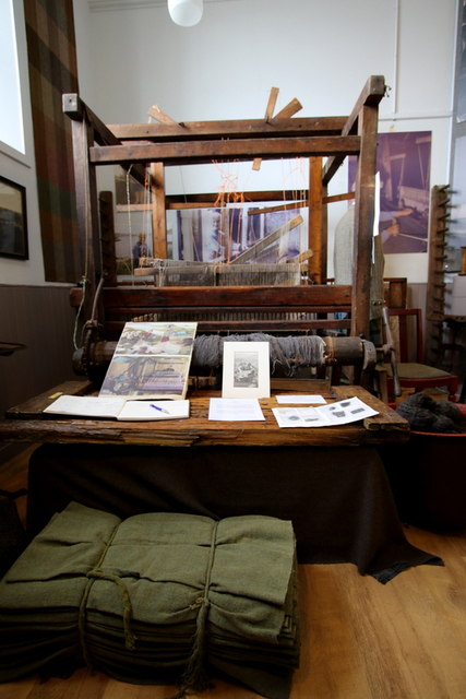
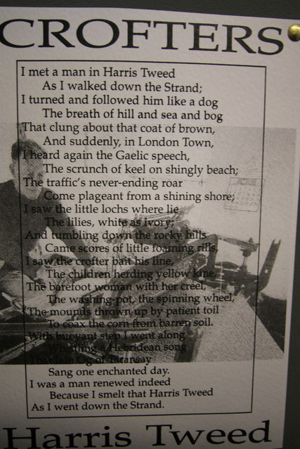
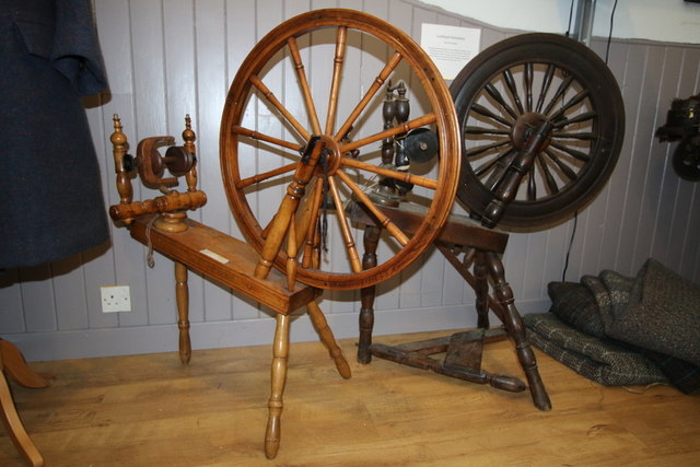
The main economic activities in Ceann-na-Cleithe revolve around agriculture and tourism. Local farmers cultivate crops and rear livestock in the fertile lands surrounding the hamlet. The region's natural beauty attracts visitors from all over the world, who come to explore the nearby Glen Strathfarrar Nature Reserve and Glen Cannich Forest. These areas offer opportunities for hiking, wildlife spotting, birdwatching, and fishing.

While Ceann-na-Cleithe itself does not have many amenities, the nearby village of Cannich, located just a short distance away, provides essential services such as a post office, a general store, and a few small businesses. Inverness, the capital city of the Highlands, is also easily accessible, offering a wider range of amenities and cultural attractions.

Ceann-na-Cleithe is well-known for its strong sense of community spirit, with locals organizing various events throughout the year, including Highland games, music festivals, and traditional ceilidhs. These events foster a sense of pride and unity among the residents, as well as providing entertainment for visitors.

In summary, Ceann-na-Cleithe is a small, idyllic hamlet in Inverness-shire, Scotland, renowned for its stunning natural surroundings, close-knit community, and traditional way of life. It is a haven for nature lovers and those seeking a peaceful retreat in the heart of the Scottish Highlands.

If you have any feedback on the listing, please let us know in the comments section below.

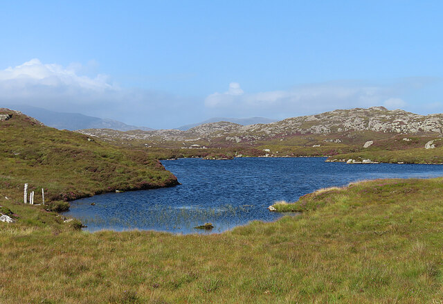
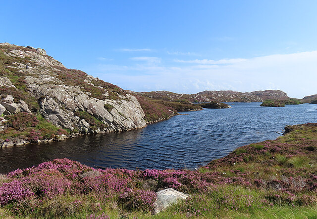
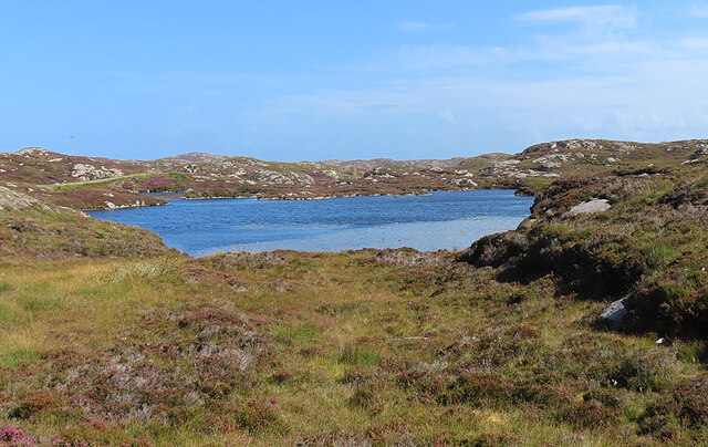
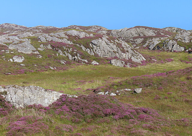
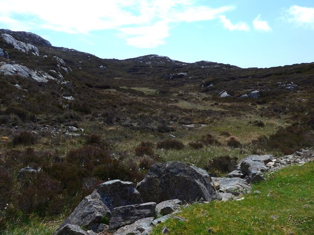
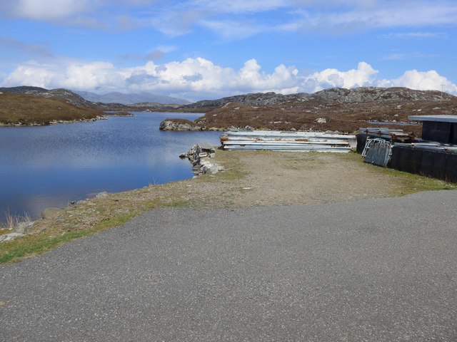
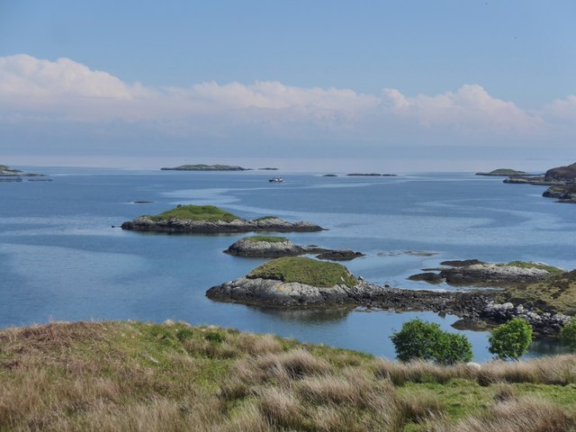
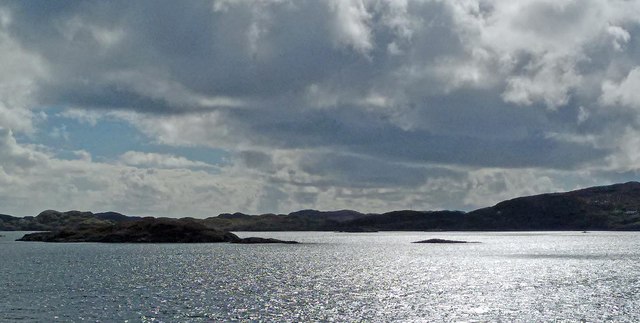
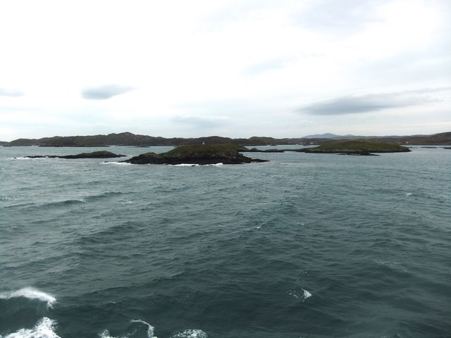
Ceann-na-Cleithe Images

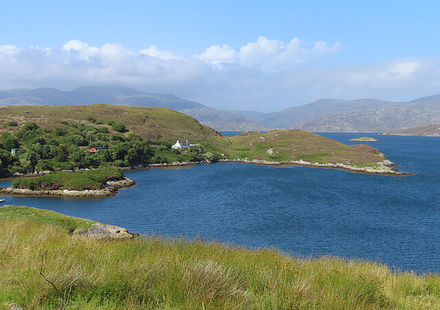
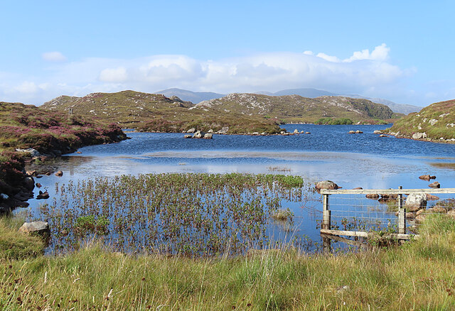
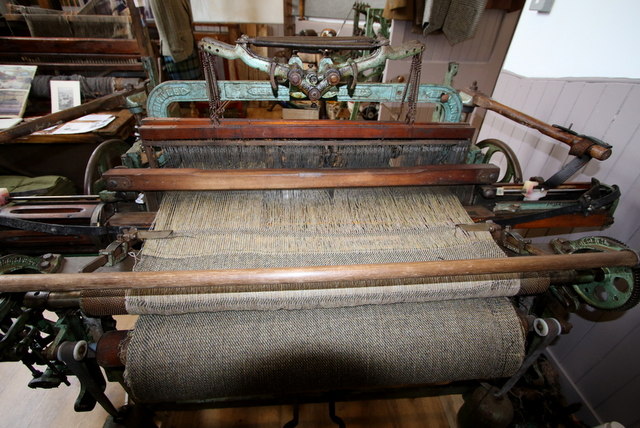
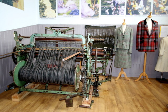
Images are sourced within 2km of 57.84581/-6.7606866 or Grid Reference NG1793. Thanks to Geograph Open Source API. All images are credited.

Loch Harmasaig Most of this loch is hidden behind the knoll on the left.
Loch Harmasaig
Most of this loch is hidden behind the knoll on the left.
Loch nan Uidhean Typical 'Cnoc and Lochan' topography, with a small loch hemmed in by steeply dipping hummocky Lewisian gneiss.
Loch nan Uidhean
Typical 'Cnoc and Lochan' topography, with a small loch hemmed in by steeply dipping hummocky Lewisian gneiss.
Nameless Lochan That is to say, the map doesn't name it.
Nameless Lochan
That is to say, the map doesn't name it.
Loch Phlocrapoil This is one of the larger lochs on the route of the Golden Road.
Loch Phlocrapoil
This is one of the larger lochs on the route of the Golden Road.
Lewisian Gneiss This is classic Lewisian Gneiss, in irregular outcrops smoothed by the glaciers of the last (and no doubt previous) Ice Ages.
Lewisian Gneiss
This is classic Lewisian Gneiss, in irregular outcrops smoothed by the glaciers of the last (and no doubt previous) Ice Ages.
Drinishader A bay on the west side of islet-studded Loch Tairbeart, the largest of the sea-lochs on the east side of Harris.
Drinishader
A bay on the west side of islet-studded Loch Tairbeart, the largest of the sea-lochs on the east side of Harris.
Loch Drinisiadair This is just the southern tip of one of the larger lochs in eastern Harris.
Loch Drinisiadair
This is just the southern tip of one of the larger lochs in eastern Harris.
In the driving seat of the Hattersley Mk1 at Drinisiadar Built in Keighley, West Yorkshire and one time Luddite bait the loom was designed by George Hattersley and from 1919 to the present has proved a godsend to the people of Harris.
In the driving seat of the Hattersley Mk1 at Drinisiadar
Built in Keighley, West Yorkshire and one time Luddite bait the loom was designed by George Hattersley and from 1919 to the present has proved a godsend to the people of Harris.
All trades their gear, tackle, and trim.. The loom and some of the products at the exhibition at Drinisiadar.
All trades their gear, tackle, and trim..
The loom and some of the products at the exhibition at Drinisiadar.
Original Harris Tweed Introduced to Harris in 1919 the Hattersley cottage loom which was manufactured by George Hattersley of Keighley, West Yorkshire and proved a godsend for the people of Harris.
Original Harris Tweed
Introduced to Harris in 1919 the Hattersley cottage loom which was manufactured by George Hattersley of Keighley, West Yorkshire and proved a godsend for the people of Harris.
Nostalgia's not what it used to be! If ever a poem ran in parallel with Yeats' Lake Isle of Innisfree then this is the one.
Nostalgia's not what it used to be!
If ever a poem ran in parallel with Yeats' Lake Isle of Innisfree then this is the one.
The Spinning Wheels of Harris Before you weave, first spin the wool.
The Spinning Wheels of Harris
Before you weave, first spin the wool.
Loch Harmasaig
Loch Harmasaig
Rough ground at Druim nan-Uidhean
Old pontoon equipment at Loch Harmasaig
Islands and skerries off Drinishader Not quite a painted ship on a painted ocean, but close;  there is a fishing boat dead-centre in this image.
Islands and skerries off Drinishader
Not quite a painted ship on a painted ocean, but close; there is a fishing boat dead-centre in this image.
Gloraig Dhubh, Loch an Tairbeairt, Harris The northern (right hand) tip of Gloraig Dhubh, the larger skerry, and the whole of the smaller skerry lie within the grid square.
Gloraig Dhubh, Loch an Tairbeairt, Harris
The northern (right hand) tip of Gloraig Dhubh, the larger skerry, and the whole of the smaller skerry lie within the grid square.
Dun Corr Mor
Dun Corr Mor
Show me another place!

Ceann-na-Cleithe is located at Grid Ref: NG1793 (Lat: 57.84581, Lng: -6.7606866)

Unitary Authority: Na h-Eileanan an Iar

Police Authority: Highlands and Islands

What 3 Words

///also.introduce.shade. Near Tarbert, Na h-Eileanan Siar

Related Wikis

East Loch Tarbert

East Loch Tarbert (Scottish Gaelic: Loch an Tairbeairt) is a sea loch that lies to the east of Harris in the Outer Hebrides of Scotland. The loch contains...

Sgeotasaigh

Scotasay (Scottish Gaelic: Sgeotasaigh) is small island in the Outer Hebrides of Scotland. It lies 1 kilometre (0.6 miles) off the east coast of Harris...

Scalpay, Outer Hebrides

Scalpay (; Scottish Gaelic: Sgalpaigh or Sgalpaigh na Hearadh; i.e. "Scalpay of Harris" to distinguish it from Scalpay off Skye) is an island in the Outer...

Stockinish Island

Stockinish Island (Scottish Gaelic: Eilean Stocainis) is an uninhabited island off Harris, in the Outer Hebrides. == Geography and geology == Stockinish...

Nearby Amenities

Located within 500m of 57.84581,-6.7606866
Passing Place
Lat/Long: 57.8451816/-6.7605263
Post Box
Operator: Royal Mail
Operator Wikidata: Q638098
Post Box Mounting: pier
Post Box Type: lamp
Ref: HS3 165
Royal Cypher: scottish_crown
Source: survey
Lat/Long: 57.8458385/-6.760663
Plocropol
Name En: Plocrapool
Name Gd: Plocropol
Place: hamlet
Lat/Long: 57.8421201/-6.757692
Tourism: camp_site
Lat/Long: 57.8457953/-6.7595016
Passing Place
Lat/Long: 57.843011/-6.7588406
Passing Place
Lat/Long: 57.8499223/-6.7630237
Passing Place
Lat/Long: 57.8477675/-6.7616228
Passing Place
Lat/Long: 57.8465822/-6.7612338
Passing Place
Lat/Long: 57.8435377/-6.7593527
Material: wood
Power: pole
Lat/Long: 57.8496244/-6.7618942
Material: wood
Power: pole
Lat/Long: 57.8457425/-6.7589103
Material: wood
Power: pole
Lat/Long: 57.8460509/-6.7582317
Material: wood
Power: pole
Lat/Long: 57.845587/-6.7585831
Material: wood
Power: pole
Lat/Long: 57.8461679/-6.7598893
Material: wood
Power: pole
Lat/Long: 57.8465769/-6.7598893
Material: wood
Power: pole
Lat/Long: 57.8471264/-6.759959
Material: wood
Power: pole
Lat/Long: 57.8477938/-6.7602702
Material: wood
Power: pole
Lat/Long: 57.8444558/-6.7596786
Material: wood
Power: pole
Lat/Long: 57.8433465/-6.7587305
Material: wood
Power: pole
Lat/Long: 57.8430725/-6.7584247
Material: wood
Power: pole
Lat/Long: 57.8428483/-6.7579285
Material: wood
Power: pole
Lat/Long: 57.8425892/-6.7574363
Material: wood
Power: pole
Lat/Long: 57.8427534/-6.7572217
Man Made: mast
Tower Type: communication
Lat/Long: 57.8430924/-6.7586915
Material: wood
Power: pole
Lat/Long: 57.8421132/-6.7561944
Street Lamp
Lat/Long: 57.8425828/-6.7572633
Material: wood
Power: pole
Lat/Long: 57.8468424/-6.7615692
Material: wood
Power: pole
Lat/Long: 57.8471104/-6.7617743
Material: wood
Power: pole
Lat/Long: 57.8475033/-6.7620896
Material: wood
Power: pole
Lat/Long: 57.84981/-6.7635729
Material: wood
Power: pole
Lat/Long: 57.849947/-6.7637928
Entrance: yes
Lat/Long: 57.8431299/-6.7586753
Passing Place
Lat/Long: 57.8486078/-6.7617253
Passing Place
Lat/Long: 57.8491628/-6.7621278
Material: wood
Power: pole
Lat/Long: 57.8488927/-6.7608234
Power: pole
Lat/Long: 57.8454668/-6.7598182
Power: pole
Lat/Long: 57.8422202/-6.7557821
Power: pole
Lat/Long: 57.8423948/-6.7568035
Telephone
Booth: K6
Covered: booth
Operator: BT
Operator Wikidata: Q593786
Phone: +44 1859 511212
Lat/Long: 57.8477129/-6.7617605
Bun na Leige
Natural: bay
Lat/Long: 57.8466523/-6.7568859
Access: private
Entrance: yes
Lat/Long: 57.8419032/-6.7565577
Access: private
Entrance: yes
Lat/Long: 57.8428182/-6.7569489
Power: pole
Lat/Long: 57.8477342/-6.7614618
Power: pole
Lat/Long: 57.8476229/-6.7617736
Passing Place
Lat/Long: 57.8499223/-6.7630237
The data included in this document is from www.openstreetmap.org. The data is made available under ODbL.

Have you been to Ceann-na-Cleithe?

Leave your review of Ceann-na-Cleithe below (or comments, questions and feedback).