Caoles

Settlement in Argyllshire

Scotland

Caoles

Plocaid Bo buoy, Gunna Sound
Plocaid Bo buoy, Gunna Sound Credit: Alpin Stewart

Caoles is a small village located in the county of Argyllshire, Scotland. Situated on the Isle of Tiree, it is surrounded by picturesque landscapes and offers a tranquil and idyllic setting for residents and visitors alike.

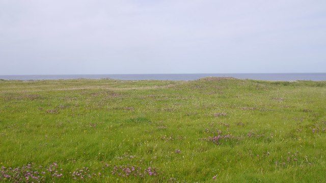
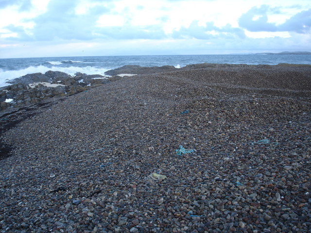
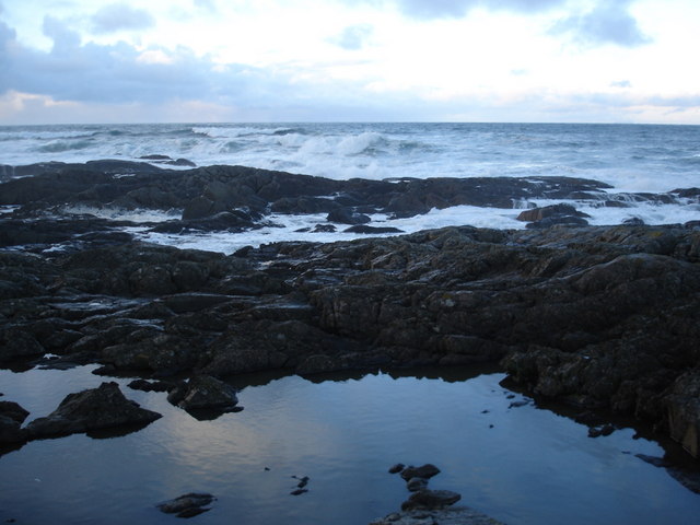
The village is known for its stunning natural beauty, with vast stretches of sandy beaches, clear blue waters, and rolling hills. It is a popular destination for outdoor enthusiasts who enjoy activities such as hiking, cycling, and birdwatching. The area is also renowned for its rich wildlife, including various species of birds and seals that can often be spotted along the shoreline.

Caoles has a close-knit community, with a population of around 100 residents. The village is characterized by its traditional white-washed cottages and small, charming houses. Despite its small size, Caoles has a strong sense of community, with various local events and gatherings taking place throughout the year.

In terms of amenities, Caoles has a small shop that caters to the basic needs of its residents. For additional services and facilities, locals often travel to nearby towns such as Scarinish or Crossapol.

Overall, Caoles offers a peaceful and scenic retreat, perfect for those looking to escape the hustle and bustle of city life. Its natural beauty, friendly community, and range of outdoor activities make it a delightful place to visit or call home.

If you have any feedback on the listing, please let us know in the comments section below.

Caoles Images

Images are sourced within 2km of 56.541163/-6.7455566 or Grid Reference NM0848. Thanks to Geograph Open Source API. All images are credited.

Plocaid Bo buoy, Gunna Sound
Port Chunn Nèill, Isle of Tiree
Northeastern corner of Tiree
East coast of Tiree
East coast of Tiree
Machair, Urvaig
Machair, Urvaig
Urvaig, Tiree
Urvaig, Tiree
Watching for sharks off the Sound Of Gunna
Rocky coast of the most northerly part of Tiree
Across the Gunna Sound
Foam on the rocks at Urvaig
Pebble beach at Urvaig
Rock pool reflection at Urvaig
Rocks and pebble bank at Urvaig
The beach at Port Chunn Neill
Port Chunn Nèill
Port Chunn Nèill
Port Chunn Nèill, Tiree
Coastal grassland at Urvaig
Port Chunn Nèill, northeast Tiree
Show me another place!

Caoles is located at Grid Ref: NM0848 (Lat: 56.541163, Lng: -6.7455566)

Unitary Authority: Argyll and Bute

Police Authority: Argyll and West Dunbartonshire

Also known as: Caolas

What 3 Words

///rivers.ambitions.parrot. Near Scarinish, Argyll & Bute

Nearby Locations

Caoles Caolas Caolas

Related Wikis

Gunna, Scotland

Gunna (Gaelic: Gunnaigh) is an island in the Inner Hebrides of Scotland. == Geography and geology == Gunna lies between Coll and Tiree, closer to Coll...

Dun Mor Vaul

Dun Mor Vaul (or simply Dun Mor; Scottish Gaelic: Dùn Mòr) is an iron-age broch located on the north coast of the island of Tiree, in Scotland. ��2�...

Tiree

Tiree (; Scottish Gaelic: Tiriodh, pronounced [ˈtʲʰiɾʲəɣ]) is the most westerly island in the Inner Hebrides of Scotland. The low-lying island, southwest...

Scarinish

Scarinish (Scottish Gaelic: Sgairinis [ˈs̪kaɾʲɪnɪʃ]) is the main village on the island of Tiree, in the Inner Hebrides of Scotland. It is located on the...

Breachacha crannog

The Breachacha crannog is a crannog located near Loch Breachacha, on the Inner Hebridean island of Coll. The crannog is recognised in the United Kingdom...

Tiree Airport

Tiree Airport (Scottish Gaelic: Port-adhair Thiriodh) (IATA: TRE, ICAO: EGPU) is located 2.5 nautical miles (4.6 km; 2.9 mi) north northeast of Balemartine...

Breachacha Castle

Breachacha Castle (also spelled Breacachadh) is either of two structures on the shore of Loch Breachacha, on the Inner Hebridean island of Coll, Scotland...

Nearby Amenities

Located within 500m of 56.541163,-6.7455566
Source: PGS
Lat/Long: 56.5429794/-6.7391416
Telephone
Defibrillator
Access: yes
Booth: K6
Covered: booth
Defibrillator Location: inside old red phone box, Caolas
Emergency: defibrillator
Man Made: telephone_box
Old Phone: +44 1879 220 310
Lat/Long: 56.5413257/-6.7448894
Barrier: cattle_grid
Lat/Long: 56.5415848/-6.7443537
Post Box
Post Box Type: wall
Ref: PA77 121
Royal Cypher: GR
Royal Cypher Wikidata: Q33102273
Lat/Long: 56.5411491/-6.7453954
Barrier: cattle_grid
Lat/Long: 56.5449382/-6.7473305
Barrier: cattle_grid
Lat/Long: 56.5434405/-6.7460684
Power: pole
Lat/Long: 56.5441901/-6.7436233
Power: pole
Lat/Long: 56.542386/-6.7452487
Power: pole
Lat/Long: 56.5421006/-6.746209
Power: pole
Lat/Long: 56.5417856/-6.747365
Power: pole
Lat/Long: 56.5413686/-6.7488965
Power: pole
Lat/Long: 56.540959/-6.7503932
Power: pole
Lat/Long: 56.5404843/-6.7520991
Power: pole
Lat/Long: 56.5415461/-6.7526436
Power: pole
Lat/Long: 56.5419158/-6.7512676
Power: pole
Lat/Long: 56.542318/-6.7499185
Power: pole
Lat/Long: 56.5430929/-6.7472953
Power: pole
Lat/Long: 56.5434359/-6.7461446
Power: pole
Lat/Long: 56.5427084/-6.7486149
Power: pole
Lat/Long: 56.543983/-6.7503047
Power: pole
Lat/Long: 56.5437169/-6.7490897
Power: pole
Lat/Long: 56.5438544/-6.7447364
Caolas
Alt Name Gd: An Caolas Tiristeach
Name Gd: An Caolas
Place: village
Lat/Long: 56.5418078/-6.7439985
Passing Place
Lat/Long: 56.5438681/-6.7464521
Passing Place
Lat/Long: 56.5406111/-6.7472671
Passing Place
Lat/Long: 56.5380346/-6.7442262
Barrier: cattle_grid
Lat/Long: 56.5401784/-6.7394474
Barrier: cattle_grid
Lat/Long: 56.5418577/-6.7431216
Power: pole
Lat/Long: 56.5432644/-6.749323
Power: pole
Lat/Long: 56.5428415/-6.7487866
Power: pole
Lat/Long: 56.5425516/-6.7483735
Power: pole
Lat/Long: 56.5427409/-6.739879
Power: pole
Lat/Long: 56.5427025/-6.74052
Power: pole
Lat/Long: 56.5426404/-6.7414266
Power: pole
Lat/Long: 56.542593/-6.7421642
Power: pole
Lat/Long: 56.5429405/-6.7432612
Power: pole
Lat/Long: 56.5427291/-6.7440203
Power: pole
Lat/Long: 56.5372033/-6.7438889
Power: pole
Lat/Long: 56.5380171/-6.7443703
Power: pole
Lat/Long: 56.5387111/-6.744685
Power: pole
Lat/Long: 56.5395703/-6.7450419
Power: pole
Lat/Long: 56.5403108/-6.7453438
Power: pole
Lat/Long: 56.541/-6.7462645
Power: pole
Lat/Long: 56.5414599/-6.7469086
Power: pole
Lat/Long: 56.5397496/-6.7383268
Power: pole
Lat/Long: 56.5398544/-6.7390785
Power: pole
Lat/Long: 56.5403713/-6.7392876
Power: pole
Lat/Long: 56.5390557/-6.7383563
Power: pole
Lat/Long: 56.5384409/-6.742888
Power: pole
Lat/Long: 56.5388799/-6.7413591
Power: pole
Lat/Long: 56.5393596/-6.7396423
The data included in this document is from www.openstreetmap.org. The data is made available under ODbL.

Have you been to Caoles?

Leave your review of Caoles below (or comments, questions and feedback).