Cairns

Settlement in Lanarkshire

Scotland

Cairns

Path through meadow Informal path through formerly grazed field
Path through meadow Credit: Jim Smillie

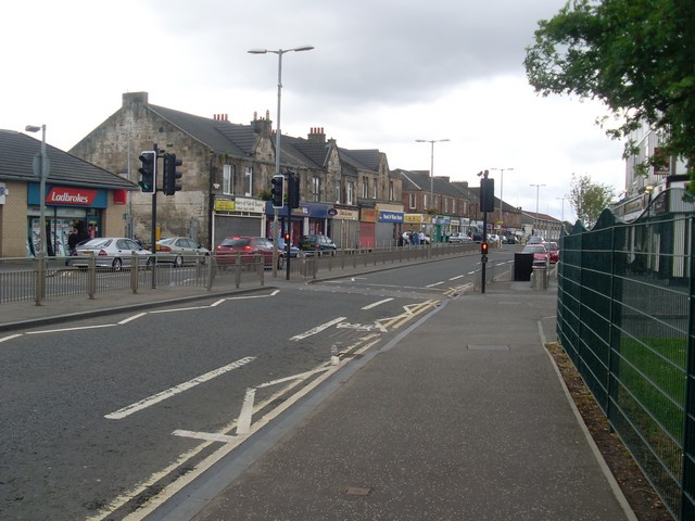
Cairns is a small village located in the county of Lanarkshire, Scotland. Situated approximately 10 miles southeast of Glasgow, it lies on the eastern bank of the River Clyde. With a population of around 2,000 residents, Cairns offers a peaceful and close-knit community atmosphere.

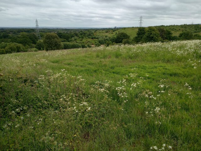
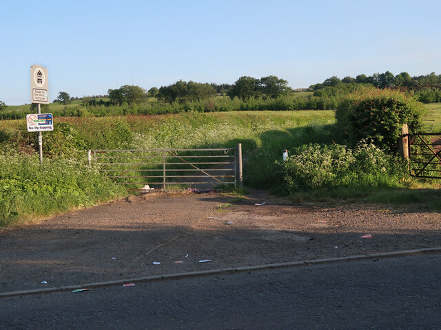
The village is known for its picturesque surroundings, surrounded by lush green fields and rolling hills. The nearby Clyde Valley provides a beautiful backdrop, offering residents and visitors stunning views and ample opportunities for outdoor activities.

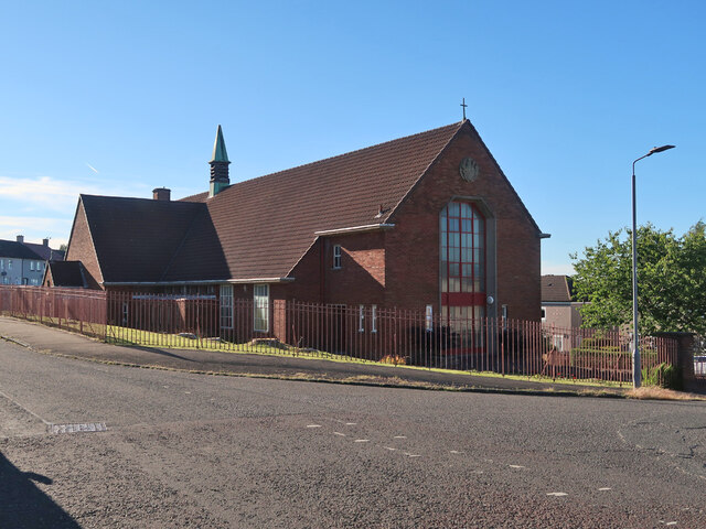
Cairns boasts a rich history, with evidence of human settlement dating back to prehistoric times. The village has several historical landmarks, including the ruins of the 13th-century Cairns Castle, which played a crucial role in Scotland's turbulent past. The village also features a charming old church that dates back to the 19th century.

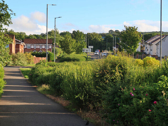
Despite its small size, Cairns offers a range of amenities to cater to its residents. There are local shops, a primary school, and a community center that hosts various events and activities throughout the year. The village is well-connected to the surrounding areas, with regular bus services and easy access to major roads.

For those seeking a slower pace of life and a tight-knit community, Cairns in Lanarkshire provides an ideal setting. The village's natural beauty, rich history, and friendly atmosphere make it a wonderful place to call home.

If you have any feedback on the listing, please let us know in the comments section below.

Cairns Images

Images are sourced within 2km of 55.81158/-4.1463545 or Grid Reference NS6559. Thanks to Geograph Open Source API. All images are credited.

Path through meadow Informal path through formerly grazed field
Path through meadow
Informal path through formerly grazed field
Hallside field 2022 Grown wilder since 2016 <a href="https://www.geograph.org.uk/photo/4875858">NS6759 : Hallside lands</a>
Hallside field 2022
Grown wilder since 2016 NS6759 : Hallside lands
Cattle near Flemington Farm Rough grazing in a field next to the minor road to East Kilbride.
Cattle near Flemington Farm
Rough grazing in a field next to the minor road to East Kilbride.
Cycle lane on the A724 Passing the site of the Bardykes Colliery on the left. The colliery opened in 1874 and closed in 1962.
Cycle lane on the A724
Passing the site of the Bardykes Colliery on the left. The colliery opened in 1874 and closed in 1962.
Footpath in Drumsargad Drumsagard Village is a new construction established after the closure of the nearby Hallside Steelworks in 1979 and is built around the site of  Drumsagard Castle. The footpath is separated by bushes from Hallside Boulevard, the main road through the development.
Footpath in Drumsargad
Drumsagard Village is a new construction established after the closure of the nearby Hallside Steelworks in 1979 and is built around the site of Drumsagard Castle. The footpath is separated by bushes from Hallside Boulevard, the main road through the development.
Manse Brae Closed to traffic it is now a walking and cycling route between Hamilton Road and Hallside Road. The Manse was for the U.P. Church and the building still exists at the Hamilton Road end of the brae.
Manse Brae
Closed to traffic it is now a walking and cycling route between Hamilton Road and Hallside Road. The Manse was for the U.P. Church and the building still exists at the Hamilton Road end of the brae.
Minor road near Gilbertfield Castle ruins The ruins are off to the left and Dechmont Rifle Ranges are off to the right.
Minor road near Gilbertfield Castle ruins
The ruins are off to the left and Dechmont Rifle Ranges are off to the right.
St Cadoc's church, Halfway, Cambuslang A brick built church in a housing estate. The church opened in 1955.
St Cadoc's church, Halfway, Cambuslang
A brick built church in a housing estate. The church opened in 1955.
Views towards Gilbertfield Castle <span class="nowrap"><a title="https://en.wikipedia.org/wiki/Gilbertfield_Castle" rel="nofollow ugc noopener" href="https://en.wikipedia.org/wiki/Gilbertfield_Castle">Link</a><img style="margin-left:2px;" alt="External link" title="External link - shift click to open in new window" src="https://s1.geograph.org.uk/img/external.png" width="10" height="10"/></span>

Gilbertfield Castle is a ruined 17th-century castle in South Lanarkshire, Scotland. It is located at NS652587, on the north slope of Dechmont Hill, just outside Cambuslang, to the south-east of Glasgow.
Views towards Gilbertfield Castle
LinkExternal link Gilbertfield Castle is a ruined 17th-century castle in South Lanarkshire, Scotland. It is located at NS652587, on the north slope of Dechmont Hill, just outside Cambuslang, to the south-east of Glasgow.
Dechmont Rifle Range
Location of Cut Mark - Dechmont Rifle Range, Building <span class="nowrap"><a title="https://www.bench-marks.org.uk/bm174463" rel="nofollow ugc noopener" href="https://www.bench-marks.org.uk/bm174463">Link</a><img style="margin-left:2px;" alt="External link" title="External link - shift click to open in new window" src="https://s1.geograph.org.uk/img/external.png" width="10" height="10"/></span>
Location of Cut Mark - Dechmont Rifle Range, Building
Cut Mark - Dechmont Rifle Range, Building <span class="nowrap"><a title="https://www.bench-marks.org.uk/bm174463" rel="nofollow ugc noopener" href="https://www.bench-marks.org.uk/bm174463">Link</a><img style="margin-left:2px;" alt="External link" title="External link - shift click to open in new window" src="https://s1.geograph.org.uk/img/external.png" width="10" height="10"/></span>
Cut Mark - Dechmont Rifle Range, Building
Dechmont Hill Trig Point Flush Bracket S3608
Turnlaw Trig Point Flush Bracket S3650
Turnlaw Road, Greenlees The road is closed to all vehicles except for farm vehicles and is used by walkers and cyclists.
Turnlaw Road, Greenlees
The road is closed to all vehicles except for farm vehicles and is used by walkers and cyclists.
Turnlaw Road at East Greenlees Road The road is closed to all vehicles except for farm vehicles and is used by walkers and cyclists.
Turnlaw Road at East Greenlees Road
The road is closed to all vehicles except for farm vehicles and is used by walkers and cyclists.
View to Back o'Hill Derelict cottage, vintage c.1920
View to Back o'Hill
Derelict cottage, vintage c.1920
Back o'Hill Cottage (Derelict) Close up view.
Back o'Hill Cottage (Derelict)
Close up view.
Show me another place!

Cairns is located at Grid Ref: NS6559 (Lat: 55.81158, Lng: -4.1463545)

Unitary Authority: South Lanarkshire

Police Authority: Lanarkshire

What 3 Words

///wishes.fans.pocket. Near Cambuslang, South Lanarkshire

Nearby Locations

Cairns Wellside Halfway

Related Wikis

Halfway, South Lanarkshire

Halfway is a largely suburban area in the town of Cambuslang, Scotland, located within the local authority area of South Lanarkshire. It borders the smaller...

Cambuslang Hibernian F.C.

Cambuslang Hibernian F.C., also known as the Cambuslang Hibs, was a football club based in the town of Cambuslang, Scotland which was founded in 1884 and...

Whitefield Park

Whitefield Park was a football ground in Cambuslang, Scotland. It was the home ground of Cambuslang F.C. between 1888 and 1897, including their two seasons...

Newton (South Lanarkshire) rail accident

On 21 July 1991, two commuter trains crashed just west of Newton railway station in Cambuslang, near Glasgow, Scotland. The junction had been remodelled...

Nearby Amenities

Located within 500m of 55.81158,-4.1463545
Bus Stop
New Road
Naptan AtcoCode: 61501682
Naptan Bearing: E
Naptan CommonName: New Road
Naptan Indicator: Before New Road
Naptan Landmark: New Road
Naptan NaptanCode: 75295458
Naptan PlusbusZoneRef: GLGC
Naptan Street: Hamilton Road
Naptan Verified: no
Source: naptan_import
Lat/Long: 55.8114073/-4.1404465
Bus Stop
New Road
Naptan AtcoCode: 6150441
Naptan Bearing: W
Naptan CommonName: New Road
Naptan Indicator: After New Road
Naptan Landmark: After New Road
Naptan NaptanCode: 75236895
Naptan PlusbusZoneRef: GLGC
Naptan Street: Hamilton Road
Naptan Verified: no
Source: naptan_import
Lat/Long: 55.8112766/-4.1407266
Bus Stop
Mill Road
Naptan AtcoCode: 6150442
Naptan Bearing: SE
Naptan CommonName: Mill Road
Naptan Indicator: At Mill Road
Naptan Landmark: Mill Road
Naptan NaptanCode: 75234695
Naptan PlusbusZoneRef: GLGC
Naptan Street: Hamilton Road
Naptan Verified: no
Source: naptan_import
Lat/Long: 55.812129/-4.1453477
Bus Stop
Craigallian Avenue
Naptan AtcoCode: 6150443
Naptan Bearing: NW
Naptan CommonName: Craigallian Avenue
Naptan Indicator: At Craigallian Avenue
Naptan Landmark: Craigallian Avenue
Naptan NaptanCode: 75236373
Naptan PlusbusZoneRef: GLGC
Naptan Street: Hamilton Road
Naptan Verified: no
Source: naptan_import
Lat/Long: 55.8123834/-4.1468365
Bus Stop
Hamilton Crescent
Naptan AtcoCode: 6150444
Naptan Bearing: NW
Naptan CommonName: Hamilton Crescent
Naptan Indicator: At Hamilton Crescent
Naptan Landmark: Hamilton Crescent
Naptan NaptanCode: 75234536
Naptan PlusbusZoneRef: GLGC
Naptan Street: Hamilton Road
Naptan Verified: no
Source: naptan_import
Lat/Long: 55.8144238/-4.1519608
Bus Stop
MacDougal Drive
Naptan AtcoCode: 6150445
Naptan Bearing: SE
Naptan CommonName: MacDougal Drive
Naptan Indicator: Near MacDougal Drive
Naptan Landmark: MacDougal Drive
Naptan NaptanCode: 75234763
Naptan PlusbusZoneRef: GLGC
Naptan Street: Hamilton Road
Naptan Verified: no
Source: naptan_import
Lat/Long: 55.8145793/-4.1518098
Bus Stop
Opposite No 65 Mill Road
Naptan AtcoCode: 6150476
Naptan Bearing: N
Naptan CommonName: Opposite No 65 Mill Road
Naptan Indicator: At Halfway Bowling Club
Naptan Landmark: Halfway Bowling Club
Naptan NaptanCode: 75237246
Naptan PlusbusZoneRef: GLGC
Naptan Street: Mill Road
Naptan Verified: no
Source: naptan_import
Lat/Long: 55.8139242/-4.1455806
Bus Stop
Overton Street
Naptan AtcoCode: 6150477
Naptan Bearing: NW
Naptan CommonName: Overton Street
Naptan Indicator: Near Overton Street
Naptan Landmark: Overton Street
Naptan NaptanCode: 75234383
Naptan PlusbusZoneRef: GLGC
Naptan Street: Overton Road
Naptan Verified: no
Source: naptan_import
Lat/Long: 55.8142064/-4.1433136
Bus Stop
Langcroft Drive
Naptan AtcoCode: 6150478
Naptan Bearing: NW
Naptan CommonName: Langcroft Drive
Naptan Indicator: Near Langcroft Road
Naptan Landmark: Langcroft Road
Naptan NaptanCode: 75236964
Naptan PlusbusZoneRef: GLGC
Naptan Street: Hamilton Crescent
Naptan Verified: no
Source: naptan_import
Lat/Long: 55.8143296/-4.152211
Bus Stop
Oak Drive
Naptan AtcoCode: 6150481
Naptan Bearing: SE
Naptan CommonName: Oak Drive
Naptan Indicator: Opp Oak Drive
Naptan Landmark: Oak Drive
Naptan NaptanCode: 75232465
Naptan PlusbusZoneRef: GLGC
Naptan Street: Rosebank Drive
Naptan Verified: no
Source: naptan_import
Lat/Long: 55.8125979/-4.1505033
Bus Stop
Wellside Drive
Naptan AtcoCode: 6150482
Naptan Bearing: SE
Naptan CommonName: Wellside Drive
Naptan Indicator: Near Wellside Drive
Naptan Landmark: Wellside Drive
Naptan NaptanCode: 75236989
Naptan PlusbusZoneRef: GLGC
Naptan Street: Rosebank Drive
Naptan Verified: no
Source: naptan_import
Lat/Long: 55.8114689/-4.1487652
Bus Stop
Trinity Drive
Naptan AtcoCode: 6150483
Naptan Bearing: W
Naptan CommonName: Trinity Drive
Naptan Indicator: Opp The Cairns School
Naptan Landmark: Trinity Drive
Naptan NaptanCode: 75235497
Naptan PlusbusZoneRef: GLGC
Naptan Street: Woodland Crescent
Naptan Verified: no
Source: naptan_import
Lat/Long: 55.8095152/-4.1489608
Bus Stop
Fernbank Avenue
Naptan AtcoCode: 6150484
Naptan Bearing: NW
Naptan CommonName: Fernbank Avenue
Naptan Indicator: Opp Fernbank Avenue
Naptan Landmark: Fernbank Avenue
Naptan NaptanCode: 75234645
Naptan PlusbusZoneRef: GLGC
Naptan Street: Woodland Crescent
Naptan Verified: no
Source: naptan_import
Lat/Long: 55.810352/-4.1530129
Halfway
Place: suburb
Wikidata: Q5641918
Wikipedia: en:Halfway, South Lanarkshire
Lat/Long: 55.8106443/-4.1423908
Street Lamp
Lat/Long: 55.8121287/-4.1456947
Street Lamp
Lat/Long: 55.8120082/-4.1453017
Street Lamp
Lat/Long: 55.8118898/-4.1449048
Street Lamp
Lat/Long: 55.8115997/-4.1436891
Street Lamp
Lat/Long: 55.8116777/-4.1440947
Street Lamp
Lat/Long: 55.8117791/-4.1445158
Crossing
Crossing: traffic_signals
Lat/Long: 55.8118284/-4.1448134
Crossing
Crossing: traffic_signals
Lat/Long: 55.8118844/-4.1447628
Man Made: planter
Lat/Long: 55.8119693/-4.1446714
Man Made: planter
Lat/Long: 55.8120391/-4.1449115
Man Made: planter
Lat/Long: 55.8120059/-4.1447975
Street Lamp
Lat/Long: 55.8123299/-4.1463304
Street Lamp
Lat/Long: 55.8122395/-4.1460501
Noexit: yes
Lat/Long: 55.8156893/-4.1492821
Noexit: yes
Lat/Long: 55.8155735/-4.149348
Restaurant
The Velvet Bar and Grill
Lat/Long: 55.8113742/-4.1426334
Street Lamp
Lamp Mount: straight_mast
Lamp Type: electric
Lat/Long: 55.8143856/-4.1469245
Street Lamp
Lamp Mount: straight_mast
Lamp Type: electric
Lat/Long: 55.8142372/-4.1469285
Street Lamp
Lamp Mount: straight_mast
Lamp Type: electric
Lat/Long: 55.8144218/-4.1459937
Street Lamp
Lamp Mount: straight_mast
Lamp Type: electric
Lat/Long: 55.814305/-4.1459991
Street Lamp
Lamp Mount: straight_mast
Lamp Type: electric
Lat/Long: 55.8141807/-4.1460246
Street Lamp
Lamp Mount: straight_mast
Lamp Type: electric
Lat/Long: 55.8141313/-4.1457946
Street Lamp
Lamp Mount: straight_mast
Lamp Type: electric
Lat/Long: 55.8143981/-4.1457396
Street Lamp
Lamp Mount: straight_mast
Lamp Type: electric
Lat/Long: 55.8137478/-4.1396242
The data included in this document is from www.openstreetmap.org. The data is made available under ODbL.

Have you been to Cairns?

Leave your review of Cairns below (or comments, questions and feedback).