Bedwellty Pits

Settlement in Monmouthshire

Wales

Bedwellty Pits

Ar lethrau Mynydd Bedwellte / On the slopes of Mynydd Bedwellte Wal gerrig sych ar lethrau Mynydd Bedwellte.

A dry stone wall on the slopes of Mynydd Bedwellte (trans. mountain of Mellte's abode).
Ar lethrau Mynydd Bedwellte / On the slopes of Mynydd Bedwellte Credit: Alan Richards

Bedwellty Pits, located in Monmouthshire, Wales, is a historic coal mining site that played a significant role in the industrial development of the region. The pits were in operation from the late 19th century until their closure in 1980, leaving behind a rich legacy and a tangible reminder of the area's industrial past.

The site consists of a network of coal mines and associated infrastructure, including pitheads, colliery buildings, and railway lines. At its peak, Bedwellty Pits employed hundreds of workers and produced large quantities of coal, which fueled the region's industrial growth.

The coal extracted from Bedwellty Pits was renowned for its high quality and was used in various industries, including iron and steel production. The mine's success attracted investment, leading to the development of a thriving mining community around the site, with facilities such as housing, schools, and social institutions.

Today, Bedwellty Pits stands as a testament to the region's mining heritage. The site has been preserved and transformed into a museum and heritage center, providing visitors with an opportunity to learn about the history of coal mining in the area. The museum offers exhibits on the working conditions of miners, the technology used in the mines, and the impact of the coal industry on the local community.

Bedwellty Pits, Monmouthshire, serves as a reminder of the vital role coal mining played in the industrialization of the region and provides an educational and immersive experience for those interested in understanding the history of Welsh mining.

If you have any feedback on the listing, please let us know in the comments section below.

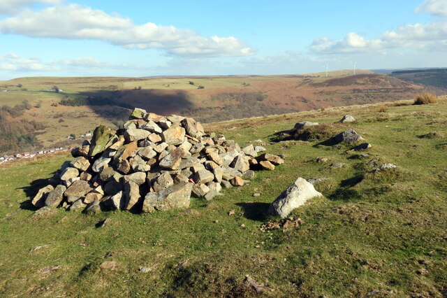
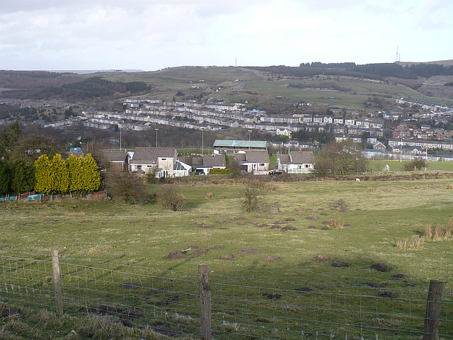
Bedwellty Pits Images

Images are sourced within 2km of 51.746955/-3.227728 or Grid Reference SO1506. Thanks to Geograph Open Source API. All images are credited.

Ar lethrau Mynydd Bedwellte / On the slopes of Mynydd Bedwellte Wal gerrig sych ar lethrau Mynydd Bedwellte.

A dry stone wall on the slopes of Mynydd Bedwellte (trans. mountain of Mellte's abode).
Ar lethrau Mynydd Bedwellte / On the slopes of Mynydd Bedwellte
Wal gerrig sych ar lethrau Mynydd Bedwellte. A dry stone wall on the slopes of Mynydd Bedwellte (trans. mountain of Mellte's abode).
Llwybr i lawr i Dredegar / Path down to Tredegar Llwybr cyhoeddus yn mynd i lawr y waered i gyfeiriad Tredegar.

A public footpath descending towards Tredegar.
Llwybr i lawr i Dredegar / Path down to Tredegar
Llwybr cyhoeddus yn mynd i lawr y waered i gyfeiriad Tredegar. A public footpath descending towards Tredegar.
Carn Stwpa Gweddillion Carn Stwpa, heneb o'r Oes Efydd. Sylwer ar y dde ymylfeini o'r garn wreiddiol.

The remains of Carn Stwpa, a Bronze Age monument. Note on the right surviving kerbstones of the original cairn.
Carn Stwpa
Gweddillion Carn Stwpa, heneb o'r Oes Efydd. Sylwer ar y dde ymylfeini o'r garn wreiddiol. The remains of Carn Stwpa, a Bronze Age monument. Note on the right surviving kerbstones of the original cairn.
Carn Stwpa Gweddillion Carn Stwpa, heneb o'r Oes Efydd. Yn y pellter mae Tredegar.

The remains of Carn Stwpa, a Bronze Age monument. Tredegar can be seen in the distance.
Carn Stwpa
Gweddillion Carn Stwpa, heneb o'r Oes Efydd. Yn y pellter mae Tredegar. The remains of Carn Stwpa, a Bronze Age monument. Tredegar can be seen in the distance.
Mynydd Bedwellte Edrych lan at gopa Mynydd Betwellte.

Looking upwards towards the summit of Mynydd Bedwellte (trans. mountain of Mellte's abode).
Mynydd Bedwellte
Edrych lan at gopa Mynydd Betwellte. Looking upwards towards the summit of Mynydd Bedwellte (trans. mountain of Mellte's abode).
Mynydd Bedwellte Trac ar gefnen Mynydd Bedwellte.

A track on the ridge of Mynydd Bedwellte (trans. mountain of Mellte's abode).
Mynydd Bedwellte
Trac ar gefnen Mynydd Bedwellte. A track on the ridge of Mynydd Bedwellte (trans. mountain of Mellte's abode).
Llwybr ger Cwarau Bedwellte / Path near Bedwellty Quarries Llwybr yn agosau at Gwarau Bedwellte.

A path approaches Bedwellty Quarries.
Llwybr ger Cwarau Bedwellte / Path near Bedwellty Quarries
Llwybr yn agosau at Gwarau Bedwellte. A path approaches Bedwellty Quarries.
Colfen farw / Dead tree Colfen farw yng Nghwarau Bedwellte.

A dead tree at Bedwellty Quarries.
Colfen farw / Dead tree
Colfen farw yng Nghwarau Bedwellte. A dead tree at Bedwellty Quarries.
Agosau at offer weindio / Approaching winding gear Llwybr yn agosau at offer weindio offer sy'n dyddio o oddeutu 1850. Cludai gerrig a glo i lawr yr inclein i'r rheilffordd ym Mhyllau Bedwellte.

A path approaches winding gear which dates c1850. It transported stone and coal down the incline to the railway at Bedwellty Pits.
Agosau at offer weindio / Approaching winding gear
Llwybr yn agosau at offer weindio offer sy'n dyddio o oddeutu 1850. Cludai gerrig a glo i lawr yr inclein i'r rheilffordd ym Mhyllau Bedwellte. A path approaches winding gear which dates c1850. It transported stone and coal down the incline to the railway at Bedwellty Pits.
Offer weindio / Winding gear Offer weindio sy'n dyddio o oddeutu 1850. Cludai gerrig a glo i lawr yr inclein i'r rheilffordd ym Mhyllau Bedwellte.

Winding gear which dates c1850. It transported stone and coal down the incline to the railway at Bedwellty Pits.
Offer weindio / Winding gear
Offer weindio sy'n dyddio o oddeutu 1850. Cludai gerrig a glo i lawr yr inclein i'r rheilffordd ym Mhyllau Bedwellte. Winding gear which dates c1850. It transported stone and coal down the incline to the railway at Bedwellty Pits.
Sticil uwchben yr A4048 / A stile above the A4048 Sticil uwchben yr A4048 ger Pyllau Bedwellte.

A stile above the A4048 near Bedwellty Pits.
Sticil uwchben yr A4048 / A stile above the A4048
Sticil uwchben yr A4048 ger Pyllau Bedwellte. A stile above the A4048 near Bedwellty Pits.
Llwybr i  Byllau Bedwellte / Path to Bedwellty Pits Llwybr troed a llwybr seiclo yn mynd i gyfeiriad Pyllau Bedwellte,

A footpath and cycle path heading towards Bedwellty Pits.
Llwybr i Byllau Bedwellte / Path to Bedwellty Pits
Llwybr troed a llwybr seiclo yn mynd i gyfeiriad Pyllau Bedwellte, A footpath and cycle path heading towards Bedwellty Pits.
Pombren ger Pyllau Bedwellte / Footbridge near Bedwellty Pits Pompren yn rhychwantu Afon Sirhywi.

A footbridge spanning Sirhowy river.
Pombren ger Pyllau Bedwellte / Footbridge near Bedwellty Pits
Pompren yn rhychwantu Afon Sirhywi. A footbridge spanning Sirhowy river.
Llwybr i Gefn Manmoel / Path to Cefn Manmoel Llwybr yn dringo'r tyle i Gefn Manmoel.

Path ascending the hill to Cefn Manmoel.
Llwybr i Gefn Manmoel / Path to Cefn Manmoel
Llwybr yn dringo'r tyle i Gefn Manmoel. Path ascending the hill to Cefn Manmoel.
Llwybr i Droedrhiwgwair / Path to Troedrhiwgwair Llwybr cyhoeddus yn mynd i lawr y waered i gyfeiriad Troedrhiwgwair.

Path descending the hill towards Troedrhiwgwair (trans. foot of the hay slope).
Llwybr i Droedrhiwgwair / Path to Troedrhiwgwair
Llwybr cyhoeddus yn mynd i lawr y waered i gyfeiriad Troedrhiwgwair. Path descending the hill towards Troedrhiwgwair (trans. foot of the hay slope).
Llwybr i Droedrhiwgwair / Path to Troedrhiwgwair Llwybr yn mynd i lawr y waered i gyfeiriad Troedrhiwgwair.

Path descending the hill towards Troedrhiwgwair (trans. foot of the hay slope).
Llwybr i Droedrhiwgwair / Path to Troedrhiwgwair
Llwybr yn mynd i lawr y waered i gyfeiriad Troedrhiwgwair. Path descending the hill towards Troedrhiwgwair (trans. foot of the hay slope).
Cefn Manmoel Cefn Manmoel uwchben Glyn Ebwy.

Cefn Manmoel above Ebbw Vale.
Cefn Manmoel
Cefn Manmoel uwchben Glyn Ebwy. Cefn Manmoel above Ebbw Vale.
Y Domen Fawr Agosau at Y Domen Fawr, y bryncyn yn y pellter.

Approaching Y Domen Fawr (trans. the big mound), the hillock in the distance.
Y Domen Fawr
Agosau at Y Domen Fawr, y bryncyn yn y pellter. Approaching Y Domen Fawr (trans. the big mound), the hillock in the distance.
Show me another place!

Bedwellty Pits is located at Grid Ref: SO1506 (Lat: 51.746955, Lng: -3.227728)

Unitary Authority: Blaenau Gwent

Police Authority: Gwent

What 3 Words

///oblige.hazelnuts.troubles. Near Victoria, Blaenau Gwent

Related Wikis

Bedwellty Pits Halt railway station

Bedwellty Pits Halt railway station was a station on the Sirhowy Railway. It was initially spelled Bedwelty, then known as Bedwellty Pits, and finally...

Mynydd Bedwellte

Mynydd Bedwellte is the name given to the broad ridge of high ground between the Rhymney Valley (Welsh: Cwm Rhymni) and the Sirhowy Valley in the Valleys...

Cefn Manmoel

Cefn Manmoel is the name given to the broad ridge of high ground between the Sirhowy Valley and Ebbw Vale in the Valleys region of South Wales. It straddles...

Bedwellty Union Workhouse

The Bedwellty Union Workhouse was situated in Georgetown, Tredegar. It is 2.9 miles (4.7 km) from the Nanybwtch Junction A465. The building was in existence...

Tredegar Town F.C.

Tredegar Town Football Club are a football club based in Tredegar, in Wales. The club plays in the Ardal Leagues South East, the third tier of the Welsh...

Valleys Radio

Valleys Radio (Welsh: Radio'r Cymoedd) was an Independent Local Radio station broadcasting to the heads of the South Wales Valleys. The broadcast area...

Georgetown, Blaenau Gwent

Georgetown is a village in the Sirhowy Valley in Blaenau Gwent. It belongs in the ward of Georgetown.It is located 0.59 miles (0.95 km) south of Tredegar...

Abertysswg railway station

Abertysswg railway station was a station which served Abertysswg, in the Welsh county of Glamorgan. It was served by trains on the line from Pengam (Mon...

Nearby Amenities

Located within 500m of 51.746955,-3.227728
Bedwellty Pits
Place: hamlet
Lat/Long: 51.7471684/-3.2238678
Bedwellty Winding Engine
Historic: industrial
Lat/Long: 51.7447738/-3.2277652
Bedwellty Pits Halt
Historic Railway: station
Railway: site
Wikidata: Q85746274
Wikipedia: en:Bedwellty Pits Halt railway station
Lat/Long: 51.746566/-3.2224855
The data included in this document is from www.openstreetmap.org. The data is made available under ODbL.

Have you been to Bedwellty Pits?

Leave your review of Bedwellty Pits below (or comments, questions and feedback).