Caenby Corner

Settlement in Lincolnshire West Lindsey

England

Caenby Corner

A15 northbound at Spital in the Street
A15 northbound at Spital in the Street Credit: Colin Pyle

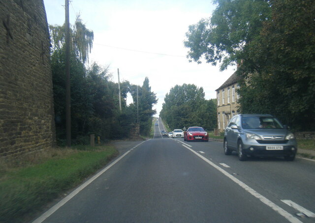
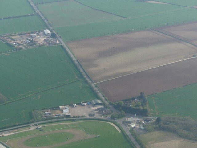
Caenby Corner is a small village located in the county of Lincolnshire, England. Situated just off the A15 road, it lies approximately 12 miles north of the city of Lincoln. The village is known primarily for its prominent road junction, which connects the A15 with the A631 and the A1500. This junction acts as a key transportation hub for the surrounding areas, facilitating easy access to major cities such as Lincoln and Scunthorpe.

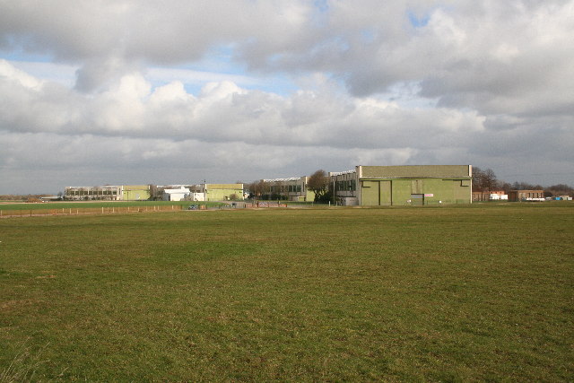
Despite its small size, Caenby Corner offers a range of amenities and services for both residents and visitors. The village is home to a few local businesses, including a petrol station, a hotel, and a restaurant, making it a convenient stop for travelers passing through the area. Additionally, there are several agricultural and industrial units nearby, reflecting the region's rural and industrial heritage.

Caenby Corner is surrounded by picturesque countryside, offering beautiful views and opportunities for outdoor activities. The village is located near the Lincolnshire Wolds, an Area of Outstanding Natural Beauty, which attracts visitors who enjoy hiking, cycling, and exploring the scenic landscapes.

Overall, Caenby Corner is a small yet significant village in Lincolnshire, known for its strategic road junction and its proximity to the stunning Lincolnshire Wolds. With its convenient amenities and natural beauty, it serves as a gateway to both rural tranquility and urban convenience.

If you have any feedback on the listing, please let us know in the comments section below.

Caenby Corner Images

Images are sourced within 2km of 53.393571/-0.54888918 or Grid Reference SK9689. Thanks to Geograph Open Source API. All images are credited.

A15 northbound at Spital in the Street
A15 nearing Bishop Norton turn
A631 at Hemswell Cliff
Caenby Corner: aerial 2022
Entrance to Glentworth House Priory Hospital, Lincolnshire
Entrance to Glentworth House
Priory Hospital, Lincolnshire
Fields south of Dog Kennel Lane
Old Milestone by the A631, Helmswell Cliff, Harpswell Carved stone post by the A631, in parish of HARPSWELL (WEST LINDSEY District), Hemswell airfield, East of main entrance, by junction with Gibraltar Road, Harpswell, on cut grass verge, at junction, on North side of road. Erected by the Beckford Harbour turnpike trust in the 19th century. 

Inscription reads:-
: RASEN / 11 / MILES : : HARPSWELL : : GAINSBRO / 9 / MILES : 

Milestone Society National ID: LI_GBRS09
Old Milestone by the A631, Helmswell Cliff, Harpswell
Carved stone post by the A631, in parish of HARPSWELL (WEST LINDSEY District), Hemswell airfield, East of main entrance, by junction with Gibraltar Road, Harpswell, on cut grass verge, at junction, on North side of road. Erected by the Beckford Harbour turnpike trust in the 19th century. Inscription reads:- : RASEN / 11 / MILES : : HARPSWELL : : GAINSBRO / 9 / MILES : Milestone Society National ID: LI_GBRS09
Former Bomber Command aerodrome Hemswell The tall building is a former water tower. The site is full of all sorts of businesses particularly antiques.
Former Bomber Command aerodrome Hemswell
The tall building is a former water tower. The site is full of all sorts of businesses particularly antiques.
Memorial to former RAF Bomber Command base here 1937 to 1967
One of the many antique centres at Hemswell
How do I get out of here? Maze of roads and buildings on the former RAF base.
How do I get out of here?
Maze of roads and buildings on the former RAF base.
The old water tower at RAF Hemswell The sprawling RAF campus ceased its service in 1967. In more recent times it has become an antiques centre with numerous businesses located in the old RAF buildings.
The old water tower at RAF Hemswell
The sprawling RAF campus ceased its service in 1967. In more recent times it has become an antiques centre with numerous businesses located in the old RAF buildings.
On the old campus of RAF Hemswell Looking beyond one of the administration blocks towards the old water tower.
On the old campus of RAF Hemswell
Looking beyond one of the administration blocks towards the old water tower.
Field, Spital
Field, Spital
A15 The A15 is the main north-south road in Lincolnshire, running the entire length of the county for almost 100 miles between Hessle, near Kingston upon Hull, and Peterborough via Lincoln, Sleaford and Bourne. It is also the road that crosses the Humber Bridge.
A15
The A15 is the main north-south road in Lincolnshire, running the entire length of the county for almost 100 miles between Hessle, near Kingston upon Hull, and Peterborough via Lincoln, Sleaford and Bourne. It is also the road that crosses the Humber Bridge.
Norton Lane towards the A15
New memorial at ex RAF Hemswell The memorial which is at Astra Antiques Centre is dedicated to all those who made the ultimate sacrifice whilst serving at RAF Hemswell.
The brass plate reads: "THIS MEMORIAL IS DEDICATED TO THE 55573 SOULS OF BOMBER COMMAND. WE OWE OUR GRATITUDE TO THOSE WHO MADE THE ULTIMATE SACRIFICE TO ENABLE ALL FUTURE GENERATIONS TO ENJOY THE FREEDOMS OF TODAY.
LEST WE FORGET"
Astra Antiques Centre
New memorial at ex RAF Hemswell
The memorial which is at Astra Antiques Centre is dedicated to all those who made the ultimate sacrifice whilst serving at RAF Hemswell. The brass plate reads: "THIS MEMORIAL IS DEDICATED TO THE 55573 SOULS OF BOMBER COMMAND. WE OWE OUR GRATITUDE TO THOSE WHO MADE THE ULTIMATE SACRIFICE TO ENABLE ALL FUTURE GENERATIONS TO ENJOY THE FREEDOMS OF TODAY. LEST WE FORGET" Astra Antiques Centre
RAF Hemswell / Harpswell Memorial The Royal Flying Corps opened this flying field as RFC Station Harpswell in 1916 and used as a night landing ground. Nos. 199 and 200 Training Squadrons were established at the airfield. Shortly after the end of WWI the site returned to farmland.
A new RAF Station, to be known as Hemswell, was built in the 1930s to a design for Bomber airfields and was one of a number of permanent bases being built to accommodate the then rapidly expanding Royal Air Force. Concrete runways weren't added until much later. Bomber Command was formed in 1936 and on 31st December 1936, Hemswell was opened as one of the first airfields within No.5 Group.
<a title="https://www.geograph.org.uk/article/Royal-Air-Force-Stations-in-Lincolnshire" href="https://www.geograph.org.uk/article/Royal-Air-Force-Stations-in-Lincolnshire">Link</a>
RAF Hemswell / Harpswell Memorial
The Royal Flying Corps opened this flying field as RFC Station Harpswell in 1916 and used as a night landing ground. Nos. 199 and 200 Training Squadrons were established at the airfield. Shortly after the end of WWI the site returned to farmland. A new RAF Station, to be known as Hemswell, was built in the 1930s to a design for Bomber airfields and was one of a number of permanent bases being built to accommodate the then rapidly expanding Royal Air Force. Concrete runways weren't added until much later. Bomber Command was formed in 1936 and on 31st December 1936, Hemswell was opened as one of the first airfields within No.5 Group. Link
Show me another place!

Caenby Corner is located at Grid Ref: SK9689 (Lat: 53.393571, Lng: -0.54888918)

Division: Parts of Lindsey

Administrative County: Lincolnshire

District: West Lindsey

Police Authority: Lincolnshire

What 3 Words

///builder.countries.winter. Near Kirton in Lindsey, Lincolnshire

Related Wikis

Caenby Corner

Caenby Corner is a small area in the West Lindsey district of Lincolnshire, England, at the roundabout junction of the A15 and A631 roads. Close to the...

Spital-in-the-Street

Spital-in-the-Street is a small hamlet in the West Lindsey district of Lincolnshire, England. It is situated on the A15 road (Roman Ermine Street), 12...

Hemswell Cliff

Hemswell Cliff is a village and civil parish in the West Lindsey district of Lincolnshire, England. It is situated on the A631 road between Caenby Corner...

RAF Hemswell

Royal Air Force Hemswell or more simply RAF Hemswell is a former Royal Air Force (RAF) station located 7.8 miles (12.6 km) east of Gainsborough, Lincolnshire...

Glentworth, Lincolnshire

Glentworth is a village and civil parish in the West Lindsey district of Lincolnshire, England. The population of the parish (including Caenby Corner)...

St Chad's Church, Harpswell

St Chad's Church, Harpswell, is a parish church in the Church of England in Harpswell, Lincolnshire. == History == The ancient church of St Chad in the...

Harpswell, Lincolnshire

Harpswell is a village and civil parish in the West Lindsey district of Lincolnshire, England. It is situated just west off the junction of the A631 and...

Bishop Norton

Bishop Norton is a village and the main settlement of the civil parish of the same name in the West Lindsey district of Lincolnshire, England. The village...

Nearby Amenities

Located within 500m of 53.393571,-0.54888918
Bus Stop
The Monck's Arms PH
Naptan AtcoCode: 270000014259
Naptan Bearing: W
Naptan CommonName: The Monck's Arms PH
Naptan Indicator: adj
Naptan Landmark: The Monck's Arms PH
Naptan NaptanCode: linjpgja
Naptan Street: A631
Naptan Verified: no
Source: naptan_import
Lat/Long: 53.3925364/-0.5453281
Bus Stop
The Monck's Arms PH
Naptan AtcoCode: 270000014260
Naptan Bearing: E
Naptan CommonName: The Monck's Arms PH
Naptan Indicator: opp
Naptan Landmark: The Monck's Arms PH
Naptan NaptanCode: linjpgjd
Naptan Street: A631
Naptan Verified: no
Source: naptan_import
Lat/Long: 53.3926642/-0.5454891
Service Station
Naptan AtcoCode: 270002701179
Naptan Bearing: N
Naptan BusStopType: CUS
Naptan CommonName: Service Station
Naptan Indicator: adj
Naptan Landmark: Service Station
Naptan Street: A15
Naptan Verified: no
Source: naptan_import
Lat/Long: 53.3937518/-0.5476929
Service Station
Naptan AtcoCode: 270002701180
Naptan Bearing: S
Naptan BusStopType: CUS
Naptan CommonName: Service Station
Naptan Indicator: opp
Naptan Landmark: Service Station
Naptan Street: A15
Naptan Verified: no
Source: naptan_import
Lat/Long: 53.3936682/-0.5474701
Caenby Corner
Place: locality
Source: Bing
Wikidata: Q5016818
Lat/Long: 53.39298/-0.547641
White Heather Croft
Place: isolated_dwelling
Lat/Long: 53.3947461/-0.5509293
The data included in this document is from www.openstreetmap.org. The data is made available under ODbL.

Have you been to Caenby Corner?

Leave your review of Caenby Corner below (or comments, questions and feedback).