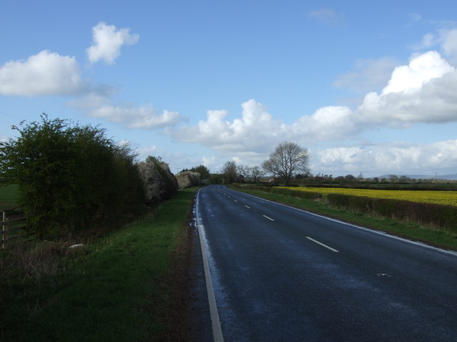
Busby Stoop

Settlement in Yorkshire Hambleton

England

Busby Stoop

Old milepost At the north end of Sand Hutton near the footpath sign this milepost is deteriorating as the years pass by, in spite of new buildings nearby.  In 2011 there were only small patches of rust, in 2022, more rust than paint.
Old milepost Credit: Hilary Jones

The requested URL returned error: 429 Too Many Requests

If you have any feedback on the listing, please let us know in the comments section below.

Busby Stoop Images

Images are sourced within 2km of 54.221927/-1.4135414 or Grid Reference SE3880. Thanks to Geograph Open Source API. All images are credited.

Old milepost At the north end of Sand Hutton near the footpath sign this milepost is deteriorating as the years pass by, in spite of new buildings nearby.  In 2011 there were only small patches of rust, in 2022, more rust than paint.
Old milepost
At the north end of Sand Hutton near the footpath sign this milepost is deteriorating as the years pass by, in spite of new buildings nearby. In 2011 there were only small patches of rust, in 2022, more rust than paint.
Old milepost Only 2 of this style of post, forged at the Mattison of Bedale foundry, remain on the A61 between Ripon and Thirsk.  Recently this one in Carlton Miniott has been painted after years of neglect.
Old milepost
Only 2 of this style of post, forged at the Mattison of Bedale foundry, remain on the A61 between Ripon and Thirsk. Recently this one in Carlton Miniott has been painted after years of neglect.
Sandhutton Lane The main street of the village with wide strips of grass to either side. Sandhutton should not be confused with Sand Hutton which is a few miles north-east of York.
Sandhutton Lane
The main street of the village with wide strips of grass to either side. Sandhutton should not be confused with Sand Hutton which is a few miles north-east of York.
Church of St Lawrence
Church House On the A61 Carlton Road with the OS bench mark on the wall pillar by the lamp post
Church House
On the A61 Carlton Road with the OS bench mark on the wall pillar by the lamp post
Old milepost Continuing the story of this milepost in Sandhutton on the A167.   There is development taking place on the land behind the milepost.   When the work is finished next year the milepost will be reset in a landscaped area.
Old milepost
Continuing the story of this milepost in Sandhutton on the A167. There is development taking place on the land behind the milepost. When the work is finished next year the milepost will be reset in a landscaped area.
The Kings Arms has grown Recent building work has seen the Kings Arms expand by one extra bay, the evidence being in the different roof colour. Whilst many village pubs are in difficulty, the Kings Arms does a good trade with diners.
The Kings Arms has grown
Recent building work has seen the Kings Arms expand by one extra bay, the evidence being in the different roof colour. Whilst many village pubs are in difficulty, the Kings Arms does a good trade with diners.
Busby Stoop Garage Busy garage close to the roundabout where the A61 and A167 meet.
Busby Stoop Garage
Busy garage close to the roundabout where the A61 and A167 meet.
Courteous farmer Having followed this contraption for a fair while it was nice to see it pull over and let the queue of traffic pass. This is Carlton Road, entering Carlton Miniott from the west.
Courteous farmer
Having followed this contraption for a fair while it was nice to see it pull over and let the queue of traffic pass. This is Carlton Road, entering Carlton Miniott from the west.
Farmland, Carlton Miniott A view past stacked bales towards Coronation Whin (wood) from the A167 to the south of Busby Stoop.
Farmland, Carlton Miniott
A view past stacked bales towards Coronation Whin (wood) from the A167 to the south of Busby Stoop.
Farmland, Sandhutton Bales in harvested farmland to the west of the A167.
Farmland, Sandhutton
Bales in harvested farmland to the west of the A167.
St Lawrence's church in Carlton Miniott
The Dog and Gun at Carlton Miniott I note the pub was extended in 1939 probably coinciding with the opening of the new bomber station at nearby RAF Topcliffe?
The Dog and Gun at Carlton Miniott
I note the pub was extended in 1939 probably coinciding with the opening of the new bomber station at nearby RAF Topcliffe?
The Busby Stoop inn on a cold and wet Easter Monday 2012
Farmland off the A167
A167 towards Northallerton
The Busby Stoop
The Busby Stoop
Farm track off Carlton Road
Show me another place!

Busby Stoop is located at Grid Ref: SE3880 (Lat: 54.221927, Lng: -1.4135414)

Division: North Riding

Administrative County: North Yorkshire

District: Hambleton

Police Authority: North Yorkshire

What 3 Words

///lies.completed.maple. Near Thirsk, North Yorkshire

Related Wikis

RAF Skipton-on-Swale

Royal Air Force Skipton-on-Swale or more simply RAF Skipton-on-Swale is a former Royal Air Force station operated by RAF Bomber Command during the Second...

Carlton Miniott

Carlton Miniott, formerly Carlton Islebeck is a village and civil parish in the Hambleton district of North Yorkshire, England, on the A61 road to the...

Sandhutton

Sandhutton is a small village and civil parish in Hambleton District of North Yorkshire, England. It lies about 3 miles (5 km) west of Thirsk on the A167...

Topcliffe railway station

Topcliffe railway station served the village of Topcliffe, North Yorkshire, England from 1848 to 1959 on the Leeds and Thirsk Railway. == History == The...

Nearby Amenities

Located within 500m of 54.221927,-1.4135414
Restaurant
Jaipur Spice
Addr City: Thirsk
Addr Housename: Busby Stoop Inn
Addr Postcode: YO7 4EQ
Addr Street: Busby Stoop Road
Alt Name: Busby Stoop
Note: Exists April 2010
Old Name: Busby Stoop
Source: local knowledge
Lat/Long: 54.2218492/-1.4144183
Busby Stoop Garage
Addr City: Thirsk
Addr Postcode: YO7 4EQ
Shop: car_repair
Lat/Long: 54.2210328/-1.4155364
Fuel Shop Go
Addr City: Thirsk
Addr Postcode: YO7 4EQ
Shop: convenience
Lat/Long: 54.2210956/-1.4153615
Busby Stoop
Place: hamlet
Lat/Long: 54.2215864/-1.4147559
The data included in this document is from www.openstreetmap.org. The data is made available under ODbL.

Have you been to Busby Stoop?

Leave your review of Busby Stoop below (or comments, questions and feedback).