Bury End

Settlement in Hertfordshire North Hertfordshire

England

Bury End

Hinxworth War memorial clock tower. An unusual war memorial and a distinctive feature of Hinxworth Village.
Hinxworth War memorial clock tower. Credit: Robin Hall

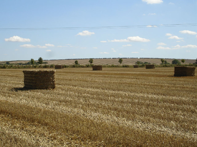
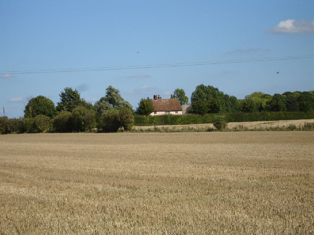
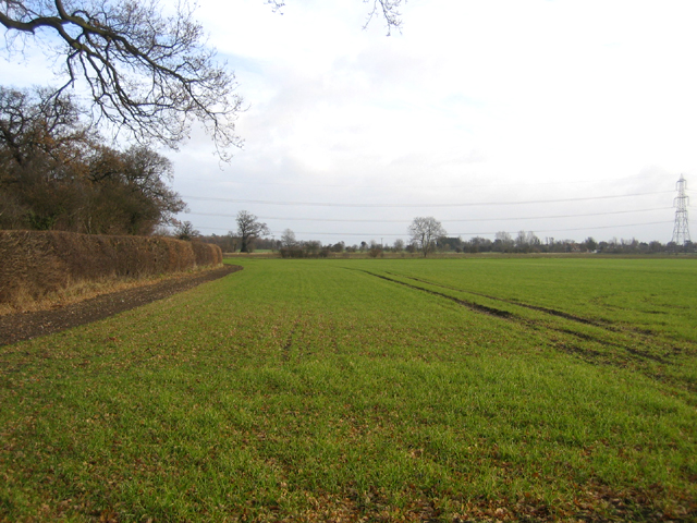
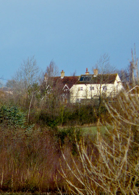
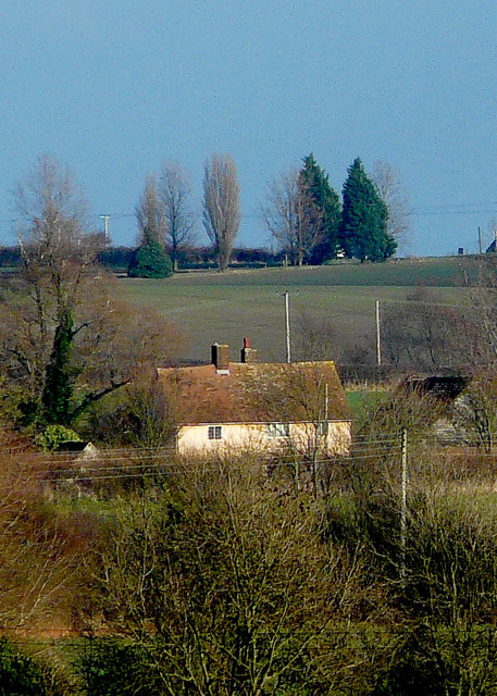
Bury End is a small hamlet located in the county of Hertfordshire, England. Situated approximately 30 miles north of London, it falls within the local government district of North Hertfordshire. Bury End is surrounded by picturesque countryside, with rolling hills and lush green fields characterizing the area.

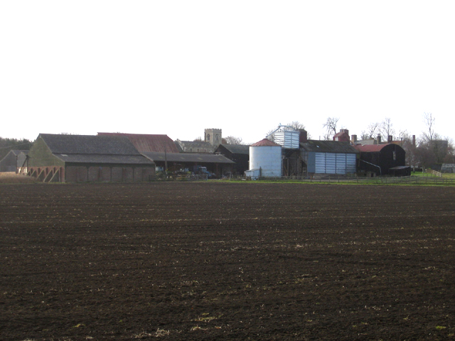
The hamlet itself comprises a handful of houses, with a population of around 100 residents. It is a tight-knit community, known for its friendly and welcoming atmosphere. The architecture in Bury End is predominantly traditional, with charming cottages and farmhouses dotting the landscape.

Despite its small size, Bury End benefits from its proximity to nearby towns and villages, offering residents easy access to a range of amenities. The market town of Royston is just a short distance away, providing a variety of shops, restaurants, and recreational facilities. There are also several schools in the vicinity, making Bury End an attractive location for families.

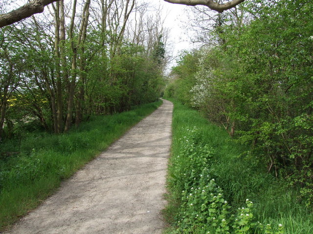
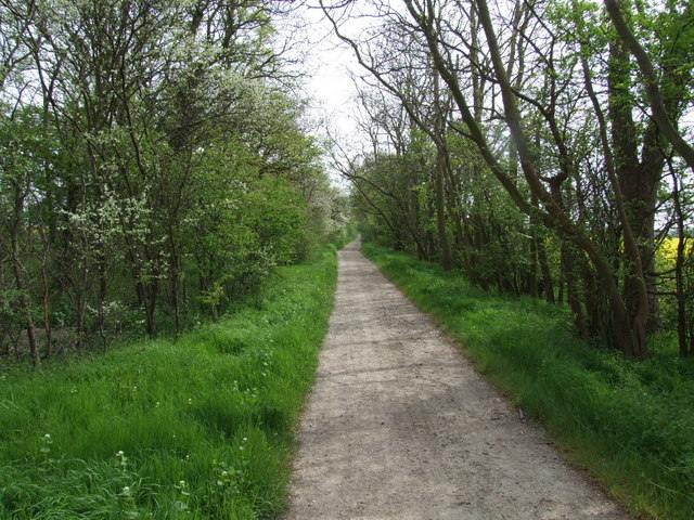
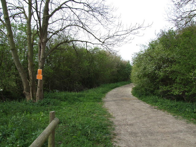
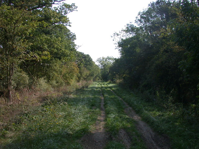
The surrounding countryside offers ample opportunities for outdoor activities, including hiking, cycling, and horse riding. Bury End is also close to the expansive Ashridge Estate, a National Trust site known for its woodlands, meadows, and historic landmarks.

Overall, Bury End is a tranquil and idyllic village, offering a peaceful retreat from the hustle and bustle of city life. Its charming character and natural beauty make it a desirable place to live for those seeking a rural lifestyle.

If you have any feedback on the listing, please let us know in the comments section below.
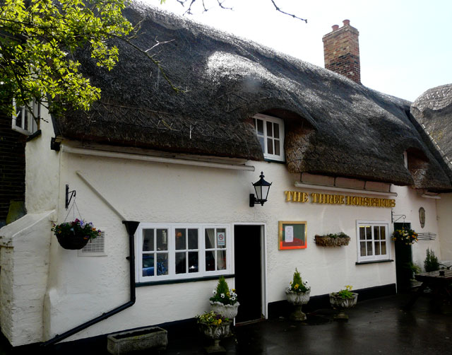
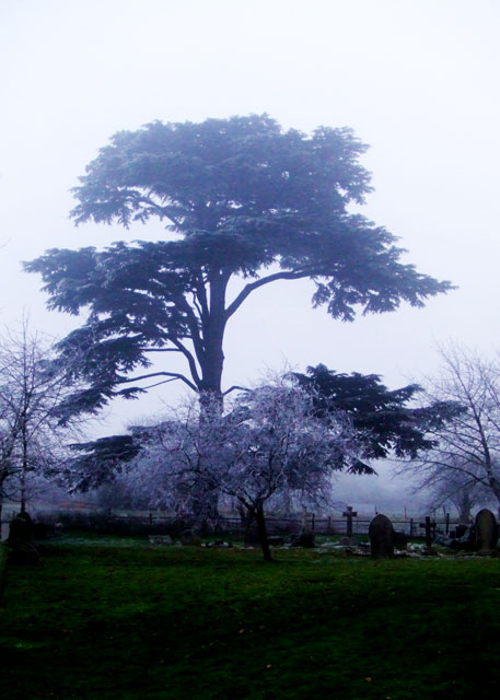
Bury End Images

Images are sourced within 2km of 52.046684/-0.19213915 or Grid Reference TL2440. Thanks to Geograph Open Source API. All images are credited.

Hinxworth War memorial clock tower. An unusual war memorial and a distinctive feature of Hinxworth Village.
Hinxworth War memorial clock tower.
An unusual war memorial and a distinctive feature of Hinxworth Village.
Fields between Hinxworth and Ashwell Large wide open arable fields typical of the area.
Fields between Hinxworth and Ashwell
Large wide open arable fields typical of the area.
Cottage over the fields near Ashwell. Taken on a really warm day at the end of the summer.  The fields were recently harvested wheat.
Cottage over the fields near Ashwell.
Taken on a really warm day at the end of the summer. The fields were recently harvested wheat.
Hinxworth parish church, Hertfordshire Dedicated to St Nicholas.
Hinxworth parish church, Hertfordshire
Dedicated to St Nicholas.
Manor Farm and parish church, Edworth, Beds – view from the NE; the church nestling behind the farm is dedicated to St George.
Manor Farm and parish church, Edworth, Beds
– view from the NE; the church nestling behind the farm is dedicated to St George.
Farmland, Edworth, Beds winter wheat growing in the NE part of the square.
Farmland, Edworth, Beds
winter wheat growing in the NE part of the square.
"Green Lane" a green lane
Green Lane
Green Lane
Lane closed ahead.
Lane closed ahead.
Green Lane living up to its name
St Nicholas Hinxworth
St Nicholas Hinxworth View from footpath north of Hinxworth Placec
St Nicholas Hinxworth
View from footpath north of Hinxworth Placec
The Three Horseshoes Hinxworth Pub Website:
<span class="nowrap"><a title="http://threehorseshoeshinxworth.zxq.net/index.htm" rel="nofollow ugc noopener" href="http://threehorseshoeshinxworth.zxq.net/index.htm">Link</a><img style="margin-left:2px;" alt="External link" title="External link - shift click to open in new window" src="https://s1.geograph.org.uk/img/external.png" width="10" height="10"/></span>
The Three Horseshoes Hinxworth
Pub Website: LinkExternal link
St Nicholas' Churchyard Trees Hawfrost on trees at midday.
St Nicholas' Churchyard Trees
Hawfrost on trees at midday.
Jackdaw Bird nesting inside chimney of The Three Horseshoes.
Jackdaw
Bird nesting inside chimney of The Three Horseshoes.
Robin In The Three Horseshoes garden
Robin
In The Three Horseshoes garden
Hill Cottage & Hillside Cottage Gantry on gable of Hill Cottage for lifting pianos!
Hill Cottage & Hillside Cottage
Gantry on gable of Hill Cottage for lifting pianos!
Cottage at Ashwell End Benetts Lane and Northfields Road in background.
Cottage at Ashwell End
Benetts Lane and Northfields Road in background.
Show me another place!

Bury End is located at Grid Ref: TL2440 (Lat: 52.046684, Lng: -0.19213915)

Administrative County: Hertfordshire

District: North Hertfordshire

Police Authority: Hertfordshire

What 3 Words

///signified.weekend.sandwich. Near Hinxworth, Hertfordshire

Nearby Locations

Bridget's Wood Bury End

Related Wikis

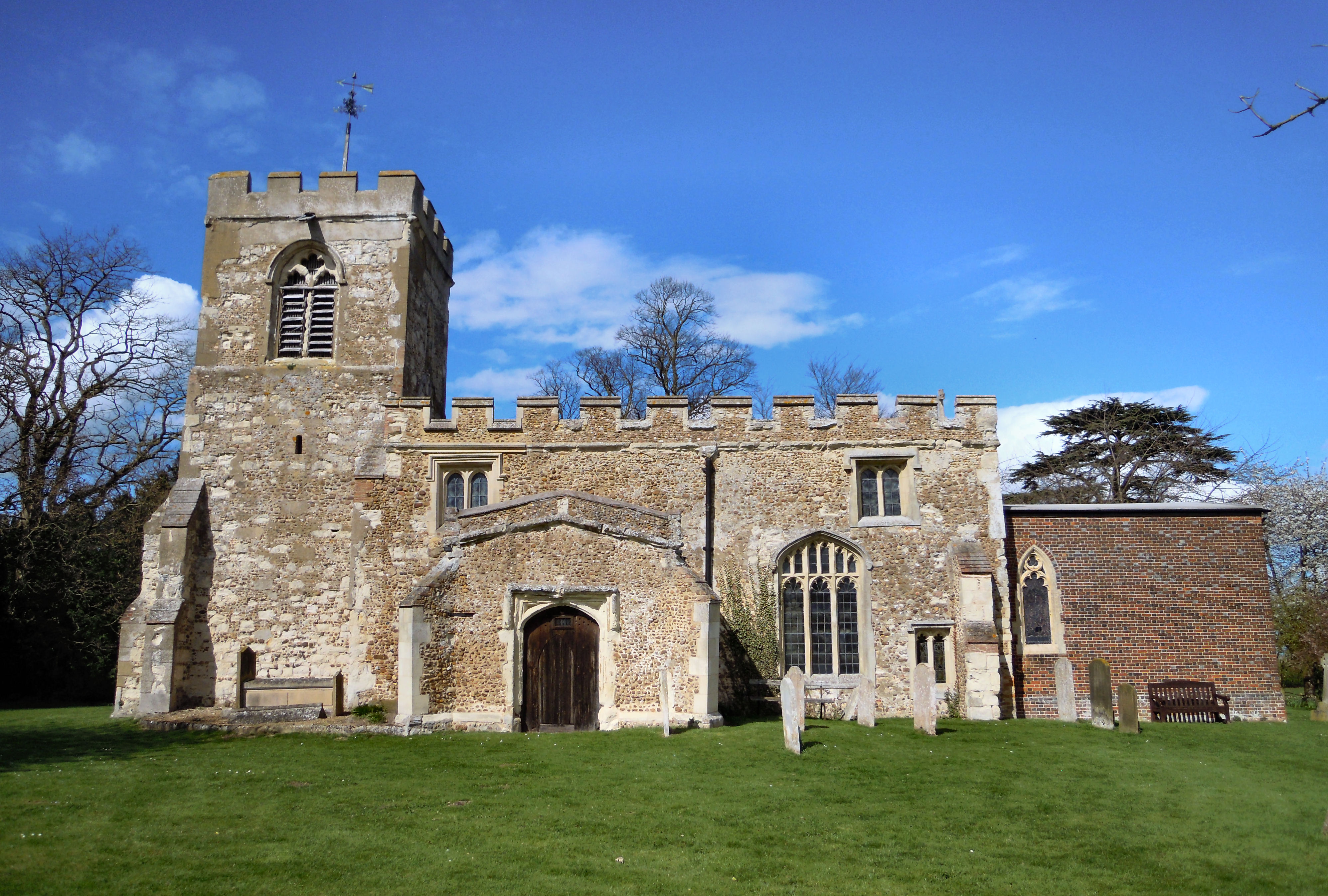
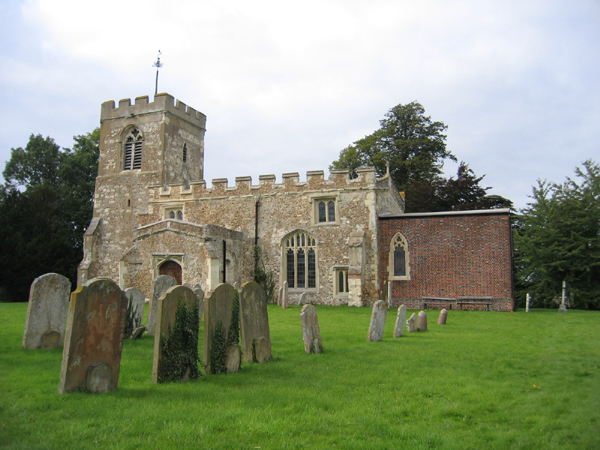
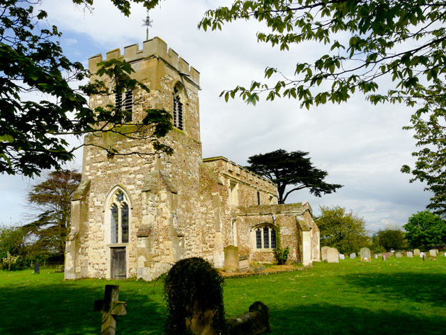
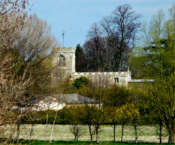
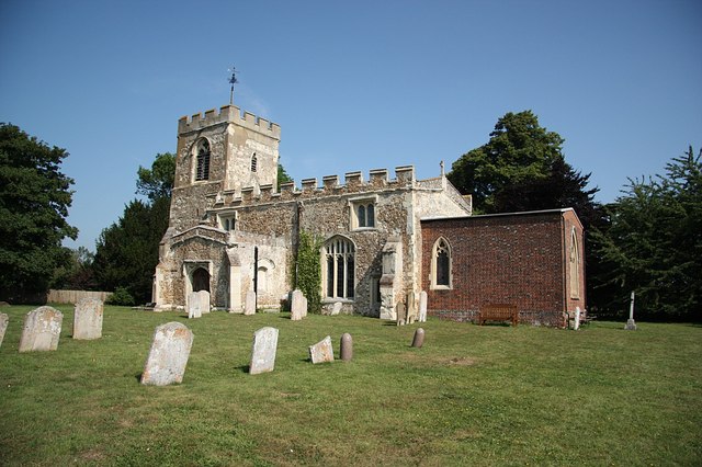
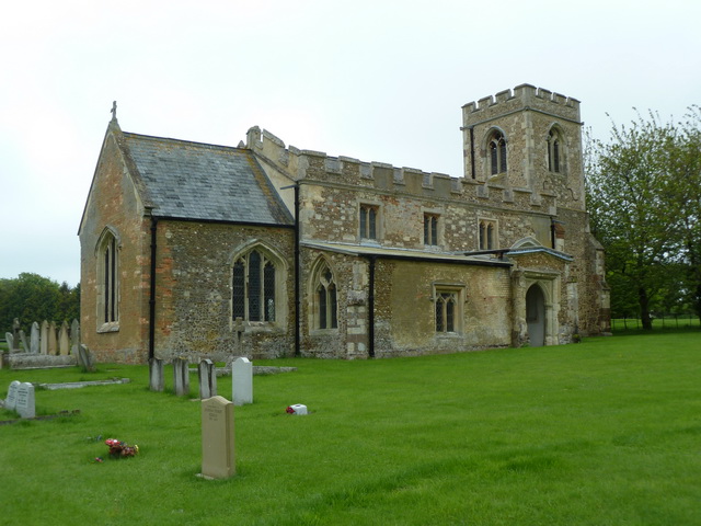
Church of St Nicholas, Hinxworth

The Church of St Nicholas is a Church of England parish church in the village of Hinxworth in Hertfordshire and is a Grade II* listed building dating mostly...

Hinxworth

Hinxworth is a village and civil parish in North Hertfordshire, England. It sits just off the Great North Road between Baldock and Biggleswade. It has...
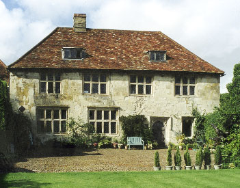
Hinxworth Place

Hinxworth Place is a medieval manor house near Hinxworth, Hertfordshire, England. Formerly the Manor of Pulters, building was started c. 1390. The construction...

Ashwell Quarry and Quarry Springs

Ashwell Quarry and Quarry Springs is a three hectare nature reserve managed by the Herts and Middlesex Wildlife Trust near Ashwell in Hertfordshire. Ashwell...

St Mary Magdalene's Church, Caldecote

St Mary Magdalene's Church is a redundant Anglican church standing in the deserted medieval village of Caldecote, Hertfordshire, England. It is recorded...

Edworth Manor

Edworth Manor was a manor in Bedfordshire, England. The manor was mentioned in the Domesday Book. The manor was owned in the 16th & 17th centuries by the...

St George's Church, Edworth

St George's Church, Edworth, is a redundant Anglican church in the village of Edworth, Bedfordshire, England. It is recorded in the National Heritage...

Edworth

Edworth is a hamlet and civil parish in the Central Bedfordshire district of the county of Bedfordshire, England about 12 miles (19 km) south-east of the...

Nearby Amenities

Located within 500m of 52.046684,-0.19213915
Bus Stop
New Inn Road
Naptan AtcoCode: 210021103000
Naptan Bearing: SE
Naptan CommonName: New Inn Road
Naptan Crossing: opp Post Office
Naptan Indicator: opp
Naptan Landmark: opp Post Office
Naptan NaptanCode: hrtgjtdw
Naptan ShortCommonName: NA
Naptan Street: Ashwell Road
Naptan Verified: no
Source: naptan_import
Lat/Long: 52.0487799/-0.197854
New Inn Road
Naptan AtcoCode: 210021105200
Naptan Bearing: NW
Naptan BusStopType: CUS
Naptan CommonName: New Inn Road
Naptan Indicator: adj
Naptan Landmark: Unknown
Naptan NaptanCode: hrtgjpam
Naptan ShortCommonName: NA
Naptan Street: New Inn Road
Naptan Verified: no
Source: naptan_import
Lat/Long: 52.0486914/-0.197945
Power: pole
Lat/Long: 52.0489144/-0.1960051
Power: pole
Lat/Long: 52.0490711/-0.1920917
Power: pole
Lat/Long: 52.0491635/-0.1898896
Power: pole
Lat/Long: 52.0489738/-0.1944789
Power: pole
Lat/Long: 52.0492806/-0.1864805
Power: pole
Lat/Long: 52.0488517/-0.197542
Power: pole
Lat/Long: 52.0492393/-0.18765
Barrier: kissing_gate
Foot: yes
Source: GPS, observation
Lat/Long: 52.0474055/-0.1968044
The data included in this document is from www.openstreetmap.org. The data is made available under ODbL.

Have you been to Bury End?

Leave your review of Bury End below (or comments, questions and feedback).