Burtree Ford

Settlement in Durham

England

Burtree Ford

Attending to the ewes at Burtree Pastures Sheep gathered around a farmer and his quad bike on moorland above the west side of the valley of the Sedling Burn.
Attending to the ewes at Burtree Pastures Credit: Trevor Littlewood

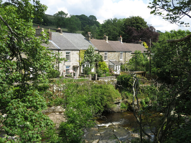
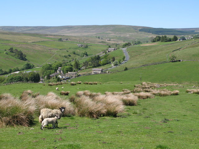
Burtree Ford is a small village located in County Durham, England. Situated approximately 4 miles northwest of the city of Durham, it falls within the civil parish of Witton Gilbert. The village is surrounded by picturesque countryside and offers a tranquil and rural setting.

Burtree Ford is known for its historical significance, particularly due to the presence of Burtree House. This Grade II listed building dates back to the 18th century and is a prominent feature of the village. The house is built in the Georgian style and boasts beautiful architecture, making it a key attraction for visitors.

The village itself is relatively small, with a close-knit community of residents. It offers a peaceful and friendly environment, making it an ideal place to live for those seeking a quieter lifestyle away from the hustle and bustle of city living.

Despite its small size, Burtree Ford benefits from its proximity to Durham, where residents can access a wide range of amenities and services, including shops, restaurants, and leisure facilities. The city is also home to the prestigious Durham University, adding a vibrant and youthful energy to the area.

Overall, Burtree Ford is a charming village that offers a blend of historic architecture, natural beauty, and a close community spirit. Its location near Durham provides residents with the best of both worlds – a peaceful countryside retreat and easy access to urban amenities.

If you have any feedback on the listing, please let us know in the comments section below.
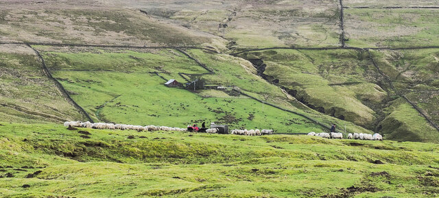
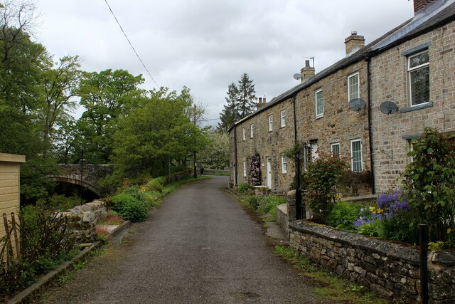
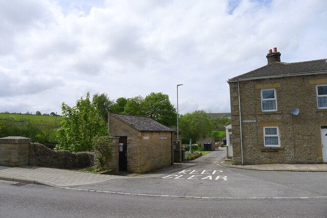
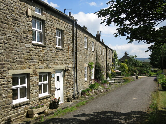
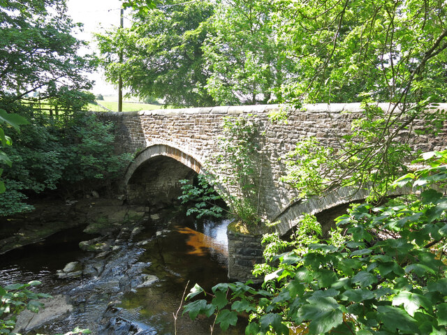
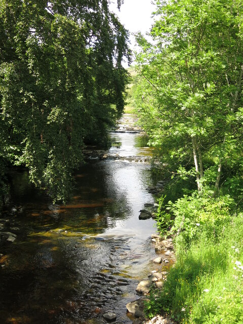
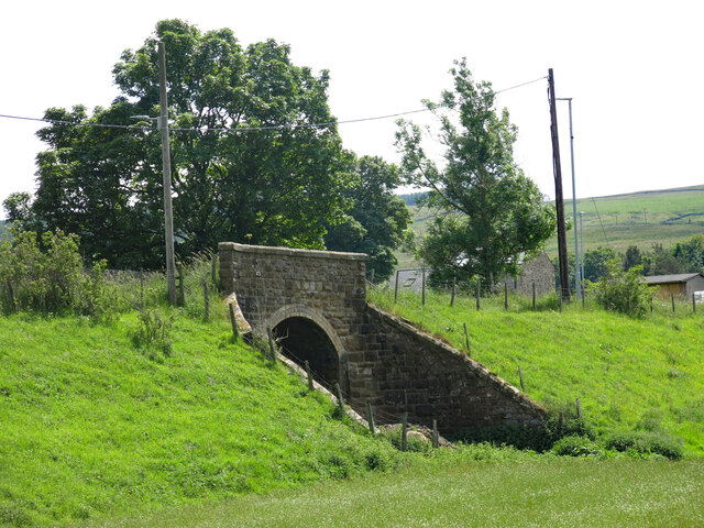
Burtree Ford Images

Images are sourced within 2km of 54.759862/-2.2285243 or Grid Reference NY8540. Thanks to Geograph Open Source API. All images are credited.

Attending to the ewes at Burtree Pastures Sheep gathered around a farmer and his quad bike on moorland above the west side of the valley of the Sedling Burn.
Attending to the ewes at Burtree Pastures
Sheep gathered around a farmer and his quad bike on moorland above the west side of the valley of the Sedling Burn.
River Wear near Waterside Farm
Newfield The property at Newfield seen along its access road high on the northern side of Weardale.
Newfield
The property at Newfield seen along its access road high on the northern side of Weardale.
Trees in valley of Elmford Cleugh Elmford Cleugh is a tributary of the River Wear descending on the north side of the valley.
Trees in valley of Elmford Cleugh
Elmford Cleugh is a tributary of the River Wear descending on the north side of the valley.
Head of the River Wear The point where Killhope Burn and Burnhope Burn meet to become the River Wear - at the aptly named village of Wearhead.
Head of the River Wear
The point where Killhope Burn and Burnhope Burn meet to become the River Wear - at the aptly named village of Wearhead.
Wearhead The A689 running through the small village of Wearhead
Wearhead
The A689 running through the small village of Wearhead
West Blackdene Small community near Ireshopeburn in Weardale
West Blackdene
Small community near Ireshopeburn in Weardale
Weardale Way between Wearhead and West Blackdene Riverside path in pastures beside the Wear
Weardale Way between Wearhead and West Blackdene
Riverside path in pastures beside the Wear
River Wear at West Blackdene The Weardale Way crosses the river at this point, to reach West Blackdene
River Wear at West Blackdene
The Weardale Way crosses the river at this point, to reach West Blackdene
River level monitoring station on the Killhope Burn, Wearhead For information on water levels: <span class="nowrap"><a title="https://riverlevels.uk/killhope-burn-stanhope-wearhead#.YpYn1qjMJPY" rel="nofollow ugc noopener" href="https://riverlevels.uk/killhope-burn-stanhope-wearhead#.YpYn1qjMJPY">Link</a><img style="margin-left:2px;" alt="External link" title="External link - shift click to open in new window" src="https://s1.geograph.org.uk/img/external.png" width="10" height="10"/></span>
River level monitoring station on the Killhope Burn, Wearhead
For information on water levels: LinkExternal link
The head of the Wear at Wearhead The River Wear starts here, below the junction of the Burnhope Burn and the Killhope Burn. Weardale, and the Weardale Way start 4½ miles upstream at the head of the Killhope Burn
The head of the Wear at Wearhead
The River Wear starts here, below the junction of the Burnhope Burn and the Killhope Burn. Weardale, and the Weardale Way start 4½ miles upstream at the head of the Killhope Burn
Public convenience, Wearhead The villages of Weardale are well supplied with free toilets.
Public convenience, Wearhead
The villages of Weardale are well supplied with free toilets.
The Weardale Way crossing the Wear to West Blackdene A 77 mile route following the River Wear from the sea at the Lindesfarne Memorial, Sunderland to the headwaters in the east Pennines, keeping as close as is possible to the river. It visits Lumley Castle, Durham (where the Castle and Cathedral forms a World Heritage Site), Bishop Auckland and Stanhope. After Stanhope the Way makes a northward loop to Rookhope to take in part of a tributary, Rookhope Burn.
The Weardale Way crossing the Wear to West Blackdene
A 77 mile route following the River Wear from the sea at the Lindesfarne Memorial, Sunderland to the headwaters in the east Pennines, keeping as close as is possible to the river. It visits Lumley Castle, Durham (where the Castle and Cathedral forms a World Heritage Site), Bishop Auckland and Stanhope. After Stanhope the Way makes a northward loop to Rookhope to take in part of a tributary, Rookhope Burn.
Cottages at West Blackdene
Bridge over the River Wear at West Blackdene The 18th C bridge is Grade II listed <span class="nowrap"><a title="https://historicengland.org.uk/listing/the-list/list-entry/1277160?section=official-list-entry" rel="nofollow ugc noopener" href="https://historicengland.org.uk/listing/the-list/list-entry/1277160?section=official-list-entry">Link</a><img style="margin-left:2px;" alt="External link" title="External link - shift click to open in new window" src="https://s1.geograph.org.uk/img/external.png" width="10" height="10"/></span> .
Bridge over the River Wear at West Blackdene
The 18th C bridge is Grade II listed LinkExternal link .
The River Wear at West Blackdene Photo taken looking upstream from the <a href="https://www.geograph.org.uk/photo/7240340">NY8639 : Bridge over the River Wear at West Blackdene</a>.
The River Wear at West Blackdene
Photo taken looking upstream from the NY8639 : Bridge over the River Wear at West Blackdene.
Bridge over the former Weardale Railway at West Blackdene
The River Wear and cottages at West Blackdene
Show me another place!

Burtree Ford is located at Grid Ref: NY8540 (Lat: 54.759862, Lng: -2.2285243)

Unitary Authority: County Durham

Police Authority: Durham

What 3 Words

///flagpole.remark.boldest. Near Stanhope, Co. Durham

Related Wikis

Cowshill

Cowshill is a village in the civil parish of Stanhope, in County Durham, England. It is situated at the top of Weardale, between Lanehead and Wearhead...

Copthill

Copthill is a village in the civil parish of Stanhope, in County Durham, England. It is situated on the north side of Weardale, between Cowshill and Cornriggs...

Wearhead

Wearhead is a village in the civil parish of Stanhope, in County Durham, England. It is situated at the top of Weardale between Cowshill and Ireshopeburn...

Cornriggs

Cornriggs is a hamlet in the civil parish of Stanhope, in County Durham, England. It is situated on the north side of Weardale in the North Pennines,...

Cornriggs Meadows

Cornriggs Meadows is a Site of Special Scientific Interest in Upper Weardale in north-west County Durham, England. It consists of a group of fields, located...

Wearhead railway station

Wearhead railway station served the village of Wearhead, County Durham, England, from 1895 to 1961 on the Weardale Railway. == History == The station opened...

Lanehead

Lanehead is a hamlet in the civil parish of Stanhope, in County Durham, England. It lies at the head of Weardale, approximately 2 km west of Cowshill....

New House, County Durham

New House or Newhouse is a hamlet in the civil parish of Stanhope, in County Durham, England. It lies on the north side of the River Wear, opposite Ireshopeburn...

Nearby Amenities

Located within 500m of 54.759862,-2.2285243
Bus Stop
Hotel
Naptan AtcoCode: 13004521D
Naptan Bearing: SE
Naptan CommonName: Hotel
Naptan Indicator: south east bound
Naptan Landmark: Landmark not known
Naptan NaptanCode: durdatdj
Naptan Notes: Opposite St Thomas Church- A689- Cowshill
Naptan Street: Unclassified Village Street
Naptan Verified: no
Source: naptan_import
Lat/Long: 54.7604368/-2.2262346
Give Way
Direction: backward
Lat/Long: 54.760371/-2.2259731
Barrier: cattle_grid
Lat/Long: 54.7616175/-2.2232047
Bench
Lat/Long: 54.7602861/-2.224942
Cowshill
Place: hamlet
Source: survey
Website: https://cowshill.net/
Wikidata: Q5179829
Wikipedia: en:Cowshill
Lat/Long: 54.7606649/-2.2266122
Power: pole
Lat/Long: 54.7585722/-2.2246465
Power: pole
Lat/Long: 54.7579455/-2.2243478
Power: pole
Lat/Long: 54.7566394/-2.223757
Power: pole
Lat/Long: 54.7573086/-2.2240557
Power: pole
Lat/Long: 54.7576179/-2.224205
Power: pole
Lat/Long: 54.7573188/-2.2240074
Power: pole
Lat/Long: 54.7578029/-2.2233923
Power: pole
Lat/Long: 54.7583555/-2.2225665
Power: pole
Lat/Long: 54.7591109/-2.2220525
Power: pole
Lat/Long: 54.7599017/-2.2215561
Power: pole
Lat/Long: 54.7591464/-2.222136
Power: pole
Lat/Long: 54.7596533/-2.2232298
Power: pole
Lat/Long: 54.7599777/-2.2238975
Cowshill War Memorial
Historic: memorial
Memorial: war_memorial
Wikidata: Q26678165
Wikimedia Commons: File:Cowshill War Memorial.jpg
Lat/Long: 54.7625176/-2.2304106
Barrier: stile
Lat/Long: 54.7612125/-2.2236842
Give Way
Direction: backward
Lat/Long: 54.760073/-2.2252365
Post Box
Post Box Type: lamp
Royal Cypher: EIIR
Royal Cypher Wikidata: Q33102113
Lat/Long: 54.7604768/-2.2265392
Bench
Backrest: yes
Material: wood
Seats: 3
Lat/Long: 54.7604401/-2.2261221
Bench
Backrest: yes
Material: wood
Seats: 3
Lat/Long: 54.7604667/-2.2265111
Bench
Backrest: yes
Material: wood
Seats: 3
Lat/Long: 54.7605017/-2.2266019
Power: pole
Lat/Long: 54.7593136/-2.2353315
Power: pole
Lat/Long: 54.7602918/-2.2353195
Power: pole
Lat/Long: 54.7613395/-2.2353195
Barrier: cattle_grid
Lat/Long: 54.7591554/-2.2209639
Information: map
Tourism: information
Lat/Long: 54.7602612/-2.2249682
Give Way
Direction: forward
Lat/Long: 54.7632403/-2.2321549
Give Way
Direction: backward
Lat/Long: 54.7623987/-2.2303598
Defibrillator
Defibrillator Location: outside Cowshill & Lanehead Village Hall
Emergency: defibrillator
Indoor: no
Lat/Long: 54.7605065/-2.2266389
Mapillary: 554466015541258
Power: pole
Transformer: distribution
Lat/Long: 54.7603684/-2.2247509
Power: pole
Lat/Long: 54.7606686/-2.2210541
Power: pole
Lat/Long: 54.7606941/-2.2210997
Power: pole
Lat/Long: 54.7614258/-2.2222672
Power: pole
Lat/Long: 54.7621582/-2.2234319
Power: pole
Lat/Long: 54.762713/-2.2243103
Power: pole
Lat/Long: 54.76325/-2.2251834
Power: pole
Lat/Long: 54.7635819/-2.2257239
Power: pole
Lat/Long: 54.7641413/-2.228508
Power: pole
Lat/Long: 54.7635625/-2.2294495
The data included in this document is from www.openstreetmap.org. The data is made available under ODbL.

Have you been to Burtree Ford?

Leave your review of Burtree Ford below (or comments, questions and feedback).