Cowshill

Settlement in Durham

England

Cowshill

River Wear near Waterside Farm
River Wear near Waterside Farm Credit: Clive Nicholson

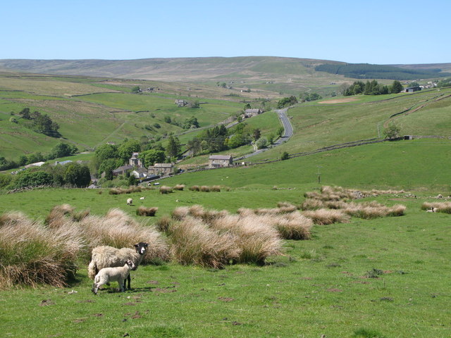
Cowshill is a small village located in the county of Durham, England. Situated on the eastern slopes of the North Pennines, it is nestled in a picturesque valley surrounded by rolling hills and green pastures. The village is part of the wider Wear Valley district and lies approximately 10 miles west of the market town of Bishop Auckland.

With a population of around 150 residents, Cowshill is a close-knit community. The village primarily consists of traditional stone-built houses, giving it a charming and timeless character. The nearby Cowshill Moor provides stunning panoramic views of the surrounding countryside, making it a popular destination for hikers and nature enthusiasts.

Despite its small size, Cowshill has a rich history. In the 19th century, the village was a hub for lead mining, and remnants of this industrial past can still be seen in the form of abandoned mine shafts and buildings. Today, the village is known for its peaceful atmosphere and idyllic rural setting.

Although Cowshill lacks some amenities such as shops and schools, it benefits from its proximity to nearby towns and villages. The area offers a range of outdoor activities, including walking, cycling, and fishing in the nearby River Wear. Additionally, the village is within easy reach of attractions such as the High Force waterfall and the historic Raby Castle.

In summary, Cowshill is a small, picturesque village nestled in the scenic North Pennines. It offers a tranquil and rural lifestyle, with abundant opportunities for outdoor activities and exploration of the stunning surrounding landscape.

If you have any feedback on the listing, please let us know in the comments section below.
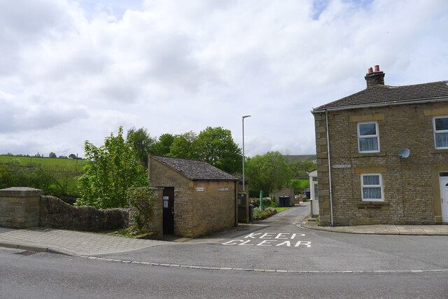
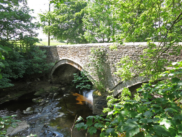
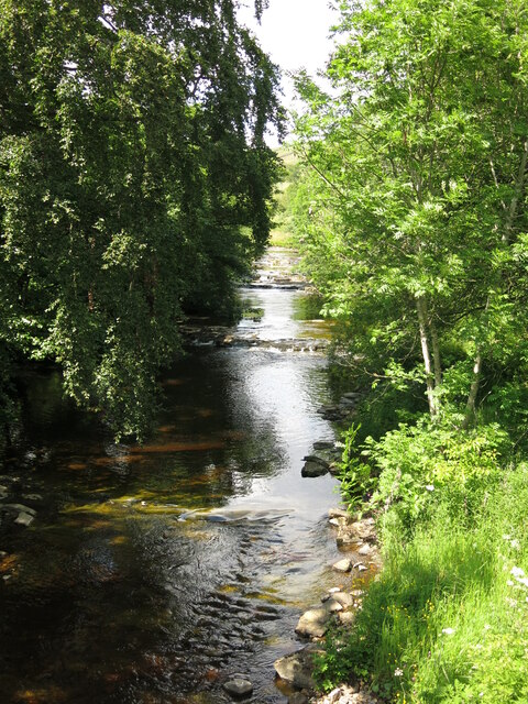
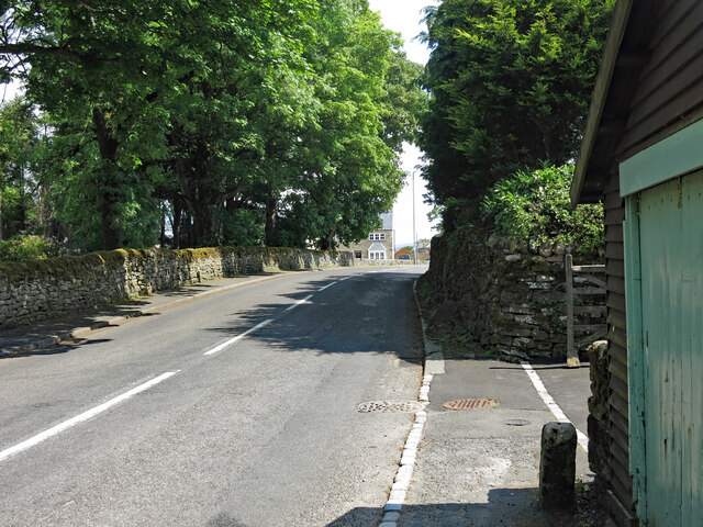
Cowshill Images

Images are sourced within 2km of 54.760499/-2.229183 or Grid Reference NY8540. Thanks to Geograph Open Source API. All images are credited.

River Wear near Waterside Farm
Newfield The property at Newfield seen along its access road high on the northern side of Weardale.
Newfield
The property at Newfield seen along its access road high on the northern side of Weardale.
Trees in valley of Elmford Cleugh Elmford Cleugh is a tributary of the River Wear descending on the north side of the valley.
Trees in valley of Elmford Cleugh
Elmford Cleugh is a tributary of the River Wear descending on the north side of the valley.
Head of the River Wear The point where Killhope Burn and Burnhope Burn meet to become the River Wear - at the aptly named village of Wearhead.
Head of the River Wear
The point where Killhope Burn and Burnhope Burn meet to become the River Wear - at the aptly named village of Wearhead.
Wearhead The A689 running through the small village of Wearhead
Wearhead
The A689 running through the small village of Wearhead
Weardale Way between Wearhead and West Blackdene Riverside path in pastures beside the Wear
Weardale Way between Wearhead and West Blackdene
Riverside path in pastures beside the Wear
River level monitoring station on the Killhope Burn, Wearhead For information on water levels: <span class="nowrap"><a title="https://riverlevels.uk/killhope-burn-stanhope-wearhead#.YpYn1qjMJPY" rel="nofollow ugc noopener" href="https://riverlevels.uk/killhope-burn-stanhope-wearhead#.YpYn1qjMJPY">Link</a><img style="margin-left:2px;" alt="External link" title="External link - shift click to open in new window" src="https://s1.geograph.org.uk/img/external.png" width="10" height="10"/></span>
River level monitoring station on the Killhope Burn, Wearhead
For information on water levels: LinkExternal link
The head of the Wear at Wearhead The River Wear starts here, below the junction of the Burnhope Burn and the Killhope Burn. Weardale, and the Weardale Way start 4½ miles upstream at the head of the Killhope Burn
The head of the Wear at Wearhead
The River Wear starts here, below the junction of the Burnhope Burn and the Killhope Burn. Weardale, and the Weardale Way start 4½ miles upstream at the head of the Killhope Burn
Public convenience, Wearhead The villages of Weardale are well supplied with free toilets.
Public convenience, Wearhead
The villages of Weardale are well supplied with free toilets.
The Weardale Way crossing the Wear to West Blackdene A 77 mile route following the River Wear from the sea at the Lindesfarne Memorial, Sunderland to the headwaters in the east Pennines, keeping as close as is possible to the river. It visits Lumley Castle, Durham (where the Castle and Cathedral forms a World Heritage Site), Bishop Auckland and Stanhope. After Stanhope the Way makes a northward loop to Rookhope to take in part of a tributary, Rookhope Burn.
The Weardale Way crossing the Wear to West Blackdene
A 77 mile route following the River Wear from the sea at the Lindesfarne Memorial, Sunderland to the headwaters in the east Pennines, keeping as close as is possible to the river. It visits Lumley Castle, Durham (where the Castle and Cathedral forms a World Heritage Site), Bishop Auckland and Stanhope. After Stanhope the Way makes a northward loop to Rookhope to take in part of a tributary, Rookhope Burn.
Bridge over the River Wear at West Blackdene The 18th C bridge is Grade II listed <span class="nowrap"><a title="https://historicengland.org.uk/listing/the-list/list-entry/1277160?section=official-list-entry" rel="nofollow ugc noopener" href="https://historicengland.org.uk/listing/the-list/list-entry/1277160?section=official-list-entry">Link</a><img style="margin-left:2px;" alt="External link" title="External link - shift click to open in new window" src="https://s1.geograph.org.uk/img/external.png" width="10" height="10"/></span> .
Bridge over the River Wear at West Blackdene
The 18th C bridge is Grade II listed LinkExternal link .
The River Wear at West Blackdene Photo taken looking upstream from the <a href="https://www.geograph.org.uk/photo/7240340">NY8639 : Bridge over the River Wear at West Blackdene</a>.
The River Wear at West Blackdene
Photo taken looking upstream from the NY8639 : Bridge over the River Wear at West Blackdene.
The track bed of the former Weardale Railway west of West Blackdene Photo taken from the <a href="https://www.geograph.org.uk/photo/7240353">NY8639 : Bridge over the former Weardale Railway at West Blackdene</a>.
The track bed of the former Weardale Railway west of West Blackdene
Old bridge marker, Wearhead The Durham Historic Environment Record (HER) <span class="nowrap"><a title="https://www.heritagegateway.org.uk/Gateway/Results_Single.aspx?uid=D8876&resourceID=109" rel="nofollow ugc noopener" href="https://www.heritagegateway.org.uk/Gateway/Results_Single.aspx?uid=D8876&resourceID=109">Link</a><img style="margin-left:2px;" alt="External link" title="External link - shift click to open in new window" src="https://s1.geograph.org.uk/img/external.png" width="10" height="10"/></span> says that this is "a stone milestone or property marker". But a longstanding local resident told me that the "C", which is the Latin letter for 100, indicated that the river (Wear) was 100 yards (presumably Roman yards) away.
The location of this stone is shown in <a href="https://www.geograph.org.uk/photo/7240849">NY8539 : Front Street, Wearhead</a> and <a href="https://www.geograph.org.uk/photo/7240852">NY8539 : Front Street, Wearhead (2)</a>.
Old bridge marker, Wearhead
The Durham Historic Environment Record (HER) LinkExternal link says that this is "a stone milestone or property marker". But a longstanding local resident told me that the "C", which is the Latin letter for 100, indicated that the river (Wear) was 100 yards (presumably Roman yards) away. The location of this stone is shown in NY8539 : Front Street, Wearhead and NY8539 : Front Street, Wearhead (2).
Front Street, Wearhead Shows the location of the <a href="https://www.geograph.org.uk/photo/7240846">NY8539 : Old bridge marker, Wearhead</a>.
Front Street, Wearhead
Shows the location of the NY8539 : Old bridge marker, Wearhead.
Front Street, Wearhead (2) Shows the location of the <a href="https://www.geograph.org.uk/photo/7240846">NY8539 : Old bridge marker, Wearhead</a>.
Front Street, Wearhead (2)
Shows the location of the NY8539 : Old bridge marker, Wearhead.
Path on north side of Burnhope Reservoir Maps show that if full the reservoir's water would reach close to the path. That's far from the situation in mid-August 2022 when the water level was well down.
It seems that the reservoir is not now used as a direct supply source for homes or industry but to top up when necessary, water flow in the River Wear.
Path on north side of Burnhope Reservoir
Maps show that if full the reservoir's water would reach close to the path. That's far from the situation in mid-August 2022 when the water level was well down. It seems that the reservoir is not now used as a direct supply source for homes or industry but to top up when necessary, water flow in the River Wear.
Pipeline crossing valley of Black Cleugh Being so close to Burnhope Reservoir it's assumed that the pipe carries water either to or from there. Both the pipe and the reservoir surface are close to the 400 m. contour so it's unclear in which direction, (if under gravity), water would flow.
Pipeline crossing valley of Black Cleugh
Being so close to Burnhope Reservoir it's assumed that the pipe carries water either to or from there. Both the pipe and the reservoir surface are close to the 400 m. contour so it's unclear in which direction, (if under gravity), water would flow.
Show me another place!

Cowshill is located at Grid Ref: NY8540 (Lat: 54.760499, Lng: -2.229183)

Unitary Authority: County Durham

Police Authority: Durham

What 3 Words

///project.airbase.predict. Near Stanhope, Co. Durham

Related Wikis

Cowshill

Cowshill is a village in the civil parish of Stanhope, in County Durham, England. It is situated at the top of Weardale, between Lanehead and Wearhead...

Copthill

Copthill is a village in the civil parish of Stanhope, in County Durham, England. It is situated on the north side of Weardale, between Cowshill and Cornriggs...

Cornriggs

Cornriggs is a hamlet in the civil parish of Stanhope, in County Durham, England. It is situated on the north side of Weardale in the North Pennines,...

Wearhead

Wearhead is a village in the civil parish of Stanhope, in County Durham, England. It is situated at the top of Weardale between Cowshill and Ireshopeburn...

Nearby Amenities

Located within 500m of 54.760499,-2.229183
Bus Stop
Hotel
Naptan AtcoCode: 13004521D
Naptan Bearing: SE
Naptan CommonName: Hotel
Naptan Indicator: south east bound
Naptan Landmark: Landmark not known
Naptan NaptanCode: durdatdj
Naptan Notes: Opposite St Thomas Church- A689- Cowshill
Naptan Street: Unclassified Village Street
Naptan Verified: no
Source: naptan_import
Lat/Long: 54.7604368/-2.2262346
Give Way
Direction: backward
Lat/Long: 54.760371/-2.2259731
Barrier: cattle_grid
Lat/Long: 54.7616175/-2.2232047
Bench
Lat/Long: 54.7602861/-2.224942
Cowshill
Place: hamlet
Source: survey
Website: https://cowshill.net/
Wikidata: Q5179829
Wikipedia: en:Cowshill
Lat/Long: 54.7606649/-2.2266122
Power: pole
Lat/Long: 54.7585722/-2.2246465
Power: pole
Lat/Long: 54.7579455/-2.2243478
Power: pole
Lat/Long: 54.7573086/-2.2240557
Power: pole
Lat/Long: 54.7576179/-2.224205
Power: pole
Lat/Long: 54.7573188/-2.2240074
Power: pole
Lat/Long: 54.7578029/-2.2233923
Power: pole
Lat/Long: 54.7583555/-2.2225665
Power: pole
Lat/Long: 54.7591109/-2.2220525
Power: pole
Lat/Long: 54.7599017/-2.2215561
Power: pole
Lat/Long: 54.7591464/-2.222136
Power: pole
Lat/Long: 54.7596533/-2.2232298
Power: pole
Lat/Long: 54.7599777/-2.2238975
Cowshill War Memorial
Historic: memorial
Memorial: war_memorial
Wikidata: Q26678165
Wikimedia Commons: File:Cowshill War Memorial.jpg
Lat/Long: 54.7625176/-2.2304106
Barrier: stile
Lat/Long: 54.7612125/-2.2236842
Give Way
Direction: backward
Lat/Long: 54.760073/-2.2252365
Post Box
Post Box Type: lamp
Royal Cypher: EIIR
Royal Cypher Wikidata: Q33102113
Lat/Long: 54.7604768/-2.2265392
Bench
Backrest: yes
Material: wood
Seats: 3
Lat/Long: 54.7604401/-2.2261221
Bench
Backrest: yes
Material: wood
Seats: 3
Lat/Long: 54.7604667/-2.2265111
Bench
Backrest: yes
Material: wood
Seats: 3
Lat/Long: 54.7605017/-2.2266019
Power: pole
Lat/Long: 54.7593136/-2.2353315
Power: pole
Lat/Long: 54.7602918/-2.2353195
Power: pole
Lat/Long: 54.7613395/-2.2353195
Power: pole
Lat/Long: 54.7622727/-2.2353101
Power: pole
Lat/Long: 54.7630712/-2.2344746
Power: pole
Lat/Long: 54.7638837/-2.2336458
Information: map
Tourism: information
Lat/Long: 54.7602612/-2.2249682
Give Way
Direction: forward
Lat/Long: 54.7632403/-2.2321549
Give Way
Direction: backward
Lat/Long: 54.7623987/-2.2303598
Defibrillator
Defibrillator Location: outside Cowshill & Lanehead Village Hall
Emergency: defibrillator
Indoor: no
Lat/Long: 54.7605065/-2.2266389
Mapillary: 554466015541258
Power: pole
Transformer: distribution
Lat/Long: 54.7603684/-2.2247509
Power: pole
Lat/Long: 54.7614258/-2.2222672
Power: pole
Lat/Long: 54.7621582/-2.2234319
Power: pole
Lat/Long: 54.762713/-2.2243103
Power: pole
Lat/Long: 54.76325/-2.2251834
Power: pole
Lat/Long: 54.7635819/-2.2257239
Power: pole
Lat/Long: 54.7642976/-2.2268423
Power: pole
Lat/Long: 54.7646373/-2.2273956
Power: pole
Lat/Long: 54.764734/-2.2275437
Power: pole
Lat/Long: 54.7647015/-2.2275947
Power: pole
Lat/Long: 54.7641413/-2.228508
Power: pole
Lat/Long: 54.7635625/-2.2294495
The data included in this document is from www.openstreetmap.org. The data is made available under ODbL.

Have you been to Cowshill?

Leave your review of Cowshill below (or comments, questions and feedback).