Burraton

Settlement in Devon South Hams

England

Burraton

River Yealm from Popple's Bridge Looking south downstream. The Yealm drops steadily here in its wooded valley between low hills.
River Yealm from Popple's Bridge Credit: Derek Harper

Burraton is a small village located in the county of Devon, England. Situated approximately five miles north of Saltash, it is nestled in the beautiful Tamar Valley. The village is predominantly residential, with a population of around 1,000 residents.

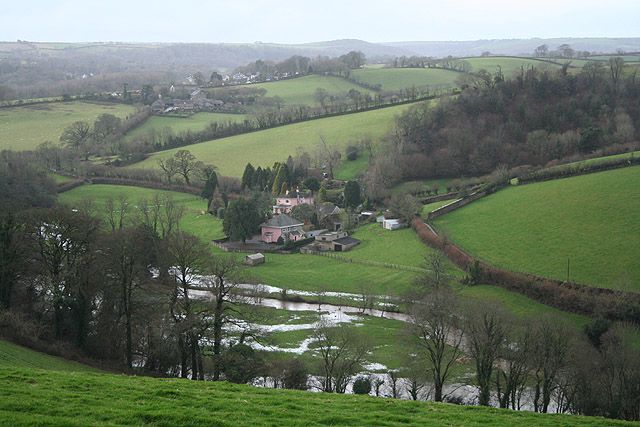
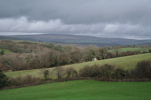
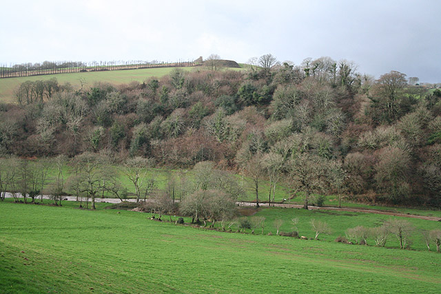
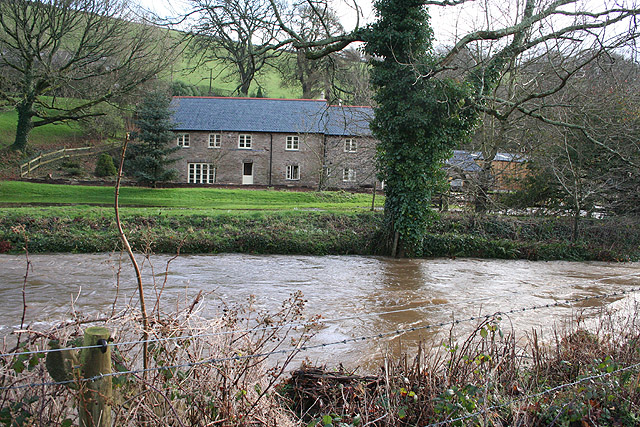
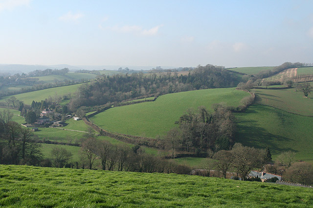
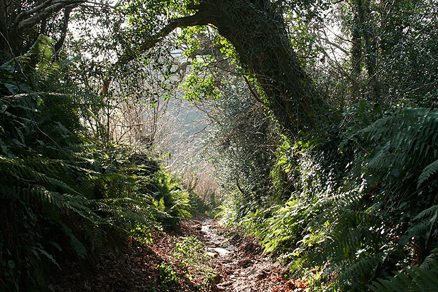
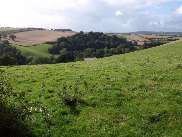
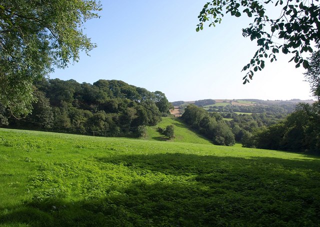
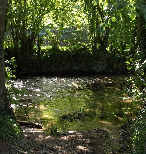
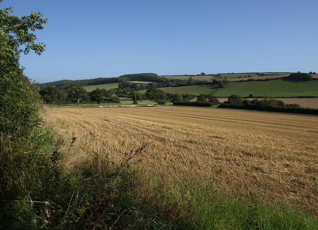
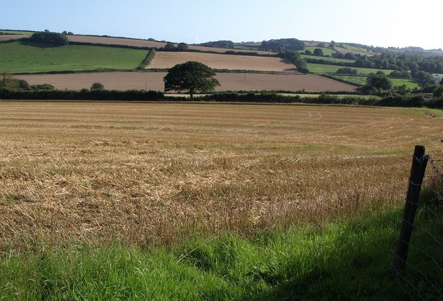
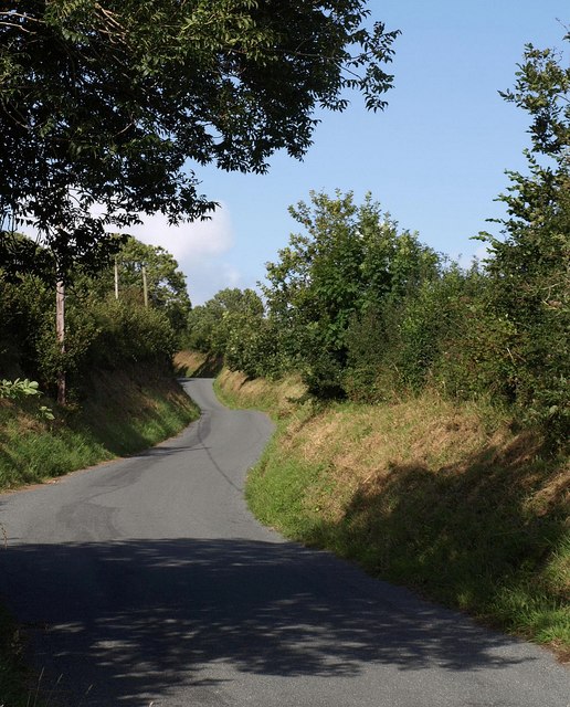
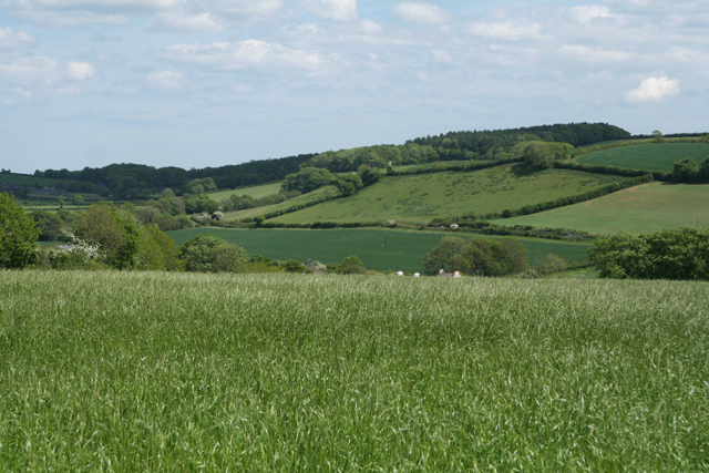
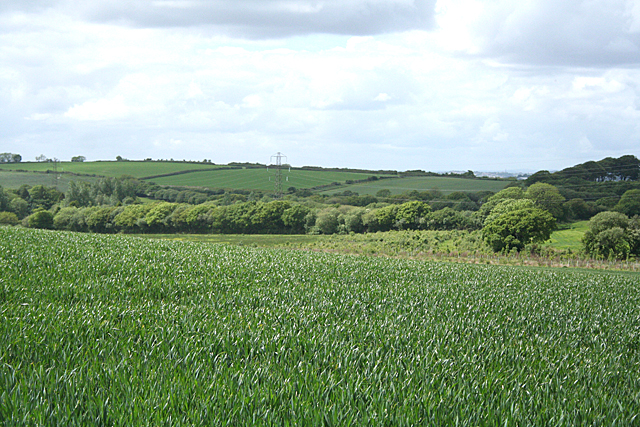
Burraton is known for its picturesque countryside, offering stunning views and a peaceful atmosphere. The area is surrounded by lush green fields and rolling hills, making it an ideal location for nature lovers and outdoor enthusiasts. There are several walking and cycling paths in the vicinity, providing opportunities to explore the surrounding natural beauty.

In terms of amenities, Burraton has a few local shops and a primary school, catering to the needs of its residents. For more extensive shopping and leisure options, the nearby town of Saltash offers a wider range of facilities.

The village has a strong sense of community, with various local events and activities taking place throughout the year. The annual Burraton Carnival is a popular event, bringing residents together for a day of celebration and entertainment.

Burraton's location also allows for easy access to major cities in the region. Plymouth, with its array of shopping centers, cultural attractions, and employment opportunities, is just a short drive away.

Overall, Burraton offers a tranquil and idyllic setting for those seeking a peaceful countryside lifestyle, while still being within reach of more urban amenities.

If you have any feedback on the listing, please let us know in the comments section below.
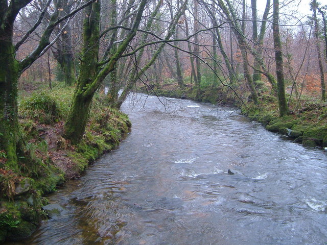
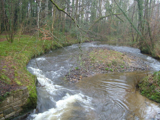
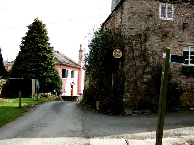
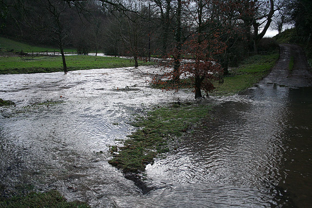
Burraton Images

Images are sourced within 2km of 50.360973/-3.9538167 or Grid Reference SX6153. Thanks to Geograph Open Source API. All images are credited.

River Yealm from Popple's Bridge Looking south downstream. The Yealm drops steadily here in its wooded valley between low hills.
River Yealm from Popple's Bridge
Looking south downstream. The Yealm drops steadily here in its wooded valley between low hills.
River Yealm from Lotherton Bridge The Yealm cutting away at both banks as it reaches Lotherton Bridge. Photo taken from the bridge looking upstream (north).
River Yealm from Lotherton Bridge
The Yealm cutting away at both banks as it reaches Lotherton Bridge. Photo taken from the bridge looking upstream (north).
Cottage near Yealmbridge A quiet little spot at the end of a lane clustered near Yeo Farm.
The footpath goes into Allercombe Wood off to the North West.
Cottage near Yealmbridge
A quiet little spot at the end of a lane clustered near Yeo Farm. The footpath goes into Allercombe Wood off to the North West.
Yealmpton: in the Yealm valley Looking south-south-east near the disused Yeo Quarry on a day when the Yealm was in spate after heavy rains
Yealmpton: in the Yealm valley
Looking south-south-east near the disused Yeo Quarry on a day when the Yealm was in spate after heavy rains
Yealmpton: overlooking Yeo Farm The Yealm valley seen from the lane near Worston on a day when the Yealm was in spate after heavy rains
Yealmpton: overlooking Yeo Farm
The Yealm valley seen from the lane near Worston on a day when the Yealm was in spate after heavy rains
Yealmpton: towards Dartmoor A view north-north-west near Winsor in the Yealm valley
Yealmpton: towards Dartmoor
A view north-north-west near Winsor in the Yealm valley
Yealmpton: towards Treby Wood A view across the Yealm valley. Seen from a public footpath near Winsor
Yealmpton: towards Treby Wood
A view across the Yealm valley. Seen from a public footpath near Winsor
Yealmpton: Worston Mill By the river Yealm, seen in spate. In the nineteenth century there was a working watermill here. But the leat has been ploughed out and the remaining buildings converted to a private residence. View from the public footpath to Winsor
Yealmpton: Worston Mill
By the river Yealm, seen in spate. In the nineteenth century there was a working watermill here. But the leat has been ploughed out and the remaining buildings converted to a private residence. View from the public footpath to Winsor
Yealmpton: above Worston Mill View towards Yeo Farm - on the left- in the Yealm valley
Yealmpton: above Worston Mill
View towards Yeo Farm - on the left- in the Yealm valley
Yealmpton: by Worston Wood A slippery path leading to a bridge over the Yealm below Yeo Farm
Yealmpton: by Worston Wood
A slippery path leading to a bridge over the Yealm below Yeo Farm
Yealm valley at Worston Seen from the lane at Worston. The roof belongs to a building at Worston Mill, tucked into the Yealm valley. On the far side is Treby Wood.
Yealm valley at Worston
Seen from the lane at Worston. The roof belongs to a building at Worston Mill, tucked into the Yealm valley. On the far side is Treby Wood.
Wood and field, Worston A view from a gateway higher up the lane shown in <a href="https://www.geograph.org.uk/photo/687002">SX5952 : Yealmpton: by Worston Wood</a>. The small valley drops from the hamlet of Worston to the Yealm.
Wood and field, Worston
A view from a gateway higher up the lane shown in SX5952 : Yealmpton: by Worston Wood. The small valley drops from the hamlet of Worston to the Yealm.
River Yealm below Worston One side of a ford for the path shown in <a href="https://www.geograph.org.uk/photo/687002">SX5952 : Yealmpton: by Worston Wood</a>, now replaced by a nearby footbridge.
River Yealm below Worston
One side of a ford for the path shown in SX5952 : Yealmpton: by Worston Wood, now replaced by a nearby footbridge.
Field near Orchard Farm From a gateway on Orchard Hill. The broad valley is occupied by a very small tributary of the Yealm.
Field near Orchard Farm
From a gateway on Orchard Hill. The broad valley is occupied by a very small tributary of the Yealm.
Field and tree, Orchard Farm Another view across the field shown in <a href="https://www.geograph.org.uk/photo/1458514">SX5952 : Field near Orchard Farm</a>, from the same gateway, looking more to the right.
Field and tree, Orchard Farm
Another view across the field shown in SX5952 : Field near Orchard Farm, from the same gateway, looking more to the right.
Orchard Hill Looking up the lane, between banks, which leads to Worston, from close to the point where <a href="https://www.geograph.org.uk/photo/1458514">SX5952 : Field near Orchard Farm</a> was taken.
Orchard Hill
Looking up the lane, between banks, which leads to Worston, from close to the point where SX5952 : Field near Orchard Farm was taken.
Yealmpton: towards the A379 Overlooking the Yealm valley by Longbrook with the Plymouth-Kingsbridge road in mid distance. Butland Wood, beyond this square, stands on the skyline
Yealmpton: towards the A379
Overlooking the Yealm valley by Longbrook with the Plymouth-Kingsbridge road in mid distance. Butland Wood, beyond this square, stands on the skyline
Ermington: towards Tod Moor Not far from Westlake in Ermington parish
Ermington: towards Tod Moor
Not far from Westlake in Ermington parish
Show me another place!

Burraton is located at Grid Ref: SX6153 (Lat: 50.360973, Lng: -3.9538167)

Administrative County: Devon

District: South Hams

Police Authority: Devon and Cornwall

What 3 Words

///rental.products.daredevil. Near Yealmpton, Devon

Nearby Locations

Burraton Ley Green

Related Wikis

Flete House

Flete House is a Grade I listed country house at Holbeton, in the South Hams region of Devon, England. == History == With roots in Saxon times, the Manor...

Ermington, Devon

Ermington is a village and civil parish located approximately 2 miles (3.2 km) south of the town of Ivybridge in the county of Devon, England. The village...

Holbury, Holbeton

Holbury is an Iron Age hill fort situated close to Holbeton in Devon, England. The fort is situated on a hilltop east of the Village approximately 95 metres...

Holbeton

Holbeton is a civil parish and village located 9 miles south east of Plymouth in the South Hams district of Devon, England. At the 2001 census the parish...

Ivybridge Town F.C.

Ivybridge Town Football Club is an amateur football club based in Ivybridge, Devon, England. They are currently members of the South West Peninsula League...

Ivybridge Priory

Ivybridge Priory or St. Austin's Priory was a monastic house in Devon, England. From 1932 it was a priory of the Order of Augustinian Recollects. They...

Yealmpton railway station

Yealmpton station was a stone built railway station in Devon, England, and was the terminus of the Plymouth to Yealmpton Branch built to the south and...

Stamford Fort

Stamford Fort is a 19th-century fort, built as a result of the Royal Commission on National Defence of 1859. Part of an extensive scheme known as Palmerston...

Nearby Amenities

Located within 500m of 50.360973,-3.9538167
Burraton
Is In: Devon
Place: hamlet
Lat/Long: 50.3601443/-3.9525949
Turning Circle
Lat/Long: 50.3603325/-3.9530961
The data included in this document is from www.openstreetmap.org. The data is made available under ODbL.

Have you been to Burraton?

Leave your review of Burraton below (or comments, questions and feedback).