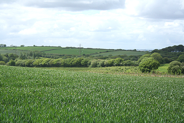
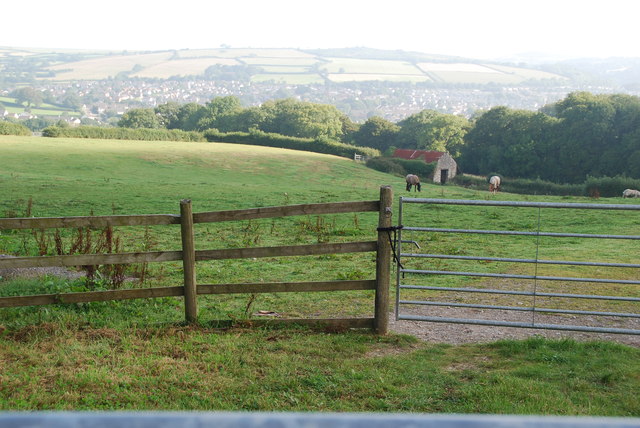
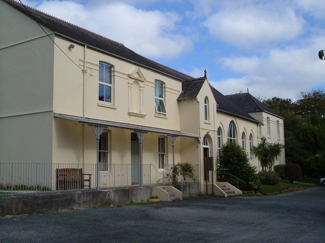
Ley Green

Downs, Moorland in Devon South Hams

England

Ley Green

Ermington : The A3121 Looking along the road.
Ermington : The A3121 Credit: Lewis Clarke

The requested URL returned error: 429 Too Many Requests

If you have any feedback on the listing, please let us know in the comments section below.

Ley Green Images

Images are sourced within 2km of 50.36773/-3.9445602 or Grid Reference SX6153. Thanks to Geograph Open Source API. All images are credited.

Ermington : The A3121 Looking along the road.
Ermington : The A3121
Looking along the road.
A38 at the Westlake Turnoff The A38 is a major A-class trunk route. When first designated in 1922, it ran from Derby to Plymouth but it was later extended at both ends so that it now runs for 292 miles from Mansfield in Nottinghamshire to Bodmin in Cornwall.

Prior to the opening of the M5 motorway in the 1960s and 1970s, the A38 formed the main "holiday route" from the Midlands to Somerset, Devon and Cornwall and the south-western section was notorious at holiday times for the congestion. Nowadays, for most of the southern section, the A38 is a fairly quiet road shadowing the M5 extremely closely; often running alongside the motorway as a single carriageway road. The section between Exeter and Plymouth is, however, a busy dual carriageway which serves as the southern extension of the M5 and is known as “the Devon Expressway”.

More information at <span class="nowrap"><a title="http://en.wikipedia.org/wiki/A38_road" rel="nofollow ugc noopener" href="http://en.wikipedia.org/wiki/A38_road">Link</a><img style="margin-left:2px;" alt="External link" title="External link - shift click to open in new window" src="https://s1.geograph.org.uk/img/external.png" width="10" height="10"/></span>  (Wikipedia) and <span class="nowrap"><a title="http://www.sabre-roads.org.uk/wiki/index.php?title=A38" rel="nofollow ugc noopener" href="http://www.sabre-roads.org.uk/wiki/index.php?title=A38">Link</a><img style="margin-left:2px;" alt="External link" title="External link - shift click to open in new window" src="https://s1.geograph.org.uk/img/external.png" width="10" height="10"/></span>  (SABRE).
A38 at the Westlake Turnoff
The A38 is a major A-class trunk route. When first designated in 1922, it ran from Derby to Plymouth but it was later extended at both ends so that it now runs for 292 miles from Mansfield in Nottinghamshire to Bodmin in Cornwall. Prior to the opening of the M5 motorway in the 1960s and 1970s, the A38 formed the main "holiday route" from the Midlands to Somerset, Devon and Cornwall and the south-western section was notorious at holiday times for the congestion. Nowadays, for most of the southern section, the A38 is a fairly quiet road shadowing the M5 extremely closely; often running alongside the motorway as a single carriageway road. The section between Exeter and Plymouth is, however, a busy dual carriageway which serves as the southern extension of the M5 and is known as “the Devon Expressway”. More information at LinkExternal link (Wikipedia) and LinkExternal link (SABRE).
Ermington: lane to Worthele Cross And on to Ivybridge. In Ermington parish
Ermington: lane to Worthele Cross
And on to Ivybridge. In Ermington parish
Ermington: towards Tod Moor Not far from Westlake in Ermington parish
Ermington: towards Tod Moor
Not far from Westlake in Ermington parish
Ermington: Ivybridge NTL tower TV transmitter on a high point between Ivybridge and the village of Ermington
Ermington: Ivybridge NTL tower
TV transmitter on a high point between Ivybridge and the village of Ermington
Ermington: Worthele Cross The lane by the signpost leads to East Worthele farm
Ermington: Worthele Cross
The lane by the signpost leads to East Worthele farm
Ermington: towards Ivybridge View from Worthele Cross with Western Beacon on the skyline, centre right. Overlooking a field of mown grass
Ermington: towards Ivybridge
View from Worthele Cross with Western Beacon on the skyline, centre right. Overlooking a field of mown grass
Ermington: towards Tod Moor Field ploughed, harrowed and sown. Compare with a similar view -<a href="https://www.geograph.org.uk/photo/2407302">SX6253 : Ermington: towards Tod Moor</a>
Ermington: towards Tod Moor
Field ploughed, harrowed and sown. Compare with a similar view -SX6253 : Ermington: towards Tod Moor
At Endsleigh Garden Centre, Ivybridge Ugborough Beacon can be seen in the distance.
At Endsleigh Garden Centre, Ivybridge
Ugborough Beacon can be seen in the distance.
The A38 eastbound at Cadleigh Lane
The A38 eastbound towards Cadleigh Lane
South Hams : Sheep Grazing Sheep grazing in a field beside the A38 road.
South Hams : Sheep Grazing
Sheep grazing in a field beside the A38 road.
Swainstone Cross Close to Swainstone Combe Wood.
Swainstone Cross
Close to Swainstone Combe Wood.
Pasture Land On the minor road between Ivybridge and Ermington.
Pasture Land
On the minor road between Ivybridge and Ermington.
Pasture Land Further along the minor road to Ermington.
Pasture Land
Further along the minor road to Ermington.
Marjery Cross On the minor road between Ivybridge and Ermington.
Marjery Cross
On the minor road between Ivybridge and Ermington.
Marjery Cross Looking in the opposite direction back towards Ivybridge.
Marjery Cross
Looking in the opposite direction back towards Ivybridge.
Pasture Land At a spot known as Three corners i think. On the Hunsdon Road. With part of Ivybridge in the background.
Pasture Land
At a spot known as Three corners i think. On the Hunsdon Road. With part of Ivybridge in the background.
Show me another place!

Ley Green is located at Grid Ref: SX6153 (Lat: 50.36773, Lng: -3.9445602)

Administrative County: Devon

District: South Hams

Police Authority: Devon and Cornwall

What 3 Words

///addicted.unguarded.skate. Near Ivybridge, Devon

Nearby Locations

Burraton Ley Green

Related Wikis

Ermington, Devon

Ermington is a village and civil parish located approximately 2 miles (3.2 km) south of the town of Ivybridge in the county of Devon, England. The village...

Ivybridge Town F.C.

Ivybridge Town Football Club is an amateur football club based in Ivybridge, Devon, England. They are currently members of the South West Peninsula League...

Ivybridge Priory

Ivybridge Priory or St. Austin's Priory was a monastic house in Devon, England. From 1932 it was a priory of the Order of Augustinian Recollects. They...

Flete House

Flete House is a Grade I listed country house at Holbeton, in the South Hams region of Devon, England. == History == With roots in Saxon times, the Manor...

Related Videos

Walking Tennis

Music by : Music: I'm Sitting Here Wondering Musician: Philip E Morris.

Walking the Dog in the Rain in 4K | Countryside Ambience

Walking Missy along the river Erme in the rain. The river was raging after a heavy storm and the leaves have started to fall.

Ivybridge welcomes you!

A town of thriving independent shops, cafes, restaurants, leisure and essential services, come to discover - or rediscover - all that ...

Christmas Day 2019 walk on Dartmoor

Christmas Day 2019 walk on Dartmoor (although you can do it anytime!) starts in Ivybridge and heads up onto Dartmoor. The first ...

Nearby Amenities

Located within 500m of 50.36773,-3.9445602
Power: tower
Source: bing
Lat/Long: 50.3681994/-3.943876
Power: tower
Source: bing
Lat/Long: 50.3687539/-3.9404658
Power: pole
Lat/Long: 50.37196/-3.9434534
Power: pole
Lat/Long: 50.3712688/-3.9449233
Power: pole
Lat/Long: 50.3712004/-3.9484209
Westlake Farm
Place: farm
Lat/Long: 50.3665948/-3.9377376
The data included in this document is from www.openstreetmap.org. The data is made available under ODbL.

Have you been to Ley Green?

Leave your review of Ley Green below (or comments, questions and feedback).