Burnend

Settlement in Banffshire

Scotland

Burnend

Turbine in the Forest Long before I rounded a bend and saw it, I could hear the rhythmic sound of the wind turbine at Loanhead.
Turbine in the Forest Credit: Anne Burgess

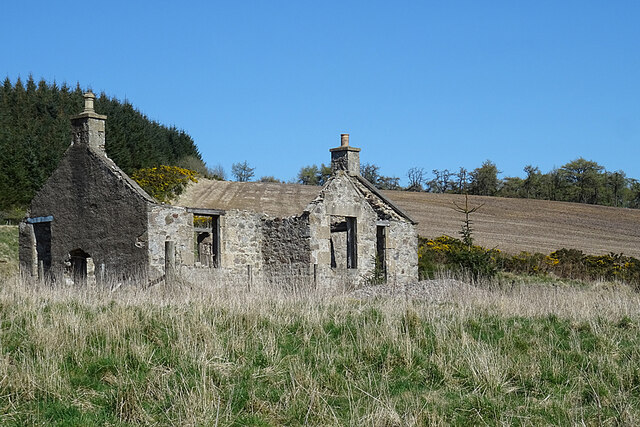
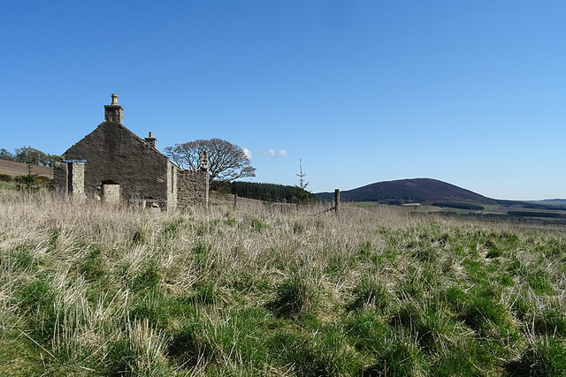
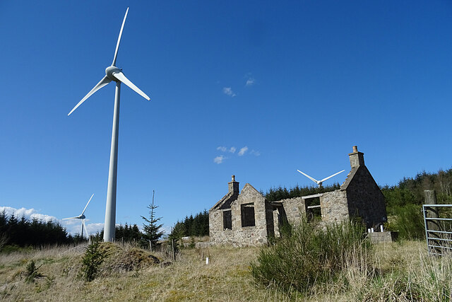
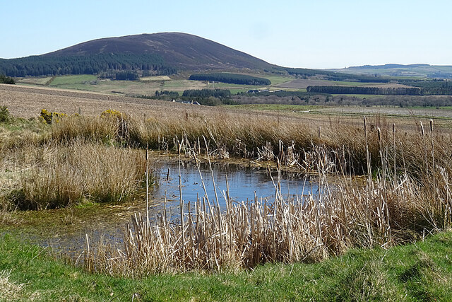
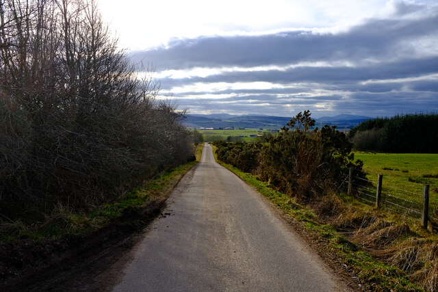
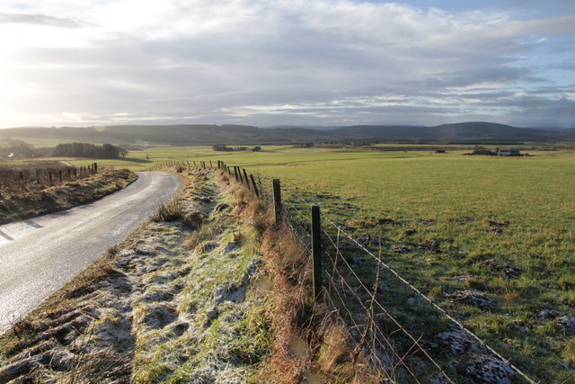
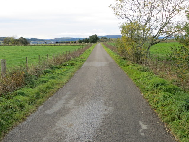
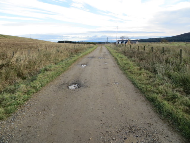
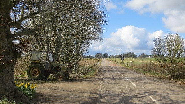
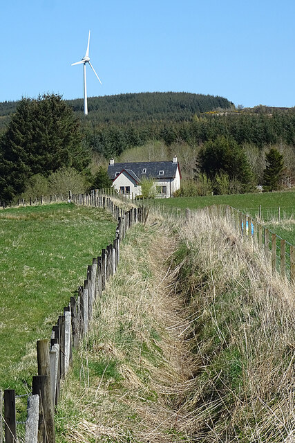
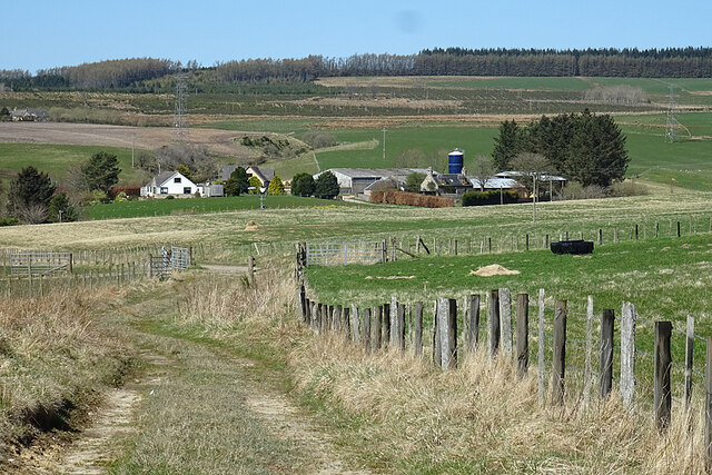
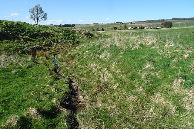
Burnend is a small village located in the historical county of Banffshire, Scotland. Situated in the northeastern part of the country, it lies approximately 6 miles southeast of the town of Banff and 5 miles northwest of Turriff. The village is surrounded by picturesque countryside, with rolling hills and farmland dominating the landscape.

With a population of around 200 residents, Burnend is a tight-knit community known for its tranquil and idyllic setting. The village primarily consists of traditional stone houses, showcasing the architectural style typical of the region. The main focal point of the village is the Burnend Community Hall, which serves as a meeting place for various local activities and events.

Despite its small size, Burnend benefits from its proximity to larger towns, providing its residents with access to essential amenities and services. The village enjoys a peaceful atmosphere, away from the hustle and bustle of urban life, making it an attractive location for those seeking a quiet and rural lifestyle.

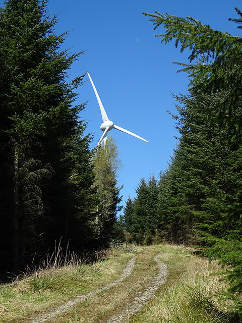
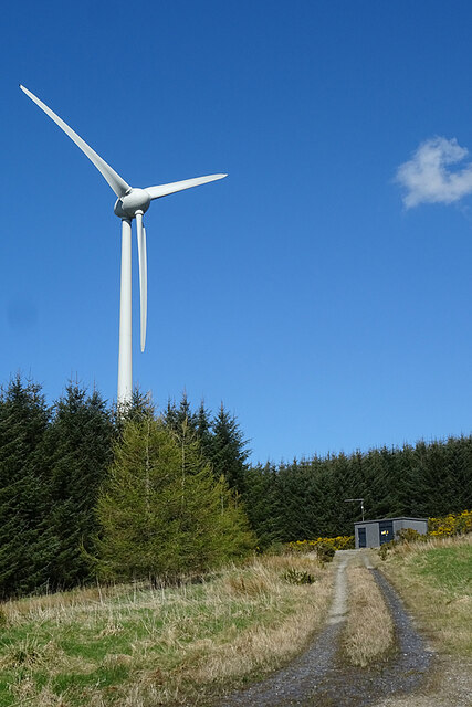
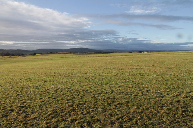
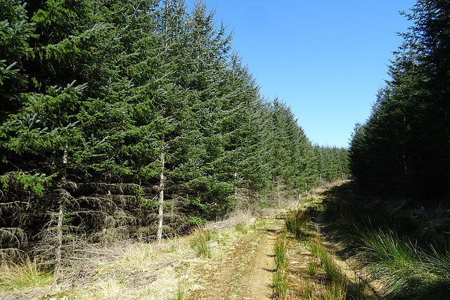
The surrounding natural beauty offers ample opportunities for outdoor activities, with numerous walking trails and cycling routes in the vicinity. The nearby River Deveron also provides an excellent spot for fishing enthusiasts. The countryside surrounding Burnend is not only visually stunning but also serves as a vital agricultural area, with farming playing an important role in the local economy.

Overall, Burnend offers a charming and tranquil setting for its residents, combining the beauty of the Scottish countryside with a strong sense of community spirit.

If you have any feedback on the listing, please let us know in the comments section below.
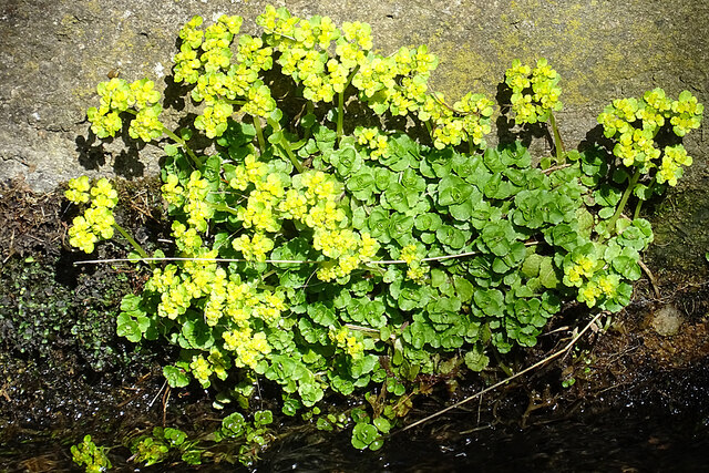
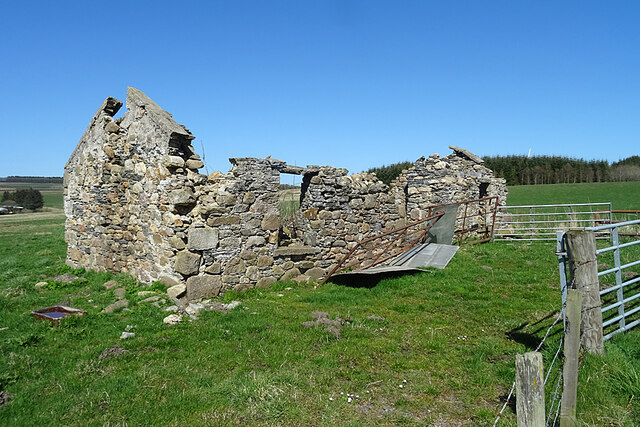
Burnend Images

Images are sourced within 2km of 57.590184/-2.8557524 or Grid Reference NJ4855. Thanks to Geograph Open Source API. All images are credited.

Turbine in the Forest Long before I rounded a bend and saw it, I could hear the rhythmic sound of the wind turbine at Loanhead.
Turbine in the Forest
Long before I rounded a bend and saw it, I could hear the rhythmic sound of the wind turbine at Loanhead.
Loanhead of Myrietown This is exactly the sort of place I would have liked to live in when I was younger. Sheltered by a hill and forest to the north and east, with an open aspect to the south-west and a good view. No problems with noisy neighbours or passers-by dropping litter, but a long way from any shops, and very difficult to get to in a snowy winter. But it now sits almost underneath a wind turbine so I don't suppose anyone would want it now.
Loanhead of Myrietown
This is exactly the sort of place I would have liked to live in when I was younger. Sheltered by a hill and forest to the north and east, with an open aspect to the south-west and a good view. No problems with noisy neighbours or passers-by dropping litter, but a long way from any shops, and very difficult to get to in a snowy winter. But it now sits almost underneath a wind turbine so I don't suppose anyone would want it now.
Loanhead of Myrietown This is exactly the sort of place I would have liked to live in when I was younger. Sheltered by a hill and forest to the north and east, with an open aspect to the south-west and a good view. No problems with noisy neighbours or passers-by dropping litter, but a long way from any shops, and very difficult to get to in a snowy winter. But it now sits almost underneath a wind turbine so I don't suppose anyone would want it now. The distant hill is Knock Hill.
Loanhead of Myrietown
This is exactly the sort of place I would have liked to live in when I was younger. Sheltered by a hill and forest to the north and east, with an open aspect to the south-west and a good view. No problems with noisy neighbours or passers-by dropping litter, but a long way from any shops, and very difficult to get to in a snowy winter. But it now sits almost underneath a wind turbine so I don't suppose anyone would want it now. The distant hill is Knock Hill.
Loanhead of Myrietown This is exactly the sort of place I would have liked to live in when I was younger. Sheltered by a hill and forest to the north and east, with an open aspect to the south-west and a good view. No problems with noisy neighbours or passers-by dropping litter, but a long way from any shops, and very difficult to get to in a snowy winter. But it now sits almost underneath a wind turbine so I don't suppose anyone would want it now.
Loanhead of Myrietown
This is exactly the sort of place I would have liked to live in when I was younger. Sheltered by a hill and forest to the north and east, with an open aspect to the south-west and a good view. No problems with noisy neighbours or passers-by dropping litter, but a long way from any shops, and very difficult to get to in a snowy winter. But it now sits almost underneath a wind turbine so I don't suppose anyone would want it now.
Pond with a View In the foreground is a small artificial pond, and beyond it is the fine view to Knock Hill that was enjoyed by the occupants of Loanhead of Myriehill before it was allowed to fall into ruin.
Pond with a View
In the foreground is a small artificial pond, and beyond it is the fine view to Knock Hill that was enjoyed by the occupants of Loanhead of Myriehill before it was allowed to fall into ruin.
Turbine 1 This turbine is designated No 1 in the Myretown and Lurg Hill wind farm, although it doesn't appear to be the first one erected there.
Turbine 1
This turbine is designated No 1 in the Myretown and Lurg Hill wind farm, although it doesn't appear to be the first one erected there.
Downhill Road Heading down hill on a quite backroad
Downhill Road
Heading down hill on a quite backroad
Farmland Around Ploverwards
Minor Road and Farmland Near Brambleburn
Track to Westertown and Ploverwards Looking south-westward.
Track to Westertown and Ploverwards
Looking south-westward.
Track to Brambleburn Steading Looking north-eastward.
Track to Brambleburn Steading
Looking north-eastward.
Grange Crossroads The B9018 Cullen to Keith road.
Grange Crossroads
The B9018 Cullen to Keith road.
Alternater-leaved Golden Saxifrage (Chrysosplenium alternifolium) This is a plant of damp places, in this case on the dyke beside the bridge over a nameless tributary of the Bowie Burn.
Alternater-leaved Golden Saxifrage (Chrysosplenium alternifolium)
This is a plant of damp places, in this case on the dyke beside the bridge over a nameless tributary of the Bowie Burn.
Upper Burnend The ditch is part of a complex of ditches that eventually become part of the Bowie Burn. The new house at Upper Burnend isn't yet on the maps.
Upper Burnend
The ditch is part of a complex of ditches that eventually become part of the Bowie Burn. The new house at Upper Burnend isn't yet on the maps.
Field Access The track flanked by fences on both sides just leads into a field which is behind me. The farm buildings are at Goukstone, and Black Hill is on the skyline.
Field Access
The track flanked by fences on both sides just leads into a field which is behind me. The farm buildings are at Goukstone, and Black Hill is on the skyline.
Ruin at Burnend Evidently the remains of a house, this is marked on the 19th century maps but not named. It has deteriorated significantly in the 16 years since <a href="https://www.geograph.org.uk/photo/238462">NJ4955 : The  derelict cottage of Burnend.</a> was taken.
Ruin at Burnend
Evidently the remains of a house, this is marked on the 19th century maps but not named. It has deteriorated significantly in the 16 years since NJ4955 : The derelict cottage of Burnend. was taken.
Mill Lade This is shown on the 19th century maps as a mill lade, presumably powering a mill at Burnend, though no mill is actually named. The farm buildings are at Goukstone.
Mill Lade
This is shown on the 19th century maps as a mill lade, presumably powering a mill at Burnend, though no mill is actually named. The farm buildings are at Goukstone.
Forest Track Rising gently through the plantation at Myretown towards Lurg Hill.
Forest Track
Rising gently through the plantation at Myretown towards Lurg Hill.
Show me another place!

Burnend is located at Grid Ref: NJ4855 (Lat: 57.590184, Lng: -2.8557524)

Unitary Authority: Moray

Police Authority: North East

What 3 Words

///thrillers.remover.lookout. Near Keith, Moray

Nearby Locations

Burnend

Related Wikis

Foudland Hills

The Foudland Hills is a mountain range in the northeast of Aberdeenshire, Scotland and northwest of Morayshire. The Foudland Hills are a prominent feature...

Grange, Moray

Grange is a parish in the Scottish county of Banffshire that dates back to a royal charter granting the lands to the abbots and monks of Kinloss in 1196...

Farmtown

Farmtown is a village in the Moray council area of Scotland. Farmtown lies on the junction of the A95 and B9117 roads east of the town of Keith.

Grange railway station (Scotland)

Grange railway station was a railway station in the parish of Grange, historically in Banffshire (although currently in Moray). Opened in 1856 by the...

Millegin railway station

Millegin railway station, Millagan railway station or later Millegin Siding was briefly an intermediate stop situated on what became the Great North of...

Deskford Tower

Tower of Deskford was a 14th-century tower house, about 3.5 miles (5.6 km) south of Cullen, Moray, Scotland at Deskford, west of the burn. The tower and...

Deskford

Deskford (Scottish Gaelic: Deasgard) is a parish and a small settlement in Moray, Scotland, formerly in Banffshire. A number of significant historical...

Newmill

Newmill is a planned village 2 kilometres (1.2 mi) north of the town of Keith in the Moray council area of north-east Scotland. The resident population...

Nearby Amenities

Located within 500m of 57.590184,-2.8557524
Power: tower
Lat/Long: 57.5912464/-2.8600135
Power: pole
Lat/Long: 57.5884969/-2.8621155
Power: pole
Lat/Long: 57.5891726/-2.8612411
Power: pole
Lat/Long: 57.589923/-2.8602621
Power: pole
Lat/Long: 57.5908474/-2.859098
Power: pole
Lat/Long: 57.5916208/-2.858111
Power: pole
Lat/Long: 57.5923726/-2.8580144
Power: pole
Lat/Long: 57.5933299/-2.8578749
Power: pole
Lat/Long: 57.5943103/-2.8577301
Power: tower
Lat/Long: 57.58935/-2.8626369
Power: tower
Lat/Long: 57.5933023/-2.8596807
Power: pole
Lat/Long: 57.5929186/-2.8622929
Power: pole
Lat/Long: 57.5926907/-2.8611423
Power: pole
Lat/Long: 57.5924876/-2.8600794
Power: pole
Lat/Long: 57.5921258/-2.8608004
Power: pole
Lat/Long: 57.5917147/-2.8615916
Power: pole
Lat/Long: 57.5912719/-2.8623126
Power: pole
Lat/Long: 57.5908138/-2.8630533
Power: pole
Lat/Long: 57.5903475/-2.8637897
Power: pole
Lat/Long: 57.5932187/-2.8500497
Power: pole
Lat/Long: 57.5925974/-2.8496662
Power: pole
Lat/Long: 57.5919478/-2.8495478
Power: pole
Lat/Long: 57.5912725/-2.8497275
Power: pole
Lat/Long: 57.5907239/-2.849881
Power: pole
Lat/Long: 57.5901965/-2.850019
Power: pole
Lat/Long: 57.5897572/-2.8506633
Power: pole
Lat/Long: 57.5892498/-2.851369
Power: pole
Lat/Long: 57.5889456/-2.8518073
Power: pole
Lat/Long: 57.588491/-2.8524451
Power: pole
Lat/Long: 57.5879095/-2.8532582
Power: pole
Lat/Long: 57.5873127/-2.8540055
Power: pole
Lat/Long: 57.5867195/-2.8547572
Power: pole
Lat/Long: 57.5862684/-2.8553226
Power: pole
Lat/Long: 57.5912584/-2.8484652
The data included in this document is from www.openstreetmap.org. The data is made available under ODbL.

Have you been to Burnend?

Leave your review of Burnend below (or comments, questions and feedback).