Bruna Hill

Settlement in Lancashire Wyre

England

Bruna Hill

High Street, Garstang High Street in the centre of the small town of Garstang in Lancashire.
High Street, Garstang Credit: Malc McDonald

Bruna Hill is a small village located in the picturesque county of Lancashire, England. Situated in the heart of the Ribble Valley, it offers residents and visitors a tranquil and idyllic setting to enjoy the countryside.

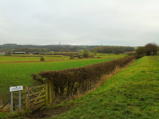
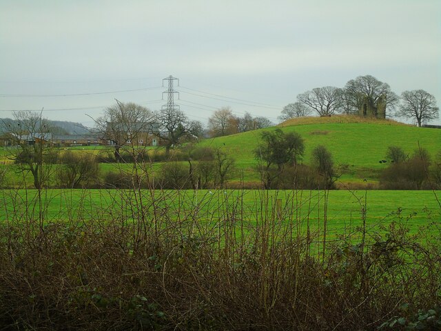
With a population of around 500, Bruna Hill maintains a close-knit community atmosphere. The village is characterized by its charming stone cottages and well-preserved historic buildings, showcasing the region's rich heritage. The surrounding landscape is predominantly rural, featuring rolling hills, lush green fields, and meandering country lanes.

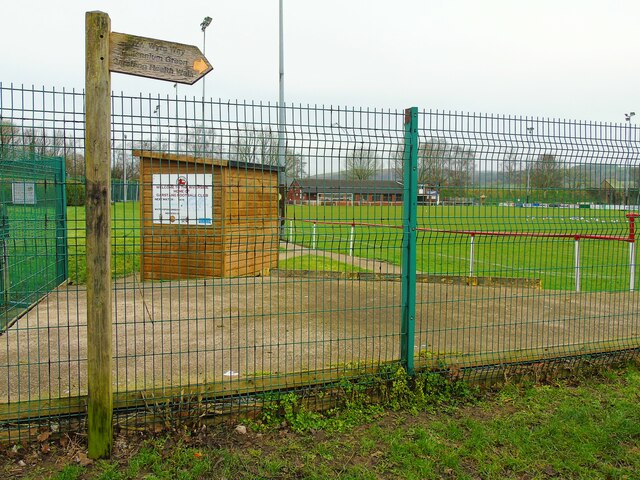
Despite its small size, Bruna Hill offers a range of amenities for its residents. These include a local pub serving traditional British fare, a village hall hosting community events, and a primary school that caters to the educational needs of the village's children. The nearby market town of Clitheroe provides additional services such as shops, supermarkets, and healthcare facilities.

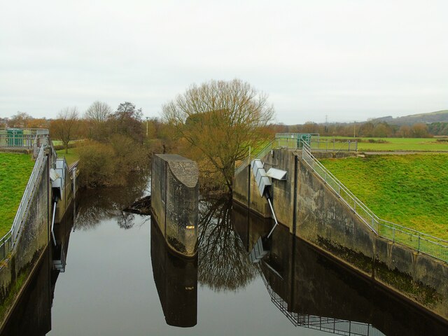
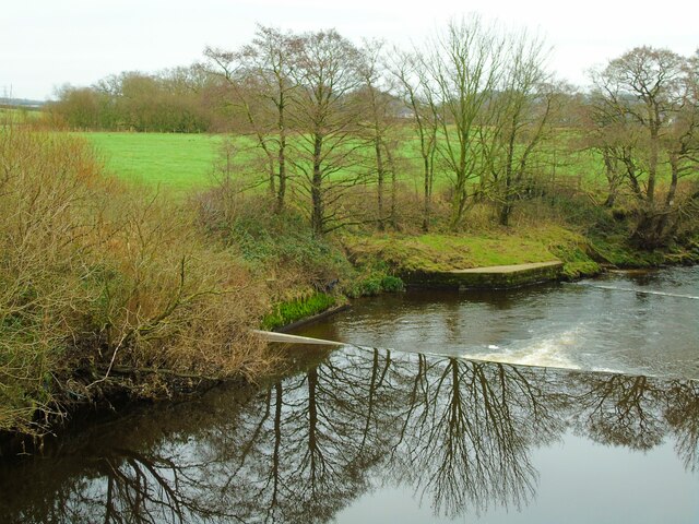
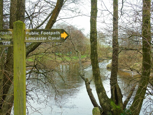
For outdoor enthusiasts, Bruna Hill is a paradise. The village is surrounded by an extensive network of footpaths and bridleways, making it an ideal destination for walkers, hikers, and cyclists. The nearby Forest of Bowland, an Area of Outstanding Natural Beauty, offers breathtaking vistas and diverse wildlife, further enhancing the area's appeal.

In conclusion, Bruna Hill is a delightful village in Lancashire, known for its peaceful ambiance, stunning countryside, and strong sense of community. Whether you are seeking a rural retreat or a place to call home, this charming village is sure to captivate with its natural beauty and welcoming atmosphere.

If you have any feedback on the listing, please let us know in the comments section below.
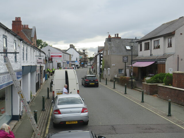
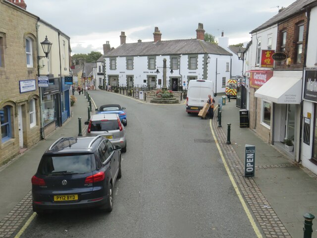
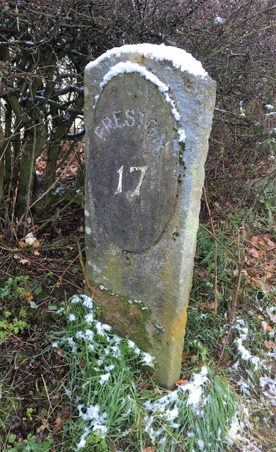
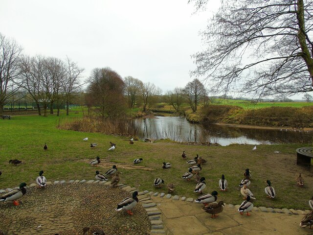
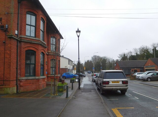
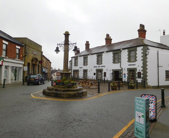
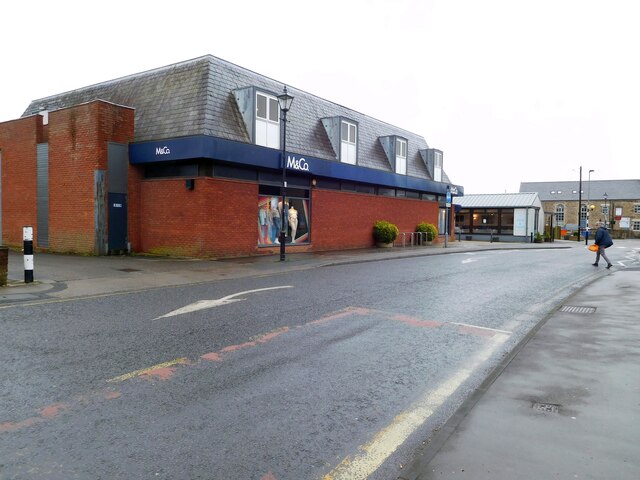
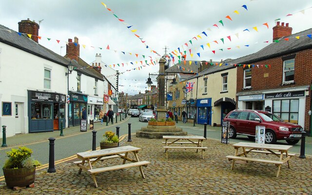
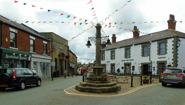
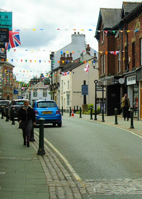
Bruna Hill Images

Images are sourced within 2km of 53.88828/-2.7599638 or Grid Reference SD5043. Thanks to Geograph Open Source API. All images are credited.

High Street, Garstang High Street in the centre of the small town of Garstang in Lancashire.
High Street, Garstang
High Street in the centre of the small town of Garstang in Lancashire.
High Street, Garstang A view of the High Street in the small town of Garstang, in Lancashire.
High Street, Garstang
A view of the High Street in the small town of Garstang, in Lancashire.
Old Milestone, Lancaster Canal NW of Byerworth Bridge, Garstang.

Inscription reads: Preston / 17

Milestone Society National ID: LAN-17
Old Milestone, Lancaster Canal
NW of Byerworth Bridge, Garstang. Inscription reads: Preston / 17 Milestone Society National ID: LAN-17
River Wyre at High Street car park This is the River Wyre as it meanders by the High Street car park in Garstang, Lancashire.
River Wyre at High Street car park
This is the River Wyre as it meanders by the High Street car park in Garstang, Lancashire.
Garstang Football Club Taken on the Wyre Way at the ground of Garstang Football, Rugby and Cricket Clubs. Garstang, Lancashire.
Garstang Football Club
Taken on the Wyre Way at the ground of Garstang Football, Rugby and Cricket Clubs. Garstang, Lancashire.
Garstang Flood Storage Basin dam This is the dam whose gates are raised to control the flow of water along the River Wyre as it passes Garstang and Catterall at times of flood. Garstang, Lancashire.
Garstang Flood Storage Basin dam
This is the dam whose gates are raised to control the flow of water along the River Wyre as it passes Garstang and Catterall at times of flood. Garstang, Lancashire.
Weirs on the River Wyre These weirs are south of the footbridge beside the Flood Storage Basin which controls water flow on the River Wyre as it passes Garstang, Lancashire.
Weirs on the River Wyre
These weirs are south of the footbridge beside the Flood Storage Basin which controls water flow on the River Wyre as it passes Garstang, Lancashire.
Garstang Flood Storage Basin Taken baside the Garstang Flood Storage Basin, Garstang, Lancashire, I am looking east towards Calder Vale. The traffic flow on the M6 can be discerned in the distance.
Garstang Flood Storage Basin
Taken baside the Garstang Flood Storage Basin, Garstang, Lancashire, I am looking east towards Calder Vale. The traffic flow on the M6 can be discerned in the distance.
Greenhalgh Castle Farm This is Greenhalgh Castle Farm, taken from the riverside path along the River Wyre in Garstang. On the hillock is what remains of Greenhalgh Castle which was built in the late 15th century by Thomas Stanley, 1st Earl of Derby, to protect lands which are said to have been gifted to him by Henry Tudor.
Greenhalgh Castle Farm
This is Greenhalgh Castle Farm, taken from the riverside path along the River Wyre in Garstang. On the hillock is what remains of Greenhalgh Castle which was built in the late 15th century by Thomas Stanley, 1st Earl of Derby, to protect lands which are said to have been gifted to him by Henry Tudor.
The Wyre Way to Lancaster Canal This is the section of the Wyre Way at the High Street car park in Garstang, Lancashire, which takes the walker to Lancaster Canal as it passes to the south of the town.
The Wyre Way to Lancaster Canal
This is the section of the Wyre Way at the High Street car park in Garstang, Lancashire, which takes the walker to Lancaster Canal as it passes to the south of the town.
OS Bench Mark OS flush bracket bench mark (no. G2784) on old town hall in High Street. 20.91 m above datum.
OS Bench Mark
OS flush bracket bench mark (no. G2784) on old town hall in High Street. 20.91 m above datum.
OS Bench Mark OS bolt bench mark on St Thomas's Church. 22.83 m above datum.
OS Bench Mark
OS bolt bench mark on St Thomas's Church. 22.83 m above datum.
Bridge Street, Garstang 
Originally this was the A6 through Garstang but is now the B6430.
Bridge Street, Garstang
Originally this was the A6 through Garstang but is now the B6430.
Garstang Market Place 
The ancient market cross, standing in front of the Royal Oak Hotel in Market Place.

The Market Cross, which is a scheduled ancient monument (<span class="nowrap"><a title="http://www.ancientmonuments.info/en23784-garstang-market-cross" rel="nofollow ugc noopener" href="http://www.ancientmonuments.info/en23784-garstang-market-cross">Link</a><img style="margin-left:2px;" alt="External link" title="External link - shift click to open in new window" src="https://s1.geograph.org.uk/img/external.png" width="10" height="10"/></span> ), probably lost its actual cross  from the top of the stone pillar around the time of Cromwell. The steps are seventeenth century (or earlier) and the column and pedestal date from 1754. 

The original medieval shaft was removed in 1754 because of local strong feelings against Roman Catholics. It was replaced by the present obelisk which was restored in 1897 to mark Queen Victoria's Diamond Jubilee.

The area surrounding the cross was the original Market Place. Garstang received a Royal Charter to hold an annual fair in 1288 and, in 1314, Edward II granted the right to hold a market on Thursdays. The weekly street market still continues every Thursday.

The Royal Oak Hotel was Garstang's Principal Posting House on the London to Edinburgh route. It is a Grade II listed building, probably dating from the early nineteenth century <span class="nowrap"><a title="https://historicengland.org.uk/listing/the-list/list-entry/1361932?section=official-list-entry" rel="nofollow ugc noopener" href="https://historicengland.org.uk/listing/the-list/list-entry/1361932?section=official-list-entry">Link</a><img style="margin-left:2px;" alt="External link" title="External link - shift click to open in new window" src="https://s1.geograph.org.uk/img/external.png" width="10" height="10"/></span>.
Garstang Market Place
The ancient market cross, standing in front of the Royal Oak Hotel in Market Place. The Market Cross, which is a scheduled ancient monument (LinkExternal link ), probably lost its actual cross from the top of the stone pillar around the time of Cromwell. The steps are seventeenth century (or earlier) and the column and pedestal date from 1754. The original medieval shaft was removed in 1754 because of local strong feelings against Roman Catholics. It was replaced by the present obelisk which was restored in 1897 to mark Queen Victoria's Diamond Jubilee. The area surrounding the cross was the original Market Place. Garstang received a Royal Charter to hold an annual fair in 1288 and, in 1314, Edward II granted the right to hold a market on Thursdays. The weekly street market still continues every Thursday. The Royal Oak Hotel was Garstang's Principal Posting House on the London to Edinburgh route. It is a Grade II listed building, probably dating from the early nineteenth century LinkExternal link.
M&Co, Garstang
M&Co, Garstang
Market cross, Garstang Taken from the forecourt of the Royal Oak, Garstang, Lancashire, I am looking past the market cross northwards up the High Street. You see the town centre decked out in bunting and Union flags to mark the Queen's Platinum Jubilee.
Market cross, Garstang
Taken from the forecourt of the Royal Oak, Garstang, Lancashire, I am looking past the market cross northwards up the High Street. You see the town centre decked out in bunting and Union flags to mark the Queen's Platinum Jubilee.
Royal Oak Hotel, Garstang Taken on the High Street, Garstang, Lancashire, I am looking southwards past the market cross to the Royal Oak Hotel and down Bridge Street beyond to the left. You see the town centre decked out in bunting and Union flags to mark the Queen's Platinum Jubilee.
Royal Oak Hotel, Garstang
Taken on the High Street, Garstang, Lancashire, I am looking southwards past the market cross to the Royal Oak Hotel and down Bridge Street beyond to the left. You see the town centre decked out in bunting and Union flags to mark the Queen's Platinum Jubilee.
High Street, Garstang I am looking south along High Street, Garstang, Lancashire, which is decked out in bunting and Union flags to mark the Queen's Platinum Jubilee.
High Street, Garstang
I am looking south along High Street, Garstang, Lancashire, which is decked out in bunting and Union flags to mark the Queen's Platinum Jubilee.
Show me another place!

Bruna Hill is located at Grid Ref: SD5043 (Lat: 53.88828, Lng: -2.7599638)

Administrative County: Lancashire

District: Wyre

Police Authority: Lancashire

What 3 Words

///replays.roses.ribcage. Near Catterall, Lancashire

Nearby Locations

Bruna Hill Catterall Basin

Related Wikis

Garstang Community Academy

Garstang Community Academy (formerly Garstang High School) is a secondary school with academy status in the parish of Barnacre-with-Bonds near Garstang...

Bowgreave

Bowgreave is a village in the parish of Barnacre-with-Bonds, Lancashire, England. Its nearest town is Garstang, a mile to the north. Garstang Community...

Garstang and Catterall railway station

Garstang and Catterall railway station served as the interchange between the Garstang and Knot-End Railway and the London and North Western Railway, in...

Catterall

Catterall is a village and civil parish in the borough of Wyre, Lancashire, England. Historically in the Amounderness Hundred, it is situated on the A6...

Bonds, Lancashire

Bonds is a village in Lancashire, England. It lies immediately south of Garstang town centre, on the opposite bank of the River Wyre. It is bounded by...

Church of St Mary and St Michael, Bonds

The Church of St Mary and St Michael is in the village of Bonds, to the south of Garstang, Lancashire, England. It is an active Roman Catholic church in...
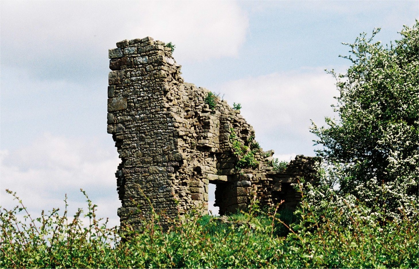
Greenhalgh Castle

Greenhalgh Castle is a castle, now ruined, near the town of Garstang in Lancashire, England. Thomas Stanley, 1st Earl of Derby, had the castle built in...

St Thomas' Church, Garstang

St Thomas' Church is a Church of England church in Garstang, a market town in Lancashire, England. It is an active Church of England parish church in the...

Nearby Amenities

Located within 500m of 53.88828,-2.7599638
Barrier: block
Lat/Long: 53.8842975/-2.7607934
Bus Stop
Calder House Lane
Bench: no
Bin: no
Lit: yes
Naptan AtcoCode: 2500DCL3114
Naptan Bearing: N
Naptan BusStopType: MKD
Naptan CommonName: Calder House Lane
Naptan Indicator: opp
Naptan Landmark: Calder House Lane
Naptan LocalityCode: E0016534
Naptan NaptanCode: landgpdt
Naptan Street: Garstang Road
Naptan Verified: yes
Public Transport: platform
Ref: landgpdt
Shelter: yes
Tactile Paving: yes
Lat/Long: 53.886325/-2.7648223
Bus Stop
Calder House Lane
Bench: yes
Bin: yes
Check Date Shelter: 2023-06-11
Lit: yes
Naptan AtcoCode: 2500IMG1301
Naptan Bearing: SE
Naptan BusStopType: MKD
Naptan CommonName: Calder House Lane
Naptan Indicator: by
Naptan Landmark: Calder House Lane
Naptan LocalityCode: E0016534
Naptan NaptanCode: landptwa
Naptan Street: Garstang Road
Naptan Verified: yes
Public Transport: platform
Ref: landptwa
Shelter: yes
Tactile Paving: yes
Lat/Long: 53.8865382/-2.7648101
Bus Stop
Garstang High School
Bench: no
Bin: no
Lit: yes
Naptan AtcoCode: 25001693
Naptan Bearing: N
Naptan BusStopType: MKD
Naptan CommonName: Garstang High School
Naptan Indicator: opp
Naptan Landmark: Garstang High School
Naptan LocalityCode: E0016534
Naptan NaptanCode: lanatdga
Naptan Street: Garstang Road
Naptan Verified: yes
Public Transport: platform
Ref: lanatdga
Shelter: yes
Tactile Paving: yes
Lat/Long: 53.8885807/-2.766921
Bus Stop
Garstang High School
Bench: no
Bin: no
Check Date Shelter: 2023-06-11
Lit: yes
Naptan AtcoCode: 2500LAA15733
Naptan Bearing: SE
Naptan BusStopType: MKD
Naptan CommonName: Garstang High School
Naptan Indicator: o/s
Naptan Landmark: Garstang High School
Naptan LocalityCode: E0016534
Naptan NaptanCode: lanjtdam
Naptan Street: Garstang Road
Naptan Verified: yes
Public Transport: platform
Ref: lanjtdam
Shelter: no
Tactile Paving: yes
Lat/Long: 53.8887656/-2.7669344
Calder House Lane
Bus: yes
Public Transport: stop_position
Lat/Long: 53.8865237/-2.7648543
Garstang High School
Bus: yes
Public Transport: stop_position
Lat/Long: 53.8887412/-2.7670037
Garstang High School
Bus: yes
Public Transport: stop_position
Public Transport Version: 2
Lat/Long: 53.8885887/-2.7668803
Calder House Lane
Bus: yes
Public Transport: stop_position
Public Transport Version: 2
Lat/Long: 53.8863446/-2.7647391
Crossing
Crossing: marked
Lat/Long: 53.8892052/-2.766557
Crossing
Crossing: marked
Lat/Long: 53.8890364/-2.7662907
Bench
Backrest: yes
Lat/Long: 53.8864955/-2.7647112
Man Made: street_cabinet
Lat/Long: 53.8863591/-2.7648356
Man Made: street_cabinet
Lat/Long: 53.8855888/-2.7644952
Give Way
Direction: backward
Lat/Long: 53.886421/-2.7647169
Man Made: outfall
Lat/Long: 53.8861583/-2.7634442
Give Way
Direction: backward
Lat/Long: 53.8866925/-2.7638105
Give Way
Direction: backward
Lat/Long: 53.88651/-2.7643024
The data included in this document is from www.openstreetmap.org. The data is made available under ODbL.

Have you been to Bruna Hill?

Leave your review of Bruna Hill below (or comments, questions and feedback).