Browney

Settlement in Durham

England

Browney

Detached house beside Browney Lane The road is Browney Lane, the B6300. The detached house is one of a number of recently built properties just outside the village of Meadowfield. At the left side of the image is a road sign in the blue and yellow colours found typically in County Durham.
Detached house beside Browney Lane Credit: Trevor Littlewood

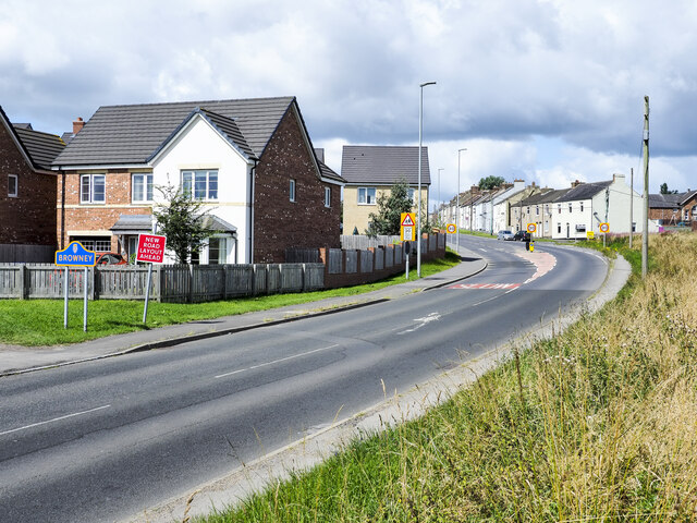
Browney is a small village located in the county of Durham, England. Situated approximately 3 miles northeast of the city of Durham, it lies on the banks of the River Browney, after which it is named. The village is part of the Browney ward and falls within the North West Durham parliamentary constituency.

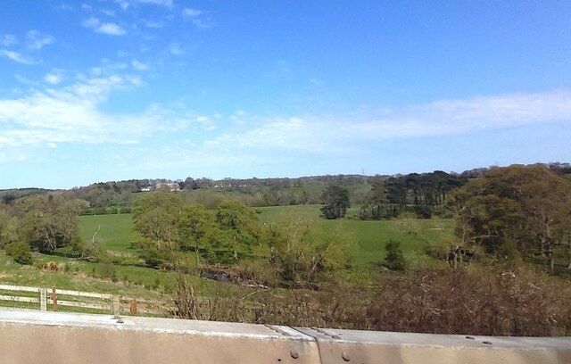
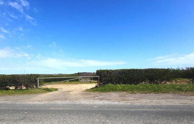
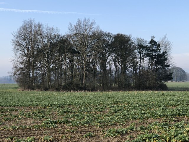
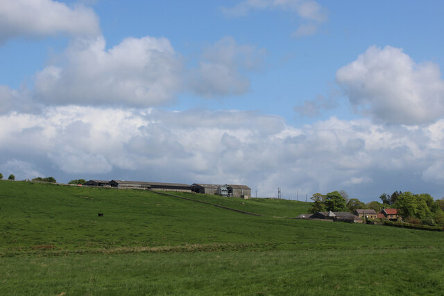
With a population of around 1,000 residents, Browney is a close-knit community with a strong sense of local pride. The village is predominantly residential, characterized by charming cottages and well-maintained gardens. The picturesque landscape surrounding Browney is primarily agricultural, with vast fields and green pastures stretching out in every direction.

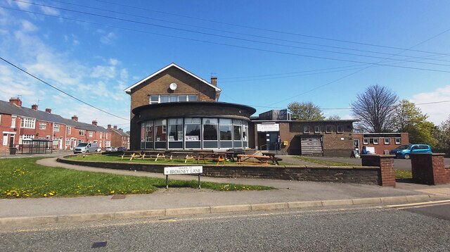
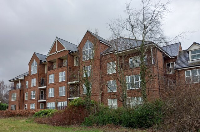
Despite its small size, Browney boasts a number of amenities essential for everyday life. These include a primary school, a village hall, and a local pub, which serves as a social hub for residents. Additionally, there are several shops and services catering to the community's needs. The village is well-connected, with regular bus services providing links to nearby towns and cities.

Browney is also known for its rich history. The area has evidence of human habitation dating back to Roman times, and remnants of a medieval settlement can still be seen today. The village's proximity to Durham offers residents easy access to the city's historical landmarks, such as Durham Cathedral and Durham Castle.

Overall, Browney is a quiet and idyllic village that offers a peaceful and friendly environment for its residents, while also providing convenient access to nearby urban centers and cultural attractions.

If you have any feedback on the listing, please let us know in the comments section below.
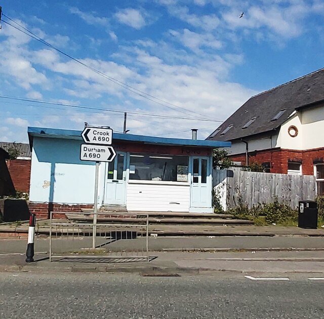
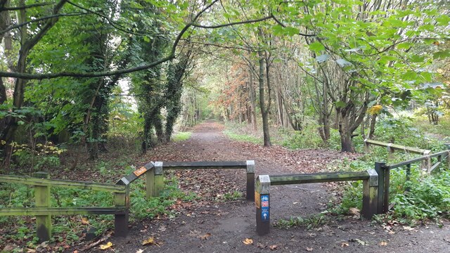
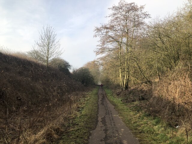
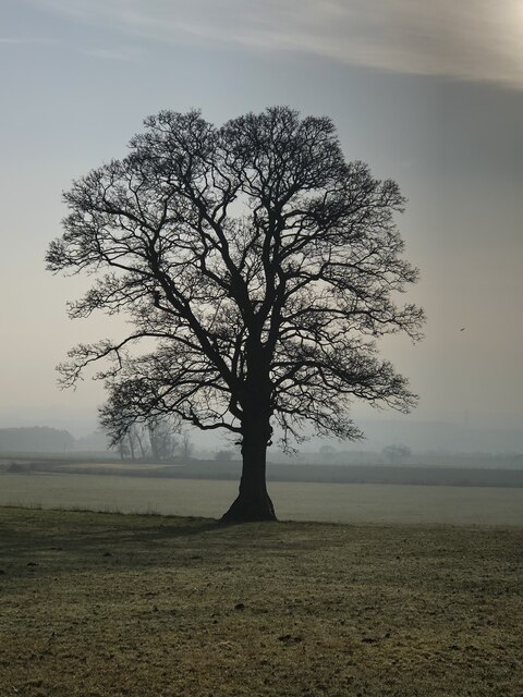
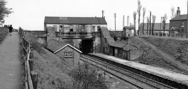
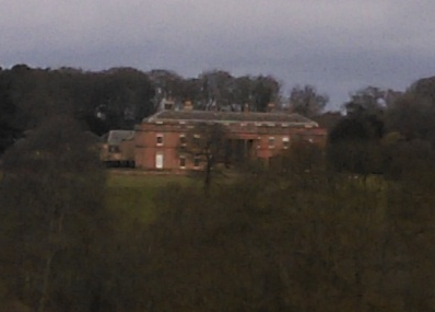
Browney Images

Images are sourced within 2km of 54.747152/-1.6195074 or Grid Reference NZ2439. Thanks to Geograph Open Source API. All images are credited.

Detached house beside Browney Lane The road is Browney Lane, the B6300. The detached house is one of a number of recently built properties just outside the village of Meadowfield. At the left side of the image is a road sign in the blue and yellow colours found typically in County Durham.
Detached house beside Browney Lane
The road is Browney Lane, the B6300. The detached house is one of a number of recently built properties just outside the village of Meadowfield. At the left side of the image is a road sign in the blue and yellow colours found typically in County Durham.
Towards the River Browney from Burnigill
Track off Browney Lane
Meadowfield and District Social Club and Institute
Tung Fong Chinese Takeaway - Meadowfield
Brandon to Bishop Auckland Railway Path This is part of National Cycle Network route 70.
Brandon to Bishop Auckland Railway Path
This is part of National Cycle Network route 70.
Route of the former Bishop Auckland - Durham railway at Brandon
Bare tree in light mist  beside Scripton Lane
Bare tree in light mist beside Scripton Lane
Copse of trees near Tudhoe Lodge
Private Road to Holywell
Durham, Cock of the North Hotel According to the OS benchmark database the OS Flush Bracket 8969 was embedded into the pub and hotel which was at this location. The pub has been demolished and replaced with new housing. It is likely the Flush Bracket has been destroyed.
Durham, Cock of the North Hotel
According to the OS benchmark database the OS Flush Bracket 8969 was embedded into the pub and hotel which was at this location. The pub has been demolished and replaced with new housing. It is likely the Flush Bracket has been destroyed.
View towards Burnigill and High Burnigill As seen from the Weardale Way near Croxdale
View towards Burnigill and High Burnigill
As seen from the Weardale Way near Croxdale
Sewage Works
Sewage Works
Wear Valley near Croxdale
Sewage Works near Burn Hall
Farm Land North of Hett Looking in a north easterly direction toward Sunderland Bridge and Brandon
Farm Land North of Hett
Looking in a north easterly direction toward Sunderland Bridge and Brandon
Sewage Works near Burn Hall
Brandon to Bishop Auckland Walk near Brancepeth The Brandon to Bishop Auckland Walk follows the route of an old railway bed; the view here is towards Brandon which is about a mile distant.
Brandon to Bishop Auckland Walk near Brancepeth
The Brandon to Bishop Auckland Walk follows the route of an old railway bed; the view here is towards Brandon which is about a mile distant.
Show me another place!

Browney is located at Grid Ref: NZ2439 (Lat: 54.747152, Lng: -1.6195074)

Unitary Authority: County Durham

Police Authority: Durham

What 3 Words

///wisdom.improving.somewhere. Near Brandon, Co. Durham

Nearby Locations

Browney Brandon

Related Wikis

Related Videos

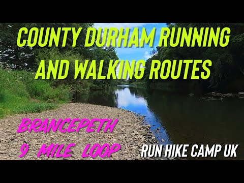
County Durham Running and Walking Routes: Brancepeth 9 miles inc Weardale Way and Railway Lines

Hike from the 100 Walks in Count Durham book by Gary Richardson. Perfect for a sunny Sunday afternoon. The Weardale Way is ...

County Durham Running and Walking Routes: Deerness Valley Way 8.5 miles Broompark to Crook

A easy walk in terms of underfoot, elevation and navigation. Start at Broompark in County Durham DH7 7RW, then follow the old ...

Let's WALK - with Dr Renwick. His first walking video along the River Wear, from Sunderland Bridge.

Hi everyone - follow me on this nature-packed walk along the River Wear close to where I live! Have you been out and about for a ...

Nearby Amenities

Located within 500m of 54.747152,-1.6195074
Crossing
Crossing: traffic_signals
Crossing Island: no
Kerb: lowered
Tactile Paving: yes
Lat/Long: 54.7512187/-1.618823
Browney
Created By: Potlatch 0.10c
Place: village
Wikidata: Q4976505
Lat/Long: 54.7462966/-1.6171498
Meadowfield
Created By: Potlatch 0.10d
Place: village
Lat/Long: 54.7493813/-1.6237042
Post Box
Ele: 93.1328125
Lat/Long: 54.7473436/-1.6196632
Telephone
Ele: 94.3344727
Lat/Long: 54.7472396/-1.6193284
Bus Stop
Browney Lane End (Club)
Bench: no
Bin: yes
Naptan AtcoCode: 13005037B
Naptan Bearing: NE
Naptan CommonName: Browney Lane End (Club)
Naptan Indicator: north east bound
Naptan Landmark: Landmark not known
Naptan NaptanCode: durdgmgw
Naptan Notes: On A690- in front of 63 Frederick Street North- near junction with East View- Brandon
Naptan PlusbusZoneRef: DRHM
Naptan Street: A690
Naptan Verified: yes
Shelter: yes
Source: naptan_import; survey
Lat/Long: 54.7494848/-1.6231108
Bus Stop
Browney Lane End (Club)
Naptan AtcoCode: 13005037D
Naptan Bearing: SE
Naptan CommonName: Browney Lane End (Club)
Naptan Indicator: south east bound
Naptan Landmark: Landmark not known
Naptan NaptanCode: durgamwa
Naptan Street: B6300 - Browney Lane
Naptan Verified: no
Source: naptan_import
Lat/Long: 54.7486292/-1.6225284
Bus Stop
Browney Lane End (Club)
Bench: no
Naptan AtcoCode: 13005037F
Naptan Bearing: SW
Naptan CommonName: Browney Lane End (Club)
Naptan Indicator: south west bound
Naptan Landmark: Landmark not known
Naptan NaptanCode: durdgmja
Naptan PlusbusZoneRef: DRHM
Naptan Street: A690
Naptan Verified: no
Shelter: yes
Source: naptan_import
Lat/Long: 54.7489223/-1.6246452
Bus Stop
Tennyson House
Naptan AtcoCode: 13005038B
Naptan Bearing: NE
Naptan CommonName: Tennyson House
Naptan Indicator: north east bound
Naptan Landmark: Landmark not known
Naptan NaptanCode: durdgmjd
Naptan Notes: On corner of A690 High Street and The Terrace- at Brancepeth Castle Inn (PH)- Brandon
Naptan Street: A690 - John Street
Naptan Verified: yes
Old Name: Brancepeth Castle Hotel
Source: naptan_import; survey
Lat/Long: 54.75102/-1.6193255
Bus Stop
Station Road
Naptan AtcoCode: 13005926D
Naptan Bearing: SE
Naptan CommonName: Station Road
Naptan Indicator: south east bound
Naptan Landmark: Landmark not known
Naptan NaptanCode: durdmjgj
Naptan Notes: 11 Station Road- near junction with A690 High Street- Brandon
Naptan PlusbusZoneRef: DRHM
Naptan Street: Station Road
Naptan Verified: no
Source: naptan_import
Lat/Long: 54.7491948/-1.6252108
Bus Stop
Post Office
Naptan AtcoCode: 13005928D
Naptan Bearing: SE
Naptan CommonName: Post Office
Naptan Indicator: south east bound
Naptan Landmark: Outside Nos 39 and 41
Naptan NaptanCode: durdmjgm
Naptan Street: B6300 Browney Lane
Naptan Verified: no
Source: naptan_import
Lat/Long: 54.7473084/-1.6197288
Bus Stop
Post Office
Naptan AtcoCode: 13005928H
Naptan Bearing: NW
Naptan CommonName: Post Office
Naptan Indicator: north west bound
Naptan Landmark: opposite Nos 39 and 41
Naptan NaptanCode: durdmjgp
Naptan Street: B6300 Browney Lane
Naptan Verified: no
Source: naptan_import
Lat/Long: 54.747626/-1.6207045
Bus Stop
Bottom Stop
Naptan AtcoCode: 13005929D
Naptan Bearing: SE
Naptan CommonName: Bottom Stop
Naptan Indicator: south east bound
Naptan Landmark: At junction with St Johns Road
Naptan NaptanCode: durdmjgt
Naptan Street: B6300 Browney Lane
Naptan Verified: no
Source: naptan_import
Lat/Long: 54.7461089/-1.617206
Bus Stop
Bottom Stop
Naptan AtcoCode: 13005929H
Naptan Bearing: NW
Naptan CommonName: Bottom Stop
Naptan Indicator: north west bound
Naptan Landmark: At junction with St Johns Road
Naptan NaptanCode: durdmjgw
Naptan Street: B6300 Browney Lane
Naptan Verified: no
Source: naptan_import
Lat/Long: 54.7460981/-1.6174456
Post Box
Ref: DH7 29
Lat/Long: 54.7463219/-1.6253752
Traffic Calming: hump
Lat/Long: 54.7474133/-1.6219241
Crossing
Crossing: traffic_signals
Crossing Island: no
Tactile Paving: yes
Lat/Long: 54.749089/-1.6242316
Specialist Cycles
Shop: bicycle
Lat/Long: 54.7490741/-1.6228719
Fast Food
Pizza Top
Addr City: Durham
Addr Housenumber: 10
Addr Postcode: DH7 8LZ
Addr Street: Frederick Street South
Addr Village: Meadowfield
Cuisine: pizza
Fhrs Id: 303141
Source Addr: FHRS Open Data
Lat/Long: 54.750691/-1.619436
Turning Circle
Lat/Long: 54.7453272/-1.6189036
Charging Station
Meadowfield Filling Station
Bicycle: no
Capacity: 2
Fee: yes
Motorcar: yes
Operator: ChargePoint
Parking Fee: no
Payment Credit Cards: yes
Payment Debit Cards: yes
Socket Chademo: 2
Socket Type2: 2
Socket Type2 Output: 44 kW
Socket Type2 Combo: 2
Truck: no
Lat/Long: 54.7491776/-1.6244196
Childcare
Sharon Harris Childminder
Addr City: Durham
Addr Housename: The Old Police Station
Addr Postcode: DH7 8RP
Addr Street: John Street South
Addr Village: Meadowfield
After School: yes
Age Group: 0-16
Kindergarten: yes
Nursery: yes
Phone: +44 191 378 0350
Lat/Long: 54.7511608/-1.6185005
Unique Interiors
Addr City: Durham
Addr Housenumber: 1a
Addr Postcode: DH7 8RS
Addr Street: John Street
Addr Village: Meadowfield
Furniture: kitchen;bathroom;bedroom;office
Opening Hours: Mo-Fr 08:00-17:00; Sa 09:00-12:00
Phone: +44 191 378 2388
Shop: furniture
Website: https://uniqueinteriorsltd.co.uk
Lat/Long: 54.7512154/-1.6191773
Generator Method: photovoltaic
Generator Output Electricity: yes
Generator Source: solar
Generator Type: solar_photovoltaic_panel
Location: roof
Power: generator
Lat/Long: 54.7509151/-1.6225272
Generator Method: photovoltaic
Generator Output Electricity: yes
Generator Source: solar
Generator Type: solar_photovoltaic_panel
Location: roof
Power: generator
Lat/Long: 54.7505606/-1.6203245
Generator Method: photovoltaic
Generator Output Electricity: yes
Generator Source: solar
Generator Type: solar_photovoltaic_panel
Location: roof
Power: generator
Lat/Long: 54.7497619/-1.623989
Generator Method: photovoltaic
Generator Output Electricity: yes
Generator Source: solar
Generator Type: solar_photovoltaic_panel
Location: roof
Power: generator
Lat/Long: 54.7500622/-1.6232327
Generator Method: photovoltaic
Generator Output Electricity: yes
Generator Source: solar
Generator Type: solar_photovoltaic_panel
Location: roof
Power: generator
Lat/Long: 54.7502975/-1.6226372
Generator Method: photovoltaic
Generator Output Electricity: yes
Generator Source: solar
Generator Type: solar_photovoltaic_panel
Location: roof
Power: generator
Lat/Long: 54.7505591/-1.6229323
Generator Method: photovoltaic
Generator Output Electricity: yes
Generator Source: solar
Generator Type: solar_photovoltaic_panel
Location: roof
Power: generator
Lat/Long: 54.7505312/-1.6245443
Generator Method: photovoltaic
Generator Output Electricity: yes
Generator Source: solar
Generator Type: solar_photovoltaic_panel
Location: roof
Power: generator
Lat/Long: 54.7503145/-1.6243646
Generator Method: photovoltaic
Generator Output Electricity: yes
Generator Source: solar
Generator Type: solar_photovoltaic_panel
Location: roof
Power: generator
Lat/Long: 54.7503455/-1.6238147
Generator Method: photovoltaic
Generator Output Electricity: yes
Generator Source: solar
Generator Type: solar_photovoltaic_panel
Location: roof
Power: generator
Lat/Long: 54.750412/-1.6239166
Power: pole
Lat/Long: 54.7452646/-1.6133487
Power: pole
Lat/Long: 54.7451732/-1.6145584
Power: pole
Lat/Long: 54.7442954/-1.615174
Power: pole
Lat/Long: 54.743745/-1.6149554
Addr City: Durham
Addr Housenumber: 54
Addr Postcode: DH7 8NA
Addr Street: Frederick Street South
Addr Village: Meadowfield
Disused Shop: bakery
Fhrs Id: 303142
Old Name: J Storey
Source Addr: FHRS Open Data
Lat/Long: 54.7497379/-1.6217226
Historic: milepost
Image: https://www.geograph.org.uk/photo/6049928
Lat/Long: 54.749131/-1.6236967
Post Box
Mapillary: 295018935514288
Lat/Long: 54.7486798/-1.6256748
Post Box
Mapillary: 767265130482561
Lat/Long: 54.750539/-1.6202728
Rio Verde
Contact Facebook: rioverdenailsbeautyhair
Shop: beauty
Lat/Long: 54.7507394/-1.6193368
Bespoke Deli
Addr City: Durham
Addr Housenumber: 13
Addr Postcode: DH7 8LZ
Addr Street: Frederick Street South
Addr Village: Meadowfield
Contact Facebook: https://www.facebook.com/p/Bespoke-Deli-100083990391533/
Fhrs Id: 1542386
Old Name: Treats Delivery
Shop: deli
Lat/Long: 54.7506117/-1.6195808
Durham Carpet Centre
Addr City: Durham
Addr Housenumber: 17-18
Addr Postcode: DH7 8LZ
Addr Street: Frederick Street South
Addr Village: Meadowfield
Mapillary: 451496345949834
Shop: carpet
Source Addr: website
Website: https://www.durhamcarpetcentre.co.uk/
Lat/Long: 54.7504801/-1.619841
Chisholm Bookmakers
Addr City: Durham
Addr Housenumber: 14
Addr Postcode: DH7 8NB
Addr Street: Frederick Street North
Addr Village: Meadowfield
Fhrs Id: 405973
Mapillary: 451496345949834
Shop: bookmaker
Lat/Long: 54.7506202/-1.6202179
Meadowfield Convenience Store
Addr City: Durham
Addr Housenumber: 15
Addr Postcode: DH7 8NB
Addr Street: Frederick Street North
Addr Village: Meadowfield
Brand: Premier
Brand Wikidata: Q7240340
Fhrs Id: 303139
Shop: convenience
Website: https://www.premier-stores.co.uk/our-stores/meadowfield-convenience-store
Lat/Long: 54.7505885/-1.6204231
Browney Social Club
Addr City: Durham
Addr Housenumber: 30
Addr Postcode: DH7 8HT
Addr Street: Browney Lane
Addr Village: Browney
Club: social
Fhrs Id: 754650
Mapillary: 251738043402714
Operator: Browney Working Mens Club
Source Addr: FHRS data
Lat/Long: 54.7466974/-1.6183135
Bench
Backrest: yes
Mapillary: 251738043402714
Lat/Long: 54.7465581/-1.6185133
Brandon & Meadowfield Royal British Legion Club
Addr City: Durham
Addr Postcode: DH7 8RT
Addr Village: Meadowfield
Club: social
Contact Facebook: brandonmeadowfieldlegion
Fhrs Id: 303001
Image: https://www.geograph.org.uk/photo/3832987
Lat/Long: 54.7515157/-1.6194923
Fuel
Brand: Jet
Image: https://www.geograph.org.uk/photo/4815843
Opening Hours: 24/7
Lat/Long: 54.7493114/-1.6241218
Topline Barbers
Male: yes
Shop: hairdresser
Lat/Long: 54.7504616/-1.6206698
Cafe
Emmys
Addr City: Durham
Addr Housenumber: 7
Addr Postcode: DH7 8RS
Addr Street: John Street North
Addr Village: Meadowfield
Fhrs Id: 1591464
Old Name: Jane's Kitchen
Lat/Long: 54.7513749/-1.6188701
Central Avenue/A690, Meadowfield
Camera Mount: pole
Camera Type: fixed
Contact Webcam: https://dcc.ussgroup.co.uk/i_dutmc_48.html
Man Made: surveillance
Operator: Durham County Council
Surveillance: public
Surveillance Type: camera
Surveillance Zone: traffic
Website: https://www.durham.gov.uk/article/21806
Lat/Long: 54.748775/-1.6252711
Traffic Calming: hump
Lat/Long: 54.7503695/-1.624952
Bespoke Hair Salon
Contact Facebook: bespokehair2020
Female: no
Shop: hairdresser
Unisex: yes
Lat/Long: 54.7505807/-1.6196506
Power: pole
Lat/Long: 54.7430065/-1.6171105
Doctors
Meadowfield Clinic
Addr Street: Frederick Street South
Fixme: Confirm status of clinic. Seemed active June 2022, but no concrete information online
Operator: NHS
Lat/Long: 54.75096/-1.6189277
Traffic Calming: hump
Lat/Long: 54.7487157/-1.6250606
Traffic Calming: hump
Lat/Long: 54.7482618/-1.6247374
Traffic Calming: hump
Lat/Long: 54.7476464/-1.620989
The Bronzing Boutique
Contact Facebook: Thebronzingboutiquedurham
Leisure: tanning_salon
Lat/Long: 54.7502789/-1.6211768
Traffic Signals
Crossing: no
Traffic Signals Direction: forward
Lat/Long: 54.7512374/-1.6187945
Traffic Signals
Crossing: no
Traffic Signals Direction: backward
Lat/Long: 54.7512/-1.6188515
Traffic Signals
Crossing: no
Traffic Signals Direction: forward
Lat/Long: 54.749098/-1.6241946
Traffic Signals
Crossing: no
Traffic Signals Direction: backward
Lat/Long: 54.7490799/-1.6242686
Orchard Care
Office: company
Lat/Long: 54.7457171/-1.6125962
Defibrillator
Access: yes
Check Date: 2023-03-31
Emergency: defibrillator
Indoor: no
Lat/Long: 54.7457289/-1.6177262
Defibrillator
Access: yes
Check Date: 2023-03-31
Defibrillator Location En: Browney Social Club
Emergency: defibrillator
Indoor: no
Lat/Long: 54.7468457/-1.6188638
Defibrillator
Access: yes
Check Date: 2023-03-31
Defibrillator Location: Meadowfield & District Social Club
Emergency: defibrillator
Indoor: no
Ref GB The Circuit: 1FEB719B-07AC-4D2C-9C9A-AEAF014201F5
Lat/Long: 54.7491394/-1.6233509
Car Wash
Self Service: yes
Lat/Long: 54.7492928/-1.6244175
Glink
Addr City: Durham
Addr Housenumber: 38
Addr Postcode: DH7 8NB
Addr Street: Frederick Street North
Addr Suburb: Meadowfield
Fixme: Confirm exact location within terrace
Shop: tattoo
Website: http://glinktattoo.co.uk/
Lat/Long: 54.7500498/-1.6217896
The data included in this document is from www.openstreetmap.org. The data is made available under ODbL.

Have you been to Browney?

Leave your review of Browney below (or comments, questions and feedback).