Brook Hill

Settlement in Yorkshire

England

Brook Hill

Hawksworth Road, Baildon Moor
Hawksworth Road, Baildon Moor Credit: habiloid

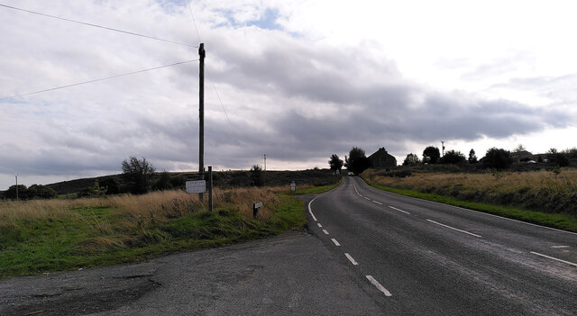
Brook Hill is a charming village located in the picturesque region of Yorkshire, England. Nestled amidst rolling hills and lush green landscapes, this idyllic settlement is renowned for its natural beauty and tranquil atmosphere. The village is situated approximately 10 miles southwest of the bustling city of Leeds, making it an ideal retreat for those seeking a peaceful escape from urban life.

Characterized by its quaint stone cottages and well-manicured gardens, Brook Hill exudes a timeless charm. The village is home to a close-knit community that takes pride in preserving its rich heritage, evident in the well-preserved historic buildings and traditional local customs. The local church, St. Mary's, stands proudly at the heart of the village, serving as a visual reminder of its deep-rooted history.

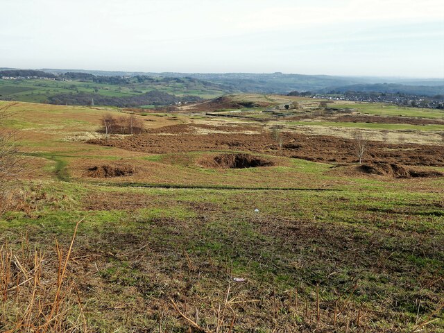
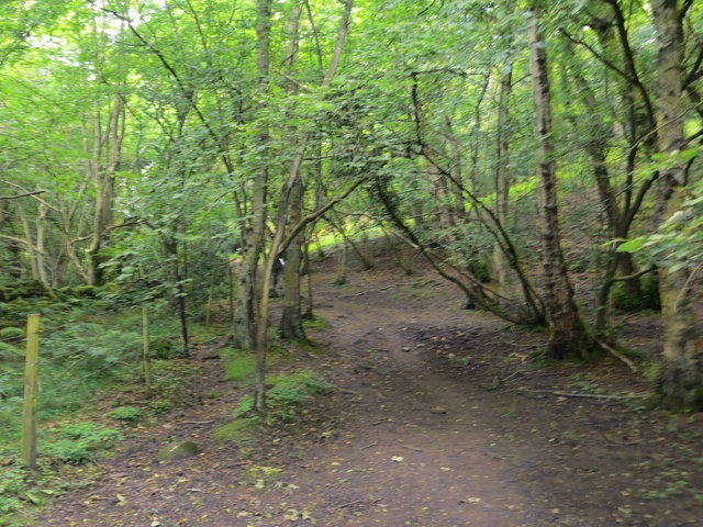
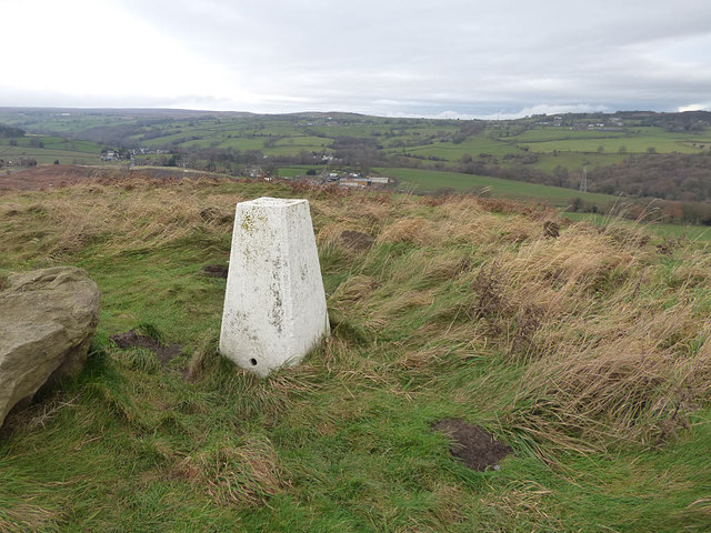
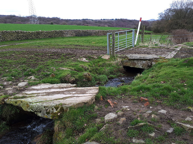
Surrounded by vast open spaces, Brook Hill offers numerous opportunities for outdoor activities. The expansive countryside provides ample trails for hiking and biking, allowing visitors to immerse themselves in the breathtaking natural surroundings. Additionally, the nearby rivers and ponds cater to fishing enthusiasts, providing a serene setting to indulge in their favorite pastime.

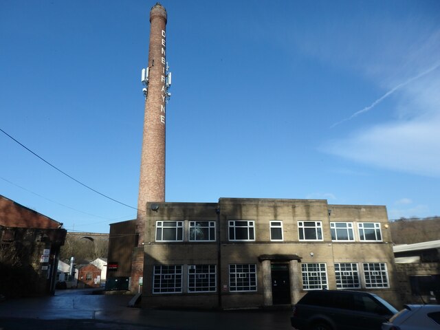
While the village retains its rural charm, modern amenities are readily available to residents and visitors alike. Local shops and businesses cater to everyday needs, while charming pubs and quaint tearooms offer delightful dining experiences. The village also hosts a range of community events throughout the year, fostering a strong sense of togetherness among its residents.

Brook Hill truly embodies the essence of Yorkshire's countryside, with its scenic beauty, warm community spirit, and a perfect blend of tradition and modernity. It is a destination that welcomes visitors to relax, unwind, and immerse themselves in the natural wonders of this enchanting part of England.

If you have any feedback on the listing, please let us know in the comments section below.
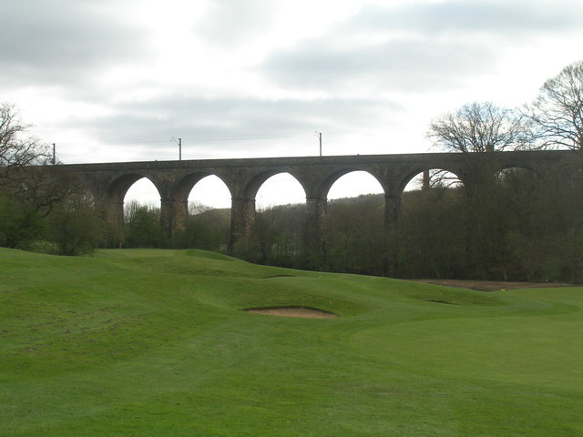
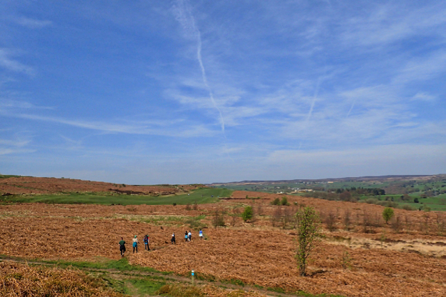
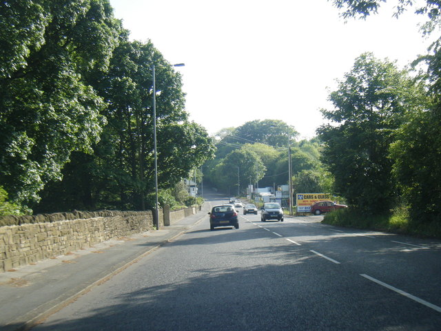
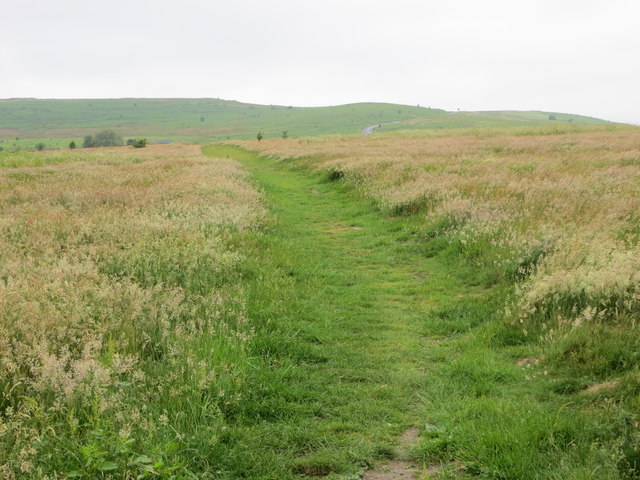
Brook Hill Images

Images are sourced within 2km of 53.848938/-1.7582494 or Grid Reference SE1639. Thanks to Geograph Open Source API. All images are credited.

Hawksworth Road, Baildon Moor
Denbirayne Chimney, Tong Park Industrial Estate, Baildon See <a href="https://www.geograph.org.uk/photo/6887736">SE1640 : The Denbirayne chimney</a> for another view and a brief history. Also see <a href="https://www.geograph.org.uk/photo/7096458">SE1640 : Looking Up the Denbirayne Chimney, Tong Park Industrial Estate, Baildon</a> for a much closer view. Tong Park railway viaduct is in the distance.
Denbirayne Chimney, Tong Park Industrial Estate, Baildon
See SE1640 : The Denbirayne chimney for another view and a brief history. Also see SE1640 : Looking Up the Denbirayne Chimney, Tong Park Industrial Estate, Baildon for a much closer view. Tong Park railway viaduct is in the distance.
Looking Up the Denbirayne Chimney, Tong Park Industrial Estate, Baildon I almost fell over backwards taking this image, but it was something I just had to do. See <a href="https://www.geograph.org.uk/photo/7084813">SE1640 : Denbirayne Chimney, Tong Park Industrial Estate, Baildon</a> for a more distant view.
Looking Up the Denbirayne Chimney, Tong Park Industrial Estate, Baildon
I almost fell over backwards taking this image, but it was something I just had to do. See SE1640 : Denbirayne Chimney, Tong Park Industrial Estate, Baildon for a more distant view.
Old Bell Pit remains View from the bridleway to Dobrudden with the disused Baildon reservoir embankments beyond the pit hollows
Old Bell Pit remains
View from the bridleway to Dobrudden with the disused Baildon reservoir embankments beyond the pit hollows
Tong Park Viaduct In the foreground is part of the Hollins Hall golf course
Tong Park Viaduct
In the foreground is part of the Hollins Hall golf course
Approaching Bracken Hill on Baildon Moor
A6038 Hollins Hill, Esholt
Locally walked path crossing Baildon Moor Looking westward.
Locally walked path crossing Baildon Moor
Looking westward.
Path through woodland near Hawksworth Spring Looking north-westward.
Path through woodland near Hawksworth Spring
Looking north-westward.
Trig pillar above Baildon This location is not as remote as it looks - only a few steps from a car park which itself is only a short distance outside Baildon. The spot height on the map is 194 metres.
Trig pillar above Baildon
This location is not as remote as it looks - only a few steps from a car park which itself is only a short distance outside Baildon. The spot height on the map is 194 metres.
Footpath across Baildon Moor This part of the moor is also called Bracken Hill, although it seems to be lacking in the stuff now.
Footpath across Baildon Moor
This part of the moor is also called Bracken Hill, although it seems to be lacking in the stuff now.
Low Hill A view from up on Baildon Moor, see <a href="https://www.geograph.org.uk/photo/748480">SE1540 : Low Hill, Baildon</a> for a closer view and some history of this settlement.
Low Hill
A view from up on Baildon Moor, see SE1540 : Low Hill, Baildon for a closer view and some history of this settlement.
Gate on footpath below the Whitehouse The public footpath crosses Hawksworth Gill.This looks like a former green lane that has been blocked (apart from pedestrian access) by a stone wall.  A sign on the gate reminds mountain-bikers that they are not allowed on footpaths.
Gate on footpath below the Whitehouse
The public footpath crosses Hawksworth Gill.This looks like a former green lane that has been blocked (apart from pedestrian access) by a stone wall. A sign on the gate reminds mountain-bikers that they are not allowed on footpaths.
Low Springs Farm Viewed from a public footpath to the south.
Low Springs Farm
Viewed from a public footpath to the south.
Footbridge over a stream below Low Springs Farm A large slab of stone serves as a simple clapper bridge for the footpath, with a concrete bridge for farm traffic a few metres further downstream.
Footbridge over a stream below Low Springs Farm
A large slab of stone serves as a simple clapper bridge for the footpath, with a concrete bridge for farm traffic a few metres further downstream.
Pylon above Low Springs Farm
Stepping stones and footbridge over Hawksworth Gill Beck "Stepping Stones" are marked on the map here, and I think the rocks in the foreground are the ones intended.  I much preferred to use the wooden footbridge a few metres further downstream.
Stepping stones and footbridge over Hawksworth Gill Beck
"Stepping Stones" are marked on the map here, and I think the rocks in the foreground are the ones intended. I much preferred to use the wooden footbridge a few metres further downstream.
Pipeline marker by Hawksworth Gill Beck There is one of these gas pipeline markers each side of the beck, so presumably the pipe runs beneath it.
Pipeline marker by Hawksworth Gill Beck
There is one of these gas pipeline markers each side of the beck, so presumably the pipe runs beneath it.
Show me another place!

Brook Hill is located at Grid Ref: SE1639 (Lat: 53.848938, Lng: -1.7582494)

Division: West Riding

Unitary Authority: Bradford

Police Authority: West Yorkshire

What 3 Words

///love.golf.shed. Near Shipley, West Yorkshire

Related Wikis

Baildon railway station

Baildon railway station serves the town of Baildon near Shipley in West Yorkshire, England. The station reopened under British Rail on 5 January 1973,...

Baildon

Baildon is a town and civil parish in the Bradford Metropolitan Borough in West Yorkshire, England and within the historic boundaries of the West Riding...

Baildon Urban District

Baildon was an urban district in the West Riding of Yorkshire, England between 1894 and 1974. It was enlarged on 1 April 1937 by gaining part of Wharfedale...

Colne Valley Urban District

Colne Valley was an urban district in the West Riding of Yorkshire, England between 1937 and 1974. It takes its name from the River Colne which rises above...

Nearby Amenities

Located within 500m of 53.848938,-1.7582494
Baildon
Naptan AtcoCode: 9100BAILDON
Network: National Rail
Network Website: https://www.nationalrail.co.uk/stations/bld/
Network Wikidata: Q26334
Operator: Northern Rail
Operator Website: https://www.northernrailway.co.uk/stations/baildon
Operator Wikidata: Q85789775
Railway: station
Ref Crs: BLD
Source: NPE
Wheelchair: yes
Wikidata: Q4475770
Wikipedia: en:Baildon railway station
Lat/Long: 53.8501789/-1.7536925
Source: landsat
Lat/Long: 53.8448803/-1.7615403
Source: landsat
Lat/Long: 53.8468286/-1.760333
Source: landsat
Lat/Long: 53.8458028/-1.7593046
Source: landsat
Lat/Long: 53.8449001/-1.7562952
Source: landsat
Lat/Long: 53.8455405/-1.7542173
Source: landsat
Lat/Long: 53.8463994/-1.7522717
Source: landsat
Lat/Long: 53.8470039/-1.7514106
Source: landsat
Lat/Long: 53.8479888/-1.7511375
Bus Stop
Otley Road Kirklands Lane
Bus: yes
Local Ref: 45018850
Naptan AtcoCode: 450018850
Naptan Bearing: SW
Naptan CommonName: Otley Road Kirklands Lane
Naptan Crossing: Kirklands Lane
Naptan Indicator: Stop 45018850
Naptan Landmark: Halfway House PH
Naptan PlusbusZoneRef: LEEDS
Naptan ShortCommonName: Kirklands Lane
Naptan Street: Otley Road
Naptan Verified: no
Public Transport: platform
Shelter: yes
Source: naptan_import
Lat/Long: 53.8462245/-1.7523214
Bus Stop
Otley Road Kirklands Lane
Bus: yes
Local Ref: 45018851
Naptan AtcoCode: 450018851
Naptan Bearing: NE
Naptan CommonName: Otley Road Kirklands Lane
Naptan Crossing: Kirklands Lane
Naptan Indicator: Stop 45018851
Naptan Landmark: Halfway House PH
Naptan PlusbusZoneRef: LEEDS
Naptan ShortCommonName: Kirklands Lane
Naptan Street: Otley Road
Public Transport: platform
Shelter: no
Source: naptan_import;survey
Lat/Long: 53.8460639/-1.7528695
Bus Stop
Otley Road St Johns Court
Bus: yes
Local Ref: 45018852
Naptan AtcoCode: 450018852
Naptan Bearing: NE
Naptan CommonName: Otley Road St Johns Court
Naptan Crossing: St Johns Court
Naptan Indicator: Stop 45018852
Naptan PlusbusZoneRef: LEEDS
Naptan ShortCommonName: St. Johns Court
Naptan Street: Otley Road
Public Transport: platform
Shelter: no
Source: naptan_import;survey
Lat/Long: 53.8446523/-1.7570424
Bus Stop
Otley Road St Johns Court
Bench: yes
Bus: yes
Local Ref: 45018853
Naptan AtcoCode: 450018853
Naptan Bearing: SW
Naptan CommonName: Otley Road St Johns Court
Naptan Crossing: St Johns Court
Naptan Indicator: Stop 45018853
Naptan PlusbusZoneRef: LEEDS
Naptan ShortCommonName: St. Johns Court
Naptan Street: Otley Road
Public Transport: platform
Shelter: yes
Source: naptan_import;survey
Lat/Long: 53.8445085/-1.7570736
Bus Stop
Station Road Netherhall Road
Bus: yes
Local Ref: 45018892
Naptan AtcoCode: 450018892
Naptan Bearing: W
Naptan CommonName: Station Road Netherhall Road
Naptan Crossing: Netherhall Road
Naptan Indicator: Stop 45018892
Naptan PlusbusZoneRef: LEEDS
Naptan ShortCommonName: Netherhall Road
Naptan Street: Station Road
Naptan Verified: no
Public Transport: platform
Source: naptan_import
Lat/Long: 53.8491178/-1.7652706
Bus Stop
Station Road Borrins Way
Local Ref: 45018893
Naptan AtcoCode: 450018893
Naptan Bearing: SW
Naptan CommonName: Station Road Borrins Way
Naptan Crossing: Borrins way
Naptan Indicator: Stop 45018893
Naptan PlusbusZoneRef: LEEDS
Naptan ShortCommonName: Borrins Way
Naptan Street: Station Road
Naptan Verified: no
Shelter: no
Source: naptan_import
Lat/Long: 53.8496137/-1.7615284
Bus Stop
Station Road Kirkfields
Bench: no
Bin: no
Lit: yes
Local Ref: 45018894
Naptan AtcoCode: 450018894
Naptan Bearing: W
Naptan CommonName: Station Road Kirkfields
Naptan Crossing: Kirkfields
Naptan Indicator: Stop 45018894
Naptan PlusbusZoneRef: LEEDS
Naptan ShortCommonName: Kirkfields
Naptan Street: Station Road
Naptan Verified: no
Shelter: no
Source: naptan_import
Tactile Paving: no
Lat/Long: 53.8501083/-1.7571324
Bus Stop
Baildon Road Temple Rhydding Drive
Bus: yes
Local Ref: 45020501
Naptan AtcoCode: 450020501
Naptan Bearing: SE
Naptan CommonName: Baildon Road Temple Rhydding Drive
Naptan Crossing: Temple Rhydding Drive
Naptan Indicator: Stop 45020501
Naptan PlusbusZoneRef: LEEDS
Naptan ShortCommonName: Temple Rhydding Dr
Naptan Street: Baildon Road
Naptan Verified: no
Public Transport: platform
Source: naptan_import
Lat/Long: 53.8471943/-1.7652813
Bus Stop
Holden Lane
Local Ref: 45020509
Naptan AtcoCode: 450020509
Naptan Bearing: SE
Naptan CommonName: Holden Lane
Naptan Crossing: The Beeches
Naptan Indicator: Stop 45020509
Naptan PlusbusZoneRef: LEEDS
Naptan ShortCommonName: Kirk Drive
Naptan Street: Holden Lane
Naptan Verified: no
Source: naptan_import
Lat/Long: 53.8526871/-1.7612068
Bus Stop
Kirkfields Fennel Road
Bench: no
Bin: no
Lit: yes
Local Ref: 45020510
Naptan AtcoCode: 450020510
Naptan Bearing: S
Naptan CommonName: Kirkfields Fennel Road
Naptan Crossing: Langley Crescent
Naptan Indicator: Stop 45020510
Naptan PlusbusZoneRef: LEEDS
Naptan ShortCommonName: Ashfield Drive
Naptan Street: Kirkfields
Naptan Verified: no
Shelter: no
Source: naptan_import
Tactile Paving: no
Lat/Long: 53.8514483/-1.7575199
Kirklands Road
Local Ref: 45024614
Naptan AtcoCode: 450024614
Naptan Bearing: SE
Naptan BusStopType: CUS
Naptan CommonName: Kirklands Road
Naptan Crossing: Hawthorne View
Naptan Indicator: Stop 45024614
Naptan PlusbusZoneRef: LEEDS
Naptan ShortCommonName: Hawthorn Way
Naptan Street: Kirklands Road
Naptan Verified: no
Source: naptan_import
Lat/Long: 53.8484995/-1.7572025
Fyfe Grove
Local Ref: 45024615
Naptan AtcoCode: 450024615
Naptan Bearing: NE
Naptan BusStopType: CUS
Naptan CommonName: Fyfe Grove
Naptan Crossing: Kirklands Lane
Naptan Indicator: Stop 45024615
Naptan PlusbusZoneRef: LEEDS
Naptan ShortCommonName: Kirklands Lane
Naptan Street: Fyfe Grove
Naptan Verified: no
Source: naptan_import
Lat/Long: 53.8478375/-1.7543183
Bus Stop
Station Road Kirkfields
Bench: yes
Bin: no
Lit: yes
Local Ref: 45024766
Naptan AtcoCode: 450024766
Naptan Bearing: E
Naptan CommonName: Station Road Kirkfields
Naptan Crossing: Kirkfields
Naptan Indicator: Stop 45024766
Naptan PlusbusZoneRef: LEEDS
Naptan ShortCommonName: Kirkfields
Naptan Street: Station Road
Naptan Verified: no
Shelter: yes
Source: naptan_import
Tactile Paving: no
Lat/Long: 53.8501983/-1.7572231
Bus Stop
Holden Lane Baildon
Local Ref: 45050958
Naptan AtcoCode: 450050958
Naptan Bearing: NW
Naptan BusStopType: CUS
Naptan CommonName: Holden Lane Baildon
Naptan Indicator: Stop 45050958
Naptan PlusbusZoneRef: LEEDS
Naptan ShortCommonName: Kirk Drive
Naptan Street: Holden Lane
Naptan Verified: no
Source: naptan_import
Lat/Long: 53.8526153/-1.7612681
Bus Stop
Kirkfields Baildon
Bench: no
Bin: no
Lit: yes
Local Ref: 45050959
Naptan AtcoCode: 450050959
Naptan Bearing: N
Naptan BusStopType: CUS
Naptan CommonName: Kirkfields Baildon
Naptan Indicator: Stop 45050959
Naptan PlusbusZoneRef: LEEDS
Naptan ShortCommonName: Ashfield Drive
Naptan Street: Kirkfields
Naptan Verified: no
Shelter: no
Source: naptan_import
Tactile Paving: no
Lat/Long: 53.8514216/-1.7576417
Bus Stop
Station Road Netherhall Road
Bus: yes
Local Ref: 45050703
Naptan AtcoCode: 450050703
Naptan Bearing: E
Naptan BusStopType: CUS
Naptan CommonName: Station Road Netherhall Road
Naptan Indicator: Stop 45050703
Naptan PlusbusZoneRef: LEEDS
Naptan ShortCommonName: Whitelands Road
Naptan Street: Station Road
Naptan Verified: no
Public Transport: platform
Source: naptan_import
Lat/Long: 53.8492346/-1.7652699
Bus Stop
Station Road Borrins Way
Local Ref: 45050704
Naptan AtcoCode: 450050704
Naptan Bearing: SE
Naptan BusStopType: CUS
Naptan CommonName: Station Road Borrins Way
Naptan Indicator: Stop 45050704
Naptan PlusbusZoneRef: LEEDS
Naptan ShortCommonName: Borrins Way
Naptan Street: Station Road
Naptan Verified: no
Shelter: no
Source: naptan_import
Lat/Long: 53.8496948/-1.7615887
Turning Circle
Lat/Long: 53.847739/-1.7513878
Noexit: yes
Lat/Long: 53.8502429/-1.7521869
Woodward Nursery
Shop: garden_centre
Lat/Long: 53.8484016/-1.7625263
Crossing
Crossing: uncontrolled
Crossing Island: no
Crossing Ref: zebra
Kerb: lowered
Tactile Paving: yes
Lat/Long: 53.85029/-1.7557898
Turning Circle
Lat/Long: 53.8498087/-1.7657127
Pub
New Inn
Addr City: Shipley
Addr Hamlet: Charlestown
Addr Housenumber: 22-24
Addr Postcode: BD17 7JN
Addr Street: Otley Road
Addr Village: Baildon
Contact Facebook: thenewinncharlestown
Fhrs Id: 327763
Operator: Stonegate
Operator Wikidata: Q7619176
Source Addr: FHRS Open Data
Website: https://www.craftunionpubs.com/the-new-inn-charlestown
Lat/Long: 53.8454943/-1.754486
Charlestown Community Notice Board
Information: board
Tourism: information
Lat/Long: 53.8446871/-1.7575057
Cup and Ring Stone
Archaeological Site: petroglyph
Heritage: 2
Heritage Operator: Historic England
Historic: archaeological_site
Ref GB Nhle: 1013373
Wikidata: Q17675274
Lat/Long: 53.848625/-1.7522696
Butterflies
Shop: hairdresser
Lat/Long: 53.8447174/-1.7577334
Fast Food
Charlestown Fisheries
Addr City: Shipley
Addr Country: GB
Addr Housenumber: 12
Addr Postcode: BD17 7JT
Addr Street: St Johns Court
Addr Suburb: Baildon
Cuisine: fish_and_chips
Fhrs Id: 327797
Source Addr: FHRS Open Data
Lat/Long: 53.8447369/-1.7579097
Snakes 'n' Daggers
Addr City: Shipley
Addr Postcode: BD17 7JT
Shop: tattoo
Website: http://www.snakes-n-daggers.co.uk/
Lat/Long: 53.844701/-1.7580187
Beauty Boutique
Addr City: Shipley
Addr Housenumber: 1
Addr Postcode: BD17 7JT
Addr Street: St. John's Court
Shop: beauty
Website: https://www.beautyboutiquebaildon.com/
Lat/Long: 53.8445927/-1.7580714
Crossing
Crossing: unmarked
Crossing Island: yes
Tactile Paving: yes
Lat/Long: 53.8447644/-1.7564962
Post Box
Operator: Royal Mail
Post Box Type: wall
Royal Cypher: EIIR
Royal Cypher Wikidata: Q33102113
Lat/Long: 53.8499274/-1.7599621
Post Box
Operator: Royal Mail
Operator Wikidata: Q638098
Post Box Type: lamp
Royal Cypher: EIIR
Royal Cypher Wikidata: Q33102113
Lat/Long: 53.8445271/-1.7577701
Crossing: informal
Lat/Long: 53.8522402/-1.7632797
Crossing
Crossing: unmarked
Crossing Island: yes
Tactile Paving: yes
Lat/Long: 53.8457163/-1.7535146
Source: landsat
Lat/Long: 53.8455091/-1.7538752
Noexit: yes
Lat/Long: 53.849394/-1.7543669
Noexit: yes
Lat/Long: 53.849422/-1.75431
Noexit: yes
Lat/Long: 53.8494529/-1.7542656
Noexit: yes
Lat/Long: 53.8494682/-1.7542358
Noexit: yes
Lat/Long: 53.849542/-1.7541683
Noexit: yes
Lat/Long: 53.8495622/-1.7541152
Noexit: yes
Lat/Long: 53.8495985/-1.7540591
Noexit: yes
Lat/Long: 53.8496332/-1.7540042
Noexit: yes
Lat/Long: 53.8496478/-1.7539052
Noexit: yes
Lat/Long: 53.8496844/-1.7538561
Noexit: yes
Lat/Long: 53.8497403/-1.7537584
Parking
Access: private
Lat/Long: 53.8456231/-1.7532635
Give Way
Direction: backward
Lat/Long: 53.8453725/-1.7536558
Fixme: continue?
Lat/Long: 53.85034/-1.753236
The data included in this document is from www.openstreetmap.org. The data is made available under ODbL.

Have you been to Brook Hill?

Leave your review of Brook Hill below (or comments, questions and feedback).