Broad Langdon

Settlement in Cornwall

England

Broad Langdon

Ordnance Survey Flush Bracket G3520 This can be found on the wall of a building at Lower Exe.
For more detail see : <span class="nowrap"><a title="http://www.bench-marks.org.uk/bm15666" rel="nofollow ugc noopener" href="http://www.bench-marks.org.uk/bm15666">Link</a><img style="margin-left:2px;" alt="External link" title="External link - shift click to open in new window" src="https://s1.geograph.org.uk/img/external.png" width="10" height="10"/></span>
Ordnance Survey Flush Bracket G3520 Credit: Peter Wood

Broad Langdon is a quaint village located in the county of Cornwall, in southwestern England. Situated in a picturesque rural setting, the village is surrounded by lush green fields, rolling hills, and charming countryside landscapes. It is part of the civil parish of St. Stephens by Launceston and lies just a few miles away from the town of Launceston.

Broad Langdon is characterized by its traditional Cornish architecture, with many of the buildings dating back several centuries. The village is home to a small community of residents who enjoy a peaceful and close-knit lifestyle. The local economy primarily revolves around agriculture, with farming being the main occupation of the villagers.

Despite its small size, Broad Langdon offers a few amenities to its residents and visitors. The village has a local pub, which serves as a social hub and a place for locals to gather. Additionally, there is a small church that holds regular services and community events.

The surrounding area of Broad Langdon provides ample opportunities for outdoor activities and exploration. The nearby countryside is crisscrossed with footpaths and bridleways, making it ideal for walking, hiking, and horseback riding. The village's proximity to the rugged coastline of Cornwall also offers residents and visitors the chance to enjoy beautiful beaches and stunning coastal views.

In summary, Broad Langdon is a picturesque and peaceful village in Cornwall, offering a tranquil lifestyle amidst beautiful natural surroundings.

If you have any feedback on the listing, please let us know in the comments section below.

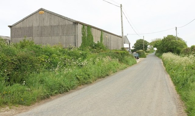
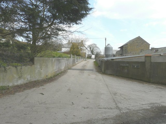
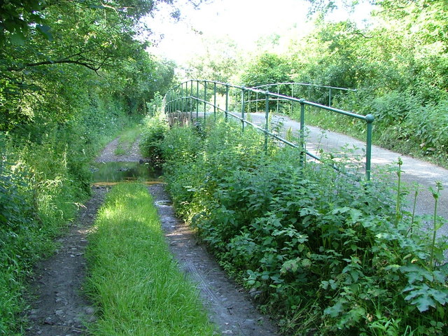
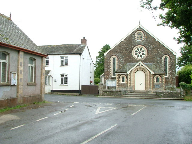
Broad Langdon Images

Images are sourced within 2km of 50.706705/-4.542331 or Grid Reference SX2092. Thanks to Geograph Open Source API. All images are credited.

Ordnance Survey Flush Bracket G3520 This can be found on the wall of a building at Lower Exe.
For more detail see : <span class="nowrap"><a title="http://www.bench-marks.org.uk/bm15666" rel="nofollow ugc noopener" href="http://www.bench-marks.org.uk/bm15666">Link</a><img style="margin-left:2px;" alt="External link" title="External link - shift click to open in new window" src="https://s1.geograph.org.uk/img/external.png" width="10" height="10"/></span>
Ordnance Survey Flush Bracket G3520
This can be found on the wall of a building at Lower Exe. For more detail see : LinkExternal link
Towards Blagdon From a gateway just to the right of the camera position in <a href="https://www.geograph.org.uk/photo/846928">SX2094 : Junction of lanes, Headon.</a>.
Towards Blagdon
From a gateway just to the right of the camera position in SX2094 : Junction of lanes, Headon..
Track, Broadlands Farm This seems to be a fairly new track, joining an older one that you can see in the background, making its way to several fields. Neither of them are rights of way.
Track, Broadlands Farm
This seems to be a fairly new track, joining an older one that you can see in the background, making its way to several fields. Neither of them are rights of way.
Lane to Eden Farm A no through road, seen from the same place as <a href="https://www.geograph.org.uk/photo/4976860">SX2094 : Towards Blagdon</a>.
Lane to Eden Farm
A no through road, seen from the same place as SX2094 : Towards Blagdon.
Field east of Headon Cross A field of long grass on the other side of the lane <a href="https://www.geograph.org.uk/photo/5183319">SX2094 : Lane to Eden Farm</a> from <a href="https://www.geograph.org.uk/photo/4976860">SX2094 : Towards Blagdon</a>.
Field east of Headon Cross
A field of long grass on the other side of the lane SX2094 : Lane to Eden Farm from SX2094 : Towards Blagdon.
Fields by Broadlands Farm A similar view to <a href="https://www.geograph.org.uk/photo/713460">SX2093 : Fields by Broadlands Farm</a> from the same spot as <a href="https://www.geograph.org.uk/photo/4976942">SX2093 : Track, Broadlands Farm</a> looking left.
Fields by Broadlands Farm
A similar view to SX2093 : Fields by Broadlands Farm from the same spot as SX2093 : Track, Broadlands Farm looking left.
Road to Canworthy Water Looking left again from the same spot as <a href="https://www.geograph.org.uk/photo/5183618">SX2093 : Fields by Broadlands Farm</a> and <a href="https://www.geograph.org.uk/photo/4976942">SX2093 : Track, Broadlands Farm</a>.
Road to Canworthy Water
Looking left again from the same spot as SX2093 : Fields by Broadlands Farm and SX2093 : Track, Broadlands Farm.
Broadlands Farm Looking in the opposite direction along the road shown in <a href="https://www.geograph.org.uk/photo/5183632">SX2093 : Road to Canworthy Water</a>.
Broadlands Farm
Looking in the opposite direction along the road shown in SX2093 : Road to Canworthy Water.
Road junction at Warbstow Cross The road to the left takes one to Warbstow church while that straight on ends at Hallworthy in <a href="https://www.geograph.org.uk/gridref/SX1887">SX1887</a> on the A395.
Road junction at Warbstow Cross
The road to the left takes one to Warbstow church while that straight on ends at Hallworthy in SX1887 on the A395.
The road through Trengune
Trengune Farm
Trengune Farm
The crossroads at Eden Methodist church The church dates from 1893. The road on the left takes you to Trengune, the road to the left of the barn to Wainhouse Corner and to its right to Jacobstow, while the road just past the church to Headon.
The crossroads at Eden Methodist church
The church dates from 1893. The road on the left takes you to Trengune, the road to the left of the barn to Wainhouse Corner and to its right to Jacobstow, while the road just past the church to Headon.
Eden Methodist church The church dates from 1893.
Eden Methodist church
The church dates from 1893.
Field, Fonston Fonston is a straggle of buildings along the road between Warbstow Green and Canworthy Water. This looks parallel to the road (on the left) along one of the larger gaps between the buildings.
Field, Fonston
Fonston is a straggle of buildings along the road between Warbstow Green and Canworthy Water. This looks parallel to the road (on the left) along one of the larger gaps between the buildings.
Tree by Hendra Cottage No prizes for guessing which way the prevailing winds blow around here. Hendra Cottage is just down the road to Langdon.
Tree by Hendra Cottage
No prizes for guessing which way the prevailing winds blow around here. Hendra Cottage is just down the road to Langdon.
Lane to Langdon This lane, followed by NCN 3, cuts across the southeast corner of the square.
Lane to Langdon
This lane, followed by NCN 3, cuts across the southeast corner of the square.
Farmland, Hendra A view from footpath 561 1/2 near the farm, looking towards the Ottery valley.
Farmland, Hendra
A view from footpath 561 1/2 near the farm, looking towards the Ottery valley.
Road to the Ottery Dropping down to cross the River Ottery just round the bend. This is NCN 3 - it must be exhilarating to cycle down this hill. Ahead up the other side is Broad Langdon.
Road to the Ottery
Dropping down to cross the River Ottery just round the bend. This is NCN 3 - it must be exhilarating to cycle down this hill. Ahead up the other side is Broad Langdon.
Show me another place!

Broad Langdon is located at Grid Ref: SX2092 (Lat: 50.706705, Lng: -4.542331)

Unitary Authority: Cornwall

Police Authority: Devon and Cornwall

What 3 Words

///handrail.layers.filed. Near Jacobstow, Cornwall

Nearby Locations

Broad Langdon

Related Wikis

Fonston

Fonston is a hamlet 8 miles (13 km) north-west of Launceston in Cornwall, England. Fonston lies at around 495 metres (1,624 ft) above sea level on the...

Trengune

Trengune is a hamlet in Cornwall, England, United Kingdom. It is part of the civil parish of Warbstow and is located 1.5 miles north and 1 mile west of...

Warbstow Bury

Warbstow Bury is an Iron Age hillfort about 0.5 miles (0.80 km) west of the village of Warbstow, in Cornwall, England. It is a scheduled monument. ��2...

Canworthy Water

Canworthy Water (Cornish: Boskarn) is a settlement in northeast Cornwall, England, United Kingdom. It is situated beside the River Ottery at OS grid ref...

Nearby Amenities

Located within 500m of 50.706705,-4.542331
Bus Stop
Langdon Cross
Naptan AtcoCode: 0800FWX38820
Naptan Bearing: SE
Naptan CommonName: Langdon Cross
Naptan NaptanCode: cordpgjt
Naptan Street: Unclassified
Naptan Verified: no
Source: naptan_import
Lat/Long: 50.7075796/-4.5390737
Langdon
Name Kw: Goonhir
Place: hamlet
Source: NPE
Lat/Long: 50.708425/-4.5394878
Broadlands Farm
Place: isolated_dwelling
Lat/Long: 50.7099659/-4.5452832
Post Box
Operator: Royal Mail
Operator Type: private
Operator Wikidata: Q638098
Post Box Mounting: pier
Post Box Type: lamp
Ref: EX23 139
Royal Cypher: EIIR
Royal Cypher Wikidata: Q33102113
Survey Date: 2023-01-21
Lat/Long: 50.7072806/-4.5386249
The data included in this document is from www.openstreetmap.org. The data is made available under ODbL.

Have you been to Broad Langdon?

Leave your review of Broad Langdon below (or comments, questions and feedback).