Brick End

Settlement in Herefordshire

England

Brick End

Afternoon sun at How Caple Afternoon winter sun on a field near Brook House at How Caple, Lyndor Wood, above the River Wye can be seen in the distance.
Afternoon sun at How Caple Credit: Philip Halling

Brick End is a charming village located in the county of Herefordshire, England. Situated amidst picturesque countryside, this rural settlement offers a tranquil and idyllic setting for residents and visitors alike. With a population of around 500 inhabitants, Brick End retains its small village charm and close-knit community atmosphere.

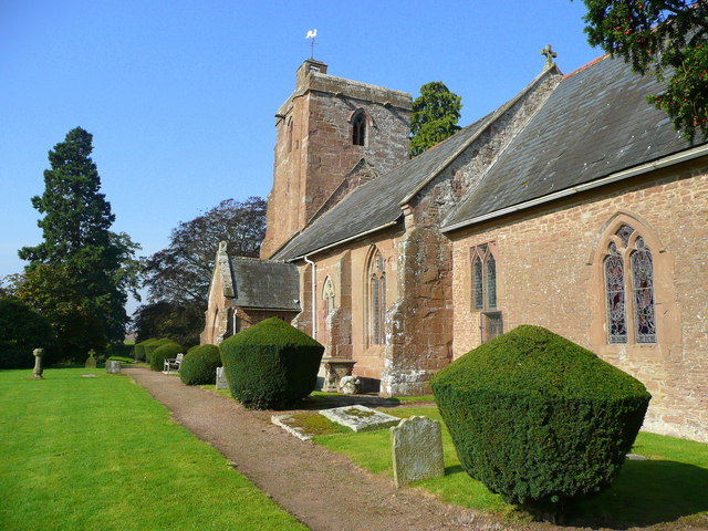
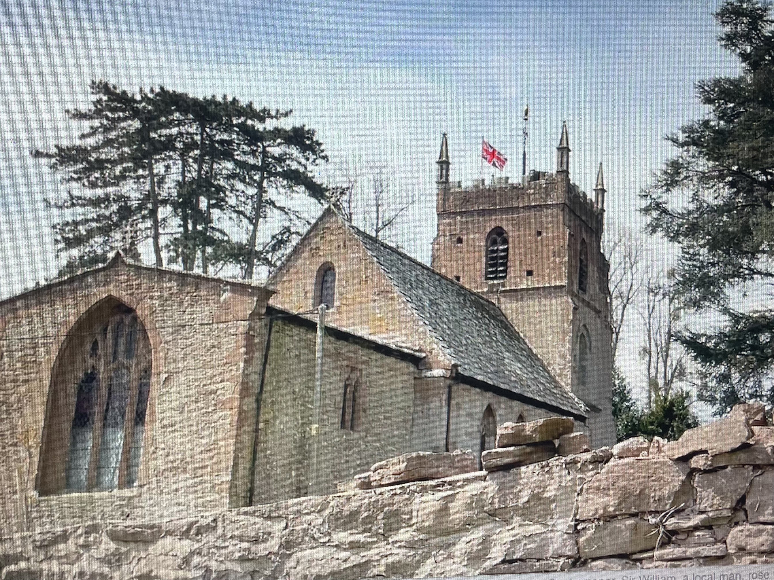
The village is renowned for its beautiful architecture, characterized by its traditional brick and timber-framed houses that date back to the 17th and 18th centuries. These historic buildings add to the village's distinctive character, creating a sense of stepping back in time. The well-preserved St. Mary's Church, dating back to the 12th century, is another notable landmark that highlights the rich history of the area.

Despite its small size, Brick End boasts a range of amenities catering to the needs of its residents. The village has a local pub, The Brick Arms, which serves as a hub for social gatherings and community events. Additionally, there is a primary school, a village hall, and a small convenience store that provides essential services to the local population.

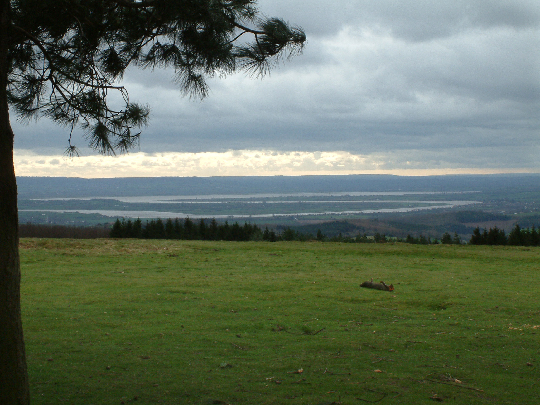
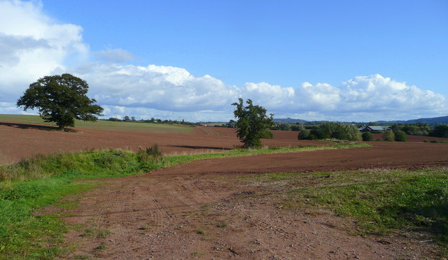
Nature lovers are drawn to Brick End due to its proximity to the stunning Herefordshire countryside. The village is surrounded by rolling hills, verdant meadows, and picturesque walking trails, making it an ideal destination for outdoor enthusiasts. The nearby River Wye offers opportunities for fishing and boating, further adding to the area's natural beauty.

In conclusion, Brick End is a quaint village in Herefordshire that offers a peaceful and scenic retreat for its residents and visitors. With its historic architecture, sense of community, and access to the beautiful countryside, it truly embodies the charm of rural England.

If you have any feedback on the listing, please let us know in the comments section below.

Brick End Images

Images are sourced within 2km of 51.955727/-2.581502 or Grid Reference SO6028. Thanks to Geograph Open Source API. All images are credited.

Afternoon sun at How Caple Afternoon winter sun on a field near Brook House at How Caple, Lyndor Wood, above the River Wye can be seen in the distance.
Afternoon sun at How Caple
Afternoon winter sun on a field near Brook House at How Caple, Lyndor Wood, above the River Wye can be seen in the distance.
Sun on a field at How Caple Afternoon winter sun on a field near Brook House at How Caple.  Lyndor Wood can be seen in the background.
Sun on a field at How Caple
Afternoon winter sun on a field near Brook House at How Caple. Lyndor Wood can be seen in the background.
Footpath to How Caple church
Lone tree by the riverside road at How Caple
Brick support for bank of the road The bank on the right has been reinforced with brickwork
Brick support for bank of the road
The bank on the right has been reinforced with brickwork
Bridge near White House Farm A small bridge over a stream that flows into the River Wye
Bridge near White House Farm
A small bridge over a stream that flows into the River Wye
Road junction at How Caple Crossroads at How Caple looking to road that leads to 'Hole-in-the-Wall'.
Road junction at How Caple
Crossroads at How Caple looking to road that leads to 'Hole-in-the-Wall'.
Brook House Farm, How Caple Seen from the Wye Valley Walk, this is the same farm as in <a href="https://www.geograph.org.uk/photo/532418">SO6030 : Farm at How Caple</a>, but from the opposite direction.
Brook House Farm, How Caple
Seen from the Wye Valley Walk, this is the same farm as in SO6030 : Farm at How Caple, but from the opposite direction.
How Caple Wood Seen from the Wye Valley Walk.
How Caple Wood
Seen from the Wye Valley Walk.
Farmland near How Caple Looking towards the River Wye.
Farmland near How Caple
Looking towards the River Wye.
Farm buildings, How Caple Brook House and associated farm buildings. Taken from the course of the Wye Valley Way.
Farm buildings, How Caple
Brook House and associated farm buildings. Taken from the course of the Wye Valley Way.
Pump house on the banks of the Wye A remarkably dull shot of the cinderblock pump house on the River Wye at How Caple! The Wye Valley Walk runs along the track to the left of the pump house.
Pump house on the banks of the Wye
A remarkably dull shot of the cinderblock pump house on the River Wye at How Caple! The Wye Valley Walk runs along the track to the left of the pump house.
River Wye, How Caple A shot of the Wye at How Caple. Taken from about as close as I could get without actually falling in!
River Wye, How Caple
A shot of the Wye at How Caple. Taken from about as close as I could get without actually falling in!
Abandoned bike A cheap and cheerful mountain bike, abandoned in a hedge and looking sorry for itself!
Abandoned bike
A cheap and cheerful mountain bike, abandoned in a hedge and looking sorry for itself!
Wye Valley Walk near How Caple The tree lined path of the Wye valley Walk. The River Wye is behind the trees on the right.
Wye Valley Walk near How Caple
The tree lined path of the Wye valley Walk. The River Wye is behind the trees on the right.
Trees in a field, How Caple, Herefordshire  Pilgrims Way <a title="https://www.geograph.org.uk/photo/7543557" href="https://www.geograph.org.uk/photo/7543557">Link</a> is behind the camera.
Trees in a field, How Caple, Herefordshire
Pilgrims Way Link is behind the camera.
Longhorn cattle at How Caple These English Longhorn cattle were grazing in farmland on the public footpath from How Caple church to Brockhampton church. The River Wye can briefly be seen in the middle-ground of this photo.
Longhorn cattle at How Caple
These English Longhorn cattle were grazing in farmland on the public footpath from How Caple church to Brockhampton church. The River Wye can briefly be seen in the middle-ground of this photo.
Swing gate at How Caple Here is a swing gate on a public footpath from How Caple church to Brockhampton church.
Swing gate at How Caple
Here is a swing gate on a public footpath from How Caple church to Brockhampton church.
Show me another place!

Brick End is located at Grid Ref: SO6028 (Lat: 51.955727, Lng: -2.581502)

Unitary Authority: County of Herefordshire

Police Authority: West Merica

What 3 Words

///refilled.flies.reviewed. Near Brockhampton, Herefordshire

Nearby Locations

Brick End

Related Wikis

Foy, Herefordshire

Foy is a hamlet and civil parish in Herefordshire, England. By road, it is 7 kilometres (4 miles) north of Ross-on-Wye, 23 kilometres (14 miles) south...

Hole-in-the-Wall, Herefordshire

Hole-in-the-Wall is a riverside settlement on the east bank of the River Wye in the English county of Herefordshire. It is some five miles to the north...

South Herefordshire and Over Severn

South Herefordshire and Over Severn is a National Character Area that extends from the south, where it is bounded by the Forest of Dean, northwards to...

How Caple

How Caple is a village and civil parish in the English county of Herefordshire. The population of this civil parish at the 2011 census was 118.To the east...

Backney Halt railway station

Backney Halt railway station was a request stop in the English county of Herefordshire. It was located on the Great Western Railway line linking Ross-on...

Brampton Abbotts

Brampton Abbotts is a village and civil parish in Herefordshire, England. It is located 2 km north of Ross-on-Wye and 16 km south east of Hereford. The...

Totnor

Totnor is a hamlet in Herefordshire in the parish of How Caple. It lies on the route of the Wye Valley Walk.

Brockhampton (near Ross-on-Wye)

Brockhampton is a village and civil parish in Herefordshire, England. The village is near the River Wye, 14 kilometres (9 mi) south east of Hereford, 13...

Nearby Amenities

Located within 500m of 51.955727,-2.581502
Post Box
Post Box Type: wall
Ref: HR9 520
Royal Cypher: VR
Royal Cypher Wikidata: Q33102356
Lat/Long: 51.9532402/-2.5858455
Foy
Power: pole
Transformer: distribution
Voltage Primary: 11000
Lat/Long: 51.9532419/-2.5870684
Power: pole
Lat/Long: 51.9535378/-2.5865118
Power: pole
Lat/Long: 51.9538411/-2.5859539
Power: pole
Lat/Long: 51.9541477/-2.5853987
Power: pole
Lat/Long: 51.9545263/-2.5846893
Power: pole
Lat/Long: 51.9548751/-2.5840482
Power: pole
Lat/Long: 51.9553644/-2.5831403
Brick End
Power: pole
Transformer: distribution
Voltage Primary: 11000
Lat/Long: 51.9562189/-2.5817623
Power: pole
Lat/Long: 51.9558784/-2.5821915
Power: pole
Lat/Long: 51.9563479/-2.5829143
Power: pole
Lat/Long: 51.9570094/-2.5839027
Brick End North
Power: pole
Transformer: distribution
Voltage Primary: 11000
Lat/Long: 51.9576202/-2.5848133
Power: pole
Lat/Long: 51.9579826/-2.585341
Power: pole
Lat/Long: 51.9583681/-2.5858989
Power: pole
Lat/Long: 51.9590177/-2.5861511
The data included in this document is from www.openstreetmap.org. The data is made available under ODbL.

Have you been to Brick End?

Leave your review of Brick End below (or comments, questions and feedback).