Bredward

Settlement in Herefordshire

England

Bredward

Ridgebourne Road Offa's Dyke Path follows Ridgebourne Road as it descends from Hergest Ridge into Kington.
Ridgebourne Road Credit: Philip Halling

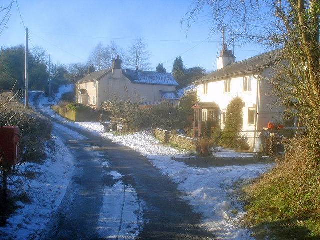
Bredward is a small village located in the county of Herefordshire in England. Situated in the picturesque West Midlands region, it is nestled amongst the rolling hills and lush green landscapes that define this rural area. Bredward is known for its tranquil and idyllic setting, making it a popular destination for those seeking a peaceful retreat away from the hustle and bustle of city life.

The village itself is quaint and charming, with a population of around 200 residents. It features a traditional village square, surrounded by historic stone buildings and cottages that date back centuries. One of the main attractions in Bredward is its ancient parish church, which stands as a testament to the village's rich history and heritage.

Surrounded by fertile farmland, Bredward is known for its agricultural traditions. The area is primarily dedicated to farming and livestock rearing, with many locals engaged in these activities. The village also benefits from its proximity to the River Wye, which runs through the county, providing not only a scenic backdrop but also opportunities for fishing and water-based activities.

While Bredward may be a small village, it is well-connected to other nearby towns and cities. The market town of Hereford is just a short drive away, offering a wider range of amenities and services. Bredward is also within easy reach of the stunning Malvern Hills, providing residents and visitors with ample opportunities for outdoor recreation and exploration.

In summary, Bredward is a tranquil and picturesque village in Herefordshire, known for its stunning natural beauty, rich agricultural traditions, and close-knit community. It offers a peaceful retreat for those seeking a slower pace of life amidst the charming English countryside.

If you have any feedback on the listing, please let us know in the comments section below.
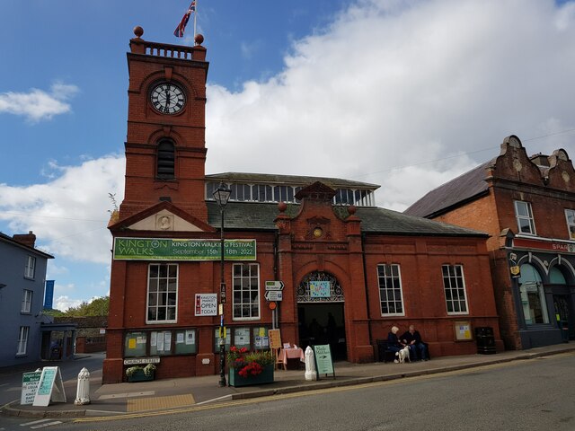
Bredward Images

Images are sourced within 2km of 52.189466/-3.0476365 or Grid Reference SO2855. Thanks to Geograph Open Source API. All images are credited.

Ridgebourne Road Offa's Dyke Path follows Ridgebourne Road as it descends from Hergest Ridge into Kington.
Ridgebourne Road
Offa's Dyke Path follows Ridgebourne Road as it descends from Hergest Ridge into Kington.
War Memorial on The Square War Memorial on The Square in Kington.
War Memorial on The Square
War Memorial on The Square in Kington.
Market Hall, Kington Kington's Market Hall was built in the 1880s and is Grade II listed, see: <span class="nowrap"><a title="https://historicengland.org.uk/listing/the-list/list-entry/1208120?section=official-list-entry" rel="nofollow ugc noopener" href="https://historicengland.org.uk/listing/the-list/list-entry/1208120?section=official-list-entry">Link</a><img style="margin-left:2px;" alt="External link" title="External link - shift click to open in new window" src="https://s1.geograph.org.uk/img/external.png" width="10" height="10"/></span>
Market Hall, Kington
Kington's Market Hall was built in the 1880s and is Grade II listed, see: LinkExternal link
The Square, Kington The War Memorial is surrounded by eighteenth and nineteenth century houses.
The Square, Kington
The War Memorial is surrounded by eighteenth and nineteenth century houses.
Toll House, Kington "The Toll House". In Hergest Road in front Hergest Mill. Erected by the Kington Turnpike Trust in the 19ᵗʰ C. More local toll houses see <a title="https://www.geograph.org.uk/discuss/index.php?&action=vthread&forum=11&topic=33104" href="https://www.geograph.org.uk/discuss/index.php?&action=vthread&forum=11&topic=33104">Link</a>


Milestone Society National ID: HF.KIN04
Toll House, Kington
"The Toll House". In Hergest Road in front Hergest Mill. Erected by the Kington Turnpike Trust in the 19ᵗʰ C. More local toll houses see Link Milestone Society National ID: HF.KIN04
Toll House, Kington "The Old Toll House", on the corner of Headbrook, Bridge Street and Townsend. Listed in 1976 but the restoration looks much newer (pre 2002 at least). A local reported that it was a ruin in the late 1950s/early 60s because he recalled playing in it. Looking closely at the chimney stack with traces of white paint, that must be original. Erected by the Kington Turnpike Trust in the 19ᵗʰ C. More local toll houses see <a title="https://www.geograph.org.uk/discuss/index.php?&action=vthread&forum=11&topic=33104" href="https://www.geograph.org.uk/discuss/index.php?&action=vthread&forum=11&topic=33104">Link</a>


Grade II Listed, No. 1208007 <span class="nowrap"><a title="https://historicengland.org.uk/listing/the-list/list-entry/1208007" rel="nofollow ugc noopener" href="https://historicengland.org.uk/listing/the-list/list-entry/1208007">Link</a><img style="margin-left:2px;" alt="External link" title="External link - shift click to open in new window" src="https://s1.geograph.org.uk/img/external.png" width="10" height="10"/></span>

Milestone Society National ID: HF.KIN02
Toll House, Kington
"The Old Toll House", on the corner of Headbrook, Bridge Street and Townsend. Listed in 1976 but the restoration looks much newer (pre 2002 at least). A local reported that it was a ruin in the late 1950s/early 60s because he recalled playing in it. Looking closely at the chimney stack with traces of white paint, that must be original. Erected by the Kington Turnpike Trust in the 19ᵗʰ C. More local toll houses see Link Grade II Listed, No. 1208007 LinkExternal link Milestone Society National ID: HF.KIN02
Toll House, Kington "The Toll House" on the A44 NW of Kington in the area known as Floodgates. Erected by the Kington Turnpike Trust in the 19ᵗʰ C. More local toll houses see <a title="https://www.geograph.org.uk/discuss/index.php?&action=vthread&forum=11&topic=33104" href="https://www.geograph.org.uk/discuss/index.php?&action=vthread&forum=11&topic=33104">Link</a>


Milestone Society National ID: HF.KIN01
Toll House, Kington
"The Toll House" on the A44 NW of Kington in the area known as Floodgates. Erected by the Kington Turnpike Trust in the 19ᵗʰ C. More local toll houses see Link Milestone Society National ID: HF.KIN01
The Coach House and Market Hall, Kington, Herefordshire
Junction of Church Street and High Street, Kington, Herefordshire
Church Street, Kington, Herefordshire
Market Hall, Kington, Herefordshire
The Old Toll House An early 19th century former Toll House on the road into Kington.  The house is Grade II listed, see: <span class="nowrap"><a title="https://historicengland.org.uk/listing/the-list/list-entry/1208007?section=official-list-entry" rel="nofollow ugc noopener" href="https://historicengland.org.uk/listing/the-list/list-entry/1208007?section=official-list-entry">Link</a><img style="margin-left:2px;" alt="External link" title="External link - shift click to open in new window" src="https://s1.geograph.org.uk/img/external.png" width="10" height="10"/></span>
The Old Toll House
An early 19th century former Toll House on the road into Kington. The house is Grade II listed, see: LinkExternal link
St Mary's church, Kington
Wych House, Kington Dates from the early nineteenth century <span class="nowrap"><a title="https://historicengland.org.uk/listing/the-list/list-entry/1208078?section=official-list-entry" rel="nofollow ugc noopener" href="https://historicengland.org.uk/listing/the-list/list-entry/1208078?section=official-list-entry">Link</a><img style="margin-left:2px;" alt="External link" title="External link - shift click to open in new window" src="https://s1.geograph.org.uk/img/external.png" width="10" height="10"/></span>
Wych House, Kington
Dates from the early nineteenth century LinkExternal link
Church House, Kington Dates from the eighteenth century with nineteenth century extension <span class="nowrap"><a title="https://historicengland.org.uk/listing/the-list/list-entry/1297583?section=official-list-entry" rel="nofollow ugc noopener" href="https://historicengland.org.uk/listing/the-list/list-entry/1297583?section=official-list-entry">Link</a><img style="margin-left:2px;" alt="External link" title="External link - shift click to open in new window" src="https://s1.geograph.org.uk/img/external.png" width="10" height="10"/></span>
Church House, Kington
Dates from the eighteenth century with nineteenth century extension LinkExternal link
Lychgate, Kington Dates from the eighteenth century <span class="nowrap"><a title="https://historicengland.org.uk/listing/the-list/list-entry/1293359?section=official-list-entry" rel="nofollow ugc noopener" href="https://historicengland.org.uk/listing/the-list/list-entry/1293359?section=official-list-entry">Link</a><img style="margin-left:2px;" alt="External link" title="External link - shift click to open in new window" src="https://s1.geograph.org.uk/img/external.png" width="10" height="10"/></span>
Lychgate, Kington
Dates from the eighteenth century LinkExternal link
Castle Hill Cottage, Kington Dates from about 1800 <span class="nowrap"><a title="https://historicengland.org.uk/listing/the-list/list-entry/1208027?section=official-list-entry" rel="nofollow ugc noopener" href="https://historicengland.org.uk/listing/the-list/list-entry/1208027?section=official-list-entry">Link</a><img style="margin-left:2px;" alt="External link" title="External link - shift click to open in new window" src="https://s1.geograph.org.uk/img/external.png" width="10" height="10"/></span>
Castle Hill Cottage, Kington
Dates from about 1800 LinkExternal link
The Swan Hotel, Kington Dates from the early nineteenth century <span class="nowrap"><a title="https://historicengland.org.uk/listing/the-list/list-entry/1196526?section=official-list-entry" rel="nofollow ugc noopener" href="https://historicengland.org.uk/listing/the-list/list-entry/1196526?section=official-list-entry">Link</a><img style="margin-left:2px;" alt="External link" title="External link - shift click to open in new window" src="https://s1.geograph.org.uk/img/external.png" width="10" height="10"/></span>
The Swan Hotel, Kington
Dates from the early nineteenth century LinkExternal link
Show me another place!

Bredward is located at Grid Ref: SO2855 (Lat: 52.189466, Lng: -3.0476365)

Unitary Authority: County of Herefordshire

Police Authority: West Merica

What 3 Words

///sideboard.washing.diverged. Near Kington, Herefordshire

Nearby Locations

Hergest Court Bredward

Related Wikis

Lower Hergest

Lower Hergest is a hamlet in Herefordshire, England. The local manor house, Hergest Court, is a Grade II* listed building built of a mixture of stone and...

The Recreation Ground, Kington

The Recreation Ground is a cricket ground in Kington, Herefordshire. In 1996, Herefordshire played Wales Minor Counties in the grounds first Minor Counties...

Lady Hawkins' School

Lady Hawkins' School is a 11-16 secondary school in Kington, Herefordshire. The headteacher is Mr Allen Brace. The school comprises four houses named...

Kington Town F.C.

Kington Town Football Club is a football club based in Kington, Herefordshire, England. They are currently members of the Herefordshire League Premier...

Nearby Amenities

Located within 500m of 52.189466,-3.0476365
Barrier: stile
Lat/Long: 52.1915439/-3.0475534
Barrier: stile
Note: There's a steep incline to reach this from SW field.
Stile: stepover
Lat/Long: 52.1909493/-3.0472357
Barrier: stile
Material: wood
Lat/Long: 52.1879209/-3.0417446
Barrier: stile
Lat/Long: 52.188624/-3.0438795
Barrier: stile
Lat/Long: 52.1864302/-3.0456272
Barrier: stile
Note: 2021: 2m long strip between these 2 stiles is currently impassable.
Lat/Long: 52.1858035/-3.047543
Barrier: stile
Note: 2021: 2m long strip between these 2 stiles is currently impassable.
Lat/Long: 52.1858227/-3.0474651
Information: guidepost
Tourism: information
Lat/Long: 52.1910651/-3.0469784
The Golden Pippin
Place: locality
Lat/Long: 52.1856493/-3.0459363
Barrier: stile
Lat/Long: 52.1851518/-3.0459236
Barrier: stile
Material: wood
Stile: stepover
Lat/Long: 52.1872297/-3.0466175
Barrier: stile
Material: wood
Stile: stepover
Lat/Long: 52.1879777/-3.0472737
Barrier: stile
Material: wood
Stile: stepover
Lat/Long: 52.1889598/-3.0486607
Barrier: stile
Material: wood
Stile: stepover
Lat/Long: 52.1890586/-3.0498611
Barrier: stile
Material: wood
Stile: stepover
Lat/Long: 52.189049/-3.0499485
Barrier: stile
Material: wood
Stile: stepover
Lat/Long: 52.1891845/-3.0507658
Barrier: stile
Material: wood
Stile: stepover
Lat/Long: 52.1891613/-3.0508248
Barrier: stile
Lat/Long: 52.1893575/-3.0519975
Barrier: stile
Lat/Long: 52.1893707/-3.052027
Barrier: stile
Lat/Long: 52.1895343/-3.0537441
Barrier: stile
Lat/Long: 52.1895351/-3.0543365
Barrier: stile
Lat/Long: 52.1895247/-3.0536432
The data included in this document is from www.openstreetmap.org. The data is made available under ODbL.

Have you been to Bredward?

Leave your review of Bredward below (or comments, questions and feedback).