Braeside

Settlement in Yorkshire

England

Braeside

View over Diggle from track connecting Back o'th Lee Farm to Lee Side
View over Diggle from track connecting Back o'th Lee Farm to Lee Side Credit: Philip Cornwall

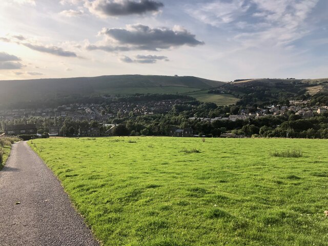
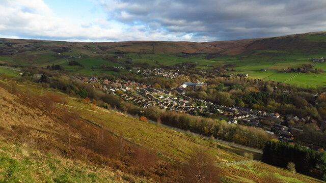
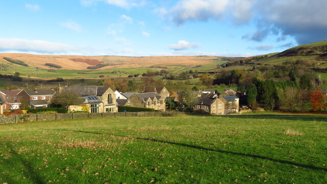
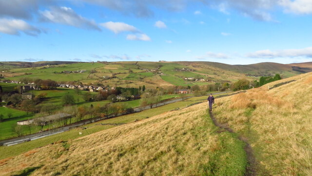
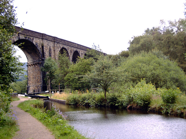
Braeside is a small village located in the county of Yorkshire, England. Situated in the stunning countryside, it is known for its picturesque landscape and tranquility. The village is nestled on the banks of the River Aire, offering residents and visitors breathtaking views and a peaceful atmosphere.

With a population of approximately 500 people, Braeside is a tight-knit community where residents take pride in maintaining a close connection with one another. The village is known for its strong community spirit, with regular social events and gatherings organized throughout the year.

Despite its small size, Braeside has all the essential amenities for its residents. It boasts a village hall, which serves as a hub for various community activities and functions. There is also a local primary school, providing education for the village's children.

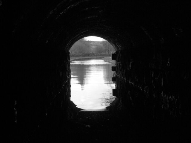
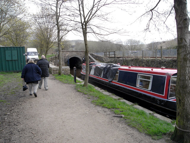
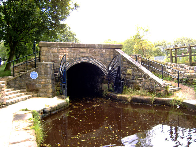
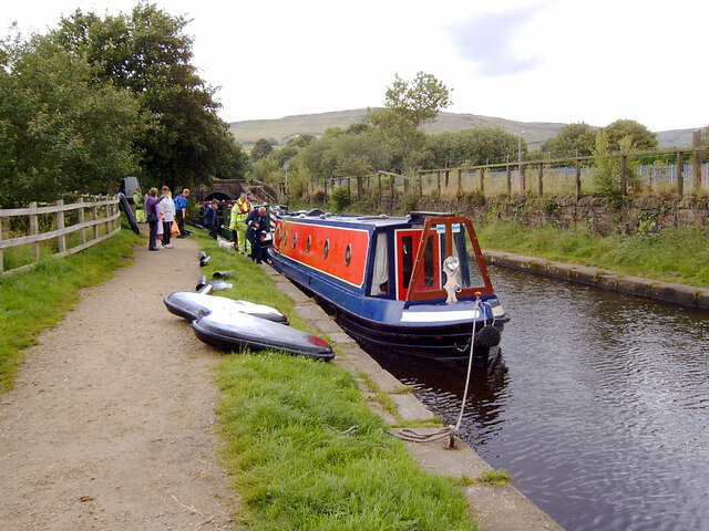
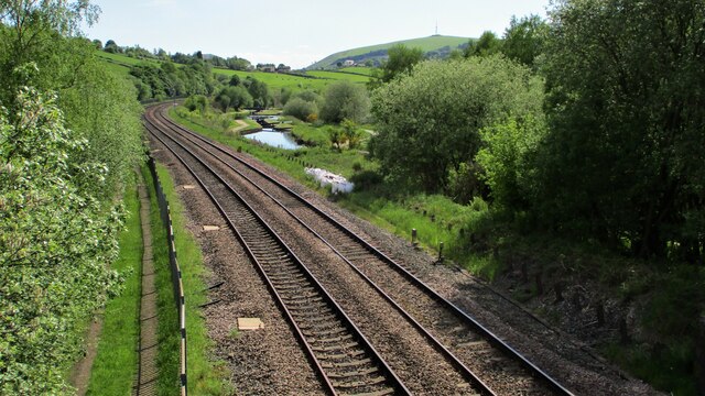
The surrounding area of Braeside offers a wealth of outdoor activities for nature enthusiasts. The village is surrounded by rolling hills and expansive forests, providing ample opportunities for hiking, cycling, and exploring. The nearby River Aire is ideal for fishing and boating, attracting anglers from all around.

For those seeking a slower pace of life, Braeside is the perfect destination. It offers a serene countryside setting with all the necessary amenities, making it an idyllic place to live or visit.

If you have any feedback on the listing, please let us know in the comments section below.
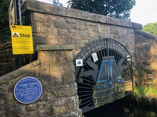
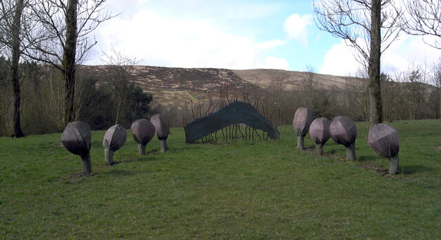
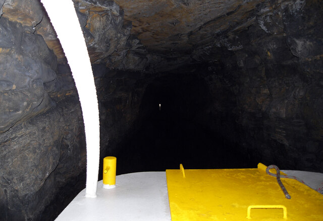
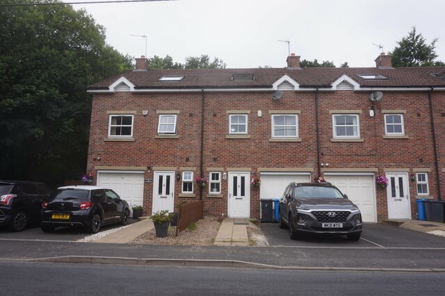
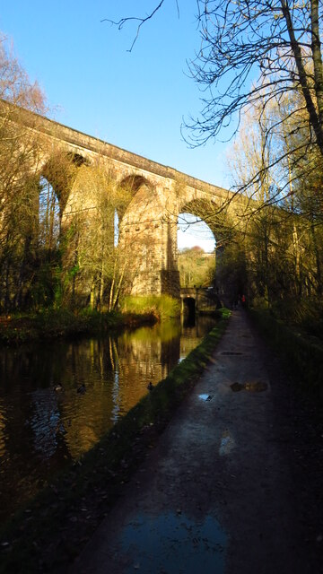
Braeside Images

Images are sourced within 2km of 53.563403/-2.0188188 or Grid Reference SD9807. Thanks to Geograph Open Source API. All images are credited.

View over Diggle from track connecting Back o'th Lee Farm to Lee Side
Entrance to Standedge Canal Tunnel, Diggle The Huddersfield Narrow Canal opened in 1811. It runs for just under 20 miles from Lock 1E, where it joins the Huddersfield Broad Canal at the rear of the University of Huddersfield campus, to the junction with the Ashton Canal at Whitelands Basin in Ashton-under-Lyne. It crosses the Pennines by means of 74 locks and the Standedge Tunnel.
Entrance to Standedge Canal Tunnel, Diggle
The Huddersfield Narrow Canal opened in 1811. It runs for just under 20 miles from Lock 1E, where it joins the Huddersfield Broad Canal at the rear of the University of Huddersfield campus, to the junction with the Ashton Canal at Whitelands Basin in Ashton-under-Lyne. It crosses the Pennines by means of 74 locks and the Standedge Tunnel.
Sculpture by the Huddersfield Narrow Canal near Diggle The Huddersfield Narrow Canal opened in 1811. It runs for just under 20 miles from Lock 1E, where it joins the Huddersfield Broad Canal at the rear of the University of Huddersfield campus, to the junction with the Ashton Canal at Whitelands Basin in Ashton-under-Lyne. It crosses the Pennines by means of 74 locks and the Standedge Tunnel.
Sculpture by the Huddersfield Narrow Canal near Diggle
The Huddersfield Narrow Canal opened in 1811. It runs for just under 20 miles from Lock 1E, where it joins the Huddersfield Broad Canal at the rear of the University of Huddersfield campus, to the junction with the Ashton Canal at Whitelands Basin in Ashton-under-Lyne. It crosses the Pennines by means of 74 locks and the Standedge Tunnel.
Approaching the West Portal of the Standedge Tunnel The Huddersfield Narrow Canal opened in 1811. It runs for just under 20 miles from Lock 1E, where it joins the Huddersfield Broad Canal at the rear of the University of Huddersfield campus, to the junction with the Ashton Canal at Whitelands Basin in Ashton-under-Lyne. It crosses the Pennines by means of 74 locks and the Standedge Tunnel.
Approaching the West Portal of the Standedge Tunnel
The Huddersfield Narrow Canal opened in 1811. It runs for just under 20 miles from Lock 1E, where it joins the Huddersfield Broad Canal at the rear of the University of Huddersfield campus, to the junction with the Ashton Canal at Whitelands Basin in Ashton-under-Lyne. It crosses the Pennines by means of 74 locks and the Standedge Tunnel.
The Huddersfield Narrow Canal seen through the West Portal of the Standedge Tunnel The Huddersfield Narrow Canal opened in 1811. It runs for just under 20 miles from Lock 1E, where it joins the Huddersfield Broad Canal at the rear of the University of Huddersfield campus, to the junction with the Ashton Canal at Whitelands Basin in Ashton-under-Lyne. It crosses the Pennines by means of 74 locks and the Standedge Tunnel.
The Huddersfield Narrow Canal seen through the West Portal of the Standedge Tunnel
The Huddersfield Narrow Canal opened in 1811. It runs for just under 20 miles from Lock 1E, where it joins the Huddersfield Broad Canal at the rear of the University of Huddersfield campus, to the junction with the Ashton Canal at Whitelands Basin in Ashton-under-Lyne. It crosses the Pennines by means of 74 locks and the Standedge Tunnel.
The West Portal of the Standedge Tunnel, Huddersfield Narrow Canal The Huddersfield Narrow Canal opened in 1811. It runs for just under 20 miles from Lock 1E, where it joins the Huddersfield Broad Canal at the rear of the University of Huddersfield campus, to the junction with the Ashton Canal at Whitelands Basin in Ashton-under-Lyne. It crosses the Pennines by means of 74 locks and the Standedge Tunnel.
The West Portal of the Standedge Tunnel, Huddersfield Narrow Canal
The Huddersfield Narrow Canal opened in 1811. It runs for just under 20 miles from Lock 1E, where it joins the Huddersfield Broad Canal at the rear of the University of Huddersfield campus, to the junction with the Ashton Canal at Whitelands Basin in Ashton-under-Lyne. It crosses the Pennines by means of 74 locks and the Standedge Tunnel.
Diggle from Harrop Edge
The West Portal of the Standedge Tunnel, Huddersfield Narrow Canal The Standedge Tunnels are four parallel tunnels through the Pennines between Marsden, West Yorkshire and Diggle, Greater Manchester. Three of them are railway tunnels and the fourth, and earliest, carries the Huddersfield Narrow Canal.
The canal tunnel was built between 1794 and 1811; initial work was supervised by Benjamin Outram but it was completed under the direction of Thomas Telford. It only allows one-way traffic but it is the longest (4984m), deepest and highest canal tunnel in Britain.
The three railway tunnels were built in 1848 (single track), 1871 (single track) and 1894 (double track). Only the last of these remains in use.
All four tunnels are connected to each other by cross-tunnels.
The West Portal of the Standedge Tunnel, Huddersfield Narrow Canal
The Standedge Tunnels are four parallel tunnels through the Pennines between Marsden, West Yorkshire and Diggle, Greater Manchester. Three of them are railway tunnels and the fourth, and earliest, carries the Huddersfield Narrow Canal. The canal tunnel was built between 1794 and 1811; initial work was supervised by Benjamin Outram but it was completed under the direction of Thomas Telford. It only allows one-way traffic but it is the longest (4984m), deepest and highest canal tunnel in Britain. The three railway tunnels were built in 1848 (single track), 1871 (single track) and 1894 (double track). Only the last of these remains in use. All four tunnels are connected to each other by cross-tunnels.
Narrowboats outside the West Portal of the Standedge Tunnel, Huddersfield Narrow Canal The Huddersfield Narrow Canal opened in 1811. It runs for just under 20 miles from Lock 1E, where it joins the Huddersfield Broad Canal at the rear of the University of Huddersfield campus, to the junction with the Ashton Canal at Whitelands Basin in Ashton-under-Lyne. It crosses the Pennines by means of 74 locks and the Standedge Tunnel.
Narrowboats outside the West Portal of the Standedge Tunnel, Huddersfield Narrow Canal
The Huddersfield Narrow Canal opened in 1811. It runs for just under 20 miles from Lock 1E, where it joins the Huddersfield Broad Canal at the rear of the University of Huddersfield campus, to the junction with the Ashton Canal at Whitelands Basin in Ashton-under-Lyne. It crosses the Pennines by means of 74 locks and the Standedge Tunnel.
Railway and Canal Together View south from large footbridge that serves Ravenstones Drive
Railway and Canal Together
View south from large footbridge that serves Ravenstones Drive
Huddersfield Narrow Canal, Uppermill Railway Viaduct visible in distance
Huddersfield Narrow Canal, Uppermill
Railway Viaduct visible in distance
The Swan Inn, Delph
The Swan Inn, Delph
Oldham Road A62, Delph
Houses on Delph New Road
Uppermill - Huddersfield Narrow Canal & Uppermill Viaduct
Houses on Delph Lane, Upper Dale, Delph
Path leading up from A62 Huddersfield Road to Harrop Edge Lane
Uppermill Viaduct crossing the Huddersfield Narrow Canal The Huddersfield Narrow Canal opened in 1811. It runs for just under 20 miles from Lock 1E, where it joins the Huddersfield Broad Canal at the rear of the University of Huddersfield campus, to the junction with the Ashton Canal at Whitelands Basin in Ashton-under-Lyne. It crosses the Pennines by means of 74 locks and the Standedge Tunnel.
Uppermill Viaduct crossing the Huddersfield Narrow Canal
The Huddersfield Narrow Canal opened in 1811. It runs for just under 20 miles from Lock 1E, where it joins the Huddersfield Broad Canal at the rear of the University of Huddersfield campus, to the junction with the Ashton Canal at Whitelands Basin in Ashton-under-Lyne. It crosses the Pennines by means of 74 locks and the Standedge Tunnel.
Show me another place!

Braeside is located at Grid Ref: SD9807 (Lat: 53.563403, Lng: -2.0188188)

Division: West Riding

Unitary Authority: Oldham

Police Authority: Greater Manchester

What 3 Words

///pianists.threading.backyards. Near Delph, Manchester

Related Wikis

Delph railway station

Delph railway station served the village of Delph, Oldham, in what is now Greater Manchester, United Kingdom, between 1851 and 1955. == History == The...

Delph

Delph (Old English (ge)delf a quarry) is a village in the civil parish of Saddleworth in the Metropolitan Borough of Oldham, in Greater Manchester, England...

Measurements Halt railway station

Measurements Halt railway station was opened on 18 July 1932 as part of the former London and North Western Railway route from Oldham to Delph. The station...

Dobcross

Dobcross is a village in the civil parish of Saddleworth in the Metropolitan Borough of Oldham in Greater Manchester, England. It is in a valley in the...

Dobcross railway station

Dobcross railway station served the village of Dobcross between 1912 and 1955. == History == The station was opened on 1 January 1912 as part of the London...

Saddleworth railway station

Saddleworth railway station, on the Huddersfield Line in Dobcross to the north of Uppermill, opened in August 1849 and closed to passengers in October...

Heights, Greater Manchester

Heights is a hamlet in the Saddleworth parish of the Metropolitan Borough of Oldham, in Greater Manchester, England. It is directly north of Delph, and...

Greenfield, Greater Manchester

Greenfield is a village in the civil parish of Saddleworth in the Metropolitan Borough of Oldham, in Greater Manchester, England. It is 4 miles (6.4 km...

Nearby Amenities

Located within 500m of 53.563403,-2.0188188
New Delph
Alt Name Ur: نیو ڈیلف
Is In: Oldham, Greater Manchester, England, UK
Name Ur: نیا ڈیلف
Place: village
Source: npe
Lat/Long: 53.5648133/-2.0175833
Pub
Old Bell Inn
Lat/Long: 53.5643347/-2.0194748
Delph & Dobcross Cricket Club
Sport: cricket
Lat/Long: 53.5666818/-2.0169761
Bus Stop
Delph, Oldham Road / opposite Stoneswood
Bus: yes
Naptan AtcoCode: 1800ED12241
Naptan Bearing: SW
Naptan CommonName: Oldham Road/Stoneswood
Naptan Indicator: Nr House 33
Naptan Landmark: NR ELS 136
Naptan NaptanCode: manamtdw
Naptan Notes: INDICATOR AMENDED
Naptan PlusbusZoneRef: MNCRPIC
Naptan ShortCommonName: Stoneswood
Naptan Street: OLDHAM ROAD
Naptan Verified: no
Network: TfGM
Operator: TfGM
Public Transport: platform
Source: naptan_import
Lat/Long: 53.5622928/-2.0249112
Bus Stop
Delph, Oldham Road / outside Stoneswood
Bus: yes
Naptan AtcoCode: 1800ED12251
Naptan Bearing: NE
Naptan CommonName: Oldham Road/Stoneswood
Naptan Indicator: Opp House 33
Naptan Landmark: CARE HOME
Naptan NaptanCode: manamtga
Naptan Notes: INDICATOR AMENDED
Naptan PlusbusZoneRef: MNCRPIC
Naptan ShortCommonName: Stoneswood
Naptan Street: OLDHAM ROAD
Naptan Verified: no
Network: TfGM
Operator: TfGM
Public Transport: platform
Source: naptan_import
Lat/Long: 53.5622478/-2.025198
Bus Stop
Delph, Oldham Road / by Delph Cross Roads
Bus: yes
Naptan AtcoCode: 1800ED12261
Naptan Bearing: NE
Naptan CommonName: Oldham Road/Delph Cross Roads
Naptan Indicator: Lay By
Naptan Landmark: Zebra Crossing
Naptan NaptanCode: manamtgd
Naptan PlusbusZoneRef: MNCRPIC
Naptan ShortCommonName: Delph Cross Roads
Naptan Street: OLDHAM ROAD
Naptan Verified: no
Network: TfGM
Operator: TfGM
Public Transport: platform
Source: naptan_import
Lat/Long: 53.5637406/-2.0217112
Bus Stop
Delph, The Sound / adjacent Oldham Road
Bus: yes
Naptan AtcoCode: 1800ED12271
Naptan Bearing: N
Naptan CommonName: The Sound/Oldham Road
Naptan Indicator: Nr Open Land
Naptan Landmark: Crossroads
Naptan NaptanCode: manamtgj
Naptan PlusbusZoneRef: MNCRPIC
Naptan ShortCommonName: Oldham Road
Naptan Street: THE SOUND
Naptan Verified: no
Network: TfGM
Operator: TfGM
Public Transport: platform
Source: naptan_import
Lat/Long: 53.564307/-2.0208962
Bus Stop
Delph, The Sound / near Oldham Road
Bus: yes
Naptan AtcoCode: 1800ED12281
Naptan Bearing: S
Naptan CommonName: The Sound/Oldham Road
Naptan Indicator: Nr Open Land
Naptan Landmark: Crossroads
Naptan NaptanCode: manamtgm
Naptan PlusbusZoneRef: MNCRPIC
Naptan ShortCommonName: Oldham Road
Naptan Street: THE SOUND
Naptan Verified: no
Network: TfGM
Operator: TfGM
Public Transport: platform
Source: naptan_import
Lat/Long: 53.5643609/-2.0207754
Bus Stop
Delph, Delph New Road / opposite Oakdale Mill
Bus: yes
Naptan AtcoCode: 1800ED13241
Naptan Bearing: N
Naptan CommonName: Delph New Road/Gatehead Mill
Naptan Indicator: O/s House 6
Naptan Landmark: HOUSE 6
Naptan NaptanCode: manapagd
Naptan PlusbusZoneRef: MNCRPIC
Naptan ShortCommonName: Gatehead Mill
Naptan Street: DELPH NEW ROAD
Naptan Verified: no
Network: TfGM
Operator: TfGM
Public Transport: platform
Source: naptan_import
Lat/Long: 53.5608997/-2.0242612
Bus Stop
Delph, Delph New Road / outside Oakdale Mill
Bus: yes
Naptan AtcoCode: 1800ED13251
Naptan Bearing: S
Naptan CommonName: Delph New Road/Gatehead Mill
Naptan Indicator: Atherton Dyers
Naptan Landmark: WORKS
Naptan NaptanCode: manapagj
Naptan PlusbusZoneRef: MNCRPIC
Naptan ShortCommonName: Gatehead Mill
Naptan Street: DELPH NEW ROAD
Naptan Verified: no
Network: TfGM
Operator: TfGM
Public Transport: platform
Source: naptan_import
Lat/Long: 53.5613222/-2.0239746
Bus Stop
Delph, Delph New Road / at Delph Cross Roads
Bus: yes
Naptan AtcoCode: 1800ED13261
Naptan Bearing: N
Naptan CommonName: Delph New Road/Delph Cross Roads
Naptan Indicator: Old Station Hou
Naptan Landmark: OLD STATION HSE
Naptan NaptanCode: manapagm
Naptan PlusbusZoneRef: MNCRPIC
Naptan ShortCommonName: Delph Cross Roads
Naptan Street: DELPH NEW ROAD
Naptan Verified: no
Network: TfGM
Operator: TfGM
Public Transport: platform
Source: naptan_import
Lat/Long: 53.5637047/-2.0211526
Post Box
Collection Times: Mo-Fr 09:00; Sa 07:00
Operator: Royal Mail
Operator Wikidata: Q638098
Post Box Type: wall
Ref: OL3 37
Royal Cypher: GR
Royal Cypher Wikidata: Q33102273
Source: survey
Survey Date: 2015-05-19
Lat/Long: 53.5639046/-2.0212849
Noexit: yes
Lat/Long: 53.5606128/-2.0247619
Noexit: yes
Lat/Long: 53.5609593/-2.0246299
Geosyntec Consultants
Addr City: Delph
Addr Housename: Gatehead Business Park
Addr Postcode: OL3 5DE
Addr Street: Delph New Road
Office: yes
Lat/Long: 53.5626404/-2.021365
Restaurant
Fresca
Cuisine: italian
Lat/Long: 53.5627168/-2.0212939
Generator Method: photovoltaic
Generator Output Electricity: yes
Generator Source: solar
Generator Type: solar_photovoltaic_panel
Location: roof
Power: generator
Lat/Long: 53.5639188/-2.0216984
Generator Method: photovoltaic
Generator Output Electricity: yes
Generator Source: solar
Generator Type: solar_photovoltaic_panel
Location: roof
Power: generator
Lat/Long: 53.5639251/-2.0217601
Generator Method: photovoltaic
Generator Output Electricity: yes
Generator Source: solar
Generator Type: solar_photovoltaic_panel
Location: roof
Power: generator
Lat/Long: 53.5667399/-2.0230314
Redmonds Solicitors
Addr City: Delph
Addr Housenumber: 6
Addr Postcode: OL3 5JG
Addr Street: Millgate
Office: lawyer
Opening Hours: Mo-Fr 09:00-17:00
Phone: +44 1457 879500
Website: https://www.redmonds-solicitors.co.uk
Lat/Long: 53.566988/-2.0229934
Generator Method: wind_turbine
Generator Source: wind
Power: generator
Lat/Long: 53.5611123/-2.0131269
Barrier: stile
Stile: stepover
Lat/Long: 53.5618154/-2.0256999
Restaurant
La Rustica
Cuisine: pizza;italian
Lat/Long: 53.5649965/-2.0196596
Give Way
Direction: forward
Lat/Long: 53.5641055/-2.0194268
Give Way
Direction: forward
Lat/Long: 53.5638183/-2.0211965
Give Way
Direction: backward
Lat/Long: 53.5640388/-2.0208405
Delph
Historic Railway: station
Railway: site
Wikidata: Q5254386
Wikipedia: en:Delph railway station
Lat/Long: 53.5633931/-2.0215265
Defibrillator
Access: yes
Defibrillator Location: On wall of Library in yellow box
Emergency: defibrillator
Indoor: no
Operator: NHS Northwest Ambulance Service
Lat/Long: 53.5669382/-2.0231898
The data included in this document is from www.openstreetmap.org. The data is made available under ODbL.

Have you been to Braeside?

Leave your review of Braeside below (or comments, questions and feedback).