Brabling Green

Settlement in Suffolk East Suffolk

England

Brabling Green

Into  Framlingham  on  Saxtead  Road  B1119 The road curves right, straight ahead is Pembroke Road
Into Framlingham on Saxtead Road B1119 Credit: Martin Dawes

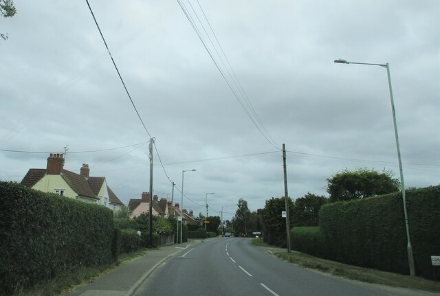
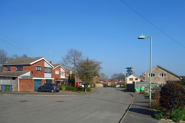
Brabling Green is a quaint village located in the county of Suffolk, England. Situated in the eastern part of the country, this picturesque settlement is known for its idyllic charm and tranquil surroundings. With a population of around 500 residents, it offers a close-knit community atmosphere that is highly valued by its inhabitants.

The village is characterized by its lush green landscape, dotted with charming cottages and traditional buildings. The architecture reflects the area's rich history, with some structures dating back several centuries. The village church, St. Mary's, is a prominent feature that adds to the village's historic appeal.

Brabling Green boasts a range of amenities to cater to its residents' needs. The village has a local primary school, providing education for the younger population. Additionally, there is a village hall that serves as a gathering place for community events and activities. The village also has a few local shops and a cozy pub, which acts as a social hub for both residents and visitors.

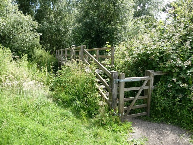
Surrounded by rolling fields and picturesque countryside, Brabling Green offers ample opportunities for outdoor activities. The village is well-connected to a network of footpaths and scenic trails, making it an ideal location for walkers and nature enthusiasts. The nearby river provides fishing opportunities, and the surrounding woodlands offer a peaceful retreat for those seeking tranquility.

Overall, Brabling Green is a charming and peaceful village that embodies the quintessential English countryside. Its rich history, close community ties, and stunning natural surroundings make it an attractive place to live or visit for those seeking a slower pace of life and a genuine rural experience.

If you have any feedback on the listing, please let us know in the comments section below.

Brabling Green Images

Images are sourced within 2km of 52.232472/1.3593706 or Grid Reference TM2964. Thanks to Geograph Open Source API. All images are credited.

Into  Framlingham  on  Saxtead  Road  B1119 The road curves right, straight ahead is Pembroke Road
Into Framlingham on Saxtead Road B1119
The road curves right, straight ahead is Pembroke Road
Passing  Moat  Farm  on  Saxmundham  Road  B1119
Passing Moat Farm on Saxmundham Road B1119
Water  Tower  in  fields  from  Saxmundham  Road  B1119
Water Tower in fields from Saxmundham Road B1119
View  from  the  wall  walk  at  Framlingham  Castle Over The Mere toward Framlingham Castle
View from the wall walk at Framlingham Castle
Over The Mere toward Framlingham Castle
Framlingham  Castle  Wall  Walk  on  the  battlements Framlingham College can be seen between two towers in the centre
Framlingham Castle Wall Walk on the battlements
Framlingham College can be seen between two towers in the centre
Framlingham  Castle  Wall  Walk In the centre of the wall the deep recess is the site of the Chapel
Framlingham Castle Wall Walk
In the centre of the wall the deep recess is the site of the Chapel
Framlingham  Castle  remains  of  the  Tudor  Bridge Over the Inner Ditch
Framlingham Castle remains of the Tudor Bridge
Over the Inner Ditch
St  Michael's  Church  name  board At the entrance from Church Street
St Michael's Church name board
At the entrance from Church Street
St  Michael's  Parish  Church  Framlingham
St Michael's Parish Church Framlingham
Framlingham  town  sign  in  Market  Place
Framlingham town sign in Market Place
Framlingham Castle Gate House Consolidation work on the walls in 1989 <span class="nowrap"><a title="https://historicengland.org.uk/listing/the-list/list-entry/1002965?section=official-listing" rel="nofollow ugc noopener" href="https://historicengland.org.uk/listing/the-list/list-entry/1002965?section=official-listing">Link</a><img style="margin-left:2px;" alt="External link" title="External link - shift click to open in new window" src="https://s1.geograph.org.uk/img/external.png" width="10" height="10"/></span>
Framlingham Castle Gate House
Consolidation work on the walls in 1989 LinkExternal link
Market Hill, Framlingham
Flag in the Market Place Framlingham Market Place March 2022 and the Ukrainian flag is flying in the town centre as it is in towns and villages all over the land just now as the nation expresses its support for that unfortunate country.
Flag in the Market Place
Framlingham Market Place March 2022 and the Ukrainian flag is flying in the town centre as it is in towns and villages all over the land just now as the nation expresses its support for that unfortunate country.
Danforth Close, Framlingham
Framlingham Castle inner court A view across the inner court of Framlingham Castle from the East walkway along the outer walls. A link to a picture of the same during the very hot and dry August of 2022 - <a title="https://www.geograph.org.uk/photo/7253272" href="https://www.geograph.org.uk/photo/7253272">Link</a>
Wikipedia website link - <span class="nowrap"><a title="https://en.wikipedia.org/wiki/Framlingham_Castle" rel="nofollow ugc noopener" href="https://en.wikipedia.org/wiki/Framlingham_Castle">Link</a><img style="margin-left:2px;" alt="External link" title="External link - shift click to open in new window" src="https://s1.geograph.org.uk/img/external.png" width="10" height="10"/></span>
Framlingham Castle inner court
A view across the inner court of Framlingham Castle from the East walkway along the outer walls. A link to a picture of the same during the very hot and dry August of 2022 - Link Wikipedia website link - LinkExternal link
Colourful mural in Bridge Street, Framlingham
The Mere, Framlingham The Mere is frankly a disappointment, as dense reedbeds surround it on all sides, inhibiting close access to the water.
The Mere, Framlingham
The Mere is frankly a disappointment, as dense reedbeds surround it on all sides, inhibiting close access to the water.
Footbridge over the River Ore At the outlet from the Mere, Framlingham.
Footbridge over the River Ore
At the outlet from the Mere, Framlingham.
Show me another place!

Brabling Green is located at Grid Ref: TM2964 (Lat: 52.232472, Lng: 1.3593706)

Administrative County: Suffolk

District: East Suffolk

Police Authority: Suffolk

What 3 Words

///relegate.inventors.relay. Near Framlingham, Suffolk

Nearby Locations

Brabling Green

Related Wikis

Framlingham Town F.C.

Framlingham Town Football Club is a football club based in Framlingham, Suffolk, England. Affiliated to the Suffolk County Football Association, they are...
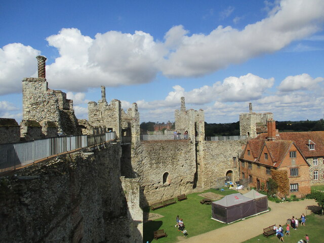
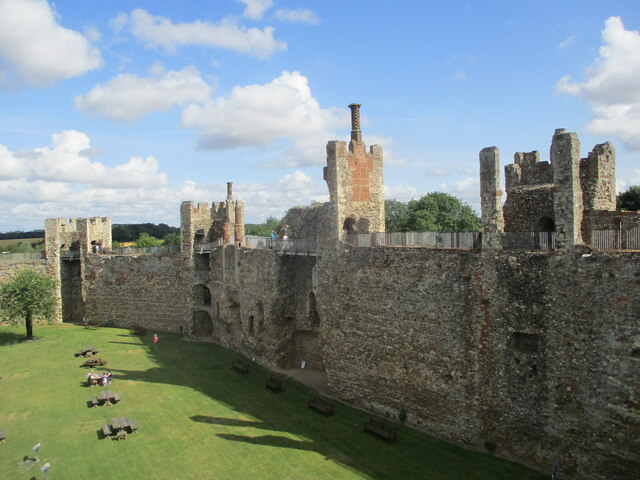
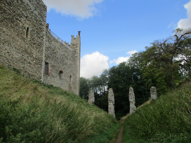
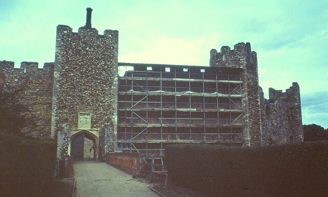
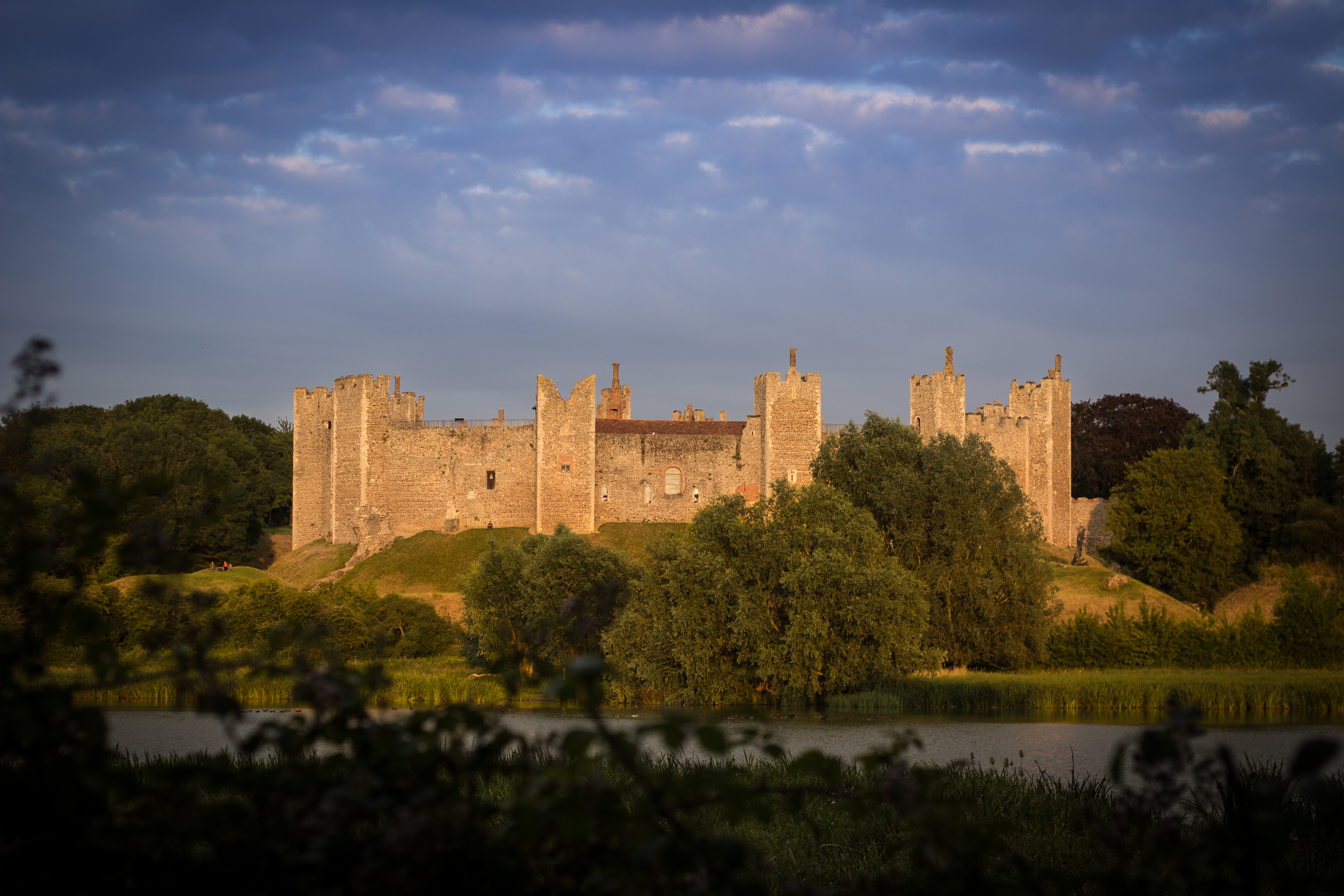
Framlingham Castle

Framlingham Castle is a castle in the market town of Framlingham, Suffolk, England. An early motte and bailey or ringwork Norman castle was built on the...

Regency House

Regency House is a grade II* listed house at 7 Church Street in Framlingham, Suffolk, England. The house is timber-framed, of three storeys, and dates...

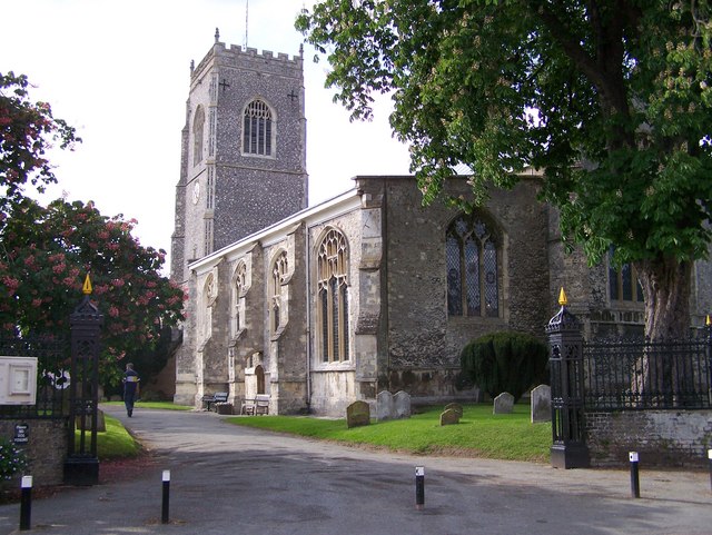
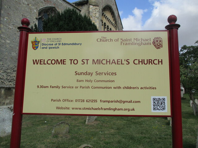
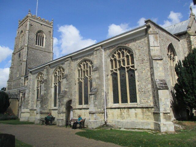
St Michael the Archangel's Church, Framlingham

St Michael's Church in Framlingham, Suffolk is a Church of England church dedicated to Saint Michael. It was the burial site of the Howard family. The...

Framlingham College

Framlingham College is a public school (private boarding and day school) in the town of Framlingham, near Woodbridge, Suffolk, England. Together with its...
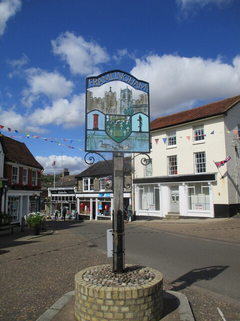
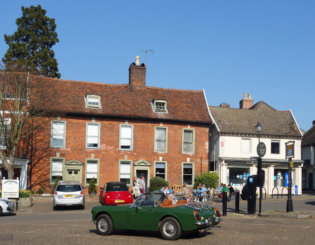
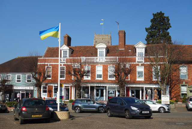
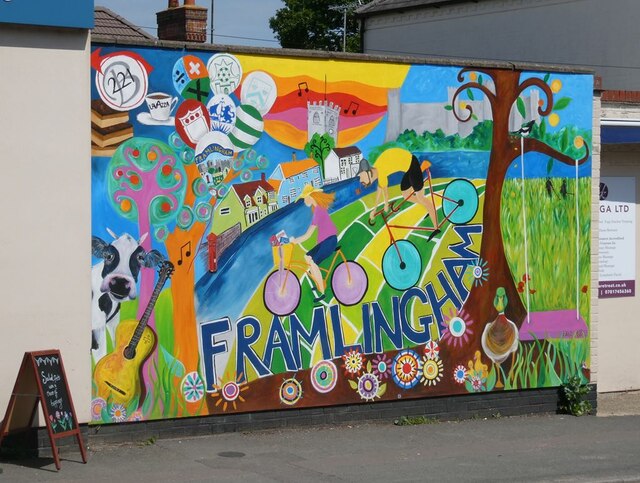
Framlingham

Framlingham is a market town and civil parish in Suffolk, England. Of Anglo-Saxon origin, it appears in the 1086 Domesday Book. The parish had a population...
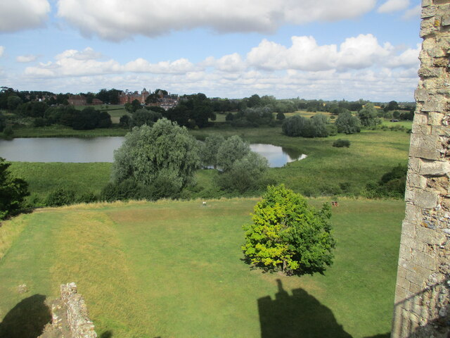
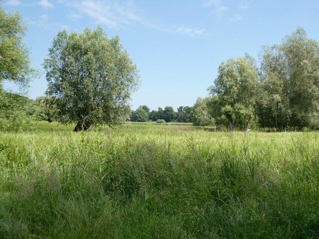
Framlingham Mere

Framlingham Mere is a 13.8-hectare nature reserve in Framlingham in Suffolk. It is managed by the Suffolk Wildlife Trust.This site has a lake and wet meadows...

Sir Robert Hitcham's Almshouses

Sir Robert Hitcham's Almshouses are grade II* listed almshouses in New Road, Framlingham, Suffolk, England. They were built in 1654 under the will of Sir...

Nearby Amenities

Located within 500m of 52.232472,1.3593706
Post Box
Naptan AtcoCode: 390061006
Naptan Bearing: NE
Naptan BusStopType: CUS
Naptan CommonName: Post Box
Naptan Indicator: o/s
Naptan Landmark: Post Box
Naptan NaptanCode: sufjmdwj
Naptan Street: B1120
Naptan Verified: no
Source: naptan_import
Lat/Long: 52.233696/1.3611537
Post Box
Naptan AtcoCode: 390061007
Naptan Bearing: SW
Naptan BusStopType: CUS
Naptan CommonName: Post Box
Naptan Indicator: opp
Naptan Landmark: Post Box
Naptan NaptanCode: sufjmdwm
Naptan Street: B1120
Naptan Verified: no
Source: naptan_import
Lat/Long: 52.2336486/1.361238
Fixme: incomplete
Lat/Long: 52.2322925/1.3566169
Fixme: incomplete
Lat/Long: 52.2340799/1.3654616
Fixme: incomplete
Lat/Long: 52.2320393/1.3568314
Post Box
Collection Times: Mo-Fr 09:00; Sa 10:00
Post Box Mounting: pier
Post Box Type: lamp
Ref: IP13 6330
Royal Cypher: EIIR
Royal Cypher Wikidata: Q33102113
Lat/Long: 52.2337185/1.3612291
The data included in this document is from www.openstreetmap.org. The data is made available under ODbL.

Have you been to Brabling Green?

Leave your review of Brabling Green below (or comments, questions and feedback).