Bosorne

Settlement in Cornwall

England

Bosorne

Windswept, St Just Clearly the owners of this shop have an eye for detail and design.
Windswept, St Just Credit: Jonathan Billinger

Bosorne is a picturesque village located in the southwestern region of Cornwall, England. Situated just a few miles from the popular coastal town of St. Just, Bosorne offers a tranquil and idyllic setting amidst the stunning landscape of the Penwith Peninsula.

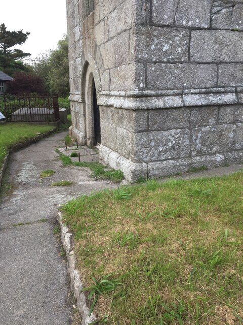
The village is known for its charming and traditional Cornish cottages, many of which date back several centuries, giving visitors a glimpse into the area's rich history. The surrounding countryside is characterized by rolling hills, lush green fields, and breathtaking views of the Atlantic Ocean.

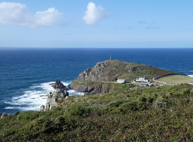
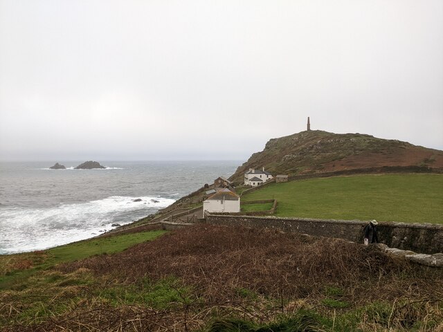
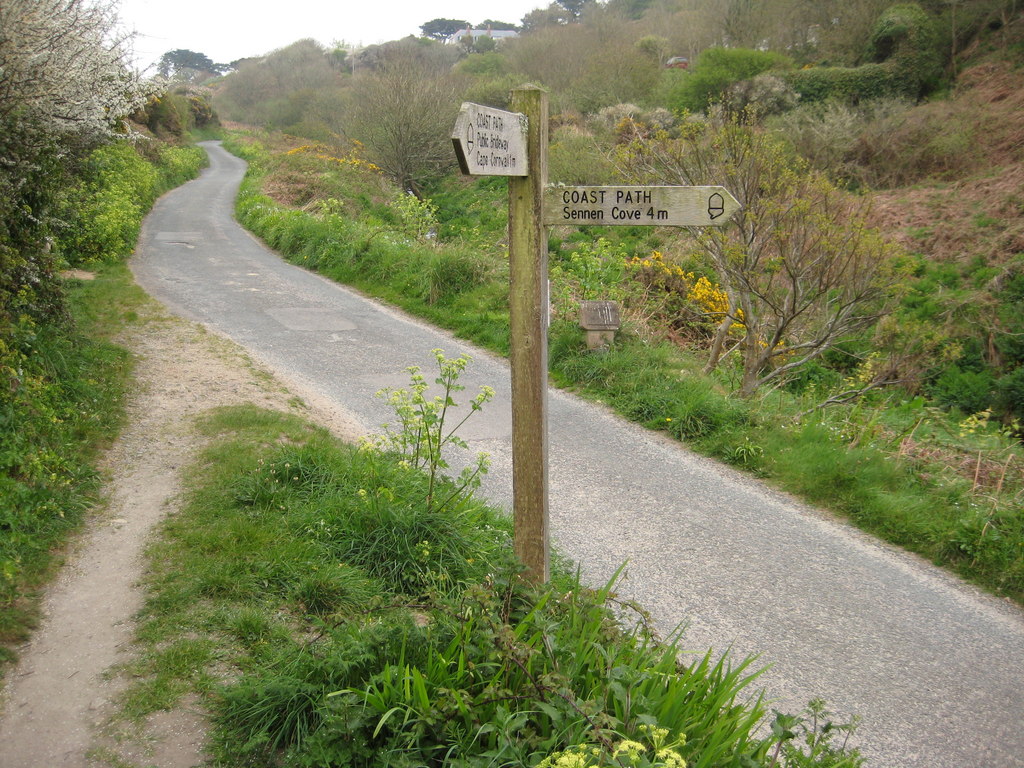
One of the highlights of Bosorne is its proximity to the dramatic Cornish coastline. The village is only a short distance from the rugged cliffs and sandy beaches that are characteristic of this part of the country. Visitors can enjoy leisurely walks along the coastal paths, exploring hidden coves, and witnessing the power of the crashing waves.

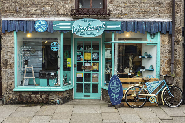
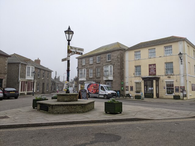
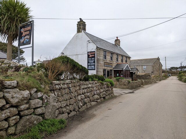
Despite its small size, Bosorne has a close-knit community and a friendly atmosphere. The village is home to a handful of local businesses, including a small convenience store and a traditional pub, where visitors can sample delicious local cuisine and mingle with the locals.

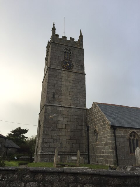
For those interested in history and culture, Bosorne is conveniently located near several ancient sites, such as the iconic Men-an-Tol standing stones and the Iron Age hillfort of Chun Castle, providing a glimpse into the region's ancient past.

Overall, Bosorne is a charming and peaceful village that offers visitors a chance to escape the hustle and bustle of modern life and immerse themselves in the beauty of Cornwall's natural landscapes and rich heritage.

If you have any feedback on the listing, please let us know in the comments section below.
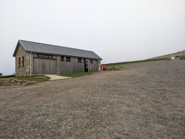
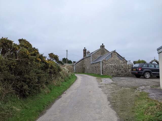
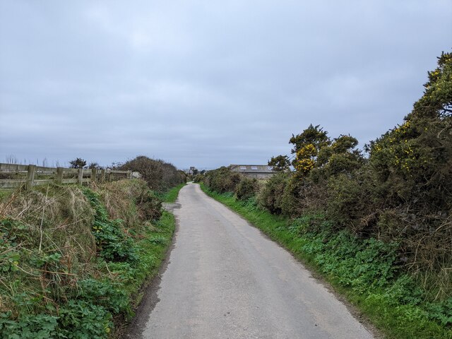
Bosorne Images

Images are sourced within 2km of 50.119245/-5.6902504 or Grid Reference SW3630. Thanks to Geograph Open Source API. All images are credited.

Windswept, St Just Clearly the owners of this shop have an eye for detail and design.
Windswept, St Just
Clearly the owners of this shop have an eye for detail and design.
St Just Church Tower
St Just from the churchyard of St Just church
OS Cut Mark - St Just, St Just's Church <span class="nowrap"><a title="https://www.bench-marks.org.uk/bm43294" rel="nofollow ugc noopener" href="https://www.bench-marks.org.uk/bm43294">Link</a><img style="margin-left:2px;" alt="External link" title="External link - shift click to open in new window" src="https://s1.geograph.org.uk/img/external.png" width="10" height="10"/></span>
OS Cut Mark - St Just, St Just's Church
Location of OS Cut Mark - St Just, St Just's Church <span class="nowrap"><a title="https://www.bench-marks.org.uk/bm43294" rel="nofollow ugc noopener" href="https://www.bench-marks.org.uk/bm43294">Link</a><img style="margin-left:2px;" alt="External link" title="External link - shift click to open in new window" src="https://s1.geograph.org.uk/img/external.png" width="10" height="10"/></span>
Location of OS Cut Mark - St Just, St Just's Church
Carn Gloose Trig Point Flush Bracket S8141
Ballowall Barrow This Bronze Age barrow was excavated (and radically altered) in 1878 by Cornish antiquarian William Borlase. The internal walls were rebuilt by him which has unfortunately affected the way it is perceived. It is however an evocative site in a stunning location.
See <span class="nowrap"><a title="https://www.english-heritage.org.uk/visit/places/ballowall-barrow" rel="nofollow ugc noopener" href="https://www.english-heritage.org.uk/visit/places/ballowall-barrow">Link</a><img style="margin-left:2px;" alt="External link" title="External link - shift click to open in new window" src="https://s1.geograph.org.uk/img/external.png" width="10" height="10"/></span>
Ballowall Barrow
This Bronze Age barrow was excavated (and radically altered) in 1878 by Cornish antiquarian William Borlase. The internal walls were rebuilt by him which has unfortunately affected the way it is perceived. It is however an evocative site in a stunning location. See LinkExternal link
Cape Cornwall from Ballowall Barrow Looking over to England's only cape - Cape Cornwall as seen from beside <a href="https://www.geograph.org.uk/photo/6982138">SW3531 : Ballowall Barrow</a>
Cape Cornwall from Ballowall Barrow
Looking over to England's only cape - Cape Cornwall as seen from beside SW3531 : Ballowall Barrow
The centre of St Just
Cape Cornwall seen from the National Trust car park
National Trust car park and hut at Cape Cornwall
The Queen's Arms, Botallock
Truthwall Lane, Botallock, looking east
House at the end of Truthwall Lane
Truthwall Lane, looking west
The stream from Cot Valley discharging onto the beach at Porth Nanven
Eroded rocks on the beach at Porth Nanven Worn away by the stream in the Cot Valley, which discharges onto the beach here.
Eroded rocks on the beach at Porth Nanven
Worn away by the stream in the Cot Valley, which discharges onto the beach here.
Emergency call point at Porth Nanven
Show me another place!

Bosorne is located at Grid Ref: SW3630 (Lat: 50.119245, Lng: -5.6902504)

Unitary Authority: Cornwall

Police Authority: Devon and Cornwall

What 3 Words

///sweep.grapes.pampered. Near St Just, Cornwall

Nearby Locations

Bosorne Cot Valley

Related Wikis

Porth Nanven

Porth Nanven (grid reference SW355307; most well known as Cot Valley and occasionally known as Penanwell) is a beach in the far west of Cornwall, England...

Cot Valley

Cot Valley is located half-a-mile south of St Just in west Cornwall, United Kingdom. It has a very mild microclimate.The stream which runs down the valley...

Cape Cornwall School

Cape Cornwall School is a coeducational secondary school located in St Just in Penwith, Cornwall, England. As of January 2022, the school had 270 pupils...

Ballowall Barrow

Ballowall Barrow (Cornish: Krug Karrekloos) is a prehistoric funerary cairn (chambered tomb) which Ashbee (1982) and Hencken (1902–81) state contains...

Nearby Amenities

Located within 500m of 50.119245,-5.6902504
Land's End Youth Hostel
Brand: YHA
Brand Wikidata: Q8059214
Contact Website: https://www.yha.org.uk/hostel/yha-lands-end
Tourism: hostel
Lat/Long: 50.1159562/-5.6882085
Cot Valley
Is In: Cornwall, England, UK
Place: locality
Wikidata: Q5175255
Wikipedia: en:Cot Valley
Lat/Long: 50.11678/-5.6912531
Carrallack
Name Kw: Kargallek
Place: hamlet
Lat/Long: 50.1199285/-5.6843356
Barrier: stile
Lat/Long: 50.1173524/-5.6852856
Noexit: yes
Source: Bing;Mapillary
Lat/Long: 50.1225013/-5.687869
Noexit: yes
Source: Bing;Mapillary
Lat/Long: 50.1226481/-5.6876561
Addr City: St Just
Addr Housename: Bosorne House
Addr Postcode: TR19 7NR
Addr Street: Bosorne
Building: house
Lat/Long: 50.1190378/-5.6906561
Generator Method: photovoltaic
Generator Output Electricity: yes
Generator Source: solar
Generator Type: solar_photovoltaic_panel
Location: roof
Power: generator
Lat/Long: 50.1192645/-5.6935351
Generator Method: photovoltaic
Generator Output Electricity: yes
Generator Source: solar
Generator Type: solar_photovoltaic_panel
Location: roof
Power: generator
Lat/Long: 50.119316/-5.6935887
Generator Method: photovoltaic
Generator Output Electricity: yes
Generator Source: solar
Generator Type: solar_photovoltaic_panel
Location: roof
Power: generator
Lat/Long: 50.1167841/-5.6880059
Turning Loop
Lat/Long: 50.1158154/-5.6866679
Direction: W
Generator Method: photovoltaic
Generator Output Electricity: small_installation
Generator Source: solar
Generator Type: solar_photovoltaic_panel
Location: roof
Power: generator
Source: bing
Lat/Long: 50.1226151/-5.6856166
Crossing
Lat/Long: 50.1183369/-5.6964756
Crossing
Lat/Long: 50.1184091/-5.6969009
Power: pole
Transformer: distribution
Lat/Long: 50.119517/-5.6854275
Power: pole
Lat/Long: 50.1189237/-5.6865272
Power: pole
Lat/Long: 50.118578/-5.6871387
Power: pole
Transformer: distribution
Lat/Long: 50.1193012/-5.6903882
Power: pole
Lat/Long: 50.1188119/-5.6893449
Location Transition: yes
Power: pole
Lat/Long: 50.1184034/-5.6884731
Power: pole
Lat/Long: 50.1181325/-5.6879233
Power: pole
Lat/Long: 50.1170241/-5.6866801
Power: pole
Lat/Long: 50.1163146/-5.6858996
Power: pole
Transformer: distribution
Lat/Long: 50.1149249/-5.6918567
Power: pole
Lat/Long: 50.1152603/-5.6913123
Power: pole
Lat/Long: 50.1156163/-5.6907275
Power: pole
Lat/Long: 50.1155578/-5.6892845
Power: pole
Transformer: distribution
Lat/Long: 50.1155209/-5.6883229
Power: pole
Lat/Long: 50.1150625/-5.6880172
The data included in this document is from www.openstreetmap.org. The data is made available under ODbL.

Have you been to Bosorne?

Leave your review of Bosorne below (or comments, questions and feedback).